Pagoda directory by province
3395 pagodas, temples and monasteries in 34 provinces.
AllAn Giang (133)Bắc Ninh (203)Cà Mau (11)Cao Bằng (4)Cần Thơ (120)Đà Nẵng (62)Đắk Lắk (17)Điện Biên (2)Đồng Nai (228)Đồng Tháp (67)Gia Lai (41)Hà Nội (630)Hà Tĩnh (6)Hải Phòng (117)Huế (31)Hưng Yên (69)Khánh Hòa (108)Lai Châu (5)Lạng Sơn (3)Lào Cai (14)Lâm Đồng (72)Nghệ An (6)Ninh Bình (91)Phú Thọ (34)Quảng Ngãi (13)Quảng Ninh (43)Quảng Trị (7)Sơn La (3)Tây Ninh (140)Thái Nguyên (18)Thanh Hóa (10)TP. Hồ Chí Minh (1018)Tuyên Quang (12)Vĩnh Long (57)
An Giang (133)

Bồ Đề Đạo Tràng (Châu Đốc)
Bồ Đề Đạo Tràng is a Buddhist architectural structure, located at the central square in Châu Đốc ward, An Giang province, Vietnam.

Chùa Giồng Thành
Giồng Thành Pagoda, with the formal name Long Hưng Tự (隆興寺), is located in Tân Châu Ward, An Giang Province, and is a heritage site recognised and classified as a national-level monument by the Ministry of Culture and Information on 12 December 1986 in Vietnam.

Chùa Huỳnh Đạo
Huỳnh Đạo Pagoda is located in Vĩnh Đông II hamlet, Vĩnh Tế ward, An Giang province, Vietnam. This is a scenic site and a famous landmark of the province.

Chùa Linh Sơn (Ba Thê)
Linh Sơn Pagoda, also known as the Four-Armed Buddha Pagoda of Ba Thê Mountain, is located in Óc Eo commune (formerly Vọng Thê commune, Thoại Sơn district), An Giang province, Vietnam. This is a national-level heritage site and one of the most famous pilgrimage destinations in the province.

Chùa Ông Bắc
Ông Bắc Pagoda, formally known as Quảng Đông Provincial Assembly Hall (Chinese: 廣東省會館), is a pagoda of the Cantonese Chinese community located in Long Xuyên ward, and is the first Chinese assembly hall in An Giang (Vietnam). The pagoda was recognised as a national-level historical and cultural site on 15 June 1987.

Chùa Phật Lớn (An Giang)
Phật Lớn Pagoda, with its full name being Thiền viện chùa Phật Lớn, is a renowned pagoda currently located on Cấm Mountain, in Núi Cấm commune, An Giang province, Vietnam.

Chùa Phi Lai
Phi Lai Pagoda is a renowned monastic temple of the Tứ Ân Hiếu Nghĩa tradition and a national-level historical site located in Ba Chúc commune, An Giang province, Vietnam.

Chùa Phước Điền
Phước Điền Temple (Vietnamese: Chùa Phước Điền) (also known as Chùa Hang or Hang Temple) is a temple in Châu Đốc, An Giang Province, southwestern Vietnam. It is an official historic monument, proclaimed on July 10, 1980, by the Ministry of Culture and Information of Vietnam.

Chùa Sùng Hưng (Phú Quốc)
Sùng Hưng Pagoda (崇興古寺) (Sùng Hưng Cổ Tự) is the oldest pagoda in the Phú Quốc special zone, An Giang province, Vietnam.

Chùa Tam Bảo (Rạch Giá)
Tam Bảo Temple (Vietnamese: Chùa Tam Bảo), also known as Sắc Tứ Tam Bảo or Chùa Ông Đồng, is a historic Buddhist temple located in Rạch Giá, Kiên Giang Province, Vietnam. Established in the late 18th century, it played a pivotal role in the revival of Vietnamese Buddhism during the 1930s and 1940s, serving as a center for charitable activities, educational initiatives, and covert revolutionary operations against French colonial rule. Recognized as a national historical and cultural relic in 1988, the temple occupies nearly 10,000 square meters and continues to function as the office for…

Chùa Tam Bửu
Tam Bửu Pagoda, also known as Tam Bảo Pagoda, is regarded as the Tổ đình (founding temple) of the Tứ Ân Hiếu Nghĩa religion (abbreviated as 'Hiếu Nghĩa'). This is a renowned monastic institution and a national-level historical site in An Giang, Vietnam.

Chùa Tây An
Tây An Temple is a notable Buddhist temple in southern Vietnam, near the town of Châu Đốc in An Giang Province in the Mekong Delta, known for its historic and architectural features.

Chùa Thới Sơn
Thới Sơn Pagoda is located in the Két Mountain area, in Thới Sơn Ward, An Giang Province, Vietnam. This is a pagoda dedicated to the Three Jewels (Tam bảo) of the Bửu Sơn Kỳ Hương tradition, and is also a revolutionary historical site of the province.

Chùa Vạn Linh
Vạn Linh Pagoda is situated at an altitude of 535 metres (above sea level) on Cấm Mountain, at the foot of Vồ Bồ Hông (which is over 700 metres high), beside Thủy Liêm Lake (with a capacity of 60,000 m³ of water); it is now located in Vồ Đầu hamlet, Núi Cấm commune, An Giang province (Vietnam). This is a renowned Buddhist site and scenic spot, attracting many visitors and pilgrims.

Chùa Xà Tón
Xà Tón Pagoda, also known as Xvayton Pagoda, is located in Hamlet 3, Tri Tôn Commune, An Giang Province. This pagoda is a representative example of the stupa pagoda architectural art of the Khmer people in Southern Vietnam. It is the oldest Khmer pagoda in the province and is the place that preserves the largest number of palm-leaf scripture books in Vietnam.

Chùa Hang (Kiên Giang)
Hải Sơn Pagoda, commonly known as Chùa Hang (the Cave Pagoda), is located at the foot of An Hải Sơn mountain, in Kiên Lương commune, An Giang province, Vietnam (formerly Bình An commune, Kiên Lương district, Kiên Giang province). This is a heritage site, a pilgrimage destination, and also a tourist attraction of the province.
Because the mountain is limestone that has been eroded for thousands of years, there is a large cave behind the pagoda that leads all the way to the sea, where Hòn Phụ Tử is located. Currently, Chùa Hang is part of the system of pagodas managed by the Central Executive Council of the Vietnam Buddhist Sangha.
The stone cave behind Hải Sơn Pagoda runs along a northeast-southwest axis, with a length of over 50 metres, and its entrance faces the sea. The cave extends for 40 metres, with the narrowest point allowing only about 3-4 people to pass through at once. Inside the cave, there are strangely shaped formations created by water erosion.
Hải Sơn Pagoda was discovered in the 18th century by Thai monks and fishermen who came here to reclaim and settle the land. (A brief history of the pagodas in Kiên Giang.) These monks then established the pagoda, which at first had no name.
In 1771, the Siamese army invaded Vietnam and withdrew in 1774, and the monks had to leave with them. Seeing the pagoda abandoned for a long time, the local people invited a Khmer monk to become abbot. Later, Khmer monks (whose Dharma names are unknown) built an additional hermitage (am) outside, not far from the old pagoda, and named it Thái Lùa Pagoda (Prakchaokia) or Ba Trại Pagoda. It was called Ba Trại Pagoda because it was located in the base area of the insurgent forces led by Nguyễn Trung Trực.
In 1800, two brothers, Võ Thường Lễ and Võ Thường Nghĩa (Dharma names unknown), restored the old pagoda and named it Chùa Hang (the Cave Pagoda). The next abbot was a Vietnamese monk with the Dharma name Thiện Tông.
In 1920, Venerable Thiện Tông passed away in the Buddha Sleeping Cave, and Venerable Thượng Tố became the abbot.
From 1939 to 1944, the abbot of Chùa Hang was Venerable Chí (surname unknown, affectionately called Sư Chưởng by local residents). He passed away at the age of 70.
In 1953, local residents invited a nun, commonly known as Cô Sáu (Dharma name unknown), to take care of Buddhist affairs.
In 1975, Nun Sáu passed away. Venerable Thiện Hóa (Thầy Tư) continued as abbot until his passing in 1999, at the age of 79. During his 45 years as abbot of Chùa Hang, Venerable Thiện Hóa oversaw many renovations, especially a major restoration in 1962 that gave the pagoda its present appearance. The site was recognised by the Ministry of Culture and Information as a historical and scenic heritage site in 1989.
From 1999 to 2002, the pagoda was managed by Venerable Thích Minh Hải. After that, Venerable Thích Minh Nhẫn became abbot and continues to serve in this role to the present day.

Chùa Phật Lớn (Hà Tiên)
Phật Lớn Pagoda, formally named Thiên Trúc tự, is an ancient Vietnamese pagoda. The pagoda is located at 197/11 Phương Thành Street, Hà Tiên ward, An Giang province. The site still preserves a large Buddha statue modelled after the Thai style, belonging to the Theravada tradition (Southern Buddhism), as well as a Great Bell (Đại Hồng Chung) associated with the Mahayana tradition (Northern Buddhism).

Chùa Phù Dung
Phù Dung Pagoda is an ancient pagoda located at the foot of Bình San Mountain, in Hà Tiên ward, An Giang province, Vietnam. The pagoda is known not only as a pilgrimage site and an attractive tourist destination for visitors due to its ancient beauty harmoniously blended with nature, but also for the mysterious and controversial stories surrounding the origins of the pagoda.
🏯
Chùa 3 Cô (Bửu Viên Tịnh Xá)
Chùa 3 Cô (Bửu Viên Tịnh Xá) is a Buddhist pagoda in An Giang, Vietnam. Its location comes from OpenStreetMap community data; further details will be added when reliable sources become available.
🏯
Chùa Ấp Voi
Chùa Ấp Voi is a Buddhist pagoda in An Giang, Vietnam. Its location comes from OpenStreetMap community data; further details will be added when reliable sources become available.
🏯
Chùa Ba Thê
Chùa Ba Thê is a Buddhist pagoda in An Giang, Vietnam. Its location comes from OpenStreetMap community data; further details will be added when reliable sources become available.
🏯
Chùa Bạch Vân
Chùa Bạch Vân is a Buddhist pagoda in An Giang, Vietnam. Its location comes from OpenStreetMap community data; further details will be added when reliable sources become available.
🏯
Chùa Bửu Lâm Tự
Chùa Bửu Lâm Tự is a Buddhist pagoda in An Giang, Vietnam. Its location comes from OpenStreetMap community data; further details will be added when reliable sources become available.
🏯
Chùa Cà Rắc
Chùa Cà Rắc is a Buddhist pagoda in An Giang, Vietnam. Its location comes from OpenStreetMap community data; further details will be added when reliable sources become available.
🏯
Chùa Cây Khoa - វត្តគិរីរង្សី "ខ្លាខ្វា"
Chùa Cây Khoa - វត្តគិរីរង្សី "ខ្លាខ្វា" is a Buddhist pagoda in An Giang, Vietnam. Its location comes from OpenStreetMap community data; further details will be added when reliable sources become available.
🏯
Chùa Cây Mít
Chùa Cây Mít is a Buddhist pagoda in An Giang, Vietnam. Its location comes from OpenStreetMap community data; further details will be added when reliable sources become available.
🏯
Chùa Châu Long
Chùa Châu Long is a Buddhist pagoda in An Giang, Vietnam. Its location comes from OpenStreetMap community data; further details will be added when reliable sources become available.
🏯
Chùa Châu Viên
Chùa Châu Viên is a Buddhist pagoda in An Giang, Vietnam. Its location comes from OpenStreetMap community data; further details will be added when reliable sources become available.
🏯
Chùa Giác Tâm
Chùa Giác Tâm is a Buddhist pagoda in An Giang, Vietnam. Its location comes from OpenStreetMap community data; further details will be added when reliable sources become available.
🏯
Chùa Hang
Chùa Hang is a Buddhist pagoda in An Giang, Vietnam. Its location comes from OpenStreetMap community data; further details will be added when reliable sources become available.
🏯
Chùa Huỳnh Phước
Chùa Huỳnh Phước is a Buddhist pagoda in An Giang, Vietnam. Its location comes from OpenStreetMap community data; further details will be added when reliable sources become available.
🏯
Chùa Kim Tiên
Chùa Kim Tiên is a Buddhist pagoda in An Giang, Vietnam. Its location comes from OpenStreetMap community data; further details will be added when reliable sources become available.
🏯
Chùa Liên Hoa
Chùa Liên Hoa is a Buddhist pagoda in An Giang, Vietnam. Its location comes from OpenStreetMap community data; further details will be added when reliable sources become available.
🏯
Chùa Long Sơn
Chùa Long Sơn is a Buddhist pagoda in An Giang, Vietnam. Its location comes from OpenStreetMap community data; further details will be added when reliable sources become available.
🏯
Chùa Long Sơn
Chùa Long Sơn is a Buddhist pagoda in An Giang, Vietnam. Its location comes from OpenStreetMap community data; further details will be added when reliable sources become available.
🏯
Chùa Lục Linh
Chùa Lục Linh is a Buddhist pagoda in An Giang, Vietnam. Its location comes from OpenStreetMap community data; further details will be added when reliable sources become available.
🏯
Chùa Một Cột Núi Sam
Chùa Một Cột Núi Sam is a Buddhist pagoda in An Giang, Vietnam. Its location comes from OpenStreetMap community data; further details will be added when reliable sources become available.
🏯
Chùa Năm Căn Cổ Tự
Chùa Năm Căn Cổ Tự is a Buddhist pagoda in An Giang, Vietnam. Its location comes from OpenStreetMap community data; further details will be added when reliable sources become available.
🏯
Chùa Neng Non - វត្តគីរីសូផនសូវាន់ណែងណង
Chùa Neng Non - វត្តគីរីសូផនសូវាន់ណែងណង is a Buddhist pagoda in An Giang, Vietnam. Its location comes from OpenStreetMap community data; further details will be added when reliable sources become available.
🏯
Chùa Ông Châu Đốc
Chùa Ông Châu Đốc is a Buddhist pagoda in An Giang, Vietnam. Its location comes from OpenStreetMap community data; further details will be added when reliable sources become available.
🏯
Chùa Ông Đạo Nằm
Chùa Ông Đạo Nằm is a Buddhist pagoda in An Giang, Vietnam. Its location comes from OpenStreetMap community data; further details will be added when reliable sources become available.
🏯
Chùa Phật Nhỏ
Chùa Phật Nhỏ is a Buddhist pagoda in An Giang, Vietnam. Its location comes from OpenStreetMap community data; further details will be added when reliable sources become available.
🏯
Chùa Phật Quang
Chùa Phật Quang is a Buddhist pagoda in An Giang, Vietnam. Its location comes from OpenStreetMap community data; further details will be added when reliable sources become available.
🏯
Chùa Phật Thiền
Chùa Phật Thiền is a Buddhist pagoda in An Giang, Vietnam. Its location comes from OpenStreetMap community data; further details will be added when reliable sources become available.
🏯
Chùa Phước Hải
Chùa Phước Hải is a Buddhist pagoda in An Giang, Vietnam. Its location comes from OpenStreetMap community data; further details will be added when reliable sources become available.
🏯
Chùa Phước Hậu
Chùa Phước Hậu is a Buddhist pagoda in An Giang, Vietnam. Its location comes from OpenStreetMap community data; further details will be added when reliable sources become available.
🏯
Chùa Phước Lâm
Chùa Phước Lâm is a Buddhist pagoda in An Giang, Vietnam. Its location comes from OpenStreetMap community data; further details will be added when reliable sources become available.
🏯
Chùa Phước Linh
Chùa Phước Linh is a Buddhist pagoda in An Giang, Vietnam. Its location comes from OpenStreetMap community data; further details will be added when reliable sources become available.
🏯
Chùa Phước Quang
Chùa Phước Quang is a Buddhist pagoda in An Giang, Vietnam. Its location comes from OpenStreetMap community data; further details will be added when reliable sources become available.
🏯
Chùa Quan Âm
Chùa Quan Âm is a Buddhist pagoda in An Giang, Vietnam. Its location comes from OpenStreetMap community data; further details will be added when reliable sources become available.
🏯
Chùa Quan Âm Phật Đài
Chùa Quan Âm Phật Đài is a Buddhist pagoda in An Giang, Vietnam. Its location comes from OpenStreetMap community data; further details will be added when reliable sources become available.
🏯
Chùa Quan Thánh Đế Quân
Chùa Quan Thánh Đế Quân is a Buddhist pagoda in An Giang, Vietnam. Its location comes from OpenStreetMap community data; further details will be added when reliable sources become available.
🏯
Chùa Quỳnh Quang
Chùa Quỳnh Quang is a Buddhist pagoda in An Giang, Vietnam. Its location comes from OpenStreetMap community data; further details will be added when reliable sources become available.
🏯
Chùa Reachatuasnaram Sđach Toth
Chùa Reachatuasnaram Sđach Toth is a Buddhist pagoda in An Giang, Vietnam. Its location comes from OpenStreetMap community data; further details will be added when reliable sources become available.
🏯
Chùa Sơn Tiên
Chùa Sơn Tiên is a Buddhist pagoda in An Giang, Vietnam. Its location comes from OpenStreetMap community data; further details will be added when reliable sources become available.
🏯
Chùa Tà Pạ
Chùa Tà Pạ is a Buddhist pagoda in An Giang, Vietnam. Its location comes from OpenStreetMap community data; further details will be added when reliable sources become available.
🏯
Chùa Tây Sơn
Chùa Tây Sơn is a Buddhist pagoda in An Giang, Vietnam. Its location comes from OpenStreetMap community data; further details will be added when reliable sources become available.
🏯
Chùa Thạch An
Chùa Thạch An is a Buddhist pagoda in An Giang, Vietnam. Its location comes from OpenStreetMap community data; further details will be added when reliable sources become available.
🏯
Chùa Thanh Lương
Chùa Thanh Lương is a Buddhist pagoda in An Giang, Vietnam. Its location comes from OpenStreetMap community data; further details will be added when reliable sources become available.
🏯
Chùa Thành Xuân
Chùa Thành Xuân is a Buddhist pagoda in An Giang, Vietnam. Its location comes from OpenStreetMap community data; further details will be added when reliable sources become available.
🏯
Chùa Thiếc - វត្តសិរីវង្សាចេស្តាអណ្តូងព្រូស
Chùa Thiếc - វត្តសិរីវង្សាចេស្តាអណ្តូងព្រូស is a Buddhist pagoda in An Giang, Vietnam. Its location comes from OpenStreetMap community data; further details will be added when reliable sources become available.
🏯
Chùa Thơm Mít
Chùa Thơm Mít is a Buddhist pagoda in An Giang, Vietnam. Its location comes from OpenStreetMap community data; further details will be added when reliable sources become available.
🏯
Chùa Trắng
Chùa Trắng is a Buddhist pagoda in An Giang, Vietnam. Its location comes from OpenStreetMap community data; further details will be added when reliable sources become available.
🏯
Chùa Tro Poáng Trao
Chùa Tro Poáng Trao is a Buddhist pagoda in An Giang, Vietnam. Its location comes from OpenStreetMap community data; further details will be added when reliable sources become available.
🏯
Chùa Trúc Lâm
Chùa Trúc Lâm is a Buddhist pagoda in An Giang, Vietnam. Its location comes from OpenStreetMap community data; further details will be added when reliable sources become available.
🏯
Đền Đông Hưng
Đền Đông Hưng is a temple (đền) in An Giang, Vietnam. Its location comes from OpenStreetMap community data; further details will be added when reliable sources become available.
🏯
Đình bình long
Đình bình long is a village communal house (đình) in An Giang, Vietnam. Its location comes from OpenStreetMap community data; further details will be added when reliable sources become available.
🏯
Đình Chợ Thủ
Đình Chợ Thủ is a village communal house (đình) in An Giang, Vietnam. Its location comes from OpenStreetMap community data; further details will be added when reliable sources become available.
🏯
Đình Đa Phước
Đình Đa Phước is a village communal house (đình) in An Giang, Vietnam. Its location comes from OpenStreetMap community data; further details will be added when reliable sources become available.
🏯
Đình thần An Hòa
Đình thần An Hòa is a village communal house (đình) in An Giang, Vietnam. Its location comes from OpenStreetMap community data; further details will be added when reliable sources become available.
🏯
Đình thần Bình Mỹ
Đình thần Bình Mỹ is a village communal house (đình) in An Giang, Vietnam. Its location comes from OpenStreetMap community data; further details will be added when reliable sources become available.
🏯
Đình thân Bình Thủy
Đình thân Bình Thủy is a village communal house (đình) in An Giang, Vietnam. Its location comes from OpenStreetMap community data; further details will be added when reliable sources become available.
🏯
Đình thần Cầu Dài
Đình thần Cầu Dài is a village communal house (đình) in An Giang, Vietnam. Its location comes from OpenStreetMap community data; further details will be added when reliable sources become available.

Đình thần Châu Phú
Đình thần Châu Phú is a village communal house (đình) in An Giang, Vietnam. Its location comes from OpenStreetMap community data; further details will be added when reliable sources become available.
🏯
Đình thần Hội An
Đình thần Hội An is a village communal house (đình) in An Giang, Vietnam. Its location comes from OpenStreetMap community data; further details will be added when reliable sources become available.
🏯
Đình thần Long Phú
Đình thần Long Phú is a village communal house (đình) in An Giang, Vietnam. Its location comes from OpenStreetMap community data; further details will be added when reliable sources become available.
🏯
Đình thần Mỹ Phước
Đình thần Mỹ Phước is a village communal house (đình) in An Giang, Vietnam. Its location comes from OpenStreetMap community data; further details will be added when reliable sources become available.
🏯
Đình thần Phú Mỹ
Đình thần Phú Mỹ is a village communal house (đình) in An Giang, Vietnam. Its location comes from OpenStreetMap community data; further details will be added when reliable sources become available.
🏯
Đình thần Vĩnh Gia
Đình thần Vĩnh Gia is a village communal house (đình) in An Giang, Vietnam. Its location comes from OpenStreetMap community data; further details will be added when reliable sources become available.
🏯
Đình thần Vĩnh Nguơn
Đình thần Vĩnh Nguơn is a village communal house (đình) in An Giang, Vietnam. Its location comes from OpenStreetMap community data; further details will be added when reliable sources become available.
🏯
Miếu Bà Chúa Xứ
Miếu Bà Chúa Xứ is a shrine (miếu) in An Giang, Vietnam. Its location comes from OpenStreetMap community data; further details will be added when reliable sources become available.
🏯
Miếu Bằng Lăng
Miếu Bằng Lăng is a shrine (miếu) in An Giang, Vietnam. Its location comes from OpenStreetMap community data; further details will be added when reliable sources become available.
🏯
Miếu Khổng Tử
Miếu Khổng Tử is a shrine (miếu) in An Giang, Vietnam. Its location comes from OpenStreetMap community data; further details will be added when reliable sources become available.
🏯
Miếu thờ Trương Gia Mô
Miếu thờ Trương Gia Mô is a shrine (miếu) in An Giang, Vietnam. Its location comes from OpenStreetMap community data; further details will be added when reliable sources become available.
🏯
Thiền viện Trúc Lâm Trí Thiền
Thiền viện Trúc Lâm Trí Thiền is a Zen monastery (thiền viện) in An Giang, Vietnam. Its location comes from OpenStreetMap community data; further details will be added when reliable sources become available.
🏯
Tịnh xá Bửu Viên
Tịnh xá Bửu Viên is a Buddhist vihara (tịnh xá) in An Giang, Vietnam. Its location comes from OpenStreetMap community data; further details will be added when reliable sources become available.
🏯
Tổ đình Phi Lai
Tổ đình Phi Lai is a ancestral Buddhist temple (tổ đình) in An Giang, Vietnam. Its location comes from OpenStreetMap community data; further details will be added when reliable sources become available.
🏯
Chùa An Phước
Chùa An Phước is a Buddhist pagoda in An Giang (formerly Kiên Giang province), Vietnam. Its location comes from OpenStreetMap community data; further details will be added when reliable sources become available.
🏯
Chùa An Thiền
Chùa An Thiền is a Buddhist pagoda in An Giang (formerly Kiên Giang province), Vietnam. Its location comes from OpenStreetMap community data; further details will be added when reliable sources become available.
🏯
Chùa bà Thiên Hậu Hải Nam
Chùa bà Thiên Hậu Hải Nam is a Buddhist pagoda in An Giang (formerly Kiên Giang province), Vietnam. Its location comes from OpenStreetMap community data; further details will be added when reliable sources become available.
🏯
Chùa bà Thiên Hậu Quảng Châu
Chùa bà Thiên Hậu Quảng Châu is a Buddhist pagoda in An Giang (formerly Kiên Giang province), Vietnam. Its location comes from OpenStreetMap community data; further details will be added when reliable sources become available.
🏯
Chùa Bắc Đế
Chùa Bắc Đế is a Buddhist pagoda in An Giang (formerly Kiên Giang province), Vietnam. Its location comes from OpenStreetMap community data; further details will be added when reliable sources become available.
🏯
Chùa Bửu Kim
Chùa Bửu Kim is a Buddhist pagoda in An Giang (formerly Kiên Giang province), Vietnam. Its location comes from OpenStreetMap community data; further details will be added when reliable sources become available.
🏯
Chùa Bửu Sơn
Chùa Bửu Sơn is a Buddhist pagoda in An Giang (formerly Kiên Giang province), Vietnam. Its location comes from OpenStreetMap community data; further details will be added when reliable sources become available.
🏯
Chùa Đông Hải
Chùa Đông Hải is a Buddhist pagoda in An Giang (formerly Kiên Giang province), Vietnam. Its location comes from OpenStreetMap community data; further details will be added when reliable sources become available.
🏯
Chùa Giác Lâm
Chùa Giác Lâm is a Buddhist pagoda in An Giang (formerly Kiên Giang province), Vietnam. Its location comes from OpenStreetMap community data; further details will be added when reliable sources become available.
🏯
Chùa Khlang Ong
Chùa Khlang Ong is a Buddhist pagoda in An Giang (formerly Kiên Giang province), Vietnam. Its location comes from OpenStreetMap community data; further details will be added when reliable sources become available.
🏯
Chùa Khmer Rạch Sỏi
Chùa Khmer Rạch Sỏi is a Buddhist pagoda in An Giang (formerly Kiên Giang province), Vietnam. Its location comes from OpenStreetMap community data; further details will be added when reliable sources become available.
🏯
Chùa Kiên Tân
Chùa Kiên Tân is a Buddhist pagoda in An Giang (formerly Kiên Giang province), Vietnam. Its location comes from OpenStreetMap community data; further details will be added when reliable sources become available.
🏯
Chùa Mangalarasi Krosan
Chùa Mangalarasi Krosan is a Buddhist pagoda in An Giang (formerly Kiên Giang province), Vietnam. Its location comes from OpenStreetMap community data; further details will be added when reliable sources become available.
🏯
Chùa Minh Đức
Chùa Minh Đức is a Buddhist pagoda in An Giang (formerly Kiên Giang province), Vietnam. Its location comes from OpenStreetMap community data; further details will be added when reliable sources become available.
🏯
Chùa Ngọc Bửu Hương
Chùa Ngọc Bửu Hương is a Buddhist pagoda in An Giang (formerly Kiên Giang province), Vietnam. Its location comes from OpenStreetMap community data; further details will be added when reliable sources become available.
🏯
Chùa Ông Địa
Chùa Ông Địa is a Buddhist pagoda in An Giang (formerly Kiên Giang province), Vietnam. Its location comes from OpenStreetMap community data; further details will be added when reliable sources become available.
🏯
Chùa Phổ Minh
Chùa Phổ Minh is a Buddhist pagoda in An Giang (formerly Kiên Giang province), Vietnam. Its location comes from OpenStreetMap community data; further details will be added when reliable sources become available.
🏯
Chùa Phước Hưng (Chùa Phật) ở Xã Thạnh Phước, Huyện Giồng Riềng, Tỉnh Kiên Giang, VN
Chùa Phước Hưng (Chùa Phật) ở Xã Thạnh Phước, Huyện Giồng Riềng, Tỉnh Kiên Giang, VN is a Buddhist pagoda in An Giang (formerly Kiên Giang province), Vietnam. Its location comes from OpenStreetMap community data; further details will be added when reliable sources become available.
🏯
Chùa Phước Nguyên
Chùa Phước Nguyên is a Buddhist pagoda in An Giang (formerly Kiên Giang province), Vietnam. Its location comes from OpenStreetMap community data; further details will be added when reliable sources become available.
🏯
Chùa Phước Thiện
Chùa Phước Thiện is a Buddhist pagoda in An Giang (formerly Kiên Giang province), Vietnam. Its location comes from OpenStreetMap community data; further details will be added when reliable sources become available.
🏯
Chùa Quan Đế
Chùa Quan Đế is a Buddhist pagoda in An Giang (formerly Kiên Giang province), Vietnam. Its location comes from OpenStreetMap community data; further details will be added when reliable sources become available.
🏯
Chùa Ranh Hạt
Chùa Ranh Hạt is a Buddhist pagoda in An Giang (formerly Kiên Giang province), Vietnam. Its location comes from OpenStreetMap community data; further details will be added when reliable sources become available.
🏯
Chùa Ratanarama Tà keo
Chùa Ratanarama Tà keo is a Buddhist pagoda in An Giang (formerly Kiên Giang province), Vietnam. Its location comes from OpenStreetMap community data; further details will be added when reliable sources become available.
🏯
Chùa Ratanaransi
Chùa Ratanaransi is a Buddhist pagoda in An Giang (formerly Kiên Giang province), Vietnam. Its location comes from OpenStreetMap community data; further details will be added when reliable sources become available.
🏯
Chùa Sắc Tứ Kim Bảo
Chùa Sắc Tứ Kim Bảo is a Buddhist pagoda in An Giang (formerly Kiên Giang province), Vietnam. Its location comes from OpenStreetMap community data; further details will be added when reliable sources become available.
🏯
Chùa Sóc Xoài
Chùa Sóc Xoài is a Buddhist pagoda in An Giang (formerly Kiên Giang province), Vietnam. Its location comes from OpenStreetMap community data; further details will be added when reliable sources become available.
🏯
Chùa Sùng Đức
Chùa Sùng Đức is a Buddhist pagoda in An Giang (formerly Kiên Giang province), Vietnam. Its location comes from OpenStreetMap community data; further details will be added when reliable sources become available.
🏯
Chùa Tam Bảo
Chùa Tam Bảo is a Buddhist pagoda in An Giang (formerly Kiên Giang province), Vietnam. Its location comes from OpenStreetMap community data; further details will be added when reliable sources become available.
🏯
Chùa Xà Xía
Chùa Xà Xía is a Buddhist pagoda in An Giang (formerly Kiên Giang province), Vietnam. Its location comes from OpenStreetMap community data; further details will be added when reliable sources become available.
🏯
Đền Thánh Vicente
Đền Thánh Vicente is a temple (đền) in An Giang (formerly Kiên Giang province), Vietnam. Its location comes from OpenStreetMap community data; further details will be added when reliable sources become available.
🏯
Đền thờ Anh hùng Mai Thị Nương
Đền thờ Anh hùng Mai Thị Nương is a temple (đền) in An Giang (formerly Kiên Giang province), Vietnam. Its location comes from OpenStreetMap community data; further details will be added when reliable sources become available.
🏯
Đền thờ vua Gia Long
Đền thờ vua Gia Long is a temple (đền) in An Giang (formerly Kiên Giang province), Vietnam. Its location comes from OpenStreetMap community data; further details will be added when reliable sources become available.
🏯
Đình Nguyễn Trung Trực
Đình Nguyễn Trung Trực is a village communal house (đình) in An Giang (formerly Kiên Giang province), Vietnam. Its location comes from OpenStreetMap community data; further details will be added when reliable sources become available.
🏯
Đình Phó Quản cơ Nguyễn Hiền Điều
Đình Phó Quản cơ Nguyễn Hiền Điều is a village communal house (đình) in An Giang (formerly Kiên Giang province), Vietnam. Its location comes from OpenStreetMap community data; further details will be added when reliable sources become available.
🏯
Đình Thạnh Hòa
Đình Thạnh Hòa is a village communal house (đình) in An Giang (formerly Kiên Giang province), Vietnam. Its location comes from OpenStreetMap community data; further details will be added when reliable sources become available.
🏯
Đình thần Dương Đông
Đình thần Dương Đông is a village communal house (đình) in An Giang (formerly Kiên Giang province), Vietnam. Its location comes from OpenStreetMap community data; further details will be added when reliable sources become available.
🏯
Đình thần Nguyễn Trung Trực
Đình thần Nguyễn Trung Trực is a village communal house (đình) in An Giang (formerly Kiên Giang province), Vietnam. Its location comes from OpenStreetMap community data; further details will be added when reliable sources become available.
🏯
Đình thần Nguyễn Trung Trực
Đình thần Nguyễn Trung Trực is a village communal house (đình) in An Giang (formerly Kiên Giang province), Vietnam. Its location comes from OpenStreetMap community data; further details will be added when reliable sources become available.
🏯
Đình Thần Nguyễn Trung Trực
Đình Thần Nguyễn Trung Trực is a village communal house (đình) in An Giang (formerly Kiên Giang province), Vietnam. Its location comes from OpenStreetMap community data; further details will be added when reliable sources become available.
🏯
Đình thần Vĩnh Hòa
Đình thần Vĩnh Hòa is a village communal house (đình) in An Giang (formerly Kiên Giang province), Vietnam. Its location comes from OpenStreetMap community data; further details will be added when reliable sources become available.
🏯
Miếu Bà Chúa Xứ
Miếu Bà Chúa Xứ is a shrine (miếu) in An Giang (formerly Kiên Giang province), Vietnam. Its location comes from OpenStreetMap community data; further details will be added when reliable sources become available.
🏯
Miếu Bà Chúa Xứ Vàm Rầy
Miếu Bà Chúa Xứ Vàm Rầy is a shrine (miếu) in An Giang (formerly Kiên Giang province), Vietnam. Its location comes from OpenStreetMap community data; further details will be added when reliable sources become available.
🏯
Tịnh xá Ngọc Châu
Tịnh xá Ngọc Châu is a Buddhist vihara (tịnh xá) in An Giang (formerly Kiên Giang province), Vietnam. Its location comes from OpenStreetMap community data; further details will be added when reliable sources become available.
🏯
Tịnh Xá Ngọc Đăng
Tịnh Xá Ngọc Đăng is a Buddhist vihara (tịnh xá) in An Giang (formerly Kiên Giang province), Vietnam. Its location comes from OpenStreetMap community data; further details will be added when reliable sources become available.
🏯
Tịnh xá Ngọc Hải
Tịnh xá Ngọc Hải is a Buddhist vihara (tịnh xá) in An Giang (formerly Kiên Giang province), Vietnam. Its location comes from OpenStreetMap community data; further details will be added when reliable sources become available.
🏯
Tịnh xá Ngọc Sơn
Tịnh xá Ngọc Sơn is a Buddhist vihara (tịnh xá) in An Giang (formerly Kiên Giang province), Vietnam. Its location comes from OpenStreetMap community data; further details will be added when reliable sources become available.
Bắc Ninh (203)

Chùa Bổ Đà
Bổ Đà Pagoda, also known as Bổ Pagoda, Tam Giáo Pagoda, and by its formal name Tứ Ân Tự (四恩寺), is a pagoda situated on Phượng Hoàng Mountain (Bổ Đà Sơn), on the left bank of the Cầu River, in the area of Thượng Lát residential group, Vân Hà ward, Bắc Ninh province (during the feudal era, this was Tiên Lát village, Tiên Lát canton, Yên Việt district, Bắc Hà prefecture, former Kinh Bắc region). The pagoda is located about 10 km west of the centre of Bích Động town. Bổ Đà Pagoda is one of the most unique pagodas in the Kinh Bắc region and is a major Buddhist centre of the Trúc Lâm Yên Tử Zen school. The pagoda was recognised as a Special National Monument in 2016, and the set of Buddhist scriptures carved on persimmon wood preserved at the pagoda is considered the oldest of the Lâm Tế Zen lineage.
Bổ Pagoda is one of the few places that still preserves the original features of ancient Vietnamese traditional architecture. The pagoda has a unique and distinctive architecture compared to other traditional pagodas in northern Vietnam, with the most beautiful and largest stupa garden in Vietnam, many valuable antiques, and a rich treasury of Han-Nom heritage. This is also a place where mountains and water harmonise, with the landscape and space imbued with legend, surrounded by hills, mountains, and villages. The pagoda venerates the Three Teachings (Tam giáo), including Avalokiteśvara Bodhisattva (Quán Thế Âm Bồ Tát), the Three Patriarchs of Trúc Lâm (Trần Nhân Tông, Pháp Loa, and Huyền Quang), Confucius, and others. Books made of bamboo and stone that have been left behind are still used to train those joining the Lâm Tế school (Sơn Môn Bổ Đà) according to old customs. The Bổ Đà Pagoda complex is a collection of relics including: the ancient pagoda named Bổ Đà Sơn (commonly referred to as Bổ Đà Pagoda, Bổ Pagoda, or Quán Âm Pagoda), the main Tứ Ân Pagoda, and Am Tam Đức (built later, during the Later Lê dynasty). In addition, on Bổ Đà Mountain there is also a temple dedicated to General Thạch (i.e. Thạch Tướng Đại Vương – who contributed to helping the 16th Hùng King resist foreign invaders).
The current abbot of the pagoda is Venerable Thích Tục Vinh (secular name: Trương Lý Vinh), a member of the Executive Council of the Vietnam Buddhist Sangha, Bắc Giang province, term V (2017–2022).
Chùa Trẻ
Chùa Trẻ, also known as Mục Ngưu Tự, has existed for over 300 years and is located in Yên Khê village, Tiền Phong ward, Bắc Ninh province, Vietnam.

Chùa Vĩnh Nghiêm (Bắc Ninh)
Vĩnh Nghiêm Pagoda, also known as Đức La Pagoda, is an ancient pagoda located in Đức La village, Tân An ward, Bắc Ninh province, Vietnam. The pagoda is recognised as a Buddhist centre, a place for training monks for the whole country, and the birthplace of the Three Patriarchs of the Trúc Lâm Zen sect of Vietnamese Buddhism. In 2015, the pagoda was recognised as a Special National Relic.

Hoa Khê Tự
Hoa Khê Tự Pagoda is a Buddhist temple located in Yên Khê hamlet, Tiền Phong ward, Bắc Ninh province (formerly also known as An Khê village, under Mỹ Cầu canton).
In 1805, Emperor Gia Long established An Khê village as Yên Khê Commune. At that time, Yên Khê had 306 mẫu, 3 sào, 1 thước, and 5 tấc of land; of which public land accounted for 3 mẫu, 2 sào, and 3 thước; private land accounted for 282 mẫu, 6 sào, 3 thước, and 8 tấc. In addition, there were also lands for the thần từ (ancestral temple), thổ trạch (residential land), and viên trì (ponds and gardens), among others.
🏯
Khu di tích và danh thắng Tây Yên Tử
The Tây Yên Tử Heritage and Scenic Site comprises a system of historical and cultural relics, as well as famous scenic spots, located on the western and northern slopes of the Yên Tử mountain range, within the territory of Bắc Ninh province. Tây Yên Tử stretches from Sơn Động commune to Bắc Giang ward. Tây Yên Tử is home to a system of pagodas, stupas, relics, and the majestic forests and mountains associated with the formation of the Trúc Lâm Yên Tử Zen sect during the Trần dynasty, such as Vĩnh Nghiêm Pagoda (Tân An ward), Am Vãi Pagoda (Nam Dương commune), Đồng Thông (Tây Yên Tử commune), and others. The Tây Yên Tử relic system, together with Đông Yên Tử and the Trần Dynasty Historical Site in Đông Triều, forms the Yên Tử Heritage and Scenic Complex, for which a dossier was being prepared in 2017 to propose UNESCO recognition as a World Heritage Site.

Thổ Hà
Thổ Hà is a village in Việt Yên, Bắc Giang Province, northeastern Vietnam.

Chùa Bút Tháp
Bút Tháp Temple (Vietnamese: Chùa Bút Tháp, chữ Hán: 寧福寺, Ninh Phúc tự) is a Buddhist temple located near the dyke of the Đuống River, Thuận Thành District, Bắc Ninh Province, Vietnam. The temple is also popularly called Nhạn Tháp Temple. The temple was built in the 13th century. The temple houses the biggest Quan Âm statue with one thousand eyes and a thousand arms. Bút Tháp Temple is one of the most famous temples in Vietnam. Inside, there are various valuable ancient objects and statues, which are considered to be Vietnamese masterpieces of 17th-century wood carving. During the same…
🏯
Chùa Cảm Ứng
Cảm Ứng Pagoda, also known as Trăm Gian Pagoda or Ứng Tự Pagoda, and Tam Sơn Pagoda, is a historic pagoda located in Tam Sơn Ward, in Bắc Ninh Province.
🏯
Chùa Cổ Pháp
Cổ Pháp Pagoda (literary name: Cổ Pháp tự (古法寺)) is a pagoda located in Đại Đình neighbourhood, Từ Sơn ward, Bắc Ninh province, Vietnam. Cổ Pháp Pagoda is also known as Tương Giang Pagoda, and is a Tổ đình (ancestral temple), serving as the Buddhist centre of the Tì Ni Đa Lưu Chi school.

Chùa Dạm
Dạm Pagoda, also known as Rạm Pagoda, has the formal name Đại Lãm Thần Quang Tự, and is also called Bà Tấm Pagoda, Cao Pagoda, and Trăm Gian Pagoda (because in the past the pagoda had 100 compartments, but it is not the Trăm Gian Pagoda located in Hà Nội). It is also referred to as Lãm Sơn Pagoda, after the name of the mountain. The pagoda is situated against Dạm Mountain, facing the Đuống River. In the past, it belonged to Lãm Sơn Trung village, Lãm Sơn Nam canton, Quế Dương district (now Nam Sơn ward, Bắc Ninh province). It is a major scenic and spiritual site from the Lý dynasty and is now an important historical monument of Bắc Ninh province, with a history of nearly 1,000 years.
🏯
Chùa Dàn
Dàn Pagoda (its formal name is Trí Quả Tự), also known as Dàn Phương Quan Pagoda or Dàn Câu Pagoda, is a pagoda belonging to the Tứ pháp system, which is said to have been built in the 2nd century. The pagoda is located in Phương Quan neighbourhood, Trí Quả ward, Bắc Ninh province.

Chùa Dận
Dận Pagoda (its formal name is Ứng Tâm tự (応心寺)) is a pagoda located on Chùa Dận Street, Trần Phú Road, Từ Sơn Ward, Bắc Ninh Province, right next to the old National Highway 1. The pagoda dates back to the 8th century and was once a place of practice for renowned Zen masters in history such as Định Không, Vạn Hạnh, and Lý Khánh Vân.

Chùa Dâu
Dâu Temple (Vietnamese: chùa Dâu), also known under formal names: Diên Ứng (延應寺), Pháp Vân (法雲寺), and Cổ Châu, is a major Buddhist temple in Thanh Khương commune, huyện Thuận Thành, Bắc Ninh Province. Located some 30 km east of Hanoi, the temple historically marks the ancient settlement of Luy Lâu, once an important center of Buddhism in Vietnam. 500m farther away lies the Temple of Sĩ Nhiếp, the remarkable Chinese Governor of Jiaozhi at that time.

Chùa Đậu (Bắc Ninh)
Đậu Pagoda is an ancient pagoda, formerly dedicated to Pháp Vũ, and is part of the Tứ Pháp pagoda system in Trí Quả ward, Bắc Ninh province. The pagoda was completely destroyed during the Indochina War. Currently, there are two pagodas with the same name, Đậu Pagoda (both with the same Sino-Vietnamese name, Thành Đạo Tự), in two adjacent hamlets: one Đậu Pagoda in Đông Cốc quarter, Song Liễu ward, and another Đậu Pagoda in Đại Tự quarter, Song Liễu ward. In addition, there is also a Đậu Pagoda in Hà Nội (also named Thành Đạo Tự), which is also dedicated to Pháp Vũ.

Chùa Hàm Long
Hàm Long Pagoda (chữ Hán: 寺含龍), also known as Long Hạm Tự (chữ Hán: 龍頷寺), is an ancient pagoda located in Thái Bảo neighbourhood, Nam Sơn ward, Bắc Ninh province. The pagoda is situated about 7 km southeast of the centre of Bắc Ninh city. It was built in the 12th century during the Lý dynasty. The pagoda has been a patriarchal Buddhist site since the Revival period, belonging to the Liên Tông branch of the Trúc Lâm Zen sect. Currently, the abbot of the pagoda is the Most Venerable Thích Thanh Dũng (secular name: Nghiêm Văn Dũng), who also serves as Vice Supreme Patriarch and Chief Secretary of the Verification Council of the Central Committee of the Vietnam Buddhist Sangha, as well as Vice Head of the Executive Board and Head of the Legal Affairs Committee of the Vietnam Buddhist Sangha in Bắc Ninh province.

Chùa Kim Đài
Kim Đài Pagoda (also known as Đài Pagoda, Quỳnh Lâm Pagoda (Quỳnh Lâm tự), or Lục Tổ Pagoda) is a pagoda located in Xuân Đài hamlet, Từ Sơn ward, Bắc Ninh province. According to legend, Lý Công Uẩn, the founder of the Lý dynasty of Vietnam, was once a novice monk at this pagoda during his childhood.
🏯
Chùa Phả Lại
Phả Lại Pagoda, with the formal name Chúc Thánh tự, is a nationally recognised historical and cultural site located in Phù Lãng commune, Bắc Ninh province. It is 26 km from Bắc Ninh city (via National Route 18) and 57 km from the capital, Hà Nội. Phả Lại Pagoda is situated on the summit of Phả Lại Mountain, facing the mouth of the Lục Đầu River (Lục Đầu Giang), in a picturesque landscape. It is one of the Ancient Scenic Pagodas (Danh Lam Cổ Tự), built during the Lý dynasty in the 11th century. Every year, the pagoda holds a festival from the 12th to the 14th day of the 8th lunar month.

Chùa Phật Tích
Phật Tích Temple (Vietnamese: Chùa Phật Tích, Chữ Hán: 佛跡寺, literally the Temple of Buddhist Relics) is a Buddhist temple located in the south of Phat Tich mountain, Tiên Du District, Bac Ninh Province, Vietnam.
🏯
Chùa Phi Tướng
Phi Tướng Pagoda (its formal name is Phi Tướng Đại Thiền Tự), also known as Tướng Pagoda, is located in Khương Tự neighbourhood, Trí Quả ward, Bắc Ninh province. The pagoda belongs to the Tứ Pháp (Four Dharmas) pagoda system and was first built around the 2nd century to the south of the centre of the ancient Luy Lâu citadel, situated within the cluster of the earliest Buddhist relics in Vietnam.
🏯
Chùa Phúc Lâm (Bắc Ninh)
Phúc Lâm Tự is the formal name of the pagoda in Tam Tảo village, located in Tiên Du commune, Bắc Ninh province, Vietnam.
🏯
Chùa Tổ
Tổ Pagoda, formally named Phúc Nghiêm Tự, is located in Mãn Xá village, Song Liễu ward, Bắc Ninh province. The pagoda worships the Buddha and the Buddhist Mother Man Nương. This is also the homeland of Lady Man Nương in the legend of the Four Dharma Goddesses (Tứ Pháp) of the Kẻ Dâu, Luy Lâu region.
In addition to the Buddha and Man Nương, the pagoda also worships:
- Master Khâu Đà La
- Tu Định and his wife (the parents of Man Nương)
Khâu Đà La, Tu Định, and Man Nương are collectively called the Three Patriarchs (Tam Tổ) and are worshipped at Tổ Pagoda. Meanwhile, Pháp Vân, Pháp Vũ, Pháp Lôi, and Pháp Điện, known as the Four Dharma Goddesses (Tứ Pháp), are worshipped at the Dâu, Đậu, Tướng, and Dàn pagodas respectively.
Every year, during the Dâu Festival on the 8th day of the 4th lunar month, the procession groups from the Four Dharma pagodas—Dâu, Đậu, Tướng, and Dàn—gather at Tổ Pagoda to pay homage to the Buddhist Mother. Afterwards, the pagoda prepares xôi (sticky rice) and oản (offering cakes) to be equally distributed for the Four Dharma sisters to take back to their respective pagodas.
🏯
Chùa Xuân Quan
Xuân Quan Pagoda (its formal name is Huệ Trạch Tự), also known as Dàn Xuân Quan Pagoda, is a pagoda located within the Tứ Pháp pagoda complex, though it was built later, reportedly around the 13th century. The pagoda is situated in Trí Quả ward, Bắc Ninh province.
🏯
Chùa Thông
Chùa Thông is a Buddhist pagoda in Bắc Ninh (formerly Bắc Giang province), Vietnam. Its location comes from OpenStreetMap community data; further details will be added when reliable sources become available.
🏯
Đình Dĩnh Thép
Đình Dĩnh Thép is a village communal house (đình) in Bắc Ninh (formerly Bắc Giang province), Vietnam. Its location comes from OpenStreetMap community data; further details will be added when reliable sources become available.
🏯
Chùa Bảo Khánh (Khu phố Mai Cương)
Chùa Bảo Khánh (Khu phố Mai Cương) is a Buddhist pagoda in Bắc Ninh, Vietnam. Its location comes from OpenStreetMap community data; further details will be added when reliable sources become available.
🏯
Chùa Bính Hạ
Chùa Bính Hạ is a Buddhist pagoda in Bắc Ninh, Vietnam. Its location comes from OpenStreetMap community data; further details will be added when reliable sources become available.
🏯
Chùa Cao
Chùa Cao is a Buddhist pagoda in Bắc Ninh, Vietnam. Its location comes from OpenStreetMap community data; further details will be added when reliable sources become available.
🏯
Chùa Châu Sơn
Chùa Châu Sơn is a Buddhist pagoda in Bắc Ninh, Vietnam. Its location comes from OpenStreetMap community data; further details will be added when reliable sources become available.
🏯
Chùa Cổ Châu
Chùa Cổ Châu is a Buddhist pagoda in Bắc Ninh, Vietnam. Its location comes from OpenStreetMap community data; further details will be added when reliable sources become available.
🏯
Chùa Cổ Linh
Chùa Cổ Linh is a Buddhist pagoda in Bắc Ninh, Vietnam. Its location comes from OpenStreetMap community data; further details will be added when reliable sources become available.
🏯
Chùa Cổ Lũng
Chùa Cổ Lũng is a Buddhist pagoda in Bắc Ninh, Vietnam. Its location comes from OpenStreetMap community data; further details will be added when reliable sources become available.
🏯
Chùa Cô Tiên
Chùa Cô Tiên is a Buddhist pagoda in Bắc Ninh, Vietnam. Its location comes from OpenStreetMap community data; further details will be added when reliable sources become available.
🏯
Chùa Di Đà
Chùa Di Đà is a Buddhist pagoda in Bắc Ninh, Vietnam. Its location comes from OpenStreetMap community data; further details will be added when reliable sources become available.
🏯
Chùa Diên Quang
Chùa Diên Quang is a Buddhist pagoda in Bắc Ninh, Vietnam. Its location comes from OpenStreetMap community data; further details will be added when reliable sources become available.
🏯
Chùa Doi Sóc
Chùa Doi Sóc is a Buddhist pagoda in Bắc Ninh, Vietnam. Its location comes from OpenStreetMap community data; further details will be added when reliable sources become available.
🏯
Chùa Duệ Nam
Chùa Duệ Nam is a Buddhist pagoda in Bắc Ninh, Vietnam. Its location comes from OpenStreetMap community data; further details will be added when reliable sources become available.
🏯
Chùa Dương Lôi
Chùa Dương Lôi is a Buddhist pagoda in Bắc Ninh, Vietnam. Its location comes from OpenStreetMap community data; further details will be added when reliable sources become available.
🏯
Chùa Đào Xá
Chùa Đào Xá is a Buddhist pagoda in Bắc Ninh, Vietnam. Its location comes from OpenStreetMap community data; further details will be added when reliable sources become available.
🏯
Chùa Đáp Cầu
Chùa Đáp Cầu is a Buddhist pagoda in Bắc Ninh, Vietnam. Its location comes from OpenStreetMap community data; further details will be added when reliable sources become available.
🏯
Chùa Điều Sơn
Chùa Điều Sơn is a Buddhist pagoda in Bắc Ninh, Vietnam. Its location comes from OpenStreetMap community data; further details will be added when reliable sources become available.
🏯
Chùa Đống Cao
Chùa Đống Cao is a Buddhist pagoda in Bắc Ninh, Vietnam. Its location comes from OpenStreetMap community data; further details will be added when reliable sources become available.
🏯
Chùa Đồng Hương
Chùa Đồng Hương is a Buddhist pagoda in Bắc Ninh, Vietnam. Its location comes from OpenStreetMap community data; further details will be added when reliable sources become available.
🏯
Chùa Hòa Đình
Chùa Hòa Đình is a Buddhist pagoda in Bắc Ninh, Vietnam. Its location comes from OpenStreetMap community data; further details will be added when reliable sources become available.
🏯
Chùa Hồng Ân
Chùa Hồng Ân is a Buddhist pagoda in Bắc Ninh, Vietnam. Its location comes from OpenStreetMap community data; further details will be added when reliable sources become available.
🏯
Chùa Hưng Giao
Chùa Hưng Giao is a Buddhist pagoda in Bắc Ninh, Vietnam. Its location comes from OpenStreetMap community data; further details will be added when reliable sources become available.
🏯
Chùa Hưng Phúc (Khu phố Hà Liễu)
Chùa Hưng Phúc (Khu phố Hà Liễu) is a Buddhist pagoda in Bắc Ninh, Vietnam. Its location comes from OpenStreetMap community data; further details will be added when reliable sources become available.
🏯
Chùa Khai Nghiêm
Chùa Khai Nghiêm is a Buddhist pagoda in Bắc Ninh, Vietnam. Its location comes from OpenStreetMap community data; further details will be added when reliable sources become available.
🏯
Chùa làng Me
Chùa làng Me is a Buddhist pagoda in Bắc Ninh, Vietnam. Its location comes from OpenStreetMap community data; further details will be added when reliable sources become available.
🏯
Chùa Làng Nội Trì
Chùa Làng Nội Trì is a Buddhist pagoda in Bắc Ninh, Vietnam. Its location comes from OpenStreetMap community data; further details will be added when reliable sources become available.
🏯
Chùa Làng Trang Liệt
Chùa Làng Trang Liệt is a Buddhist pagoda in Bắc Ninh, Vietnam. Its location comes from OpenStreetMap community data; further details will be added when reliable sources become available.
🏯
Chùa Liễn Hạ
Chùa Liễn Hạ is a Buddhist pagoda in Bắc Ninh, Vietnam. Its location comes from OpenStreetMap community data; further details will be added when reliable sources become available.
🏯
Chùa Lim
Chùa Lim is a Buddhist pagoda in Bắc Ninh, Vietnam. Its location comes from OpenStreetMap community data; further details will be added when reliable sources become available.
🏯
Chùa Linh Quang
Chùa Linh Quang is a Buddhist pagoda in Bắc Ninh, Vietnam. Its location comes from OpenStreetMap community data; further details will be added when reliable sources become available.
🏯
Chùa Linh Quang
Chùa Linh Quang is a Buddhist pagoda in Bắc Ninh, Vietnam. Its location comes from OpenStreetMap community data; further details will be added when reliable sources become available.
🏯
Chùa Mai Động
Chùa Mai Động is a Buddhist pagoda in Bắc Ninh, Vietnam. Its location comes from OpenStreetMap community data; further details will be added when reliable sources become available.
🏯
Chùa Nghinh Phúc
Chùa Nghinh Phúc is a Buddhist pagoda in Bắc Ninh, Vietnam. Its location comes from OpenStreetMap community data; further details will be added when reliable sources become available.
🏯
Chùa Nhân Thọ
Chùa Nhân Thọ is a Buddhist pagoda in Bắc Ninh, Vietnam. Its location comes from OpenStreetMap community data; further details will be added when reliable sources become available.
🏯
Chùa Phong Cốc
Chùa Phong Cốc is a Buddhist pagoda in Bắc Ninh, Vietnam. Its location comes from OpenStreetMap community data; further details will be added when reliable sources become available.
🏯
Chùa Phú Đa
Chùa Phú Đa is a Buddhist pagoda in Bắc Ninh, Vietnam. Its location comes from OpenStreetMap community data; further details will be added when reliable sources become available.
🏯
Chùa Phù Khê Thượng
Chùa Phù Khê Thượng is a Buddhist pagoda in Bắc Ninh, Vietnam. Its location comes from OpenStreetMap community data; further details will be added when reliable sources become available.
🏯
Chùa Phù Lãng
Chùa Phù Lãng is a Buddhist pagoda in Bắc Ninh, Vietnam. Its location comes from OpenStreetMap community data; further details will be added when reliable sources become available.
🏯
Chùa Phù Lưu
Chùa Phù Lưu is a Buddhist pagoda in Bắc Ninh, Vietnam. Its location comes from OpenStreetMap community data; further details will be added when reliable sources become available.
🏯
Chùa Phúc Khánh
Chùa Phúc Khánh is a Buddhist pagoda in Bắc Ninh, Vietnam. Its location comes from OpenStreetMap community data; further details will be added when reliable sources become available.
🏯
Chùa Phúc Lộc
Chùa Phúc Lộc is a Buddhist pagoda in Bắc Ninh, Vietnam. Its location comes from OpenStreetMap community data; further details will be added when reliable sources become available.
🏯
Chùa Phúc Tinh
Chùa Phúc Tinh is a Buddhist pagoda in Bắc Ninh, Vietnam. Its location comes from OpenStreetMap community data; further details will be added when reliable sources become available.
🏯
Chùa Phương Vỹ
Chùa Phương Vỹ is a Buddhist pagoda in Bắc Ninh, Vietnam. Its location comes from OpenStreetMap community data; further details will be added when reliable sources become available.
🏯
Chùa Quang Đổ
Chùa Quang Đổ is a Buddhist pagoda in Bắc Ninh, Vietnam. Its location comes from OpenStreetMap community data; further details will be added when reliable sources become available.
🏯
Chùa Song Liễu
Chùa Song Liễu is a Buddhist pagoda in Bắc Ninh, Vietnam. Its location comes from OpenStreetMap community data; further details will be added when reliable sources become available.
🏯
Chùa Song Tháp
Chùa Song Tháp is a Buddhist pagoda in Bắc Ninh, Vietnam. Its location comes from OpenStreetMap community data; further details will be added when reliable sources become available.
🏯
Chùa Sùng Khánh
Chùa Sùng Khánh is a Buddhist pagoda in Bắc Ninh, Vietnam. Its location comes from OpenStreetMap community data; further details will be added when reliable sources become available.
🏯
Chùa Tạ Xá
Chùa Tạ Xá is a Buddhist pagoda in Bắc Ninh, Vietnam. Its location comes from OpenStreetMap community data; further details will be added when reliable sources become available.
🏯
Chùa Tam Sơn
Chùa Tam Sơn is a Buddhist pagoda in Bắc Ninh, Vietnam. Its location comes from OpenStreetMap community data; further details will be added when reliable sources become available.
🏯
Chùa Tam Thanh
Chùa Tam Thanh is a Buddhist pagoda in Bắc Ninh, Vietnam. Its location comes from OpenStreetMap community data; further details will be added when reliable sources become available.
🏯
Chùa Tây Am (chùa Đồng Kỵ)
Chùa Tây Am (chùa Đồng Kỵ) is a Buddhist pagoda in Bắc Ninh, Vietnam. Its location comes from OpenStreetMap community data; further details will be added when reliable sources become available.
🏯
Chùa Thanh Lãng
Chùa Thanh Lãng is a Buddhist pagoda in Bắc Ninh, Vietnam. Its location comes from OpenStreetMap community data; further details will be added when reliable sources become available.
🏯
Chùa Thiên Khánh
Chùa Thiên Khánh is a Buddhist pagoda in Bắc Ninh, Vietnam. Its location comes from OpenStreetMap community data; further details will be added when reliable sources become available.
🏯
Chùa thôn Dương Húc
Chùa thôn Dương Húc is a Buddhist pagoda in Bắc Ninh, Vietnam. Its location comes from OpenStreetMap community data; further details will be added when reliable sources become available.
🏯
Chùa thôn Đại Thượng
Chùa thôn Đại Thượng is a Buddhist pagoda in Bắc Ninh, Vietnam. Its location comes from OpenStreetMap community data; further details will be added when reliable sources become available.
🏯
Chùa Tiến Bào
Chùa Tiến Bào is a Buddhist pagoda in Bắc Ninh, Vietnam. Its location comes from OpenStreetMap community data; further details will be added when reliable sources become available.
🏯
Chùa Tiêu
Chùa Tiêu is a Buddhist pagoda in Bắc Ninh, Vietnam. Its location comes from OpenStreetMap community data; further details will be added when reliable sources become available.
🏯
Chùa Tiêu Sơn
Chùa Tiêu Sơn is a Buddhist pagoda in Bắc Ninh, Vietnam. Its location comes from OpenStreetMap community data; further details will be added when reliable sources become available.
🏯
Chùa Vạn Phúc
Chùa Vạn Phúc is a Buddhist pagoda in Bắc Ninh, Vietnam. Its location comes from OpenStreetMap community data; further details will be added when reliable sources become available.
🏯
Chùa Văn Phong
Chùa Văn Phong is a Buddhist pagoda in Bắc Ninh, Vietnam. Its location comes from OpenStreetMap community data; further details will be added when reliable sources become available.
🏯
Chùa Vân Đoàn
Chùa Vân Đoàn is a Buddhist pagoda in Bắc Ninh, Vietnam. Its location comes from OpenStreetMap community data; further details will be added when reliable sources become available.
🏯
Chùa Vĩnh Kiều
Chùa Vĩnh Kiều is a Buddhist pagoda in Bắc Ninh, Vietnam. Its location comes from OpenStreetMap community data; further details will be added when reliable sources become available.
🏯
Chùa Vinh Phúc
Chùa Vinh Phúc is a Buddhist pagoda in Bắc Ninh, Vietnam. Its location comes from OpenStreetMap community data; further details will be added when reliable sources become available.
🏯
Chùa Vĩnh Phúc (Thích Minh Lương Thiền Sư)
Chùa Vĩnh Phúc (Thích Minh Lương Thiền Sư) is a Buddhist pagoda in Bắc Ninh, Vietnam. Its location comes from OpenStreetMap community data; further details will be added when reliable sources become available.
🏯
Chùa Xuân Thụ
Chùa Xuân Thụ is a Buddhist pagoda in Bắc Ninh, Vietnam. Its location comes from OpenStreetMap community data; further details will be added when reliable sources become available.
🏯
Chùa Yên Lã
Chùa Yên Lã is a Buddhist pagoda in Bắc Ninh, Vietnam. Its location comes from OpenStreetMap community data; further details will be added when reliable sources become available.
🏯
Đền - Đình Trang Liệt
Đền - Đình Trang Liệt is a temple (đền) in Bắc Ninh, Vietnam. Its location comes from OpenStreetMap community data; further details will be added when reliable sources become available.
🏯
Đền Bà Chúa kho
Đền Bà Chúa kho is a temple (đền) in Bắc Ninh, Vietnam. Its location comes from OpenStreetMap community data; further details will be added when reliable sources become available.
🏯
Đền Bắc Hợp
Đền Bắc Hợp is a temple (đền) in Bắc Ninh, Vietnam. Its location comes from OpenStreetMap community data; further details will be added when reliable sources become available.
🏯
Đền Bình Ngô
Đền Bình Ngô is a temple (đền) in Bắc Ninh, Vietnam. Its location comes from OpenStreetMap community data; further details will be added when reliable sources become available.
🏯
Đền Can Vang-Thọ Đức
Đền Can Vang-Thọ Đức is a temple (đền) in Bắc Ninh, Vietnam. Its location comes from OpenStreetMap community data; further details will be added when reliable sources become available.
🏯
Đền Cô Bơ Sài Đồng
Đền Cô Bơ Sài Đồng is a temple (đền) in Bắc Ninh, Vietnam. Its location comes from OpenStreetMap community data; further details will be added when reliable sources become available.
🏯
Đền Cùng - Giếng Ngọc
Đền Cùng - Giếng Ngọc is a temple (đền) in Bắc Ninh, Vietnam. Its location comes from OpenStreetMap community data; further details will be added when reliable sources become available.
🏯
Đền Đại Tư Mã
Đền Đại Tư Mã is a temple (đền) in Bắc Ninh, Vietnam. Its location comes from OpenStreetMap community data; further details will be added when reliable sources become available.
🏯
Đền Đầm
Đền Đầm is a temple (đền) in Bắc Ninh, Vietnam. Its location comes from OpenStreetMap community data; further details will be added when reliable sources become available.

Đền Đô
The Lý Bát Đế Temple or Đô Temple (Vietnamese: Đền Lý Bát Đế [ʔɗen˨˩ li˧˦ ʔɓaːt̚˧˦ ʔɗe˧˦] or Đền Đô [ʔɗen˨˩ ʔɗo˧˧]), formal Buddhist name Cổ Pháp Điện, is a temple near Hanoi of which the central section was built in 1028 on the death of Lý Thái Tổ (李太祖), and the complex enlarged as seven of his descendant Lý dynasty emperors were also buried at the shrine – Lý Bát Đế means "Eight Lý Emperors." Traditionally, the shrine serves for ancestor worship of the eight emperors. It is located in Đình Bảng Commune, Từ Sơn District, in the Red River Delta province of Bắc Ninh. Another national…
🏯
Đền Đồng Kỵ
Đền Đồng Kỵ is a temple (đền) in Bắc Ninh, Vietnam. Its location comes from OpenStreetMap community data; further details will be added when reliable sources become available.
🏯
Đền Hội Đồng
Đền Hội Đồng is a temple (đền) in Bắc Ninh, Vietnam. Its location comes from OpenStreetMap community data; further details will be added when reliable sources become available.
🏯
Đền khu phố Tự
Đền khu phố Tự is a temple (đền) in Bắc Ninh, Vietnam. Its location comes from OpenStreetMap community data; further details will be added when reliable sources become available.
🏯
Đền làng Đọ Xá
Đền làng Đọ Xá is a temple (đền) in Bắc Ninh, Vietnam. Its location comes from OpenStreetMap community data; further details will be added when reliable sources become available.
🏯
Đền làng Nội Trì
Đền làng Nội Trì is a temple (đền) in Bắc Ninh, Vietnam. Its location comes from OpenStreetMap community data; further details will be added when reliable sources become available.
🏯
Đền Lý triều Thánh Mẫu
Đền Lý triều Thánh Mẫu is a temple (đền) in Bắc Ninh, Vietnam. Its location comes from OpenStreetMap community data; further details will be added when reliable sources become available.
🏯
Đền Mẫu Đồng Phúc
Đền Mẫu Đồng Phúc is a temple (đền) in Bắc Ninh, Vietnam. Its location comes from OpenStreetMap community data; further details will be added when reliable sources become available.
🏯
Đền Phấn Động
Đền Phấn Động is a temple (đền) in Bắc Ninh, Vietnam. Its location comes from OpenStreetMap community data; further details will be added when reliable sources become available.
🏯
Đền Phúc Sơn
Đền Phúc Sơn is a temple (đền) in Bắc Ninh, Vietnam. Its location comes from OpenStreetMap community data; further details will be added when reliable sources become available.
🏯
Đền Rồng
Đền Rồng is a temple (đền) in Bắc Ninh, Vietnam. Its location comes from OpenStreetMap community data; further details will be added when reliable sources become available.
🏯
Đền Tam Phủ
Đền Tam Phủ is a temple (đền) in Bắc Ninh, Vietnam. Its location comes from OpenStreetMap community data; further details will be added when reliable sources become available.
🏯
Đền Thánh Mẫu Liễu Hạnh An Trạch
Đền Thánh Mẫu Liễu Hạnh An Trạch is a temple (đền) in Bắc Ninh, Vietnam. Its location comes from OpenStreetMap community data; further details will be added when reliable sources become available.
🏯
Đền Thanh Sơn (Đền Quan Tam Phủ)
Đền Thanh Sơn (Đền Quan Tam Phủ) is a temple (đền) in Bắc Ninh, Vietnam. Its location comes from OpenStreetMap community data; further details will be added when reliable sources become available.
🏯
Đền Thờ Đô Thống Lê Phụng Hiểu
Đền Thờ Đô Thống Lê Phụng Hiểu is a temple (đền) in Bắc Ninh, Vietnam. Its location comes from OpenStreetMap community data; further details will be added when reliable sources become available.
🏯
Đền thờ Đức thánh Mẫu
Đền thờ Đức thánh Mẫu is a temple (đền) in Bắc Ninh, Vietnam. Its location comes from OpenStreetMap community data; further details will be added when reliable sources become available.
🏯
Đền thờ Đức thánh Tam Giang
Đền thờ Đức thánh Tam Giang is a temple (đền) in Bắc Ninh, Vietnam. Its location comes from OpenStreetMap community data; further details will be added when reliable sources become available.
🏯
Đền thờ Đức Vua Bà
Đền thờ Đức Vua Bà is a temple (đền) in Bắc Ninh, Vietnam. Its location comes from OpenStreetMap community data; further details will be added when reliable sources become available.
🏯
Đền Thờ Mẫu Đức Thánh Gióng
Đền Thờ Mẫu Đức Thánh Gióng is a temple (đền) in Bắc Ninh, Vietnam. Its location comes from OpenStreetMap community data; further details will be added when reliable sources become available.
🏯
Đền thờ Thái úy Lý Thường Kiệt
Đền thờ Thái úy Lý Thường Kiệt is a temple (đền) in Bắc Ninh, Vietnam. Its location comes from OpenStreetMap community data; further details will be added when reliable sources become available.
🏯
Đền Thủy Tổ Vua Bà
Đền Thủy Tổ Vua Bà is a temple (đền) in Bắc Ninh, Vietnam. Its location comes from OpenStreetMap community data; further details will be added when reliable sources become available.
🏯
Đền Trình Bà Chúa Kho
Đền Trình Bà Chúa Kho is a temple (đền) in Bắc Ninh, Vietnam. Its location comes from OpenStreetMap community data; further details will be added when reliable sources become available.
🏯
Đền Trịnh Nguyễn
Đền Trịnh Nguyễn is a temple (đền) in Bắc Ninh, Vietnam. Its location comes from OpenStreetMap community data; further details will be added when reliable sources become available.
🏯
Đền Trong
Đền Trong is a temple (đền) in Bắc Ninh, Vietnam. Its location comes from OpenStreetMap community data; further details will be added when reliable sources become available.
🏯
Đền Vân Mẫu (Đền Mẫu Tam Giang)
Đền Vân Mẫu (Đền Mẫu Tam Giang) is a temple (đền) in Bắc Ninh, Vietnam. Its location comes from OpenStreetMap community data; further details will be added when reliable sources become available.
🏯
Đền Vọng Nguyệt
Đền Vọng Nguyệt is a temple (đền) in Bắc Ninh, Vietnam. Its location comes from OpenStreetMap community data; further details will be added when reliable sources become available.
🏯
Đền Xóm Nội
Đền Xóm Nội is a temple (đền) in Bắc Ninh, Vietnam. Its location comes from OpenStreetMap community data; further details will be added when reliable sources become available.
🏯
Đình Bồ Sơn
Đình Bồ Sơn is a village communal house (đình) in Bắc Ninh, Vietnam. Its location comes from OpenStreetMap community data; further details will be added when reliable sources become available.
🏯
Đình Cẩm Giang
Đình Cẩm Giang is a village communal house (đình) in Bắc Ninh, Vietnam. Its location comes from OpenStreetMap community data; further details will be added when reliable sources become available.
🏯
Đình chùa làng Kim Thiều
Đình chùa làng Kim Thiều is a village communal house (đình) in Bắc Ninh, Vietnam. Its location comes from OpenStreetMap community data; further details will be added when reliable sources become available.
🏯
Đình chùa làng Xuân Thụ
Đình chùa làng Xuân Thụ is a village communal house (đình) in Bắc Ninh, Vietnam. Its location comes from OpenStreetMap community data; further details will be added when reliable sources become available.
🏯
Đình chùa Lễ Xuyên
Đình chùa Lễ Xuyên is a village communal house (đình) in Bắc Ninh, Vietnam. Its location comes from OpenStreetMap community data; further details will be added when reliable sources become available.
🏯
Đình chùa Tam Lư
Đình chùa Tam Lư is a village communal house (đình) in Bắc Ninh, Vietnam. Its location comes from OpenStreetMap community data; further details will be added when reliable sources become available.
🏯
Đình Duệ Khánh
Đình Duệ Khánh is a village communal house (đình) in Bắc Ninh, Vietnam. Its location comes from OpenStreetMap community data; further details will be added when reliable sources become available.
🏯
Đình Đẩu Hàn
Đình Đẩu Hàn is a village communal house (đình) in Bắc Ninh, Vietnam. Its location comes from OpenStreetMap community data; further details will be added when reliable sources become available.
🏯
Đình Đình Bảng
Đình Đình Bảng is a village communal house (đình) in Bắc Ninh, Vietnam. Its location comes from OpenStreetMap community data; further details will be added when reliable sources become available.
🏯
Đình Đọ Xá
Đình Đọ Xá is a village communal house (đình) in Bắc Ninh, Vietnam. Its location comes from OpenStreetMap community data; further details will be added when reliable sources become available.
🏯
Đình Đồng Kỵ
Đình Đồng Kỵ is a village communal house (đình) in Bắc Ninh, Vietnam. Its location comes from OpenStreetMap community data; further details will be added when reliable sources become available.
🏯
Đình Hà Liễu
Đình Hà Liễu is a village communal house (đình) in Bắc Ninh, Vietnam. Its location comes from OpenStreetMap community data; further details will be added when reliable sources become available.
🏯
Đình Hồi Quan
Đình Hồi Quan is a village communal house (đình) in Bắc Ninh, Vietnam. Its location comes from OpenStreetMap community data; further details will be added when reliable sources become available.
🏯
Đình Hương Triện
Đình Hương Triện is a village communal house (đình) in Bắc Ninh, Vietnam. Its location comes from OpenStreetMap community data; further details will be added when reliable sources become available.
🏯
Đình Keo
Đình Keo is a village communal house (đình) in Bắc Ninh, Vietnam. Its location comes from OpenStreetMap community data; further details will be added when reliable sources become available.
🏯
Đình Khả Lễ
Đình Khả Lễ is a village communal house (đình) in Bắc Ninh, Vietnam. Its location comes from OpenStreetMap community data; further details will be added when reliable sources become available.
🏯
Đình Kiều Lương
Đình Kiều Lương is a village communal house (đình) in Bắc Ninh, Vietnam. Its location comes from OpenStreetMap community data; further details will be added when reliable sources become available.
🏯
Đình làng Bính Hạ
Đình làng Bính Hạ is a village communal house (đình) in Bắc Ninh, Vietnam. Its location comes from OpenStreetMap community data; further details will be added when reliable sources become available.
🏯
Đình làng Chì
Đình làng Chì is a village communal house (đình) in Bắc Ninh, Vietnam. Its location comes from OpenStreetMap community data; further details will be added when reliable sources become available.
🏯
Đình làng Diềm
Đình làng Diềm is a village communal house (đình) in Bắc Ninh, Vietnam. Its location comes from OpenStreetMap community data; further details will be added when reliable sources become available.
🏯
Đình làng Dương Húc
Đình làng Dương Húc is a village communal house (đình) in Bắc Ninh, Vietnam. Its location comes from OpenStreetMap community data; further details will be added when reliable sources become available.
🏯
Đình làng Dương Lôi
Đình làng Dương Lôi is a village communal house (đình) in Bắc Ninh, Vietnam. Its location comes from OpenStreetMap community data; further details will be added when reliable sources become available.
🏯
Đình Làng Đa Hội
Đình Làng Đa Hội is a village communal house (đình) in Bắc Ninh, Vietnam. Its location comes from OpenStreetMap community data; further details will be added when reliable sources become available.
🏯
Đình làng Đa Vạn
Đình làng Đa Vạn is a village communal house (đình) in Bắc Ninh, Vietnam. Its location comes from OpenStreetMap community data; further details will be added when reliable sources become available.
🏯
Đình làng Đại Mão
Đình làng Đại Mão is a village communal house (đình) in Bắc Ninh, Vietnam. Its location comes from OpenStreetMap community data; further details will be added when reliable sources become available.
🏯
Đình làng Đại Phúc
Đình làng Đại Phúc is a village communal house (đình) in Bắc Ninh, Vietnam. Its location comes from OpenStreetMap community data; further details will be added when reliable sources become available.
🏯
Đình làng Đại Thượng
Đình làng Đại Thượng is a village communal house (đình) in Bắc Ninh, Vietnam. Its location comes from OpenStreetMap community data; further details will be added when reliable sources become available.
🏯
Đình làng Đình Cả
Đình làng Đình Cả is a village communal house (đình) in Bắc Ninh, Vietnam. Its location comes from OpenStreetMap community data; further details will be added when reliable sources become available.
🏯
Đình làng Đoài
Đình làng Đoài is a village communal house (đình) in Bắc Ninh, Vietnam. Its location comes from OpenStreetMap community data; further details will be added when reliable sources become available.
🏯
Đình làng Đồng Đông
Đình làng Đồng Đông is a village communal house (đình) in Bắc Ninh, Vietnam. Its location comes from OpenStreetMap community data; further details will be added when reliable sources become available.
🏯
Đình làng Đông Phù
Đình làng Đông Phù is a village communal house (đình) in Bắc Ninh, Vietnam. Its location comes from OpenStreetMap community data; further details will be added when reliable sources become available.
🏯
Đình làng Đông Xuất
Đình làng Đông Xuất is a village communal house (đình) in Bắc Ninh, Vietnam. Its location comes from OpenStreetMap community data; further details will be added when reliable sources become available.
🏯
Đình làng Đông Xuyên
Đình làng Đông Xuyên is a village communal house (đình) in Bắc Ninh, Vietnam. Its location comes from OpenStreetMap community data; further details will be added when reliable sources become available.
🏯
Đình làng Hộ Vệ
Đình làng Hộ Vệ is a village communal house (đình) in Bắc Ninh, Vietnam. Its location comes from OpenStreetMap community data; further details will be added when reliable sources become available.
🏯
Đình làng Hữu Chấp
Đình làng Hữu Chấp is a village communal house (đình) in Bắc Ninh, Vietnam. Its location comes from OpenStreetMap community data; further details will be added when reliable sources become available.
🏯
Đình làng Kim Bảng
Đình làng Kim Bảng is a village communal house (đình) in Bắc Ninh, Vietnam. Its location comes from OpenStreetMap community data; further details will be added when reliable sources become available.
🏯
Đình làng Kim Đôi
Đình làng Kim Đôi is a village communal house (đình) in Bắc Ninh, Vietnam. Its location comes from OpenStreetMap community data; further details will be added when reliable sources become available.
🏯
Đình làng Lạc Thổ
Đình làng Lạc Thổ is a village communal house (đình) in Bắc Ninh, Vietnam. Its location comes from OpenStreetMap community data; further details will be added when reliable sources become available.
🏯
Đình làng Lim
Đình làng Lim is a village communal house (đình) in Bắc Ninh, Vietnam. Its location comes from OpenStreetMap community data; further details will be added when reliable sources become available.
🏯
Đình làng Mai Động
Đình làng Mai Động is a village communal house (đình) in Bắc Ninh, Vietnam. Its location comes from OpenStreetMap community data; further details will be added when reliable sources become available.
🏯
Đình làng Mẫn Xá
Đình làng Mẫn Xá is a village communal house (đình) in Bắc Ninh, Vietnam. Its location comes from OpenStreetMap community data; further details will be added when reliable sources become available.
🏯
Đình làng Me
Đình làng Me is a village communal house (đình) in Bắc Ninh, Vietnam. Its location comes from OpenStreetMap community data; further details will be added when reliable sources become available.
🏯
Đình Làng Móng
Đình Làng Móng is a village communal house (đình) in Bắc Ninh, Vietnam. Its location comes from OpenStreetMap community data; further details will be added when reliable sources become available.
🏯
Đình làng Nghĩa Lập
Đình làng Nghĩa Lập is a village communal house (đình) in Bắc Ninh, Vietnam. Its location comes from OpenStreetMap community data; further details will be added when reliable sources become available.
🏯
Đình làng Nội Trì
Đình làng Nội Trì is a village communal house (đình) in Bắc Ninh, Vietnam. Its location comes from OpenStreetMap community data; further details will be added when reliable sources become available.
🏯
Đình làng Phù Lưu
Đình làng Phù Lưu is a village communal house (đình) in Bắc Ninh, Vietnam. Its location comes from OpenStreetMap community data; further details will be added when reliable sources become available.
🏯
Đình làng Phù Xá
Đình làng Phù Xá is a village communal house (đình) in Bắc Ninh, Vietnam. Its location comes from OpenStreetMap community data; further details will be added when reliable sources become available.
🏯
Đình làng Phúc Tinh
Đình làng Phúc Tinh is a village communal house (đình) in Bắc Ninh, Vietnam. Its location comes from OpenStreetMap community data; further details will be added when reliable sources become available.
🏯
Đình làng Tam Sơn
Đình làng Tam Sơn is a village communal house (đình) in Bắc Ninh, Vietnam. Its location comes from OpenStreetMap community data; further details will be added when reliable sources become available.
🏯
Đình làng Thọ Khê
Đình làng Thọ Khê is a village communal house (đình) in Bắc Ninh, Vietnam. Its location comes from OpenStreetMap community data; further details will be added when reliable sources become available.
🏯
Đình làng thôn Nội Viên
Đình làng thôn Nội Viên is a village communal house (đình) in Bắc Ninh, Vietnam. Its location comes from OpenStreetMap community data; further details will be added when reliable sources become available.
🏯
Đình làng thôn Phù Lộc
Đình làng thôn Phù Lộc is a village communal house (đình) in Bắc Ninh, Vietnam. Its location comes from OpenStreetMap community data; further details will be added when reliable sources become available.
🏯
Đình Làng Thụ
Đình Làng Thụ is a village communal house (đình) in Bắc Ninh, Vietnam. Its location comes from OpenStreetMap community data; further details will be added when reliable sources become available.
🏯
Đình làng Tiến Bào
Đình làng Tiến Bào is a village communal house (đình) in Bắc Ninh, Vietnam. Its location comes from OpenStreetMap community data; further details will be added when reliable sources become available.
🏯
Đình làng Tiêu Long
Đình làng Tiêu Long is a village communal house (đình) in Bắc Ninh, Vietnam. Its location comes from OpenStreetMap community data; further details will be added when reliable sources become available.
🏯
Đình làng Tiêu Thượng
Đình làng Tiêu Thượng is a village communal house (đình) in Bắc Ninh, Vietnam. Its location comes from OpenStreetMap community data; further details will be added when reliable sources become available.
🏯
Đình làng Trang Liệt
Đình làng Trang Liệt is a village communal house (đình) in Bắc Ninh, Vietnam. Its location comes from OpenStreetMap community data; further details will be added when reliable sources become available.
🏯
Đình làng Vọng
Đình làng Vọng is a village communal house (đình) in Bắc Ninh, Vietnam. Its location comes from OpenStreetMap community data; further details will be added when reliable sources become available.
🏯
Đình làng Yên Hậu
Đình làng Yên Hậu is a village communal house (đình) in Bắc Ninh, Vietnam. Its location comes from OpenStreetMap community data; further details will be added when reliable sources become available.
🏯
Đình làng Yên Vĩ
Đình làng Yên Vĩ is a village communal house (đình) in Bắc Ninh, Vietnam. Its location comes from OpenStreetMap community data; further details will be added when reliable sources become available.
🏯
Đình Long Khám
Đình Long Khám is a village communal house (đình) in Bắc Ninh, Vietnam. Its location comes from OpenStreetMap community data; further details will be added when reliable sources become available.
🏯
Đình Ngang
Đình Ngang is a village communal house (đình) in Bắc Ninh, Vietnam. Its location comes from OpenStreetMap community data; further details will be added when reliable sources become available.
🏯
Đình Niềm Xá
Đình Niềm Xá is a village communal house (đình) in Bắc Ninh, Vietnam. Its location comes from OpenStreetMap community data; further details will be added when reliable sources become available.
🏯
Đình Phù Khê Dưới
Đình Phù Khê Dưới is a village communal house (đình) in Bắc Ninh, Vietnam. Its location comes from OpenStreetMap community data; further details will be added when reliable sources become available.
🏯
Đình Phù Khê Trên
Đình Phù Khê Trên is a village communal house (đình) in Bắc Ninh, Vietnam. Its location comes from OpenStreetMap community data; further details will be added when reliable sources become available.
🏯
Đình Phù Lưu
Đình Phù Lưu is a village communal house (đình) in Bắc Ninh, Vietnam. Its location comes from OpenStreetMap community data; further details will be added when reliable sources become available.
🏯
Đình Quan Độ
Đình Quan Độ is a village communal house (đình) in Bắc Ninh, Vietnam. Its location comes from OpenStreetMap community data; further details will be added when reliable sources become available.
🏯
Đình Tam Tảo
Đình Tam Tảo is a village communal house (đình) in Bắc Ninh, Vietnam. Its location comes from OpenStreetMap community data; further details will be added when reliable sources become available.
🏯
Đình Thịnh Lai
Đình Thịnh Lai is a village communal house (đình) in Bắc Ninh, Vietnam. Its location comes from OpenStreetMap community data; further details will be added when reliable sources become available.
🏯
Đình thôn Duệ Nam
Đình thôn Duệ Nam is a village communal house (đình) in Bắc Ninh, Vietnam. Its location comes from OpenStreetMap community data; further details will be added when reliable sources become available.
🏯
Đình thôn Tiền
Đình thôn Tiền is a village communal house (đình) in Bắc Ninh, Vietnam. Its location comes from OpenStreetMap community data; further details will be added when reliable sources become available.
🏯
Đình Y Na
Đình Y Na is a village communal house (đình) in Bắc Ninh, Vietnam. Its location comes from OpenStreetMap community data; further details will be added when reliable sources become available.
🏯
Đình Yên La
Đình Yên La is a village communal house (đình) in Bắc Ninh, Vietnam. Its location comes from OpenStreetMap community data; further details will be added when reliable sources become available.
🏯
Đình Yên Mẫn
Đình Yên Mẫn is a village communal house (đình) in Bắc Ninh, Vietnam. Its location comes from OpenStreetMap community data; further details will be added when reliable sources become available.
🏯
Đình Yên Từ
Đình Yên Từ is a village communal house (đình) in Bắc Ninh, Vietnam. Its location comes from OpenStreetMap community data; further details will be added when reliable sources become available.
🏯
Miếu Ông Thiêng
Miếu Ông Thiêng is a shrine (miếu) in Bắc Ninh, Vietnam. Its location comes from OpenStreetMap community data; further details will be added when reliable sources become available.
🏯
Miếu Tiêu Sơn
Miếu Tiêu Sơn is a shrine (miếu) in Bắc Ninh, Vietnam. Its location comes from OpenStreetMap community data; further details will be added when reliable sources become available.
🏯
Miếu Tô Lịch
Miếu Tô Lịch is a shrine (miếu) in Bắc Ninh, Vietnam. Its location comes from OpenStreetMap community data; further details will be added when reliable sources become available.
Cà Mau (11)

Chùa Xiêm Cán
Xiêm Cán Pagoda is located on Huyện 31 Road, Biển Đông B quarter, Hiệp Thành ward, Cà Mau province. It is an outstanding architectural work and the venue for the annual festivals of the Khmer people. The pagoda has a campus of 4 hectares and is one of the largest religious architectural complexes in the Mekong Delta region.

Quan Âm Phật Đài (Bạc Liêu)
Quan Âm Phật Đài (also known as Mẹ Nam Hải) is the name of a pagoda belonging to the Northern School of Vietnamese Buddhism, located in Hiệp Thành ward, Cà Mau province, Vietnam. This is a prominent spiritual and cultural site of the province, featuring an 11-metre-tall statue of the Bodhisattva Quán Thế Âm standing in an open space facing the East Sea.
🏯
Chùa Cao Dân
Cao Dân Pagoda (Khmer: Saraymel Chey) is a pagoda of the Khmer people located in Tân Lộc commune, Cà Mau province, Vietnam.
🏯
Chùa Giác Hoa
Chùa Giác Hoa is a Buddhist pagoda in Cà Mau (formerly Bạc Liêu province), Vietnam. Its location comes from OpenStreetMap community data; further details will be added when reliable sources become available.
🏯
Chùa Quan âm Nam Hải
Chùa Quan âm Nam Hải is a Buddhist pagoda in Cà Mau (formerly Bạc Liêu province), Vietnam. Its location comes from OpenStreetMap community data; further details will be added when reliable sources become available.
🏯
Đình An Trạch
Đình An Trạch is a village communal house (đình) in Cà Mau (formerly Bạc Liêu province), Vietnam. Its location comes from OpenStreetMap community data; further details will be added when reliable sources become available.
🏯
Đình Tân Hưng
Đình Tân Hưng is a village communal house (đình) in Cà Mau (formerly Bạc Liêu province), Vietnam. Its location comes from OpenStreetMap community data; further details will be added when reliable sources become available.
🏯
Đình Tân Hưng
Đình Tân Hưng is a village communal house (đình) in Cà Mau, Vietnam. Its location comes from OpenStreetMap community data; further details will be added when reliable sources become available.
🏯
Đình thần Tân Xuyên
Đình thần Tân Xuyên is a village communal house (đình) in Cà Mau, Vietnam. Its location comes from OpenStreetMap community data; further details will be added when reliable sources become available.
🏯
Thiền viện Trúc Lâm
Thiền viện Trúc Lâm is a Zen monastery (thiền viện) in Cà Mau, Vietnam. Its location comes from OpenStreetMap community data; further details will be added when reliable sources become available.
🏯
Tịnh xá Ngọc Minh
Tịnh xá Ngọc Minh is a Buddhist vihara (tịnh xá) in Cà Mau, Vietnam. Its location comes from OpenStreetMap community data; further details will be added when reliable sources become available.
Cao Bằng (4)
🏯
Chùa Phật tích Trúc Lâm Bản Giốc
Truc Lam Ban Gioc Pagoda is built on the slope of Phja Nham mountain at Ban Gioc, Dam Thuy commune, Trung Khanh district, Cao Bang province, on about 3 ha of land overlooking the majestic Ban Gioc waterfall. It is the first pagoda ever built on Vietnam's northern border and is regarded as a spiritual landmark of the frontier.
🏯
Chùa Đà Quận (Viên Minh tự)
Da Quan Pagoda, formally Vien Minh Temple, lies within the Da Quan Pagoda – Quan Trieu Temple relic complex in Hung Dao commune, Cao Bang city. Historical records count it among the three oldest pagodas of Cao Bang.
🏯
Đền Bà Hoàng
Đền Bà Hoàng is a temple (đền) in Cao Bằng, Vietnam. Its location comes from OpenStreetMap community data; further details will be added when reliable sources become available.
🏯
Đền Kỳ Sầm
Đền Kỳ Sầm is a temple (đền) in Cao Bằng, Vietnam. Its location comes from OpenStreetMap community data; further details will be added when reliable sources become available.
Cần Thơ (120)

Chùa Bốn Mặt
Bốn Mặt Pagoda, also known as Preah Buone Preah Phek, Wat Nei Rei, Wat Ba Rai, Wat Prha Buông Mút, Wat Buôl - Pres - Phek, or Wat Prés on Prés Buôl Prés Phék in Khmer, is an ancient pagoda within the Khmer pagoda system in Cần Thơ city. Built in the early 16th century and having existed for nearly 500 years, the pagoda still retains its overall original structures, including the Tam Quan gate (three-entrance gate), Main Hall, Sala house (assembly hall), burial area, refectory, and monks’ quarters, all featuring the distinctive Angkor-Khmer architectural style typical of the Southwest region of Vietnam.
This site is a cultural destination in Cần Thơ, with characteristic designs and activities such as religious practice, cultural events, education for local children, and monthly entertainment. Every year, the pagoda grounds also host many traditional festivals of the Khmer people in Cần Thơ.
🏯
Chùa Chrôi Tưm Chắs
Chrôi Tưm Chắs Pagoda (also known as Old Trà Tim Pagoda, Chruitim Chắs) is one of the oldest Khmer pagodas in the Sóc Trăng region of Southern Vietnam, built around the 15th–16th centuries. The pagoda is notable for its hundreds of ancient Hopea (Hopea spp.) trees, which remain lush and green. These trees create a cool and peaceful atmosphere throughout the year.

Chùa Dơi
Dơi Pagoda is a pagoda with architecture blending the Vietnamese and Khmer cultures, located in Cần Thơ city. The pagoda is also known as Serây tê chô mahatúp, which in Khmer means 'created by virtue and merit'.

Chùa Đất Sét
Đất Sét Pagoda (official name: Bửu Sơn Tự, Chinese characters: 寶山寺) is one of the religious worship sites belonging to the organisational system of the Bửu Sơn Kỳ Hương sect in Cần Thơ city. It is famous for housing thousands of clay statues and four pairs of large candles.

Chùa Hội Linh (Cần Thơ)
Hội Linh Pagoda, also known as Hội Linh Cổ Tự, belongs to the Lâm Tế Zen school. It is currently located in an alley at 314/36 Cách mạng Tháng Tám Street (about 200 metres from the main road), in Bình Thủy Ward, Cần Thơ City, Vietnam. This ancient pagoda features unique architecture and, over its 118-year history, has played a significant role in the resistance movements against the French and the Americans in Cần Thơ. From 1941 to 1975, the venerable monks, abbots, monks and nuns at the pagoda, together with the local people, sheltered and protected many revolutionary cadres and soldiers operating in the area, making it a revolutionary base that served the revolutionary movement in Cần Thơ. Many meetings to implement important Party resolutions were held here, contributing to the victories of the armed forces and people of Cần Thơ.

Chùa Khléang
Khleang Temple (Khmer: វត្តឃ្លាំង [ʋŏət kʰlĕəŋ]; Vietnamese: Chùa Khléang) is a notable Theravada Buddhist temple in Sóc Trăng, a city in the Mekong Delta region of southern Vietnam known for its large Khmer Krom population.

Chùa Long Quang (Cần Thơ)
Long Quang Pagoda (official name: Long Quang Cổ Tự, Chinese characters: 隆光古寺) is an ancient pagoda situated on the banks of the Bình Thủy River; it is currently located at 155/6, Bình Chánh area, Long Tuyền ward, Cần Thơ city, Vietnam.

Chùa Nam Nhã
Nam Nhã Pagoda (in Chinese characters: 南雅佛堂 – Nam Nhã Phật Đường), is located at 612 Cách mạng tháng tám Street, Bình Thủy Ward, Cần Thơ City, Vietnam.

Chùa Sà Lôn
Sà Lôn Pagoda (in Khmer: វត្តស្រឡូង, also known as Wath Chro Luông, and commonly called Chén Kiểu Pagoda) is an ancient pagoda belonging to the Khmer Theravāda Buddhist tradition.

Chùa Som Rong
Som Rong Pagoda, with the full name Wat Pătum Wôngsa Som Rông (Khmer: វត្តបទុមវង្សាសំរោង), is a Khmer pagoda located in Sóc Trăng ward, Cần Thơ city. The pagoda attracts thousands of visitors and Buddhists who come to pay homage, and is famous for having the largest reclining Buddha statue in the country.

Hội quán Quảng Triệu (Cần Thơ)
Quảng Triệu Hội Quán (Chinese characters: 廣肇會館), commonly known as Chùa Ông, is a religious site located at 32 Hai Bà Trưng Street, Ninh Kiều Ward, Cần Thơ City, Vietnam. This is a temple of the Cantonese Chinese community in Cần Thơ, and has been recognised as a national historical monument since 1993.

Thiền viện Trúc Lâm Phương Nam
Thiền viện Trúc Lâm Phương Nam is located in Mỹ Nhơn hamlet, Phong Điền commune, Cần Thơ city, Vietnam. As of 2014, this thiền viện (Zen monastery) is among the largest in the Southwest region of Vietnam.
The thiền viện began construction on 16 July 2013 (19th day of the 6th lunar month, year of the Snake - Quý Tỵ), on an area of 38,016 m². After several months of construction, the thiền viện was inaugurated on 17 May 2014 (19th day of the 4th lunar month, year of the Horse - Giáp Ngọ).
The main hall (chánh điện) is roofed with eight eaves in the architectural style of the Trần dynasty. The ancestral hall (Tổ điện) is roofed with four eaves in the style of the Lý dynasty. The drum tower and bell tower (housing a great bronze bell weighing 1.5 tonnes) are built in the style of the bell tower at Keo Pagoda in Thái Bình province. Notably, the timber used in these four structures is all lim wood imported from South Africa (totalling about 1,000 cubic metres).
Inside the main hall, at the centre, stands a bronze statue of Buddha Shakyamuni weighing 3.5 tonnes, depicted seated and holding a flower (niêm hoa vi tiếu gesture); on either side are statues of the Bodhisattvas Samantabhadra (Phổ Hiền) and Manjushri (Văn Thù). Inside the ancestral hall are statues of Bodhidharma (Tổ Bồ Đề Đạt Ma) and the Three Patriarchs of the Trúc Lâm school (Trúc Lâm Tam Tổ). Except for the Buddha Shakyamuni statue, which is cast in bronze, the other worship statues here are carved from fossilised yew wood (du sam đá vôi) estimated to be around 800 years old.
Additionally, within the grounds are other structures such as the Quan Âm Hall, Di Lặc Hall, One Pillar Pagoda, Lecture Hall, Guest Hall, Dining Hall, Library, Traditional Medicine Room (Eastern and Southern medicine), and more.
🏯
Thiền viện Trúc Lâm Hậu Giang
Truc Lam Hau Giang Zen Monastery stands at the Vinh Tuong junction in Vinh Tuong ward, Long My town, Hau Giang province. It follows the Truc Lam Yen Tu Zen school founded by King Tran Nhan Tong, a tradition deeply rooted in Vietnamese culture.
🏯
Già Lam Cổ Tự
Gia Lam Ancient Pagoda is located in Xeo Vong C hamlet, Hiep Loi commune, Nga Bay city, Hau Giang province, on grounds of about 2,376 m². A Northern-school (Mahayana) temple, it features a distinctive Indian-influenced architectural ensemble rare in the Mekong Delta.
🏯
Chùa Bà
Chùa Bà is a Buddhist pagoda in Cần Thơ, Vietnam. Its location comes from OpenStreetMap community data; further details will be added when reliable sources become available.
🏯
Chùa Giác Linh
Chùa Giác Linh is a Buddhist pagoda in Cần Thơ, Vietnam. Its location comes from OpenStreetMap community data; further details will be added when reliable sources become available.
🏯
Chùa Giác Thuyền
Chùa Giác Thuyền is a Buddhist pagoda in Cần Thơ, Vietnam. Its location comes from OpenStreetMap community data; further details will be added when reliable sources become available.
🏯
Chùa Khmer Muniransay
Chùa Khmer Muniransay is a Buddhist pagoda in Cần Thơ, Vietnam. Its location comes from OpenStreetMap community data; further details will be added when reliable sources become available.
🏯
Chùa Linh Quang Tự
Chùa Linh Quang Tự is a Buddhist pagoda in Cần Thơ, Vietnam. Its location comes from OpenStreetMap community data; further details will be added when reliable sources become available.
🏯
Chùa Ông
Chùa Ông is a Buddhist pagoda in Cần Thơ, Vietnam. Its location comes from OpenStreetMap community data; further details will be added when reliable sources become available.
🏯
Chùa Phật Học
Chùa Phật Học is a Buddhist pagoda in Cần Thơ, Vietnam. Its location comes from OpenStreetMap community data; further details will be added when reliable sources become available.
🏯
Chùa Phước An
Chùa Phước An is a Buddhist pagoda in Cần Thơ, Vietnam. Its location comes from OpenStreetMap community data; further details will be added when reliable sources become available.
🏯
Chùa Phước Thạnh
Chùa Phước Thạnh is a Buddhist pagoda in Cần Thơ, Vietnam. Its location comes from OpenStreetMap community data; further details will be added when reliable sources become available.
🏯
Chùa Quan Âm
Chùa Quan Âm is a Buddhist pagoda in Cần Thơ, Vietnam. Its location comes from OpenStreetMap community data; further details will be added when reliable sources become available.
🏯
Chùa Quang Đức
Chùa Quang Đức is a Buddhist pagoda in Cần Thơ, Vietnam. Its location comes from OpenStreetMap community data; further details will be added when reliable sources become available.
🏯
Chùa Se Ray Vong Sa
Chùa Se Ray Vong Sa is a Buddhist pagoda in Cần Thơ, Vietnam. Its location comes from OpenStreetMap community data; further details will be added when reliable sources become available.
🏯
Đền Thờ Hải Thượng Lãng Ông
Đền Thờ Hải Thượng Lãng Ông is a temple (đền) in Cần Thơ, Vietnam. Its location comes from OpenStreetMap community data; further details will be added when reliable sources become available.
🏯
Đền thờ Vua Hùng
Đền thờ Vua Hùng is a temple (đền) in Cần Thơ, Vietnam. Its location comes from OpenStreetMap community data; further details will be added when reliable sources become available.

Đình Bình Thủy
Đình Bình Thủy is a village communal house (đình) in Cần Thơ, Vietnam. Its location comes from OpenStreetMap community data; further details will be added when reliable sources become available.
🏯
Đình Thạnh Hòa
Đình Thạnh Hòa is a village communal house (đình) in Cần Thơ, Vietnam. Its location comes from OpenStreetMap community data; further details will be added when reliable sources become available.
🏯
Đình thần Phú Luông
Đình thần Phú Luông is a village communal house (đình) in Cần Thơ, Vietnam. Its location comes from OpenStreetMap community data; further details will be added when reliable sources become available.
🏯
Đình thần Tân An
Đình thần Tân An is a village communal house (đình) in Cần Thơ, Vietnam. Its location comes from OpenStreetMap community data; further details will be added when reliable sources become available.
🏯
Đình thần Tân Lộc Đông
Đình thần Tân Lộc Đông is a village communal house (đình) in Cần Thơ, Vietnam. Its location comes from OpenStreetMap community data; further details will be added when reliable sources become available.
🏯
Đình thần Thới Bình
Đình thần Thới Bình is a village communal house (đình) in Cần Thơ, Vietnam. Its location comes from OpenStreetMap community data; further details will be added when reliable sources become available.
🏯
Đình thần Thuận Hưng
Đình thần Thuận Hưng is a village communal house (đình) in Cần Thơ, Vietnam. Its location comes from OpenStreetMap community data; further details will be added when reliable sources become available.
🏯
Đình thần Thường Thạnh
Đình thần Thường Thạnh is a village communal house (đình) in Cần Thơ, Vietnam. Its location comes from OpenStreetMap community data; further details will be added when reliable sources become available.
🏯
Đình Thới An
Đình Thới An is a village communal house (đình) in Cần Thơ, Vietnam. Its location comes from OpenStreetMap community data; further details will be added when reliable sources become available.
🏯
Đình Thới An Đông
Đình Thới An Đông is a village communal house (đình) in Cần Thơ, Vietnam. Its location comes from OpenStreetMap community data; further details will be added when reliable sources become available.
🏯
Đình Thới Thuận
Đình Thới Thuận is a village communal house (đình) in Cần Thơ, Vietnam. Its location comes from OpenStreetMap community data; further details will be added when reliable sources become available.
🏯
Đình Vĩnh Trinh
Đình Vĩnh Trinh is a village communal house (đình) in Cần Thơ, Vietnam. Its location comes from OpenStreetMap community data; further details will be added when reliable sources become available.
🏯
Tịnh xá Ngọc Liên
Tịnh xá Ngọc Liên is a Buddhist vihara (tịnh xá) in Cần Thơ, Vietnam. Its location comes from OpenStreetMap community data; further details will be added when reliable sources become available.
🏯
Chùa Bảo Tịnh
Chùa Bảo Tịnh is a Buddhist pagoda in Cần Thơ (formerly Hậu Giang province), Vietnam. Its location comes from OpenStreetMap community data; further details will be added when reliable sources become available.
🏯
Chùa Pháp Lạc
Chùa Pháp Lạc is a Buddhist pagoda in Cần Thơ (formerly Hậu Giang province), Vietnam. Its location comes from OpenStreetMap community data; further details will be added when reliable sources become available.
🏯
Chùa Phước Lâm
Chùa Phước Lâm is a Buddhist pagoda in Cần Thơ (formerly Hậu Giang province), Vietnam. Its location comes from OpenStreetMap community data; further details will be added when reliable sources become available.
🏯
Chùa Phước Long
Chùa Phước Long is a Buddhist pagoda in Cần Thơ (formerly Hậu Giang province), Vietnam. Its location comes from OpenStreetMap community data; further details will be added when reliable sources become available.
🏯
Chùa Vĩnh Hiệp
Chùa Vĩnh Hiệp is a Buddhist pagoda in Cần Thơ (formerly Hậu Giang province), Vietnam. Its location comes from OpenStreetMap community data; further details will be added when reliable sources become available.
🏯
Tịnh xá Ngọc Hiệp
Tịnh xá Ngọc Hiệp is a Buddhist vihara (tịnh xá) in Cần Thơ (formerly Hậu Giang province), Vietnam. Its location comes from OpenStreetMap community data; further details will be added when reliable sources become available.
🏯
Chùa Bà
Chùa Bà is a Buddhist pagoda in Cần Thơ (formerly Sóc Trăng province), Vietnam. Its location comes from OpenStreetMap community data; further details will be added when reliable sources become available.
🏯
Chùa Bà khu Hải Ngư
Chùa Bà khu Hải Ngư is a Buddhist pagoda in Cần Thơ (formerly Sóc Trăng province), Vietnam. Its location comes from OpenStreetMap community data; further details will be added when reliable sources become available.
🏯
Chùa bà Thiên Hậu Quảng Châu 天后庙
Chùa bà Thiên Hậu Quảng Châu 天后庙 is a Buddhist pagoda in Cần Thơ (formerly Sóc Trăng province), Vietnam. Its location comes from OpenStreetMap community data; further details will be added when reliable sources become available.
🏯
Chùa Chắtusmukhănaram Peam Buône Kôn Kaek
Chùa Chắtusmukhănaram Peam Buône Kôn Kaek is a Buddhist pagoda in Cần Thơ (formerly Sóc Trăng province), Vietnam. Its location comes from OpenStreetMap community data; further details will be added when reliable sources become available.
🏯
Chùa Chhata Won Tăng Du វត្តឆ័ត្រវ័នតាំងយូ
Chùa Chhata Won Tăng Du វត្តឆ័ត្រវ័នតាំងយូ is a Buddhist pagoda in Cần Thơ (formerly Sóc Trăng province), Vietnam. Its location comes from OpenStreetMap community data; further details will be added when reliable sources become available.
🏯
Chùa Chrui Tum Candal
Chùa Chrui Tum Candal is a Buddhist pagoda in Cần Thơ (formerly Sóc Trăng province), Vietnam. Its location comes from OpenStreetMap community data; further details will be added when reliable sources become available.
🏯
Chùa Đay Ta Pay
Chùa Đay Ta Pay is a Buddhist pagoda in Cần Thơ (formerly Sóc Trăng province), Vietnam. Its location comes from OpenStreetMap community data; further details will be added when reliable sources become available.
🏯
Chùa Đom Pinh
Chùa Đom Pinh is a Buddhist pagoda in Cần Thơ (formerly Sóc Trăng province), Vietnam. Its location comes from OpenStreetMap community data; further details will be added when reliable sources become available.
🏯
Chùa Đom Thnot
Chùa Đom Thnot is a Buddhist pagoda in Cần Thơ (formerly Sóc Trăng province), Vietnam. Its location comes from OpenStreetMap community data; further details will be added when reliable sources become available.
🏯
Chùa Đong Kđoong វត្តដងក្តោង
Chùa Đong Kđoong វត្តដងក្តោង is a Buddhist pagoda in Cần Thơ (formerly Sóc Trăng province), Vietnam. Its location comes from OpenStreetMap community data; further details will be added when reliable sources become available.
🏯
Chùa Đôl Tru
Chùa Đôl Tru is a Buddhist pagoda in Cần Thơ (formerly Sóc Trăng province), Vietnam. Its location comes from OpenStreetMap community data; further details will be added when reliable sources become available.
🏯
Chùa Hội Phước
Chùa Hội Phước is a Buddhist pagoda in Cần Thơ (formerly Sóc Trăng province), Vietnam. Its location comes from OpenStreetMap community data; further details will be added when reliable sources become available.
🏯
Chùa Hương Sơn
Chùa Hương Sơn is a Buddhist pagoda in Cần Thơ (formerly Sóc Trăng province), Vietnam. Its location comes from OpenStreetMap community data; further details will be added when reliable sources become available.
🏯
Chùa Kh'leang វត្តឃ្លាំង
Chùa Kh'leang វត្តឃ្លាំង is a Buddhist pagoda in Cần Thơ (formerly Sóc Trăng province), Vietnam. Its location comes from OpenStreetMap community data; further details will be added when reliable sources become available.
🏯
Chùa Khánh Sơn
Chùa Khánh Sơn is a Buddhist pagoda in Cần Thơ (formerly Sóc Trăng province), Vietnam. Its location comes from OpenStreetMap community data; further details will be added when reliable sources become available.
🏯
Chùa Kompong Pro Tel
Chùa Kompong Pro Tel is a Buddhist pagoda in Cần Thơ (formerly Sóc Trăng province), Vietnam. Its location comes from OpenStreetMap community data; further details will be added when reliable sources become available.
🏯
Chùa La Hán
Chùa La Hán is a Buddhist pagoda in Cần Thơ (formerly Sóc Trăng province), Vietnam. Its location comes from OpenStreetMap community data; further details will be added when reliable sources become available.
🏯
Chùa Lăng Ca
Chùa Lăng Ca is a Buddhist pagoda in Cần Thơ (formerly Sóc Trăng province), Vietnam. Its location comes from OpenStreetMap community data; further details will be added when reliable sources become available.
🏯
Chùa Luông Bassac Bãi Xàu វត្តហ្លួងបាស័កបាយឆៅ
Chùa Luông Bassac Bãi Xàu វត្តហ្លួងបាស័កបាយឆៅ is a Buddhist pagoda in Cần Thơ (formerly Sóc Trăng province), Vietnam. Its location comes from OpenStreetMap community data; further details will be added when reliable sources become available.
🏯
Chùa Mahatup វត្តសេរីតេជោមហាទប់
Chùa Mahatup វត្តសេរីតេជោមហាទប់ is a Buddhist pagoda in Cần Thơ (formerly Sóc Trăng province), Vietnam. Its location comes from OpenStreetMap community data; further details will be added when reliable sources become available.
🏯
Chùa Năng Nhơn
Chùa Năng Nhơn is a Buddhist pagoda in Cần Thơ (formerly Sóc Trăng province), Vietnam. Its location comes from OpenStreetMap community data; further details will be added when reliable sources become available.
🏯
Chùa Ông
Chùa Ông is a Buddhist pagoda in Cần Thơ (formerly Sóc Trăng province), Vietnam. Its location comes from OpenStreetMap community data; further details will be added when reliable sources become available.
🏯
Chùa Ông Bổn
Chùa Ông Bổn is a Buddhist pagoda in Cần Thơ (formerly Sóc Trăng province), Vietnam. Its location comes from OpenStreetMap community data; further details will be added when reliable sources become available.
🏯
Chùa Ông Bổn
Chùa Ông Bổn is a Buddhist pagoda in Cần Thơ (formerly Sóc Trăng province), Vietnam. Its location comes from OpenStreetMap community data; further details will be added when reliable sources become available.
🏯
Chùa Ông Lớn 关圣帝庙
Chùa Ông Lớn 关圣帝庙 is a Buddhist pagoda in Cần Thơ (formerly Sóc Trăng province), Vietnam. Its location comes from OpenStreetMap community data; further details will be added when reliable sources become available.
🏯
Chùa Pem Buôl
Chùa Pem Buôl is a Buddhist pagoda in Cần Thơ (formerly Sóc Trăng province), Vietnam. Its location comes from OpenStreetMap community data; further details will be added when reliable sources become available.
🏯
Chùa Phật Địa Mẫu
Chùa Phật Địa Mẫu is a Buddhist pagoda in Cần Thơ (formerly Sóc Trăng province), Vietnam. Its location comes from OpenStreetMap community data; further details will be added when reliable sources become available.
🏯
Chùa Phật Học
Chùa Phật Học is a Buddhist pagoda in Cần Thơ (formerly Sóc Trăng province), Vietnam. Its location comes from OpenStreetMap community data; further details will be added when reliable sources become available.
🏯
Chùa Phnô Cam Bốth វត្តសិរីឧតម្តផ្នោកំបុក
Chùa Phnô Cam Bốth វត្តសិរីឧតម្តផ្នោកំបុក is a Buddhist pagoda in Cần Thơ (formerly Sóc Trăng province), Vietnam. Its location comes from OpenStreetMap community data; further details will be added when reliable sources become available.
🏯
Chùa Phổ Quang
Chùa Phổ Quang is a Buddhist pagoda in Cần Thơ (formerly Sóc Trăng province), Vietnam. Its location comes from OpenStreetMap community data; further details will be added when reliable sources become available.
🏯
Chùa Phước Hòa
Chùa Phước Hòa is a Buddhist pagoda in Cần Thơ (formerly Sóc Trăng province), Vietnam. Its location comes from OpenStreetMap community data; further details will be added when reliable sources become available.
🏯
Chùa Phước Lâm
Chùa Phước Lâm is a Buddhist pagoda in Cần Thơ (formerly Sóc Trăng province), Vietnam. Its location comes from OpenStreetMap community data; further details will be added when reliable sources become available.
🏯
Chùa Phước Nghiêm
Chùa Phước Nghiêm is a Buddhist pagoda in Cần Thơ (formerly Sóc Trăng province), Vietnam. Its location comes from OpenStreetMap community data; further details will be added when reliable sources become available.
🏯
Chùa Prếk Chák
Chùa Prếk Chák is a Buddhist pagoda in Cần Thơ (formerly Sóc Trăng province), Vietnam. Its location comes from OpenStreetMap community data; further details will be added when reliable sources become available.
🏯
Chùa Quan Âm Linh Ứng
Chùa Quan Âm Linh Ứng is a Buddhist pagoda in Cần Thơ (formerly Sóc Trăng province), Vietnam. Its location comes from OpenStreetMap community data; further details will be added when reliable sources become available.
🏯
Chùa Sala Pôthi វត្តសាលាពោធិ
Chùa Sala Pôthi វត្តសាលាពោធិ is a Buddhist pagoda in Cần Thơ (formerly Sóc Trăng province), Vietnam. Its location comes from OpenStreetMap community data; further details will be added when reliable sources become available.
🏯
Chùa Serey Nokorchum Ompuyear
Chùa Serey Nokorchum Ompuyear is a Buddhist pagoda in Cần Thơ (formerly Sóc Trăng province), Vietnam. Its location comes from OpenStreetMap community data; further details will be added when reliable sources become available.
🏯
Chùa Serey Pôthi Đơm Pô វត្តដើមពោធិ
Chùa Serey Pôthi Đơm Pô វត្តដើមពោធិ is a Buddhist pagoda in Cần Thơ (formerly Sóc Trăng province), Vietnam. Its location comes from OpenStreetMap community data; further details will be added when reliable sources become available.
🏯
Chùa Sê Rây Cro Săng វត្តស្រីក្រសាំង
Chùa Sê Rây Cro Săng វត្តស្រីក្រសាំង is a Buddhist pagoda in Cần Thơ (formerly Sóc Trăng province), Vietnam. Its location comes from OpenStreetMap community data; further details will be added when reliable sources become available.
🏯
Chùa Sê Rây Ta Mơn
Chùa Sê Rây Ta Mơn is a Buddhist pagoda in Cần Thơ (formerly Sóc Trăng province), Vietnam. Its location comes from OpenStreetMap community data; further details will be added when reliable sources become available.
🏯
Chùa Soài Côn
Chùa Soài Côn is a Buddhist pagoda in Cần Thơ (formerly Sóc Trăng province), Vietnam. Its location comes from OpenStreetMap community data; further details will be added when reliable sources become available.
🏯
Chùa Soài Côn
Chùa Soài Côn is a Buddhist pagoda in Cần Thơ (formerly Sóc Trăng province), Vietnam. Its location comes from OpenStreetMap community data; further details will be added when reliable sources become available.
🏯
Chùa Sơ rây Kan Dal វត្តសិរីកណ្តាល
Chùa Sơ rây Kan Dal វត្តសិរីកណ្តាល is a Buddhist pagoda in Cần Thơ (formerly Sóc Trăng province), Vietnam. Its location comes from OpenStreetMap community data; further details will be added when reliable sources become available.
🏯
Chùa Srey Won Phnô Kanh Chơ Thmây វត្តផ្នោកញ្ជើថ្មី
Chùa Srey Won Phnô Kanh Chơ Thmây វត្តផ្នោកញ្ជើថ្មី is a Buddhist pagoda in Cần Thơ (formerly Sóc Trăng province), Vietnam. Its location comes from OpenStreetMap community data; further details will be added when reliable sources become available.
🏯
Chùa Srey Won Phnôr Kanh Chơ Chắs វត្តផ្នោកញ្ជើចាស់
Chùa Srey Won Phnôr Kanh Chơ Chắs វត្តផ្នោកញ្ជើចាស់ is a Buddhist pagoda in Cần Thơ (formerly Sóc Trăng province), Vietnam. Its location comes from OpenStreetMap community data; further details will be added when reliable sources become available.
🏯
Chùa Ta Đơk វត្តធម្មជោតិ
Chùa Ta Đơk វត្តធម្មជោតិ is a Buddhist pagoda in Cần Thơ (formerly Sóc Trăng province), Vietnam. Its location comes from OpenStreetMap community data; further details will be added when reliable sources become available.
🏯
Chùa Ta Sêk វត្តសិរីតាសេក
Chùa Ta Sêk វត្តសិរីតាសេក is a Buddhist pagoda in Cần Thơ (formerly Sóc Trăng province), Vietnam. Its location comes from OpenStreetMap community data; further details will be added when reliable sources become available.
🏯
Chùa Tắc Giồng វត្តតាកយង់
Chùa Tắc Giồng វត្តតាកយង់ is a Buddhist pagoda in Cần Thơ (formerly Sóc Trăng province), Vietnam. Its location comes from OpenStreetMap community data; further details will be added when reliable sources become available.
🏯
Chùa Tầng Du
Chùa Tầng Du is a Buddhist pagoda in Cần Thơ (formerly Sóc Trăng province), Vietnam. Its location comes from OpenStreetMap community data; further details will be added when reliable sources become available.
🏯
Chùa Tịnh Độ
Chùa Tịnh Độ is a Buddhist pagoda in Cần Thơ (formerly Sóc Trăng province), Vietnam. Its location comes from OpenStreetMap community data; further details will be added when reliable sources become available.
🏯
Chùa Trà Tim mới
Chùa Trà Tim mới is a Buddhist pagoda in Cần Thơ (formerly Sóc Trăng province), Vietnam. Its location comes from OpenStreetMap community data; further details will be added when reliable sources become available.
🏯
Chùa Từ Huyền
Chùa Từ Huyền is a Buddhist pagoda in Cần Thơ (formerly Sóc Trăng province), Vietnam. Its location comes from OpenStreetMap community data; further details will be added when reliable sources become available.
🏯
Chùa Vạn Phước
Chùa Vạn Phước is a Buddhist pagoda in Cần Thơ (formerly Sóc Trăng province), Vietnam. Its location comes from OpenStreetMap community data; further details will be added when reliable sources become available.
🏯
Chùa Vĩnh Hưng
Chùa Vĩnh Hưng is a Buddhist pagoda in Cần Thơ (formerly Sóc Trăng province), Vietnam. Its location comes from OpenStreetMap community data; further details will be added when reliable sources become available.
🏯
Chùa Vĩnh Khánh
Chùa Vĩnh Khánh is a Buddhist pagoda in Cần Thơ (formerly Sóc Trăng province), Vietnam. Its location comes from OpenStreetMap community data; further details will be added when reliable sources become available.
🏯
Chùa Wat Chroy Tim Chas Khet Khleang
Chùa Wat Chroy Tim Chas Khet Khleang is a Buddhist pagoda in Cần Thơ (formerly Sóc Trăng province), Vietnam. Its location comes from OpenStreetMap community data; further details will be added when reliable sources become available.
🏯
Chùa Wat Pech Meangkol វត្តពេជ្រ
Chùa Wat Pech Meangkol វត្តពេជ្រ is a Buddhist pagoda in Cần Thơ (formerly Sóc Trăng province), Vietnam. Its location comes from OpenStreetMap community data; further details will be added when reliable sources become available.
🏯
Chùa Xén Cón
Chùa Xén Cón is a Buddhist pagoda in Cần Thơ (formerly Sóc Trăng province), Vietnam. Its location comes from OpenStreetMap community data; further details will be added when reliable sources become available.
🏯
Đình thần
Đình thần is a village communal house (đình) in Cần Thơ (formerly Sóc Trăng province), Vietnam. Its location comes from OpenStreetMap community data; further details will be added when reliable sources become available.
🏯
Đình thần Khánh Hòa
Đình thần Khánh Hòa is a village communal house (đình) in Cần Thơ (formerly Sóc Trăng province), Vietnam. Its location comes from OpenStreetMap community data; further details will be added when reliable sources become available.
🏯
Đình thần Mỹ Xuyên
Đình thần Mỹ Xuyên is a village communal house (đình) in Cần Thơ (formerly Sóc Trăng province), Vietnam. Its location comes from OpenStreetMap community data; further details will be added when reliable sources become available.
🏯
Đình thần Nam Chánh
Đình thần Nam Chánh is a village communal house (đình) in Cần Thơ (formerly Sóc Trăng province), Vietnam. Its location comes from OpenStreetMap community data; further details will be added when reliable sources become available.
🏯
Miếu bà Chúa Xứ
Miếu bà Chúa Xứ is a shrine (miếu) in Cần Thơ (formerly Sóc Trăng province), Vietnam. Its location comes from OpenStreetMap community data; further details will be added when reliable sources become available.
🏯
Miếu Bà Chúa Xứ
Miếu Bà Chúa Xứ is a shrine (miếu) in Cần Thơ (formerly Sóc Trăng province), Vietnam. Its location comes from OpenStreetMap community data; further details will be added when reliable sources become available.
🏯
Miếu bà Hỏa
Miếu bà Hỏa is a shrine (miếu) in Cần Thơ (formerly Sóc Trăng province), Vietnam. Its location comes from OpenStreetMap community data; further details will be added when reliable sources become available.
🏯
Miếu bà Thiên Hậu Triều Châu 天后古庙
Miếu bà Thiên Hậu Triều Châu 天后古庙 is a shrine (miếu) in Cần Thơ (formerly Sóc Trăng province), Vietnam. Its location comes from OpenStreetMap community data; further details will be added when reliable sources become available.
🏯
Miếu Quan Đế
Miếu Quan Đế is a shrine (miếu) in Cần Thơ (formerly Sóc Trăng province), Vietnam. Its location comes from OpenStreetMap community data; further details will be added when reliable sources become available.
🏯
Thiền viện Trúc Lâm Sóc Trăng
Thiền viện Trúc Lâm Sóc Trăng is a Zen monastery (thiền viện) in Cần Thơ (formerly Sóc Trăng province), Vietnam. Its location comes from OpenStreetMap community data; further details will be added when reliable sources become available.
🏯
Tịnh xá Ngọc Châu Như
Tịnh xá Ngọc Châu Như is a Buddhist vihara (tịnh xá) in Cần Thơ (formerly Sóc Trăng province), Vietnam. Its location comes from OpenStreetMap community data; further details will be added when reliable sources become available.
🏯
Tịnh xá Ngọc Định
Tịnh xá Ngọc Định is a Buddhist vihara (tịnh xá) in Cần Thơ (formerly Sóc Trăng province), Vietnam. Its location comes from OpenStreetMap community data; further details will be added when reliable sources become available.
🏯
Tịnh xá Ngọc Khánh
Tịnh xá Ngọc Khánh is a Buddhist vihara (tịnh xá) in Cần Thơ (formerly Sóc Trăng province), Vietnam. Its location comes from OpenStreetMap community data; further details will be added when reliable sources become available.
🏯
Tịnh xá Ngọc Mỹ
Tịnh xá Ngọc Mỹ is a Buddhist vihara (tịnh xá) in Cần Thơ (formerly Sóc Trăng province), Vietnam. Its location comes from OpenStreetMap community data; further details will be added when reliable sources become available.
🏯
Tổ Đình Quốc Tổ Lạc Hồng
Tổ Đình Quốc Tổ Lạc Hồng is a ancestral Buddhist temple (tổ đình) in Cần Thơ (formerly Sóc Trăng province), Vietnam. Its location comes from OpenStreetMap community data; further details will be added when reliable sources become available.
Đà Nẵng (62)
🏯
Chùa Pháp Lâm
Pháp Lâm Pagoda is a pagoda of the Northern School (Bắc tông) tradition, located at 500 Ông Ích Khiêm Street, Đà Nẵng City.
🏯
Chùa Quán Thế Âm
Quán Thế Âm Pagoda is located in Sơn Thủy village, Hòa Hải commune, Hòa Vang district, Đà Nẵng city, within the Ngũ Hành Sơn area, beside the Trường Giang river. The pagoda belongs to the Northern (Bắc tông) Buddhist tradition.

Chùa Cầu
The Japanese Bridge (Vietnamese: Chùa Cầu, lit. Buddhist Temple Bridge) is a footbridge with a temple atop, located in Hội An, Da Nang, Vietnam. It dates from the late 16th century by Japanese merchantmen but successive renovations and repairs on the bridge have occurred throughout the period to the modern day.

Chùa Hải Tạng
Hải Tạng Pagoda is an ancient pagoda located on Cù lao Chàm Island, Tân Hiệp commune, Đà Nẵng city. The pagoda was built in 1758 (the 19th year of the Cảnh Hưng era). It is situated at the foot of the western mountain of Hòn Lao Island, with its back against the mountain and its front facing a small valley, which is the only rice field on Cù lao Chàm. Hải Tạng Pagoda worships both Buddhas and deities, serving the spiritual needs of local fishermen and also acting as a place where merchant ships from Buddhist countries would stop to perform rituals and pray. Initially, the pagoda was built about 200 metres northeast of its current location, but after storms caused damage, in 1848 (the first year of the Tự Đức era), some fishermen and merchants joined forces to rebuild the pagoda at its present site. The pagoda is surrounded by a stone wall to keep out pythons and venomous snakes. The tam quan (three-entrance gate) of the pagoda is 5 metres high, 1.5 metres wide, and 6 metres long. The name 'Hải Tạng': 'Hải' means sea, 'Tạng' refers to the Tripitaka (the Buddhist scriptures), signifying that the pagoda is a place where the vast Tripitaka is gathered like the ocean. Notably, the pagoda still preserves a great bronze bell, on which there is a dragon in the style of the early Lê dynasty, suggesting that the bell may predate the construction of the pagoda itself. Currently, the pagoda does not have a resident abbot, but is cared for by an elderly couple who tend to the incense and offerings. Hải Tạng Pagoda is also a tourist attraction for visitors to Cù lao Chàm.
🏯
Chùa An Hải
Chùa An Hải is a Buddhist pagoda in Đà Nẵng, Vietnam. Its location comes from OpenStreetMap community data; further details will be added when reliable sources become available.
🏯
Chùa An Long
Chùa An Long is a Buddhist pagoda in Đà Nẵng, Vietnam. Its location comes from OpenStreetMap community data; further details will be added when reliable sources become available.
🏯
Chùa An Phước
Chùa An Phước is a Buddhist pagoda in Đà Nẵng, Vietnam. Its location comes from OpenStreetMap community data; further details will be added when reliable sources become available.
🏯
Chùa Báo Ân
Chùa Báo Ân is a Buddhist pagoda in Đà Nẵng, Vietnam. Its location comes from OpenStreetMap community data; further details will be added when reliable sources become available.
🏯
Chùa Bồ Đề
Chùa Bồ Đề is a Buddhist pagoda in Đà Nẵng, Vietnam. Its location comes from OpenStreetMap community data; further details will be added when reliable sources become available.
🏯
Chùa Bửu Đài Sơn
Chùa Bửu Đài Sơn is a Buddhist pagoda in Đà Nẵng, Vietnam. Its location comes from OpenStreetMap community data; further details will be added when reliable sources become available.
🏯
Chùa Giác Hoàng Viên
Chùa Giác Hoàng Viên is a Buddhist pagoda in Đà Nẵng, Vietnam. Its location comes from OpenStreetMap community data; further details will be added when reliable sources become available.
🏯
Chùa Hương Sơn
Chùa Hương Sơn is a Buddhist pagoda in Đà Nẵng, Vietnam. Its location comes from OpenStreetMap community data; further details will be added when reliable sources become available.
🏯
Chùa Kỳ Viên
Chùa Kỳ Viên is a Buddhist pagoda in Đà Nẵng, Vietnam. Its location comes from OpenStreetMap community data; further details will be added when reliable sources become available.
🏯
Chùa Linh Ứng
Chùa Linh Ứng is a Buddhist pagoda in Đà Nẵng, Vietnam. Its location comes from OpenStreetMap community data; further details will be added when reliable sources become available.
🏯
Chùa Linh Ứng
Chùa Linh Ứng is a Buddhist pagoda in Đà Nẵng, Vietnam. Its location comes from OpenStreetMap community data; further details will be added when reliable sources become available.
🏯
Chùa Linh Ứng
Chùa Linh Ứng is a Buddhist pagoda in Đà Nẵng, Vietnam. Its location comes from OpenStreetMap community data; further details will be added when reliable sources become available.
🏯
Chùa Long Thơ
Chùa Long Thơ is a Buddhist pagoda in Đà Nẵng, Vietnam. Its location comes from OpenStreetMap community data; further details will be added when reliable sources become available.
🏯
Chùa Mỹ Khê
Chùa Mỹ Khê is a Buddhist pagoda in Đà Nẵng, Vietnam. Its location comes from OpenStreetMap community data; further details will be added when reliable sources become available.
🏯
Chùa Phổ Đà
Chùa Phổ Đà is a Buddhist pagoda in Đà Nẵng, Vietnam. Its location comes from OpenStreetMap community data; further details will be added when reliable sources become available.
🏯
Chùa Phục Đán
Chùa Phục Đán is a Buddhist pagoda in Đà Nẵng, Vietnam. Its location comes from OpenStreetMap community data; further details will be added when reliable sources become available.
🏯
Chùa Quang Minh
Chùa Quang Minh is a Buddhist pagoda in Đà Nẵng, Vietnam. Its location comes from OpenStreetMap community data; further details will be added when reliable sources become available.
🏯
Chùa Tam Bảo
Chùa Tam Bảo is a Buddhist pagoda in Đà Nẵng, Vietnam. Its location comes from OpenStreetMap community data; further details will be added when reliable sources become available.
🏯
Chùa Tam Thai
Chùa Tam Thai is a Buddhist pagoda in Đà Nẵng, Vietnam. Its location comes from OpenStreetMap community data; further details will be added when reliable sources become available.
🏯
Chùa Tam Tôn
Chùa Tam Tôn is a Buddhist pagoda in Đà Nẵng, Vietnam. Its location comes from OpenStreetMap community data; further details will be added when reliable sources become available.
🏯
Chùa Tân Thái
Chùa Tân Thái is a Buddhist pagoda in Đà Nẵng, Vietnam. Its location comes from OpenStreetMap community data; further details will be added when reliable sources become available.
🏯
Chùa Thanh Bình
Chùa Thanh Bình is a Buddhist pagoda in Đà Nẵng, Vietnam. Its location comes from OpenStreetMap community data; further details will be added when reliable sources become available.
🏯
Chùa Thuận Thành
Chùa Thuận Thành is a Buddhist pagoda in Đà Nẵng, Vietnam. Its location comes from OpenStreetMap community data; further details will be added when reliable sources become available.
🏯
Chùa Trung Lương
Chùa Trung Lương is a Buddhist pagoda in Đà Nẵng, Vietnam. Its location comes from OpenStreetMap community data; further details will be added when reliable sources become available.
🏯
Chùa Từ Tâm
Chùa Từ Tâm is a Buddhist pagoda in Đà Nẵng, Vietnam. Its location comes from OpenStreetMap community data; further details will be added when reliable sources become available.
🏯
Chùa Từ Tôn
Chùa Từ Tôn is a Buddhist pagoda in Đà Nẵng, Vietnam. Its location comes from OpenStreetMap community data; further details will be added when reliable sources become available.
🏯
Đền Bà Càn Khôn
Đền Bà Càn Khôn is a temple (đền) in Đà Nẵng, Vietnam. Its location comes from OpenStreetMap community data; further details will be added when reliable sources become available.
🏯
Đền Lĩnh Chúa Linh Từ
Đền Lĩnh Chúa Linh Từ is a temple (đền) in Đà Nẵng, Vietnam. Its location comes from OpenStreetMap community data; further details will be added when reliable sources become available.
🏯
Đền thờ Tiền Hiền làng Lổ Giang
Đền thờ Tiền Hiền làng Lổ Giang is a temple (đền) in Đà Nẵng, Vietnam. Its location comes from OpenStreetMap community data; further details will be added when reliable sources become available.
🏯
Đình Bồ Bản
Đình Bồ Bản is a village communal house (đình) in Đà Nẵng, Vietnam. Its location comes from OpenStreetMap community data; further details will be added when reliable sources become available.
🏯
Đình làng Phước Ninh
Đình làng Phước Ninh is a village communal house (đình) in Đà Nẵng, Vietnam. Its location comes from OpenStreetMap community data; further details will be added when reliable sources become available.
🏯
Đình Lổ Giáng
Đình Lổ Giáng is a village communal house (đình) in Đà Nẵng, Vietnam. Its location comes from OpenStreetMap community data; further details will be added when reliable sources become available.
🏯
Đình Mỹ Khê
Đình Mỹ Khê is a village communal house (đình) in Đà Nẵng, Vietnam. Its location comes from OpenStreetMap community data; further details will be added when reliable sources become available.
🏯
Đình Nại Nam
Đình Nại Nam is a village communal house (đình) in Đà Nẵng, Vietnam. Its location comes from OpenStreetMap community data; further details will be added when reliable sources become available.
🏯
Đình Phục Đán
Đình Phục Đán is a village communal house (đình) in Đà Nẵng, Vietnam. Its location comes from OpenStreetMap community data; further details will be added when reliable sources become available.
🏯
Đình Túy Loan
Đình Túy Loan is a village communal house (đình) in Đà Nẵng, Vietnam. Its location comes from OpenStreetMap community data; further details will be added when reliable sources become available.
🏯
Miếu Cây Đa Đò Xu
Miếu Cây Đa Đò Xu is a shrine (miếu) in Đà Nẵng, Vietnam. Its location comes from OpenStreetMap community data; further details will be added when reliable sources become available.
🏯
Miếu Thành Hoàng Bổn Xứ
Miếu Thành Hoàng Bổn Xứ is a shrine (miếu) in Đà Nẵng, Vietnam. Its location comes from OpenStreetMap community data; further details will be added when reliable sources become available.
🏯
Miếu xóm
Miếu xóm is a shrine (miếu) in Đà Nẵng, Vietnam. Its location comes from OpenStreetMap community data; further details will be added when reliable sources become available.
🏯
Miếu Xóm An Mỹ
Miếu Xóm An Mỹ is a shrine (miếu) in Đà Nẵng, Vietnam. Its location comes from OpenStreetMap community data; further details will be added when reliable sources become available.
🏯
Tịnh xá Ngọc Giáng
Tịnh xá Ngọc Giáng is a Buddhist vihara (tịnh xá) in Đà Nẵng, Vietnam. Its location comes from OpenStreetMap community data; further details will be added when reliable sources become available.
🏯
Chùa Bảo Thắng
Chùa Bảo Thắng is a Buddhist pagoda in Đà Nẵng (formerly Quảng Nam province), Vietnam. Its location comes from OpenStreetMap community data; further details will be added when reliable sources become available.
🏯
Chùa Chúc Thánh
Chùa Chúc Thánh is a Buddhist pagoda in Đà Nẵng (formerly Quảng Nam province), Vietnam. Its location comes from OpenStreetMap community data; further details will be added when reliable sources become available.
🏯
Chùa Diên Khánh
Chùa Diên Khánh is a Buddhist pagoda in Đà Nẵng (formerly Quảng Nam province), Vietnam. Its location comes from OpenStreetMap community data; further details will be added when reliable sources become available.
🏯
Chùa Kim Bửu
Chùa Kim Bửu is a Buddhist pagoda in Đà Nẵng (formerly Quảng Nam province), Vietnam. Its location comes from OpenStreetMap community data; further details will be added when reliable sources become available.
🏯
Chùa Kỳ Viên
Chùa Kỳ Viên is a Buddhist pagoda in Đà Nẵng (formerly Quảng Nam province), Vietnam. Its location comes from OpenStreetMap community data; further details will be added when reliable sources become available.
🏯
Chùa Pháp Bảo
Chùa Pháp Bảo is a Buddhist pagoda in Đà Nẵng (formerly Quảng Nam province), Vietnam. Its location comes from OpenStreetMap community data; further details will be added when reliable sources become available.
🏯
Chùa Phước Lâm
Chùa Phước Lâm is a Buddhist pagoda in Đà Nẵng (formerly Quảng Nam province), Vietnam. Its location comes from OpenStreetMap community data; further details will be added when reliable sources become available.
🏯
Chùa Quán Thé Âm
Chùa Quán Thé Âm is a Buddhist pagoda in Đà Nẵng (formerly Quảng Nam province), Vietnam. Its location comes from OpenStreetMap community data; further details will be added when reliable sources become available.
🏯
Chùa Vĩnh Gia đường ái nghĩa.
Chùa Vĩnh Gia đường ái nghĩa. is a Buddhist pagoda in Đà Nẵng (formerly Quảng Nam province), Vietnam. Its location comes from OpenStreetMap community data; further details will be added when reliable sources become available.
🏯
Đền thờ anh hùng dân tộc Tây Giang
Đền thờ anh hùng dân tộc Tây Giang is a temple (đền) in Đà Nẵng (formerly Quảng Nam province), Vietnam. Its location comes from OpenStreetMap community data; further details will be added when reliable sources become available.
🏯
Đình Cẩm Phô
Đình Cẩm Phô is a village communal house (đình) in Đà Nẵng (formerly Quảng Nam province), Vietnam. Its location comes from OpenStreetMap community data; further details will be added when reliable sources become available.
🏯
Miếu bà chúa Ngọc
Miếu bà chúa Ngọc is a shrine (miếu) in Đà Nẵng (formerly Quảng Nam province), Vietnam. Its location comes from OpenStreetMap community data; further details will be added when reliable sources become available.
🏯
Miếu Bà thái dương, điện minh, điện bàn
Miếu Bà thái dương, điện minh, điện bàn is a shrine (miếu) in Đà Nẵng (formerly Quảng Nam province), Vietnam. Its location comes from OpenStreetMap community data; further details will be added when reliable sources become available.
🏯
Miếu Bà Vải, Thanh Quýt 1, Điện Thắng Trung, Điện Bàn
Miếu Bà Vải, Thanh Quýt 1, Điện Thắng Trung, Điện Bàn is a shrine (miếu) in Đà Nẵng (formerly Quảng Nam province), Vietnam. Its location comes from OpenStreetMap community data; further details will be added when reliable sources become available.
🏯
Miếu Bắc Đế Trấn Vũ
Miếu Bắc Đế Trấn Vũ is a shrine (miếu) in Đà Nẵng (formerly Quảng Nam province), Vietnam. Its location comes from OpenStreetMap community data; further details will be added when reliable sources become available.
🏯
Miếu Lục Vị (lăng cô), khối Thanh Chiếm, Thanh Hà, Hội An
Miếu Lục Vị (lăng cô), khối Thanh Chiếm, Thanh Hà, Hội An is a shrine (miếu) in Đà Nẵng (formerly Quảng Nam province), Vietnam. Its location comes from OpenStreetMap community data; further details will be added when reliable sources become available.
🏯
Miếu Lùm Bà dàng, thanh hà, hội an
Miếu Lùm Bà dàng, thanh hà, hội an is a shrine (miếu) in Đà Nẵng (formerly Quảng Nam province), Vietnam. Its location comes from OpenStreetMap community data; further details will be added when reliable sources become available.
Đắk Lắk (17)

Chùa Khải Đoan
Khải Đoan Pagoda (its full name is Sắc tứ Khải Đoan Pagoda, in Chinese characters: 敕賜啟端寺, transliteration: Sắc tứ Khải Đoan tự) is the largest pagoda in Buôn Ma Thuột ward, Đắk Lắk province, Vietnam. This is also the first pagoda ever built in the Central Highlands. The name Khải Đoan is formed by combining the names of King Khải Định and his wife, Queen Dowager Đoan Huy.

Chùa Liên Trì (Đắk Lắk)
Liên Trì Pagoda is a pagoda located in Hamlet 2, Hòa Thuận Commune, Buôn Ma Thuột City, Đắk Lắk Province. Its boundaries stretch from kilometre 372 to kilometre 376, situated beside National Highway 14 on the route from Buôn Ma Thuột City to Gia Lai Province.

Chùa Phổ Minh (Buôn Ma Thuột)
Phổ Minh Pagoda is considered the second largest pagoda in Buôn Ma Thuột city. The pagoda is located at 68 Nguyễn Cư Trinh Street, Tự An Ward, Buôn Ma Thuột City, Đăk Lăk Province, about 1 km southeast of the city centre of Buôn Ma Thuột.

Tịnh xá Ngọc Quang
Ngọc Quang Tịnh xá is located at 22 Đoàn Thị Điểm Street, Buôn Ma Thuột Ward, Đắk Lắk Province, with an area of 3,123 m². The tịnh xá (Buddhist monastery) belongs to the Vietnamese Mendicant Buddhist Sect, Congregation III.
🏯
Chùa Đá Trắng
Đá Trắng Pagoda (Bạch Thạch Tự) is located to the north of Nhơn Mỹ Bridge in Tuy An District, Phú Yên Province, adjacent to National Highway 1A. Built on the slope of Đá Trắng Mountain, the pagoda is named Bạch Thạch Tự.
🏯
Chùa Bồ Đề
Chùa Bồ Đề is a Buddhist pagoda in Đắk Lắk, Vietnam. Its location comes from OpenStreetMap community data; further details will be added when reliable sources become available.
🏯
Chùa Bửu Lâm
Chùa Bửu Lâm is a Buddhist pagoda in Đắk Lắk, Vietnam. Its location comes from OpenStreetMap community data; further details will be added when reliable sources become available.
🏯
Chùa Khánh Sơn
Chùa Khánh Sơn is a Buddhist pagoda in Đắk Lắk, Vietnam. Its location comes from OpenStreetMap community data; further details will be added when reliable sources become available.
🏯
Chùa Ngọc Thành
Chùa Ngọc Thành is a Buddhist pagoda in Đắk Lắk, Vietnam. Its location comes from OpenStreetMap community data; further details will be added when reliable sources become available.
🏯
Chùa Vương Xá
Chùa Vương Xá is a Buddhist pagoda in Đắk Lắk, Vietnam. Its location comes from OpenStreetMap community data; further details will be added when reliable sources become available.
🏯
Chùa Khánh Lâm
Chùa Khánh Lâm is a Buddhist pagoda in Đắk Lắk (formerly Phú Yên province), Vietnam. Its location comes from OpenStreetMap community data; further details will be added when reliable sources become available.
🏯
Chùa Phật Học
Chùa Phật Học is a Buddhist pagoda in Đắk Lắk (formerly Phú Yên province), Vietnam. Its location comes from OpenStreetMap community data; further details will be added when reliable sources become available.
🏯
Chùa Phước Phú
Chùa Phước Phú is a Buddhist pagoda in Đắk Lắk (formerly Phú Yên province), Vietnam. Its location comes from OpenStreetMap community data; further details will be added when reliable sources become available.
🏯
Chùa Thanh Lương
Chùa Thanh Lương is a Buddhist pagoda in Đắk Lắk (formerly Phú Yên province), Vietnam. Its location comes from OpenStreetMap community data; further details will be added when reliable sources become available.
🏯
Chùa Thiên Quang
Chùa Thiên Quang is a Buddhist pagoda in Đắk Lắk (formerly Phú Yên province), Vietnam. Its location comes from OpenStreetMap community data; further details will be added when reliable sources become available.
🏯
Chùa Xuân Vân
Chùa Xuân Vân is a Buddhist pagoda in Đắk Lắk (formerly Phú Yên province), Vietnam. Its location comes from OpenStreetMap community data; further details will be added when reliable sources become available.
🏯
Miếu Quan Âm
Miếu Quan Âm is a shrine (miếu) in Đắk Lắk (formerly Phú Yên province), Vietnam. Its location comes from OpenStreetMap community data; further details will be added when reliable sources become available.
Điện Biên (2)
🏯
Thành Bản Phủ – Đền Hoàng Công Chất
The Ban Phu Citadel relic, popularly known as Hoang Cong Chat Temple, lies in Noong Het commune, Dien Bien district, 8 km south of Dien Bien Phu city, amid the Muong Thanh valley — the great rice basket of the Northwest.
🏯
Đền thờ Liệt sĩ tại Chiến trường Điện Biên Phủ
The Martyrs' Temple at the Dien Bien Phu Battlefield stands on the Hill F relic in Muong Thanh ward, Dien Bien Phu city — one of the 45 component sites of the Dien Bien Phu Battlefield special national relic complex.
Đồng Nai (228)

Chùa Sóc Lớn
Sóc Lớn Pagoda, in Pali called Rajamahajetavanaram (Khmer: រាជមហាជេតវនារាម), means the pagoda built by the wealthy benefactor Anāthapiṇḍika and Prince Jeta in the city of Sravasti (ancient India) to offer to the Buddha in the Prince Jeta's Grove. The pagoda is also known as Wat Phum Thum according to its Khmer name, where 'phum thum' means 'Sóc Lớn' in Khmer.
🏯
Chùa Bửu Phong
Bửu Phong Temple (Chùa Bửu Phong) is a historic 17th century Buddhist temple in Đồng Nai Province in southern Vietnam, north of Ho Chi Minh City.
🏯
Chùa Đại Giác
Đại Giác Pagoda (大覺寺), also known as Đại Giác Ancient Pagoda, Great Buddha Pagoda or Statue Pagoda, was formerly located in Bình Hoành village, Hiệp Hòa commune, Trấn Biên district; it is now situated in Nhị Hòa quarter, Trấn Biên ward, Đồng Nai city, Vietnam.
🏯
Chùa Long Thiền
Long Thiền Pagoda is an ancient pagoda located by the Đồng Nai River in Biên Hòa ward, Đồng Nai city, Vietnam (formerly part of Bình Long village, Phước Long district, Trấn Biên administrative division). The pagoda is situated opposite the centre of Biên Hòa city across the Đồng Nai River, in the midst of a densely populated residential area. From Sông Phố Square, there are two routes to reach Long Thiền Pagoda: one can go via Rạch Cát Bridge and Ghềnh Bridge, then turn right at the Đồn Market crossroads, or go via Hóa An Bridge and then turn left at the roundabout at the foot of the bridge.
🏯
Chùa Bảo Quang
Chùa Bảo Quang is a Buddhist pagoda in Đồng Nai (formerly Bình Phước province), Vietnam. Its location comes from OpenStreetMap community data; further details will be added when reliable sources become available.
🏯
Chùa Bảo Quang
Chùa Bảo Quang is a Buddhist pagoda in Đồng Nai (formerly Bình Phước province), Vietnam. Its location comes from OpenStreetMap community data; further details will be added when reliable sources become available.
🏯
Chùa Đức Hạnh
Chùa Đức Hạnh is a Buddhist pagoda in Đồng Nai (formerly Bình Phước province), Vietnam. Its location comes from OpenStreetMap community data; further details will be added when reliable sources become available.
🏯
Chùa Đức Huệ
Chùa Đức Huệ is a Buddhist pagoda in Đồng Nai (formerly Bình Phước province), Vietnam. Its location comes from OpenStreetMap community data; further details will be added when reliable sources become available.
🏯
Chùa Hiếu Huệ
Chùa Hiếu Huệ is a Buddhist pagoda in Đồng Nai (formerly Bình Phước province), Vietnam. Its location comes from OpenStreetMap community data; further details will be added when reliable sources become available.
🏯
Chùa Long Đức
Chùa Long Đức is a Buddhist pagoda in Đồng Nai (formerly Bình Phước province), Vietnam. Its location comes from OpenStreetMap community data; further details will be added when reliable sources become available.
🏯
Chùa Long Hà
Chùa Long Hà is a Buddhist pagoda in Đồng Nai (formerly Bình Phước province), Vietnam. Its location comes from OpenStreetMap community data; further details will be added when reliable sources become available.
🏯
Chùa Minh Đức
Chùa Minh Đức is a Buddhist pagoda in Đồng Nai (formerly Bình Phước province), Vietnam. Its location comes from OpenStreetMap community data; further details will be added when reliable sources become available.
🏯
Chùa Nam Ngãi
Chùa Nam Ngãi is a Buddhist pagoda in Đồng Nai (formerly Bình Phước province), Vietnam. Its location comes from OpenStreetMap community data; further details will be added when reliable sources become available.
🏯
Chùa Nam Thiên
Chùa Nam Thiên is a Buddhist pagoda in Đồng Nai (formerly Bình Phước province), Vietnam. Its location comes from OpenStreetMap community data; further details will be added when reliable sources become available.
🏯
Chùa Pháp Tịnh
Chùa Pháp Tịnh is a Buddhist pagoda in Đồng Nai (formerly Bình Phước province), Vietnam. Its location comes from OpenStreetMap community data; further details will be added when reliable sources become available.
🏯
Chùa Phước Sơn
Chùa Phước Sơn is a Buddhist pagoda in Đồng Nai (formerly Bình Phước province), Vietnam. Its location comes from OpenStreetMap community data; further details will be added when reliable sources become available.
🏯
Chùa Quang Minh
Chùa Quang Minh is a Buddhist pagoda in Đồng Nai (formerly Bình Phước province), Vietnam. Its location comes from OpenStreetMap community data; further details will be added when reliable sources become available.
🏯
Chùa Quảng Phước
Chùa Quảng Phước is a Buddhist pagoda in Đồng Nai (formerly Bình Phước province), Vietnam. Its location comes from OpenStreetMap community data; further details will be added when reliable sources become available.
🏯
Chùa Sirivansa
Chùa Sirivansa is a Buddhist pagoda in Đồng Nai (formerly Bình Phước province), Vietnam. Its location comes from OpenStreetMap community data; further details will be added when reliable sources become available.
🏯
Chùa Thanh Hưng
Chùa Thanh Hưng is a Buddhist pagoda in Đồng Nai (formerly Bình Phước province), Vietnam. Its location comes from OpenStreetMap community data; further details will be added when reliable sources become available.
🏯
Chùa Thanh Long
Chùa Thanh Long is a Buddhist pagoda in Đồng Nai (formerly Bình Phước province), Vietnam. Its location comes from OpenStreetMap community data; further details will be added when reliable sources become available.
🏯
Chùa Thanh Phú
Chùa Thanh Phú is a Buddhist pagoda in Đồng Nai (formerly Bình Phước province), Vietnam. Its location comes from OpenStreetMap community data; further details will be added when reliable sources become available.
🏯
Chùa Thanh Phước
Chùa Thanh Phước is a Buddhist pagoda in Đồng Nai (formerly Bình Phước province), Vietnam. Its location comes from OpenStreetMap community data; further details will be added when reliable sources become available.
🏯
Chùa Thanh Sơn - Bình Phước
Chùa Thanh Sơn - Bình Phước is a Buddhist pagoda in Đồng Nai (formerly Bình Phước province), Vietnam. Its location comes from OpenStreetMap community data; further details will be added when reliable sources become available.
🏯
Chùa Thiên Hưng
Chùa Thiên Hưng is a Buddhist pagoda in Đồng Nai (formerly Bình Phước province), Vietnam. Its location comes from OpenStreetMap community data; further details will be added when reliable sources become available.
🏯
Chùa Viên Thành
Chùa Viên Thành is a Buddhist pagoda in Đồng Nai (formerly Bình Phước province), Vietnam. Its location comes from OpenStreetMap community data; further details will be added when reliable sources become available.
🏯
Đền thờ Vua Hùng
Đền thờ Vua Hùng is a temple (đền) in Đồng Nai (formerly Bình Phước province), Vietnam. Its location comes from OpenStreetMap community data; further details will be added when reliable sources become available.
🏯
Đình thần Hưng Long
Đình thần Hưng Long is a village communal house (đình) in Đồng Nai (formerly Bình Phước province), Vietnam. Its location comes from OpenStreetMap community data; further details will be added when reliable sources become available.
🏯
Đình thần Tân Khai
Đình thần Tân Khai is a village communal house (đình) in Đồng Nai (formerly Bình Phước province), Vietnam. Its location comes from OpenStreetMap community data; further details will be added when reliable sources become available.
🏯
Đình thần Tân Lập Phú
Đình thần Tân Lập Phú is a village communal house (đình) in Đồng Nai (formerly Bình Phước province), Vietnam. Its location comes from OpenStreetMap community data; further details will be added when reliable sources become available.
🏯
Đình thần Thanh An
Đình thần Thanh An is a village communal house (đình) in Đồng Nai (formerly Bình Phước province), Vietnam. Its location comes from OpenStreetMap community data; further details will be added when reliable sources become available.
🏯
Thiền viện Trúc Lâm Bình Phước
Thiền viện Trúc Lâm Bình Phước is a Zen monastery (thiền viện) in Đồng Nai (formerly Bình Phước province), Vietnam. Its location comes from OpenStreetMap community data; further details will be added when reliable sources become available.
🏯
Tịnh xá Ngọc Phúc
Tịnh xá Ngọc Phúc is a Buddhist vihara (tịnh xá) in Đồng Nai (formerly Bình Phước province), Vietnam. Its location comes from OpenStreetMap community data; further details will be added when reliable sources become available.
🏯
Chùa Bảo Huệ
Chùa Bảo Huệ is a Buddhist pagoda in Đồng Nai, Vietnam. Its location comes from OpenStreetMap community data; further details will be added when reliable sources become available.
🏯
Chùa Bảo Lâm
Chùa Bảo Lâm is a Buddhist pagoda in Đồng Nai, Vietnam. Its location comes from OpenStreetMap community data; further details will be added when reliable sources become available.
🏯
Chùa Bửu An
Chùa Bửu An is a Buddhist pagoda in Đồng Nai, Vietnam. Its location comes from OpenStreetMap community data; further details will be added when reliable sources become available.
🏯
Chùa Bửu Sơn
Chùa Bửu Sơn is a Buddhist pagoda in Đồng Nai, Vietnam. Its location comes from OpenStreetMap community data; further details will be added when reliable sources become available.
🏯
Chùa Bửu Sơn
Chùa Bửu Sơn is a Buddhist pagoda in Đồng Nai, Vietnam. Its location comes from OpenStreetMap community data; further details will be added when reliable sources become available.
🏯
Chùa Bửu Tháp
Chùa Bửu Tháp is a Buddhist pagoda in Đồng Nai, Vietnam. Its location comes from OpenStreetMap community data; further details will be added when reliable sources become available.
🏯
Chùa Chúc Thọ
Chùa Chúc Thọ is a Buddhist pagoda in Đồng Nai, Vietnam. Its location comes from OpenStreetMap community data; further details will be added when reliable sources become available.
🏯
Chùa Chứa Chan
Chùa Chứa Chan is a Buddhist pagoda in Đồng Nai, Vietnam. Its location comes from OpenStreetMap community data; further details will be added when reliable sources become available.
🏯
Chùa Diệu Âm
Chùa Diệu Âm is a Buddhist pagoda in Đồng Nai, Vietnam. Its location comes from OpenStreetMap community data; further details will be added when reliable sources become available.
🏯
Chùa Dưỡng Chân Tuệ Uyển
Chùa Dưỡng Chân Tuệ Uyển is a Buddhist pagoda in Đồng Nai, Vietnam. Its location comes from OpenStreetMap community data; further details will be added when reliable sources become available.
🏯
Chùa Đại Phước
Chùa Đại Phước is a Buddhist pagoda in Đồng Nai, Vietnam. Its location comes from OpenStreetMap community data; further details will be added when reliable sources become available.
🏯
Chùa Đàm Hoa
Chùa Đàm Hoa is a Buddhist pagoda in Đồng Nai, Vietnam. Its location comes from OpenStreetMap community data; further details will be added when reliable sources become available.
🏯
Chùa Định Quang
Chùa Định Quang is a Buddhist pagoda in Đồng Nai, Vietnam. Its location comes from OpenStreetMap community data; further details will be added when reliable sources become available.
🏯
Chùa Đồi
Chùa Đồi is a Buddhist pagoda in Đồng Nai, Vietnam. Its location comes from OpenStreetMap community data; further details will be added when reliable sources become available.
🏯
Chùa Đức Quang
Chùa Đức Quang is a Buddhist pagoda in Đồng Nai, Vietnam. Its location comes from OpenStreetMap community data; further details will be added when reliable sources become available.
🏯
Chùa Giác Chánh (Sammabodhi pagoda)
Chùa Giác Chánh (Sammabodhi pagoda) is a Buddhist pagoda in Đồng Nai, Vietnam. Its location comes from OpenStreetMap community data; further details will be added when reliable sources become available.
🏯
Chùa Hạnh Sơn
Chùa Hạnh Sơn is a Buddhist pagoda in Đồng Nai, Vietnam. Its location comes from OpenStreetMap community data; further details will be added when reliable sources become available.
🏯
Chùa Hiệp Thiên
Chùa Hiệp Thiên is a Buddhist pagoda in Đồng Nai, Vietnam. Its location comes from OpenStreetMap community data; further details will be added when reliable sources become available.
🏯
Chùa Hoa Đạo
Chùa Hoa Đạo is a Buddhist pagoda in Đồng Nai, Vietnam. Its location comes from OpenStreetMap community data; further details will be added when reliable sources become available.
🏯
Chùa Hoàng Mai
Chùa Hoàng Mai is a Buddhist pagoda in Đồng Nai, Vietnam. Its location comes from OpenStreetMap community data; further details will be added when reliable sources become available.
🏯
Chùa Khánh Lâm
Chùa Khánh Lâm is a Buddhist pagoda in Đồng Nai, Vietnam. Its location comes from OpenStreetMap community data; further details will be added when reliable sources become available.
🏯
Chùa Khánh Vân
Chùa Khánh Vân is a Buddhist pagoda in Đồng Nai, Vietnam. Its location comes from OpenStreetMap community data; further details will be added when reliable sources become available.
🏯
Chùa Kỳ Quang
Chùa Kỳ Quang is a Buddhist pagoda in Đồng Nai, Vietnam. Its location comes from OpenStreetMap community data; further details will be added when reliable sources become available.
🏯
Chùa Liên Trí Chơn Như
Chùa Liên Trí Chơn Như is a Buddhist pagoda in Đồng Nai, Vietnam. Its location comes from OpenStreetMap community data; further details will be added when reliable sources become available.
🏯
Chùa Linh Sơn Ni Tự
Chùa Linh Sơn Ni Tự is a Buddhist pagoda in Đồng Nai, Vietnam. Its location comes from OpenStreetMap community data; further details will be added when reliable sources become available.
🏯
Chùa Long An
Chùa Long An is a Buddhist pagoda in Đồng Nai, Vietnam. Its location comes from OpenStreetMap community data; further details will be added when reliable sources become available.
🏯
Chùa Long Bửu
Chùa Long Bửu is a Buddhist pagoda in Đồng Nai, Vietnam. Its location comes from OpenStreetMap community data; further details will be added when reliable sources become available.
🏯
Chùa Long Giao
Chùa Long Giao is a Buddhist pagoda in Đồng Nai, Vietnam. Its location comes from OpenStreetMap community data; further details will be added when reliable sources become available.
🏯
Chùa Long Hòa
Chùa Long Hòa is a Buddhist pagoda in Đồng Nai, Vietnam. Its location comes from OpenStreetMap community data; further details will be added when reliable sources become available.
🏯
Chùa Long Khánh
Chùa Long Khánh is a Buddhist pagoda in Đồng Nai, Vietnam. Its location comes from OpenStreetMap community data; further details will be added when reliable sources become available.
🏯
Chùa Long Phú
Chùa Long Phú is a Buddhist pagoda in Đồng Nai, Vietnam. Its location comes from OpenStreetMap community data; further details will be added when reliable sources become available.
🏯
Chùa Long Phú
Chùa Long Phú is a Buddhist pagoda in Đồng Nai, Vietnam. Its location comes from OpenStreetMap community data; further details will be added when reliable sources become available.
🏯
Chùa Ngọc Đăng
Chùa Ngọc Đăng is a Buddhist pagoda in Đồng Nai, Vietnam. Its location comes from OpenStreetMap community data; further details will be added when reliable sources become available.
🏯
Chùa Ông - Thất Phủ Cổ Miếu
Chùa Ông - Thất Phủ Cổ Miếu is a Buddhist pagoda in Đồng Nai, Vietnam. Its location comes from OpenStreetMap community data; further details will be added when reliable sources become available.
🏯
Chùa Pháp Bảo
Chùa Pháp Bảo is a Buddhist pagoda in Đồng Nai, Vietnam. Its location comes from OpenStreetMap community data; further details will be added when reliable sources become available.
🏯
Chùa Pháp Bảo
Chùa Pháp Bảo is a Buddhist pagoda in Đồng Nai, Vietnam. Its location comes from OpenStreetMap community data; further details will be added when reliable sources become available.
🏯
Chùa Pháp Thường
Chùa Pháp Thường is a Buddhist pagoda in Đồng Nai, Vietnam. Its location comes from OpenStreetMap community data; further details will be added when reliable sources become available.
🏯
Chùa Phật Bửu
Chùa Phật Bửu is a Buddhist pagoda in Đồng Nai, Vietnam. Its location comes from OpenStreetMap community data; further details will be added when reliable sources become available.
🏯
Chùa Phi Lai
Chùa Phi Lai is a Buddhist pagoda in Đồng Nai, Vietnam. Its location comes from OpenStreetMap community data; further details will be added when reliable sources become available.
🏯
Chùa Phổ Minh
Chùa Phổ Minh is a Buddhist pagoda in Đồng Nai, Vietnam. Its location comes from OpenStreetMap community data; further details will be added when reliable sources become available.
🏯
Chùa Phổ Phước
Chùa Phổ Phước is a Buddhist pagoda in Đồng Nai, Vietnam. Its location comes from OpenStreetMap community data; further details will be added when reliable sources become available.
🏯
Chùa Phổ Quang
Chùa Phổ Quang is a Buddhist pagoda in Đồng Nai, Vietnam. Its location comes from OpenStreetMap community data; further details will be added when reliable sources become available.
🏯
Chùa Phúc Lâm
Chùa Phúc Lâm is a Buddhist pagoda in Đồng Nai, Vietnam. Its location comes from OpenStreetMap community data; further details will be added when reliable sources become available.
🏯
Chùa Phước Hội
Chùa Phước Hội is a Buddhist pagoda in Đồng Nai, Vietnam. Its location comes from OpenStreetMap community data; further details will be added when reliable sources become available.
🏯
Chùa Phước Lâm Cổ Tự
Chùa Phước Lâm Cổ Tự is a Buddhist pagoda in Đồng Nai, Vietnam. Its location comes from OpenStreetMap community data; further details will be added when reliable sources become available.
🏯
Chùa Phước Quang
Chùa Phước Quang is a Buddhist pagoda in Đồng Nai, Vietnam. Its location comes from OpenStreetMap community data; further details will be added when reliable sources become available.
🏯
Chùa Quan Âm
Chùa Quan Âm is a Buddhist pagoda in Đồng Nai, Vietnam. Its location comes from OpenStreetMap community data; further details will be added when reliable sources become available.
🏯
Chùa Quan Âm
Chùa Quan Âm is a Buddhist pagoda in Đồng Nai, Vietnam. Its location comes from OpenStreetMap community data; further details will be added when reliable sources become available.
🏯
Chùa Quan Âm
Chùa Quan Âm is a Buddhist pagoda in Đồng Nai, Vietnam. Its location comes from OpenStreetMap community data; further details will be added when reliable sources become available.
🏯
Chùa Quan Âm Già Lam
Chùa Quan Âm Già Lam is a Buddhist pagoda in Đồng Nai, Vietnam. Its location comes from OpenStreetMap community data; further details will be added when reliable sources become available.
🏯
Chùa Quảng Đức
Chùa Quảng Đức is a Buddhist pagoda in Đồng Nai, Vietnam. Its location comes from OpenStreetMap community data; further details will be added when reliable sources become available.
🏯
Chùa Quang Long
Chùa Quang Long is a Buddhist pagoda in Đồng Nai, Vietnam. Its location comes from OpenStreetMap community data; further details will be added when reliable sources become available.
🏯
Chùa Quảng Nghiêm
Chùa Quảng Nghiêm is a Buddhist pagoda in Đồng Nai, Vietnam. Its location comes from OpenStreetMap community data; further details will be added when reliable sources become available.
🏯
Chùa Quốc Ân Khải Tường
Chùa Quốc Ân Khải Tường is a Buddhist pagoda in Đồng Nai, Vietnam. Its location comes from OpenStreetMap community data; further details will be added when reliable sources become available.
🏯
Chùa Tam Bảo
Chùa Tam Bảo is a Buddhist pagoda in Đồng Nai, Vietnam. Its location comes from OpenStreetMap community data; further details will be added when reliable sources become available.
🏯
Chùa Tam Đức
Chùa Tam Đức is a Buddhist pagoda in Đồng Nai, Vietnam. Its location comes from OpenStreetMap community data; further details will be added when reliable sources become available.
🏯
Chùa TÂM NGUYỆN
Chùa TÂM NGUYỆN is a Buddhist pagoda in Đồng Nai, Vietnam. Its location comes from OpenStreetMap community data; further details will be added when reliable sources become available.
🏯
Chùa Thành Hiếu
Chùa Thành Hiếu is a Buddhist pagoda in Đồng Nai, Vietnam. Its location comes from OpenStreetMap community data; further details will be added when reliable sources become available.
🏯
Chùa Thanh Lương
Chùa Thanh Lương is a Buddhist pagoda in Đồng Nai, Vietnam. Its location comes from OpenStreetMap community data; further details will be added when reliable sources become available.
🏯
Chùa Thiền Tôn Ni Tự
Chùa Thiền Tôn Ni Tự is a Buddhist pagoda in Đồng Nai, Vietnam. Its location comes from OpenStreetMap community data; further details will be added when reliable sources become available.
🏯
Chùa Tỉnh Hội
Chùa Tỉnh Hội is a Buddhist pagoda in Đồng Nai, Vietnam. Its location comes from OpenStreetMap community data; further details will be added when reliable sources become available.
🏯
Chùa Tịnh Lâm
Chùa Tịnh Lâm is a Buddhist pagoda in Đồng Nai, Vietnam. Its location comes from OpenStreetMap community data; further details will be added when reliable sources become available.
🏯
Chùa Tịnh Nghiêm
Chùa Tịnh Nghiêm is a Buddhist pagoda in Đồng Nai, Vietnam. Its location comes from OpenStreetMap community data; further details will be added when reliable sources become available.
🏯
Chùa Tịnh Quang
Chùa Tịnh Quang is a Buddhist pagoda in Đồng Nai, Vietnam. Its location comes from OpenStreetMap community data; further details will be added when reliable sources become available.
🏯
Chùa Trúc Lâm
Chùa Trúc Lâm is a Buddhist pagoda in Đồng Nai, Vietnam. Its location comes from OpenStreetMap community data; further details will be added when reliable sources become available.
🏯
Chùa Trúc Viên Lan Nhã
Chùa Trúc Viên Lan Nhã is a Buddhist pagoda in Đồng Nai, Vietnam. Its location comes from OpenStreetMap community data; further details will be added when reliable sources become available.
🏯
Chùa Trúc Viên Lan Nhã 2
Chùa Trúc Viên Lan Nhã 2 is a Buddhist pagoda in Đồng Nai, Vietnam. Its location comes from OpenStreetMap community data; further details will be added when reliable sources become available.
🏯
Chùa Từ Đức
Chùa Từ Đức is a Buddhist pagoda in Đồng Nai, Vietnam. Its location comes from OpenStreetMap community data; further details will be added when reliable sources become available.
🏯
Chùa Từ Tôn
Chùa Từ Tôn is a Buddhist pagoda in Đồng Nai, Vietnam. Its location comes from OpenStreetMap community data; further details will be added when reliable sources become available.
🏯
Chùa Vạn Linh
Chùa Vạn Linh is a Buddhist pagoda in Đồng Nai, Vietnam. Its location comes from OpenStreetMap community data; further details will be added when reliable sources become available.
🏯
Chùa Vân Sơn
Chùa Vân Sơn is a Buddhist pagoda in Đồng Nai, Vietnam. Its location comes from OpenStreetMap community data; further details will be added when reliable sources become available.
🏯
Chùa Viên Thông
Chùa Viên Thông is a Buddhist pagoda in Đồng Nai, Vietnam. Its location comes from OpenStreetMap community data; further details will be added when reliable sources become available.
🏯
Chùa Vĩnh An
Chùa Vĩnh An is a Buddhist pagoda in Đồng Nai, Vietnam. Its location comes from OpenStreetMap community data; further details will be added when reliable sources become available.
🏯
Chùa Xuân Hòa
Chùa Xuân Hòa is a Buddhist pagoda in Đồng Nai, Vietnam. Its location comes from OpenStreetMap community data; further details will be added when reliable sources become available.
🏯
Đền Mẫu Thoải Phúc Xá Vọng Từ
Đền Mẫu Thoải Phúc Xá Vọng Từ is a temple (đền) in Đồng Nai, Vietnam. Its location comes from OpenStreetMap community data; further details will be added when reliable sources become available.
🏯
Đền thờ Đại tướng Võ Nguyên Giáp
Đền thờ Đại tướng Võ Nguyên Giáp is a temple (đền) in Đồng Nai, Vietnam. Its location comes from OpenStreetMap community data; further details will be added when reliable sources become available.
🏯
Đền thờ Đoàn Văn Cự và 16 Nghĩa binh
Đền thờ Đoàn Văn Cự và 16 Nghĩa binh is a temple (đền) in Đồng Nai, Vietnam. Its location comes from OpenStreetMap community data; further details will be added when reliable sources become available.
🏯
Đền thờ Đức Thánh Trần Hưng Đạo
Đền thờ Đức Thánh Trần Hưng Đạo is a temple (đền) in Đồng Nai, Vietnam. Its location comes from OpenStreetMap community data; further details will be added when reliable sources become available.
🏯
Đền thờ liệt sĩ huyện Thống Nhất
Đền thờ liệt sĩ huyện Thống Nhất is a temple (đền) in Đồng Nai, Vietnam. Its location comes from OpenStreetMap community data; further details will be added when reliable sources become available.
🏯
Đền thờ Liệt sĩ thành phố Long Khánh
Đền thờ Liệt sĩ thành phố Long Khánh is a temple (đền) in Đồng Nai, Vietnam. Its location comes from OpenStreetMap community data; further details will be added when reliable sources become available.
🏯
Đền thờ Nguyễn Hữu Cảnh
Đền thờ Nguyễn Hữu Cảnh is a temple (đền) in Đồng Nai, Vietnam. Its location comes from OpenStreetMap community data; further details will be added when reliable sources become available.
🏯
Đền thờ Nguyễn Tri Phương
Đền thờ Nguyễn Tri Phương is a temple (đền) in Đồng Nai, Vietnam. Its location comes from OpenStreetMap community data; further details will be added when reliable sources become available.
🏯
Đình An Hòa
Đình An Hòa is a village communal house (đình) in Đồng Nai, Vietnam. Its location comes from OpenStreetMap community data; further details will be added when reliable sources become available.
🏯
Đình An Lợi
Đình An Lợi is a village communal house (đình) in Đồng Nai, Vietnam. Its location comes from OpenStreetMap community data; further details will be added when reliable sources become available.
🏯
Đình An Phú
Đình An Phú is a village communal house (đình) in Đồng Nai, Vietnam. Its location comes from OpenStreetMap community data; further details will be added when reliable sources become available.
🏯
Đình An Phước
Đình An Phước is a village communal house (đình) in Đồng Nai, Vietnam. Its location comes from OpenStreetMap community data; further details will be added when reliable sources become available.
🏯
Đình Bình Hòa
Đình Bình Hòa is a village communal house (đình) in Đồng Nai, Vietnam. Its location comes from OpenStreetMap community data; further details will be added when reliable sources become available.
🏯
Đình Bình Long
Đình Bình Long is a village communal house (đình) in Đồng Nai, Vietnam. Its location comes from OpenStreetMap community data; further details will be added when reliable sources become available.
🏯
Đình Bình Lợi
Đình Bình Lợi is a village communal house (đình) in Đồng Nai, Vietnam. Its location comes from OpenStreetMap community data; further details will be added when reliable sources become available.
🏯
Đình Bình Quan
Đình Bình Quan is a village communal house (đình) in Đồng Nai, Vietnam. Its location comes from OpenStreetMap community data; further details will be added when reliable sources become available.
🏯
Đình Bình Thảo
Đình Bình Thảo is a village communal house (đình) in Đồng Nai, Vietnam. Its location comes from OpenStreetMap community data; further details will be added when reliable sources become available.
🏯
Đình Bình Thiền
Đình Bình Thiền is a village communal house (đình) in Đồng Nai, Vietnam. Its location comes from OpenStreetMap community data; further details will be added when reliable sources become available.
🏯
Đình Bình Trước
Đình Bình Trước is a village communal house (đình) in Đồng Nai, Vietnam. Its location comes from OpenStreetMap community data; further details will be added when reliable sources become available.
🏯
Đình Bình Xương
Đình Bình Xương is a village communal house (đình) in Đồng Nai, Vietnam. Its location comes from OpenStreetMap community data; further details will be added when reliable sources become available.
🏯
Đình Cẩm Vinh
Đình Cẩm Vinh is a village communal house (đình) in Đồng Nai, Vietnam. Its location comes from OpenStreetMap community data; further details will be added when reliable sources become available.
🏯
Đình Dầu Giây
Đình Dầu Giây is a village communal house (đình) in Đồng Nai, Vietnam. Its location comes from OpenStreetMap community data; further details will be added when reliable sources become available.
🏯
Đình Hàm Hòa
Đình Hàm Hòa is a village communal house (đình) in Đồng Nai, Vietnam. Its location comes from OpenStreetMap community data; further details will be added when reliable sources become available.
🏯
Đình Hóa An
Đình Hóa An is a village communal house (đình) in Đồng Nai, Vietnam. Its location comes from OpenStreetMap community data; further details will be added when reliable sources become available.
🏯
Đình Hòa Quới
Đình Hòa Quới is a village communal house (đình) in Đồng Nai, Vietnam. Its location comes from OpenStreetMap community data; further details will be added when reliable sources become available.
🏯
Đình Hưng Lộc
Đình Hưng Lộc is a village communal house (đình) in Đồng Nai, Vietnam. Its location comes from OpenStreetMap community data; further details will be added when reliable sources become available.
🏯
Đình Long Chiến
Đình Long Chiến is a village communal house (đình) in Đồng Nai, Vietnam. Its location comes from OpenStreetMap community data; further details will be added when reliable sources become available.
🏯
Đình Long Điền
Đình Long Điền is a village communal house (đình) in Đồng Nai, Vietnam. Its location comes from OpenStreetMap community data; further details will be added when reliable sources become available.
🏯
Đình Long Hiệu
Đình Long Hiệu is a village communal house (đình) in Đồng Nai, Vietnam. Its location comes from OpenStreetMap community data; further details will be added when reliable sources become available.
🏯
Đình Long Quới
Đình Long Quới is a village communal house (đình) in Đồng Nai, Vietnam. Its location comes from OpenStreetMap community data; further details will be added when reliable sources become available.
🏯
Đình Mỹ Khoan
Đình Mỹ Khoan is a village communal house (đình) in Đồng Nai, Vietnam. Its location comes from OpenStreetMap community data; further details will be added when reliable sources become available.
🏯
Đình Phú Hội
Đình Phú Hội is a village communal house (đình) in Đồng Nai, Vietnam. Its location comes from OpenStreetMap community data; further details will be added when reliable sources become available.
🏯
Đình Phú Mỹ
Đình Phú Mỹ is a village communal house (đình) in Đồng Nai, Vietnam. Its location comes from OpenStreetMap community data; further details will be added when reliable sources become available.
🏯
Đình Phước Khánh
Đình Phước Khánh is a village communal house (đình) in Đồng Nai, Vietnam. Its location comes from OpenStreetMap community data; further details will be added when reliable sources become available.
🏯
Đình Phước Lai
Đình Phước Lai is a village communal house (đình) in Đồng Nai, Vietnam. Its location comes from OpenStreetMap community data; further details will be added when reliable sources become available.
🏯
Đình Phước Lộc
Đình Phước Lộc is a village communal house (đình) in Đồng Nai, Vietnam. Its location comes from OpenStreetMap community data; further details will be added when reliable sources become available.
🏯
Đình Phước Lương
Đình Phước Lương is a village communal house (đình) in Đồng Nai, Vietnam. Its location comes from OpenStreetMap community data; further details will be added when reliable sources become available.
🏯
Đình Phước Thái
Đình Phước Thái is a village communal house (đình) in Đồng Nai, Vietnam. Its location comes from OpenStreetMap community data; further details will be added when reliable sources become available.
🏯
Đình Phước Thiền
Đình Phước Thiền is a village communal house (đình) in Đồng Nai, Vietnam. Its location comes from OpenStreetMap community data; further details will be added when reliable sources become available.
🏯
Đình Tam Phước
Đình Tam Phước is a village communal house (đình) in Đồng Nai, Vietnam. Its location comes from OpenStreetMap community data; further details will be added when reliable sources become available.
🏯
Đình Tân Đức
Đình Tân Đức is a village communal house (đình) in Đồng Nai, Vietnam. Its location comes from OpenStreetMap community data; further details will be added when reliable sources become available.
🏯
Đình Tân Giám
Đình Tân Giám is a village communal house (đình) in Đồng Nai, Vietnam. Its location comes from OpenStreetMap community data; further details will be added when reliable sources become available.
🏯
Đình Tân Khai
Đình Tân Khai is a village communal house (đình) in Đồng Nai, Vietnam. Its location comes from OpenStreetMap community data; further details will be added when reliable sources become available.

Đình Tân Lân
Đình Tân Lân is a village communal house (đình) in Đồng Nai, Vietnam. Its location comes from OpenStreetMap community data; further details will be added when reliable sources become available.
🏯
Đình Tân Tường
Đình Tân Tường is a village communal house (đình) in Đồng Nai, Vietnam. Its location comes from OpenStreetMap community data; further details will be added when reliable sources become available.
🏯
Đình Tân Xuân
Đình Tân Xuân is a village communal house (đình) in Đồng Nai, Vietnam. Its location comes from OpenStreetMap community data; further details will be added when reliable sources become available.
🏯
Đình Thành Hưng
Đình Thành Hưng is a village communal house (đình) in Đồng Nai, Vietnam. Its location comes from OpenStreetMap community data; further details will be added when reliable sources become available.
🏯
Đình thần An Hảo
Đình thần An Hảo is a village communal house (đình) in Đồng Nai, Vietnam. Its location comes from OpenStreetMap community data; further details will be added when reliable sources become available.
🏯
Đình thần Bạch Khôi
Đình thần Bạch Khôi is a village communal house (đình) in Đồng Nai, Vietnam. Its location comes from OpenStreetMap community data; further details will be added when reliable sources become available.
🏯
Đình thần Bình Dương
Đình thần Bình Dương is a village communal house (đình) in Đồng Nai, Vietnam. Its location comes from OpenStreetMap community data; further details will be added when reliable sources become available.
🏯
Đình thần Bình Đa
Đình thần Bình Đa is a village communal house (đình) in Đồng Nai, Vietnam. Its location comes from OpenStreetMap community data; further details will be added when reliable sources become available.
🏯
Đình thần Bình Điện
Đình thần Bình Điện is a village communal house (đình) in Đồng Nai, Vietnam. Its location comes from OpenStreetMap community data; further details will be added when reliable sources become available.
🏯
Đình thần Bình Lục
Đình thần Bình Lục is a village communal house (đình) in Đồng Nai, Vietnam. Its location comes from OpenStreetMap community data; further details will be added when reliable sources become available.
🏯
Đình thần Bình Mỹ
Đình thần Bình Mỹ is a village communal house (đình) in Đồng Nai, Vietnam. Its location comes from OpenStreetMap community data; further details will be added when reliable sources become available.
🏯
Đình thần Bình Ninh
Đình thần Bình Ninh is a village communal house (đình) in Đồng Nai, Vietnam. Its location comes from OpenStreetMap community data; further details will be added when reliable sources become available.
🏯
Đình thần Bình Sơn
Đình thần Bình Sơn is a village communal house (đình) in Đồng Nai, Vietnam. Its location comes from OpenStreetMap community data; further details will be added when reliable sources become available.
🏯
Đình thần Bình Thạch
Đình thần Bình Thạch is a village communal house (đình) in Đồng Nai, Vietnam. Its location comes from OpenStreetMap community data; further details will be added when reliable sources become available.
🏯
Đình thần Bình Thạnh
Đình thần Bình Thạnh is a village communal house (đình) in Đồng Nai, Vietnam. Its location comes from OpenStreetMap community data; further details will be added when reliable sources become available.
🏯
Đình thần Bình Thới
Đình thần Bình Thới is a village communal house (đình) in Đồng Nai, Vietnam. Its location comes from OpenStreetMap community data; further details will be added when reliable sources become available.
🏯
Đình thần Bình Trị
Đình thần Bình Trị is a village communal house (đình) in Đồng Nai, Vietnam. Its location comes from OpenStreetMap community data; further details will be added when reliable sources become available.
🏯
Đình thần Bình Tự
Đình thần Bình Tự is a village communal house (đình) in Đồng Nai, Vietnam. Its location comes from OpenStreetMap community data; further details will be added when reliable sources become available.
🏯
Đình thần Bình Ý
Đình thần Bình Ý is a village communal house (đình) in Đồng Nai, Vietnam. Its location comes from OpenStreetMap community data; further details will be added when reliable sources become available.
🏯
Đình thần Bưng Môn
Đình thần Bưng Môn is a village communal house (đình) in Đồng Nai, Vietnam. Its location comes from OpenStreetMap community data; further details will be added when reliable sources become available.
🏯
Đình thần Đa Lộc
Đình thần Đa Lộc is a village communal house (đình) in Đồng Nai, Vietnam. Its location comes from OpenStreetMap community data; further details will be added when reliable sources become available.
🏯
Đình thần Đại An
Đình thần Đại An is a village communal house (đình) in Đồng Nai, Vietnam. Its location comes from OpenStreetMap community data; further details will be added when reliable sources become available.
🏯
Đình thần Định Quán
Đình thần Định Quán is a village communal house (đình) in Đồng Nai, Vietnam. Its location comes from OpenStreetMap community data; further details will be added when reliable sources become available.
🏯
Đình thần Hưng Phú
Đình thần Hưng Phú is a village communal house (đình) in Đồng Nai, Vietnam. Its location comes from OpenStreetMap community data; further details will be added when reliable sources become available.
🏯
Đình thần Long Hòa
Đình thần Long Hòa is a village communal house (đình) in Đồng Nai, Vietnam. Its location comes from OpenStreetMap community data; further details will be added when reliable sources become available.
🏯
Đình thần Long Phú
Đình thần Long Phú is a village communal house (đình) in Đồng Nai, Vietnam. Its location comes from OpenStreetMap community data; further details will be added when reliable sources become available.
🏯
Đình thần Long Thuận
Đình thần Long Thuận is a village communal house (đình) in Đồng Nai, Vietnam. Its location comes from OpenStreetMap community data; further details will be added when reliable sources become available.
🏯
Đình thần Ông Kèo
Đình thần Ông Kèo is a village communal house (đình) in Đồng Nai, Vietnam. Its location comes from OpenStreetMap community data; further details will be added when reliable sources become available.
🏯
Đình thần Phú Thạnh
Đình thần Phú Thạnh is a village communal house (đình) in Đồng Nai, Vietnam. Its location comes from OpenStreetMap community data; further details will be added when reliable sources become available.
🏯
Đình thần Phú Trạch
Đình thần Phú Trạch is a village communal house (đình) in Đồng Nai, Vietnam. Its location comes from OpenStreetMap community data; further details will be added when reliable sources become available.
🏯
Đình thần Phước Kiển
Đình thần Phước Kiển is a village communal house (đình) in Đồng Nai, Vietnam. Its location comes from OpenStreetMap community data; further details will be added when reliable sources become available.
🏯
Đình thần Phước Long
Đình thần Phước Long is a village communal house (đình) in Đồng Nai, Vietnam. Its location comes from OpenStreetMap community data; further details will be added when reliable sources become available.
🏯
Đình thần Phước Lư
Đình thần Phước Lư is a village communal house (đình) in Đồng Nai, Vietnam. Its location comes from OpenStreetMap community data; further details will be added when reliable sources become available.
🏯
Đình thần Phước Nguyên
Đình thần Phước Nguyên is a village communal house (đình) in Đồng Nai, Vietnam. Its location comes from OpenStreetMap community data; further details will be added when reliable sources become available.
🏯
Đình thần Phước Tân
Đình thần Phước Tân is a village communal house (đình) in Đồng Nai, Vietnam. Its location comes from OpenStreetMap community data; further details will be added when reliable sources become available.
🏯
Đình thần Phước Thọ
Đình thần Phước Thọ is a village communal house (đình) in Đồng Nai, Vietnam. Its location comes from OpenStreetMap community data; further details will be added when reliable sources become available.
🏯
Đình thần Tam An
Đình thần Tam An is a village communal house (đình) in Đồng Nai, Vietnam. Its location comes from OpenStreetMap community data; further details will be added when reliable sources become available.
🏯
Đình thần Tam Thiện
Đình thần Tam Thiện is a village communal house (đình) in Đồng Nai, Vietnam. Its location comes from OpenStreetMap community data; further details will be added when reliable sources become available.
🏯
Đình thần Tân Bản
Đình thần Tân Bản is a village communal house (đình) in Đồng Nai, Vietnam. Its location comes from OpenStreetMap community data; further details will be added when reliable sources become available.
🏯
Đình thần Tân Hạnh
Đình thần Tân Hạnh is a village communal house (đình) in Đồng Nai, Vietnam. Its location comes from OpenStreetMap community data; further details will be added when reliable sources become available.
🏯
Đình thần Tân Huệ
Đình thần Tân Huệ is a village communal house (đình) in Đồng Nai, Vietnam. Its location comes from OpenStreetMap community data; further details will be added when reliable sources become available.
🏯
Đình thần Tân Lại
Đình thần Tân Lại is a village communal house (đình) in Đồng Nai, Vietnam. Its location comes from OpenStreetMap community data; further details will be added when reliable sources become available.
🏯
Đình thần Tân Mai
Đình thần Tân Mai is a village communal house (đình) in Đồng Nai, Vietnam. Its location comes from OpenStreetMap community data; further details will be added when reliable sources become available.
🏯
Đình thần Tân Mỹ
Đình thần Tân Mỹ is a village communal house (đình) in Đồng Nai, Vietnam. Its location comes from OpenStreetMap community data; further details will be added when reliable sources become available.
🏯
Đình thần Tân Phong
Đình thần Tân Phong is a village communal house (đình) in Đồng Nai, Vietnam. Its location comes from OpenStreetMap community data; further details will be added when reliable sources become available.
🏯
Đình thần Tân Thạch
Đình thần Tân Thạch is a village communal house (đình) in Đồng Nai, Vietnam. Its location comes from OpenStreetMap community data; further details will be added when reliable sources become available.
🏯
Đình thần Tân Thành
Đình thần Tân Thành is a village communal house (đình) in Đồng Nai, Vietnam. Its location comes from OpenStreetMap community data; further details will be added when reliable sources become available.
🏯
Đình thần Tân Vạn
Đình thần Tân Vạn is a village communal house (đình) in Đồng Nai, Vietnam. Its location comes from OpenStreetMap community data; further details will be added when reliable sources become available.
🏯
Đình thần Tập Phước
Đình thần Tập Phước is a village communal house (đình) in Đồng Nai, Vietnam. Its location comes from OpenStreetMap community data; further details will be added when reliable sources become available.
🏯
Đình thần Thanh Nguyên
Đình thần Thanh Nguyên is a village communal house (đình) in Đồng Nai, Vietnam. Its location comes from OpenStreetMap community data; further details will be added when reliable sources become available.
🏯
Đình thần Trương Công Định
Đình thần Trương Công Định is a village communal house (đình) in Đồng Nai, Vietnam. Its location comes from OpenStreetMap community data; further details will be added when reliable sources become available.
🏯
Đình thần Tuy Long
Đình thần Tuy Long is a village communal house (đình) in Đồng Nai, Vietnam. Its location comes from OpenStreetMap community data; further details will be added when reliable sources become available.
🏯
Đình thần xã Phước Thái
Đình thần xã Phước Thái is a village communal house (đình) in Đồng Nai, Vietnam. Its location comes from OpenStreetMap community data; further details will be added when reliable sources become available.
🏯
Đình Thiết Tượng
Đình Thiết Tượng is a village communal house (đình) in Đồng Nai, Vietnam. Its location comes from OpenStreetMap community data; further details will be added when reliable sources become available.
🏯
Đình Vinh Tây
Đình Vinh Tây is a village communal house (đình) in Đồng Nai, Vietnam. Its location comes from OpenStreetMap community data; further details will be added when reliable sources become available.
🏯
Đình Vinh Thạnh
Đình Vinh Thạnh is a village communal house (đình) in Đồng Nai, Vietnam. Its location comes from OpenStreetMap community data; further details will be added when reliable sources become available.
🏯
Đình Xuân Hòa
Đình Xuân Hòa is a village communal house (đình) in Đồng Nai, Vietnam. Its location comes from OpenStreetMap community data; further details will be added when reliable sources become available.
🏯
Đình Xuân Lộc
Đình Xuân Lộc is a village communal house (đình) in Đồng Nai, Vietnam. Its location comes from OpenStreetMap community data; further details will be added when reliable sources become available.
🏯
Miếu Bà Chúa Xứ
Miếu Bà Chúa Xứ is a shrine (miếu) in Đồng Nai, Vietnam. Its location comes from OpenStreetMap community data; further details will be added when reliable sources become available.
🏯
Miếu Bà Ngũ Hành
Miếu Bà Ngũ Hành is a shrine (miếu) in Đồng Nai, Vietnam. Its location comes from OpenStreetMap community data; further details will be added when reliable sources become available.
🏯
Miếu Quan Âm
Miếu Quan Âm is a shrine (miếu) in Đồng Nai, Vietnam. Its location comes from OpenStreetMap community data; further details will be added when reliable sources become available.
🏯
Miếu Quan Âm
Miếu Quan Âm is a shrine (miếu) in Đồng Nai, Vietnam. Its location comes from OpenStreetMap community data; further details will be added when reliable sources become available.
🏯
Miếu Quan Âm ấp Tân Mỹ 護國觀音廟
Miếu Quan Âm ấp Tân Mỹ 護國觀音廟 is a shrine (miếu) in Đồng Nai, Vietnam. Its location comes from OpenStreetMap community data; further details will be added when reliable sources become available.
🏯
Miếu Quan Đế
Miếu Quan Đế is a shrine (miếu) in Đồng Nai, Vietnam. Its location comes from OpenStreetMap community data; further details will be added when reliable sources become available.
🏯
Thiền viện Liễu Đức
Thiền viện Liễu Đức is a Zen monastery (thiền viện) in Đồng Nai, Vietnam. Its location comes from OpenStreetMap community data; further details will be added when reliable sources become available.
🏯
Thiền viện Linh Chiếu
Thiền viện Linh Chiếu is a Zen monastery (thiền viện) in Đồng Nai, Vietnam. Its location comes from OpenStreetMap community data; further details will be added when reliable sources become available.
🏯
Thiền viện Minh Đăng
Thiền viện Minh Đăng is a Zen monastery (thiền viện) in Đồng Nai, Vietnam. Its location comes from OpenStreetMap community data; further details will be added when reliable sources become available.
🏯
Thiền viện Phước Sơn
Thiền viện Phước Sơn is a Zen monastery (thiền viện) in Đồng Nai, Vietnam. Its location comes from OpenStreetMap community data; further details will be added when reliable sources become available.
🏯
Thiền viện Thường Chiếu
Thiền viện Thường Chiếu is a Zen monastery (thiền viện) in Đồng Nai, Vietnam. Its location comes from OpenStreetMap community data; further details will be added when reliable sources become available.
🏯
Thiền viện Viên Chiếu
Thiền viện Viên Chiếu is a Zen monastery (thiền viện) in Đồng Nai, Vietnam. Its location comes from OpenStreetMap community data; further details will be added when reliable sources become available.
🏯
Tịnh xá BỬU SƠN
Tịnh xá BỬU SƠN is a Buddhist vihara (tịnh xá) in Đồng Nai, Vietnam. Its location comes from OpenStreetMap community data; further details will be added when reliable sources become available.
🏯
Tịnh xá Liên Hoa
Tịnh xá Liên Hoa is a Buddhist vihara (tịnh xá) in Đồng Nai, Vietnam. Its location comes from OpenStreetMap community data; further details will be added when reliable sources become available.
🏯
Tịnh xá Ngọc Hiệp
Tịnh xá Ngọc Hiệp is a Buddhist vihara (tịnh xá) in Đồng Nai, Vietnam. Its location comes from OpenStreetMap community data; further details will be added when reliable sources become available.
🏯
Tịnh xá Ngọc Khánh
Tịnh xá Ngọc Khánh is a Buddhist vihara (tịnh xá) in Đồng Nai, Vietnam. Its location comes from OpenStreetMap community data; further details will be added when reliable sources become available.
🏯
Tịnh xá Ngọc Khánh
Tịnh xá Ngọc Khánh is a Buddhist vihara (tịnh xá) in Đồng Nai, Vietnam. Its location comes from OpenStreetMap community data; further details will be added when reliable sources become available.
🏯
Tịnh xá Ngọc Uyển
Tịnh xá Ngọc Uyển is a Buddhist vihara (tịnh xá) in Đồng Nai, Vietnam. Its location comes from OpenStreetMap community data; further details will be added when reliable sources become available.
🏯
Tịnh xá Ngọc Xuân
Tịnh xá Ngọc Xuân is a Buddhist vihara (tịnh xá) in Đồng Nai, Vietnam. Its location comes from OpenStreetMap community data; further details will be added when reliable sources become available.
🏯
Tịnh xá Thắng Liên Hoa
Tịnh xá Thắng Liên Hoa is a Buddhist vihara (tịnh xá) in Đồng Nai, Vietnam. Its location comes from OpenStreetMap community data; further details will be added when reliable sources become available.
Đồng Tháp (67)

Chùa Bửu Hưng
Bửu Hưng Pagoda (commonly known as Chùa Cả Cát) is located in Hòa Long commune, Đồng Tháp province, Vietnam. This is an ancient pagoda of significant historical and artistic value, which was recognised as a 'National Historic Site' on 3 August 2007.

Chùa Hội Phước
Hội Phước Pagoda, also known as Hội Phước Tự, is an ancient pagoda located in Ấp Tân Bình, Lai Vung commune, Đồng Tháp province. It was built in 1841 during the reign of Emperor Thiệu Trị, founded by Venerable Thích Hoằng Ân.
🏯
Chùa Kim Huê
Kim Huê Pagoda (commonly known as Bông Pagoda) is an ancient Tổ đình (patriarchal temple), located at 73 Cái Sơn, Sa Đéc ward, Đồng Tháp. The pagoda is situated beside the poetic Cái Sơn canal, with rows of willows draping their branches in the gentle breeze of the garden region.

Chùa Phước Hưng
Phước Hưng Tự (also known as Hương Pagoda) is an ancient pagoda, currently located at 461 Hùng Vương Street, Ward 1 (former), Sa Đéc City, Đồng Tháp Province, Vietnam.

Chùa Vĩnh Tràng
Vĩnh Tràng Temple is a Buddhist temple near Mỹ Tho in the Mekong Delta region of southern Vietnam. It is one of the best-known temples in the region.

Thiền viện Trúc Lâm Chánh Giác
Trúc Lâm Chánh Giác Zen Monastery is located in Hamlet 1 (about 20 km from National Highway 1 and more than 500 m from Tràm Mù Road); in Tân Phước 2 Commune, Đồng Tháp Province, Vietnam. The abbot of Trúc Lâm Chánh Giác Zen Monastery is Most Venerable Thích Thông Phương, a disciple of Zen Master Most Venerable Thích Thanh Từ, who made significant contributions to the revival of the Vietnamese Trúc Lâm Zen School.
🏯
Chùa An Phước
Chùa An Phước is a Buddhist pagoda in Đồng Tháp, Vietnam. Its location comes from OpenStreetMap community data; further details will be added when reliable sources become available.
🏯
Chùa bà Thiên Hậu
Chùa bà Thiên Hậu is a Buddhist pagoda in Đồng Tháp, Vietnam. Its location comes from OpenStreetMap community data; further details will be added when reliable sources become available.
🏯
Chùa Cao Minh
Chùa Cao Minh is a Buddhist pagoda in Đồng Tháp, Vietnam. Its location comes from OpenStreetMap community data; further details will be added when reliable sources become available.
🏯
Chùa Đôn Hậu
Chùa Đôn Hậu is a Buddhist pagoda in Đồng Tháp, Vietnam. Its location comes from OpenStreetMap community data; further details will be added when reliable sources become available.
🏯
Chùa Đồng Hoà Tự
Chùa Đồng Hoà Tự is a Buddhist pagoda in Đồng Tháp, Vietnam. Its location comes from OpenStreetMap community data; further details will be added when reliable sources become available.
🏯
Chùa Hòa An Tự
Chùa Hòa An Tự is a Buddhist pagoda in Đồng Tháp, Vietnam. Its location comes from OpenStreetMap community data; further details will be added when reliable sources become available.
🏯
Chùa Hòa Long
Chùa Hòa Long is a Buddhist pagoda in Đồng Tháp, Vietnam. Its location comes from OpenStreetMap community data; further details will be added when reliable sources become available.
🏯
Chùa Hội An
Chùa Hội An is a Buddhist pagoda in Đồng Tháp, Vietnam. Its location comes from OpenStreetMap community data; further details will be added when reliable sources become available.
🏯
Chùa Khánh An
Chùa Khánh An is a Buddhist pagoda in Đồng Tháp, Vietnam. Its location comes from OpenStreetMap community data; further details will be added when reliable sources become available.
🏯
Chùa Khánh An
Chùa Khánh An is a Buddhist pagoda in Đồng Tháp, Vietnam. Its location comes from OpenStreetMap community data; further details will be added when reliable sources become available.
🏯
Chùa Lập Phúc
Chùa Lập Phúc is a Buddhist pagoda in Đồng Tháp, Vietnam. Its location comes from OpenStreetMap community data; further details will be added when reliable sources become available.
🏯
Chùa Long Phước
Chùa Long Phước is a Buddhist pagoda in Đồng Tháp, Vietnam. Its location comes from OpenStreetMap community data; further details will be added when reliable sources become available.
🏯
Chùa Long Tế
Chùa Long Tế is a Buddhist pagoda in Đồng Tháp, Vietnam. Its location comes from OpenStreetMap community data; further details will be added when reliable sources become available.
🏯
Chùa Nghĩa Hòa Tự
Chùa Nghĩa Hòa Tự is a Buddhist pagoda in Đồng Tháp, Vietnam. Its location comes from OpenStreetMap community data; further details will be added when reliable sources become available.
🏯
Chùa Phước Huệ
Chùa Phước Huệ is a Buddhist pagoda in Đồng Tháp, Vietnam. Its location comes from OpenStreetMap community data; further details will be added when reliable sources become available.
🏯
Chùa Phước Thiện
Chùa Phước Thiện is a Buddhist pagoda in Đồng Tháp, Vietnam. Its location comes from OpenStreetMap community data; further details will be added when reliable sources become available.
🏯
Chùa Quê Hương
Chùa Quê Hương is a Buddhist pagoda in Đồng Tháp, Vietnam. Its location comes from OpenStreetMap community data; further details will be added when reliable sources become available.
🏯
Chùa Tâm Thành
Chùa Tâm Thành is a Buddhist pagoda in Đồng Tháp, Vietnam. Its location comes from OpenStreetMap community data; further details will be added when reliable sources become available.
🏯
Chùa Tân Long
Chùa Tân Long is a Buddhist pagoda in Đồng Tháp, Vietnam. Its location comes from OpenStreetMap community data; further details will be added when reliable sources become available.
🏯
Chùa Thanh Lương
Chùa Thanh Lương is a Buddhist pagoda in Đồng Tháp, Vietnam. Its location comes from OpenStreetMap community data; further details will be added when reliable sources become available.
🏯
Chùa Thiền
Chùa Thiền is a Buddhist pagoda in Đồng Tháp, Vietnam. Its location comes from OpenStreetMap community data; further details will be added when reliable sources become available.
🏯
Đền thờ Liệt sĩ
Đền thờ Liệt sĩ is a temple (đền) in Đồng Tháp, Vietnam. Its location comes from OpenStreetMap community data; further details will be added when reliable sources become available.
🏯
Đình Tân Phú Trung
Đình Tân Phú Trung is a village communal house (đình) in Đồng Tháp, Vietnam. Its location comes from OpenStreetMap community data; further details will be added when reliable sources become available.
🏯
Đình thần Định Yên
Đình thần Định Yên is a village communal house (đình) in Đồng Tháp, Vietnam. Its location comes from OpenStreetMap community data; further details will be added when reliable sources become available.
🏯
Đình thần Long Khánh
Đình thần Long Khánh is a village communal house (đình) in Đồng Tháp, Vietnam. Its location comes from OpenStreetMap community data; further details will be added when reliable sources become available.
🏯
Đình thần Phú Hựu
Đình thần Phú Hựu is a village communal house (đình) in Đồng Tháp, Vietnam. Its location comes from OpenStreetMap community data; further details will be added when reliable sources become available.
🏯
Đình thần Tân Nhuận Đông
Đình thần Tân Nhuận Đông is a village communal house (đình) in Đồng Tháp, Vietnam. Its location comes from OpenStreetMap community data; further details will be added when reliable sources become available.
🏯
Đình thần Tân Thành
Đình thần Tân Thành is a village communal house (đình) in Đồng Tháp, Vietnam. Its location comes from OpenStreetMap community data; further details will be added when reliable sources become available.
🏯
Đình thần Vĩnh Phước
Đình thần Vĩnh Phước is a village communal house (đình) in Đồng Tháp, Vietnam. Its location comes from OpenStreetMap community data; further details will be added when reliable sources become available.
🏯
Đình thần Vĩnh Thới
Đình thần Vĩnh Thới is a village communal house (đình) in Đồng Tháp, Vietnam. Its location comes from OpenStreetMap community data; further details will be added when reliable sources become available.
🏯
Miếu Bà Cội Đại
Miếu Bà Cội Đại is a shrine (miếu) in Đồng Tháp, Vietnam. Its location comes from OpenStreetMap community data; further details will be added when reliable sources become available.
🏯
Chùa Bình An
Chùa Bình An is a Buddhist pagoda in Đồng Tháp (formerly Tiền Giang province), Vietnam. Its location comes from OpenStreetMap community data; further details will be added when reliable sources become available.
🏯
Chùa Chơn Minh
Chùa Chơn Minh is a Buddhist pagoda in Đồng Tháp (formerly Tiền Giang province), Vietnam. Its location comes from OpenStreetMap community data; further details will be added when reliable sources become available.
🏯
Chùa Huệ Quang
Chùa Huệ Quang is a Buddhist pagoda in Đồng Tháp (formerly Tiền Giang province), Vietnam. Its location comes from OpenStreetMap community data; further details will be added when reliable sources become available.
🏯
Chùa Linh Thứu 3
Chùa Linh Thứu 3 is a Buddhist pagoda in Đồng Tháp (formerly Tiền Giang province), Vietnam. Its location comes from OpenStreetMap community data; further details will be added when reliable sources become available.
🏯
Chùa Phật Ân
Chùa Phật Ân is a Buddhist pagoda in Đồng Tháp (formerly Tiền Giang province), Vietnam. Its location comes from OpenStreetMap community data; further details will be added when reliable sources become available.
🏯
Chùa Phổ Đức
Chùa Phổ Đức is a Buddhist pagoda in Đồng Tháp (formerly Tiền Giang province), Vietnam. Its location comes from OpenStreetMap community data; further details will be added when reliable sources become available.
🏯
Chùa Phước An
Chùa Phước An is a Buddhist pagoda in Đồng Tháp (formerly Tiền Giang province), Vietnam. Its location comes from OpenStreetMap community data; further details will be added when reliable sources become available.
🏯
Chùa Thiên Huệ
Chùa Thiên Huệ is a Buddhist pagoda in Đồng Tháp (formerly Tiền Giang province), Vietnam. Its location comes from OpenStreetMap community data; further details will be added when reliable sources become available.
🏯
Chùa Thiền Lâm
Chùa Thiền Lâm is a Buddhist pagoda in Đồng Tháp (formerly Tiền Giang province), Vietnam. Its location comes from OpenStreetMap community data; further details will be added when reliable sources become available.
🏯
Đình An Đức Đông
Đình An Đức Đông is a village communal house (đình) in Đồng Tháp (formerly Tiền Giang province), Vietnam. Its location comes from OpenStreetMap community data; further details will be added when reliable sources become available.
🏯
Đình An Phước
Đình An Phước is a village communal house (đình) in Đồng Tháp (formerly Tiền Giang province), Vietnam. Its location comes from OpenStreetMap community data; further details will be added when reliable sources become available.
🏯
Đình Bình Hài
Đình Bình Hài is a village communal house (đình) in Đồng Tháp (formerly Tiền Giang province), Vietnam. Its location comes from OpenStreetMap community data; further details will be added when reliable sources become available.
🏯
Đình Bình Phong
Đình Bình Phong is a village communal house (đình) in Đồng Tháp (formerly Tiền Giang province), Vietnam. Its location comes from OpenStreetMap community data; further details will be added when reliable sources become available.
🏯
Đình Bình Tạo
Đình Bình Tạo is a village communal house (đình) in Đồng Tháp (formerly Tiền Giang province), Vietnam. Its location comes from OpenStreetMap community data; further details will be added when reliable sources become available.
🏯
Đình Đạo Ngạn
Đình Đạo Ngạn is a village communal house (đình) in Đồng Tháp (formerly Tiền Giang province), Vietnam. Its location comes from OpenStreetMap community data; further details will be added when reliable sources become available.
🏯
Đình Điều Hòa
Đình Điều Hòa is a village communal house (đình) in Đồng Tháp (formerly Tiền Giang province), Vietnam. Its location comes from OpenStreetMap community data; further details will be added when reliable sources become available.
🏯
Đình Đông Hòa Hiệp
Đình Đông Hòa Hiệp is a village communal house (đình) in Đồng Tháp (formerly Tiền Giang province), Vietnam. Its location comes from OpenStreetMap community data; further details will be added when reliable sources become available.
🏯
Đình Long Hòa
Đình Long Hòa is a village communal house (đình) in Đồng Tháp (formerly Tiền Giang province), Vietnam. Its location comes from OpenStreetMap community data; further details will be added when reliable sources become available.
🏯
Đình Long Hưng
Đình Long Hưng is a village communal house (đình) in Đồng Tháp (formerly Tiền Giang province), Vietnam. Its location comes from OpenStreetMap community data; further details will be added when reliable sources become available.
🏯
Đình Long Trung
Đình Long Trung is a village communal house (đình) in Đồng Tháp (formerly Tiền Giang province), Vietnam. Its location comes from OpenStreetMap community data; further details will be added when reliable sources become available.
🏯
Đình Mỹ Chánh
Đình Mỹ Chánh is a village communal house (đình) in Đồng Tháp (formerly Tiền Giang province), Vietnam. Its location comes from OpenStreetMap community data; further details will be added when reliable sources become available.
🏯
Đình Mỹ Lương
Đình Mỹ Lương is a village communal house (đình) in Đồng Tháp (formerly Tiền Giang province), Vietnam. Its location comes from OpenStreetMap community data; further details will be added when reliable sources become available.
🏯
Đình Mỹ Phong
Đình Mỹ Phong is a village communal house (đình) in Đồng Tháp (formerly Tiền Giang province), Vietnam. Its location comes from OpenStreetMap community data; further details will be added when reliable sources become available.
🏯
Đình Phong Thuận
Đình Phong Thuận is a village communal house (đình) in Đồng Tháp (formerly Tiền Giang province), Vietnam. Its location comes from OpenStreetMap community data; further details will be added when reliable sources become available.
🏯
Đình Tân Đông
Đình Tân Đông is a village communal house (đình) in Đồng Tháp (formerly Tiền Giang province), Vietnam. Its location comes from OpenStreetMap community data; further details will be added when reliable sources become available.
🏯
Đình Thạnh Trị
Đình Thạnh Trị is a village communal house (đình) in Đồng Tháp (formerly Tiền Giang province), Vietnam. Its location comes from OpenStreetMap community data; further details will be added when reliable sources become available.
🏯
Đình thần Mỹ Thuận
Đình thần Mỹ Thuận is a village communal house (đình) in Đồng Tháp (formerly Tiền Giang province), Vietnam. Its location comes from OpenStreetMap community data; further details will be added when reliable sources become available.
🏯
Đình Thới Sơn
Đình Thới Sơn is a village communal house (đình) in Đồng Tháp (formerly Tiền Giang province), Vietnam. Its location comes from OpenStreetMap community data; further details will be added when reliable sources become available.
🏯
Đình Trung Đồng Thạnh
Đình Trung Đồng Thạnh is a village communal house (đình) in Đồng Tháp (formerly Tiền Giang province), Vietnam. Its location comes from OpenStreetMap community data; further details will be added when reliable sources become available.
🏯
Đình Trung Gò Công
Đình Trung Gò Công is a village communal house (đình) in Đồng Tháp (formerly Tiền Giang province), Vietnam. Its location comes from OpenStreetMap community data; further details will be added when reliable sources become available.
Gia Lai (41)
🏯
Chùa Bồ Đề (Bình Định)
Bồ Đề Pagoda is located in Ngọc Sơn Bắc quarter, Hoài Nhơn ward, Gia Lai province. In the past, the pagoda belonged to Bồ Đề commune, Bồng Sơn district, Hoài Nhơn prefecture, so people named the pagoda after the local area. The pagoda is currently a small house with an area of 4 x 6 square metres. Above the water threshold, there is a signboard in Han script: Bồ Đề Tự. The pagoda is believed to worship Lady Cao Thị Nguyên, the wife of Đào Duy Từ.
🏯
Chùa Hang (Bình Định)
Hang Pagoda is the common name for Thiên Sanh Thạch Tự (also known as Thạch Cốc), located halfway up Chùa Mountain (whose literary name is Lý Thạch, also called La Hơi) in Hội Khánh hamlet, Phù Mỹ Tây commune, Gia Lai province.
According to the abbot of Hang Pagoda, the pagoda was founded in 1613 during the reign of Lord Nguyễn Phúc Nguyên. Some other sources claim that at the end of the 16th century and the beginning of the 17th century, someone came to the stone cave in Hội Khánh hamlet and established a pagoda there for religious practice, calling it Hang Pagoda. Halfway up Chùa Mountain, within Hội Khánh hamlet (Phù Mỹ Tây commune, Gia Lai province), there is a pagoda formed from a stone cave, hence the name Hang Pagoda.
In fact, the name Chùa Mountain also originates from the local people's habit of referring to the mountain where the pagoda is located (since there are many other mountains in the area without pagodas), while this mountain's actual name is La Hơi, and its literary name is Lý Thạch. Mr. Đặng Như Dước, 95 years old, one of the few elders in Hội Khánh with extensive knowledge and stories about Thiên Sanh Pagoda, explained the name La Hơi of the mountain: 'Legend has it that when there is a drought, if one hears a 'ồ ồ' sound on the mountain (towards Thiên Sanh Pagoda), like the sound of people milling rice, then soon after, it will rain. Conversely, if it is raining heavily and one hears the same 'ồ ồ' sound, the rain will immediately stop and the sun will come out.' Mr. Dước added that this phenomenon is the reason the mountain was named La Hơi, and that this phenomenon still occurs today, though not as frequently as before.
Two legends about Hang Pagoda
As mentioned above, Hang Pagoda is the common name for Thiên Sanh Thạch Tự. Venerable Thích Nhuận Tín, the current abbot, said the pagoda was founded in 1613 during the reign of Lord Nguyễn Phúc Nguyên. However, to this day, there are no historical documents that accurately confirm this.
Some other sources claim that after Thập Tháp Di Đà Pagoda (in An Nhơn town, Bình Định province) was built, Buddhism in the region flourished. Therefore, at the end of the 17th century and the beginning of the 18th century, someone came to the stone cave in Hội Khánh hamlet and established a pagoda for religious practice, calling it Hang Pagoda. Initially, the pagoda was still primitive and simply arranged; it was not until the late 19th and early 20th centuries that the pagoda was renovated on a larger scale.
According to Venerable Thích Nhuận Tín, he has only been the abbot for a few years, and all the history and stories related to the pagoda were recorded and handed over by Mr. Dước. Mr. Dước was previously a pre-revolutionary cadre and later the Party Secretary of Mỹ Hòa commune. The documents and stories recorded by Mr. Dước are still kept at the cultural office of Mỹ Hòa commune. Currently, there are two legends about Hang Pagoda. At that time, there were already several pagodas in the Phù Mỹ area, but none had resident abbots. Upon hearing that Mr. Phan Chọn from the district had become a monk at Trà Cang Pagoda (in Bình Thuận), the locals discussed inviting him back. The abbot of Trà Cang Pagoda agreed to let monk Trà Ban (i.e., Mr. Phan Chọn, some sources record as Trà Bang) return to be the abbot of Hang Pagoda, which was in 1896. In addition, upon his return, monk Trà Ban also established many other pagodas in the district and neighbouring areas.
It is said that due to his spiritual attainment, monk Trà Ban could move as swiftly as the wind and clouds. He was also skilled in medicine and Buddhist scriptures, and he gathered information to provide to the resistance forces of Trần Cao Vân during the period when Trần Cao Vân used the Bình Định and Phú Yên mountains as bases against the French.
In the book 'Nhân vật Bình Định' by Lộc Xuyên Đặng Quí Địch, in the section about Võ Trứ (a deputy general under Mai Xuân Thưởng in the Cần Vương movement in Bình Định, who later, together with Trần Cao Vân, initiated the Minh Trai movement in Phú Yên but was unsuccessful), there is mention of a strange event in Bình Định. In the year Giáp Ngọ (1894), Phù Cát district and many places in Bình Định were ravaged by epidemics, many villages were quarantined, and some villagers burned their villages and fled elsewhere. The dead could not be buried in time, and everywhere was shrouded in the atmosphere of death and disease.
At this time, an old monk appeared, known as the monk of Hang Pagoda, and a few days later, Võ Trứ also arrived. The two distributed medicine to the people, which was a piece of yellow paper printed with five images of Bodhisattva Quan Âm, called 'Ngũ công Quan Âm'. At first, people were suspicious of this medicine and did not dare to use it, but later, thinking they had no other hope and seeing that it was free, they followed the monk's instructions, prayed to the saviour, burned the paper, mixed it with water, drank it, and recovered.
News of the efficacy of the medicine distributed by the old monk and Võ Trứ spread quickly, causing the district magistrate of Phù Cát to fear that the monk of Hang Pagoda would gather people to rebel, so he forbade people from seeking the medicine and ordered a strict search for the monk. Being spiritually accomplished, the monk of Hang Pagoda had many disciples, and when the medicine distribution attracted the attention of the authorities, most of his disciples were implicated, many lost their fortunes, and some even lost their lives. 'As for the monk of Hang Pagoda, it is said that to avoid arrest, he had to hide in different houses from day to day. At that time, only Võ Trứ continued to secretly distribute medicine to the people, evading the authorities. Later, it is not known when or where the old monk died, but in gratitude, the people came to the cave to establish Hang Pagoda to worship and remember his life-saving deeds,' Mr. Dước recounted.
According to Mr. Dước, regarding the time of Hang Pagoda's appearance, there is also another opinion that the pagoda was established during the Trần dynasty. The reason is that previously, someone illegally excavating in front of the pagoda discovered a statue of Amitābha Buddha, on which was inscribed 'Gift from Princess Huyền Trân' (it is unclear to whom it was given).
The legendary path to the underworld
Here, a brief introduction to Hang Pagoda: It is a deep stone cave halfway up the mountain, with the front of the pagoda facing east towards vast rice fields and coconut forests. To reach Hang Pagoda, one must follow a winding rocky slope; when a large rock is encountered, that is the 'roof' of the pagoda. To the left of the 'roof' are several stone benches, and to the right of these benches is a small path leading into the cave. To pass through this path, one must stoop down, at which point the chill of the stone cave can be felt. After a few more stone steps, one will see the altars to the Buddhas.
Although Hang Pagoda is small, it is spacious enough for more than a dozen people to move around comfortably. At the age of 95, Mr. Dước is only slightly hard of hearing, but his mind is still sharp, and he remembers clearly the history and legends of Hang Pagoda.
He recounted that previously, Hang Pagoda had two paths: one leading to heaven and one to the underworld. Above the altar in Hang Pagoda, slightly to the right, there is a 'ventilation hole'. This 'ventilation hole' is said to be the path to heaven, though no stories about this path have been heard. In reality, the 'ventilation hole' Mr. Dước refers to is the space above the altar. The Buddhas and worship objects are arranged on ascending steps like a staircase, with the highest step of the altar being very close to the path to heaven, according to Mr. Dước.
Previously, below the 'roof' of Hang Pagoda (it is unclear which direction), there was a tunnel leading down, known as the path to the underworld. It is said that when alive, one abbot, Venerable Nguyên Lượng, tried to explore it, but the further he went, the deeper and more difficult it became, so he had to turn back.
There is also a story of a person who, wanting to test the depth of the 'path to the underworld', carried two baskets of candles to light the way. When the candles were almost gone, the cave still seemed endless, so he had to return. Someone once dropped a grapefruit marked with a sign into the cave, and some time later, it was found at the mouth of Đề Gi estuary, more than 20 km from the pagoda. Since then, people have said that the cave connects to the sea. Through the wars, the path to the underworld has been buried.
During the Cần Vương movement, Hang Pagoda was a hiding and operating place for several leaders such as Trần Cao Vân and Bùi Điền. During the resistance against the French, Hang Pagoda was the second base of Mỹ Hòa commune in particular and Phù Mỹ district in general. During the resistance against the Americans, Hang Pagoda was a base for revolutionary cadres and liberation soldiers. For this reason, on 29 January 1968, US and South Vietnamese forces dropped gas bombs, killing 24 civilians who were sheltering in the cave.
Today, to meet the wishes of the local people as well as Buddhist monks, nuns, and followers, many auxiliary structures of the pagoda have been and are being built.
🏯
Chùa Linh Phong (Bình Định)
Linh Phong Thiền Tự, also known as Ông Núi Pagoda, is a famous ancient pagoda in Gia Lai, Vietnam.

Chùa Minh Thành (Gia Lai)
Minh Thành Pagoda is a pagoda located about 2 km from the centre of Pleiku city, at 348 Nguyễn Viết Xuân Street, Hội Phú Ward, Gia Lai Province. Minh Thành Pagoda is considered an attractive sightseeing spot in Pleiku - Gia Lai. The pagoda represents an intersection between the architectural culture of the Lý - Trần dynasties and the style of Japanese pagodas. The pagoda was built in 1964 under the abbotship of Most Venerable Thích Giác Đạo and has become a place of worship and incense offering for Buddhists in the area.
🏯
Chùa Diêu Phong
Chùa Diêu Phong is a Buddhist pagoda in Gia Lai (formerly Bình Định province), Vietnam. Its location comes from OpenStreetMap community data; further details will be added when reliable sources become available.
🏯
Chùa Gia Khánh
Chùa Gia Khánh is a Buddhist pagoda in Gia Lai (formerly Bình Định province), Vietnam. Its location comes from OpenStreetMap community data; further details will be added when reliable sources become available.
🏯
Chùa Giác Hải (Nhơn Lý)
Chùa Giác Hải (Nhơn Lý) is a Buddhist pagoda in Gia Lai (formerly Bình Định province), Vietnam. Its location comes from OpenStreetMap community data; further details will be added when reliable sources become available.
🏯
Chùa Hiển Nam
Chùa Hiển Nam is a Buddhist pagoda in Gia Lai (formerly Bình Định province), Vietnam. Its location comes from OpenStreetMap community data; further details will be added when reliable sources become available.
🏯
Chùa Hoa Nghiêm
Chùa Hoa Nghiêm is a Buddhist pagoda in Gia Lai (formerly Bình Định province), Vietnam. Its location comes from OpenStreetMap community data; further details will be added when reliable sources become available.
🏯
Chùa Hoằng Hóa
Chùa Hoằng Hóa is a Buddhist pagoda in Gia Lai (formerly Bình Định province), Vietnam. Its location comes from OpenStreetMap community data; further details will be added when reliable sources become available.
🏯
Chùa Hương Mai
Chùa Hương Mai is a Buddhist pagoda in Gia Lai (formerly Bình Định province), Vietnam. Its location comes from OpenStreetMap community data; further details will be added when reliable sources become available.
🏯
Chùa Lạc Sơn
Chùa Lạc Sơn is a Buddhist pagoda in Gia Lai (formerly Bình Định province), Vietnam. Its location comes from OpenStreetMap community data; further details will be added when reliable sources become available.
🏯
Chùa Long Khánh
Chùa Long Khánh is a Buddhist pagoda in Gia Lai (formerly Bình Định province), Vietnam. Its location comes from OpenStreetMap community data; further details will be added when reliable sources become available.
🏯
Chùa Minh Tịnh
Chùa Minh Tịnh is a Buddhist pagoda in Gia Lai (formerly Bình Định province), Vietnam. Its location comes from OpenStreetMap community data; further details will be added when reliable sources become available.
🏯
Chùa Ông Núi
Chùa Ông Núi is a Buddhist pagoda in Gia Lai (formerly Bình Định province), Vietnam. Its location comes from OpenStreetMap community data; further details will be added when reliable sources become available.
🏯
Chùa Phổ Minh
Chùa Phổ Minh is a Buddhist pagoda in Gia Lai (formerly Bình Định province), Vietnam. Its location comes from OpenStreetMap community data; further details will be added when reliable sources become available.
🏯
Chùa Phổ Quang
Chùa Phổ Quang is a Buddhist pagoda in Gia Lai (formerly Bình Định province), Vietnam. Its location comes from OpenStreetMap community data; further details will be added when reliable sources become available.
🏯
Chùa Phước Xa
Chùa Phước Xa is a Buddhist pagoda in Gia Lai (formerly Bình Định province), Vietnam. Its location comes from OpenStreetMap community data; further details will be added when reliable sources become available.
🏯
Chùa Sơn Long
Chùa Sơn Long is a Buddhist pagoda in Gia Lai (formerly Bình Định province), Vietnam. Its location comes from OpenStreetMap community data; further details will be added when reliable sources become available.
🏯
Chùa Tâm Ấn Tự
Chùa Tâm Ấn Tự is a Buddhist pagoda in Gia Lai (formerly Bình Định province), Vietnam. Its location comes from OpenStreetMap community data; further details will be added when reliable sources become available.
🏯
Chùa Thập Tháp
Chùa Thập Tháp is a Buddhist pagoda in Gia Lai (formerly Bình Định province), Vietnam. Its location comes from OpenStreetMap community data; further details will be added when reliable sources become available.
🏯
Chùa Thiên An
Chùa Thiên An is a Buddhist pagoda in Gia Lai (formerly Bình Định province), Vietnam. Its location comes from OpenStreetMap community data; further details will be added when reliable sources become available.
🏯
Chùa Thiên Hưng
Chùa Thiên Hưng is a Buddhist pagoda in Gia Lai (formerly Bình Định province), Vietnam. Its location comes from OpenStreetMap community data; further details will be added when reliable sources become available.
🏯
Chùa Thiên Tôn
Chùa Thiên Tôn is a Buddhist pagoda in Gia Lai (formerly Bình Định province), Vietnam. Its location comes from OpenStreetMap community data; further details will be added when reliable sources become available.
🏯
Chùa Tịnh Quang
Chùa Tịnh Quang is a Buddhist pagoda in Gia Lai (formerly Bình Định province), Vietnam. Its location comes from OpenStreetMap community data; further details will be added when reliable sources become available.
🏯
Chùa Tịnh xá Ngọc Nhơn
Chùa Tịnh xá Ngọc Nhơn is a Buddhist pagoda in Gia Lai (formerly Bình Định province), Vietnam. Its location comes from OpenStreetMap community data; further details will be added when reliable sources become available.
🏯
Chùa Trúc Lâm
Chùa Trúc Lâm is a Buddhist pagoda in Gia Lai (formerly Bình Định province), Vietnam. Its location comes from OpenStreetMap community data; further details will be added when reliable sources become available.
🏯
Chùa Trung Thành
Chùa Trung Thành is a Buddhist pagoda in Gia Lai (formerly Bình Định province), Vietnam. Its location comes from OpenStreetMap community data; further details will be added when reliable sources become available.
🏯
Đền thờ Đô đóc Bùi Thị Xuân
Đền thờ Đô đóc Bùi Thị Xuân is a temple (đền) in Gia Lai (formerly Bình Định province), Vietnam. Its location comes from OpenStreetMap community data; further details will be added when reliable sources become available.
🏯
Đình làng Quảng Tín
Đình làng Quảng Tín is a village communal house (đình) in Gia Lai (formerly Bình Định province), Vietnam. Its location comes from OpenStreetMap community data; further details will be added when reliable sources become available.
🏯
Thiền viện Thiên Hưng
Thiền viện Thiên Hưng is a Zen monastery (thiền viện) in Gia Lai (formerly Bình Định province), Vietnam. Its location comes from OpenStreetMap community data; further details will be added when reliable sources become available.
🏯
Tịnh xá Bửu Quang
Tịnh xá Bửu Quang is a Buddhist vihara (tịnh xá) in Gia Lai (formerly Bình Định province), Vietnam. Its location comes from OpenStreetMap community data; further details will be added when reliable sources become available.
🏯
Tịnh xá Ngọc Hòa
Tịnh xá Ngọc Hòa is a Buddhist vihara (tịnh xá) in Gia Lai (formerly Bình Định province), Vietnam. Its location comes from OpenStreetMap community data; further details will be added when reliable sources become available.
🏯
Tịnh xá Ngọc Long
Tịnh xá Ngọc Long is a Buddhist vihara (tịnh xá) in Gia Lai (formerly Bình Định province), Vietnam. Its location comes from OpenStreetMap community data; further details will be added when reliable sources become available.
🏯
Chùa Bửu Hải
Chùa Bửu Hải is a Buddhist pagoda in Gia Lai, Vietnam. Its location comes from OpenStreetMap community data; further details will be added when reliable sources become available.
🏯
Chùa Minh Đạo, Diên Phú, Thành phố Pleiku, Gia Lai, Vietnam
Chùa Minh Đạo, Diên Phú, Thành phố Pleiku, Gia Lai, Vietnam is a Buddhist pagoda in Gia Lai, Vietnam. Its location comes from OpenStreetMap community data; further details will be added when reliable sources become available.
🏯
Chùa Mỹ Thạch
Chùa Mỹ Thạch is a Buddhist pagoda in Gia Lai, Vietnam. Its location comes from OpenStreetMap community data; further details will be added when reliable sources become available.
🏯
Chùa Phước Minh
Chùa Phước Minh is a Buddhist pagoda in Gia Lai, Vietnam. Its location comes from OpenStreetMap community data; further details will be added when reliable sources become available.
🏯
Chùa Vĩnh Nghiêm
Chùa Vĩnh Nghiêm is a Buddhist pagoda in Gia Lai, Vietnam. Its location comes from OpenStreetMap community data; further details will be added when reliable sources become available.
🏯
Tịnh xá Ngọc Lai
Tịnh xá Ngọc Lai is a Buddhist vihara (tịnh xá) in Gia Lai, Vietnam. Its location comes from OpenStreetMap community data; further details will be added when reliable sources become available.
🏯
Tịnh xá Ngọc Phúc
Tịnh xá Ngọc Phúc is a Buddhist vihara (tịnh xá) in Gia Lai, Vietnam. Its location comes from OpenStreetMap community data; further details will be added when reliable sources become available.
Hà Nội (630)
🏯
Các chùa ở Hương Sơn
Hương Sơn is a commune located in the south of Mỹ Đức District, Hanoi City, Vietnam. Here, there are many limestone mountain ranges beside winding streams. On the mountains and within the caves, many temples and pagodas have been built, with the centrepiece being Hương Pagoda in Hương Tích Cave. The system of pagodas, temples, and caves in this area is situated among limestone mountains and tropical forests, covering a total area of approximately 6 km².
🏯
Chùa Anh Linh
Anh Linh Pagoda, also known as Anh Linh Tự, is located in Cổ Nhuế 2 Ward, Bắc Từ Liêm District, Hanoi. The pagoda was established by Princess Trần Khắc Hãn (Princess Túc Trinh), daughter of King Trần Nhân Tông, who assisted the people in reclaiming land, founding the village, and building this pagoda. In 1993, the pagoda was recognised as a historical and artistic relic.

Chùa Bà Đá
Bà Đá Pagoda, also known as Linh Quang tự and Sùng Khánh tự, is an ancient pagoda located at No. 3 Nhà Thờ Street, Hanoi, near Hoàn Kiếm Lake.
Bà Đá Pagoda was built in 1056 during the reign of Lý Thánh Tông. The pagoda was erected on the foundation of the famous Báo Thiên Tower of old Thăng Long Citadel.
The pagoda's front hall is constructed in the 'nhất' (一) character style, while the central hall is built in the 'đinh' (丁) character style; these two sections are connected, forming a square architectural block. Inside the pagoda are many wooden statues. The pagoda is situated on a small street only a few hundred metres long, yet it is home to both Buddhist and Catholic belief systems.
The pagoda was originally the headquarters of the Lâm Tế Zen school; today, it serves as the main office of the Hanoi Buddhist Sangha. The Hanoi Intermediate School of Buddhist Studies is also located within the pagoda. Every year, the pagoda regularly hosts ceremonies organised by the Hanoi Buddhist Sangha.
In the past, the pagoda housed the Phát Lâm Statue (a statue with a joyful smile), which was considered one of the 'four treasures' of Hanoi.
🏯
Chùa Bà Già
Bà Già Pagoda is a pagoda located in Phú Gia village, Phú Thượng ward, Hà Nội.

Chùa Bà Nành (Hà Nội)
Bà Nành Pagoda (also known as Tiên Phúc Tự) is a pagoda located at 27 Văn Miếu Street (Hà Nội), with another entrance at 154 Nguyễn Khuyến Street.

Chùa Bà Ngô (Hà Nội)
Bà Ngô Pagoda is an ancient pagoda in Hà Nội, dating back to the reign of King Lý Nhân Tông. Its formal name is Ngọc Hồ Tự, also known as Ngọc Hồ Pagoda, and it is currently located at 128 Nguyễn Khuyến Street, Văn Miếu Ward, Hà Nội. The French used to call it Sinh Từ Pagoda, as it is situated on Sinh Từ Street. Over nearly 900 years of existence, Bà Ngô Pagoda has preserved many stone steles, parallel sentences, and a large number of relics in various forms such as imperial thrones, ancestral tablets, ritual objects, and more. The pagoda is a beautiful and unique religious structure, closely associated with many legends and figures throughout the development of Thăng Long - Hà Nội's history.
🏯
Chùa Bà Tấm
Bà Tấm Pagoda (Temple dedicated to Imperial Consort - Empress Dowager Ỷ Lan) is located in Dương Xá commune, Gia Lâm district, on the outskirts of Hanoi.

Chùa Báo Ân
Báo Ân Pagoda was a large pagoda that once existed in Hanoi, Vietnam. This pagoda is different from another pagoda also named Báo Ân Pagoda in the area now belonging to Gia Lâm District, Hanoi, which was built during the Trần dynasty. The pagoda was destroyed by the French colonialists in 1888 to build the Hanoi Post Office.
🏯
Chùa Báo Thiên
Báo Thiên Pagoda (chữ Hán: 報天寺), with its full name Sùng Khánh Báo Thiên Pagoda (崇慶報天寺), was once an ancient, magnificent, and grand pagoda, among the most splendid in the history of Vietnam. It was built in 1056, during the reign of Emperor Lý Thánh Tông. Within the pagoda stood the Báo Thiên Tower, which was one of the Four Great Treasures of An Nam.
The pagoda was located in Tiên Thị village, Thọ Xương district (formerly known as Báo Thiên ward), near Lục Thủy Lake (Hoàn Kiếm Lake), outside the walls of Thăng Long Citadel. Today, this area is Nhà Chung Street, where St. Joseph's Cathedral, the former Apostolic Delegation, and many other Catholic offices are situated.

Chùa Bát Tháp
Bát Tháp Pagoda, with the formal name Bát Tháp Tự and also known as Vạn Bảo Pagoda, is located on Đội Cấn Street, Đội Cấn Ward, Ba Đình District, Hà Nội.
🏯
Chùa Bồ Đề (Hà Nội)
The chùa Bồ Đề or Bồ Đề pagoda is a Vietnamese Buddhist temple in Hanoi, Vietnam.
🏯
Chùa Bồ Tát
Bảo Tháp Tự is an ancient pagoda commonly known as Bồ Tát Pagoda, located in Thượng Phúc Hamlet, Tả Thanh Oai Commune, Thanh Trì District, Hà Nội. The pagoda was built at the end of the Lý dynasty by a royal member of the Lý family, Lý Thầm (son of King Lý Cao Tông, uncle of Lý Chiêu Hoàng), who came here to establish a hermitage and practise asceticism.
In 1328, during the Trần dynasty, a high-ranking monk named Hồ Bà Lam came to practise here. He was a royal member of the Hồ family. While practising at the pagoda, in addition to reciting sutras and chanting the Buddha’s name, he also took in orphans and widows to care for them at the pagoda. The people of the time praised him and honoured him as a living Bodhisattva.
The third person to practise at the pagoda was Lady Minh Từ Hoàng Thái hậu Hồ Thuận Nương (Lê Thị?) (paternal aunt of Hồ Quý Ly). She was from Diễn Châu District, Nghệ An, married King Trần Minh Tông, and gave birth to two sons who both became kings (Trần Hiến Tông and Trần Nghệ Tông). She came here to escape the invasion of the Chăm. While overseeing Bảo Tháp Pagoda for more than three years, she repaired the pagoda and also built Phúc Khê Pagoda.
At this site, the original versions of 32 imperial edicts (mainly for the Minh Từ shrine), genealogical records, a stone stele from the 3rd year of Quang Thái under Trần Thuận Tông, the 'Mộc Bản' stele carved in the 2nd year of Bảo Thái, a bronze bell cast during the Gia Long era, and a bronze gong cast during the Thiệu Trị era are still preserved.
In 1990, Bảo Tháp Pagoda was recognised by the Ministry of Culture and Information as a Historical and Cultural Relic.
🏯
Chùa Bộc
Bộc Pagoda (also known by its formal names Sùng Phúc Tự or Thiên Phúc Tự) is located in Khương Thượng village, now part of Kim Liên ward, Hanoi city. The pagoda is situated in the area where the historic Đống Đa battle of 1789 took place (about 300 metres from Đống Đa Mound), next to Loa Mountain (Loa Sơn), also called Cây Cờ Mountain, where the enemy general Sầm Nghi Đống hanged himself. The pagoda was originally built for the worship of the Buddha, but because it stands adjacent to a battlefield between the Tây Sơn and Qing armies, it also venerates King Quang Trung and the souls of those who died in the battle.

Chùa Bối Khê
Bối Khê Pagoda (formal name: Đại Bi Tự) is an ancient pagoda located in Tam Hưng commune, Hanoi city. The pagoda is renowned as one of the few that still preserves original wooden architectural features from the Trần dynasty, and it holds significant value for the development of Buddhism in the Red River Delta throughout the history of the feudal era. The pagoda is also among the rare ancient Vietnamese architectural works that still retain the 'đấu củng' (bracket set) structure as a load-bearing component. Research on Bối Khê Pagoda was initiated by French scholars in the 1930s and has since been continuously advanced by Vietnamese researchers from the 1960s to the present. In 1979, the pagoda was designated as a national historical and cultural monument by the Minister of Culture and Information.
🏯
Chùa Cao
Cao Pagoda, also known as Linh Thông Pagoda, is located in Ninh Sơn hamlet, Chúc Sơn township. The abbot is Venerable Thích Đạo Phong. The pagoda is situated on the summit of Phượng Hoàng Mountain (also called Ninh Mountain), and thanks to its elevated position, visitors to the pagoda can enjoy panoramic views of Chúc Sơn township and the surrounding communes.
Currently, the pagoda has been restored and solemnly renovated by Venerable Thích Đạo Phong. The pagoda also houses a bell weighing 1.5 tonnes, which is the heaviest bell in the area. The path leading up to the pagoda has been repaired by local villagers and pilgrims, and now visitors' cars can reach the pagoda courtyard. When visiting the pagoda, guests can enjoy the fresh, tranquil air, as if escaping the noisy, bustling world to immerse themselves in the peaceful, sacred space. Listening to the sound of the pagoda bell, everyone feels a sense of peace and serenity.
🏯
Chùa Chân Tiên (Hà Nội)
Chân Tiên Pagoda (Phúc Lâm tự) is located at 151 Bà Triệu Street, Lê Đại Hành Ward, Hai Bà Trưng District, Hanoi City.
🏯
Chùa Châu Long
Châu Long Pagoda, also known as Châu Long Tự, is located in Trúc Bạch Ward, Ba Đình District, Hanoi. The pagoda is associated with a princess of the Trần dynasty, the daughter of King Trần Nhân Tông, who once practised religious cultivation here. Later, the pagoda erected a statue to worship her, and successive dynasties conferred upon her the title of Linh Thông Princess.
🏯
Chùa Cổ Loa
Cổ Loa Pagoda (古螺寺), also known as Bảo Sơn Pagoda (寶山寺), is located in Cổ Loa commune, Đông Anh district, Hanoi city. The pagoda is situated within the Cổ Loa relic complex and belongs to the Northern School (Bắc tông) of Vietnamese Buddhism. The pagoda still preserves 19th-century tứ linh (Four Sacred Animals) scrolls, and 134 statues of artistic value arranged in the main hall, rear sanctuary, corridor, and Mother Goddess house. The pagoda also has five stone steles dating from the 17th to the 19th centuries, two large bronze bells cast in the 2nd year of Gia Long (1803), a bronze gong, and many other valuable ritual objects.
In 1993, the pagoda was recognised by the Ministry of Culture and Information as a National Historic and Cultural Site.
🏯
Chùa Dụ Tiền
Dụ Tiền Pagoda, located in Thanh Thùy commune, Thanh Oai district, Hà Nội, is a site associated with the Buddhist religion. Dụ Tiền Pagoda was established and exists to meet the religious and spiritual needs of the people of Dụ Tiền village.
🏯
Chùa Đại Phúc
Đại Phúc Pagoda, also known as Ngọc Trục Pagoda, is located in Ngọc Trục village, Đại Mỗ ward, Hanoi city. The pagoda was recognised by the Ministry of Culture and Information as a national historical and cultural relic in 1992.
🏯
Chùa Đậu
Đậu Pagoda (temple name: Thành Đạo tự 成道寺) is a pagoda located in Gia Phúc village, Nguyễn Trãi commune, Thường Tín district, Hà Nội. As the pagoda venerates Lady Đậu, also known as the Great Bodhisattva Pháp Vũ, it is called Đậu Pagoda and is also known as Pháp Vũ tự.

Chùa Hà
Hà Pagoda, with the formal name Thánh Đức tự (Chinese characters: 聖德寺), together with Bối Hà Communal House, forms the Hà Communal House - Pagoda heritage complex located on a single plot of land. This area formerly belonged to Hà hamlet (situated opposite across Cầu Giấy road) - Trung village - Dịch Vọng commune, Từ Liêm district, and is now at 86 Chùa Hà Street, Cầu Giấy ward, Hanoi city. Hà Pagoda, along with Duyên Ninh Pagoda, are the two temples in the North renowned for prayers for love and relationships.

Chùa Hòe Nhai
Hòe Nhai Pagoda, formally known as Hồng Phúc Tự, is located at 19 Hàng Than Street, Ba Đình Ward, Hà Nội. This is an ancient pagoda, which is traditionally said to date back to the Lý dynasty.
🏯
Chùa Hưng Ký
Hưng Ký Pagoda, also known as Vũ Hưng Tự and bearing the title Võ Hưng Truyền Am, is located in Hoàng Mai village of Đoài hamlet, now Hưng Ký alley, Minh Khai street, Hai Bà Trưng district, Hà Nội. Hưng Ký Pagoda is a unique architectural and artistic work from the end of the Nguyễn dynasty. Situated on a 3,000m² site, the pagoda was not built from ordinary wood, bricks, or tiles, but is made from unique ceramics and porcelain. The pagoda was listed for preservation by the Ministry of Culture and Information in 1992.
🏯
Chùa Hưng Long
Hưng Long Pagoda is located in Đông Phù hamlet, Nam Phù commune (formerly Đông Mỹ commune, Thanh Trì district), now part of Hanoi city. In the past, it was also known as Long Hưng Pagoda, Hưng Hóa Pagoda, Nhót Pagoda, Phù Liệt Pagoda, and Đông Phù Pagoda. The pagoda belongs to the two villages of Đông Phù Liệt and Đông Trạch.
The pagoda was first constructed in 1011, the second year of the Thuận Thiên era (Tân Hợi year), by imperial decree and funding from King Lý Thái Tổ. The pagoda features the architectural style of 'nội công ngoại quốc, tiền Phật hậu Thánh' (inner structure in the shape of the Chinese character '工', outer structure in the shape of '国', with Buddha worship at the front and Saint worship at the back).
During the reign of King Lý Thánh Tông (1054–1072), Empress Thượng Dương gave birth to two princesses: Lý Từ Thục and Lý Từ Huy. Upon reaching adulthood, the two princesses came to Hưng Long Pagoda to renounce the world and become Buddhist nuns, and passed away at Liên Hoa Mausoleum on the 15th day of the 3rd lunar month, Ất Hợi year, the 4th year of the Hội Phong era (1095), during the reign of King Lý Nhân Tông, with the Dharma names Đại Thánh Bồ Tát Lý Từ Thục and Đại Thánh Bồ Tát Lý Từ Huy. The local people commonly refer to them as the Two Bodhisattvas.
Every year, on the 14th, 15th, and 16th days of the 3rd lunar month, the people of the villages of Đông Phù, Đông Trạch, Tương Trúc, Tự Khoát, Mỹ Ả, Tranh Khúc, Văn Uyên, Mỹ Liệt, and Ninh Xá organise a festival to express gratitude for the merits of the Two Bodhisattvas, who contributed to guiding and teaching the local people in farming and handicrafts. Out of reverence for the virtues of the Two Bodhisattvas, the people have carved statues and enshrined them in prominent positions at Hưng Long Pagoda (Đông Phù), Hưng Phúc Pagoda (Tự Khoát), and Phổ Quang Pagoda (Ninh Xá).
Over thousands of years of existence, Hưng Long Pagoda has been restored and embellished many times through the devotion of generations of resident monks and nuns, as well as Buddhist followers from near and far. Notably, in 1619, Lady Princess Dowager Trịnh Thị Ngọc Thưởng donated the entire cost for a major restoration.
In 2004, the Hanoi City People's Committee allocated a budget of over 2 billion VND to restore the Tam Bảo hall, including the seven-bay front hall, the rear sanctuary, eleven-bay left wing (dedicated to Đức Thánh Hiền – the Holy Sages), and a three-bay ceremonial hall in front of the altar of the Two Bodhisattvas.
In September 2008, the Central Committee of the Vietnam Buddhist Sangha and the Hanoi Buddhist Association appointed Venerable Thích Minh Tiến – Secretary Member of the Central Executive Council of the Vietnam Buddhist Sangha – as abbot of Hưng Long Pagoda.
From January to December of the Kỷ Sửu year (2009), the abbot carried out restoration and reconstruction of the remaining structures: the system of worship statues in the Tam Bảo hall, the Holy Mother statue, altars, incense tables, horizontal lacquered boards, parallel sentences, decorative archways, and restored the three-bay altar of the Two Bodhisattvas, eleven-bay right wing (dedicated to Đức Ông – the Holy Lord), ten-bay altar of the Holy Mother, fourteen-bay ancestral hall, twelve-bay monks' quarters and guest room, bell tower, drum tower, and other auxiliary works. The funding for this restoration was raised by the abbot from Buddhist followers and his relatives.
After the 2009 restoration, the abbot petitioned the Hanoi City People's Committee and the Ministry of Defence to return a portion of land adjacent to the pagoda, which was being used by the Special Forces Command, to expand the pagoda's grounds. By early 2017, Hưng Long Pagoda's area had been expanded by more than 2,500 square metres after nearly six years of completing the procedures. The abbot then built a lecture hall, dining hall, and library to serve the study and practice of monks, nuns, and lay Buddhists.
Hưng Long Pagoda has been recognised by the Ministry of Culture, Sports and Tourism of the Socialist Republic of Vietnam as a National Historical and Cultural Monument, and by the Hanoi City People's Committee as a Revolutionary Historical Monument. In 2010, the Hanoi City People's Committee installed a plaque designating Hưng Long Pagoda as a commemorative project for the 1000th anniversary of Thăng Long – Hanoi.

Chùa Hương
The Hương Temple (Vietnamese: Chùa Hương, Chữ Hán: 香寺) is a vast complex of Buddhist temples and shrines built into the limestone Hương Tích mountains. It is the site of a religious festival which draws large numbers of pilgrims from across Vietnam.
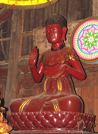
Chùa Keo (Hà Nội)
Keo Pagoda in Hà Nội, formally named Báo Ân Trùng Nghiêm Tự, is located in Chè village, Kim Sơn commune, Gia Lâm district, Hà Nội. The pagoda venerates Lady Keo, also known as Lady Pháp Vân, who is one of the Four Great Dharma Goddesses (Tứ Đại Phật Pháp) of ancient Vietnam.
🏯
Chùa Khai Nguyên
Khai Nguyên Pagoda, also known as Xuân La Pagoda, is located at Group 39, Cluster 5A, Xuân La Ward, Tây Hồ District, Hanoi City. The grand annual memorial day is held on the 24th day of the 2nd lunar month.
🏯
Chùa Kiến Sơ
The Kiến Sơ Temple (Vietnamese: chùa Kiến Sơ) is a Buddhist temple in Gia Lâm District of Hanoi, Vietnam. The Chinese monk Vô Ngôn Thông came to reside in the temple around 820 and it became an important base for propagation of Buddhism in Vietnam.

Chùa Kim Liên
The Kim Liên Pagoda (Vietnamese: Chùa Kim Liên, Kim Liên tự), Chữ Hán: 金蓮寺) is a Buddhist pagoda in Hanoi. The pagoda is built on a strip of silt land by West Lake, then in Nghi Tàm village, today in Quảng An village, Tây Hồ district. According to tradition, the pagoda was built on the foundation of the Lý dynasty Từ Hoa Palace, named after princess Từ Hoa, daughter of Lý Thần Tông (1128-1138), in an area used as a royal silk farm. The current pagoda was reconstructed 1771–1792.

Chùa Kim Sơn (Hà Nội)
Kim Sơn Pagoda, commonly known as Kim Mã Pagoda, is located at 73 Kim Mã Street, Giảng Võ Ward, Hà Nội City.

Chùa Láng
Chiêu Thiền Pagoda (Vietnamese: Chiêu Thiền tự, Hán Nôm: 昭禪寺) is a Buddhist temple in Kẻ Láng Village, now Láng Ward of the capital Hanoi, Vietnam.
🏯
Chùa Liên Phái
Liên Phái Pagoda is a pagoda in the capital city of Hanoi, Vietnam. The pagoda is located in Liên Phái alley, Bạch Mai street, in Cầu Dền ward, Hai Bà Trưng district. Liên Phái has been the name of the pagoda since 1840; previously, it was called Liên Hoa and then Liên Tông.

Chùa Mía
Mía Pagoda (formal name: Sùng Nghiêm tự, 崇嚴寺) is a pagoda located in Sơn Tây ward, Hanoi city. In the past, this area was called Cam Giá, with the vernacular name Mía, hence the pagoda is commonly known as Mía Pagoda. This is the pagoda that preserves the largest number of artistic statues in Vietnam (287 statues).
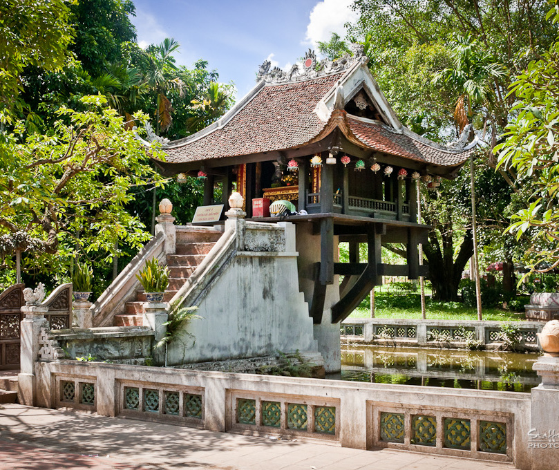
Chùa Một Cột
The One Pillar Pagoda (Vietnamese: Chùa Một Cột; chữ Nôm: 廚𠬠榾), formally belongs to an architecture complex called Diên Hựu tự (chữ Hán: 延祐寺) which means 'pagoda of extended blessings'. The pagoda is a historic Buddhist temple in the central Ba Đình district (near the Thăng Long Citadel), Hanoi, the capital of Vietnam. The most famous part of this architecture complex is Liên Hoa Đài (蓮花臺) means 'the lotus pedestal' which is a temple with special structure: a building laid on one pillar. The original pagoda was built in 1049, had some additions and was perfected in 1105. It is regarded…
🏯
Chùa Nam Dư Thượng
Nam Dư Thượng Pagoda is located in Nam Dư Thượng village, now part of Lĩnh Nam ward, Hoàng Mai district, Hanoi City. The pagoda was classified as an architectural and artistic heritage site by the Ministry of Culture and Information on 31 January 1992.

Chùa Nành
Nành Pagoda, also known as Pháp Vân Pagoda or colloquially as Chùa Cả, is located in Nành village, Phù Đổng commune, Hà Nội. Nành Pagoda was once renowned as the 'foremost Zen monastery of Bắc Giang'. It belongs to the system of pagodas dedicated to the worship of the Tứ Pháp (Four Dharma Goddesses), and is one of the largest in northern Vietnam. The pagoda was built during the Lý dynasty. Its scale is considerable, comprising a thuỷ đình (water pavilion), tam quan (three-entrance gate), tiền đường (front hall), bridge, tam bảo (main Buddha hall), tả vu (left chamber), hữu vu (right chamber), Tổ house (ancestral hall), Mẫu shrine (Mother Goddess sanctuary), and auxiliary areas. The pagoda still preserves many artefacts from the 17th and 18th centuries, such as a bronze bell (1653), a bronze gong (1733), three stone steles, and many precious lacquered wooden statues, including the set of Tam Thế Buddha statues (each statue 0.8m tall, lotus pedestal and base 0.7m high), Tuyết Sơn statue (0.73m tall), the Eight Vajra Warriors statues (1.56m tall), the Ten Kings of the Underworld statues (1.35m tall), the Eighteen Arhats statues (1.08m tall), and the Bà Nành statue. The pagoda’s festival is held annually from the 4th to the 6th day of the 2nd lunar month. Nành Pagoda has been recognised as a national architectural and artistic heritage site of Vietnam since 1989.

Chùa Nga My
Hoàng Mai Pagoda (formal name: 'Nga My tự') is located at No. 8 Hoàng Mai Street, Tương Mai Ward, Hanoi (formerly part of Hoàng Mai Village in the Kẻ Mơ area), but is actually situated within Alley 160 and Alley 94 of Hoàng Mai Street, Tương Mai Ward, Hanoi. According to the stone stele in the pagoda, it underwent major renovations in the 28th year of the Hồng Đức era (1497), comprising the front hall, incense burning house, and upper hall. The stele also states that the pagoda was built immediately after King Lý Công Uẩn moved the capital from Hoa Lư to Thăng Long.

Chùa Ngũ Xã
Ngũ Xã Pagoda, with the formal name Thần Quang Tự, is located at 44 Ngũ Xã Street, Ba Đình Ward, Hà Nội. The pagoda was built during the Later Lê dynasty, in the 18th century. It is dedicated to the worship of the Buddha and Nguyễn Minh Không, the patriarch of the bronze casting craft. The name Thần Quang was chosen following the names of several pagodas founded by this national master, such as Cổ Lễ Pagoda (Ninh Bình), Keo Pagoda (Hưng Yên), and others. The pagoda belongs to the Northern School (Bắc tông) of Buddhism.
The pagoda was recognised by the Ministry of Culture and Information as a National Historical and Cultural Site in 1995.

Chùa Non Nước (Hà Nội)
Non Nước Pagoda, officially as ( Sóc Thiên Vương Thiền tự, 朔天王禪寺) is a Buddhist temple founded by Khuông Việt in 10th century in Sóc Sơn, Hanoi. The main attraction is a bronze Buddha.
🏯
Chùa Pháp Hoa (Hà Nội)
Pháp Hoa Pagoda is located on Trần Bình Trọng Street, Hai Bà Trưng Ward, Hà Nội City. An inscription stele carved in the 12th year of the Tự Đức era (1860) records that the villagers of Pháp Hoa contributed money and resources to build the pagoda in 1860. The pagoda still preserves many artefacts and ancient statues in the artistic style of the 19th century, which are of significant value. In 1989, the pagoda was classified as a scenic relic by the Ministry of Culture and Information. The cluster of three pagodas—Thiền Quang, Quang Hoa, and Pháp Hoa—stand next to each other at numbers 31–33.
🏯
Chùa Phúc Khánh
Phúc Khánh Pagoda (福慶寺), also known as Sở Pagoda (㕑所), is an ancient pagoda located at 382 Tây Sơn Street, Đống Đa Ward, Hà Nội. The pagoda was recognised by the Ministry of Culture and Information as a National Historical and Cultural Site in 1988.

Chùa Quán Sứ
Quán Sứ Pagoda (Vietnamese: Chùa Quán Sứ, chữ Hán: 舘使寺) is a Buddhist temple located at 73 Quan Su Street, Hanoi, Vietnam. The temple is the headquarters of the Buddhist Sangha of Vietnam.

Chùa Quang Hoa (Hà Nội)
Quang Hoa Pagoda is a pagoda located on Trần Bình Trọng Street, Hai Bà Trưng District, Hà Nội.
According to the stele "Quang Hoa tự thập phương bi" currently erected at Quang Hoa Pagoda, the pagoda was originally situated in Quang Hoa village, to the west of Thiền Quang village (both villages are now within Thống Nhất Park). The stele, carved in the 12th year of Tự Đức's reign (1860), records that the villagers of Pháp Hoa contributed funds to build the pagoda in 1860.
Around 1933–1934, the French colonial authorities relocated the three villages of Quang Hoa and Thiền Quang to other places to make way for road construction, and required the villagers to move to the current location.
Quang Hoa Pagoda faces south and has a triple-arched gate (tam quan), a main sanctuary (tam bảo) in the shape of a string of pestles, consisting of a front hall with 7 bays, a rear sanctuary with 5 bays, an ancestral house with 10 bays, two rows of side houses, each with 10 bays, and a stupa garden. The pagoda currently preserves many artefacts and ancient statues of valuable 19th-century artistic style. In 1989, the pagoda and the associated complex were classified as a scenic relic by the Ministry of Culture and Information. Quang Hoa Pagoda has a stele carved in 1880 that describes the construction of the pagoda. The cluster of three pagodas—Thiền Quang, Quang Hoa, and Pháp Hoa—stand next to each other at numbers 31–33.
Especially notable is the unique system of parallel sentences (câu đối) at the gate of Quang Hoa Pagoda. The name of the pagoda appears in both lines of the couplets, either at the beginning or in the middle:
Vernacular (Nôm) couplet:
QUANG cảnh tốt tươi, cửa Phật tiêu dao người tám cõi;
HOA hương ngào ngạt, lối trần hoan hỉ khách mười phương.
Translation:
Radiant scenery, the Buddha's gate brings ease to people of the eight realms;
Fragrant flowers, the worldly path delights guests from the ten directions.
Classical Chinese (Hán) couplets:
蓮座光生長引金繩開覺路;
池塘花映接來寶筏渡迷津。
Liên tọa QUANG sinh, trường dẫn kim thằng khai giác lộ;
Trì đường HOA ánh, tiếp lai bảo phiệt độ mê tân.
Translation:
From the lotus seat, radiance arises, the golden cord long draws forth, opening the path to enlightenment;
By the pond, flower reflections connect, bringing the precious raft to ferry across the sea of delusion.
無邊光景一時新,山水縈迴成畫本;
不盡花香三界舊,竹松幽雅獲清修。
Vô biên QUANG cảnh nhất thời tân, sơn thủy oanh hồi thành họa bản;
Bất tận HOA hương tam giới cựu, trúc tùng u nhã hoạch thanh tu.
Translation:
Boundless radiant scenery, newly revealed at this moment, mountains and waters winding, forming a living painting;
Endless floral fragrance, as of the old three realms, bamboo and pine in secluded elegance, attaining pure cultivation.
僧到佛來,光被萬家千古燭;
地靈天寶,花開十仗四辰蓮。
Tăng đáo Phật lai, QUANG bị vạn gia thiên cổ chúc;
Địa linh thiên bảo, HOA khai thập trượng tứ thời liên.
Translation:
Monks arrive, Buddhas come, radiance shines on ten thousand homes, an eternal lamp;
The land is sacred, heaven bestows treasures, flowers bloom ten trượng high, lotuses of all four seasons.
🏯
Chùa Quang Lãng
Quang Lãng Pagoda, with the formal name Viên Minh Tự and commonly known among the people as Chùa Ráng, is located in Phú Xuyên District, Hanoi. It is the residence of the Third Supreme Patriarch of the Vietnam Buddhist Sangha, Thích Phổ Tuệ.

Chùa Quảng Nghiêm
Quảng Nghiêm Pagoda (Chữ Hán: 廣嚴寺), also known as Tiên Lữ Pagoda or the Hundred-Bay Pagoda (Chùa Trăm Gian), is a pagoda situated on a hill approximately 50 metres high, in Tiên Lữ hamlet, Chương Mỹ ward, Hà Nội. The pagoda was established during the reign of Lý Cao Tông of the Lý dynasty, in the 10th year of the Trinh Phù era, 1185. During the Trần dynasty, there was a monk named Bình An, originally from Bối Khê, who practised here and was reputed to possess many miraculous powers. After his death, the villagers built a stupa to preserve his remains and respectfully referred to him as Đức Thánh Bối (the Holy One of Bối). The large pagoda as it exists today has been restored and expanded over many eras.
In the pagoda courtyard stands a two-storey, eight-roofed bell tower, erected in the year Quý Dậu 1693, during the Chính Hòa era under the reign of Lê Hy Tông, which is an architectural work of high artistic value. The pagoda also preserves many precious artefacts and statues. The name 'Hundred-Bay', a very popular name, seems to express the imposing appearance of the pagoda.

Chùa Sải
Sải Pagoda, with the formal name Tĩnh Lâu Tự, is located on the banks of West Lake in Hồ Khẩu village, formerly part of Trung canton, Vĩnh Thuận district, Hoài Đức prefecture, now in Bưởi ward, Tây Hồ district, Hanoi city. Tĩnh Lâu Pagoda was recognised as a historical and cultural relic according to Decision No. 1460 QĐ/BT dated 26 June 1996 by the Ministry of Culture and Information of Vietnam.
🏯
Chùa Sét
Sét Pagoda (formal name: 'Đại Bi tự' or 'Cổ Am tự') is located at 515 Trương Định Street, Hoàng Mai Ward, Hà Nội (formerly part of Giáp Lục of the old Sét Village (Kẻ Sét) or Thịnh Liệt), situated in an unnamed alley off Trương Định Street. The pagoda originally comprised two temples: 'Cổ Am tự' and 'Đại Bi tự', but today only 'Cổ Am tự' remains preserved. The pagoda is one of the temples that worship all of the Four Dharma Goddesses (Tứ pháp).
🏯
Chùa Sủi
Sủi Pagoda, whose formal name is Đại Dương Sùng Phúc Tự, is an ancient pagoda located in Phú Thị village, Gia Lâm commune, Hà Nội. During the Lý and Trần dynasties, the kings would often stay here overnight to await dreams and divine messages from the spirits. The pagoda currently preserves a stone khánh (a type of gong) that is over a thousand years old. The current abbot is Venerable Thích Thanh Phương. The pagoda was recently restored in 2006 and is part of a complex of đình (communal house), pagoda, and temple (dedicated to Ỷ Lan Nguyên Phi).

Chùa Tảo Sách
Tảo Sách Pagoda, also known as Tào Sách or Linh Sơn Tự, is located at 386 Lạc Long Quân Street, Nhật Tân Ward, Tây Hồ District, Hà Nội. The pagoda belongs to the Tào Động sect, which originated from Zen Master Thủy Nguyệt, the head of the Tào Động school, who taught disciples serving as abbots of pagodas around West Lake. In 1993, the pagoda was recognised by the State as a national-level historical and cultural site.

Chùa Tây Phương
Tây Phương Pagoda (its formal name is Sùng Phúc tự 崇福寺) is a pagoda built on the summit of Câu Lâu hill in Tây Phương commune, Hanoi city.

Chùa Thầy
Thầy Temple (Vietnamese: Chùa Thầy or Master's Temple) is a Buddhist temple in Quốc Oai Commune (formerly Hà Tây Province, now part of Hanoi), Vietnam. The temple is also known as Thiên Phúc Tự ("Temple of Heavenly Blessings"). The temple was established in the 11th century during the reign of Emperor Lý Nhân Tông of the Lý dynasty. It is dedicated to Zen master Từ Đạo Hạnh (1072–1116). It is one of the oldest Buddhist temples in Vietnam. It is well maintained by the monks.

Chùa Thiên Niên
Thiên Niên Pagoda, with the formal name Thiên Niên Cổ Tự, also known as Trích Sài Pagoda, is a pagoda located right on the shore of West Lake, in Trích Sài village, Bưởi ward, bordering Xuân La ward, Tây Hồ district, Hanoi city.
Chùa Thiền Quang
Thiền Quang Pagoda is located on Trần Bình Trọng Street, Cửa Nam Ward, Hanoi City. The pagoda still preserves many artefacts and ancient statues in the artistic style of the 19th century, which are of significant value. Within the pagoda, there is currently a stele carved in 1882 that recounts the pagoda's origins. In 1989, the pagoda was classified as a scenic relic by the Ministry of Culture and Information. The complex of three pagodas—Thiền Quang, Quang Hoa, and Pháp Hoa—stand next to each other at numbers 31–33.
🏯
Chùa Trầm
Trầm Pagoda is located on Trầm Mountain, also known as Tử Trầm Sơn (紫沉山), a complex of several pagodas situated in Chương Mỹ ward, Hà Nội, about 20 km from the centre of Hà Nội, formerly Long Châu village, Hà Đông province. The pagoda enjoys a beautiful setting, surrounded by smaller mountains such as Ninh Sơn, Đồng Lư, and Tiên Lữ. Every weekend, the site attracts large numbers of Buddhists and visitors who come to sightsee and organise overnight camping trips. It is also a paradise for enthusiasts of trekking, cycling, photography, and similar activities. This is a renowned scenic and cultural site, comprising Trầm Mountain and three pagodas: Trầm Pagoda, Hang Pagoda, and Vô Vi Pagoda. The three pagodas have achieved a remarkable harmony between mountain and pagoda, creating such a natural impression that visitors feel each pagoda is an inseparable part of its mountain.

Chùa Trấn Quốc
Trấn Quốc Pagoda (Vietnamese: chùa Trấn Quốc; Sino-Vietnamese: Trấn Quốc tự, chữ Hán: 鎮國寺), the oldest Buddhist temple in Hanoi, is located on a small island near the southeastern shore of Hanoi's West Lake, Vietnam.

Chùa Tư Khánh
Tư Khánh Pagoda, also known as Vẽ Pagoda or Cả Pagoda, is located in Đông Ngạc commune, Từ Liêm district, Hà Nội, about 10 km northeast of the city centre. The pagoda belongs to the Northern School (Bắc tông) of Vietnamese Buddhism and was built during the Later Lê dynasty. An inscription stele from the reign of Lê Thần Tông records the meritorious deeds of Mr. Nguyễn Phúc Ninh and Mrs. Trần Thị Ngọc Luân, who generously contributed to the renovation of the large pagoda.
The pagoda is constructed in an architectural style comprising a three-entrance gate (tam quan), bell tower, a square building with a layered roof (mái chồng diêm), the main pagoda, and the ancestral house (nhà Tổ). The main pagoda is structured in the shape of the letter 'Đinh', including a front hall (tiền đường) with three bays and two wings, and a rear sanctuary (hậu cung) with a layered roof. The Buddha hall (Điện Phật) is arranged in a solemn manner. The pagoda still preserves five elaborately crafted statues in the artistic style of the 18th–19th centuries, as well as many ancient worship objects.
In 1993, Tư Khánh Pagoda was recognised by the Minister of Culture and Information under Decision 2015/QĐ-BT as a national architectural and artistic heritage site, with a designated protected area.
🏯
Chùa Tự Khoát
Tự Khoát Pagoda, also known as Hưng Phúc Tự, is located in Tự Khoát village, Ngũ Hiệp commune, Thanh Trì district, Hà Nội. The pagoda was built with funds provided by two princesses of the Lý dynasty, who then also practised religious cultivation there.
🏯
Chùa Tứ Kỳ
Tứ Kỳ Pagoda, also known as Linh Tiên Tự, is located in Tứ Kỳ village, Hoàng Liệt ward, Hà Nội. The pagoda was recognised as a historical and cultural site in 1995.

Chùa Tứ Liên
Tứ Liên Pagoda, also known as Tứ Tổng Pagoda, with the formal name Tam Bảo Pagoda, is located on Âu Cơ Street, Tây Hồ Ward, Hanoi Capital. According to the pagoda's records, it was built during the Later Lê dynasty, in the reign of King Lê Thần Tông, in the third year of Đức Long (1631). The pagoda has been recognised by the Ministry of Culture as a National Historical and Cultural Site.

Chùa Vạn Niên
Vạn Niên Pagoda is located on the western shore of West Lake, Hanoi. The pagoda was formerly known as Vạn Tuế, situated in Quán La hamlet, which is now Vệ Hồ village, Xuân La ward, Tây Hồ district.
In the Lý dynasty, the year Giáp Dần, the fifth year of the Thuận Thiên era (1014), the Thạch Nhai Sangha leader Tấu requested permission to establish a precepts platform here to gather monks for ordination, which was approved by imperial edict. Many renowned monks such as Lâm Tuệ Sinh and Lý Thảo Đường successively served as abbots here. Later, a monk from Quảng Châu named Biện Tài came to practise and reside, and a record of dialogues was circulated in his time.
The pagoda formerly belonged to the Thảo Đường school. Among the recent abbots are: Most Venerable Thích Viên Thành (1950–2002), Venerable Thích Minh Tuệ. The pagoda belongs to the Hương Tích monastic lineage and propagates Esoteric Buddhism (Mật Tông).
🏯
Chùa Võng Thị
Võng Thị Pagoda, also known as Vinh Khánh Tự, is located at 75 Võng Thị, Bưởi Ward, Tây Hồ District, Hà Nội. The pagoda was built at the end of the Lý dynasty and has undergone numerous restorations. The main hall is solemnly arranged, with the uppermost level enshrining a set of Tam Thế Phật (Three Buddhas of the Past, Present, and Future) statues. Each statue is 0.9 metres high, including the lotus pedestal is 1.2 metres, and the knee width is 0.54 metres; they were carved from wood during the Mạc dynasty. The pagoda has been recognised by the Ministry of Culture as a National Historical and Cultural Site.
🏯
Chùa Vũ Thạch
Vũ Thạch Pagoda is named after Vũ Thạch village, which was once home to a renowned school and the village teacher Nguyễn Huy Đức (1824–1898), who was famous for his virtuous character and for training many talented and virtuous students in Thăng Long. The pagoda's architecture has a floor plan in the shape of a pestle handle, and the Buddha statues are arranged in a complete traditional system. In 1986, the pagoda and its associated relic complex were recognised by the Ministry of Culture and Information as an architectural and artistic heritage site.
Festivals are held annually on the 10th day of the 2nd lunar month and the 15th day of the 10th lunar month. During the festival, there is always a delegation of guests from Xuân Đỗ (Hạ) village who come to participate. The traditional offerings to the deities at the temple include a tray of sticky rice and a rooster. After the ritual, there are folk games and performances such as tổ tôm (a traditional card game), ca trù singing, hát văn (spiritual singing), and demonstrations of traditional martial arts.
🏯
Chùa Vua
Vua Pagoda is located in Phố Huế ward, Hai Bà Trưng district, Hà Nội. The pagoda was built during the Lê dynasty (1428–1527) and is dedicated to the chess king Đế Thích.

Chùa Yên Phú
Yên Phú Pagoda, located in Ngọc Hồi Commune, Hà Nội, is the oldest pagoda in Vietnam, established in the early years of the Common Era.
🏯
Cụm di tích Đình – Chùa – Bia Bà La Khê
The Đình – Chùa – Bia Bà La Khê Heritage Complex is a cultural heritage site located in La Khê Village, La Khê Ward, Hà Đông District, Hà Nội City. This complex includes La Khê Communal House (đình), Diên Khánh Pagoda (chùa), and Võ Quận Linh Từ (the Ancestral Hall of General Trần Chân) at Ngòi Pagoda.

Đạo quán Linh Tiên
Linh Tiên Đạo Quán, also known as Linh Tiên Quán Pagoda or Linh Tiên Pagoda, is a Taoist architectural structure established during the Triệu dynasty of Nam Việt. However, the architecture that exists today dates from the Mạc period.
This is a syncretic religious centre of both Buddhism and Taoism. Initially, it was a Buddhist monk's hermitage, later converted into a đạo quán (Taoist temple), and then from a đạo quán transformed again into a pagoda as it is today.
🏯
Đông Linh tự
Thanh Am Pagoda, also known as Đông Linh tự, is an ancient pagoda located at No. 76, Group 24, Thanh Am Street, Thượng Thanh Ward, Long Biên, Hà Nội.
🏯
Tháp Báo Thiên
Báo Thiên Tower (chữ Hán: 報天塔), with its full name Đại Thắng Tư Thiên Bảo Tháp (大勝資天寳塔), was built in 1057 at Báo Thiên Pagoda, now located on the western edge of Hoàn Kiếm Lake in Hà Nội (on land belonging to Nhà Chung Street, near the Cathedral). This tower reached a height of 100 trượng (approximately 33 metres), and had a total of 12 storeys. The top storey was made of bronze, while the lower storeys were constructed from stone and brick. The tower was ranked among the 'An Nam tứ đại khí', the four great treasures of the country, alongside the Buddha statue of Quỳnh Lâm Pagoda, the Phổ Minh Cauldron, and the Quy Điền Bell.

Tháp Hòa Phong
Hòa Phong Tower is a tower located on the shore of Hoàn Kiếm Lake, Hanoi, Vietnam. It is the only remaining ancient relic of Báo Ân Pagoda, a large pagoda built in 1842 during the Nguyễn dynasty. This tower is different from the tower of the same name at Dâu Pagoda in Thanh Khương ward, Thuận Thành town, Bắc Ninh province (see image).

Viên Dương Quán
This is an ancient Đạo Quán (Taoist temple) which has now been converted into a pagoda. The former quán belonged to the 'Đan Sơn Tứ Quán' system in the Đoài region, and is currently located in the east of Chiền hamlet, Đức Thượng commune, Hoài Đức district, Hanoi city. The quán is commonly known as Quán Chiền, with its formal name being Viên Dương Đạo Quán.
🏯
Chùa A Phái
Chùa A Phái is a Buddhist pagoda in Hà Nội, Vietnam. Its location comes from OpenStreetMap community data; further details will be added when reliable sources become available.
🏯
Chùa Ái Mộ
Chùa Ái Mộ is a Buddhist pagoda in Hà Nội, Vietnam. Its location comes from OpenStreetMap community data; further details will be added when reliable sources become available.
🏯
Chùa An Quốc
Chùa An Quốc is a Buddhist pagoda in Hà Nội, Vietnam. Its location comes from OpenStreetMap community data; further details will be added when reliable sources become available.
🏯
Chùa An Trai
Chùa An Trai is a Buddhist pagoda in Hà Nội, Vietnam. Its location comes from OpenStreetMap community data; further details will be added when reliable sources become available.
🏯
Chùa Âu Vàng
Chùa Âu Vàng is a Buddhist pagoda in Hà Nội, Vietnam. Its location comes from OpenStreetMap community data; further details will be added when reliable sources become available.
🏯
Chùa Bà
Chùa Bà is a Buddhist pagoda in Hà Nội, Vietnam. Its location comes from OpenStreetMap community data; further details will be added when reliable sources become available.
🏯
Chùa Bái Ân
Chùa Bái Ân is a Buddhist pagoda in Hà Nội, Vietnam. Its location comes from OpenStreetMap community data; further details will be added when reliable sources become available.
🏯
Chùa Báo Đáp
Chùa Báo Đáp is a Buddhist pagoda in Hà Nội, Vietnam. Its location comes from OpenStreetMap community data; further details will be added when reliable sources become available.
🏯
Chùa Bảo Phúc
Chùa Bảo Phúc is a Buddhist pagoda in Hà Nội, Vietnam. Its location comes from OpenStreetMap community data; further details will be added when reliable sources become available.
🏯
Chùa Bát Mẫu
Chùa Bát Mẫu is a Buddhist pagoda in Hà Nội, Vietnam. Its location comes from OpenStreetMap community data; further details will be added when reliable sources become available.
🏯
Chùa Bắc Biên
Chùa Bắc Biên is a Buddhist pagoda in Hà Nội, Vietnam. Its location comes from OpenStreetMap community data; further details will be added when reliable sources become available.
🏯
Chùa Bằng
Chùa Bằng is a Buddhist pagoda in Hà Nội, Vietnam. Its location comes from OpenStreetMap community data; further details will be added when reliable sources become available.
🏯
Chùa Bi
Chùa Bi is a Buddhist pagoda in Hà Nội, Vietnam. Its location comes from OpenStreetMap community data; further details will be added when reliable sources become available.
🏯
Chùa Bình Nguyên
Chùa Bình Nguyên is a Buddhist pagoda in Hà Nội, Vietnam. Its location comes from OpenStreetMap community data; further details will be added when reliable sources become available.
🏯
Chùa Bụt Mọc
Chùa Bụt Mọc is a Buddhist pagoda in Hà Nội, Vietnam. Its location comes from OpenStreetMap community data; further details will be added when reliable sources become available.
🏯
Chùa Bụt Mọc
Chùa Bụt Mọc is a Buddhist pagoda in Hà Nội, Vietnam. Its location comes from OpenStreetMap community data; further details will be added when reliable sources become available.
🏯
Chùa Cả
Chùa Cả is a Buddhist pagoda in Hà Nội, Vietnam. Its location comes from OpenStreetMap community data; further details will be added when reliable sources become available.
🏯
Chùa Cả
Chùa Cả is a Buddhist pagoda in Hà Nội, Vietnam. Its location comes from OpenStreetMap community data; further details will be added when reliable sources become available.
🏯
Chùa Cát Bi
Chùa Cát Bi is a Buddhist pagoda in Hà Nội, Vietnam. Its location comes from OpenStreetMap community data; further details will be added when reliable sources become available.
🏯
Chùa Cát Linh
Chùa Cát Linh is a Buddhist pagoda in Hà Nội, Vietnam. Its location comes from OpenStreetMap community data; further details will be added when reliable sources become available.
🏯
Chùa Cầu Đen
Chùa Cầu Đen is a Buddhist pagoda in Hà Nội, Vietnam. Its location comes from OpenStreetMap community data; further details will be added when reliable sources become available.
🏯
Chùa Cầu Đông
Chùa Cầu Đông is a Buddhist pagoda in Hà Nội, Vietnam. Its location comes from OpenStreetMap community data; further details will be added when reliable sources become available.
🏯
Chùa Cây Quế
Chùa Cây Quế is a Buddhist pagoda in Hà Nội, Vietnam. Its location comes from OpenStreetMap community data; further details will be added when reliable sources become available.
🏯
Chùa Châu Lâm
Chùa Châu Lâm is a Buddhist pagoda in Hà Nội, Vietnam. Its location comes from OpenStreetMap community data; further details will be added when reliable sources become available.
🏯
Chùa Chung Linh
Chùa Chung Linh is a Buddhist pagoda in Hà Nội, Vietnam. Its location comes from OpenStreetMap community data; further details will be added when reliable sources become available.
🏯
Chùa Cót
Chùa Cót is a Buddhist pagoda in Hà Nội, Vietnam. Its location comes from OpenStreetMap community data; further details will be added when reliable sources become available.
🏯
Chùa Cổ Hạc
Chùa Cổ Hạc is a Buddhist pagoda in Hà Nội, Vietnam. Its location comes from OpenStreetMap community data; further details will be added when reliable sources become available.
🏯
Chùa Cống Yên
Chùa Cống Yên is a Buddhist pagoda in Hà Nội, Vietnam. Its location comes from OpenStreetMap community data; further details will be added when reliable sources become available.
🏯
Chùa Cực Lạc
Chùa Cực Lạc is a Buddhist pagoda in Hà Nội, Vietnam. Its location comes from OpenStreetMap community data; further details will be added when reliable sources become available.
🏯
Chùa Cửu Việt
Chùa Cửu Việt is a Buddhist pagoda in Hà Nội, Vietnam. Its location comes from OpenStreetMap community data; further details will be added when reliable sources become available.
🏯
Chùa Dền
Chùa Dền is a Buddhist pagoda in Hà Nội, Vietnam. Its location comes from OpenStreetMap community data; further details will be added when reliable sources become available.
🏯
Chùa Diên Khánh
Chùa Diên Khánh is a Buddhist pagoda in Hà Nội, Vietnam. Its location comes from OpenStreetMap community data; further details will be added when reliable sources become available.
🏯
Chùa Diên Khánh
Chùa Diên Khánh is a Buddhist pagoda in Hà Nội, Vietnam. Its location comes from OpenStreetMap community data; further details will be added when reliable sources become available.
🏯
Chùa Diên Phúc
Chùa Diên Phúc is a Buddhist pagoda in Hà Nội, Vietnam. Its location comes from OpenStreetMap community data; further details will be added when reliable sources become available.
🏯
Chùa Duệ Tú
Chùa Duệ Tú is a Buddhist pagoda in Hà Nội, Vietnam. Its location comes from OpenStreetMap community data; further details will be added when reliable sources become available.
🏯
Chùa Dương Quang
Chùa Dương Quang is a Buddhist pagoda in Hà Nội, Vietnam. Its location comes from OpenStreetMap community data; further details will be added when reliable sources become available.
🏯
Chùa Đa Phúc
Chùa Đa Phúc is a Buddhist pagoda in Hà Nội, Vietnam. Its location comes from OpenStreetMap community data; further details will be added when reliable sources become available.
🏯
Chùa Đại An
Chùa Đại An is a Buddhist pagoda in Hà Nội, Vietnam. Its location comes from OpenStreetMap community data; further details will be added when reliable sources become available.
🏯
Chùa Đại Bi
Chùa Đại Bi is a Buddhist pagoda in Hà Nội, Vietnam. Its location comes from OpenStreetMap community data; further details will be added when reliable sources become available.
🏯
Chùa Đại Lan
Chùa Đại Lan is a Buddhist pagoda in Hà Nội, Vietnam. Its location comes from OpenStreetMap community data; further details will be added when reliable sources become available.
🏯
Chùa Đại Từ
Chùa Đại Từ is a Buddhist pagoda in Hà Nội, Vietnam. Its location comes from OpenStreetMap community data; further details will be added when reliable sources become available.
🏯
Chùa Đào Xá
Chùa Đào Xá is a Buddhist pagoda in Hà Nội, Vietnam. Its location comes from OpenStreetMap community data; further details will be added when reliable sources become available.
🏯
Chùa Đào Xuyên
Chùa Đào Xuyên is a Buddhist pagoda in Hà Nội, Vietnam. Its location comes from OpenStreetMap community data; further details will be added when reliable sources become available.
🏯
Chùa Đặng
Chùa Đặng is a Buddhist pagoda in Hà Nội, Vietnam. Its location comes from OpenStreetMap community data; further details will be added when reliable sources become available.
🏯
Chùa Điền Xá
Chùa Điền Xá is a Buddhist pagoda in Hà Nội, Vietnam. Its location comes from OpenStreetMap community data; further details will be added when reliable sources become available.
🏯
Chùa Đỏ
Chùa Đỏ is a Buddhist pagoda in Hà Nội, Vietnam. Its location comes from OpenStreetMap community data; further details will be added when reliable sources become available.
🏯
Chùa Đông Dư Thượng
Chùa Đông Dư Thượng is a Buddhist pagoda in Hà Nội, Vietnam. Its location comes from OpenStreetMap community data; further details will be added when reliable sources become available.
🏯
Chùa Đống Lim
Chùa Đống Lim is a Buddhist pagoda in Hà Nội, Vietnam. Its location comes from OpenStreetMap community data; further details will be added when reliable sources become available.
🏯
Chùa Đồng Quang
Chùa Đồng Quang is a Buddhist pagoda in Hà Nội, Vietnam. Its location comes from OpenStreetMap community data; further details will be added when reliable sources become available.
🏯
Chùa Đông Tân
Chùa Đông Tân is a Buddhist pagoda in Hà Nội, Vietnam. Its location comes from OpenStreetMap community data; further details will be added when reliable sources become available.
🏯
Chùa Đức Hòa - Phật Giáo Nguyên Thủy
Chùa Đức Hòa - Phật Giáo Nguyên Thủy is a Buddhist pagoda in Hà Nội, Vietnam. Its location comes from OpenStreetMap community data; further details will be added when reliable sources become available.
🏯
Chùa Gia Quất
Chùa Gia Quất is a Buddhist pagoda in Hà Nội, Vietnam. Its location comes from OpenStreetMap community data; further details will be added when reliable sources become available.
🏯
Chùa Giải Oan
Chùa Giải Oan is a Buddhist pagoda in Hà Nội, Vietnam. Its location comes from OpenStreetMap community data; further details will be added when reliable sources become available.
🏯
Chùa Giao Quang
Chùa Giao Quang is a Buddhist pagoda in Hà Nội, Vietnam. Its location comes from OpenStreetMap community data; further details will be added when reliable sources become available.
🏯
Chùa Giáp Bát
Chùa Giáp Bát is a Buddhist pagoda in Hà Nội, Vietnam. Its location comes from OpenStreetMap community data; further details will be added when reliable sources become available.
🏯
Chùa Giấy
Chùa Giấy is a Buddhist pagoda in Hà Nội, Vietnam. Its location comes from OpenStreetMap community data; further details will be added when reliable sources become available.
🏯
Chùa Hà Trì
Chùa Hà Trì is a Buddhist pagoda in Hà Nội, Vietnam. Its location comes from OpenStreetMap community data; further details will be added when reliable sources become available.
🏯
Chùa Hậu Ái
Chùa Hậu Ái is a Buddhist pagoda in Hà Nội, Vietnam. Its location comes from OpenStreetMap community data; further details will be added when reliable sources become available.
🏯
Chùa Hiển Quang
Chùa Hiển Quang is a Buddhist pagoda in Hà Nội, Vietnam. Its location comes from OpenStreetMap community data; further details will be added when reliable sources become available.
🏯
Chùa Hoà Bình Green City
Chùa Hoà Bình Green City is a Buddhist pagoda in Hà Nội, Vietnam. Its location comes from OpenStreetMap community data; further details will be added when reliable sources become available.
🏯
Chùa Hoa Lăng
Chùa Hoa Lăng is a Buddhist pagoda in Hà Nội, Vietnam. Its location comes from OpenStreetMap community data; further details will be added when reliable sources become available.
🏯
Chùa Hoà Phúc
Chùa Hoà Phúc is a Buddhist pagoda in Hà Nội, Vietnam. Its location comes from OpenStreetMap community data; further details will be added when reliable sources become available.
🏯
Chùa Hoàn Phúc
Chùa Hoàn Phúc is a Buddhist pagoda in Hà Nội, Vietnam. Its location comes from OpenStreetMap community data; further details will be added when reliable sources become available.
🏯
Chùa Hội
Chùa Hội is a Buddhist pagoda in Hà Nội, Vietnam. Its location comes from OpenStreetMap community data; further details will be added when reliable sources become available.
🏯
Chùa Hội Xá
Chùa Hội Xá is a Buddhist pagoda in Hà Nội, Vietnam. Its location comes from OpenStreetMap community data; further details will be added when reliable sources become available.
🏯
Chùa Huy Văn
Chùa Huy Văn is a Buddhist pagoda in Hà Nội, Vietnam. Its location comes from OpenStreetMap community data; further details will be added when reliable sources become available.
🏯
Chùa Hưng Khánh
Chùa Hưng Khánh is a Buddhist pagoda in Hà Nội, Vietnam. Its location comes from OpenStreetMap community data; further details will be added when reliable sources become available.
🏯
Chùa Hưng Phúc
Chùa Hưng Phúc is a Buddhist pagoda in Hà Nội, Vietnam. Its location comes from OpenStreetMap community data; further details will be added when reliable sources become available.
🏯
Chùa Hưng Phúc
Chùa Hưng Phúc is a Buddhist pagoda in Hà Nội, Vietnam. Its location comes from OpenStreetMap community data; further details will be added when reliable sources become available.
🏯
Chùa Hương Đỗ
Chùa Hương Đỗ is a Buddhist pagoda in Hà Nội, Vietnam. Its location comes from OpenStreetMap community data; further details will be added when reliable sources become available.
🏯
Chùa Hương Vân
Chùa Hương Vân is a Buddhist pagoda in Hà Nội, Vietnam. Its location comes from OpenStreetMap community data; further details will be added when reliable sources become available.
🏯
Chùa Hương Vân
Chùa Hương Vân is a Buddhist pagoda in Hà Nội, Vietnam. Its location comes from OpenStreetMap community data; further details will be added when reliable sources become available.
🏯
Chùa Khai Quang
Chùa Khai Quang is a Buddhist pagoda in Hà Nội, Vietnam. Its location comes from OpenStreetMap community data; further details will be added when reliable sources become available.
🏯
Chùa Khánh Linh
Chùa Khánh Linh is a Buddhist pagoda in Hà Nội, Vietnam. Its location comes from OpenStreetMap community data; further details will be added when reliable sources become available.
🏯
Chùa Khuyến Lương
Chùa Khuyến Lương is a Buddhist pagoda in Hà Nội, Vietnam. Its location comes from OpenStreetMap community data; further details will be added when reliable sources become available.
🏯
Chùa Kim Quan
Chùa Kim Quan is a Buddhist pagoda in Hà Nội, Vietnam. Its location comes from OpenStreetMap community data; further details will be added when reliable sources become available.
🏯
Chùa Kim Quy
Chùa Kim Quy is a Buddhist pagoda in Hà Nội, Vietnam. Its location comes from OpenStreetMap community data; further details will be added when reliable sources become available.
🏯
Chùa Kỳ Đà
Chùa Kỳ Đà is a Buddhist pagoda in Hà Nội, Vietnam. Its location comes from OpenStreetMap community data; further details will be added when reliable sources become available.
🏯
Chùa Kỳ Viên
Chùa Kỳ Viên is a Buddhist pagoda in Hà Nội, Vietnam. Its location comes from OpenStreetMap community data; further details will be added when reliable sources become available.
🏯
Chùa Lai
Chùa Lai is a Buddhist pagoda in Hà Nội, Vietnam. Its location comes from OpenStreetMap community data; further details will be added when reliable sources become available.
🏯
Chùa làng Cam
Chùa làng Cam is a Buddhist pagoda in Hà Nội, Vietnam. Its location comes from OpenStreetMap community data; further details will be added when reliable sources become available.
🏯
Chùa Làng Nghiêm Xá
Chùa Làng Nghiêm Xá is a Buddhist pagoda in Hà Nội, Vietnam. Its location comes from OpenStreetMap community data; further details will be added when reliable sources become available.
🏯
Chùa làng Thượng
Chùa làng Thượng is a Buddhist pagoda in Hà Nội, Vietnam. Its location comes from OpenStreetMap community data; further details will be added when reliable sources become available.
🏯
Chùa Làng Vân Côn
Chùa Làng Vân Côn is a Buddhist pagoda in Hà Nội, Vietnam. Its location comes from OpenStreetMap community data; further details will be added when reliable sources become available.
🏯
Chùa làng Yên Sơn
Chùa làng Yên Sơn is a Buddhist pagoda in Hà Nội, Vietnam. Its location comes from OpenStreetMap community data; further details will be added when reliable sources become available.
🏯
Chùa Lâm Du
Chùa Lâm Du is a Buddhist pagoda in Hà Nội, Vietnam. Its location comes from OpenStreetMap community data; further details will be added when reliable sources become available.
🏯
Chùa Lệ Mật
Chùa Lệ Mật is a Buddhist pagoda in Hà Nội, Vietnam. Its location comes from OpenStreetMap community data; further details will be added when reliable sources become available.
🏯
Chùa Lê Xá
Chùa Lê Xá is a Buddhist pagoda in Hà Nội, Vietnam. Its location comes from OpenStreetMap community data; further details will be added when reliable sources become available.
🏯
Chùa Liên Đàm
Chùa Liên Đàm is a Buddhist pagoda in Hà Nội, Vietnam. Its location comes from OpenStreetMap community data; further details will be added when reliable sources become available.
🏯
Chùa Liên Hoa
Chùa Liên Hoa is a Buddhist pagoda in Hà Nội, Vietnam. Its location comes from OpenStreetMap community data; further details will be added when reliable sources become available.
🏯
Chùa Linh Nhân Tư Phúc
Chùa Linh Nhân Tư Phúc is a Buddhist pagoda in Hà Nội, Vietnam. Its location comes from OpenStreetMap community data; further details will be added when reliable sources become available.
🏯
Chùa Linh Quang
Chùa Linh Quang is a Buddhist pagoda in Hà Nội, Vietnam. Its location comes from OpenStreetMap community data; further details will be added when reliable sources become available.
🏯
Chùa Linh Quang
Chùa Linh Quang is a Buddhist pagoda in Hà Nội, Vietnam. Its location comes from OpenStreetMap community data; further details will be added when reliable sources become available.
🏯
Chùa Linh Quang
Chùa Linh Quang is a Buddhist pagoda in Hà Nội, Vietnam. Its location comes from OpenStreetMap community data; further details will be added when reliable sources become available.
🏯
Chùa Linh Thông
Chùa Linh Thông is a Buddhist pagoda in Hà Nội, Vietnam. Its location comes from OpenStreetMap community data; further details will be added when reliable sources become available.
🏯
Chùa Linh Thông
Chùa Linh Thông is a Buddhist pagoda in Hà Nội, Vietnam. Its location comes from OpenStreetMap community data; further details will be added when reliable sources become available.
🏯
Chùa Linh Ứng
Chùa Linh Ứng is a Buddhist pagoda in Hà Nội, Vietnam. Its location comes from OpenStreetMap community data; further details will be added when reliable sources become available.
🏯
Chùa Long Đẩu
Chùa Long Đẩu is a Buddhist pagoda in Hà Nội, Vietnam. Its location comes from OpenStreetMap community data; further details will be added when reliable sources become available.
🏯
Chùa Long Quang
Chùa Long Quang is a Buddhist pagoda in Hà Nội, Vietnam. Its location comes from OpenStreetMap community data; further details will be added when reliable sources become available.
🏯
Chùa Long Tiên
Chùa Long Tiên is a Buddhist pagoda in Hà Nội, Vietnam. Its location comes from OpenStreetMap community data; further details will be added when reliable sources become available.
🏯
Chùa Lủ
Chùa Lủ is a Buddhist pagoda in Hà Nội, Vietnam. Its location comes from OpenStreetMap community data; further details will be added when reliable sources become available.

Chùa Lý Triều Quốc Sư
Chùa Lý Triều Quốc Sư is a Buddhist pagoda in Hà Nội, Vietnam. Its location comes from OpenStreetMap community data; further details will be added when reliable sources become available.
🏯
Chùa Mai Phúc
Chùa Mai Phúc is a Buddhist pagoda in Hà Nội, Vietnam. Its location comes from OpenStreetMap community data; further details will be added when reliable sources become available.
🏯
Chùa Mật Dụng
Chùa Mật Dụng is a Buddhist pagoda in Hà Nội, Vietnam. Its location comes from OpenStreetMap community data; further details will be added when reliable sources become available.
🏯
Chùa Minh Ngộ
Chùa Minh Ngộ is a Buddhist pagoda in Hà Nội, Vietnam. Its location comes from OpenStreetMap community data; further details will be added when reliable sources become available.
🏯
Chùa Mỗ Lao
Chùa Mỗ Lao is a Buddhist pagoda in Hà Nội, Vietnam. Its location comes from OpenStreetMap community data; further details will be added when reliable sources become available.
🏯
Chùa Một Mái
Chùa Một Mái is a Buddhist pagoda in Hà Nội, Vietnam. Its location comes from OpenStreetMap community data; further details will be added when reliable sources become available.
🏯
Chùa Mỹ Quang
Chùa Mỹ Quang is a Buddhist pagoda in Hà Nội, Vietnam. Its location comes from OpenStreetMap community data; further details will be added when reliable sources become available.
🏯
Chùa Nam An Khánh
Chùa Nam An Khánh is a Buddhist pagoda in Hà Nội, Vietnam. Its location comes from OpenStreetMap community data; further details will be added when reliable sources become available.
🏯
Chùa Nam Bảo
Chùa Nam Bảo is a Buddhist pagoda in Hà Nội, Vietnam. Its location comes from OpenStreetMap community data; further details will be added when reliable sources become available.
🏯
Chùa Nam Dư Hạ
Chùa Nam Dư Hạ is a Buddhist pagoda in Hà Nội, Vietnam. Its location comes from OpenStreetMap community data; further details will be added when reliable sources become available.
🏯
Chùa Nam Đồng
Chùa Nam Đồng is a Buddhist pagoda in Hà Nội, Vietnam. Its location comes from OpenStreetMap community data; further details will be added when reliable sources become available.
🏯
Chùa Nền
Chùa Nền is a Buddhist pagoda in Hà Nội, Vietnam. Its location comes from OpenStreetMap community data; further details will be added when reliable sources become available.
🏯
Chùa Ngãi Cầu
Chùa Ngãi Cầu is a Buddhist pagoda in Hà Nội, Vietnam. Its location comes from OpenStreetMap community data; further details will be added when reliable sources become available.
🏯
Chùa Nghinh Phúc
Chùa Nghinh Phúc is a Buddhist pagoda in Hà Nội, Vietnam. Its location comes from OpenStreetMap community data; further details will be added when reliable sources become available.
🏯
Chùa Ngọc Động
Chùa Ngọc Động is a Buddhist pagoda in Hà Nội, Vietnam. Its location comes from OpenStreetMap community data; further details will be added when reliable sources become available.
🏯
Chùa Ngọc Hồ
Chùa Ngọc Hồ is a Buddhist pagoda in Hà Nội, Vietnam. Its location comes from OpenStreetMap community data; further details will be added when reliable sources become available.
🏯
Chùa Ngọc Hồi
Chùa Ngọc Hồi is a Buddhist pagoda in Hà Nội, Vietnam. Its location comes from OpenStreetMap community data; further details will be added when reliable sources become available.
🏯
Chùa Ngọc Trục
Chùa Ngọc Trục is a Buddhist pagoda in Hà Nội, Vietnam. Its location comes from OpenStreetMap community data; further details will be added when reliable sources become available.
🏯
Chùa Ngòi
Chùa Ngòi is a Buddhist pagoda in Hà Nội, Vietnam. Its location comes from OpenStreetMap community data; further details will be added when reliable sources become available.
🏯
Chùa Ngô
Chùa Ngô is a Buddhist pagoda in Hà Nội, Vietnam. Its location comes from OpenStreetMap community data; further details will be added when reliable sources become available.
🏯
Chùa Nhân Lễ
Chùa Nhân Lễ is a Buddhist pagoda in Hà Nội, Vietnam. Its location comes from OpenStreetMap community data; further details will be added when reliable sources become available.
🏯
Chùa Phả Quang
Chùa Phả Quang is a Buddhist pagoda in Hà Nội, Vietnam. Its location comes from OpenStreetMap community data; further details will be added when reliable sources become available.
🏯
Chùa Pháp Bảo Tạng
Chùa Pháp Bảo Tạng is a Buddhist pagoda in Hà Nội, Vietnam. Its location comes from OpenStreetMap community data; further details will be added when reliable sources become available.
🏯
Chùa Pháp Văn
Chùa Pháp Văn is a Buddhist pagoda in Hà Nội, Vietnam. Its location comes from OpenStreetMap community data; further details will be added when reliable sources become available.
🏯
Chùa Pháp Vân
Chùa Pháp Vân is a Buddhist pagoda in Hà Nội, Vietnam. Its location comes from OpenStreetMap community data; further details will be added when reliable sources become available.
🏯
Chùa Phổ Giác
Chùa Phổ Giác is a Buddhist pagoda in Hà Nội, Vietnam. Its location comes from OpenStreetMap community data; further details will be added when reliable sources become available.
🏯
Chùa Phổ Linh
Chùa Phổ Linh is a Buddhist pagoda in Hà Nội, Vietnam. Its location comes from OpenStreetMap community data; further details will be added when reliable sources become available.
🏯
Chùa Phú Đôi
Chùa Phú Đôi is a Buddhist pagoda in Hà Nội, Vietnam. Its location comes from OpenStreetMap community data; further details will be added when reliable sources become available.
🏯
Chùa Phúc Khánh (Mơ Táo)
Chùa Phúc Khánh (Mơ Táo) is a Buddhist pagoda in Hà Nội, Vietnam. Its location comes from OpenStreetMap community data; further details will be added when reliable sources become available.
🏯
Chùa Phúc Lâm
Chùa Phúc Lâm is a Buddhist pagoda in Hà Nội, Vietnam. Its location comes from OpenStreetMap community data; further details will be added when reliable sources become available.
🏯
Chùa Phúc Lâm
Chùa Phúc Lâm is a Buddhist pagoda in Hà Nội, Vietnam. Its location comes from OpenStreetMap community data; further details will be added when reliable sources become available.
🏯
Chùa Phúc Long
Chùa Phúc Long is a Buddhist pagoda in Hà Nội, Vietnam. Its location comes from OpenStreetMap community data; further details will be added when reliable sources become available.
🏯
Chùa Phúc Long
Chùa Phúc Long is a Buddhist pagoda in Hà Nội, Vietnam. Its location comes from OpenStreetMap community data; further details will be added when reliable sources become available.
🏯
Chùa Phúc Nương
Chùa Phúc Nương is a Buddhist pagoda in Hà Nội, Vietnam. Its location comes from OpenStreetMap community data; further details will be added when reliable sources become available.
🏯
Chùa Phụng Thánh
Chùa Phụng Thánh is a Buddhist pagoda in Hà Nội, Vietnam. Its location comes from OpenStreetMap community data; further details will be added when reliable sources become available.
🏯
Chùa Phượng Nghĩa
Chùa Phượng Nghĩa is a Buddhist pagoda in Hà Nội, Vietnam. Its location comes from OpenStreetMap community data; further details will be added when reliable sources become available.
🏯
Chùa Phượng Vũ
Chùa Phượng Vũ is a Buddhist pagoda in Hà Nội, Vietnam. Its location comes from OpenStreetMap community data; further details will be added when reliable sources become available.
🏯
Chùa Quan Âm
Chùa Quan Âm is a Buddhist pagoda in Hà Nội, Vietnam. Its location comes from OpenStreetMap community data; further details will be added when reliable sources become available.
🏯
Chùa Quan Hoa
Chùa Quan Hoa is a Buddhist pagoda in Hà Nội, Vietnam. Its location comes from OpenStreetMap community data; further details will be added when reliable sources become available.
🏯
Chùa Quán Huyền Thiên
Chùa Quán Huyền Thiên is a Buddhist pagoda in Hà Nội, Vietnam. Its location comes from OpenStreetMap community data; further details will be added when reliable sources become available.
🏯
Chùa Quan Nhân
Chùa Quan Nhân is a Buddhist pagoda in Hà Nội, Vietnam. Its location comes from OpenStreetMap community data; further details will be added when reliable sources become available.
🏯
Chùa Quán Tình
Chùa Quán Tình is a Buddhist pagoda in Hà Nội, Vietnam. Its location comes from OpenStreetMap community data; further details will be added when reliable sources become available.
🏯
Chùa Quang Phúc
Chùa Quang Phúc is a Buddhist pagoda in Hà Nội, Vietnam. Its location comes from OpenStreetMap community data; further details will be added when reliable sources become available.
🏯
Chùa Quế Lâm
Chùa Quế Lâm is a Buddhist pagoda in Hà Nội, Vietnam. Its location comes from OpenStreetMap community data; further details will be added when reliable sources become available.
🏯
Chùa Quỳnh Lôi
Chùa Quỳnh Lôi is a Buddhist pagoda in Hà Nội, Vietnam. Its location comes from OpenStreetMap community data; further details will be added when reliable sources become available.
🏯
Chùa Quýt
Chùa Quýt is a Buddhist pagoda in Hà Nội, Vietnam. Its location comes from OpenStreetMap community data; further details will be added when reliable sources become available.
🏯
Chùa Sen Hồ
Chùa Sen Hồ is a Buddhist pagoda in Hà Nội, Vietnam. Its location comes from OpenStreetMap community data; further details will be added when reliable sources become available.
🏯
Chùa Sở Vòng
Chùa Sở Vòng is a Buddhist pagoda in Hà Nội, Vietnam. Its location comes from OpenStreetMap community data; further details will be added when reliable sources become available.
🏯
Chùa Sùng Ân
Chùa Sùng Ân is a Buddhist pagoda in Hà Nội, Vietnam. Its location comes from OpenStreetMap community data; further details will be added when reliable sources become available.
🏯
Chùa Sùng Ân (Cũ)
Chùa Sùng Ân (Cũ) is a Buddhist pagoda in Hà Nội, Vietnam. Its location comes from OpenStreetMap community data; further details will be added when reliable sources become available.
🏯
Chùa Sùng Ân (Mới)
Chùa Sùng Ân (Mới) is a Buddhist pagoda in Hà Nội, Vietnam. Its location comes from OpenStreetMap community data; further details will be added when reliable sources become available.
🏯
Chùa Sùng Quang
Chùa Sùng Quang is a Buddhist pagoda in Hà Nội, Vietnam. Its location comes from OpenStreetMap community data; further details will be added when reliable sources become available.
🏯
Chùa Sùng Tích
Chùa Sùng Tích is a Buddhist pagoda in Hà Nội, Vietnam. Its location comes from OpenStreetMap community data; further details will be added when reliable sources become available.
🏯
Chùa Tăng Phúc
Chùa Tăng Phúc is a Buddhist pagoda in Hà Nội, Vietnam. Its location comes from OpenStreetMap community data; further details will be added when reliable sources become available.
🏯
Chùa Tâm Pháp - Giáp Nhị
Chùa Tâm Pháp - Giáp Nhị is a Buddhist pagoda in Hà Nội, Vietnam. Its location comes from OpenStreetMap community data; further details will be added when reliable sources become available.
🏯
Chùa Tề Đồng Vật Ngã
Chùa Tề Đồng Vật Ngã is a Buddhist pagoda in Hà Nội, Vietnam. Its location comes from OpenStreetMap community data; further details will be added when reliable sources become available.
🏯
Chùa Tế Tiêu
Chùa Tế Tiêu is a Buddhist pagoda in Hà Nội, Vietnam. Its location comes from OpenStreetMap community data; further details will be added when reliable sources become available.
🏯
Chùa Thạch Cầu
Chùa Thạch Cầu is a Buddhist pagoda in Hà Nội, Vietnam. Its location comes from OpenStreetMap community data; further details will be added when reliable sources become available.
🏯
Chùa Thanh An
Chùa Thanh An is a Buddhist pagoda in Hà Nội, Vietnam. Its location comes from OpenStreetMap community data; further details will be added when reliable sources become available.
🏯
Chùa Thánh Chúa
Chùa Thánh Chúa is a Buddhist pagoda in Hà Nội, Vietnam. Its location comes from OpenStreetMap community data; further details will be added when reliable sources become available.
🏯
Chùa Thanh Ninh
Chùa Thanh Ninh is a Buddhist pagoda in Hà Nội, Vietnam. Its location comes from OpenStreetMap community data; further details will be added when reliable sources become available.
🏯
Chùa Tháp
Chùa Tháp is a Buddhist pagoda in Hà Nội, Vietnam. Its location comes from OpenStreetMap community data; further details will be added when reliable sources become available.
🏯
Chùa Thần Quang
Chùa Thần Quang is a Buddhist pagoda in Hà Nội, Vietnam. Its location comes from OpenStreetMap community data; further details will be added when reliable sources become available.
🏯
Chùa Thiện Khánh Mai Động
Chùa Thiện Khánh Mai Động is a Buddhist pagoda in Hà Nội, Vietnam. Its location comes from OpenStreetMap community data; further details will be added when reliable sources become available.
🏯
Chùa Thiên Long
Chùa Thiên Long is a Buddhist pagoda in Hà Nội, Vietnam. Its location comes from OpenStreetMap community data; further details will be added when reliable sources become available.
🏯
Chùa Thiên Phúc
Chùa Thiên Phúc is a Buddhist pagoda in Hà Nội, Vietnam. Its location comes from OpenStreetMap community data; further details will be added when reliable sources become available.
🏯
Chùa Thiên Phúc
Chùa Thiên Phúc is a Buddhist pagoda in Hà Nội, Vietnam. Its location comes from OpenStreetMap community data; further details will be added when reliable sources become available.
🏯
Chùa Thiên Phúc
Chùa Thiên Phúc is a Buddhist pagoda in Hà Nội, Vietnam. Its location comes from OpenStreetMap community data; further details will be added when reliable sources become available.

Chùa Thiên Trù
The Hương Temple (Vietnamese: Chùa Hương, Chữ Hán: 香寺) is a vast complex of Buddhist temples and shrines built into the limestone Hương Tích mountains. It is the site of a religious festival which draws large numbers of pilgrims from across Vietnam.
🏯
Chùa Thọ Cầu
Chùa Thọ Cầu is a Buddhist pagoda in Hà Nội, Vietnam. Its location comes from OpenStreetMap community data; further details will be added when reliable sources become available.
🏯
Chùa Thọ Lão
Chùa Thọ Lão is a Buddhist pagoda in Hà Nội, Vietnam. Its location comes from OpenStreetMap community data; further details will be added when reliable sources become available.
🏯
Chùa Thọ Sơn
Chùa Thọ Sơn is a Buddhist pagoda in Hà Nội, Vietnam. Its location comes from OpenStreetMap community data; further details will be added when reliable sources become available.
🏯
Chùa Thổ Khối
Chùa Thổ Khối is a Buddhist pagoda in Hà Nội, Vietnam. Its location comes from OpenStreetMap community data; further details will be added when reliable sources become available.
🏯
Chùa thôn Cống Trung
Chùa thôn Cống Trung is a Buddhist pagoda in Hà Nội, Vietnam. Its location comes from OpenStreetMap community data; further details will be added when reliable sources become available.
🏯
Chùa thôn Dương Kệ
Chùa thôn Dương Kệ is a Buddhist pagoda in Hà Nội, Vietnam. Its location comes from OpenStreetMap community data; further details will be added when reliable sources become available.
🏯
Chùa thôn Đình Vỹ
Chùa thôn Đình Vỹ is a Buddhist pagoda in Hà Nội, Vietnam. Its location comes from OpenStreetMap community data; further details will be added when reliable sources become available.
🏯
Chùa thôn Đỗ Xá
Chùa thôn Đỗ Xá is a Buddhist pagoda in Hà Nội, Vietnam. Its location comes from OpenStreetMap community data; further details will be added when reliable sources become available.
🏯
Chùa Thôn Nghè
Chùa Thôn Nghè is a Buddhist pagoda in Hà Nội, Vietnam. Its location comes from OpenStreetMap community data; further details will be added when reliable sources become available.
🏯
Chùa Thôn Trung
Chùa Thôn Trung is a Buddhist pagoda in Hà Nội, Vietnam. Its location comes from OpenStreetMap community data; further details will be added when reliable sources become available.
🏯
Chùa Thôn Yên Viên
Chùa Thôn Yên Viên is a Buddhist pagoda in Hà Nội, Vietnam. Its location comes from OpenStreetMap community data; further details will be added when reliable sources become available.
🏯
Chùa Thuận Tốn
Chùa Thuận Tốn is a Buddhist pagoda in Hà Nội, Vietnam. Its location comes from OpenStreetMap community data; further details will be added when reliable sources become available.
🏯
Chùa Thượng Đồng
Chùa Thượng Đồng is a Buddhist pagoda in Hà Nội, Vietnam. Its location comes from OpenStreetMap community data; further details will be added when reliable sources become available.
🏯
Chùa Thượng Lâm
Chùa Thượng Lâm is a Buddhist pagoda in Hà Nội, Vietnam. Its location comes from OpenStreetMap community data; further details will be added when reliable sources become available.
🏯
Chùa Tiên Tân
Chùa Tiên Tân is a Buddhist pagoda in Hà Nội, Vietnam. Its location comes from OpenStreetMap community data; further details will be added when reliable sources become available.
🏯
Chùa Tiêu Giao
Chùa Tiêu Giao is a Buddhist pagoda in Hà Nội, Vietnam. Its location comes from OpenStreetMap community data; further details will be added when reliable sources become available.
🏯
Chùa Tiêu Giao
Chùa Tiêu Giao is a Buddhist pagoda in Hà Nội, Vietnam. Its location comes from OpenStreetMap community data; further details will be added when reliable sources become available.
🏯
Chùa Tỉnh Âm
Chùa Tỉnh Âm is a Buddhist pagoda in Hà Nội, Vietnam. Its location comes from OpenStreetMap community data; further details will be added when reliable sources become available.

Chùa Tĩnh Lâu
Chùa Tĩnh Lâu is a Buddhist pagoda in Hà Nội, Vietnam. Its location comes from OpenStreetMap community data; further details will be added when reliable sources become available.
🏯
Chùa Tình Quang
Chùa Tình Quang is a Buddhist pagoda in Hà Nội, Vietnam. Its location comes from OpenStreetMap community data; further details will be added when reliable sources become available.
🏯
Chùa Tràng An
Chùa Tràng An is a Buddhist pagoda in Hà Nội, Vietnam. Its location comes from OpenStreetMap community data; further details will be added when reliable sources become available.
🏯
Chùa Tranh Khúc
Chùa Tranh Khúc is a Buddhist pagoda in Hà Nội, Vietnam. Its location comes from OpenStreetMap community data; further details will be added when reliable sources become available.
🏯
Chùa Trăm Gian
Chùa Trăm Gian is a Buddhist pagoda in Hà Nội, Vietnam. Its location comes from OpenStreetMap community data; further details will be added when reliable sources become available.
🏯
Chùa Trúc Động
Chùa Trúc Động is a Buddhist pagoda in Hà Nội, Vietnam. Its location comes from OpenStreetMap community data; further details will be added when reliable sources become available.
🏯
Chùa Trung Đồng
Chùa Trung Đồng is a Buddhist pagoda in Hà Nội, Vietnam. Its location comes from OpenStreetMap community data; further details will be added when reliable sources become available.
🏯
Chùa Trung Hậu
Chùa Trung Hậu is a Buddhist pagoda in Hà Nội, Vietnam. Its location comes from OpenStreetMap community data; further details will be added when reliable sources become available.
🏯
Chùa Trung Kính Thượng
Chùa Trung Kính Thượng is a Buddhist pagoda in Hà Nội, Vietnam. Its location comes from OpenStreetMap community data; further details will be added when reliable sources become available.
🏯
Chùa Trung Lập
Chùa Trung Lập is a Buddhist pagoda in Hà Nội, Vietnam. Its location comes from OpenStreetMap community data; further details will be added when reliable sources become available.
🏯
Chùa Trùng Quán
Chùa Trùng Quán is a Buddhist pagoda in Hà Nội, Vietnam. Its location comes from OpenStreetMap community data; further details will be added when reliable sources become available.
🏯
Chùa Trung Tự
Chùa Trung Tự is a Buddhist pagoda in Hà Nội, Vietnam. Its location comes from OpenStreetMap community data; further details will be added when reliable sources become available.
🏯
Chùa Tứ Xã
Chùa Tứ Xã is a Buddhist pagoda in Hà Nội, Vietnam. Its location comes from OpenStreetMap community data; further details will be added when reliable sources become available.
🏯
Chùa Tương Mai
Chùa Tương Mai is a Buddhist pagoda in Hà Nội, Vietnam. Its location comes from OpenStreetMap community data; further details will be added when reliable sources become available.
🏯
Chùa Tựu Liệt
Chùa Tựu Liệt is a Buddhist pagoda in Hà Nội, Vietnam. Its location comes from OpenStreetMap community data; further details will be added when reliable sources become available.
🏯
Chùa Văn Phú
Chùa Văn Phú is a Buddhist pagoda in Hà Nội, Vietnam. Its location comes from OpenStreetMap community data; further details will be added when reliable sources become available.
🏯
Chùa Vân Hồ
Chùa Vân Hồ is a Buddhist pagoda in Hà Nội, Vietnam. Its location comes from OpenStreetMap community data; further details will be added when reliable sources become available.
🏯
Chùa Viên Thành
Chùa Viên Thành is a Buddhist pagoda in Hà Nội, Vietnam. Its location comes from OpenStreetMap community data; further details will be added when reliable sources become available.
🏯
Chùa Vĩnh Khánh
Chùa Vĩnh Khánh is a Buddhist pagoda in Hà Nội, Vietnam. Its location comes from OpenStreetMap community data; further details will be added when reliable sources become available.
🏯
Chùa Vĩnh Lạc
Chùa Vĩnh Lạc is a Buddhist pagoda in Hà Nội, Vietnam. Its location comes from OpenStreetMap community data; further details will be added when reliable sources become available.
🏯
Chùa Vĩnh Trù
Chùa Vĩnh Trù is a Buddhist pagoda in Hà Nội, Vietnam. Its location comes from OpenStreetMap community data; further details will be added when reliable sources become available.
🏯
Chùa Vo Đông
Chùa Vo Đông is a Buddhist pagoda in Hà Nội, Vietnam. Its location comes from OpenStreetMap community data; further details will be added when reliable sources become available.
🏯
Chùa Vo Trung
Chùa Vo Trung is a Buddhist pagoda in Hà Nội, Vietnam. Its location comes from OpenStreetMap community data; further details will be added when reliable sources become available.
🏯
Chùa Vô Vi
Chùa Vô Vi is a Buddhist pagoda in Hà Nội, Vietnam. Its location comes from OpenStreetMap community data; further details will be added when reliable sources become available.
🏯
Chùa Vực
Chùa Vực is a Buddhist pagoda in Hà Nội, Vietnam. Its location comes from OpenStreetMap community data; further details will be added when reliable sources become available.
🏯
Chùa Xã Đàn
Chùa Xã Đàn is a Buddhist pagoda in Hà Nội, Vietnam. Its location comes from OpenStreetMap community data; further details will be added when reliable sources become available.
🏯
Chùa Xuân Thụy
Chùa Xuân Thụy is a Buddhist pagoda in Hà Nội, Vietnam. Its location comes from OpenStreetMap community data; further details will be added when reliable sources become available.
🏯
Chùa Yên Kiện
Chùa Yên Kiện is a Buddhist pagoda in Hà Nội, Vietnam. Its location comes from OpenStreetMap community data; further details will be added when reliable sources become available.
🏯
Đền – Chùa Nguyên Phi Ỷ Lan
Đền – Chùa Nguyên Phi Ỷ Lan is a temple (đền) in Hà Nội, Vietnam. Its location comes from OpenStreetMap community data; further details will be added when reliable sources become available.
🏯
Đền Án
Đền Án is a temple (đền) in Hà Nội, Vietnam. Its location comes from OpenStreetMap community data; further details will be added when reliable sources become available.
🏯
Đền Bà Ả Lanh
Đền Bà Ả Lanh is a temple (đền) in Hà Nội, Vietnam. Its location comes from OpenStreetMap community data; further details will be added when reliable sources become available.
🏯
Đền Bà Bụi - Miếu Tổng Thịnh Liệt
Đền Bà Bụi - Miếu Tổng Thịnh Liệt is a temple (đền) in Hà Nội, Vietnam. Its location comes from OpenStreetMap community data; further details will be added when reliable sources become available.
🏯
Đền Bà Chúa
Đền Bà Chúa is a temple (đền) in Hà Nội, Vietnam. Its location comes from OpenStreetMap community data; further details will be added when reliable sources become available.

Đền Bà Kiệu
Đền Bà Kiệu is a temple (đền) in Hà Nội, Vietnam. Its location comes from OpenStreetMap community data; further details will be added when reliable sources become available.
🏯
Đền ba làng Thượng Trung Hạ
Đền ba làng Thượng Trung Hạ is a temple (đền) in Hà Nội, Vietnam. Its location comes from OpenStreetMap community data; further details will be added when reliable sources become available.
🏯
Đền Bà Tấm
Đền Bà Tấm is a temple (đền) in Hà Nội, Vietnam. Its location comes from OpenStreetMap community data; further details will be added when reliable sources become available.
🏯
Đền Bà Tễu
Đền Bà Tễu is a temple (đền) in Hà Nội, Vietnam. Its location comes from OpenStreetMap community data; further details will be added when reliable sources become available.

Đền Bạch Mã
Đền Bạch Mã is a temple (đền) in Hà Nội, Vietnam. Its location comes from OpenStreetMap community data; further details will be added when reliable sources become available.
🏯
Đền Bia Bà
Đền Bia Bà is a temple (đền) in Hà Nội, Vietnam. Its location comes from OpenStreetMap community data; further details will be added when reliable sources become available.
🏯
Đền Bích Tiêu
Đền Bích Tiêu is a temple (đền) in Hà Nội, Vietnam. Its location comes from OpenStreetMap community data; further details will be added when reliable sources become available.
🏯
Đền Cát Triệu
Đền Cát Triệu is a temple (đền) in Hà Nội, Vietnam. Its location comes from OpenStreetMap community data; further details will be added when reliable sources become available.
🏯
Đền Chầu Bà
Đền Chầu Bà is a temple (đền) in Hà Nội, Vietnam. Its location comes from OpenStreetMap community data; further details will be added when reliable sources become available.
🏯
Đền chính - Đền Voi Phục
Đền chính - Đền Voi Phục is a temple (đền) in Hà Nội, Vietnam. Its location comes from OpenStreetMap community data; further details will be added when reliable sources become available.
🏯
Đền Cổ Lương
Đền Cổ Lương is a temple (đền) in Hà Nội, Vietnam. Its location comes from OpenStreetMap community data; further details will be added when reliable sources become available.
🏯
Đền Cổ Mai
Đền Cổ Mai is a temple (đền) in Hà Nội, Vietnam. Its location comes from OpenStreetMap community data; further details will be added when reliable sources become available.
🏯
Đền Cống Yên
Đền Cống Yên is a temple (đền) in Hà Nội, Vietnam. Its location comes from OpenStreetMap community data; further details will be added when reliable sources become available.
🏯
Đền Cuông Vọng Tử
Đền Cuông Vọng Tử is a temple (đền) in Hà Nội, Vietnam. Its location comes from OpenStreetMap community data; further details will be added when reliable sources become available.
🏯
Đền Du Ngoại
Đền Du Ngoại is a temple (đền) in Hà Nội, Vietnam. Its location comes from OpenStreetMap community data; further details will be added when reliable sources become available.
🏯
Đền Dực Thánh
Đền Dực Thánh is a temple (đền) in Hà Nội, Vietnam. Its location comes from OpenStreetMap community data; further details will be added when reliable sources become available.
🏯
Đền Đống Nước
Đền Đống Nước is a temple (đền) in Hà Nội, Vietnam. Its location comes from OpenStreetMap community data; further details will be added when reliable sources become available.
🏯
Đền Đức Ông Đào Kỳ
Đền Đức Ông Đào Kỳ is a temple (đền) in Hà Nội, Vietnam. Its location comes from OpenStreetMap community data; further details will be added when reliable sources become available.
🏯
Đền Đức Vua
Đền Đức Vua is a temple (đền) in Hà Nội, Vietnam. Its location comes from OpenStreetMap community data; further details will be added when reliable sources become available.
🏯
Đền Ghềnh
Đền Ghềnh is a temple (đền) in Hà Nội, Vietnam. Its location comes from OpenStreetMap community data; further details will be added when reliable sources become available.
🏯
Đền Giang Xá
Đền Giang Xá is a temple (đền) in Hà Nội, Vietnam. Its location comes from OpenStreetMap community data; further details will be added when reliable sources become available.

Đền Hai Bà Trưng
The Hai Bà Trưng Temple is a place of worship in Hanoi near Hoàn Kiếm Lake. It is one of several temples to the two Trưng Sisters in Vietnam.
🏯
Đền Hàng Cà
Đền Hàng Cà is a temple (đền) in Hà Nội, Vietnam. Its location comes from OpenStreetMap community data; further details will be added when reliable sources become available.
🏯
Đền Hàng Tre
Đền Hàng Tre is a temple (đền) in Hà Nội, Vietnam. Its location comes from OpenStreetMap community data; further details will be added when reliable sources become available.
🏯
Đền Hội Thống
Đền Hội Thống is a temple (đền) in Hà Nội, Vietnam. Its location comes from OpenStreetMap community data; further details will be added when reliable sources become available.
🏯
Đền Hương Nghĩa
Đền Hương Nghĩa is a temple (đền) in Hà Nội, Vietnam. Its location comes from OpenStreetMap community data; further details will be added when reliable sources become available.
🏯
Đền Hương Tượng
Đền Hương Tượng is a temple (đền) in Hà Nội, Vietnam. Its location comes from OpenStreetMap community data; further details will be added when reliable sources become available.
🏯
Đền Khải Thánh
Đền Khải Thánh is a temple (đền) in Hà Nội, Vietnam. Its location comes from OpenStreetMap community data; further details will be added when reliable sources become available.

Đền Kim Liên
Đền Kim Liên is a temple (đền) in Hà Nội, Vietnam. Its location comes from OpenStreetMap community data; further details will be added when reliable sources become available.
🏯
Đền Kim Ngưu
Đền Kim Ngưu is a temple (đền) in Hà Nội, Vietnam. Its location comes from OpenStreetMap community data; further details will be added when reliable sources become available.
🏯
Đền Kim Quyết
Đền Kim Quyết is a temple (đền) in Hà Nội, Vietnam. Its location comes from OpenStreetMap community data; further details will be added when reliable sources become available.
🏯
Đền Lâm Du
Đền Lâm Du is a temple (đền) in Hà Nội, Vietnam. Its location comes from OpenStreetMap community data; further details will be added when reliable sources become available.
🏯
Đền Liễu Giai
Đền Liễu Giai is a temple (đền) in Hà Nội, Vietnam. Its location comes from OpenStreetMap community data; further details will be added when reliable sources become available.
🏯
Đền Lư Giang
Đền Lư Giang is a temple (đền) in Hà Nội, Vietnam. Its location comes from OpenStreetMap community data; further details will be added when reliable sources become available.
🏯
Đền Lương Sử
Đền Lương Sử is a temple (đền) in Hà Nội, Vietnam. Its location comes from OpenStreetMap community data; further details will be added when reliable sources become available.
🏯
Đền Mai Hoa
Đền Mai Hoa is a temple (đền) in Hà Nội, Vietnam. Its location comes from OpenStreetMap community data; further details will be added when reliable sources become available.
🏯
Đền Mai Sau
Đền Mai Sau is a temple (đền) in Hà Nội, Vietnam. Its location comes from OpenStreetMap community data; further details will be added when reliable sources become available.
🏯
Đền mẫu Đại Lộ
Đền mẫu Đại Lộ is a temple (đền) in Hà Nội, Vietnam. Its location comes from OpenStreetMap community data; further details will be added when reliable sources become available.
🏯
Đền Mẫu Đầm Sen
Đền Mẫu Đầm Sen is a temple (đền) in Hà Nội, Vietnam. Its location comes from OpenStreetMap community data; further details will be added when reliable sources become available.
🏯
Đền Mẫu Linh
Đền Mẫu Linh is a temple (đền) in Hà Nội, Vietnam. Its location comes from OpenStreetMap community data; further details will be added when reliable sources become available.
🏯
Đền Mẫu Thoải Phúc Xá
Đền Mẫu Thoải Phúc Xá is a temple (đền) in Hà Nội, Vietnam. Its location comes from OpenStreetMap community data; further details will be added when reliable sources become available.
🏯
Đền Miếu Môn
Đền Miếu Môn is a temple (đền) in Hà Nội, Vietnam. Its location comes from OpenStreetMap community data; further details will be added when reliable sources become available.
🏯
Đền Miếu Trắng
Đền Miếu Trắng is a temple (đền) in Hà Nội, Vietnam. Its location comes from OpenStreetMap community data; further details will be added when reliable sources become available.
🏯
Đền Nghĩa Dũng
Đền Nghĩa Dũng is a temple (đền) in Hà Nội, Vietnam. Its location comes from OpenStreetMap community data; further details will be added when reliable sources become available.

Đền Ngọc Sơn
The Ngọc Sơn Temple (Vietnamese: Đền Ngọc Sơn, chữ Nôm: 𪽛玉山) is located on an islet in Hoàn Kiếm Lake, central Hanoi, Vietnam.
🏯
Đền Nhân Nội
Đền Nhân Nội is a temple (đền) in Hà Nội, Vietnam. Its location comes from OpenStreetMap community data; further details will be added when reliable sources become available.
🏯
Đền Núi Sưa
Đền Núi Sưa is a temple (đền) in Hà Nội, Vietnam. Its location comes from OpenStreetMap community data; further details will be added when reliable sources become available.
🏯
Đền Quan Đế
Đền Quan Đế is a temple (đền) in Hà Nội, Vietnam. Its location comes from OpenStreetMap community data; further details will be added when reliable sources become available.
🏯
Đền Quán Đôi
Đền Quán Đôi is a temple (đền) in Hà Nội, Vietnam. Its location comes from OpenStreetMap community data; further details will be added when reliable sources become available.
🏯
Đền Quan Ông
Đền Quan Ông is a temple (đền) in Hà Nội, Vietnam. Its location comes from OpenStreetMap community data; further details will be added when reliable sources become available.

Đền Quán Thánh
Quán Thánh Temple (Vietnamese: Đền Quán Thánh), also known as Trấn Vũ Temple (Sino-Vietnamese: Chân Vũ Quán, chữ Hán: 真武觀), is a Taoist temple in Hanoi, Vietnam. Dated to the 11th century, the temple was dedicated to Xuan Wu, or Trấn Vũ (chữ Hán: 鎮武) in Vietnamese, one of the principal deities in Taoism. As one of the Four Sacred Temples of the capital, Quan Thánh Temple is located near West Lake in a ward of the same name: Quán Thánh Ward; and is one of the leading tourist attractions in Hanoi. The temple's name means Place (alternatively shop/restaurant) of the Gods. The name of the long…
🏯
Đền Rừng
Đền Rừng is a temple (đền) in Hà Nội, Vietnam. Its location comes from OpenStreetMap community data; further details will be added when reliable sources become available.
🏯
Đền Sái
Đền Sái is a temple (đền) in Hà Nội, Vietnam. Its location comes from OpenStreetMap community data; further details will be added when reliable sources become available.
🏯
Đền Sơn Hải
Đền Sơn Hải is a temple (đền) in Hà Nội, Vietnam. Its location comes from OpenStreetMap community data; further details will be added when reliable sources become available.
🏯
Đền Sơn Phượng
Đền Sơn Phượng is a temple (đền) in Hà Nội, Vietnam. Its location comes from OpenStreetMap community data; further details will be added when reliable sources become available.
🏯
Đền Thiên Hoa
Đền Thiên Hoa is a temple (đền) in Hà Nội, Vietnam. Its location comes from OpenStreetMap community data; further details will be added when reliable sources become available.
🏯
Đền Thiên Vương Thịnh
Đền Thiên Vương Thịnh is a temple (đền) in Hà Nội, Vietnam. Its location comes from OpenStreetMap community data; further details will be added when reliable sources become available.
🏯
Đền Thọ Chi
Đền Thọ Chi is a temple (đền) in Hà Nội, Vietnam. Its location comes from OpenStreetMap community data; further details will be added when reliable sources become available.
🏯
Đền Thọ Nam
Đền Thọ Nam is a temple (đền) in Hà Nội, Vietnam. Its location comes from OpenStreetMap community data; further details will be added when reliable sources become available.
🏯
Đền thờ An Dương Vương
Đền thờ An Dương Vương is a temple (đền) in Hà Nội, Vietnam. Its location comes from OpenStreetMap community data; further details will be added when reliable sources become available.
🏯
Đền Thờ Bác Hồ
Đền Thờ Bác Hồ is a temple (đền) in Hà Nội, Vietnam. Its location comes from OpenStreetMap community data; further details will be added when reliable sources become available.
🏯
Đền thờ Đức Vua Cha Bát Hải (Trương Định)
Đền thờ Đức Vua Cha Bát Hải (Trương Định) is a temple (đền) in Hà Nội, Vietnam. Its location comes from OpenStreetMap community data; further details will be added when reliable sources become available.
🏯
Đền thờ Hai Bà Trưng
Đền thờ Hai Bà Trưng is a temple (đền) in Hà Nội, Vietnam. Its location comes from OpenStreetMap community data; further details will be added when reliable sources become available.
🏯
Đền Thờ Họ Hà
Đền Thờ Họ Hà is a temple (đền) in Hà Nội, Vietnam. Its location comes from OpenStreetMap community data; further details will be added when reliable sources become available.
🏯
Đền thờ Mẫu Đệ nhị thượng ngàn
Đền thờ Mẫu Đệ nhị thượng ngàn is a temple (đền) in Hà Nội, Vietnam. Its location comes from OpenStreetMap community data; further details will be added when reliable sources become available.
🏯
Đền thờ Quang Trung
Đền thờ Quang Trung is a temple (đền) in Hà Nội, Vietnam. Its location comes from OpenStreetMap community data; further details will be added when reliable sources become available.
🏯
Đền Thủy Trung Tiên
Đền Thủy Trung Tiên is a temple (đền) in Hà Nội, Vietnam. Its location comes from OpenStreetMap community data; further details will be added when reliable sources become available.
🏯
Đền Thượng
Đền Thượng is a temple (đền) in Hà Nội, Vietnam. Its location comes from OpenStreetMap community data; further details will be added when reliable sources become available.
🏯
Đền Thượng
Đền Thượng is a temple (đền) in Hà Nội, Vietnam. Its location comes from OpenStreetMap community data; further details will be added when reliable sources become available.
🏯
Đền Thượng
Đền Thượng is a temple (đền) in Hà Nội, Vietnam. Its location comes from OpenStreetMap community data; further details will be added when reliable sources become available.
🏯
Đền Trình Đục Khê
Đền Trình Đục Khê is a temple (đền) in Hà Nội, Vietnam. Its location comes from OpenStreetMap community data; further details will be added when reliable sources become available.
🏯
Đền Trình Ngũ Lạc Linh Từ
Đền Trình Ngũ Lạc Linh Từ is a temple (đền) in Hà Nội, Vietnam. Its location comes from OpenStreetMap community data; further details will be added when reliable sources become available.
🏯
Đền Trúc Lâm
Đền Trúc Lâm is a temple (đền) in Hà Nội, Vietnam. Its location comes from OpenStreetMap community data; further details will be added when reliable sources become available.
🏯
Đền Trung Hạ
Đền Trung Hạ is a temple (đền) in Hà Nội, Vietnam. Its location comes from OpenStreetMap community data; further details will be added when reliable sources become available.
🏯
Đền Trung Nha
Đền Trung Nha is a temple (đền) in Hà Nội, Vietnam. Its location comes from OpenStreetMap community data; further details will be added when reliable sources become available.
🏯
Đền Trung Phụng
Đền Trung Phụng is a temple (đền) in Hà Nội, Vietnam. Its location comes from OpenStreetMap community data; further details will be added when reliable sources become available.
🏯
Đền Tứ Vị
Đền Tứ Vị is a temple (đền) in Hà Nội, Vietnam. Its location comes from OpenStreetMap community data; further details will be added when reliable sources become available.
🏯
Đền tưởng niệm liệt sĩ huyện Mỹ Đức
Đền tưởng niệm liệt sĩ huyện Mỹ Đức is a temple (đền) in Hà Nội, Vietnam. Its location comes from OpenStreetMap community data; further details will be added when reliable sources become available.
🏯
Đền Văn Chỉ
Đền Văn Chỉ is a temple (đền) in Hà Nội, Vietnam. Its location comes from OpenStreetMap community data; further details will be added when reliable sources become available.
🏯
Đền Vĩnh Phúc
Đền Vĩnh Phúc is a temple (đền) in Hà Nội, Vietnam. Its location comes from OpenStreetMap community data; further details will be added when reliable sources become available.

Đền Voi Phục
Đền Voi Phục is a temple (đền) in Hà Nội, Vietnam. Its location comes from OpenStreetMap community data; further details will be added when reliable sources become available.
🏯
Đền Vua Lê
Đền Vua Lê is a temple (đền) in Hà Nội, Vietnam. Its location comes from OpenStreetMap community data; further details will be added when reliable sources become available.
🏯
Đền Yên Khê
Đền Yên Khê is a temple (đền) in Hà Nội, Vietnam. Its location comes from OpenStreetMap community data; further details will be added when reliable sources become available.
🏯
Đền Yên Thành
Đền Yên Thành is a temple (đền) in Hà Nội, Vietnam. Its location comes from OpenStreetMap community data; further details will be added when reliable sources become available.
🏯
Đền Yên Thuận Thượng
Đền Yên Thuận Thượng is a temple (đền) in Hà Nội, Vietnam. Its location comes from OpenStreetMap community data; further details will be added when reliable sources become available.
🏯
Đình An Đà
Đình An Đà is a village communal house (đình) in Hà Nội, Vietnam. Its location comes from OpenStreetMap community data; further details will be added when reliable sources become available.
🏯
Đình An Đào
Đình An Đào is a village communal house (đình) in Hà Nội, Vietnam. Its location comes from OpenStreetMap community data; further details will be added when reliable sources become available.
🏯
Đình An Lạc
Đình An Lạc is a village communal house (đình) in Hà Nội, Vietnam. Its location comes from OpenStreetMap community data; further details will be added when reliable sources become available.
🏯
Đình An Phú
Đình An Phú is a village communal house (đình) in Hà Nội, Vietnam. Its location comes from OpenStreetMap community data; further details will be added when reliable sources become available.
🏯
Đình An Thái
Đình An Thái is a village communal house (đình) in Hà Nội, Vietnam. Its location comes from OpenStreetMap community data; further details will be added when reliable sources become available.
🏯
Đình An Thọ
Đình An Thọ is a village communal house (đình) in Hà Nội, Vietnam. Its location comes from OpenStreetMap community data; further details will be added when reliable sources become available.
🏯
Đình An Trai
Đình An Trai is a village communal house (đình) in Hà Nội, Vietnam. Its location comes from OpenStreetMap community data; further details will be added when reliable sources become available.
🏯
Đình An Trí
Đình An Trí is a village communal house (đình) in Hà Nội, Vietnam. Its location comes from OpenStreetMap community data; further details will be added when reliable sources become available.
🏯
Đình Bái Ân
Đình Bái Ân is a village communal house (đình) in Hà Nội, Vietnam. Its location comes from OpenStreetMap community data; further details will be added when reliable sources become available.
🏯
Đình Báo Đáp
Đình Báo Đáp is a village communal house (đình) in Hà Nội, Vietnam. Its location comes from OpenStreetMap community data; further details will be added when reliable sources become available.
🏯
Đình Bắc Lãm
Đình Bắc Lãm is a village communal house (đình) in Hà Nội, Vietnam. Its location comes from OpenStreetMap community data; further details will be added when reliable sources become available.
🏯
Đình Cát Bi
Đình Cát Bi is a village communal house (đình) in Hà Nội, Vietnam. Its location comes from OpenStreetMap community data; further details will be added when reliable sources become available.

Đình Chèm
Đình Chèm is a village communal house (đình) in Hà Nội, Vietnam. Its location comes from OpenStreetMap community data; further details will be added when reliable sources become available.
🏯
Đình Chính Trung
Đình Chính Trung is a village communal house (đình) in Hà Nội, Vietnam. Its location comes from OpenStreetMap community data; further details will be added when reliable sources become available.
🏯
Đình Chùa Đồng Kho
Đình Chùa Đồng Kho is a village communal house (đình) in Hà Nội, Vietnam. Its location comes from OpenStreetMap community data; further details will be added when reliable sources become available.
🏯
Đình chùa thôn Cống Đặng
Đình chùa thôn Cống Đặng is a village communal house (đình) in Hà Nội, Vietnam. Its location comes from OpenStreetMap community data; further details will be added when reliable sources become available.
🏯
Đình Chùa thôn Hoàng Xá
Đình Chùa thôn Hoàng Xá is a village communal house (đình) in Hà Nội, Vietnam. Its location comes from OpenStreetMap community data; further details will be added when reliable sources become available.
🏯
Đình Chùa Vàng
Đình Chùa Vàng is a village communal house (đình) in Hà Nội, Vietnam. Its location comes from OpenStreetMap community data; further details will be added when reliable sources become available.
🏯
Đình Chung
Đình Chung is a village communal house (đình) in Hà Nội, Vietnam. Its location comes from OpenStreetMap community data; further details will be added when reliable sources become available.
🏯
Đình Cổ Vũ
Đình Cổ Vũ is a village communal house (đình) in Hà Nội, Vietnam. Its location comes from OpenStreetMap community data; further details will be added when reliable sources become available.
🏯
Đình Cống Thôn
Đình Cống Thôn is a village communal house (đình) in Hà Nội, Vietnam. Its location comes from OpenStreetMap community data; further details will be added when reliable sources become available.
🏯
Đình Cống Vị
Đình Cống Vị is a village communal house (đình) in Hà Nội, Vietnam. Its location comes from OpenStreetMap community data; further details will be added when reliable sources become available.
🏯
Đình Cự Đồng
Đình Cự Đồng is a village communal house (đình) in Hà Nội, Vietnam. Its location comes from OpenStreetMap community data; further details will be added when reliable sources become available.
🏯
Đình Di Trạch
Đình Di Trạch is a village communal house (đình) in Hà Nội, Vietnam. Its location comes from OpenStreetMap community data; further details will be added when reliable sources become available.
🏯
Đình Dịch Vọng Sở
Đình Dịch Vọng Sở is a village communal house (đình) in Hà Nội, Vietnam. Its location comes from OpenStreetMap community data; further details will be added when reliable sources become available.
🏯
Đình Đại Lan
Đình Đại Lan is a village communal house (đình) in Hà Nội, Vietnam. Its location comes from OpenStreetMap community data; further details will be added when reliable sources become available.
🏯
Đình Đại Phùng
Đình Đại Phùng is a village communal house (đình) in Hà Nội, Vietnam. Its location comes from OpenStreetMap community data; further details will be added when reliable sources become available.
🏯
Đình Đại Từ
Đình Đại Từ is a village communal house (đình) in Hà Nội, Vietnam. Its location comes from OpenStreetMap community data; further details will be added when reliable sources become available.
🏯
Đình Đại Yên
Đình Đại Yên is a village communal house (đình) in Hà Nội, Vietnam. Its location comes from OpenStreetMap community data; further details will be added when reliable sources become available.
🏯
Đình Đản Dị
Đình Đản Dị is a village communal house (đình) in Hà Nội, Vietnam. Its location comes from OpenStreetMap community data; further details will be added when reliable sources become available.
🏯
Đình Đào Xuyên
Đình Đào Xuyên is a village communal house (đình) in Hà Nội, Vietnam. Its location comes from OpenStreetMap community data; further details will be added when reliable sources become available.
🏯
Đình đền Đông Thiên Vĩnh Hưng
Đình đền Đông Thiên Vĩnh Hưng is a village communal house (đình) in Hà Nội, Vietnam. Its location comes from OpenStreetMap community data; further details will be added when reliable sources become available.
🏯
Đình Điền Xá
Đình Điền Xá is a village communal house (đình) in Hà Nội, Vietnam. Its location comes from OpenStreetMap community data; further details will be added when reliable sources become available.
🏯
Đình Đông Dư Thượng
Đình Đông Dư Thượng is a village communal house (đình) in Hà Nội, Vietnam. Its location comes from OpenStreetMap community data; further details will be added when reliable sources become available.
🏯
Đình Đông Ngạc
Đình Đông Ngạc is a village communal house (đình) in Hà Nội, Vietnam. Its location comes from OpenStreetMap community data; further details will be added when reliable sources become available.
🏯
Đình Đông Sàng
Đình Đông Sàng is a village communal house (đình) in Hà Nội, Vietnam. Its location comes from OpenStreetMap community data; further details will be added when reliable sources become available.
🏯
Đình Đồng Táng
Đình Đồng Táng is a village communal house (đình) in Hà Nội, Vietnam. Its location comes from OpenStreetMap community data; further details will be added when reliable sources become available.
🏯
Đình Đông Thành
Đình Đông Thành is a village communal house (đình) in Hà Nội, Vietnam. Its location comes from OpenStreetMap community data; further details will be added when reliable sources become available.
🏯
Đình Đồng Trì
Đình Đồng Trì is a village communal house (đình) in Hà Nội, Vietnam. Its location comes from OpenStreetMap community data; further details will be added when reliable sources become available.
🏯
Đình Đông Xã
Đình Đông Xã is a village communal house (đình) in Hà Nội, Vietnam. Its location comes from OpenStreetMap community data; further details will be added when reliable sources become available.
🏯
Đình Đồng Xung
Đình Đồng Xung is a village communal house (đình) in Hà Nội, Vietnam. Its location comes from OpenStreetMap community data; further details will be added when reliable sources become available.
🏯
Đình Gia Quất
Đình Gia Quất is a village communal house (đình) in Hà Nội, Vietnam. Its location comes from OpenStreetMap community data; further details will be added when reliable sources become available.
🏯
Đình Gia Thượng
Đình Gia Thượng is a village communal house (đình) in Hà Nội, Vietnam. Its location comes from OpenStreetMap community data; further details will be added when reliable sources become available.
🏯
Đình Giảng Võ
Đình Giảng Võ is a village communal house (đình) in Hà Nội, Vietnam. Its location comes from OpenStreetMap community data; further details will be added when reliable sources become available.
🏯
Đình Giang Xá
Đình Giang Xá is a village communal house (đình) in Hà Nội, Vietnam. Its location comes from OpenStreetMap community data; further details will be added when reliable sources become available.
🏯
Đình Giáp Lục
Đình Giáp Lục is a village communal house (đình) in Hà Nội, Vietnam. Its location comes from OpenStreetMap community data; further details will be added when reliable sources become available.
🏯
Đình Hạ Hiệp
Đình Hạ Hiệp is a village communal house (đình) in Hà Nội, Vietnam. Its location comes from OpenStreetMap community data; further details will be added when reliable sources become available.
🏯
Đình Hạ thôn Đông
Đình Hạ thôn Đông is a village communal house (đình) in Hà Nội, Vietnam. Its location comes from OpenStreetMap community data; further details will be added when reliable sources become available.
🏯
Đình Hạ Yên Quyết
Đình Hạ Yên Quyết is a village communal house (đình) in Hà Nội, Vietnam. Its location comes from OpenStreetMap community data; further details will be added when reliable sources become available.
🏯
Đình Hàn Lạc
Đình Hàn Lạc is a village communal house (đình) in Hà Nội, Vietnam. Its location comes from OpenStreetMap community data; further details will be added when reliable sources become available.
🏯
Đình Hiếu Hiệp
Đình Hiếu Hiệp is a village communal house (đình) in Hà Nội, Vietnam. Its location comes from OpenStreetMap community data; further details will be added when reliable sources become available.
🏯
Đình Hoà Mục
Đình Hoà Mục is a village communal house (đình) in Hà Nội, Vietnam. Its location comes from OpenStreetMap community data; further details will be added when reliable sources become available.
🏯
Đình Hoàng
Đình Hoàng is a village communal house (đình) in Hà Nội, Vietnam. Its location comes from OpenStreetMap community data; further details will be added when reliable sources become available.
🏯
Đình Hoàng Mai
Đình Hoàng Mai is a village communal house (đình) in Hà Nội, Vietnam. Its location comes from OpenStreetMap community data; further details will be added when reliable sources become available.
🏯
Đình Hội
Đình Hội is a village communal house (đình) in Hà Nội, Vietnam. Its location comes from OpenStreetMap community data; further details will be added when reliable sources become available.
🏯
Đình Hội Xá
Đình Hội Xá is a village communal house (đình) in Hà Nội, Vietnam. Its location comes from OpenStreetMap community data; further details will be added when reliable sources become available.
🏯
Đình Hữu Tiệp
Đình Hữu Tiệp is a village communal house (đình) in Hà Nội, Vietnam. Its location comes from OpenStreetMap community data; further details will be added when reliable sources become available.
🏯
Đình Khương Đình
Đình Khương Đình is a village communal house (đình) in Hà Nội, Vietnam. Its location comes from OpenStreetMap community data; further details will be added when reliable sources become available.
🏯
Đình Khương Hạ
Đình Khương Hạ is a village communal house (đình) in Hà Nội, Vietnam. Its location comes from OpenStreetMap community data; further details will be added when reliable sources become available.
🏯
Đình Khương Thượng
Đình Khương Thượng is a village communal house (đình) in Hà Nội, Vietnam. Its location comes from OpenStreetMap community data; further details will be added when reliable sources become available.
🏯
Đình Kim Âu
Đình Kim Âu is a village communal house (đình) in Hà Nội, Vietnam. Its location comes from OpenStreetMap community data; further details will be added when reliable sources become available.
🏯
Đình Kim Bồng
Đình Kim Bồng is a village communal house (đình) in Hà Nội, Vietnam. Its location comes from OpenStreetMap community data; further details will be added when reliable sources become available.
🏯
Đình Kim Lũ
Đình Kim Lũ is a village communal house (đình) in Hà Nội, Vietnam. Its location comes from OpenStreetMap community data; further details will be added when reliable sources become available.
🏯
Đình Kim Mã
Đình Kim Mã is a village communal house (đình) in Hà Nội, Vietnam. Its location comes from OpenStreetMap community data; further details will be added when reliable sources become available.
🏯
Đình Kim Mã Thượng
Đình Kim Mã Thượng is a village communal house (đình) in Hà Nội, Vietnam. Its location comes from OpenStreetMap community data; further details will be added when reliable sources become available.

Đình Kim Ngân
Đình Kim Ngân is a village communal house (đình) in Hà Nội, Vietnam. Its location comes from OpenStreetMap community data; further details will be added when reliable sources become available.
🏯
Đình Kim Quan
Đình Kim Quan is a village communal house (đình) in Hà Nội, Vietnam. Its location comes from OpenStreetMap community data; further details will be added when reliable sources become available.
🏯
Đình Kim Quan
Đình Kim Quan is a village communal house (đình) in Hà Nội, Vietnam. Its location comes from OpenStreetMap community data; further details will be added when reliable sources become available.
🏯
Đình Kim Văn
Đình Kim Văn is a village communal house (đình) in Hà Nội, Vietnam. Its location comes from OpenStreetMap community data; further details will be added when reliable sources become available.
🏯
Đình làng Ái Mộ
Đình làng Ái Mộ is a village communal house (đình) in Hà Nội, Vietnam. Its location comes from OpenStreetMap community data; further details will be added when reliable sources become available.
🏯
Đình làng Bằng A
Đình làng Bằng A is a village communal house (đình) in Hà Nội, Vietnam. Its location comes from OpenStreetMap community data; further details will be added when reliable sources become available.
🏯
Đình làng Cam
Đình làng Cam is a village communal house (đình) in Hà Nội, Vietnam. Its location comes from OpenStreetMap community data; further details will be added when reliable sources become available.
🏯
Đình làng Công Đình
Đình làng Công Đình is a village communal house (đình) in Hà Nội, Vietnam. Its location comes from OpenStreetMap community data; further details will be added when reliable sources become available.
🏯
Đình Làng Dương Kệ
Đình Làng Dương Kệ is a village communal house (đình) in Hà Nội, Vietnam. Its location comes from OpenStreetMap community data; further details will be added when reliable sources become available.
🏯
Đình Làng Đa Phúc
Đình Làng Đa Phúc is a village communal house (đình) in Hà Nội, Vietnam. Its location comes from OpenStreetMap community data; further details will be added when reliable sources become available.
🏯
Đình làng Đại Bản
Đình làng Đại Bản is a village communal house (đình) in Hà Nội, Vietnam. Its location comes from OpenStreetMap community data; further details will be added when reliable sources become available.
🏯
Đình Làng Đình Vỹ
Đình Làng Đình Vỹ is a village communal house (đình) in Hà Nội, Vietnam. Its location comes from OpenStreetMap community data; further details will be added when reliable sources become available.
🏯
Đình làng Đỗ Xá
Đình làng Đỗ Xá is a village communal house (đình) in Hà Nội, Vietnam. Its location comes from OpenStreetMap community data; further details will be added when reliable sources become available.
🏯
Đình Làng Đông Ngạc
Đình Làng Đông Ngạc is a village communal house (đình) in Hà Nội, Vietnam. Its location comes from OpenStreetMap community data; further details will be added when reliable sources become available.
🏯
Đình làng Đức Thụ
Đình làng Đức Thụ is a village communal house (đình) in Hà Nội, Vietnam. Its location comes from OpenStreetMap community data; further details will be added when reliable sources become available.
🏯
Đình làng Giáp Nhị
Đình làng Giáp Nhị is a village communal house (đình) in Hà Nội, Vietnam. Its location comes from OpenStreetMap community data; further details will be added when reliable sources become available.
🏯
Đình làng Giáp Thất
Đình làng Giáp Thất is a village communal house (đình) in Hà Nội, Vietnam. Its location comes from OpenStreetMap community data; further details will be added when reliable sources become available.
🏯
Đình làng Giáp Tứ
Đình làng Giáp Tứ is a village communal house (đình) in Hà Nội, Vietnam. Its location comes from OpenStreetMap community data; further details will be added when reliable sources become available.
🏯
Đình làng Hậu
Đình làng Hậu is a village communal house (đình) in Hà Nội, Vietnam. Its location comes from OpenStreetMap community data; further details will be added when reliable sources become available.
🏯
Đình Làng Hậu Ái
Đình Làng Hậu Ái is a village communal house (đình) in Hà Nội, Vietnam. Its location comes from OpenStreetMap community data; further details will be added when reliable sources become available.
🏯
Đình Làng Hòe Thị
Đình Làng Hòe Thị is a village communal house (đình) in Hà Nội, Vietnam. Its location comes from OpenStreetMap community data; further details will be added when reliable sources become available.
🏯
Đình làng Hồ Khẩu
Đình làng Hồ Khẩu is a village communal house (đình) in Hà Nội, Vietnam. Its location comes from OpenStreetMap community data; further details will be added when reliable sources become available.
🏯
Đình làng Hữu Bằng
Đình làng Hữu Bằng is a village communal house (đình) in Hà Nội, Vietnam. Its location comes from OpenStreetMap community data; further details will be added when reliable sources become available.
🏯
Đình Làng Kim Hoàng
Đình Làng Kim Hoàng is a village communal house (đình) in Hà Nội, Vietnam. Its location comes from OpenStreetMap community data; further details will be added when reliable sources become available.
🏯
Đình làng Lã Côi
Đình làng Lã Côi is a village communal house (đình) in Hà Nội, Vietnam. Its location comes from OpenStreetMap community data; further details will be added when reliable sources become available.
🏯
Đình Làng Lập Trí
Đình Làng Lập Trí is a village communal house (đình) in Hà Nội, Vietnam. Its location comes from OpenStreetMap community data; further details will be added when reliable sources become available.
🏯
Đình làng Mai Động
Đình làng Mai Động is a village communal house (đình) in Hà Nội, Vietnam. Its location comes from OpenStreetMap community data; further details will be added when reliable sources become available.
🏯
Đình Làng Mễ Trì Hạ
Đình Làng Mễ Trì Hạ is a village communal house (đình) in Hà Nội, Vietnam. Its location comes from OpenStreetMap community data; further details will be added when reliable sources become available.
🏯
Đình Làng Miêu Nha
Đình Làng Miêu Nha is a village communal house (đình) in Hà Nội, Vietnam. Its location comes from OpenStreetMap community data; further details will be added when reliable sources become available.
🏯
Đình Làng Nghiêm Xá
Đình Làng Nghiêm Xá is a village communal house (đình) in Hà Nội, Vietnam. Its location comes from OpenStreetMap community data; further details will be added when reliable sources become available.
🏯
Đình làng Pháp Vân
Đình làng Pháp Vân is a village communal house (đình) in Hà Nội, Vietnam. Its location comes from OpenStreetMap community data; further details will be added when reliable sources become available.
🏯
Đình làng Phú Thứ
Đình làng Phú Thứ is a village communal house (đình) in Hà Nội, Vietnam. Its location comes from OpenStreetMap community data; further details will be added when reliable sources become available.
🏯
Đình Làng Quảng Bá
Đình Làng Quảng Bá is a village communal house (đình) in Hà Nội, Vietnam. Its location comes from OpenStreetMap community data; further details will be added when reliable sources become available.
🏯
Đình làng Sơn Đồng
Đình làng Sơn Đồng is a village communal house (đình) in Hà Nội, Vietnam. Its location comes from OpenStreetMap community data; further details will be added when reliable sources become available.
🏯
Đình Làng Thanh Trì
Đình Làng Thanh Trì is a village communal house (đình) in Hà Nội, Vietnam. Its location comes from OpenStreetMap community data; further details will be added when reliable sources become available.
🏯
Đình Làng Thế Trụ
Đình Làng Thế Trụ is a village communal house (đình) in Hà Nội, Vietnam. Its location comes from OpenStreetMap community data; further details will be added when reliable sources become available.
🏯
Đình làng Thôn An Cư
Đình làng Thôn An Cư is a village communal house (đình) in Hà Nội, Vietnam. Its location comes from OpenStreetMap community data; further details will be added when reliable sources become available.
🏯
Đình làng Thượng
Đình làng Thượng is a village communal house (đình) in Hà Nội, Vietnam. Its location comes from OpenStreetMap community data; further details will be added when reliable sources become available.
🏯
Đình làng Thượng Lâm
Đình làng Thượng Lâm is a village communal house (đình) in Hà Nội, Vietnam. Its location comes from OpenStreetMap community data; further details will be added when reliable sources become available.
🏯
Đình làng Tiên Tảo
Đình làng Tiên Tảo is a village communal house (đình) in Hà Nội, Vietnam. Its location comes from OpenStreetMap community data; further details will be added when reliable sources become available.
🏯
Đình làng Tri Chỉ
Đình làng Tri Chỉ is a village communal house (đình) in Hà Nội, Vietnam. Its location comes from OpenStreetMap community data; further details will be added when reliable sources become available.
🏯
Đình làng Trung Tự
Đình làng Trung Tự is a village communal house (đình) in Hà Nội, Vietnam. Its location comes from OpenStreetMap community data; further details will be added when reliable sources become available.
🏯
Đình Làng Văn Tinh
Đình Làng Văn Tinh is a village communal house (đình) in Hà Nội, Vietnam. Its location comes from OpenStreetMap community data; further details will be added when reliable sources become available.
🏯
Đình Làng Vân Côn
Đình Làng Vân Côn is a village communal house (đình) in Hà Nội, Vietnam. Its location comes from OpenStreetMap community data; further details will be added when reliable sources become available.
🏯
Đình Làng Vẽ
Đình Làng Vẽ is a village communal house (đình) in Hà Nội, Vietnam. Its location comes from OpenStreetMap community data; further details will be added when reliable sources become available.
🏯
Đình làng Vĩnh An
Đình làng Vĩnh An is a village communal house (đình) in Hà Nội, Vietnam. Its location comes from OpenStreetMap community data; further details will be added when reliable sources become available.
🏯
Đình làng Võng Thị
Đình làng Võng Thị is a village communal house (đình) in Hà Nội, Vietnam. Its location comes from OpenStreetMap community data; further details will be added when reliable sources become available.
🏯
Đình làng Yên Duyên
Đình làng Yên Duyên is a village communal house (đình) in Hà Nội, Vietnam. Its location comes from OpenStreetMap community data; further details will be added when reliable sources become available.
🏯
Đình làng Yên Sơn
Đình làng Yên Sơn is a village communal house (đình) in Hà Nội, Vietnam. Its location comes from OpenStreetMap community data; further details will be added when reliable sources become available.
🏯
Đình Làng Yên Viên
Đình Làng Yên Viên is a village communal house (đình) in Hà Nội, Vietnam. Its location comes from OpenStreetMap community data; further details will be added when reliable sources become available.
🏯
Đình Lâm Du
Đình Lâm Du is a village communal house (đình) in Hà Nội, Vietnam. Its location comes from OpenStreetMap community data; further details will be added when reliable sources become available.
🏯
Đình Lệ Mật
Đình Lệ Mật is a village communal house (đình) in Hà Nội, Vietnam. Its location comes from OpenStreetMap community data; further details will be added when reliable sources become available.
🏯
Đình Lê Xá
Đình Lê Xá is a village communal house (đình) in Hà Nội, Vietnam. Its location comes from OpenStreetMap community data; further details will be added when reliable sources become available.
🏯
Đình Liễu Giai
Đình Liễu Giai is a village communal house (đình) in Hà Nội, Vietnam. Its location comes from OpenStreetMap community data; further details will be added when reliable sources become available.
🏯
Đình Linh Đàm
Đình Linh Đàm is a village communal house (đình) in Hà Nội, Vietnam. Its location comes from OpenStreetMap community data; further details will be added when reliable sources become available.
🏯
Đình Linh Quang
Đình Linh Quang is a village communal house (đình) in Hà Nội, Vietnam. Its location comes from OpenStreetMap community data; further details will be added when reliable sources become available.

Đình Mông Phụ
Đình Mông Phụ is a village communal house (đình) in Hà Nội, Vietnam. Its location comes from OpenStreetMap community data; further details will be added when reliable sources become available.
🏯
Đình Mục Uyên
Đình Mục Uyên is a village communal house (đình) in Hà Nội, Vietnam. Its location comes from OpenStreetMap community data; further details will be added when reliable sources become available.
🏯
Đình Nam Dư Hạ
Đình Nam Dư Hạ is a village communal house (đình) in Hà Nội, Vietnam. Its location comes from OpenStreetMap community data; further details will be added when reliable sources become available.
🏯
Đình Nam Dư Thượng
Đình Nam Dư Thượng is a village communal house (đình) in Hà Nội, Vietnam. Its location comes from OpenStreetMap community data; further details will be added when reliable sources become available.
🏯
Đình Nam Đồng
Đình Nam Đồng is a village communal house (đình) in Hà Nội, Vietnam. Its location comes from OpenStreetMap community data; further details will be added when reliable sources become available.
🏯
Đình Nam Hương
Đình Nam Hương is a village communal house (đình) in Hà Nội, Vietnam. Its location comes from OpenStreetMap community data; further details will be added when reliable sources become available.
🏯
Đình Nghè làng Tri Chỉ
Đình Nghè làng Tri Chỉ is a village communal house (đình) in Hà Nội, Vietnam. Its location comes from OpenStreetMap community data; further details will be added when reliable sources become available.
🏯
Đình Nghi Tàm
Đình Nghi Tàm is a village communal house (đình) in Hà Nội, Vietnam. Its location comes from OpenStreetMap community data; further details will be added when reliable sources become available.
🏯
Đình Ngọc Động
Đình Ngọc Động is a village communal house (đình) in Hà Nội, Vietnam. Its location comes from OpenStreetMap community data; further details will be added when reliable sources become available.
🏯
Đình Ngọc Hà
Đình Ngọc Hà is a village communal house (đình) in Hà Nội, Vietnam. Its location comes from OpenStreetMap community data; further details will be added when reliable sources become available.
🏯
Đình Ngọc Khánh
Đình Ngọc Khánh is a village communal house (đình) in Hà Nội, Vietnam. Its location comes from OpenStreetMap community data; further details will be added when reliable sources become available.
🏯
Đình Ngọc Lâm
Đình Ngọc Lâm is a village communal house (đình) in Hà Nội, Vietnam. Its location comes from OpenStreetMap community data; further details will be added when reliable sources become available.
🏯
Đình Ngũ Xã
Đình Ngũ Xã is a village communal house (đình) in Hà Nội, Vietnam. Its location comes from OpenStreetMap community data; further details will be added when reliable sources become available.
🏯
Đình Nhật Tảo
Đình Nhật Tảo is a village communal house (đình) in Hà Nội, Vietnam. Its location comes from OpenStreetMap community data; further details will be added when reliable sources become available.
🏯
Đình Nhị Khê
Đình Nhị Khê is a village communal house (đình) in Hà Nội, Vietnam. Its location comes from OpenStreetMap community data; further details will be added when reliable sources become available.
🏯
Đình Ninh Hiệp
Đình Ninh Hiệp is a village communal house (đình) in Hà Nội, Vietnam. Its location comes from OpenStreetMap community data; further details will be added when reliable sources become available.
🏯
Đình Ô Cách
Đình Ô Cách is a village communal house (đình) in Hà Nội, Vietnam. Its location comes from OpenStreetMap community data; further details will be added when reliable sources become available.
🏯
Đình Ông
Đình Ông is a village communal house (đình) in Hà Nội, Vietnam. Its location comes from OpenStreetMap community data; further details will be added when reliable sources become available.
🏯
Đình Phú Xuyên
Đình Phú Xuyên is a village communal house (đình) in Hà Nội, Vietnam. Its location comes from OpenStreetMap community data; further details will be added when reliable sources become available.
🏯
Đình Phúc Lâm
Đình Phúc Lâm is a village communal house (đình) in Hà Nội, Vietnam. Its location comes from OpenStreetMap community data; further details will be added when reliable sources become available.
🏯
Đình Phúc Xá
Đình Phúc Xá is a village communal house (đình) in Hà Nội, Vietnam. Its location comes from OpenStreetMap community data; further details will be added when reliable sources become available.
🏯
Đình Phùng Khoang
Đình Phùng Khoang is a village communal house (đình) in Hà Nội, Vietnam. Its location comes from OpenStreetMap community data; further details will be added when reliable sources become available.
🏯
Đình Phương Bản
Đình Phương Bản is a village communal house (đình) in Hà Nội, Vietnam. Its location comes from OpenStreetMap community data; further details will be added when reliable sources become available.
🏯
Đình Phương Châu
Đình Phương Châu is a village communal house (đình) in Hà Nội, Vietnam. Its location comes from OpenStreetMap community data; further details will be added when reliable sources become available.
🏯
Đình Phương Liệt
Đình Phương Liệt is a village communal house (đình) in Hà Nội, Vietnam. Its location comes from OpenStreetMap community data; further details will be added when reliable sources become available.
🏯
Đình Quán Thá
Đình Quán Thá is a village communal house (đình) in Hà Nội, Vietnam. Its location comes from OpenStreetMap community data; further details will be added when reliable sources become available.
🏯
Đình Quán Tình
Đình Quán Tình is a village communal house (đình) in Hà Nội, Vietnam. Its location comes from OpenStreetMap community data; further details will be added when reliable sources become available.
🏯
Đình Quy Mông
Đình Quy Mông is a village communal house (đình) in Hà Nội, Vietnam. Its location comes from OpenStreetMap community data; further details will be added when reliable sources become available.
🏯
Đình Sài Đồng
Đình Sài Đồng is a village communal house (đình) in Hà Nội, Vietnam. Its location comes from OpenStreetMap community data; further details will be added when reliable sources become available.
🏯
Đình So
Đình So is a village communal house (đình) in Hà Nội, Vietnam. Its location comes from OpenStreetMap community data; further details will be added when reliable sources become available.
🏯
Đình Sở Thượng
Đình Sở Thượng is a village communal house (đình) in Hà Nội, Vietnam. Its location comes from OpenStreetMap community data; further details will be added when reliable sources become available.
🏯
Đình Tân Khai
Đình Tân Khai is a village communal house (đình) in Hà Nội, Vietnam. Its location comes from OpenStreetMap community data; further details will be added when reliable sources become available.
🏯
Đình Tân Khai
Đình Tân Khai is a village communal house (đình) in Hà Nội, Vietnam. Its location comes from OpenStreetMap community data; further details will be added when reliable sources become available.
🏯
Đình Tân Thụy
Đình Tân Thụy is a village communal house (đình) in Hà Nội, Vietnam. Its location comes from OpenStreetMap community data; further details will be added when reliable sources become available.

Đình Tây Đằng
Đình Tây Đằng is a village communal house (đình) in Hà Nội, Vietnam. Its location comes from OpenStreetMap community data; further details will be added when reliable sources become available.
🏯
Đình Tây Luông
Đình Tây Luông is a village communal house (đình) in Hà Nội, Vietnam. Its location comes from OpenStreetMap community data; further details will be added when reliable sources become available.
🏯
Đình Tế Xuyên
Đình Tế Xuyên is a village communal house (đình) in Hà Nội, Vietnam. Its location comes from OpenStreetMap community data; further details will be added when reliable sources become available.
🏯
Đình Thạch Cầu
Đình Thạch Cầu is a village communal house (đình) in Hà Nội, Vietnam. Its location comes from OpenStreetMap community data; further details will be added when reliable sources become available.
🏯
Đình Thành Công
Đình Thành Công is a village communal house (đình) in Hà Nội, Vietnam. Its location comes from OpenStreetMap community data; further details will be added when reliable sources become available.
🏯
Đình Thanh Điềm
Đình Thanh Điềm is a village communal house (đình) in Hà Nội, Vietnam. Its location comes from OpenStreetMap community data; further details will be added when reliable sources become available.
🏯
Đình Thanh Hà
Đình Thanh Hà is a village communal house (đình) in Hà Nội, Vietnam. Its location comes from OpenStreetMap community data; further details will be added when reliable sources become available.
🏯
Đình Tháp
Đình Tháp is a village communal house (đình) in Hà Nội, Vietnam. Its location comes from OpenStreetMap community data; further details will be added when reliable sources become available.
🏯
Đình Thị Cấm
Đình Thị Cấm is a village communal house (đình) in Hà Nội, Vietnam. Its location comes from OpenStreetMap community data; further details will be added when reliable sources become available.
🏯
Đình Thịnh Hào
Đình Thịnh Hào is a village communal house (đình) in Hà Nội, Vietnam. Its location comes from OpenStreetMap community data; further details will be added when reliable sources become available.
🏯
Đình Thịnh Quang
Đình Thịnh Quang is a village communal house (đình) in Hà Nội, Vietnam. Its location comes from OpenStreetMap community data; further details will be added when reliable sources become available.
🏯
Đình Thọ Cầu
Đình Thọ Cầu is a village communal house (đình) in Hà Nội, Vietnam. Its location comes from OpenStreetMap community data; further details will be added when reliable sources become available.
🏯
Đình Thổ Khối
Đình Thổ Khối is a village communal house (đình) in Hà Nội, Vietnam. Its location comes from OpenStreetMap community data; further details will be added when reliable sources become available.
🏯
Đình Thổ Quan
Đình Thổ Quan is a village communal house (đình) in Hà Nội, Vietnam. Its location comes from OpenStreetMap community data; further details will be added when reliable sources become available.
🏯
Đình thôn Áng Hạ
Đình thôn Áng Hạ is a village communal house (đình) in Hà Nội, Vietnam. Its location comes from OpenStreetMap community data; further details will be added when reliable sources become available.
🏯
Đình thôn Cầu
Đình thôn Cầu is a village communal house (đình) in Hà Nội, Vietnam. Its location comes from OpenStreetMap community data; further details will be added when reliable sources become available.
🏯
Đình thôn Cống Trung
Đình thôn Cống Trung is a village communal house (đình) in Hà Nội, Vietnam. Its location comes from OpenStreetMap community data; further details will be added when reliable sources become available.
🏯
Đình thôn Đặng
Đình thôn Đặng is a village communal house (đình) in Hà Nội, Vietnam. Its location comes from OpenStreetMap community data; further details will be added when reliable sources become available.
🏯
Đình thôn Đoan Nữ
Đình thôn Đoan Nữ is a village communal house (đình) in Hà Nội, Vietnam. Its location comes from OpenStreetMap community data; further details will be added when reliable sources become available.
🏯
Đình thôn Hạ
Đình thôn Hạ is a village communal house (đình) in Hà Nội, Vietnam. Its location comes from OpenStreetMap community data; further details will be added when reliable sources become available.
🏯
Đình thôn Hạ
Đình thôn Hạ is a village communal house (đình) in Hà Nội, Vietnam. Its location comes from OpenStreetMap community data; further details will be added when reliable sources become available.
🏯
Đình thôn Hoành
Đình thôn Hoành is a village communal house (đình) in Hà Nội, Vietnam. Its location comes from OpenStreetMap community data; further details will be added when reliable sources become available.
🏯
Đình thôn Lê Xá
Đình thôn Lê Xá is a village communal house (đình) in Hà Nội, Vietnam. Its location comes from OpenStreetMap community data; further details will be added when reliable sources become available.
🏯
Đình Thôn Nghè
Đình Thôn Nghè is a village communal house (đình) in Hà Nội, Vietnam. Its location comes from OpenStreetMap community data; further details will be added when reliable sources become available.
🏯
Đình thôn Nội
Đình thôn Nội is a village communal house (đình) in Hà Nội, Vietnam. Its location comes from OpenStreetMap community data; further details will be added when reliable sources become available.
🏯
Đình thôn Thượng
Đình thôn Thượng is a village communal house (đình) in Hà Nội, Vietnam. Its location comes from OpenStreetMap community data; further details will be added when reliable sources become available.
🏯
Đình thôn Thượng
Đình thôn Thượng is a village communal house (đình) in Hà Nội, Vietnam. Its location comes from OpenStreetMap community data; further details will be added when reliable sources become available.
🏯
Đình Thôn Thượng
Đình Thôn Thượng is a village communal house (đình) in Hà Nội, Vietnam. Its location comes from OpenStreetMap community data; further details will be added when reliable sources become available.
🏯
Đình thôn Trung
Đình thôn Trung is a village communal house (đình) in Hà Nội, Vietnam. Its location comes from OpenStreetMap community data; further details will be added when reliable sources become available.
🏯
Đình thôn Viên
Đình thôn Viên is a village communal house (đình) in Hà Nội, Vietnam. Its location comes from OpenStreetMap community data; further details will be added when reliable sources become available.
🏯
Đình Thôn Xuân Dục
Đình Thôn Xuân Dục is a village communal house (đình) in Hà Nội, Vietnam. Its location comes from OpenStreetMap community data; further details will be added when reliable sources become available.
🏯
Đình thờ Danh nhân tiên triết Chu Văn An
Đình thờ Danh nhân tiên triết Chu Văn An is a village communal house (đình) in Hà Nội, Vietnam. Its location comes from OpenStreetMap community data; further details will be added when reliable sources become available.
🏯
Đình Thờ Sắc
Đình Thờ Sắc is a village communal house (đình) in Hà Nội, Vietnam. Its location comes from OpenStreetMap community data; further details will be added when reliable sources become available.
🏯
Đình Thuận Quang
Đình Thuận Quang is a village communal house (đình) in Hà Nội, Vietnam. Its location comes from OpenStreetMap community data; further details will be added when reliable sources become available.
🏯
Đình Thuận Tiến
Đình Thuận Tiến is a village communal house (đình) in Hà Nội, Vietnam. Its location comes from OpenStreetMap community data; further details will be added when reliable sources become available.
🏯
Đình Thuận Tốn
Đình Thuận Tốn is a village communal house (đình) in Hà Nội, Vietnam. Its location comes from OpenStreetMap community data; further details will be added when reliable sources become available.
🏯
Đình Thuỵ Hương
Đình Thuỵ Hương is a village communal house (đình) in Hà Nội, Vietnam. Its location comes from OpenStreetMap community data; further details will be added when reliable sources become available.
🏯
Đình Thụy Khuê
Đình Thụy Khuê is a village communal house (đình) in Hà Nội, Vietnam. Its location comes from OpenStreetMap community data; further details will be added when reliable sources become available.
🏯
Đình Thuỵ Phú
Đình Thuỵ Phú is a village communal house (đình) in Hà Nội, Vietnam. Its location comes from OpenStreetMap community data; further details will be added when reliable sources become available.
🏯
Đình Thuỷ Trú
Đình Thuỷ Trú is a village communal house (đình) in Hà Nội, Vietnam. Its location comes from OpenStreetMap community data; further details will be added when reliable sources become available.
🏯
Đình Thượng
Đình Thượng is a village communal house (đình) in Hà Nội, Vietnam. Its location comes from OpenStreetMap community data; further details will be added when reliable sources become available.
🏯
Đình Thượng
Đình Thượng is a village communal house (đình) in Hà Nội, Vietnam. Its location comes from OpenStreetMap community data; further details will be added when reliable sources become available.
🏯
Đình Thượng Đồng
Đình Thượng Đồng is a village communal house (đình) in Hà Nội, Vietnam. Its location comes from OpenStreetMap community data; further details will be added when reliable sources become available.
🏯
Đình Tiên Tân
Đình Tiên Tân is a village communal house (đình) in Hà Nội, Vietnam. Its location comes from OpenStreetMap community data; further details will be added when reliable sources become available.
🏯
Đình Tình Quang
Đình Tình Quang is a village communal house (đình) in Hà Nội, Vietnam. Its location comes from OpenStreetMap community data; further details will be added when reliable sources become available.
🏯
Đình Trạm
Đình Trạm is a village communal house (đình) in Hà Nội, Vietnam. Its location comes from OpenStreetMap community data; further details will be added when reliable sources become available.
🏯
Đình Trấn Ba
Đình Trấn Ba is a village communal house (đình) in Hà Nội, Vietnam. Its location comes from OpenStreetMap community data; further details will be added when reliable sources become available.
🏯
Đình Triều Khúc
Đình Triều Khúc is a village communal house (đình) in Hà Nội, Vietnam. Its location comes from OpenStreetMap community data; further details will be added when reliable sources become available.
🏯
Đình Trúc Động
Đình Trúc Động is a village communal house (đình) in Hà Nội, Vietnam. Its location comes from OpenStreetMap community data; further details will be added when reliable sources become available.
🏯
Đình Trung Kính
Đình Trung Kính is a village communal house (đình) in Hà Nội, Vietnam. Its location comes from OpenStreetMap community data; further details will be added when reliable sources become available.
🏯
Đình Trung Kính Thượng
Đình Trung Kính Thượng is a village communal house (đình) in Hà Nội, Vietnam. Its location comes from OpenStreetMap community data; further details will be added when reliable sources become available.
🏯
Đình Trung Lâp
Đình Trung Lâp is a village communal house (đình) in Hà Nội, Vietnam. Its location comes from OpenStreetMap community data; further details will be added when reliable sources become available.
🏯
Đình Trùng Quán
Đình Trùng Quán is a village communal house (đình) in Hà Nội, Vietnam. Its location comes from OpenStreetMap community data; further details will be added when reliable sources become available.
🏯
Đình Trường Lâm
Đình Trường Lâm is a village communal house (đình) in Hà Nội, Vietnam. Its location comes from OpenStreetMap community data; further details will be added when reliable sources become available.
🏯
Đình Tứ Kỳ
Đình Tứ Kỳ is a village communal house (đình) in Hà Nội, Vietnam. Its location comes from OpenStreetMap community data; further details will be added when reliable sources become available.
🏯
Đình Tương Mai
Đình Tương Mai is a village communal house (đình) in Hà Nội, Vietnam. Its location comes from OpenStreetMap community data; further details will be added when reliable sources become available.
🏯
Đình Tựu Liệt
Đình Tựu Liệt is a village communal house (đình) in Hà Nội, Vietnam. Its location comes from OpenStreetMap community data; further details will be added when reliable sources become available.
🏯
Đình Vạn Phúc
Đình Vạn Phúc is a village communal house (đình) in Hà Nội, Vietnam. Its location comes from OpenStreetMap community data; further details will be added when reliable sources become available.
🏯
Đình Văn Hương
Đình Văn Hương is a village communal house (đình) in Hà Nội, Vietnam. Its location comes from OpenStreetMap community data; further details will be added when reliable sources become available.
🏯
Đình Văn Phú
Đình Văn Phú is a village communal house (đình) in Hà Nội, Vietnam. Its location comes from OpenStreetMap community data; further details will be added when reliable sources become available.
🏯
Đình Vĩnh Phúc
Đình Vĩnh Phúc is a village communal house (đình) in Hà Nội, Vietnam. Its location comes from OpenStreetMap community data; further details will be added when reliable sources become available.
🏯
Đình Vo Đông
Đình Vo Đông is a village communal house (đình) in Hà Nội, Vietnam. Its location comes from OpenStreetMap community data; further details will be added when reliable sources become available.
🏯
Đình Vo Trung
Đình Vo Trung is a village communal house (đình) in Hà Nội, Vietnam. Its location comes from OpenStreetMap community data; further details will be added when reliable sources become available.
🏯
Đình Vũ Thạch
Đình Vũ Thạch is a village communal house (đình) in Hà Nội, Vietnam. Its location comes from OpenStreetMap community data; further details will be added when reliable sources become available.
🏯
Đình Xuân Biểu
Đình Xuân Biểu is a village communal house (đình) in Hà Nội, Vietnam. Its location comes from OpenStreetMap community data; further details will be added when reliable sources become available.
🏯
Đình Yên Bệ - Yên Vĩnh
Đình Yên Bệ - Yên Vĩnh is a village communal house (đình) in Hà Nội, Vietnam. Its location comes from OpenStreetMap community data; further details will be added when reliable sources become available.
🏯
Đình Yên Kiện
Đình Yên Kiện is a village communal house (đình) in Hà Nội, Vietnam. Its location comes from OpenStreetMap community data; further details will be added when reliable sources become available.
🏯
Đình Yên Lạc
Đình Yên Lạc is a village communal house (đình) in Hà Nội, Vietnam. Its location comes from OpenStreetMap community data; further details will be added when reliable sources become available.
🏯
Đình Yên Phụ
Đình Yên Phụ is a village communal house (đình) in Hà Nội, Vietnam. Its location comes from OpenStreetMap community data; further details will be added when reliable sources become available.
🏯
Đình Yên Thái
Đình Yên Thái is a village communal house (đình) in Hà Nội, Vietnam. Its location comes from OpenStreetMap community data; further details will be added when reliable sources become available.
🏯
Đình Yến Vỹ
Đình Yến Vỹ is a village communal house (đình) in Hà Nội, Vietnam. Its location comes from OpenStreetMap community data; further details will be added when reliable sources become available.
🏯
Miếu Bản
Miếu Bản is a shrine (miếu) in Hà Nội, Vietnam. Its location comes from OpenStreetMap community data; further details will be added when reliable sources become available.
🏯
Miếu Cầu Đông
Miếu Cầu Đông is a shrine (miếu) in Hà Nội, Vietnam. Its location comes from OpenStreetMap community data; further details will be added when reliable sources become available.
🏯
Miếu Cậu Quận
Miếu Cậu Quận is a shrine (miếu) in Hà Nội, Vietnam. Its location comes from OpenStreetMap community data; further details will be added when reliable sources become available.
🏯
Miếu chúa sơn trang - Đền Voi Phục
Miếu chúa sơn trang - Đền Voi Phục is a shrine (miếu) in Hà Nội, Vietnam. Its location comes from OpenStreetMap community data; further details will be added when reliable sources become available.
🏯
Miếu cô bơ
Miếu cô bơ is a shrine (miếu) in Hà Nội, Vietnam. Its location comes from OpenStreetMap community data; further details will be added when reliable sources become available.
🏯
Miếu Công chúa
Miếu Công chúa is a shrine (miếu) in Hà Nội, Vietnam. Its location comes from OpenStreetMap community data; further details will be added when reliable sources become available.
🏯
Miếu Cửa Sông
Miếu Cửa Sông is a shrine (miếu) in Hà Nội, Vietnam. Its location comes from OpenStreetMap community data; further details will be added when reliable sources become available.
🏯
Miếu Dộc
Miếu Dộc is a shrine (miếu) in Hà Nội, Vietnam. Its location comes from OpenStreetMap community data; further details will be added when reliable sources become available.
🏯
Miếu Đầm
Miếu Đầm is a shrine (miếu) in Hà Nội, Vietnam. Its location comes from OpenStreetMap community data; further details will be added when reliable sources become available.
🏯
Miếu Đình Lẹm
Miếu Đình Lẹm is a shrine (miếu) in Hà Nội, Vietnam. Its location comes from OpenStreetMap community data; further details will be added when reliable sources become available.
🏯
Miếu Hai Cô
Miếu Hai Cô is a shrine (miếu) in Hà Nội, Vietnam. Its location comes from OpenStreetMap community data; further details will be added when reliable sources become available.
🏯
Miếu Hoàng Anh
Miếu Hoàng Anh is a shrine (miếu) in Hà Nội, Vietnam. Its location comes from OpenStreetMap community data; further details will be added when reliable sources become available.
🏯
Miếu Hữu
Miếu Hữu is a shrine (miếu) in Hà Nội, Vietnam. Its location comes from OpenStreetMap community data; further details will be added when reliable sources become available.
🏯
Miếu Kim Quan
Miếu Kim Quan is a shrine (miếu) in Hà Nội, Vietnam. Its location comes from OpenStreetMap community data; further details will be added when reliable sources become available.
🏯
Miếu Làng Bằng A
Miếu Làng Bằng A is a shrine (miếu) in Hà Nội, Vietnam. Its location comes from OpenStreetMap community data; further details will be added when reliable sources become available.
🏯
Miếu làng Công Đình
Miếu làng Công Đình is a shrine (miếu) in Hà Nội, Vietnam. Its location comes from OpenStreetMap community data; further details will be added when reliable sources become available.
🏯
Miếu Nam Dư
Miếu Nam Dư is a shrine (miếu) in Hà Nội, Vietnam. Its location comes from OpenStreetMap community data; further details will be added when reliable sources become available.
🏯
Miếu Thành hoàng Làng Yên Viên
Miếu Thành hoàng Làng Yên Viên is a shrine (miếu) in Hà Nội, Vietnam. Its location comes from OpenStreetMap community data; further details will be added when reliable sources become available.
🏯
Miếu thờ Đức Thánh Cả
Miếu thờ Đức Thánh Cả is a shrine (miếu) in Hà Nội, Vietnam. Its location comes from OpenStreetMap community data; further details will be added when reliable sources become available.
🏯
Miếu thờ Kim Giang
Miếu thờ Kim Giang is a shrine (miếu) in Hà Nội, Vietnam. Its location comes from OpenStreetMap community data; further details will be added when reliable sources become available.
🏯
Miếu Thuận Tốn
Miếu Thuận Tốn is a shrine (miếu) in Hà Nội, Vietnam. Its location comes from OpenStreetMap community data; further details will be added when reliable sources become available.
🏯
Miếu Thuỵ Ưng
Miếu Thuỵ Ưng is a shrine (miếu) in Hà Nội, Vietnam. Its location comes from OpenStreetMap community data; further details will be added when reliable sources become available.
🏯
Miếu Thượng Thành
Miếu Thượng Thành is a shrine (miếu) in Hà Nội, Vietnam. Its location comes from OpenStreetMap community data; further details will be added when reliable sources become available.
🏯
Miếu Tình Quang
Miếu Tình Quang is a shrine (miếu) in Hà Nội, Vietnam. Its location comes from OpenStreetMap community data; further details will be added when reliable sources become available.
🏯
Miếu Tranh Khúc
Miếu Tranh Khúc is a shrine (miếu) in Hà Nội, Vietnam. Its location comes from OpenStreetMap community data; further details will be added when reliable sources become available.
🏯
Miếu Văn Chỉ
Miếu Văn Chỉ is a shrine (miếu) in Hà Nội, Vietnam. Its location comes from OpenStreetMap community data; further details will be added when reliable sources become available.
🏯
Miếu Vật
Miếu Vật is a shrine (miếu) in Hà Nội, Vietnam. Its location comes from OpenStreetMap community data; further details will be added when reliable sources become available.
Hà Tĩnh (6)
🏯
Chùa Chân Tiên (Hà Tĩnh)
Chân Tiên Pagoda, also known as Chân Tiên Tự, is located on Tiên An Mountain in Thịnh Lộc Commune, Can Lộc District, Hà Tĩnh Province. Chân Tiên Pagoda was built during the Trần dynasty (13th century). The pagoda consists of two buildings: the left building is dedicated to the Buddha, and the right building is dedicated to the Holy Mother. The left building, dedicated to the Buddha, was constructed with lime mortar in the 'tứ trụ' (four-pillar) architectural style, has three compartments, and is surrounded by enclosing walls. The pagoda is roofed with fish-scale tiles, and on either side of the pagoda's veranda are altars to two figures: the Civil Mandarin (on the left) and the Military Mandarin (on the right). The right building, dedicated to the Holy Mother, includes structures such as the Upper Hall (nhà Thượng điện), the Long Đình palanquin, and the Worship Hall (nhà Bái đường). These structures are all decorated with quite sophisticated patterns and motifs, such as dragons, the Moon, flowers, and leaves. The pagoda currently preserves several rare and precious worship artefacts, such as Buddha statues, incense burners, drums, incense tables, and Buddhist flags.
In 1992, Chân Tiên Pagoda was recognised by the Ministry of Culture and Sports as a National-level historical and cultural site.

Chùa Hương Tích
Hương Tích Pagoda (formal name: Hương Tích Cổ Tự; popular name: Chùa Thơm) is a pagoda located at the summit of Hương Tích, part of the Hồng Lĩnh mountain range, in Thiên Lộc commune, Can Lộc district, Hà Tĩnh province, at an altitude of 650 metres above sea level. The main festival of the pagoda takes place on the 18th day of the second lunar month, and the site is dedicated to the worship of Avalokiteśvara Bodhisattva (Quan Âm Bồ Tát).
🏯
Chùa Tượng Sơn
Tượng Sơn Pagoda is a Buddhist temple located in Sơn Giang commune, Hương Sơn district, Hà Tĩnh province. The pagoda was built by Hải Thượng Lãn Ông during the reign of Lê Dụ Tông, and is dedicated to the worship of the Buddha as well as the ancestors of the Bùi and Lê Hữu families.
Because there is an Elephant Mountain range (núi Voi) behind the pagoda, it is called Tượng Sơn tự (literally 'Elephant Mountain Pagoda'); to the west, right beside the pagoda, there is a stream originating from the Đại Huệ range, which flows through rocky rapids and rushes noisily day and night, so the pagoda is also colloquially known as chùa Ầm Ầm ('Rumbling Pagoda').
The pagoda has been recognised by the Vietnamese government as a national-level historical and cultural site.
🏯
Chùa Cầm Sơn
Chùa Cầm Sơn is a Buddhist pagoda in Hà Tĩnh, Vietnam. Its location comes from OpenStreetMap community data; further details will be added when reliable sources become available.
🏯
Đền Linh Nha
Đền Linh Nha is a temple (đền) in Hà Tĩnh, Vietnam. Its location comes from OpenStreetMap community data; further details will be added when reliable sources become available.
🏯
Đền Võ Miếu
Đền Võ Miếu is a temple (đền) in Hà Tĩnh, Vietnam. Its location comes from OpenStreetMap community data; further details will be added when reliable sources become available.
Hải Phòng (117)

Chùa An Ninh
An Ninh Pagoda (安寧寺), with the formal name Vĩnh Khánh Tự (永慶寺), popularly known as the 'Hundred-Bay Pagoda of the East', is located in Vạn Lộng hamlet, later renamed An Ninh and then An Đông, in An Phú commune, Hải Phòng city. The pagoda dates back to the Trần dynasty, was restored during the Lê and Nguyễn dynasties, and currently retains 85 bays, 37 wooden statues, hundreds of printed Buddhist sutras, and many valuable antiquities. This is a large pagoda with architecture that remains quite intact. Every year, on the 13th day of the 9th lunar month, the pagoda holds a festival. An Ninh Pagoda was recognised as a heritage site in 1990.
🏯
Chùa Bạch Hào
Hào Xá Pagoda, also known as Hào Pagoda (in Sino-Vietnamese called Bạch Hào cổ thiền tự 白豪古禪寺), is located in Hào Xá village, Thanh Hà commune, Hải Phòng city; it was built during the Lý dynasty. This pagoda features picturesque river scenery and possesses many unique characteristics of the Red River Delta region. It was recognised as a national historical site in 1993 and again in 2015; the Hào Xá Pagoda festival is a national intangible cultural heritage.

Chùa Côn Sơn
Côn Sơn Pagoda (its formal name is Thiên Tư Phúc tự or Côn Sơn Tự), also known as Chùa Hun, is a pagoda located beside Côn Sơn Mountain (also known as Hun Mountain) in Trần Hưng Đạo Ward, Hải Phòng City, Vietnam. The pagoda was classified as a national relic by the Minister of Culture of the Democratic Republic of Vietnam in the first round of 1962. This is an important relic belonging to the Côn Sơn - Kiếp Bạc relic complex, which was recognised as a special national relic in 2012.
🏯
Chùa Đồng Ngọ
Động Ngọ Pagoda (Chinese characters: 洞午寺, transliteration: Động Ngọ Tự) is an ancient pagoda located in Cập Nhất village, Nam Đồng ward, Hải Phòng city. Động Ngọ Pagoda is one of the two oldest pagodas of the former Hải Dương province. National Preceptor Khuông Việt built this pagoda in 971 by imperial order of King Đinh Tiên Hoàng. Today, the pagoda bears many marks of late 17th-century architectural art, belongs to the Northern School (Bắc tông) tradition, and is recognised as a national historical and cultural relic.
🏯
Chùa Giám
Giám Pagoda (formal name: Nghiêm Quang Tự) (Chinese characters: 嚴光寺) is a pagoda located in Cẩm Giàng commune, Hải Phòng city. This is a unique Buddhist structure found only in Vietnam.
🏯
Chùa Minh Khánh
Minh Khánh Pagoda (also known as Hương Đại Pagoda or Hương Pagoda) is located in Bình Hà village, Thanh Hà commune, Hải Phòng city. It belongs to the Northern School (Bắc tông) of Buddhism, worships the Buddha and King Trần Nhân Tông, and was recognised as a National Historical and Cultural Site in 1990.

Chùa Thanh Mai
Thanh Mai Pagoda (formal name: Thanh Mai tự) is a renowned site originally belonging to Thanh Mai village, Phưỡng Nhãn district, Kinh Bắc, now located in the Thanh Mai residential group, Nguyễn Trãi ward, Hải Phòng city, Vietnam. The pagoda was built around the year 1329 by Zen Master Pháp Loa Tôn Giả, closely associated with his life and career as the second patriarch of the Trúc Lâm Yên Tử Zen sect.

Chùa Đót Sơn
Đót Sơn Pagoda (also known as Đót Pagoda) is an ancient pagoda located in Cấp Tiến Commune, Tiên Lãng District, Hải Phòng. This is the place where the Holy Patriarch Huyền Quang practised and is home to a Bodhi tree of Indian origin that is over a thousand years old. The pagoda is situated in Quan Bồ Hamlet, Cấp Tiến Commune, but formerly belonged to Kinh Lương Canton, old Tiên Lãng.
🏯
Chùa Hang (Đồ Sơn)
Chùa Hang, also known as Cốc Tự, is a Buddhist pagoda located in Zone 1, Đồ Sơn Ward, Hải Phòng City. It is considered the largest naturally formed pagoda within the Đồ Sơn historical site complex. Many Vietnamese researchers believe that this is the first place where Buddhism was introduced into Vietnam, dating back to the 2nd century BCE.
🏯
Chùa Phúc Lâm (Hải Phòng)
Dư Hàng Pagoda (its formal name is Phúc Lâm Tự) is an ancient pagoda, built during the Early Lê dynasty; it is a centre of Buddhism, spiritual tourism, and a nationally recognised historical and cultural site. The pagoda is located at 121 Chùa Hàng Street, Lê Chân District.
🏯
Chùa Trà Phương
Trà Phương Pagoda, also known as Bà Đanh Pagoda, with the formal name Thiên Phúc Tự, is an ancient pagoda located in Trà Phương village, Thụy Hương commune, Kiến Thụy district, on the outskirts of Hải Phòng city. In 2007, the pagoda was recognised by the state as a national architectural and artistic heritage site. According to some remaining stone artefacts, many historians and art researchers believe that this pagoda was first built during the Lý dynasty.

Chùa Cao Linh
Cao Linh Pagoda is located in Bac Ha hamlet, Bac Son commune, An Duong district, at the western gateway of Hai Phong, about 12 km from the city center. Covering roughly 49,000 m², it is one of the largest pagodas in Hai Phong, facing the Thien Van mountain range with the Ha Lien river behind.
🏯
Tháp Tường Long (Chùa Tháp)
Tuong Long Tower, also known as Thap Pagoda or Do Son Tower, stands on the 95.2 m summit of Long Son — the first of nine hills running along the Do Son peninsula — in Van Huong ward, Do Son district, Hai Phong.
🏯
Chùa Đỏ (Linh Độ tự)
Do Pagoda (Red Pagoda), formally Linh Do Tu, lies in a small lane off Le Lai street in Ngo Quyen district, Hai Phong. It is considered one of the most sacred pagodas of the port city and is ranked a national relic.

Chùa Vẽ (Hoa Linh tự)
Ve Pagoda, formally Hoa Linh Tu, lies about 5 km northeast of central Hai Phong at the end of Da Nang street in Dong Hai ward, Hai An district. It forms a relic cluster with Thuong Doan Palace and Phu Xa Temple beside the historic Bach Dang river, and was ranked a national architecture-and-art relic in 1994.
🏯
Chùa Mõ
Mo Pagoda belongs to the Mo temple-and-pagoda relic cluster in Ngu Phuc commune, Kien Thuy district, Hai Phong. The cluster is a nationally ranked historical-cultural relic and is famous for a giant silk-cotton tree over 700 years old.
🏯
Chùa Phổ Chiếu
Pho Chieu Pagoda stands in Du Hang Kenh ward, Le Chan district, about 1.5 km from central Hai Phong. Although founded only in the 1950s, it has the solemn, ancient look of an old temple with several distinctive structures in its grounds.
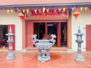
Đình Làng Trạm Bạc
Tram Bac Communal House (Đình Trạm Bạc), together with the tomb of the progenitor of the Nguyen Dinh and Nguyen Khoa lineages, stands in Tram Bac hamlet, Le Loi commune, An Duong district, Hai Phong, about 4 km from the district center. It is a traditional spiritual and cultural architectural work of the people of Tram Bac village.
🏯
Chùa Bùi
Chùa Bùi is a Buddhist pagoda in Hải Phòng (formerly Hải Dương province), Vietnam. Its location comes from OpenStreetMap community data; further details will be added when reliable sources become available.
🏯
Chùa Cả
Chùa Cả is a Buddhist pagoda in Hải Phòng (formerly Hải Dương province), Vietnam. Its location comes from OpenStreetMap community data; further details will be added when reliable sources become available.
🏯
Chùa Cảnh Linh
Chùa Cảnh Linh is a Buddhist pagoda in Hải Phòng (formerly Hải Dương province), Vietnam. Its location comes from OpenStreetMap community data; further details will be added when reliable sources become available.
🏯
Chùa Du Tiên
Chùa Du Tiên is a Buddhist pagoda in Hải Phòng (formerly Hải Dương province), Vietnam. Its location comes from OpenStreetMap community data; further details will be added when reliable sources become available.
🏯
Chùa Đại Khánh
Chùa Đại Khánh is a Buddhist pagoda in Hải Phòng (formerly Hải Dương province), Vietnam. Its location comes from OpenStreetMap community data; further details will be added when reliable sources become available.
🏯
Chùa Đò
Chùa Đò is a Buddhist pagoda in Hải Phòng (formerly Hải Dương province), Vietnam. Its location comes from OpenStreetMap community data; further details will be added when reliable sources become available.
🏯
Chùa Đống Cao
Chùa Đống Cao is a Buddhist pagoda in Hải Phòng (formerly Hải Dương province), Vietnam. Its location comes from OpenStreetMap community data; further details will be added when reliable sources become available.
🏯
Chùa Đống Duyên
Chùa Đống Duyên is a Buddhist pagoda in Hải Phòng (formerly Hải Dương province), Vietnam. Its location comes from OpenStreetMap community data; further details will be added when reliable sources become available.
🏯
Chùa Đồng Neo
Chùa Đồng Neo is a Buddhist pagoda in Hải Phòng (formerly Hải Dương province), Vietnam. Its location comes from OpenStreetMap community data; further details will be added when reliable sources become available.
🏯
Chùa Đông Thuần
Chùa Đông Thuần is a Buddhist pagoda in Hải Phòng (formerly Hải Dương province), Vietnam. Its location comes from OpenStreetMap community data; further details will be added when reliable sources become available.
🏯
Chùa Gạo
Chùa Gạo is a Buddhist pagoda in Hải Phòng (formerly Hải Dương province), Vietnam. Its location comes from OpenStreetMap community data; further details will be added when reliable sources become available.
🏯
Chùa Hưng Long
Chùa Hưng Long is a Buddhist pagoda in Hải Phòng (formerly Hải Dương province), Vietnam. Its location comes from OpenStreetMap community data; further details will be added when reliable sources become available.
🏯
Chùa Hưng Phúc
Chùa Hưng Phúc is a Buddhist pagoda in Hải Phòng (formerly Hải Dương province), Vietnam. Its location comes from OpenStreetMap community data; further details will be added when reliable sources become available.
🏯
Chùa Kim Độ
Chùa Kim Độ is a Buddhist pagoda in Hải Phòng (formerly Hải Dương province), Vietnam. Its location comes from OpenStreetMap community data; further details will be added when reliable sources become available.
🏯
Chùa Linh Thông
Chùa Linh Thông is a Buddhist pagoda in Hải Phòng (formerly Hải Dương province), Vietnam. Its location comes from OpenStreetMap community data; further details will be added when reliable sources become available.
🏯
Chùa Lôi Âm
Chùa Lôi Âm is a Buddhist pagoda in Hải Phòng (formerly Hải Dương province), Vietnam. Its location comes from OpenStreetMap community data; further details will be added when reliable sources become available.
🏯
Chùa Ngo
Chùa Ngo is a Buddhist pagoda in Hải Phòng (formerly Hải Dương province), Vietnam. Its location comes from OpenStreetMap community data; further details will be added when reliable sources become available.
🏯
Chùa Sùng Nghiêm
Chùa Sùng Nghiêm is a Buddhist pagoda in Hải Phòng (formerly Hải Dương province), Vietnam. Its location comes from OpenStreetMap community data; further details will be added when reliable sources become available.
🏯
Chùa Tây Hà
Chùa Tây Hà is a Buddhist pagoda in Hải Phòng (formerly Hải Dương province), Vietnam. Its location comes from OpenStreetMap community data; further details will be added when reliable sources become available.
🏯
Chùa Trung Sơn
Chùa Trung Sơn is a Buddhist pagoda in Hải Phòng (formerly Hải Dương province), Vietnam. Its location comes from OpenStreetMap community data; further details will be added when reliable sources become available.
🏯
Chùa Xưa
Chùa Xưa is a Buddhist pagoda in Hải Phòng (formerly Hải Dương province), Vietnam. Its location comes from OpenStreetMap community data; further details will be added when reliable sources become available.
🏯
Đền An Liệt
Đền An Liệt is a temple (đền) in Hải Phòng (formerly Hải Dương province), Vietnam. Its location comes from OpenStreetMap community data; further details will be added when reliable sources become available.
🏯
Đền Bia
Đền Bia is a temple (đền) in Hải Phòng (formerly Hải Dương province), Vietnam. Its location comes from OpenStreetMap community data; further details will be added when reliable sources become available.
🏯
Đền Chu Văn An
Đền Chu Văn An is a temple (đền) in Hải Phòng (formerly Hải Dương province), Vietnam. Its location comes from OpenStreetMap community data; further details will be added when reliable sources become available.

Đền Kiếp Bạc
Đền Kiếp Bạc is a temple (đền) in Hải Phòng (formerly Hải Dương province), Vietnam. Its location comes from OpenStreetMap community data; further details will be added when reliable sources become available.
🏯
Đền Mẫu
Đền Mẫu is a temple (đền) in Hải Phòng (formerly Hải Dương province), Vietnam. Its location comes from OpenStreetMap community data; further details will be added when reliable sources become available.
🏯
Đền Quốc Phụ
Đền Quốc Phụ is a temple (đền) in Hải Phòng (formerly Hải Dương province), Vietnam. Its location comes from OpenStreetMap community data; further details will be added when reliable sources become available.
🏯
Đền Tam Phủ
Đền Tam Phủ is a temple (đền) in Hải Phòng (formerly Hải Dương province), Vietnam. Its location comes from OpenStreetMap community data; further details will be added when reliable sources become available.
🏯
Đền thờ Bà chúa Sao Sa
Đền thờ Bà chúa Sao Sa is a temple (đền) in Hải Phòng (formerly Hải Dương province), Vietnam. Its location comes from OpenStreetMap community data; further details will be added when reliable sources become available.
🏯
Đền Xưa
Đền Xưa is a temple (đền) in Hải Phòng (formerly Hải Dương province), Vietnam. Its location comes from OpenStreetMap community data; further details will be added when reliable sources become available.
🏯
Đình Chùa Văn Xá
Đình Chùa Văn Xá is a village communal house (đình) in Hải Phòng (formerly Hải Dương province), Vietnam. Its location comes from OpenStreetMap community data; further details will be added when reliable sources become available.
🏯
Đình Làng Cập Nhất
Đình Làng Cập Nhất is a village communal house (đình) in Hải Phòng (formerly Hải Dương province), Vietnam. Its location comes from OpenStreetMap community data; further details will be added when reliable sources become available.
🏯
Đình Lôi Động
Đình Lôi Động is a village communal house (đình) in Hải Phòng (formerly Hải Dương province), Vietnam. Its location comes from OpenStreetMap community data; further details will be added when reliable sources become available.
🏯
Đình Nhân Nghĩa
Đình Nhân Nghĩa is a village communal house (đình) in Hải Phòng (formerly Hải Dương province), Vietnam. Its location comes from OpenStreetMap community data; further details will be added when reliable sources become available.
🏯
Đình Phú An
Đình Phú An is a village communal house (đình) in Hải Phòng (formerly Hải Dương province), Vietnam. Its location comes from OpenStreetMap community data; further details will be added when reliable sources become available.
🏯
Đình Thanh Trung
Đình Thanh Trung is a village communal house (đình) in Hải Phòng (formerly Hải Dương province), Vietnam. Its location comes from OpenStreetMap community data; further details will be added when reliable sources become available.
🏯
Đình Xuân An
Đình Xuân An is a village communal house (đình) in Hải Phòng (formerly Hải Dương province), Vietnam. Its location comes from OpenStreetMap community data; further details will be added when reliable sources become available.
🏯
Miếu Cầu
Miếu Cầu is a shrine (miếu) in Hải Phòng (formerly Hải Dương province), Vietnam. Its location comes from OpenStreetMap community data; further details will be added when reliable sources become available.
🏯
Miếu Cầu (Miếu Vàng)
Miếu Cầu (Miếu Vàng) is a shrine (miếu) in Hải Phòng (formerly Hải Dương province), Vietnam. Its location comes from OpenStreetMap community data; further details will be added when reliable sources become available.
🏯
Miếu Đình Tứ Giáp
Miếu Đình Tứ Giáp is a shrine (miếu) in Hải Phòng (formerly Hải Dương province), Vietnam. Its location comes from OpenStreetMap community data; further details will be added when reliable sources become available.
🏯
Miếu Nhân Lỳ
Miếu Nhân Lỳ is a shrine (miếu) in Hải Phòng (formerly Hải Dương province), Vietnam. Its location comes from OpenStreetMap community data; further details will be added when reliable sources become available.
🏯
Chùa An Tường
Chùa An Tường is a Buddhist pagoda in Hải Phòng, Vietnam. Its location comes from OpenStreetMap community data; further details will be added when reliable sources become available.
🏯
Chùa Bảo Phúc
Chùa Bảo Phúc is a Buddhist pagoda in Hải Phòng, Vietnam. Its location comes from OpenStreetMap community data; further details will be added when reliable sources become available.
🏯
Chùa Bảo Quang
Chùa Bảo Quang is a Buddhist pagoda in Hải Phòng, Vietnam. Its location comes from OpenStreetMap community data; further details will be added when reliable sources become available.
🏯
Chùa Bến
Chùa Bến is a Buddhist pagoda in Hải Phòng, Vietnam. Its location comes from OpenStreetMap community data; further details will be added when reliable sources become available.
🏯
Chùa Bính
Chùa Bính is a Buddhist pagoda in Hải Phòng, Vietnam. Its location comes from OpenStreetMap community data; further details will be added when reliable sources become available.
🏯
Chùa Cách Hạ
Chùa Cách Hạ is a Buddhist pagoda in Hải Phòng, Vietnam. Its location comes from OpenStreetMap community data; further details will be added when reliable sources become available.
🏯
Chùa Cao Thiên
Chùa Cao Thiên is a Buddhist pagoda in Hải Phòng, Vietnam. Its location comes from OpenStreetMap community data; further details will be added when reliable sources become available.
🏯
Chùa Cống Mỹ
Chùa Cống Mỹ is a Buddhist pagoda in Hải Phòng, Vietnam. Its location comes from OpenStreetMap community data; further details will be added when reliable sources become available.
🏯
Chùa Dương Quan
Chùa Dương Quan is a Buddhist pagoda in Hải Phòng, Vietnam. Its location comes from OpenStreetMap community data; further details will be added when reliable sources become available.
🏯
Chùa Đông Chấn
Chùa Đông Chấn is a Buddhist pagoda in Hải Phòng, Vietnam. Its location comes from OpenStreetMap community data; further details will be added when reliable sources become available.
🏯
Chùa Hải Ninh
Chùa Hải Ninh is a Buddhist pagoda in Hải Phòng, Vietnam. Its location comes from OpenStreetMap community data; further details will be added when reliable sources become available.
🏯
Chùa Hàm Long
Chùa Hàm Long is a Buddhist pagoda in Hải Phòng, Vietnam. Its location comes from OpenStreetMap community data; further details will be added when reliable sources become available.
🏯
Chùa Hang Lương
Chùa Hang Lương is a Buddhist pagoda in Hải Phòng, Vietnam. Its location comes from OpenStreetMap community data; further details will be added when reliable sources become available.
🏯
Chùa Huệ Hương
Chùa Huệ Hương is a Buddhist pagoda in Hải Phòng, Vietnam. Its location comes from OpenStreetMap community data; further details will be added when reliable sources become available.
🏯
Chùa Hưng Khánh
Chùa Hưng Khánh is a Buddhist pagoda in Hải Phòng, Vietnam. Its location comes from OpenStreetMap community data; further details will be added when reliable sources become available.
🏯
Chùa Khánh Long
Chùa Khánh Long is a Buddhist pagoda in Hải Phòng, Vietnam. Its location comes from OpenStreetMap community data; further details will be added when reliable sources become available.
🏯
Chùa Linh Quang
Chùa Linh Quang is a Buddhist pagoda in Hải Phòng, Vietnam. Its location comes from OpenStreetMap community data; further details will be added when reliable sources become available.
🏯
Chùa Linh Quang
Chùa Linh Quang is a Buddhist pagoda in Hải Phòng, Vietnam. Its location comes from OpenStreetMap community data; further details will be added when reliable sources become available.
🏯
Chùa Linh Quang
Chùa Linh Quang is a Buddhist pagoda in Hải Phòng, Vietnam. Its location comes from OpenStreetMap community data; further details will be added when reliable sources become available.
🏯
Chùa Linh Sơn
Chùa Linh Sơn is a Buddhist pagoda in Hải Phòng, Vietnam. Its location comes from OpenStreetMap community data; further details will be added when reliable sources become available.
🏯
Chùa Long Hoa
Chùa Long Hoa is a Buddhist pagoda in Hải Phòng, Vietnam. Its location comes from OpenStreetMap community data; further details will be added when reliable sources become available.
🏯
Chùa Lương Xâm
Chùa Lương Xâm is a Buddhist pagoda in Hải Phòng, Vietnam. Its location comes from OpenStreetMap community data; further details will be added when reliable sources become available.
🏯
Chùa Nam Hải
Chùa Nam Hải is a Buddhist pagoda in Hải Phòng, Vietnam. Its location comes from OpenStreetMap community data; further details will be added when reliable sources become available.
🏯
Chùa Nguyệt Quang
Chùa Nguyệt Quang is a Buddhist pagoda in Hải Phòng, Vietnam. Its location comes from OpenStreetMap community data; further details will be added when reliable sources become available.
🏯
Chùa Phủ Lễ
Chùa Phủ Lễ is a Buddhist pagoda in Hải Phòng, Vietnam. Its location comes from OpenStreetMap community data; further details will be added when reliable sources become available.
🏯
Chùa Quỳnh Đẩu
Chùa Quỳnh Đẩu is a Buddhist pagoda in Hải Phòng, Vietnam. Its location comes from OpenStreetMap community data; further details will be added when reliable sources become available.
🏯
Chùa Tây Sơn
Chùa Tây Sơn is a Buddhist pagoda in Hải Phòng, Vietnam. Its location comes from OpenStreetMap community data; further details will be added when reliable sources become available.
🏯
Chùa Tháp Tường Long
Chùa Tháp Tường Long is a Buddhist pagoda in Hải Phòng, Vietnam. Its location comes from OpenStreetMap community data; further details will be added when reliable sources become available.
🏯
Chùa Tiểu Trà
Chùa Tiểu Trà is a Buddhist pagoda in Hải Phòng, Vietnam. Its location comes from OpenStreetMap community data; further details will be added when reliable sources become available.
🏯
Chùa Tràng Kênh
Chùa Tràng Kênh is a Buddhist pagoda in Hải Phòng, Vietnam. Its location comes from OpenStreetMap community data; further details will be added when reliable sources become available.
🏯
Chùa Vĩnh Khánh Phương Lưu
Chùa Vĩnh Khánh Phương Lưu is a Buddhist pagoda in Hải Phòng, Vietnam. Its location comes from OpenStreetMap community data; further details will be added when reliable sources become available.
🏯
Đền Bát Tràng
Đền Bát Tràng is a temple (đền) in Hải Phòng, Vietnam. Its location comes from OpenStreetMap community data; further details will be added when reliable sources become available.
🏯
Đền Nghè
Đền Nghè is a temple (đền) in Hải Phòng, Vietnam. Its location comes from OpenStreetMap community data; further details will be added when reliable sources become available.
🏯
Đền Phú Xá
Đền Phú Xá is a temple (đền) in Hải Phòng, Vietnam. Its location comes from OpenStreetMap community data; further details will be added when reliable sources become available.
🏯
Đền Tam Kì
Đền Tam Kì is a temple (đền) in Hải Phòng, Vietnam. Its location comes from OpenStreetMap community data; further details will be added when reliable sources become available.
🏯
Đền thờ Bác Hồ
Đền thờ Bác Hồ is a temple (đền) in Hải Phòng, Vietnam. Its location comes from OpenStreetMap community data; further details will be added when reliable sources become available.
🏯
Đền thờ Đức Thánh Trần
Đền thờ Đức Thánh Trần is a temple (đền) in Hải Phòng, Vietnam. Its location comes from OpenStreetMap community data; further details will be added when reliable sources become available.
🏯
Đền thờ Đức Thánh Vương Ngô Quyền
Đền thờ Đức Thánh Vương Ngô Quyền is a temple (đền) in Hải Phòng, Vietnam. Its location comes from OpenStreetMap community data; further details will be added when reliable sources become available.
🏯
Đền thờ Hoàng đế Lê Đại Hành
Đền thờ Hoàng đế Lê Đại Hành is a temple (đền) in Hải Phòng, Vietnam. Its location comes from OpenStreetMap community data; further details will be added when reliable sources become available.
🏯
Đền Tiên Nga
Đền Tiên Nga is a temple (đền) in Hải Phòng, Vietnam. Its location comes from OpenStreetMap community data; further details will be added when reliable sources become available.
🏯
Đền Tràng Kênh
Đền Tràng Kênh is a temple (đền) in Hải Phòng, Vietnam. Its location comes from OpenStreetMap community data; further details will be added when reliable sources become available.
🏯
Đình Đẩu Sơn
Đình Đẩu Sơn is a village communal house (đình) in Hải Phòng, Vietnam. Its location comes from OpenStreetMap community data; further details will be added when reliable sources become available.
🏯
Đình Đông
Đình Đông is a village communal house (đình) in Hải Phòng, Vietnam. Its location comes from OpenStreetMap community data; further details will be added when reliable sources become available.
🏯
Đình Đông Khê
Đình Đông Khê is a village communal house (đình) in Hải Phòng, Vietnam. Its location comes from OpenStreetMap community data; further details will be added when reliable sources become available.
🏯
Đình Giếng
Đình Giếng is a village communal house (đình) in Hải Phòng, Vietnam. Its location comes from OpenStreetMap community data; further details will be added when reliable sources become available.
🏯
Đình Hàng Kênh
Đình Hàng Kênh is a village communal house (đình) in Hải Phòng, Vietnam. Its location comes from OpenStreetMap community data; further details will be added when reliable sources become available.
🏯
Đình Kiều Sơn
Đình Kiều Sơn is a village communal house (đình) in Hải Phòng, Vietnam. Its location comes from OpenStreetMap community data; further details will be added when reliable sources become available.
🏯
Đình Lạc Viên
Đình Lạc Viên is a village communal house (đình) in Hải Phòng, Vietnam. Its location comes from OpenStreetMap community data; further details will be added when reliable sources become available.
🏯
Đình Lũng Bắc
Đình Lũng Bắc is a village communal house (đình) in Hải Phòng, Vietnam. Its location comes from OpenStreetMap community data; further details will be added when reliable sources become available.
🏯
Đình Lực Hành
Đình Lực Hành is a village communal house (đình) in Hải Phòng, Vietnam. Its location comes from OpenStreetMap community data; further details will be added when reliable sources become available.
🏯
Đình Tân Dương
Đình Tân Dương is a village communal house (đình) in Hải Phòng, Vietnam. Its location comes from OpenStreetMap community data; further details will be added when reliable sources become available.
🏯
Đình Từ Lương Xâm
Đình Từ Lương Xâm is a village communal house (đình) in Hải Phòng, Vietnam. Its location comes from OpenStreetMap community data; further details will be added when reliable sources become available.
🏯
Miếu An Đà
Miếu An Đà is a shrine (miếu) in Hải Phòng, Vietnam. Its location comes from OpenStreetMap community data; further details will be added when reliable sources become available.
🏯
Miếu Hạ Đoạn
Miếu Hạ Đoạn is a shrine (miếu) in Hải Phòng, Vietnam. Its location comes from OpenStreetMap community data; further details will be added when reliable sources become available.
🏯
Miếu Linh Từ
Miếu Linh Từ is a shrine (miếu) in Hải Phòng, Vietnam. Its location comes from OpenStreetMap community data; further details will be added when reliable sources become available.
🏯
Miếu Phương Lưu
Miếu Phương Lưu is a shrine (miếu) in Hải Phòng, Vietnam. Its location comes from OpenStreetMap community data; further details will be added when reliable sources become available.
🏯
Miếu Thượng Đoạn
Miếu Thượng Đoạn is a shrine (miếu) in Hải Phòng, Vietnam. Its location comes from OpenStreetMap community data; further details will be added when reliable sources become available.
🏯
Miếu Trung Hành
Miếu Trung Hành is a shrine (miếu) in Hải Phòng, Vietnam. Its location comes from OpenStreetMap community data; further details will be added when reliable sources become available.
Huế (31)

Chùa Diệu Đế
Diệu Đế Temple (Vietnamese: Chùa Diệu Đế) is a Buddhist temple in the central city of Huế in Vietnam. It is named for the Four Noble Truths of Buddhism, which are called Tứ Diệu Đế in Vietnamese. During the 19th century Nguyễn dynasty, Emperor Thiệu Trị declared it to be one of the national pagodas of Vietnam. Outside of Vietnam, the temple is best known as a site of activism during the 1960s, as well as against the Vietnam War. On the night of 21 August 1963, it was the site of a bloody battle between the government forces of President Ngô Đình Diệm and rioting pro-Buddhist civilians who…

Chùa Huế
Pagodas in Huế began to appear in greater numbers during the Nguyễn Lords period, especially after Nguyễn Hoàng came to govern the Thuận Hóa region. The pagodas in Huế experienced significant development from the reign of Emperor Gia Long to that of Emperor Duy Tân. During this time, in addition to restoration, reconstruction, and repairs, many new pagodas were built. Today, Huế is a place with a high density of pagodas, with over one hundred large and small pagodas. There are Buddha statues, Bodhisattva statues, bells, bronze gongs, stone gongs, and many other Buddhist artefacts from the Lê, Trịnh, and Nguyễn periods that are still preserved and worshipped in the pagodas of Huế. This constitutes a cultural treasure of Huế Buddhism.

Chùa Quốc Ân
Quốc Ân Temple (Chùa Quốc Ân) is a Buddhist temple in the city of Huế, central Vietnam.

Chùa Thánh Duyên
Thánh Duyên Pagoda (chữ Hán: 聖緣寺) is a Buddhist architectural work originating from the 17th century and was restored and rebuilt by King Minh Mạng in the years 1825 and 1836. The pagoda is located on Túy Vân Mountain, Vinh Hiền commune, Phú Lộc district, Huế city. The landscape of the pagoda and Túy Vân Mountain was ranked ninth by King Thiệu Trị in the 'Thần kinh nhị thập cảnh' (Twenty Scenic Spots of the Imperial Capital).

Chùa Thiên Mụ
The Thiên Mụ Temple (meaning Temple of the Celestial Lady, Vietnamese: Chùa Thiên Mụ; also called Linh Mụ Temple) is a historic temple in the city of Huế in Vietnam. Its iconic seven-story Phước Duyên pagoda is regarded as the unofficial symbol of the city, and the temple has often been the subject of folk rhymes and ca dao about Huế.

Chùa Từ Đàm
Từ Đàm Temple (Chùa Từ Đàm) is a Buddhist temple located on a street of the same name in the Trường An District of Huế.

Chùa Từ Hiếu
Từ Hiếu Pagoda, also known as Tổ đình Từ Hiếu (in Chinese characters: 慈孝寺, Từ Hiếu Tự), is the name of a pagoda located in Dương Xuân Thượng III village, Thủy Xuân ward, Huế city. The pagoda is one of the major ancient temples and is a cultural and historical landmark of the former imperial capital of Huế.
🏯
Huyền Không Sơn Hạ
Huyền Không Sơn Hạ, also known as Tuệ Tĩnh Đường Diệu Đế, is located in Hương Hồ Ward, Huế City. This is a famous pagoda in Central Vietnam. The pagoda is part of the Huyền Không pagoda complex, together with the other two pagodas: Huyền Không Sơn Thượng and Huyền Không Sơn Trung. The pagoda follows the Southern School of Buddhism (Nam tông) and was founded by Venerable Giới Đức in 1989. The pagoda is situated in the Chằm mountain area, surrounded by pine forests that keep the atmosphere cool all year round.
Currently, the pagoda offers free medical examinations and treatments using traditional Eastern medicine methods. At the same time, it is also a training centre for traditional medicine practitioners for the Eastern medicine clinics in Huế City.

Huyền Không Sơn Thượng
Huyền Không Sơn Thượng Monastery [Pali. Abhisuññatāvanārama] is located in Chầm hamlet, Hương Hồ commune, Hương Trà District which is a famous monastery and a beautiful landscape of the ancient capital of Huế. This monastery belongs to Theravada Buddhism and was built by Ven. Sīlaguṇa in 1989. It is covered by an area of pine forest.
🏯
Chùa Cát Tường
Chùa Cát Tường is a Buddhist pagoda in Huế, Vietnam. Its location comes from OpenStreetMap community data; further details will be added when reliable sources become available.
🏯
Chùa Châu Lâm
Chùa Châu Lâm is a Buddhist pagoda in Huế, Vietnam. Its location comes from OpenStreetMap community data; further details will be added when reliable sources become available.
🏯
Chùa Đông Thiện
Chùa Đông Thiện is a Buddhist pagoda in Huế, Vietnam. Its location comes from OpenStreetMap community data; further details will be added when reliable sources become available.
🏯
Chùa Hiếu Quang
Chùa Hiếu Quang is a Buddhist pagoda in Huế, Vietnam. Its location comes from OpenStreetMap community data; further details will be added when reliable sources become available.
🏯
Chùa Hoà Quang
Chùa Hoà Quang is a Buddhist pagoda in Huế, Vietnam. Its location comes from OpenStreetMap community data; further details will be added when reliable sources become available.
🏯
Chùa Hồng Đửc
Chùa Hồng Đửc is a Buddhist pagoda in Huế, Vietnam. Its location comes from OpenStreetMap community data; further details will be added when reliable sources become available.
🏯
Chùa Huyền Không Sơn Hạ
Chùa Huyền Không Sơn Hạ is a Buddhist pagoda in Huế, Vietnam. Its location comes from OpenStreetMap community data; further details will be added when reliable sources become available.
🏯
Chùa làng Hải Triều
Chùa làng Hải Triều is a Buddhist pagoda in Huế, Vietnam. Its location comes from OpenStreetMap community data; further details will be added when reliable sources become available.
🏯
Chùa Liên Hoa
Chùa Liên Hoa is a Buddhist pagoda in Huế, Vietnam. Its location comes from OpenStreetMap community data; further details will be added when reliable sources become available.
🏯
Chùa Linh Quang
Chùa Linh Quang is a Buddhist pagoda in Huế, Vietnam. Its location comes from OpenStreetMap community data; further details will be added when reliable sources become available.
🏯
Chùa Phú Lộc, Pagoda
Chùa Phú Lộc, Pagoda is a Buddhist pagoda in Huế, Vietnam. Its location comes from OpenStreetMap community data; further details will be added when reliable sources become available.
🏯
Chùa Quang Minh
Chùa Quang Minh is a Buddhist pagoda in Huế, Vietnam. Its location comes from OpenStreetMap community data; further details will be added when reliable sources become available.
🏯
Chùa Tây Thiên
Chùa Tây Thiên is a Buddhist pagoda in Huế, Vietnam. Its location comes from OpenStreetMap community data; further details will be added when reliable sources become available.
🏯
Chùa Thiên Hy
Chùa Thiên Hy is a Buddhist pagoda in Huế, Vietnam. Its location comes from OpenStreetMap community data; further details will be added when reliable sources become available.
🏯
Chùa Thiền Lâm
Chùa Thiền Lâm is a Buddhist pagoda in Huế, Vietnam. Its location comes from OpenStreetMap community data; further details will be added when reliable sources become available.
🏯
Chùa Thọ Đức
Chùa Thọ Đức is a Buddhist pagoda in Huế, Vietnam. Its location comes from OpenStreetMap community data; further details will be added when reliable sources become available.
🏯
Chùa Từ An
Chùa Từ An is a Buddhist pagoda in Huế, Vietnam. Its location comes from OpenStreetMap community data; further details will be added when reliable sources become available.
🏯
Đình Làng Kế Môn
Đình Làng Kế Môn is a village communal house (đình) in Huế, Vietnam. Its location comes from OpenStreetMap community data; further details will be added when reliable sources become available.
🏯
Miếu Âm Hồn
Miếu Âm Hồn is a shrine (miếu) in Huế, Vietnam. Its location comes from OpenStreetMap community data; further details will be added when reliable sources become available.
🏯
Miếu Âm Hồn Làng Kế Môn
Miếu Âm Hồn Làng Kế Môn is a shrine (miếu) in Huế, Vietnam. Its location comes from OpenStreetMap community data; further details will be added when reliable sources become available.
🏯
Miếu Long Thuyền
Miếu Long Thuyền is a shrine (miếu) in Huế, Vietnam. Its location comes from OpenStreetMap community data; further details will be added when reliable sources become available.
🏯
Thiền viện Trúc Lâm Bạch Mã
Thiền viện Trúc Lâm Bạch Mã is a Zen monastery (thiền viện) in Huế, Vietnam. Its location comes from OpenStreetMap community data; further details will be added when reliable sources become available.
Hưng Yên (69)
🏯
Chùa Chuông
Chuông Temple (Vietnamese: Chùa Chuông, Chữ Hán: 金鐘寺, Sino-Vietnamese: Kim Chung Tự) is a Buddhist temple in Hưng Yên.

Chùa Keo Thái Bình
Keo Temple (Vietnamese: Chùa Keo, Official name: Thần Quang Tự (神光寺)) is a Buddhist temple in Vũ Thư District, Thái Bình Province, Vietnam. The temple was commenced in 1061 under the Lý dynasty near the Red River.
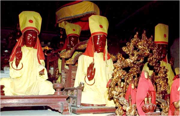
Chùa Thái Lạc
Thái Lạc Pagoda is located in Như Quỳnh commune, Hưng Yên province. The pagoda belongs to the Tứ Pháp (Four Dharmas) pagoda system and worships the Buddha and Pháp Vân. The pagoda is famous for its carved wooden panels dating from the Trần dynasty.
🏯
Chùa Chành
Chành Pagoda is located in Thái Bình ward, Hưng Yên province. It is a provincial-level historical site, recognised in 1995. The pagoda was newly restored in 2012 and was inaugurated on 5 November 2012. Every year, the pagoda holds a festival from the 1st to the 3rd day of the 3rd lunar month. It is a very sacred pagoda, well known to many devotees from near and far.
🏯
Chùa Hanh Cù
Hanh Cù Pagoda is now located in Hanh Cù hamlet, Vũ Quý commune, Kiến Xương district, formerly part of Đông Trung village, Kiến Xương prefecture. Đông Trung village (now divided into the two communes of Vũ Quý and Vũ Trung) was traditionally a cultured village with many đình (communal houses), temples, and pagodas in its hamlets. Due to the policy of scorched earth during the resistance against the French, the communal houses and pagodas were dismantled; today, in the two communes, only Hanh Cù Pagoda remains, while Đại Ngạn Pagoda is currently being restored.
🏯
Chùa Múa
Múa Pagoda, also known as Phượng Vũ Pagoda, is located in Thọ Lộc hamlet, Minh Khai commune, Vũ Thư district, Thái Bình province. This is an ancient pagoda built at the end of the 17th century during the Nguyễn dynasty. The pagoda is part of the Phượng Vũ temple-pagoda heritage complex. The pagoda is so named because, in the past, when Saint Láng Lý Triều Quốc Sư Từ Đạo Hạnh came to this land to teach the people how to cultivate crops, he saw a piece of land shaped like a phoenix spreading its wings to dance. Recognising the auspiciousness of the land, he established a pagoda there to worship the Buddha. Later, after he passed away and became a saint, the villagers, grateful to him, built a shrine in his honour.
🏯
Chùa Bình Thành
Chùa Bình Thành is a Buddhist pagoda in Hưng Yên, Vietnam. Its location comes from OpenStreetMap community data; further details will be added when reliable sources become available.
🏯
Chùa Côn Phúc
Chùa Côn Phúc is a Buddhist pagoda in Hưng Yên, Vietnam. Its location comes from OpenStreetMap community data; further details will be added when reliable sources become available.
🏯
Chùa Dương Hòa - Hòa Bình Hạ
Chùa Dương Hòa - Hòa Bình Hạ is a Buddhist pagoda in Hưng Yên, Vietnam. Its location comes from OpenStreetMap community data; further details will be added when reliable sources become available.
🏯
Chùa Đại Bi
Chùa Đại Bi is a Buddhist pagoda in Hưng Yên, Vietnam. Its location comes from OpenStreetMap community data; further details will be added when reliable sources become available.
🏯
Chùa Đại Tài
Chùa Đại Tài is a Buddhist pagoda in Hưng Yên, Vietnam. Its location comes from OpenStreetMap community data; further details will be added when reliable sources become available.
🏯
Chùa Đống Mối
Chùa Đống Mối is a Buddhist pagoda in Hưng Yên, Vietnam. Its location comes from OpenStreetMap community data; further details will be added when reliable sources become available.
🏯
Chùa Đồng Tĩnh (Vĩnh An Tự)
Chùa Đồng Tĩnh (Vĩnh An Tự) is a Buddhist pagoda in Hưng Yên, Vietnam. Its location comes from OpenStreetMap community data; further details will be added when reliable sources become available.
🏯
Chùa Giao Trì
Chùa Giao Trì is a Buddhist pagoda in Hưng Yên, Vietnam. Its location comes from OpenStreetMap community data; further details will be added when reliable sources become available.
🏯
Chùa Hoàng Bà
Chùa Hoàng Bà is a Buddhist pagoda in Hưng Yên, Vietnam. Its location comes from OpenStreetMap community data; further details will be added when reliable sources become available.
🏯
Chùa Hồng An
Chùa Hồng An is a Buddhist pagoda in Hưng Yên, Vietnam. Its location comes from OpenStreetMap community data; further details will be added when reliable sources become available.
🏯
Chùa Kim Hoa Tự
Chùa Kim Hoa Tự is a Buddhist pagoda in Hưng Yên, Vietnam. Its location comes from OpenStreetMap community data; further details will be added when reliable sources become available.
🏯
Chùa Lại Ốc
Chùa Lại Ốc is a Buddhist pagoda in Hưng Yên, Vietnam. Its location comes from OpenStreetMap community data; further details will be added when reliable sources become available.
🏯
Chùa làng Hòa Bình Thượng
Chùa làng Hòa Bình Thượng is a Buddhist pagoda in Hưng Yên, Vietnam. Its location comes from OpenStreetMap community data; further details will be added when reliable sources become available.
🏯
Chùa Long Hoa
Chùa Long Hoa is a Buddhist pagoda in Hưng Yên, Vietnam. Its location comes from OpenStreetMap community data; further details will be added when reliable sources become available.
🏯
Chùa Long Vân
Chùa Long Vân is a Buddhist pagoda in Hưng Yên, Vietnam. Its location comes from OpenStreetMap community data; further details will be added when reliable sources become available.
🏯
Chùa Minh Đức
Chùa Minh Đức is a Buddhist pagoda in Hưng Yên, Vietnam. Its location comes from OpenStreetMap community data; further details will be added when reliable sources become available.
🏯
Chùa Ngọc Động
Chùa Ngọc Động is a Buddhist pagoda in Hưng Yên, Vietnam. Its location comes from OpenStreetMap community data; further details will be added when reliable sources become available.
🏯
Chùa Nôm
Chùa Nôm is a Buddhist pagoda in Hưng Yên, Vietnam. Its location comes from OpenStreetMap community data; further details will be added when reliable sources become available.
🏯
Chùa Phố
Chùa Phố is a Buddhist pagoda in Hưng Yên, Vietnam. Its location comes from OpenStreetMap community data; further details will be added when reliable sources become available.
🏯
Chùa Phúc Lâm
Chùa Phúc Lâm is a Buddhist pagoda in Hưng Yên, Vietnam. Its location comes from OpenStreetMap community data; further details will be added when reliable sources become available.
🏯
Chùa Phước Hưng
Chùa Phước Hưng is a Buddhist pagoda in Hưng Yên, Vietnam. Its location comes from OpenStreetMap community data; further details will be added when reliable sources become available.
🏯
Chùa Sầm Khúc
Chùa Sầm Khúc is a Buddhist pagoda in Hưng Yên, Vietnam. Its location comes from OpenStreetMap community data; further details will be added when reliable sources become available.
🏯
Chùa Sở Đông
Chùa Sở Đông is a Buddhist pagoda in Hưng Yên, Vietnam. Its location comes from OpenStreetMap community data; further details will be added when reliable sources become available.
🏯
Chùa Táo
Chùa Táo is a Buddhist pagoda in Hưng Yên, Vietnam. Its location comes from OpenStreetMap community data; further details will be added when reliable sources become available.
🏯
Chùa Thiện Khánh Đa Ngưu
Chùa Thiện Khánh Đa Ngưu is a Buddhist pagoda in Hưng Yên, Vietnam. Its location comes from OpenStreetMap community data; further details will be added when reliable sources become available.
🏯
Chùa thôn Kim Ngưu
Chùa thôn Kim Ngưu is a Buddhist pagoda in Hưng Yên, Vietnam. Its location comes from OpenStreetMap community data; further details will be added when reliable sources become available.
🏯
Chùa Thôn Nhân Vực
Chùa Thôn Nhân Vực is a Buddhist pagoda in Hưng Yên, Vietnam. Its location comes from OpenStreetMap community data; further details will be added when reliable sources become available.
🏯
Chùa Tích Tâm
Chùa Tích Tâm is a Buddhist pagoda in Hưng Yên, Vietnam. Its location comes from OpenStreetMap community data; further details will be added when reliable sources become available.
🏯
Chùa Tiên Tường
Chùa Tiên Tường is a Buddhist pagoda in Hưng Yên, Vietnam. Its location comes from OpenStreetMap community data; further details will be added when reliable sources become available.
🏯
Chùa Trúc Lâm
Chùa Trúc Lâm is a Buddhist pagoda in Hưng Yên, Vietnam. Its location comes from OpenStreetMap community data; further details will be added when reliable sources become available.
🏯
Chùa Vị
Chùa Vị is a Buddhist pagoda in Hưng Yên, Vietnam. Its location comes from OpenStreetMap community data; further details will be added when reliable sources become available.
🏯
Đền Kim Đằng
Đền Kim Đằng is a temple (đền) in Hưng Yên, Vietnam. Its location comes from OpenStreetMap community data; further details will be added when reliable sources become available.
🏯
Đền Mây
Đền Mây is a temple (đền) in Hưng Yên, Vietnam. Its location comes from OpenStreetMap community data; further details will be added when reliable sources become available.
🏯
Đền Nam Hoà
Đền Nam Hoà is a temple (đền) in Hưng Yên, Vietnam. Its location comes from OpenStreetMap community data; further details will be added when reliable sources become available.
🏯
Đền Thiên Hậu
Đền Thiên Hậu is a temple (đền) in Hưng Yên, Vietnam. Its location comes from OpenStreetMap community data; further details will be added when reliable sources become available.
🏯
Đền thờ Hoàng Thái Hậu Đào Thị
Đền thờ Hoàng Thái Hậu Đào Thị is a temple (đền) in Hưng Yên, Vietnam. Its location comes from OpenStreetMap community data; further details will be added when reliable sources become available.
🏯
Đền Thờ Thành Hoàng Làng Bối Khê
Đền Thờ Thành Hoàng Làng Bối Khê is a temple (đền) in Hưng Yên, Vietnam. Its location comes from OpenStreetMap community data; further details will be added when reliable sources become available.
🏯
Đình An Vũ
Đình An Vũ is a village communal house (đình) in Hưng Yên, Vietnam. Its location comes from OpenStreetMap community data; further details will be added when reliable sources become available.
🏯
Đình Hiến
Đình Hiến is a village communal house (đình) in Hưng Yên, Vietnam. Its location comes from OpenStreetMap community data; further details will be added when reliable sources become available.
🏯
Đình lại ốc
Đình lại ốc is a village communal house (đình) in Hưng Yên, Vietnam. Its location comes from OpenStreetMap community data; further details will be added when reliable sources become available.
🏯
Đình Làng Cát Lớn
Đình Làng Cát Lớn is a village communal house (đình) in Hưng Yên, Vietnam. Its location comes from OpenStreetMap community data; further details will be added when reliable sources become available.
🏯
Đình làng Chiều Đông
Đình làng Chiều Đông is a village communal house (đình) in Hưng Yên, Vietnam. Its location comes from OpenStreetMap community data; further details will be added when reliable sources become available.
🏯
Đình làng Đa Ngưu
Đình làng Đa Ngưu is a village communal house (đình) in Hưng Yên, Vietnam. Its location comes from OpenStreetMap community data; further details will be added when reliable sources become available.
🏯
Đình Làng Như Lân( Thờ Thành Hoàng Làng)
Đình Làng Như Lân( Thờ Thành Hoàng Làng) is a village communal house (đình) in Hưng Yên, Vietnam. Its location comes from OpenStreetMap community data; further details will be added when reliable sources become available.
🏯
Đình làng Vĩnh Lộc
Đình làng Vĩnh Lộc is a village communal house (đình) in Hưng Yên, Vietnam. Its location comes from OpenStreetMap community data; further details will be added when reliable sources become available.
🏯
Đình Làng Xuân Đào
Đình Làng Xuân Đào is a village communal house (đình) in Hưng Yên, Vietnam. Its location comes from OpenStreetMap community data; further details will be added when reliable sources become available.
🏯
Đình Nghĩa Lộ
Đình Nghĩa Lộ is a village communal house (đình) in Hưng Yên, Vietnam. Its location comes from OpenStreetMap community data; further details will be added when reliable sources become available.
🏯
Đình Nhu Nhuế
Đình Nhu Nhuế is a village communal house (đình) in Hưng Yên, Vietnam. Its location comes from OpenStreetMap community data; further details will be added when reliable sources become available.
🏯
Đình như Phượng Hạ
Đình như Phượng Hạ is a village communal house (đình) in Hưng Yên, Vietnam. Its location comes from OpenStreetMap community data; further details will be added when reliable sources become available.
🏯
Đình Sầm Khúc
Đình Sầm Khúc is a village communal house (đình) in Hưng Yên, Vietnam. Its location comes from OpenStreetMap community data; further details will be added when reliable sources become available.
🏯
Đình Sở Đông
Đình Sở Đông is a village communal house (đình) in Hưng Yên, Vietnam. Its location comes from OpenStreetMap community data; further details will be added when reliable sources become available.
🏯
Đình Thượng Tân
Đình Thượng Tân is a village communal house (đình) in Hưng Yên, Vietnam. Its location comes from OpenStreetMap community data; further details will be added when reliable sources become available.
🏯
Đình Trúc Cầu
Đình Trúc Cầu is a village communal house (đình) in Hưng Yên, Vietnam. Its location comes from OpenStreetMap community data; further details will be added when reliable sources become available.
🏯
Đình Xâm Khô
Đình Xâm Khô is a village communal house (đình) in Hưng Yên, Vietnam. Its location comes from OpenStreetMap community data; further details will be added when reliable sources become available.
🏯
Miếu Bà Chúa Hoàng Thái Hậu
Miếu Bà Chúa Hoàng Thái Hậu is a shrine (miếu) in Hưng Yên, Vietnam. Its location comes from OpenStreetMap community data; further details will be added when reliable sources become available.
🏯
Miếu Thành Hoàng
Miếu Thành Hoàng is a shrine (miếu) in Hưng Yên, Vietnam. Its location comes from OpenStreetMap community data; further details will be added when reliable sources become available.
🏯
Miếu thờ thần linh
Miếu thờ thần linh is a shrine (miếu) in Hưng Yên, Vietnam. Its location comes from OpenStreetMap community data; further details will be added when reliable sources become available.
🏯
Chùa Bảo Long
Chùa Bảo Long is a Buddhist pagoda in Hưng Yên (formerly Thái Bình province), Vietnam. Its location comes from OpenStreetMap community data; further details will be added when reliable sources become available.
🏯
Chùa Bồng
Chùa Bồng is a Buddhist pagoda in Hưng Yên (formerly Thái Bình province), Vietnam. Its location comes from OpenStreetMap community data; further details will be added when reliable sources become available.
🏯
Chùa keo
Chùa keo is a Buddhist pagoda in Hưng Yên (formerly Thái Bình province), Vietnam. Its location comes from OpenStreetMap community data; further details will be added when reliable sources become available.
🏯
Chùa Quan Âm
Chùa Quan Âm is a Buddhist pagoda in Hưng Yên (formerly Thái Bình province), Vietnam. Its location comes from OpenStreetMap community data; further details will be added when reliable sources become available.
🏯
Chùa Tiền
Chùa Tiền is a Buddhist pagoda in Hưng Yên (formerly Thái Bình province), Vietnam. Its location comes from OpenStreetMap community data; further details will be added when reliable sources become available.
🏯
Đền thờ tổ họ Trần Việt Nam
Đền thờ tổ họ Trần Việt Nam is a temple (đền) in Hưng Yên (formerly Thái Bình province), Vietnam. Its location comes from OpenStreetMap community data; further details will be added when reliable sources become available.
Khánh Hòa (108)
🏯
Chùa Hải Đức
Hải Đức Pagoda is located on the western branch at the summit of Trại Thủy hill, at 51 Hải Đức Street, Phương Sơn Ward, Nha Trang City, Khánh Hòa Province. The pagoda was built over 120 years ago and is one of the four important pagodas in the Trại Thủy hill complex, along with Long Sơn Pagoda, Bửu Phong Pagoda, and Lôi Am Pagoda.
🏯
Chùa Kim Sơn (Khánh Hòa)
Kim Sơn Pagoda is located in Tây Nha Trang ward, Khánh Hòa province. The pagoda was built by Zen Master Pháp Ấn during the Later Lê dynasty on a rocky hill situated in the middle of a plain, commonly called Gành Mountain, which was later renamed Kim Sơn due to a legend that, during the construction of the pagoda, some gold was found buried there. In 1740, Nguyễn Phúc Khoát changed the pagoda's name to Quy Tôn Tự and bestowed a vermilion lacquered and gold-gilded plaque inscribed with the three large characters 'Quy Tôn Tự' along with an eight-character dedication: 'Quốc Chủ Từ Tế Đạo Nhân ngự đề' ('Inscribed by the Compassionate Sovereign'). In 1845, King Thiệu Trị decreed that the pagoda revert to its former name. During the Khải Định reign, the pagoda was also known as Chùa Bà Nghè ('Pagoda of Madame Nghè') because the wife of a mandarin became a nun and contributed to the restoration of the pagoda.
🏯
Chùa Kỳ Viên Trung Nghĩa
Kỳ Viên Trung Nghĩa Pagoda, often simply called Kỳ Viên Pagoda, is located at 132 Sinh Trung Street, Nha Trang Ward, Khánh Hòa Province. The pagoda is situated on the summit of one of the four Tứ linh (Four Sacred Creatures) hills in the heart of Nha Trang city, named Bạch Tượng (White Elephant). As a beautiful and long-standing pagoda, it is also a venue for organising summer retreats for youths and Buddhist doctrine examination courses.
🏯
Chùa Linh Sơn (Khánh Hòa)
Linh Sơn Pagoda, also known as Linh Sơn Ancestral Temple (Tổ đình Linh Sơn, Tổ Đình Linh Sơn Vạn Giã), located in Hiền Lương hamlet, Vạn Lương commune, Vạn Ninh district (Vạn Giã town), Khánh Hòa province, is a pagoda that appeared quite early in the history of Vietnamese Buddhism in general and Buddhism in Khánh Hòa in particular.

Chùa Long Sơn (Nha Trang)
Long Sơn Temple (Vietnamese: Chùa Long Sơn) is a Buddhist temple in the city of Nha Trang on South Central Coast of Vietnam. It is regarded as one of the main sites in the city, along with Hai Duc Temple.

Chùa Lộc Sơn (Nha Trang)
Lộc Sơn Pagoda is located in Đắc Lộc Hamlet, Bắc Nha Trang Ward, Khánh Hòa Province. The pagoda is about 6 km northwest of the former Nha Trang City, near National Highway 1 and close to the Nha Trang Textile Factory.
🏯
Chùa Thiên Bửu
Thiên Bửu Pagoda may refer to:
Thiên Bửu Pagoda (Upper): located in Điềm Tịnh village, Ninh Phụng commune, Ninh Hòa district, Khánh Hòa province.
Thiên Bửu Pagoda (Lower): also known as Thiên Bửu Tổ Đình (patriarchal/ancestral monastery) or Kỳ Pagoda, is an ancient pagoda located in Bình Thành village, Ninh Bình commune, Ninh Hòa district, Khánh Hòa province.
(Both pagodas were founded by Zen master Tế Hiển, dharma name Bửu Dương.)

Chùa Thiên Bửu (hạ)
Thiên Bửu (hạ) Pagoda, also known as Sắc tứ Thiên Bửu Monastic Temple (tổ đình Sắc tứ Thiên Bửu) or Tổ Pagoda, Kỳ Pagoda, is an ancient pagoda located in Bình Thành hamlet, Ninh Bình commune, Ninh Hòa town, Khánh Hòa province, on the right bank of the Dinh River, as described in these two verses:
Thanh thủy đoạn phiền não
Cô thôn hiện già lam
Rough translation:
Clear water ends afflictions
In the quiet hamlet appears the monastery
Phạm Đài (Ông Cửu Ba)
Thiên Bửu (hạ) Pagoda is among the oldest pagodas in Ninh Hòa.

Chùa Thiên Bửu (thượng)
Thiên Bửu Pagoda (Upper) is an ancient pagoda located in Điềm Tịnh village, Ninh Phụng commune, Ninh Hòa town, Khánh Hòa province. The pagoda was founded by Venerable Tế Hiển – Bửu Dương during the Lê Cảnh Hưng era, before 1763.
🏯
Chùa Trúc Lâm (Hòn Tre)
Trúc Lâm Pagoda is a pagoda built in 2008, located on Hòn Tre Island, Nha Trang City, Vietnam.

Chùa Từ Vân
Từ Vân Pagoda, also known as Shell Pagoda or Coral Pagoda, is located on 3/4 Street, Cam Linh Ward, Khánh Hòa Province. The pagoda was built in 1968, featuring unique architectural elements constructed by the monks themselves.
🏯
Thiền viện Trúc Lâm Viên Ngộ
Truc Lam Vien Ngo Zen Monastery clings to the mid-slope of Da Chong mountain (Phung Son), in Khanh Hai town, Ninh Hai district, Ninh Thuan province, about 5 km northeast of Phan Rang – Thap Cham city. It is the largest Zen monastery in Ninh Thuan.
🏯
Chùa An Lạc
Chùa An Lạc is a Buddhist pagoda in Khánh Hòa, Vietnam. Its location comes from OpenStreetMap community data; further details will be added when reliable sources become available.
🏯
Chùa Bà Thiên Hậu Thánh Mẫu Phúc Triều Thành phố Nha Trang
Chùa Bà Thiên Hậu Thánh Mẫu Phúc Triều Thành phố Nha Trang is a Buddhist pagoda in Khánh Hòa, Vietnam. Its location comes from OpenStreetMap community data; further details will be added when reliable sources become available.
🏯
Chùa Bảo Long
Chùa Bảo Long is a Buddhist pagoda in Khánh Hòa, Vietnam. Its location comes from OpenStreetMap community data; further details will be added when reliable sources become available.
🏯
Chùa Bửu Phước
Chùa Bửu Phước is a Buddhist pagoda in Khánh Hòa, Vietnam. Its location comes from OpenStreetMap community data; further details will be added when reliable sources become available.
🏯
Chùa Diên Thọ
Chùa Diên Thọ is a Buddhist pagoda in Khánh Hòa, Vietnam. Its location comes from OpenStreetMap community data; further details will be added when reliable sources become available.
🏯
Chùa Đa Bảo
Chùa Đa Bảo is a Buddhist pagoda in Khánh Hòa, Vietnam. Its location comes from OpenStreetMap community data; further details will be added when reliable sources become available.
🏯
Chùa Đại Phước
Chùa Đại Phước is a Buddhist pagoda in Khánh Hòa, Vietnam. Its location comes from OpenStreetMap community data; further details will be added when reliable sources become available.
🏯
Chùa Đức Hoà
Chùa Đức Hoà is a Buddhist pagoda in Khánh Hòa, Vietnam. Its location comes from OpenStreetMap community data; further details will be added when reliable sources become available.
🏯
Chùa Đức Sơn
Chùa Đức Sơn is a Buddhist pagoda in Khánh Hòa, Vietnam. Its location comes from OpenStreetMap community data; further details will be added when reliable sources become available.
🏯
Chùa Giác Hải
Chùa Giác Hải is a Buddhist pagoda in Khánh Hòa, Vietnam. Its location comes from OpenStreetMap community data; further details will be added when reliable sources become available.
🏯
Chùa Hoa Quang
Chùa Hoa Quang is a Buddhist pagoda in Khánh Hòa, Vietnam. Its location comes from OpenStreetMap community data; further details will be added when reliable sources become available.
🏯
Chùa Hoa Tiên
Chùa Hoa Tiên is a Buddhist pagoda in Khánh Hòa, Vietnam. Its location comes from OpenStreetMap community data; further details will be added when reliable sources become available.
🏯
Chùa Khánh An
Chùa Khánh An is a Buddhist pagoda in Khánh Hòa, Vietnam. Its location comes from OpenStreetMap community data; further details will be added when reliable sources become available.
🏯
Chùa Khánh Minh
Chùa Khánh Minh is a Buddhist pagoda in Khánh Hòa, Vietnam. Its location comes from OpenStreetMap community data; further details will be added when reliable sources become available.
🏯
Chùa Khánh Phước
Chùa Khánh Phước is a Buddhist pagoda in Khánh Hòa, Vietnam. Its location comes from OpenStreetMap community data; further details will be added when reliable sources become available.
🏯
Chùa Khánh Quang
Chùa Khánh Quang is a Buddhist pagoda in Khánh Hòa, Vietnam. Its location comes from OpenStreetMap community data; further details will be added when reliable sources become available.
🏯
Chùa Khánh Sơn
Chùa Khánh Sơn is a Buddhist pagoda in Khánh Hòa, Vietnam. Its location comes from OpenStreetMap community data; further details will be added when reliable sources become available.
🏯
Chùa Khương Hội Long Hà
Chùa Khương Hội Long Hà is a Buddhist pagoda in Khánh Hòa, Vietnam. Its location comes from OpenStreetMap community data; further details will be added when reliable sources become available.
🏯
Chùa Kim Liên Bửu Tự
Chùa Kim Liên Bửu Tự is a Buddhist pagoda in Khánh Hòa, Vietnam. Its location comes from OpenStreetMap community data; further details will be added when reliable sources become available.
🏯
Chùa Kim Long Phật Đường
Chùa Kim Long Phật Đường is a Buddhist pagoda in Khánh Hòa, Vietnam. Its location comes from OpenStreetMap community data; further details will be added when reliable sources become available.
🏯
Chùa Linh Nghĩa (Nghĩa Trũng)
Chùa Linh Nghĩa (Nghĩa Trũng) is a Buddhist pagoda in Khánh Hòa, Vietnam. Its location comes from OpenStreetMap community data; further details will be added when reliable sources become available.
🏯
Chùa Linh Quang
Chùa Linh Quang is a Buddhist pagoda in Khánh Hòa, Vietnam. Its location comes from OpenStreetMap community data; further details will be added when reliable sources become available.
🏯
Chùa Linh Sơn Pháp Ấn
Chùa Linh Sơn Pháp Ấn is a Buddhist pagoda in Khánh Hòa, Vietnam. Its location comes from OpenStreetMap community data; further details will be added when reliable sources become available.
🏯
Chùa Linh Sơn Pháp Tạng
Chùa Linh Sơn Pháp Tạng is a Buddhist pagoda in Khánh Hòa, Vietnam. Its location comes from OpenStreetMap community data; further details will be added when reliable sources become available.
🏯
Chùa Linh Thửu
Chùa Linh Thửu is a Buddhist pagoda in Khánh Hòa, Vietnam. Its location comes from OpenStreetMap community data; further details will be added when reliable sources become available.
🏯
Chùa Long Phước
Chùa Long Phước is a Buddhist pagoda in Khánh Hòa, Vietnam. Its location comes from OpenStreetMap community data; further details will be added when reliable sources become available.
🏯
Chùa Minh Lâm
Chùa Minh Lâm is a Buddhist pagoda in Khánh Hòa, Vietnam. Its location comes from OpenStreetMap community data; further details will be added when reliable sources become available.
🏯
Chùa Nam Hòa Phật Đường
Chùa Nam Hòa Phật Đường is a Buddhist pagoda in Khánh Hòa, Vietnam. Its location comes from OpenStreetMap community data; further details will be added when reliable sources become available.
🏯
Chùa Nghĩa Minh Ni Tự
Chùa Nghĩa Minh Ni Tự is a Buddhist pagoda in Khánh Hòa, Vietnam. Its location comes from OpenStreetMap community data; further details will be added when reliable sources become available.
🏯
Chùa Ngọc Sơn
Chùa Ngọc Sơn is a Buddhist pagoda in Khánh Hòa, Vietnam. Its location comes from OpenStreetMap community data; further details will be added when reliable sources become available.
🏯
Chùa Như Ý
Chùa Như Ý is a Buddhist pagoda in Khánh Hòa, Vietnam. Its location comes from OpenStreetMap community data; further details will be added when reliable sources become available.
🏯
Chùa Pháp Hải
Chùa Pháp Hải is a Buddhist pagoda in Khánh Hòa, Vietnam. Its location comes from OpenStreetMap community data; further details will be added when reliable sources become available.
🏯
Chùa Pháp Quang
Chùa Pháp Quang is a Buddhist pagoda in Khánh Hòa, Vietnam. Its location comes from OpenStreetMap community data; further details will be added when reliable sources become available.
🏯
Chùa Phật giáo Hòa Hảo
Chùa Phật giáo Hòa Hảo is a Buddhist pagoda in Khánh Hòa, Vietnam. Its location comes from OpenStreetMap community data; further details will be added when reliable sources become available.
🏯
Chùa Phật Giáo Khánh Vĩnh
Chùa Phật Giáo Khánh Vĩnh is a Buddhist pagoda in Khánh Hòa, Vietnam. Its location comes from OpenStreetMap community data; further details will be added when reliable sources become available.
🏯
Chùa Phổ Thiện
Chùa Phổ Thiện is a Buddhist pagoda in Khánh Hòa, Vietnam. Its location comes from OpenStreetMap community data; further details will be added when reliable sources become available.
🏯
Chùa Phú Phong
Chùa Phú Phong is a Buddhist pagoda in Khánh Hòa, Vietnam. Its location comes from OpenStreetMap community data; further details will be added when reliable sources become available.
🏯
Chùa Phước Duyên
Chùa Phước Duyên is a Buddhist pagoda in Khánh Hòa, Vietnam. Its location comes from OpenStreetMap community data; further details will be added when reliable sources become available.
🏯
Chùa Phước Điền
Chùa Phước Điền is a Buddhist pagoda in Khánh Hòa, Vietnam. Its location comes from OpenStreetMap community data; further details will be added when reliable sources become available.
🏯
Chùa Phước Long
Chùa Phước Long is a Buddhist pagoda in Khánh Hòa, Vietnam. Its location comes from OpenStreetMap community data; further details will be added when reliable sources become available.
🏯
Chùa Phước Long
Chùa Phước Long is a Buddhist pagoda in Khánh Hòa, Vietnam. Its location comes from OpenStreetMap community data; further details will be added when reliable sources become available.
🏯
Chùa Phước Long
Chùa Phước Long is a Buddhist pagoda in Khánh Hòa, Vietnam. Its location comes from OpenStreetMap community data; further details will be added when reliable sources become available.
🏯
Chùa Sắc Tứ Kim Sơn
Chùa Sắc Tứ Kim Sơn is a Buddhist pagoda in Khánh Hòa, Vietnam. Its location comes from OpenStreetMap community data; further details will be added when reliable sources become available.
🏯
Chùa Tân Long
Chùa Tân Long is a Buddhist pagoda in Khánh Hòa, Vietnam. Its location comes from OpenStreetMap community data; further details will be added when reliable sources become available.
🏯
Chùa Thạnh Đức
Chùa Thạnh Đức is a Buddhist pagoda in Khánh Hòa, Vietnam. Its location comes from OpenStreetMap community data; further details will be added when reliable sources become available.
🏯
Chùa Thanh Lợi
Chùa Thanh Lợi is a Buddhist pagoda in Khánh Hòa, Vietnam. Its location comes from OpenStreetMap community data; further details will be added when reliable sources become available.
🏯
Chùa Thiên Ân
Chùa Thiên Ân is a Buddhist pagoda in Khánh Hòa, Vietnam. Its location comes from OpenStreetMap community data; further details will be added when reliable sources become available.
🏯
Chùa Thiên Bình
Chùa Thiên Bình is a Buddhist pagoda in Khánh Hòa, Vietnam. Its location comes from OpenStreetMap community data; further details will be added when reliable sources become available.
🏯
Chùa Thiên Lộc
Chùa Thiên Lộc is a Buddhist pagoda in Khánh Hòa, Vietnam. Its location comes from OpenStreetMap community data; further details will be added when reliable sources become available.
🏯
Chùa Thiên Phước
Chùa Thiên Phước is a Buddhist pagoda in Khánh Hòa, Vietnam. Its location comes from OpenStreetMap community data; further details will be added when reliable sources become available.
🏯
Chùa Thiên Phước
Chùa Thiên Phước is a Buddhist pagoda in Khánh Hòa, Vietnam. Its location comes from OpenStreetMap community data; further details will be added when reliable sources become available.
🏯
Chùa Thiên Quang
Chùa Thiên Quang is a Buddhist pagoda in Khánh Hòa, Vietnam. Its location comes from OpenStreetMap community data; further details will be added when reliable sources become available.
🏯
Chùa Thiền Sơn (Chùa Lỗ Mây)
Chùa Thiền Sơn (Chùa Lỗ Mây) is a Buddhist pagoda in Khánh Hòa, Vietnam. Its location comes from OpenStreetMap community data; further details will be added when reliable sources become available.
🏯
Chùa Thừa Tiên-Vạn Khánh
Chùa Thừa Tiên-Vạn Khánh is a Buddhist pagoda in Khánh Hòa, Vietnam. Its location comes from OpenStreetMap community data; further details will be added when reliable sources become available.
🏯
Chùa Trúc Lâm Hòn Bà
Chùa Trúc Lâm Hòn Bà is a Buddhist pagoda in Khánh Hòa, Vietnam. Its location comes from OpenStreetMap community data; further details will be added when reliable sources become available.
🏯
Chùa Trường Long
Chùa Trường Long is a Buddhist pagoda in Khánh Hòa, Vietnam. Its location comes from OpenStreetMap community data; further details will be added when reliable sources become available.
🏯
Chùa Trường Thọ
Chùa Trường Thọ is a Buddhist pagoda in Khánh Hòa, Vietnam. Its location comes from OpenStreetMap community data; further details will be added when reliable sources become available.
🏯
Chùa Trường Thọ
Chùa Trường Thọ is a Buddhist pagoda in Khánh Hòa, Vietnam. Its location comes from OpenStreetMap community data; further details will be added when reliable sources become available.
🏯
Chùa Từ Hiệp
Chùa Từ Hiệp is a Buddhist pagoda in Khánh Hòa, Vietnam. Its location comes from OpenStreetMap community data; further details will be added when reliable sources become available.
🏯
Chùa Vạn Đức
Chùa Vạn Đức is a Buddhist pagoda in Khánh Hòa, Vietnam. Its location comes from OpenStreetMap community data; further details will be added when reliable sources become available.
🏯
Chùa Vạn Đức (thôn Võ Dõng)
Chùa Vạn Đức (thôn Võ Dõng) is a Buddhist pagoda in Khánh Hòa, Vietnam. Its location comes from OpenStreetMap community data; further details will be added when reliable sources become available.
🏯
Chùa Vạn Thiện
Chùa Vạn Thiện is a Buddhist pagoda in Khánh Hòa, Vietnam. Its location comes from OpenStreetMap community data; further details will be added when reliable sources become available.
🏯
Chùa Vĩnh Thọ
Chùa Vĩnh Thọ is a Buddhist pagoda in Khánh Hòa, Vietnam. Its location comes from OpenStreetMap community data; further details will be added when reliable sources become available.
🏯
Chùa Vũ Liên
Chùa Vũ Liên is a Buddhist pagoda in Khánh Hòa, Vietnam. Its location comes from OpenStreetMap community data; further details will be added when reliable sources become available.
🏯
Chùa Vùng 4HQ
Chùa Vùng 4HQ is a Buddhist pagoda in Khánh Hòa, Vietnam. Its location comes from OpenStreetMap community data; further details will be added when reliable sources become available.
🏯
Chùa Xuân Sơn (Chùa Đất Sét)
Chùa Xuân Sơn (Chùa Đất Sét) is a Buddhist pagoda in Khánh Hòa, Vietnam. Its location comes from OpenStreetMap community data; further details will be added when reliable sources become available.
🏯
Đền Thánh ANTON Bến Khế
Đền Thánh ANTON Bến Khế is a temple (đền) in Khánh Hòa, Vietnam. Its location comes from OpenStreetMap community data; further details will be added when reliable sources become available.
🏯
Đình Cửu Lợi
Đình Cửu Lợi is a village communal house (đình) in Khánh Hòa, Vietnam. Its location comes from OpenStreetMap community data; further details will be added when reliable sources become available.
🏯
Đình Đảnh Thạnh
Đình Đảnh Thạnh is a village communal house (đình) in Khánh Hòa, Vietnam. Its location comes from OpenStreetMap community data; further details will be added when reliable sources become available.
🏯
Đình làng Đại Điền Trung
Đình làng Đại Điền Trung is a village communal house (đình) in Khánh Hòa, Vietnam. Its location comes from OpenStreetMap community data; further details will be added when reliable sources become available.
🏯
Đình Mỹ Hiệp
Đình Mỹ Hiệp is a village communal house (đình) in Khánh Hòa, Vietnam. Its location comes from OpenStreetMap community data; further details will be added when reliable sources become available.
🏯
Đình Phú Ân Nam
Đình Phú Ân Nam is a village communal house (đình) in Khánh Hòa, Vietnam. Its location comes from OpenStreetMap community data; further details will be added when reliable sources become available.

Đình Phú Cang
Đình Phú Cang is a village communal house (đình) in Khánh Hòa, Vietnam. Its location comes from OpenStreetMap community data; further details will be added when reliable sources become available.
🏯
Đình Phú Lộc
Đình Phú Lộc is a village communal house (đình) in Khánh Hòa, Vietnam. Its location comes from OpenStreetMap community data; further details will be added when reliable sources become available.
🏯
Miếu Thiên Hậu Hải Nam
Miếu Thiên Hậu Hải Nam is a shrine (miếu) in Khánh Hòa, Vietnam. Its location comes from OpenStreetMap community data; further details will be added when reliable sources become available.
🏯
Miếu Tứ Chánh
Miếu Tứ Chánh is a shrine (miếu) in Khánh Hòa, Vietnam. Its location comes from OpenStreetMap community data; further details will be added when reliable sources become available.
🏯
Tịnh Xá Ngọc Châu
Tịnh Xá Ngọc Châu is a Buddhist vihara (tịnh xá) in Khánh Hòa, Vietnam. Its location comes from OpenStreetMap community data; further details will be added when reliable sources become available.
🏯
Tịnh Xá Ngọc Phước
Tịnh Xá Ngọc Phước is a Buddhist vihara (tịnh xá) in Khánh Hòa, Vietnam. Its location comes from OpenStreetMap community data; further details will be added when reliable sources become available.
🏯
Tịnh Xá Ngọc Qui
Tịnh Xá Ngọc Qui is a Buddhist vihara (tịnh xá) in Khánh Hòa, Vietnam. Its location comes from OpenStreetMap community data; further details will be added when reliable sources become available.
🏯
Tịnh Xá Ngọc Y
Tịnh Xá Ngọc Y is a Buddhist vihara (tịnh xá) in Khánh Hòa, Vietnam. Its location comes from OpenStreetMap community data; further details will be added when reliable sources become available.
🏯
Chùa Bửu Lâm
Chùa Bửu Lâm is a Buddhist pagoda in Khánh Hòa (formerly Ninh Thuận province), Vietnam. Its location comes from OpenStreetMap community data; further details will be added when reliable sources become available.
🏯
Chùa Đông Nhạc
Chùa Đông Nhạc is a Buddhist pagoda in Khánh Hòa (formerly Ninh Thuận province), Vietnam. Its location comes from OpenStreetMap community data; further details will be added when reliable sources become available.
🏯
Chùa Hải Long
Chùa Hải Long is a Buddhist pagoda in Khánh Hòa (formerly Ninh Thuận province), Vietnam. Its location comes from OpenStreetMap community data; further details will be added when reliable sources become available.
🏯
Chùa Lạc Nghiệp
Chùa Lạc Nghiệp is a Buddhist pagoda in Khánh Hòa (formerly Ninh Thuận province), Vietnam. Its location comes from OpenStreetMap community data; further details will be added when reliable sources become available.
🏯
Chùa Lạc Sơn
Chùa Lạc Sơn is a Buddhist pagoda in Khánh Hòa (formerly Ninh Thuận province), Vietnam. Its location comes from OpenStreetMap community data; further details will be added when reliable sources become available.
🏯
Chùa Liên Hoa
Chùa Liên Hoa is a Buddhist pagoda in Khánh Hòa (formerly Ninh Thuận province), Vietnam. Its location comes from OpenStreetMap community data; further details will be added when reliable sources become available.
🏯
Chùa Mỹ Thạnh
Chùa Mỹ Thạnh is a Buddhist pagoda in Khánh Hòa (formerly Ninh Thuận province), Vietnam. Its location comes from OpenStreetMap community data; further details will be added when reliable sources become available.
🏯
Chùa Mỹ Thiện
Chùa Mỹ Thiện is a Buddhist pagoda in Khánh Hòa (formerly Ninh Thuận province), Vietnam. Its location comes from OpenStreetMap community data; further details will be added when reliable sources become available.
🏯
Chùa Phước Điền
Chùa Phước Điền is a Buddhist pagoda in Khánh Hòa (formerly Ninh Thuận province), Vietnam. Its location comes from OpenStreetMap community data; further details will be added when reliable sources become available.
🏯
Chùa Quan Âm
Chùa Quan Âm is a Buddhist pagoda in Khánh Hòa (formerly Ninh Thuận province), Vietnam. Its location comes from OpenStreetMap community data; further details will be added when reliable sources become available.
🏯
Chùa Tỉnh Hội - Chùa Sùng Ân
Chùa Tỉnh Hội - Chùa Sùng Ân is a Buddhist pagoda in Khánh Hòa (formerly Ninh Thuận province), Vietnam. Its location comes from OpenStreetMap community data; further details will be added when reliable sources become available.
🏯
Đình Lạc Nghiệp
Đình Lạc Nghiệp is a village communal house (đình) in Khánh Hòa (formerly Ninh Thuận province), Vietnam. Its location comes from OpenStreetMap community data; further details will be added when reliable sources become available.
🏯
Đình làng Thuận Hòa
Đình làng Thuận Hòa is a village communal house (đình) in Khánh Hòa (formerly Ninh Thuận province), Vietnam. Its location comes from OpenStreetMap community data; further details will be added when reliable sources become available.
🏯
Đình Tân Xuân
Đình Tân Xuân is a village communal house (đình) in Khánh Hòa (formerly Ninh Thuận province), Vietnam. Its location comes from OpenStreetMap community data; further details will be added when reliable sources become available.
🏯
Miếu Bà Hòn Đỏ
Miếu Bà Hòn Đỏ is a shrine (miếu) in Khánh Hòa (formerly Ninh Thuận province), Vietnam. Its location comes from OpenStreetMap community data; further details will be added when reliable sources become available.
🏯
Tịnh Xá Ngọc Ninh
Tịnh Xá Ngọc Ninh is a Buddhist vihara (tịnh xá) in Khánh Hòa (formerly Ninh Thuận province), Vietnam. Its location comes from OpenStreetMap community data; further details will be added when reliable sources become available.
Lai Châu (5)
🏯
Đền thờ vua Lê Thái Tổ và bia Lê Lợi
The national relic complex of the King Le Thai To temple and the Le Loi stele lies 110 km southwest of Lai Chau city, in Le Loi and Pu Dao communes, Nam Nhun district, on the banks of the Da river reservoir.
🏯
Chùa Linh Sơn
Chùa Linh Sơn is a Buddhist pagoda in Lai Châu, Vietnam. Its location comes from OpenStreetMap community data; further details will be added when reliable sources become available.
🏯
Chùa Linh Ứng
Chùa Linh Ứng is a Buddhist pagoda in Lai Châu, Vietnam. Its location comes from OpenStreetMap community data; further details will be added when reliable sources become available.
🏯
Đền Nàng Han
Đền Nàng Han is a temple (đền) in Lai Châu, Vietnam. Its location comes from OpenStreetMap community data; further details will be added when reliable sources become available.
🏯
Đền thờ Lê Lợi
Đền thờ Lê Lợi is a temple (đền) in Lai Châu, Vietnam. Its location comes from OpenStreetMap community data; further details will be added when reliable sources become available.
Lạng Sơn (3)

Chùa Tam Thanh
Tam Thanh Pagoda is located within a rocky mountain cave (thus it is also known by another name, Tam Thanh Cave) in Tam Thanh ward, Lạng Sơn province. According to the historical record Đại Nam Nhất Thống Chí, Tam Thanh Pagoda dates back to the Lê dynasty, and was situated in Vĩnh Trại commune, Thoát Lãng district.

Chùa Thành
Thành Pagoda (formal name: Diên Khánh Tự) is an ancient pagoda, currently located at No. 3 Hùng Vương Street, Lương Văn Tri Ward, Lạng Sơn Province, Vietnam. In 1993, the pagoda was recognised as a National Historical and Cultural Site. At present, the pagoda serves as the headquarters of the Provincial Buddhist Representative Committee.
🏯
Đền Mẫu Đồng Đăng
Đền Mẫu Đồng Đăng is a temple (đền) in Lạng Sơn, Vietnam. Its location comes from OpenStreetMap community data; further details will be added when reliable sources become available.
Lào Cai (14)

Đền Bảo Hà
Bao Ha Temple, also known as the Temple of Lord Hoang Bay, stands at the foot of Cam hill on the bank of the Red River in Bao Ha commune, Bao Yen district, Lao Cai province. It is one of the most venerated temples of the Northwest, central to the Vietnamese Four Palaces (Tu phu) Mother Goddess tradition.
🏯
Kim Sơn Bảo Thắng Tự
Kim Son Bao Thang Pagoda sits at 3,091 m near the summit of Fansipan — the “roof of Indochina” — in Sa Pa town, Lao Cai province, within the Sun World Fansipan Legend complex.
🏯
Đền Đông Cuông
Dong Cuong Temple, also called the Ve Quoc (Nation-Guarding) Temple, stands on the right bank of the Red River in Ben Den hamlet, Dong Cuong commune, Van Yen district, Yen Bai province, 55 km from Yen Bai city. It is the principal seat of the Second Mother Goddess of the Forests (Mau De nhi Thuong Ngan) in the Vietnamese Three Palaces tradition.
🏯
Chùa Ngọc Am (Tùng Lâm Tự)
Ngoc Am Pagoda, formally Tung Lam Temple and popularly “Chua Am”, stands on the left bank of the Thao (Red) River in today's Hong Ha ward, Yen Bai city. A Northern-school Mahayana temple, it is considered the Buddhist center of Yen Bai province.
🏯
Chùa Tân Băo
Chùa Tân Băo is a Buddhist pagoda in Lào Cai, Vietnam. Its location comes from OpenStreetMap community data; further details will be added when reliable sources become available.
🏯
Đền Bắc Hà
Đền Bắc Hà is a temple (đền) in Lào Cai, Vietnam. Its location comes from OpenStreetMap community data; further details will be added when reliable sources become available.
🏯
Đền Cấm Lào Cai
Đền Cấm Lào Cai is a temple (đền) in Lào Cai, Vietnam. Its location comes from OpenStreetMap community data; further details will be added when reliable sources become available.
🏯
Đền Hàng Phố
Đền Hàng Phố is a temple (đền) in Lào Cai, Vietnam. Its location comes from OpenStreetMap community data; further details will be added when reliable sources become available.
🏯
Đền Mẫu
Đền Mẫu is a temple (đền) in Lào Cai, Vietnam. Its location comes from OpenStreetMap community data; further details will be added when reliable sources become available.
🏯
Đền Mẫu Sơn
Đền Mẫu Sơn is a temple (đền) in Lào Cai, Vietnam. Its location comes from OpenStreetMap community data; further details will be added when reliable sources become available.
🏯
Đền thờ Đức Thánh Trần
Đền thờ Đức Thánh Trần is a temple (đền) in Lào Cai, Vietnam. Its location comes from OpenStreetMap community data; further details will be added when reliable sources become available.
🏯
Đền thờ Tam Thánh Mẫu
Đền thờ Tam Thánh Mẫu is a temple (đền) in Lào Cai, Vietnam. Its location comes from OpenStreetMap community data; further details will be added when reliable sources become available.
🏯
Đền Thượng
Đền Thượng is a temple (đền) in Lào Cai, Vietnam. Its location comes from OpenStreetMap community data; further details will be added when reliable sources become available.
🏯
Thiền viện Trúc Lâm Đại Giác
Thiền viện Trúc Lâm Đại Giác is a Zen monastery (thiền viện) in Lào Cai, Vietnam. Its location comes from OpenStreetMap community data; further details will be added when reliable sources become available.
Lâm Đồng (72)

Chùa Cổ Thạch
Cổ Thạch Pagoda (also known as Đá Cổ Pagoda or Hang Pagoda) is a pagoda located in Liên Hương commune, Lâm Đồng province, Vietnam.
🏯
Chùa Linh Quang (Bình Thuận)
Linh Quang Pagoda (Linh Quang Tự) is a pagoda located in Phú Quý Special Zone, Lâm Đồng Province, Vietnam. This pagoda is a nationally recognised historical site. The pagoda is situated on a gentle hill in Hội An hamlet, Phú Quý Special Zone, Lâm Đồng Province. The pagoda was built in 1748 (the 8th year of the Cảnh Hưng era), which means it has existed for over 200 years. Many imperial edicts and valuable Buddha statues are still preserved here.

Chùa núi Tà Cú
Mount Tà Cú Pagoda (Chùa núi Tà Cú) is a temple on Tà Cú mountain, Hàm Thuận Nam District, Bình Thuận Province, Vietnam.
🏯
Chùa Phật Quang (Bình Thuận)
Phật Quang Pagoda is the oldest pagoda in Bình Thuận province, built during the Chính Hòa era (1680–1705), more than 320 years ago. The pagoda's original name was Bồ Đề, and it is popularly known as Chùa Cát (Sand Pagoda) because in the past, this area was sparsely populated and surrounded entirely by sand stretching to the sea. The pagoda is located in An Hòa hamlet, Vạn Phước canton, An Phước district, Bình Thuận prefecture, which is now Trần Quang Khải street, Hưng Long ward, Phan Thiết City, Bình Thuận province. The pagoda possesses a copy of the Lotus Sutra carved on thị huyết wood—also known as red persimmon wood—from the Lê Trung Hưng dynasty, which is a national treasure of Vietnamese Buddhism. The pagoda has been restored and renovated many times, passing through 18 generations of succession. In 2002, the pagoda was rebuilt, becoming larger and more beautiful with 15 gardens of Buddha statues, but the old pagoda remains intact with many ancient statues and ritual implements. This is also the pagoda with the most dragon decorations—166 dragons—as well as countless bas-reliefs and decorative motifs depicting Buddhist teachings and Vietnamese and Bình Thuận landmarks, all made from 48 tonnes of ceramic shards purchased from northern pottery villages and selected and assembled by artisans from Huế.

Thiền viện Trúc Lâm Đạo Nguyên
Trúc Lâm Đạo Nguyên Zen Monastery is a Buddhist institution belonging to the Trúc Lâm Yên Tử Zen school, located within the Nâm Nung Nature Reserve, in Trường Xuân commune, Lâm Đồng province (40 km north of Gia Nghĩa city). Trúc Lâm Đạo Nguyên Zen Monastery is nestled amidst vast pine forests, far from residential areas, making it very quiet and imbued with a meditative atmosphere. Backed by the Nâm Nung mountain range, which rises to 1,500 metres, the climate here is cool all year round. Trúc Lâm Đạo Nguyên Zen Monastery (Đắk Song), together with the Tà Đùng Nature Reserve (Đắk Glong), are two key tourist destinations in Đăk Nông province that have been prioritised for investment and development.
The monastery was granted permission by local authorities and, under the guidance of Most Venerable Thích Nhật Quang (Head of the Trúc Lâm Zen School Management Board), construction began in 2010. The first phase was inaugurated in 2018, witnessed by Most Venerable Thích Thanh Từ (Patriarch of the Trúc Lâm Zen School and Vice Dharma Chairman of the Certification Council of the Vietnam Buddhist Sangha), along with other venerable monks and nuns from within and outside the province. The monastery is situated in a pine forest, in the core area of the Nâm Nung Nature Reserve, which covers more than 5,000 hectares. About 2 km to the south is Lưu Ly Waterfall. Behind the monastery, to the northeast, lies the Revolutionary Historical Site of the B4 – Interprovincial IV Resistance Base, which was used by the Quảng Đức provincial resistance forces (formerly) and the Interprovincial IV resistance forces during the resistance war against America (1959–1975). The monastery is currently abboted by Venerable Thích Đạt Ma Đắc Thịnh.
According to the approved project, Trúc Lâm Đạo Nguyên Zen Monastery is being constructed with main components such as: the Main Hall (Chánh điện), the monks’ quarters (tăng đường), the Abbot’s Chamber (thất Phương Trượng), the Quan Âm đình (a small shrine dedicated to Avalokiteśvara), an exhibition house, guest house, and other auxiliary works. By 2023, the monastery had also completed the Điều Ngự Giác Hoàng Pavilion (dedicated to Trần Nhân Tông), and the Ancestors’ Hall (Tổ đường) is in its final stages of completion. The monastery serves as a place of practice for Zen students following the Trúc Lâm Zen tradition, and attracts Buddhist devotees from near and far who come to study and practise. Thanks to its beautiful scenery and cool climate, the site draws many visitors for sightseeing and worship. The architectural design of the buildings follows the cultural style of other Zen monasteries, harmonising with the sacred space and practically serving the religious and educational needs of monks, nuns, and lay Buddhists.

Chùa Linh Phong (Đà Lạt)
Linh Phong Pagoda, or by its full name, Linh Phong Nuns' Pagoda, is situated on a high hill at 72C Hoàng Hoa Thám Street, Xuân Hương Ward – Đà Lạt, Lâm Đồng Province. Linh Phong Pagoda was originally a Buddhist place of worship established in 1940, at that time roofed with thatch and with plank walls. From 1946, this place of worship was handed over to Abbess Thích Nữ Từ Hương. Step by step, Abbess Thích Nữ Từ Hương built up the pagoda as it stands today.

Chùa Linh Phước
Linh Phước Temple (Vietnamese: Chùa Linh Phước, Chữ Hán: 靈福寺, IPA: [t͡ɕûə̯ līŋ fwə̂kˀ]), also known as Ve Chai Temple, is located at No. 120 Tu Phuoc, Trai Mat District, Vietnam, 8 km from Da Lat city center, on Highway 20. The 49-meter-long dragon temple is made of 12,000 bottles; the dragon's head is 7 metres high. Linh Phuoc Pagoda is considered a special architectural mosaic of Da Lat city.

Chùa Linh Quang (Đà Lạt)
Linh Quang Pagoda is located at 133 Hai Bà Trưng Street, Cam Ly Ward – Đà Lạt. This is the first pagoda built in the city, and is therefore also known as Linh Quang Tổ đình (the founding patriarchal pagoda). The pagoda was established by Most Venerable Thích Nhân Thứ in 1931, and was subsequently restored by successive abbots, especially in 1958 and 1972 under the abbotship of Most Venerable Thích Minh Cảnh. The pagoda was granted a royal decree by King Bảo Đại in 1938.
The pagoda features traditional architecture, with layered curved roofs. On the roof, figures of the dragon (long), kylin (lân), tortoise (quy), and phoenix (phụng) are decorated with pieces of coloured porcelain. The main hall of Linh Quang Pagoda is 20 metres long, consisting of three interconnected compartments. The front hall has four bronze pillars adorned with dragons. Above the main entrance to the inner sanctum is the inscription "Chùa Linh Quang". The main hall enshrines a statue of Buddha Shakyamuni seated on a lotus throne, flanked by Bodhisattva Avalokiteśvara (Quán Thế Âm) and the Dharma Protector (Hộ pháp). Behind the main hall is the ancestral house (nhà Tổ) dedicated to Bodhidharma (Bồ Đề Đạt ma). Within the pagoda grounds, there are also three stupas (bảo tháp) and a statue of Avalokiteśvara (Quan Thế Âm) manifesting upon the body of a long dragon, artistically crafted from reinforced concrete.

Chùa Linh Sơn (Đà Lạt)
Linh Sơn Temple (Chùa Linh Sơn) is a notable Buddhist temple in the resort town of Đà Lạt, Vietnam.

Thiền viện Trúc Lâm Đà Lạt
Trúc Lâm Monastery of Da Lat (Vietnamese: Thiền Viện Trúc Lâm Đà Lạt) is a Trúc Lâm Thiền Buddhist temple outside the resort town of Đà Lạt, in Vietnam.

Thiền viện Vạn Hạnh (Đà Lạt)
Vạn Hạnh Zen Monastery is a zen monastery located at 142 Phù Đổng Thiên Vương Street, Lâm Viên Ward – Đà Lạt, Lâm Đồng Province (Vietnam). This is an old zen monastery and is one of the famous tourist attractions of Đà Lạt.

Thiên Vương Cổ Sát
Thiên Vương Cổ Sát (Chinese characters: 天王古剎), also known as Phật Trầm Pagoda or Chùa Tàu (Chinese Pagoda), is a pagoda located on Dragon Hill, at 385 Khe Sanh Street, Xuân Hương Ward – Đà Lạt, about 5 km northeast of Đà Lạt city centre.
🏯
Chùa Bình Nhơn
Chùa Bình Nhơn is a Buddhist pagoda in Lâm Đồng (formerly Bình Thuận province), Vietnam. Its location comes from OpenStreetMap community data; further details will be added when reliable sources become available.
🏯
Chùa Bửu Hùng
Chùa Bửu Hùng is a Buddhist pagoda in Lâm Đồng (formerly Bình Thuận province), Vietnam. Its location comes from OpenStreetMap community data; further details will be added when reliable sources become available.
🏯
Chùa Bửu Sơn
Chùa Bửu Sơn is a Buddhist pagoda in Lâm Đồng (formerly Bình Thuận province), Vietnam. Its location comes from OpenStreetMap community data; further details will be added when reliable sources become available.
🏯
Chùa hang cổ thạch
Chùa hang cổ thạch is a Buddhist pagoda in Lâm Đồng (formerly Bình Thuận province), Vietnam. Its location comes from OpenStreetMap community data; further details will be added when reliable sources become available.
🏯
Chùa Kim Sơn
Chùa Kim Sơn is a Buddhist pagoda in Lâm Đồng (formerly Bình Thuận province), Vietnam. Its location comes from OpenStreetMap community data; further details will be added when reliable sources become available.
🏯
Chùa Liên Hoa
Chùa Liên Hoa is a Buddhist pagoda in Lâm Đồng (formerly Bình Thuận province), Vietnam. Its location comes from OpenStreetMap community data; further details will be added when reliable sources become available.
🏯
Chùa Linh Sơn Cổ Tự
Chùa Linh Sơn Cổ Tự is a Buddhist pagoda in Lâm Đồng (formerly Bình Thuận province), Vietnam. Its location comes from OpenStreetMap community data; further details will be added when reliable sources become available.
🏯
Chùa Nga Mi Sơn
Chùa Nga Mi Sơn is a Buddhist pagoda in Lâm Đồng (formerly Bình Thuận province), Vietnam. Its location comes from OpenStreetMap community data; further details will be added when reliable sources become available.
🏯
Chùa Ông - Miếu Quan Đế
Chùa Ông - Miếu Quan Đế is a Buddhist pagoda in Lâm Đồng (formerly Bình Thuận province), Vietnam. Its location comes from OpenStreetMap community data; further details will be added when reliable sources become available.
🏯
Chùa Pháp Hội
Chùa Pháp Hội is a Buddhist pagoda in Lâm Đồng (formerly Bình Thuận province), Vietnam. Its location comes from OpenStreetMap community data; further details will be added when reliable sources become available.
🏯
Chùa Phật Học
Chùa Phật Học is a Buddhist pagoda in Lâm Đồng (formerly Bình Thuận province), Vietnam. Its location comes from OpenStreetMap community data; further details will be added when reliable sources become available.
🏯
Chùa Phúc Kiến
Chùa Phúc Kiến is a Buddhist pagoda in Lâm Đồng (formerly Bình Thuận province), Vietnam. Its location comes from OpenStreetMap community data; further details will be added when reliable sources become available.
🏯
Chùa Phước Thiện
Chùa Phước Thiện is a Buddhist pagoda in Lâm Đồng (formerly Bình Thuận province), Vietnam. Its location comes from OpenStreetMap community data; further details will be added when reliable sources become available.
🏯
Chùa Quảng Đức
Chùa Quảng Đức is a Buddhist pagoda in Lâm Đồng (formerly Bình Thuận province), Vietnam. Its location comes from OpenStreetMap community data; further details will be added when reliable sources become available.
🏯
Chùa Quảng Thắng
Chùa Quảng Thắng is a Buddhist pagoda in Lâm Đồng (formerly Bình Thuận province), Vietnam. Its location comes from OpenStreetMap community data; further details will be added when reliable sources become available.
🏯
Chùa Thạch Long
Chùa Thạch Long is a Buddhist pagoda in Lâm Đồng (formerly Bình Thuận province), Vietnam. Its location comes from OpenStreetMap community data; further details will be added when reliable sources become available.
🏯
Chùa Thiện Quang
Chùa Thiện Quang is a Buddhist pagoda in Lâm Đồng (formerly Bình Thuận province), Vietnam. Its location comes from OpenStreetMap community data; further details will be added when reliable sources become available.
🏯
Chùa Vạn Thiện
Chùa Vạn Thiện is a Buddhist pagoda in Lâm Đồng (formerly Bình Thuận province), Vietnam. Its location comes from OpenStreetMap community data; further details will be added when reliable sources become available.
🏯
Đền Thờ Liệt Sĩ
Đền Thờ Liệt Sĩ is a temple (đền) in Lâm Đồng (formerly Bình Thuận province), Vietnam. Its location comes from OpenStreetMap community data; further details will be added when reliable sources become available.
🏯
Đình Làng Võ Đắt
Đình Làng Võ Đắt is a village communal house (đình) in Lâm Đồng (formerly Bình Thuận province), Vietnam. Its location comes from OpenStreetMap community data; further details will be added when reliable sources become available.
🏯
Đình Thắng Hải
Đình Thắng Hải is a village communal house (đình) in Lâm Đồng (formerly Bình Thuận province), Vietnam. Its location comes from OpenStreetMap community data; further details will be added when reliable sources become available.
🏯
Tổ đình Quảng Ân
Tổ đình Quảng Ân is a ancestral Buddhist temple (tổ đình) in Lâm Đồng (formerly Bình Thuận province), Vietnam. Its location comes from OpenStreetMap community data; further details will be added when reliable sources become available.
🏯
Chùa Pháp Hoa
Chùa Pháp Hoa is a Buddhist pagoda in Lâm Đồng (formerly Đắk Nông province), Vietnam. Its location comes from OpenStreetMap community data; further details will be added when reliable sources become available.
🏯
Chùa Phước Điền
Chùa Phước Điền is a Buddhist pagoda in Lâm Đồng (formerly Đắk Nông province), Vietnam. Its location comes from OpenStreetMap community data; further details will be added when reliable sources become available.
🏯
Tịnh xá Ngọc Thiền
Tịnh xá Ngọc Thiền is a Buddhist vihara (tịnh xá) in Lâm Đồng (formerly Đắk Nông province), Vietnam. Its location comes from OpenStreetMap community data; further details will be added when reliable sources become available.
🏯
Chùa A Dục Vương Thiền Viện Trúc Lâm Từ Nguyên
Chùa A Dục Vương Thiền Viện Trúc Lâm Từ Nguyên is a Buddhist pagoda in Lâm Đồng, Vietnam. Its location comes from OpenStreetMap community data; further details will be added when reliable sources become available.
🏯
Chùa Di Đà
Chùa Di Đà is a Buddhist pagoda in Lâm Đồng, Vietnam. Its location comes from OpenStreetMap community data; further details will be added when reliable sources become available.
🏯
Chùa Giác Hoàng
Chùa Giác Hoàng is a Buddhist pagoda in Lâm Đồng, Vietnam. Its location comes from OpenStreetMap community data; further details will be added when reliable sources become available.
🏯
Chùa Giác Viên
Chùa Giác Viên is a Buddhist pagoda in Lâm Đồng, Vietnam. Its location comes from OpenStreetMap community data; further details will be added when reliable sources become available.
🏯
Chùa Hoa Nghiêm - Bảo Lâm
Chùa Hoa Nghiêm - Bảo Lâm is a Buddhist pagoda in Lâm Đồng, Vietnam. Its location comes from OpenStreetMap community data; further details will be added when reliable sources become available.
🏯
Chùa Khánh Vân
Chùa Khánh Vân is a Buddhist pagoda in Lâm Đồng, Vietnam. Its location comes from OpenStreetMap community data; further details will be added when reliable sources become available.
🏯
Chùa Lam Sơn
Chùa Lam Sơn is a Buddhist pagoda in Lâm Đồng, Vietnam. Its location comes from OpenStreetMap community data; further details will be added when reliable sources become available.
🏯
Chùa Linh Bảo
Chùa Linh Bảo is a Buddhist pagoda in Lâm Đồng, Vietnam. Its location comes from OpenStreetMap community data; further details will be added when reliable sources become available.
🏯
Chùa Linh Giác
Chùa Linh Giác is a Buddhist pagoda in Lâm Đồng, Vietnam. Its location comes from OpenStreetMap community data; further details will be added when reliable sources become available.
🏯
Chùa Lộc Uyển
Chùa Lộc Uyển is a Buddhist pagoda in Lâm Đồng, Vietnam. Its location comes from OpenStreetMap community data; further details will be added when reliable sources become available.
🏯
Chùa Ni Phước Huệ
Chùa Ni Phước Huệ is a Buddhist pagoda in Lâm Đồng, Vietnam. Its location comes from OpenStreetMap community data; further details will be added when reliable sources become available.
🏯
Chùa Pháp Hoa
Chùa Pháp Hoa is a Buddhist pagoda in Lâm Đồng, Vietnam. Its location comes from OpenStreetMap community data; further details will be added when reliable sources become available.
🏯
Chùa Phước Đức
Chùa Phước Đức is a Buddhist pagoda in Lâm Đồng, Vietnam. Its location comes from OpenStreetMap community data; further details will be added when reliable sources become available.
🏯
Chùa Phước Huệ
Chùa Phước Huệ is a Buddhist pagoda in Lâm Đồng, Vietnam. Its location comes from OpenStreetMap community data; further details will be added when reliable sources become available.
🏯
Chùa Phước Sơn
Chùa Phước Sơn is a Buddhist pagoda in Lâm Đồng, Vietnam. Its location comes from OpenStreetMap community data; further details will be added when reliable sources become available.
🏯
Chùa Quan Âm
Chùa Quan Âm is a Buddhist pagoda in Lâm Đồng, Vietnam. Its location comes from OpenStreetMap community data; further details will be added when reliable sources become available.
🏯
Chùa Quan Thế Âm
Chùa Quan Thế Âm is a Buddhist pagoda in Lâm Đồng, Vietnam. Its location comes from OpenStreetMap community data; further details will be added when reliable sources become available.
🏯
Chùa Tàu (Thiên Vương Cổ Sát)
Chùa Tàu (Thiên Vương Cổ Sát) is a Buddhist pagoda in Lâm Đồng, Vietnam. Its location comes from OpenStreetMap community data; further details will be added when reliable sources become available.
🏯
Chùa Tâm Ấn
Chùa Tâm Ấn is a Buddhist pagoda in Lâm Đồng, Vietnam. Its location comes from OpenStreetMap community data; further details will be added when reliable sources become available.
🏯
Chùa Tịnh Quang
Chùa Tịnh Quang is a Buddhist pagoda in Lâm Đồng, Vietnam. Its location comes from OpenStreetMap community data; further details will be added when reliable sources become available.
🏯
Chùa Từ Quang
Chùa Từ Quang is a Buddhist pagoda in Lâm Đồng, Vietnam. Its location comes from OpenStreetMap community data; further details will be added when reliable sources become available.
🏯
Chùa Từ Thuyên
Chùa Từ Thuyên is a Buddhist pagoda in Lâm Đồng, Vietnam. Its location comes from OpenStreetMap community data; further details will be added when reliable sources become available.
🏯
Chùa Tường Vân
Chùa Tường Vân is a Buddhist pagoda in Lâm Đồng, Vietnam. Its location comes from OpenStreetMap community data; further details will be added when reliable sources become available.
🏯
Chùa Vạn Dừc
Chùa Vạn Dừc is a Buddhist pagoda in Lâm Đồng, Vietnam. Its location comes from OpenStreetMap community data; further details will be added when reliable sources become available.
🏯
Đền Tử sĩ
Đền Tử sĩ is a temple (đền) in Lâm Đồng, Vietnam. Its location comes from OpenStreetMap community data; further details will be added when reliable sources become available.
🏯
Đình An Hòa
Đình An Hòa is a village communal house (đình) in Lâm Đồng, Vietnam. Its location comes from OpenStreetMap community data; further details will be added when reliable sources become available.
🏯
Đình Bao La
Đình Bao La is a village communal house (đình) in Lâm Đồng, Vietnam. Its location comes from OpenStreetMap community data; further details will be added when reliable sources become available.
🏯
Đình Đà Lạt
Đình Đà Lạt is a village communal house (đình) in Lâm Đồng, Vietnam. Its location comes from OpenStreetMap community data; further details will be added when reliable sources become available.
🏯
Đình làng Đa Thành
Đình làng Đa Thành is a village communal house (đình) in Lâm Đồng, Vietnam. Its location comes from OpenStreetMap community data; further details will be added when reliable sources become available.
🏯
Đình Mỹ Thành
Đình Mỹ Thành is a village communal house (đình) in Lâm Đồng, Vietnam. Its location comes from OpenStreetMap community data; further details will be added when reliable sources become available.
🏯
Đình Quảng Lạc
Đình Quảng Lạc is a village communal house (đình) in Lâm Đồng, Vietnam. Its location comes from OpenStreetMap community data; further details will be added when reliable sources become available.
🏯
Đình Thiên Thành
Đình Thiên Thành is a village communal house (đình) in Lâm Đồng, Vietnam. Its location comes from OpenStreetMap community data; further details will be added when reliable sources become available.
🏯
Tịnh xá Ngọc Đà
Tịnh xá Ngọc Đà is a Buddhist vihara (tịnh xá) in Lâm Đồng, Vietnam. Its location comes from OpenStreetMap community data; further details will be added when reliable sources become available.
🏯
Tịnh xá Ngọc Ninh
Tịnh xá Ngọc Ninh is a Buddhist vihara (tịnh xá) in Lâm Đồng, Vietnam. Its location comes from OpenStreetMap community data; further details will be added when reliable sources become available.
🏯
Tổ Đình Sắc Tứ Giác Nguyên
Tổ Đình Sắc Tứ Giác Nguyên is a ancestral Buddhist temple (tổ đình) in Lâm Đồng, Vietnam. Its location comes from OpenStreetMap community data; further details will be added when reliable sources become available.
Nghệ An (6)

Chùa Đức Hậu (Nghệ An)
Đức Hậu Pagoda – Thiên Linh Tự (part of the Đức Hậu Complex) is located in Đức Hậu Village, now comprising the three hamlets of Xuân Hoa, Xuân Đồng, and Xuân Đức – Nghi Đức Commune, Vinh City, Nghệ An Province.
🏯
Chùa Đại Tuệ
Chùa Đại Tuệ is a Buddhist pagoda in Nghệ An, Vietnam. Its location comes from OpenStreetMap community data; further details will be added when reliable sources become available.
🏯
Chùa Lô Sơn
Chùa Lô Sơn is a Buddhist pagoda in Nghệ An, Vietnam. Its location comes from OpenStreetMap community data; further details will be added when reliable sources become available.
🏯
Đền cờn
Đền cờn is a temple (đền) in Nghệ An, Vietnam. Its location comes from OpenStreetMap community data; further details will be added when reliable sources become available.
🏯
Đền Ông Hoàng Mười
Đền Ông Hoàng Mười is a temple (đền) in Nghệ An, Vietnam. Its location comes from OpenStreetMap community data; further details will be added when reliable sources become available.
🏯
Đền Thánh Độc Lôi Sơn
Đền Thánh Độc Lôi Sơn is a temple (đền) in Nghệ An, Vietnam. Its location comes from OpenStreetMap community data; further details will be added when reliable sources become available.
Ninh Bình (91)
🏯
Chùa Bà Đanh
Bà Đanh Pagoda is a pagoda located in Đanh village, Kim Bảng ward, Ninh Bình province, covering an area of about 10 hectares. The pagoda faces south towards the Đáy River. On the outermost side, adjacent to the road and near the riverbank, is the pagoda's tam quan (three-entrance gate). This structure is built on an elevated foundation, raised above five steps, with both ends constructed as solid walls. The tam quan has three compartments and is built with two storeys. The upper storey has two layers of roofs covered with southern-style tiles, and around the wooden floor is a balustrade with decorative balusters. This upper floor is used as a bell tower, while the three compartments below have a system of doors made from ironwood.
🏯
Chùa Đồng Vũ
Đồng Vũ Pagoda is located in Đồng Vũ hamlet, Đạo Lý commune, Lý Nhân district. According to the inscription carved on the 'Sùng Khánh tự bia' stele, dated to the 4th year of the Nguyên Thống era (1525), the pagoda was built in the early Lê Sơ period, on a raised plot of land, isolated to the south of the village. In the 13th year of Bảo Đại (1937), the village relocated the pagoda to a plot of land to the left of the đình (communal house), facilitating the religious activities of the villagers. At present, the pagoda still preserves many ancient and rare worship objects and valuable works of art, among which the stone khánh (a type of lithophone gong) is particularly notable.
🏯
Chùa Thanh Am
Thanh Am Pagoda, also known as Thanh Am Tự or Vật Pagoda, is an ancient pagoda located in Tiền hamlet, Hư Tả commune, Nam Chân district, Trấn Sơn nam hạ, now situated in Đoài Đông hamlet, Vị Khê ward, Ninh Bình province. Thanh Am Pagoda still preserves many high-value artistic carvings from the Lê Trung Hưng period. The pagoda festival is held on the 14th and 15th days of the second lunar month. In addition to the procession of sacred texts, ritual offerings, and recitation of Buddhist verses, there are also children's wrestling matches, and wrestlers from the region come to perform for the deities and compete for prizes.
🏯
Chùa Tràn
Tràn Pagoda, also known as Phúc Lâm Tự, is an ancient pagoda. In the past, it was located in Tràn village, hence its name; today, it is situated in Khang Giang hamlet, Yên Đồng commune, Ninh Bình province. The pagoda was built during the Lý dynasty (late 11th century). Initially, it was constructed with earthen walls and thatched roofs; up to now, the pagoda has undergone three major restorations. On the bell tower of the pagoda, there remains a parallel sentence composed by Phạm Văn Nghị, a Nguyễn dynasty doctoral laureate.
🏯
Chùa Tự Lạc
Tự Lạc Pagoda, with the formal name Thái An tự, is located in Hamlet 11, Xuân Hưng Commune, Ninh Bình Province.
During the period of revolution and resistance against the French, the pagoda served as a place to shelter communist cadres and print documents. At the pagoda, the monk Thích Thanh Điến actively mobilised Buddhists to support the revolutionary movement and the resistance movement against French colonialism. The pagoda was the site where the first Communist Party cell of the three districts of Xuân Trường, Hải Hậu, and Giao Thủy was established.
The festival of Tự Lạc Pagoda and Temple is held annually on the death anniversary of Đức Triệu Việt Vương, which falls on the 13th day of the eighth lunar month.
On 26 February 2003, Tự Lạc Pagoda was recognised as a Historical and Cultural Site.

Chùa Bà Ngô (Ninh Bình)
Bà Ngô Pagoda is an ancient pagoda belonging to the special national relic complex of the former capital Hoa Lư. The pagoda was built during the Đinh dynasty, right beside the right bank of the Hoàng Long River dyke and adjacent to the outer area of the old Hoa Lư citadel. Bà Ngô Pagoda was founded by Lady Ngô, the empress of Đinh Tiên Hoàng and mother of one of the Twelve Warlords, Ngô Nhật Khánh.

Chùa Bái Đính
Bái Đính Pagoda (Vietnamese: Chùa Bái Đính, Chữ Hán: 沛嵿寺) or Bái Đính Pagoda Spiritual and Cultural Complex is a complex of Buddhist temples on Bái Đính Mountain in Gia Viễn District, Ninh Bình Province, Vietnam. The compound consists of the original old temple and a newly created larger temple. It is considered one of the largest Buddhist temples in Vietnam (along with Tam Chuc Pagoda) and has become a popular site for Buddhist pilgrimages from across Vietnam.

Chùa Bích Động
Bích Động Pagoda is an ancient pagoda built on the Tràng An limestone mountain range, located in Nam Hoa Lư ward, Ninh Bình province. This is a cultural and historical site that forms part of the Tràng An – Tam Cốc – Bích Động Scenic Complex, which has been designated a Special National Monument and recognised by UNESCO as a World Heritage Site. Bích Động Pagoda was originally named 'Bạch Ngọc Thạch Sơn Đồng', meaning 'the stone pagoda as beautiful and pure as jade in a remote and secluded mountain valley'. In 1774, Lord Trịnh Sâm visited and renamed it Bích Động Pagoda.
Bích Động Pagoda is a type of cave pagoda that is very common in Ninh Bình, with other notable examples including Bái Đính Pagoda, Địch Lộng Pagoda, Cánh Diều Pagoda, Kỳ Lân Pagoda, Hoa Sơn Pagoda, and Hang Pagoda, among others. Xanh Cave (Bích Động) is one of the famous scenic spots, known as 'Nam Thiên đệ nhị động', which means 'the second most beautiful cave under the southern sky'.

Chùa Cổ Lễ
Cổ Lễ Pagoda is a complex of Buddhist and Vietnamese folk-religion architecture featuring Gothic architectural elements, located in Cổ Lễ commune, Ninh Bình province, right next to National Highway 21A, 38 km east of the provincial capital at Hoa Lư ward. Within the pagoda is the largest Đại Hồng Chung (Great Bell) in Vietnam, cast in 1936 by Venerable Thích Thế Long. The pagoda has been recognised as a Special National Relic.
🏯
Chùa Dầu
Dầu Pagoda is an ancient pagoda, located in Chùa Khánh Hòa hamlet, Đông Hoa Lư ward, Ninh Bình province. The pagoda was built during the reign of King Lý Thái Tông but bears strong imprints of the architectural style of pagodas from the Trần dynasty. The pagoda faces south and is situated on a plot of land of about 5,000 square metres. It has been recognised by the state as a national-level historical and cultural site.

Chùa Duyên Ninh
Duyên Ninh Pagoda is an ancient pagoda also known as Cầu Duyên Pagoda. The pagoda was built in the 10th century during the reign of King Đinh Tiên Hoàng. It is a special relic within the Hoa Lư Ancient Capital relic complex and is also part of the Tràng An World Heritage complex in Ninh Bình. Duyên Ninh Pagoda is considered one of the most famous pagodas in Vietnam for praying for love and relationships.
🏯
Chùa Đẩu Long
Đẩu Long Pagoda is an ancient pagoda, with its origins dating back to the Đinh – Lê dynasties in the 10th century. The pagoda has been recognised as a national historical and cultural site. Although it is a pagoda in terms of architecture, it also serves as a temple worshipping nine deities from the surrounding villages. Đẩu Long Pagoda is located in the centre of Hoa Lư ward.

Chùa Địch Lộng
The Địch Lộng Cave - Pagoda is located in Địch Lộng village, Gia Trấn commune, Ninh Bình province, Vietnam. The cave is less than 1 km from National Highway 1, accessible from Khuất Bridge by following the southern bank of the Đáy River westward. The Địch Lộng Cave - Pagoda was designated as a national historical and cultural site of Vietnam in 1990. The beauty of Địch Lộng Cave - Pagoda was so renowned among royalty and nobility in the past that it was ranked among the 'First-class caves of the South'. While Emperor Tự Đức bestowed upon Hương Tích the title of 'First-class cave of the South', Lord Trịnh Sâm granted Bích Động the title of 'Second-class cave of the South', Địch Lộng was also honoured by Emperor Minh Mạng as 'Third-class cave of the South', meaning it was considered the third most beautiful cave in the southern region.

Chùa Đùng
Đùng Pagoda, also known as Địa Tạng Phi Lai Pagoda, is a tourist site located in Chanh Ninh hamlet, Thanh Bình commune, Ninh Bình province, Vietnam. The pagoda is situated 26 km north of the provincial capital of Ninh Bình. Đùng Pagoda was built during the Đinh – Lê dynasties in the 10th century. The pagoda is nestled entirely within the Phi Lai mountain range, with its back leaning against the mountain and flanked on either side by 'left Thanh Long – right Bạch Hổ' (Azure Dragon to the left, White Tiger to the right).

Chùa Keo Hành Thiện
Keo Pagoda (formal name: Thần Quang tự 神 光 寺) is a pagoda located in Hành Thiện village, Xuân Hồng commune, Ninh Bình province, Vietnam. From Hoa Lư ward, the centre of Ninh Bình province, it is 57 km to the pagoda. This is one of the ancient pagodas in Vietnam that has been preserved with its nearly intact 400-year-old architecture. The pagoda has been classified as a special national relic since 2016.
🏯
Chùa Kim Ngân
Kim Ngân Pagoda is an ancient pagoda, built in the 10th century during the reign of King Lê Đại Hành. The pagoda is located within the special protection zone of the Hoa Lư Ancient Capital relic complex (Ninh Bình). Like other monuments in the Hoa Lư Ancient Capital heritage complex, the pagoda was designated a Special National Relic in 2012.

Chùa Nhất Trụ
Nhất Trụ Pagoda is an ancient pagoda dating from the 10th century, located within the special protected area of the Hoa Lư Ancient Capital relic complex (Ninh Bình). The pagoda still preserves many antiquities associated with the history of the formation of the Hoa Lư capital, the most prominent of which is the stone Buddhist scripture pillar in front of the pagoda courtyard. This is a national treasure, and researchers are currently preparing a dossier to propose that UNESCO recognise it as a world documentary heritage.

Chùa Non Nước (Ninh Bình)
Non Nước Pagoda in Ninh Bình province is an ancient pagoda located at the foot of Non Nước Mountain, beside the Đáy River and at the mouth of the Vân River. The pagoda is situated in Hoa Lư ward, Ninh Bình province. Non Nước Mountain and Pagoda is a national historical and cultural relic, and is also an important tourist site of Hoa Lư city.

Chùa Phổ Minh
Phổ Minh Temple (Vietnamese: Chùa Phổ Minh, Chữ Hán: 普明寺) is a Buddhist temple in Tức Mặc village, 5 kilometres north of Nam Định city, Vietnam, the home town of the Trần dynasty.

Cố đô Hoa Lư
Hoa Lư was the capital of Vietnam from 968 to 1010. It lies in Trường Yên Thượng village, Hoa Lư, Ninh Bình Province. The area is one of ricefields broken by limestone mountains, and is approximately 90 km south of Hanoi. Together with Phát Diệm Cathedral, Tam Cốc-Bích Động, Bái Đính Temple, Tràng An, and Cúc Phương, Hoa Lư is a tourist destinations in Ninh Bình Province.

Di tích ở Ninh Bình
Ninh Bình is an ancient land located at the southern gateway of the Red River Delta and the North. This place still preserves many relics directly related to ancient civilisations in Vietnam such as the Tràng An culture, Hòa Bình culture, Đa Bút culture, and Đông Sơn culture. This land, home to the former capital of Hoa Lư, was once the first capital of the centralised feudal state in Vietnam and is also the birthplace of four successive dynasties: Đinh, Lê, Lý, and Trần, marking an era of independence and long-lasting, brilliant development. Ninh Bình possesses major religious architectural works such as those of Buddhism, Catholicism, and the Mother Goddess worship belief, among others. The mountainous area of Ninh Bình was once a military base for the Trần and Tây Sơn dynasties. During the resistance wars against foreign invaders, this place had the Tam Điệp defensive line, Quỳnh Lưu resistance base, Vũ Lâm royal camp, and the historic Hà Nam Ninh campaign. The historical, cultural, natural, and human characteristics have endowed Ninh Bình with a rich and diverse system of heritage sites, contributing to the development of Ninh Bình's tourism industry. The Tràng An Scenic Landscape Complex includes many sites with outstanding natural and cultural values and has been recognised by UNESCO as a mixed World Heritage Site.

Động Am Tiên
Am Tiên Cave is a scenic site belonging to the special national relic complex of the ancient capital Hoa Lư, located in Tây Hoa Lư Ward, Ninh Bình Province, Vietnam. The cave is situated about 400 metres from the East Gate – Đinh Tiên Hoàng King Temple (20°17′08″N 105°54′12″E) in the direction of Tràng An. In the past, the location of Am Tiên Cave was adjacent to the eastern citadel of the Hoa Lư capital. Most of the Am Tiên Cave area is a flooded valley surrounded by rocky mountain cliffs. To enter the cave, after passing through the gate, one descends along a path on the left side, next to a crystal-clear lake with aquatic plants, lotuses, water lilies, and Tổng Trường perch. Local people believe this place was once a crocodile pond used for punishing criminals in ancient times. Previously, Am Tiên Cave was halfway up the mountain, requiring visitors to climb 205 stone steps along the cliff, but now there is a tunnel through the mountain leading into the cave. The cave is shaped like a dragon’s mouth, so it is also called Dragon Cave. Many stalactites inside resemble rice plants, money trees, Buddha’s hand fruit, and drooping lotus buds with water droplets. Am Tiên Cave is dubbed the 'Tuyệt tịnh cốc' ('Valley of Absolute Purity') and is a tourist destination within the Tràng An World Heritage complex.

Động Thiên Tôn
Thiên Tôn Cave is a cave located in the northern part of Hoa Lư ward, Ninh Bình province, Vietnam. The cave is situated at the foot of Voi Mountain, about 1 km from the Thiên Tôn junction (20°17′59″N 105°57′09″E) on National Highway 1. The cave is a historical and cultural relic within the Hoa Lư ancient capital relic complex. While Bái Đính Pagoda Mountain venerates the deity Cao Sơn, the mountain god guarding the western gateway to the Tây Citadel, and Tràng An Cave venerates the deity Quý Minh, the water god guarding the southern gateway to the Nam Citadel, Thiên Tôn Cave at Thiên Tôn Pagoda is a relic dedicated to the deity Thiên Tôn, the heavenly god guarding the eastern gateway to the Đông Citadel of the Hoa Lư ancient capital relic area.
Thiên Tôn Cave venerates the deity Thiên Tôn, a legendary god of the Hoa Lư capital in the 10th century. According to legend, before leading his army to quell the rebellion of the Twelve Warlords, Đinh Bộ Lĩnh brought offerings to perform rituals in the cave, hoping for the god’s assistance in defeating the other warlords. After ascending the throne, Emperor Đinh Tiên Hoàng established his capital at Hoa Lư and had the Tiền Tế House and Kính Thiên Đài built as places to receive foreign envoys before they entered the capital.
An archaeological site at Thiên Tôn Cave was discovered in 1981. Artefacts include floor tiles decorated with phoenixes and lotuses, fragments of model towers, fragments of three-crested water waves of various sizes, two small duck statues reminiscent of the Lý dynasty, a dragon head statue from the Trần dynasty, many pieces of lotus pedestal of various sizes glazed in green and yellow, and many terracotta fragments with decorations. Inside the cave, there is a rectangular stone relic carved with dragon motifs.
Thiên Tôn Cave, together with the Trương Family Ancestral Church complex—which venerates the Jade Emperor (Ngọc Hoàng Thượng đế) and notable figures of the Trương family in Vietnamese history—are attractive tourist destinations in the northern part of Hoa Lư ward, Ninh Bình province.

Lăng phát tích nhà Đinh
Lăng phát tích nhà Đinh is the ancestral shrine of the lineage of King Đinh Tiên Hoàng, located in his homeland at Đại Hữu village, formerly Đại Hoàng district, now Đại Hoàng commune, Ninh Bình province. The Lăng phát tích is also a famous scenic site within the special national relic complex of the ancient capital Hoa Lư. The Lăng phát tích is situated within the complex of Kỳ Lân Pagoda mountain, Đại Hữu Cave, and Đại Hoàng Lake. This is also a destination for visitors seeking to return to their roots, which the local area has developed as part of a tourism programme themed 'Following in the Footsteps of King Đinh Tiên Hoàng', connecting with other heritage sites: Đinh Tiên Hoàng King Temple – Lăng Phát Tích, Kỳ Lân Pagoda – Hoa Lư Cave.

Lễ hội ở Ninh Bình
Ninh Bình is a land that possesses a large number of heritage sites, with more than 5,000 sites of various types, including 10 special national relics, 265 national relics, 784 provincial relics, and dozens of national treasures and groups of national treasures. Associated with these sites are traditional festivals that are held annually.
🏯
Chùa Ba Sao
Chùa Ba Sao is a Buddhist pagoda in Ninh Bình (formerly Hà Nam province), Vietnam. Its location comes from OpenStreetMap community data; further details will be added when reliable sources become available.
🏯
Chùa làng Đồng Yên
Chùa làng Đồng Yên is a Buddhist pagoda in Ninh Bình (formerly Hà Nam province), Vietnam. Its location comes from OpenStreetMap community data; further details will be added when reliable sources become available.
🏯
Chùa Long Đọi Sơn
Chùa Long Đọi Sơn is a Buddhist pagoda in Ninh Bình (formerly Hà Nam province), Vietnam. Its location comes from OpenStreetMap community data; further details will be added when reliable sources become available.
🏯
Chùa Ngọc
Chùa Ngọc is a Buddhist pagoda in Ninh Bình (formerly Hà Nam province), Vietnam. Its location comes from OpenStreetMap community data; further details will be added when reliable sources become available.
🏯
Chùa Tam Chúc (tam quan)
Chùa Tam Chúc (tam quan) is a Buddhist pagoda in Ninh Bình (formerly Hà Nam province), Vietnam. Its location comes from OpenStreetMap community data; further details will be added when reliable sources become available.
🏯
Chùa Thông
Chùa Thông is a Buddhist pagoda in Ninh Bình (formerly Hà Nam province), Vietnam. Its location comes from OpenStreetMap community data; further details will be added when reliable sources become available.
🏯
Đền Đức Thánh Cả
Đền Đức Thánh Cả is a temple (đền) in Ninh Bình (formerly Hà Nam province), Vietnam. Its location comes from OpenStreetMap community data; further details will be added when reliable sources become available.
🏯
Đền Mẫu
Đền Mẫu is a temple (đền) in Ninh Bình (formerly Hà Nam province), Vietnam. Its location comes from OpenStreetMap community data; further details will be added when reliable sources become available.

Đền Trần Thương
Đền Trần Thương is a temple (đền) in Ninh Bình (formerly Hà Nam province), Vietnam. Its location comes from OpenStreetMap community data; further details will be added when reliable sources become available.
🏯
Đình làng Đồng Yên
Đình làng Đồng Yên is a village communal house (đình) in Ninh Bình (formerly Hà Nam province), Vietnam. Its location comes from OpenStreetMap community data; further details will be added when reliable sources become available.
🏯
Đình Ngọc Động
Đình Ngọc Động is a village communal house (đình) in Ninh Bình (formerly Hà Nam province), Vietnam. Its location comes from OpenStreetMap community data; further details will be added when reliable sources become available.
🏯
Đình Tam Chúc
Đình Tam Chúc is a village communal house (đình) in Ninh Bình (formerly Hà Nam province), Vietnam. Its location comes from OpenStreetMap community data; further details will be added when reliable sources become available.
🏯
Chùa Bình A
Chùa Bình A is a Buddhist pagoda in Ninh Bình (formerly Nam Định province), Vietnam. Its location comes from OpenStreetMap community data; further details will be added when reliable sources become available.
🏯
Chùa Cả
Chùa Cả is a Buddhist pagoda in Ninh Bình (formerly Nam Định province), Vietnam. Its location comes from OpenStreetMap community data; further details will be added when reliable sources become available.
🏯
Chùa Cát Tường
Chùa Cát Tường is a Buddhist pagoda in Ninh Bình (formerly Nam Định province), Vietnam. Its location comes from OpenStreetMap community data; further details will be added when reliable sources become available.
🏯
Chùa Con Rùa
Chùa Con Rùa is a Buddhist pagoda in Ninh Bình (formerly Nam Định province), Vietnam. Its location comes from OpenStreetMap community data; further details will be added when reliable sources become available.
🏯
Chùa Cổ Giả
Chùa Cổ Giả is a Buddhist pagoda in Ninh Bình (formerly Nam Định province), Vietnam. Its location comes from OpenStreetMap community data; further details will be added when reliable sources become available.
🏯
Chùa Dương Hồi
Chùa Dương Hồi is a Buddhist pagoda in Ninh Bình (formerly Nam Định province), Vietnam. Its location comes from OpenStreetMap community data; further details will be added when reliable sources become available.
🏯
Chùa Đồi (Phúc Lâm Cổ Tự)
Chùa Đồi (Phúc Lâm Cổ Tự) is a Buddhist pagoda in Ninh Bình (formerly Nam Định province), Vietnam. Its location comes from OpenStreetMap community data; further details will be added when reliable sources become available.
🏯
Chùa Đông
Chùa Đông is a Buddhist pagoda in Ninh Bình (formerly Nam Định province), Vietnam. Its location comes from OpenStreetMap community data; further details will be added when reliable sources become available.
🏯
Chùa Giác Hoa
Chùa Giác Hoa is a Buddhist pagoda in Ninh Bình (formerly Nam Định province), Vietnam. Its location comes from OpenStreetMap community data; further details will be added when reliable sources become available.
🏯
Chùa Hổ Sơn, đền Huyền Trân công chúa
Chùa Hổ Sơn, đền Huyền Trân công chúa is a Buddhist pagoda in Ninh Bình (formerly Nam Định province), Vietnam. Its location comes from OpenStreetMap community data; further details will be added when reliable sources become available.
🏯
Chùa Lạc Nghiệp
Chùa Lạc Nghiệp is a Buddhist pagoda in Ninh Bình (formerly Nam Định province), Vietnam. Its location comes from OpenStreetMap community data; further details will be added when reliable sources become available.
🏯
Chùa Nam Lạng
Chùa Nam Lạng is a Buddhist pagoda in Ninh Bình (formerly Nam Định province), Vietnam. Its location comes from OpenStreetMap community data; further details will be added when reliable sources become available.
🏯
Chùa Nguyệt Quang
Chùa Nguyệt Quang is a Buddhist pagoda in Ninh Bình (formerly Nam Định province), Vietnam. Its location comes from OpenStreetMap community data; further details will be added when reliable sources become available.
🏯
Chùa Phụ Long
Chùa Phụ Long is a Buddhist pagoda in Ninh Bình (formerly Nam Định province), Vietnam. Its location comes from OpenStreetMap community data; further details will be added when reliable sources become available.
🏯
Chùa Phù Nghĩa
Chùa Phù Nghĩa is a Buddhist pagoda in Ninh Bình (formerly Nam Định province), Vietnam. Its location comes from OpenStreetMap community data; further details will be added when reliable sources become available.
🏯
Chùa Phúc Lâm
Chùa Phúc Lâm is a Buddhist pagoda in Ninh Bình (formerly Nam Định province), Vietnam. Its location comes from OpenStreetMap community data; further details will be added when reliable sources become available.
🏯
Chùa Quang Tự
Chùa Quang Tự is a Buddhist pagoda in Ninh Bình (formerly Nam Định province), Vietnam. Its location comes from OpenStreetMap community data; further details will be added when reliable sources become available.
🏯
Chùa Quế Phương
Chùa Quế Phương is a Buddhist pagoda in Ninh Bình (formerly Nam Định province), Vietnam. Its location comes from OpenStreetMap community data; further details will be added when reliable sources become available.
🏯
Chùa Thượng Kỳ
Chùa Thượng Kỳ is a Buddhist pagoda in Ninh Bình (formerly Nam Định province), Vietnam. Its location comes from OpenStreetMap community data; further details will be added when reliable sources become available.
🏯
Chùa Trà Thủy
Chùa Trà Thủy is a Buddhist pagoda in Ninh Bình (formerly Nam Định province), Vietnam. Its location comes from OpenStreetMap community data; further details will be added when reliable sources become available.
🏯
Chùa Vọng Cung
Chùa Vọng Cung is a Buddhist pagoda in Ninh Bình (formerly Nam Định province), Vietnam. Its location comes from OpenStreetMap community data; further details will be added when reliable sources become available.
🏯
Chùa Yên Quần
Chùa Yên Quần is a Buddhist pagoda in Ninh Bình (formerly Nam Định province), Vietnam. Its location comes from OpenStreetMap community data; further details will be added when reliable sources become available.
🏯
Đền - Chùa Tự Lạc
Đền - Chùa Tự Lạc is a temple (đền) in Ninh Bình (formerly Nam Định province), Vietnam. Its location comes from OpenStreetMap community data; further details will be added when reliable sources become available.
🏯
Đền Cố Trạch
Đền Cố Trạch is a temple (đền) in Ninh Bình (formerly Nam Định province), Vietnam. Its location comes from OpenStreetMap community data; further details will be added when reliable sources become available.
🏯
Đền làng Lạc Nghiệp
Đền làng Lạc Nghiệp is a temple (đền) in Ninh Bình (formerly Nam Định province), Vietnam. Its location comes from OpenStreetMap community data; further details will be added when reliable sources become available.
🏯
Đền Liệt sỹ huyện Nghĩa Hưng
Đền Liệt sỹ huyện Nghĩa Hưng is a temple (đền) in Ninh Bình (formerly Nam Định province), Vietnam. Its location comes from OpenStreetMap community data; further details will be added when reliable sources become available.
🏯
Đền Thiên Trường
Đền Thiên Trường is a temple (đền) in Ninh Bình (formerly Nam Định province), Vietnam. Its location comes from OpenStreetMap community data; further details will be added when reliable sources become available.

Đền thờ vua Đinh
Đền thờ vua Đinh is a temple (đền) in Ninh Bình (formerly Nam Định province), Vietnam. Its location comes from OpenStreetMap community data; further details will be added when reliable sources become available.
🏯
Đền Trùng Hoa
Đền Trùng Hoa is a temple (đền) in Ninh Bình (formerly Nam Định province), Vietnam. Its location comes from OpenStreetMap community data; further details will be added when reliable sources become available.
🏯
Đình An Thịnh
Đình An Thịnh is a village communal house (đình) in Ninh Bình (formerly Nam Định province), Vietnam. Its location comes from OpenStreetMap community data; further details will be added when reliable sources become available.
🏯
Đình Thượng Kỳ
Đình Thượng Kỳ is a village communal house (đình) in Ninh Bình (formerly Nam Định province), Vietnam. Its location comes from OpenStreetMap community data; further details will be added when reliable sources become available.
🏯
Đình Tràng Khê
Đình Tràng Khê is a village communal house (đình) in Ninh Bình (formerly Nam Định province), Vietnam. Its location comes from OpenStreetMap community data; further details will be added when reliable sources become available.
🏯
Chùa Ân Quang
Chùa Ân Quang is a Buddhist pagoda in Ninh Bình, Vietnam. Its location comes from OpenStreetMap community data; further details will be added when reliable sources become available.
🏯
Chùa Bạc
Chùa Bạc is a Buddhist pagoda in Ninh Bình, Vietnam. Its location comes from OpenStreetMap community data; further details will be added when reliable sources become available.

Chùa Đồng Đắc
Chùa Đồng Đắc is a Buddhist pagoda in Ninh Bình, Vietnam. Its location comes from OpenStreetMap community data; further details will be added when reliable sources become available.
🏯
Chùa Hòa Lạc
Chùa Hòa Lạc is a Buddhist pagoda in Ninh Bình, Vietnam. Its location comes from OpenStreetMap community data; further details will be added when reliable sources become available.
🏯
Chùa Lạc Thiện
Chùa Lạc Thiện is a Buddhist pagoda in Ninh Bình, Vietnam. Its location comes from OpenStreetMap community data; further details will be added when reliable sources become available.
🏯
Chùa Phú Lăng
Chùa Phú Lăng is a Buddhist pagoda in Ninh Bình, Vietnam. Its location comes from OpenStreetMap community data; further details will be added when reliable sources become available.
🏯
Chùa Phúc Chỉnh
Chùa Phúc Chỉnh is a Buddhist pagoda in Ninh Bình, Vietnam. Its location comes from OpenStreetMap community data; further details will be added when reliable sources become available.
🏯
Chùa Quang Hiển
Chùa Quang Hiển is a Buddhist pagoda in Ninh Bình, Vietnam. Its location comes from OpenStreetMap community data; further details will be added when reliable sources become available.
🏯
Chùa vàng
Chùa vàng is a Buddhist pagoda in Ninh Bình, Vietnam. Its location comes from OpenStreetMap community data; further details will be added when reliable sources become available.
🏯
Đền dâu
Đền dâu is a temple (đền) in Ninh Bình, Vietnam. Its location comes from OpenStreetMap community data; further details will be added when reliable sources become available.
🏯
Đền Nguyễn Công Trứ
Đền Nguyễn Công Trứ is a temple (đền) in Ninh Bình, Vietnam. Its location comes from OpenStreetMap community data; further details will be added when reliable sources become available.
🏯
Đền Quan Nghè
Đền Quan Nghè is a temple (đền) in Ninh Bình, Vietnam. Its location comes from OpenStreetMap community data; further details will be added when reliable sources become available.
🏯
Đền Quan Trạng
Đền Quan Trạng is a temple (đền) in Ninh Bình, Vietnam. Its location comes from OpenStreetMap community data; further details will be added when reliable sources become available.
🏯
Đền Suối Tiên
Đền Suối Tiên is a temple (đền) in Ninh Bình, Vietnam. Its location comes from OpenStreetMap community data; further details will be added when reliable sources become available.
🏯
Đền thờ Thánh Cao Sơn
Đền thờ Thánh Cao Sơn is a temple (đền) in Ninh Bình, Vietnam. Its location comes from OpenStreetMap community data; further details will be added when reliable sources become available.
🏯
Đền Trình
Đền Trình is a temple (đền) in Ninh Bình, Vietnam. Its location comes from OpenStreetMap community data; further details will be added when reliable sources become available.

Đền vua Đinh Tiên Hoàng
Đinh Tiên Hoàng Temple (Vietnamese: Đền thờ Vua Đinh Tiên Hoàng) is a historic temple located in Trường Yên commune, Tây Hoa Lư ward, Ninh Bình province, Vietnam. It is dedicated to Emperor Đinh Tiên Hoàng (also known as Đinh Bộ Lĩnh), the founder of the Đinh dynasty, along with his parents, sons, and key generals. The temple is part of the ancient capital of Hoa Lư and is included in the Tràng An Scenic Landscape Complex, a UNESCO World Heritage Site recognized in 2014.

Đền vua Lê Đại Hành
Đền vua Lê Đại Hành is a temple (đền) in Ninh Bình, Vietnam. Its location comes from OpenStreetMap community data; further details will be added when reliable sources become available.

Đền Vực Vông
Đền Vực Vông is a temple (đền) in Ninh Bình, Vietnam. Its location comes from OpenStreetMap community data; further details will be added when reliable sources become available.
🏯
Đình Đông
Đình Đông is a village communal house (đình) in Ninh Bình, Vietnam. Its location comes from OpenStreetMap community data; further details will be added when reliable sources become available.
🏯
Đình Phú Lăng
Đình Phú Lăng is a village communal house (đình) in Ninh Bình, Vietnam. Its location comes from OpenStreetMap community data; further details will be added when reliable sources become available.
🏯
Đình Quang Hiển
Đình Quang Hiển is a village communal house (đình) in Ninh Bình, Vietnam. Its location comes from OpenStreetMap community data; further details will be added when reliable sources become available.
Phú Thọ (34)

Chùa Tiên
Tiên Pagoda – Mẫu Đầm Đa (also known locally as Tiên Pagoda – Đầm Đa) is a tourism complex located in Phú Nghĩa Commune, Lạc Thủy District, Hòa Bình Province. Within the complex, there is a pagoda named Tiên Pagoda, which was recognised as a Cultural and Historical Relic by the Ministry of Culture and Information of Vietnam in September 1989.
The Tiên Pagoda – Đầm Đa Tourism Area is a complex comprising many beautiful caves, temples, and pagodas, situated on the far side of the Hương Sơn mountain range of Chùa Hương.
Additionally, the Tiên Pagoda scenic complex is a nationally recognised archaeological site.
🏯
Chùa Tùng Vân
Tùng Vân Pagoda is located in the northern area of Thổ Tang commune, Phú Thọ province. It is an ancient pagoda built during the reign of King Lê Hy Tông, in the 7th year of the Chính Hoà era (1686), and has been recognised as a national cultural heritage site since 1992. The pagoda has undergone several restorations, with the most recent one taking place in 2008.
🏯
Đại Bảo Tháp Tây Thiên
Đại Bảo Tháp Tây Thiên, also known as Đại Bảo Tháp Mandala Tây Thiên, is a Buddhist structure located at the centre of the Tây Thiên Special National Relic Site, in Đại Đình commune, Tam Đảo district, Vĩnh Phúc province. The Đại Bảo Tháp is situated on the western side of the Tây Thiên basin; to its west, the Thõng Stream encircles it, to the east lies the Tây Thiên Festival Courtyard, and to the northeast are various temples and pagodas: Đền Hạ (Ha Temple), Thiên Ân Pagoda, and Trúc Lâm Tây Thiên Zen Monastery.

Tháp Bình Sơn
Bình Sơn Pagoda (Vietnamese: Tháp Bình Sơn) is an 11-story terracotta Buddhist pagoda at Vĩnh Khánh Temple in Vĩnh Phúc province, Vietnam. It was built under the Trần dynasty and is said to have stood 15 stories tall in its original form.

Đền Hùng
The Hung Kings Temple (Hung Vuong mieu) is a complex of temples and a pagoda venerating the legendary Hung Kings and their kin on Nghia Linh mountain in Viet Tri city, Phu Tho province — regarded as the ancestral land of the Vietnamese people.
🏯
Chùa Phổ Quang (Xuân Lũng)
Pho Quang Pagoda, also called Xuan Lung Pagoda, stands on a mound in Chua hamlet, Xuan Lung commune, Lam Thao district, Phu Tho province, facing west. Built in the Tran dynasty, it is about 800 years old.
🏯
Chùa Hang Bụt
Chùa Hang Bụt is a Buddhist pagoda in Phú Thọ (formerly Hòa Bình province), Vietnam. Its location comes from OpenStreetMap community data; further details will be added when reliable sources become available.
🏯
Chùa Phật Quang
Chùa Phật Quang is a Buddhist pagoda in Phú Thọ (formerly Hòa Bình province), Vietnam. Its location comes from OpenStreetMap community data; further details will be added when reliable sources become available.
🏯
Đền Mẫu
Đền Mẫu is a temple (đền) in Phú Thọ (formerly Hòa Bình province), Vietnam. Its location comes from OpenStreetMap community data; further details will be added when reliable sources become available.
🏯
Chùa Mậu Xi
Chùa Mậu Xi is a Buddhist pagoda in Phú Thọ, Vietnam. Its location comes from OpenStreetMap community data; further details will be added when reliable sources become available.
🏯
Chùa Quế Lâm
Chùa Quế Lâm is a Buddhist pagoda in Phú Thọ, Vietnam. Its location comes from OpenStreetMap community data; further details will be added when reliable sources become available.
🏯
Đền giếng
Đền giếng is a temple (đền) in Phú Thọ, Vietnam. Its location comes from OpenStreetMap community data; further details will be added when reliable sources become available.
🏯
Đền Hạ
Đền Hạ is a temple (đền) in Phú Thọ, Vietnam. Its location comes from OpenStreetMap community data; further details will be added when reliable sources become available.
🏯
Đền Thờ Đức Bà Xuân Nương
Đền Thờ Đức Bà Xuân Nương is a temple (đền) in Phú Thọ, Vietnam. Its location comes from OpenStreetMap community data; further details will be added when reliable sources become available.
🏯
Đền Thờ Tổ Mẫu Âu Cơ
Đền Thờ Tổ Mẫu Âu Cơ is a temple (đền) in Phú Thọ, Vietnam. Its location comes from OpenStreetMap community data; further details will be added when reliable sources become available.
🏯
Đền Thượng
Đền Thượng is a temple (đền) in Phú Thọ, Vietnam. Its location comes from OpenStreetMap community data; further details will be added when reliable sources become available.
🏯
Chùa Ái Vân
Chùa Ái Vân is a Buddhist pagoda in Phú Thọ (formerly Vĩnh Phúc province), Vietnam. Its location comes from OpenStreetMap community data; further details will be added when reliable sources become available.
🏯
Chùa An Lão
Chùa An Lão is a Buddhist pagoda in Phú Thọ (formerly Vĩnh Phúc province), Vietnam. Its location comes from OpenStreetMap community data; further details will be added when reliable sources become available.
🏯
Chùa An Sơn
Chùa An Sơn is a Buddhist pagoda in Phú Thọ (formerly Vĩnh Phúc province), Vietnam. Its location comes from OpenStreetMap community data; further details will be added when reliable sources become available.
🏯
Chùa Hà
Chùa Hà is a Buddhist pagoda in Phú Thọ (formerly Vĩnh Phúc province), Vietnam. Its location comes from OpenStreetMap community data; further details will be added when reliable sources become available.
🏯
Chùa Láp - An Trấn Tự
Chùa Láp - An Trấn Tự is a Buddhist pagoda in Phú Thọ (formerly Vĩnh Phúc province), Vietnam. Its location comes from OpenStreetMap community data; further details will be added when reliable sources become available.
🏯
Chùa Ngọc Bảo
Chùa Ngọc Bảo is a Buddhist pagoda in Phú Thọ (formerly Vĩnh Phúc province), Vietnam. Its location comes from OpenStreetMap community data; further details will be added when reliable sources become available.
🏯
Đền Bà Chúa Thượng Ngàn
Đền Bà Chúa Thượng Ngàn is a temple (đền) in Phú Thọ (formerly Vĩnh Phúc province), Vietnam. Its location comes from OpenStreetMap community data; further details will be added when reliable sources become available.
🏯
Đền Cậu
Đền Cậu is a temple (đền) in Phú Thọ (formerly Vĩnh Phúc province), Vietnam. Its location comes from OpenStreetMap community data; further details will be added when reliable sources become available.
🏯
Đền Cô Bé
Đền Cô Bé is a temple (đền) in Phú Thọ (formerly Vĩnh Phúc province), Vietnam. Its location comes from OpenStreetMap community data; further details will be added when reliable sources become available.
🏯
Đền Thông
Đền Thông is a temple (đền) in Phú Thọ (formerly Vĩnh Phúc province), Vietnam. Its location comes from OpenStreetMap community data; further details will be added when reliable sources become available.
🏯
Đền Thờ 2 Bà Trưng
Đền Thờ 2 Bà Trưng is a temple (đền) in Phú Thọ (formerly Vĩnh Phúc province), Vietnam. Its location comes from OpenStreetMap community data; further details will be added when reliable sources become available.
🏯
Đền Thượng
Đền Thượng is a temple (đền) in Phú Thọ (formerly Vĩnh Phúc province), Vietnam. Its location comes from OpenStreetMap community data; further details will be added when reliable sources become available.
🏯
Đền Trình Quốc Mẫu Tây Thiên
Đền Trình Quốc Mẫu Tây Thiên is a temple (đền) in Phú Thọ (formerly Vĩnh Phúc province), Vietnam. Its location comes from OpenStreetMap community data; further details will be added when reliable sources become available.
🏯
Đình Hương Canh
Đình Hương Canh is a village communal house (đình) in Phú Thọ (formerly Vĩnh Phúc province), Vietnam. Its location comes from OpenStreetMap community data; further details will be added when reliable sources become available.
🏯
Đình làng Ái Vân
Đình làng Ái Vân is a village communal house (đình) in Phú Thọ (formerly Vĩnh Phúc province), Vietnam. Its location comes from OpenStreetMap community data; further details will be added when reliable sources become available.
🏯
Đình Ngọc Canh
Đình Ngọc Canh is a village communal house (đình) in Phú Thọ (formerly Vĩnh Phúc province), Vietnam. Its location comes from OpenStreetMap community data; further details will be added when reliable sources become available.
🏯
Đình Thôn An Lão Trên
Đình Thôn An Lão Trên is a village communal house (đình) in Phú Thọ (formerly Vĩnh Phúc province), Vietnam. Its location comes from OpenStreetMap community data; further details will be added when reliable sources become available.
🏯
Đình Tiên Canh
Đình Tiên Canh is a village communal house (đình) in Phú Thọ (formerly Vĩnh Phúc province), Vietnam. Its location comes from OpenStreetMap community data; further details will be added when reliable sources become available.
Quảng Ngãi (13)

Chùa Hang (Quảng Ngãi)
Hang Pagoda (its formal name is Thiên Khổng Thạch Tự, meaning 'Heavenly Stone Pagoda', also known as 'Naturally Formed Stone Pagoda') is located in the Lý Sơn special zone, Quảng Ngãi province. It was established during the reign of King Lê Kính Tông by Trần Công Thành, one of the people who settled here, reclaiming land and founding the ancient villages of An Hải and An Vĩnh. It is called Hang Pagoda ('Cave Pagoda') because it is situated inside the largest cave in the cave system of Lý Sơn, formed from the Thới Lới mountain range, with basaltic rock and sheer cliffs nearly 20 metres high. Hang Pagoda was recognised as a national scenic site by the Ministry of Culture, Sports and Tourism under Decision No. 921 dated 20 July 1994.
The pagoda is located about 25 kilometres southeast of Sa Kỳ port.
According to the book 'Đại Nam nhất thống chí' by the National History Office of the Nguyễn Dynasty, Hang Pagoda is described as: '... on the east side of the island there is a cave, above the cave is a pagoda with tiled roof, stone beds, stone tables; on both sides of the cave there are wells with clear, fresh water, surrounded by lush trees. When there were sea pirates, the villagers would hide here.'
Hang Pagoda originated as a temple of the Champa people worshipping Brahmin deities. Later, when the Vietnamese came to reclaim Lý Sơn at the beginning of the 17th century, the pagoda became a place for Taoist cultivation and later a Buddhist temple.
The pagoda courtyard in front of the cave faces the sea. In the middle of the courtyard is a lotus pond with a Buddha statue. Around the courtyard are ancient sea almond trees, hundreds of years old. The cave is 24 metres deep, 20 metres wide, with a ceiling height of 3.2 metres, and an area of 480 square metres.
Inside the cave, the central altar is dedicated to Amitābha Buddha, Tathāgata, and Maitreya; the altar to the patriarch Bodhidharma is on the left; there are also altars to the 12 Yama Kings, the three successive founders who served the pagoda (Trần Công Thành, Trần Công Hiền, Trần Công Quân), and the seven founding elders of An Hải village. The altars are crafted from natural stalactites on the cave floor, then further shaped into shrines.
Major annual events held at the pagoda include Tết Nguyên Đán (Lunar New Year), Vu Lan Festival, Buddha's Birthday, and the death anniversaries of the founding elders. On these occasions, local people come to perform rituals, recite Buddhist scriptures, and pay homage.
Lý Sơn Island consists of five mountains rising from the sea, curved like enormous, extinguished charcoal stoves. Locals say that only four of these have ever erupted, leaving wide mouths filled with basalt.
One of these, Thới Lới mountain, has a crater as wide as one square kilometre. The local authorities plan to build a reservoir here to provide water for the entire island during the four dry months each year.
First-time visitors may feel a shiver, standing right inside a volcanic crater. Large basalt blocks, once hurled out towards the sea, still lie scattered. Higher up, pagodas nestle deep in the mountain crevices, among sparse vegetation.
The people of Lý Sơn cherish and carefully preserve their spiritual world. Every dinh (ancestral hall) and miếu (spirit shrine) is decorated and worshipped according to extremely strict regulations. Early each morning, one might see a fisherman stop his boat before the path leading up to Âm hồn biển dinh (Sea Spirits Hall) to offer a boiled chicken and a plate of fresh fruit, to comfort the wandering souls at sea and pray for a safe voyage that night.
The path to Hang Pagoda, a scenic site recognised by the Ministry of Culture and Information, is paved with small round stones, winding through lush green cornfields. In the fields, village girls laugh and chat noisily, but if visitors approach with a camera, they shyly run away or pull their sun scarves up to hide their faces beneath their conical hats.
Hang Pagoda lies deep within a massive basalt block shaped as if it were erupting. The pagoda covers 480 square metres and is only 3.2 metres high. Its predecessor was an ancient Cham temple. The Cham statues were taken away by the French in the early 20th century, and the islanders replaced them with Buddhist altars and shrines to the founding elders of the island's three largest clans.
Every afternoon, the chanting of fishermen's wives, whose husbands are out at sea, rises and lingers until sunset, filled with melancholy. Inside the pagoda, now and then a cool drop of water falls from the cave's dome, dissolving amid the chanting.
Lý Sơn also attracts visitors with its simple eateries serving dishes made from seafood, especially 14 different types of sea snails with curious names such as jumping snail, dune snail, ivory snail, fragrant snail, elephant snail, and more.
Visiting the pagoda, gazing at the dormant volcanoes in the middle of the ocean, then stopping at a local eatery to enjoy a plate of freshly caught squid, sipping a small glass of garlic wine, and watching the sunset drift towards the mainland 20 nautical miles away—Lý Sơn in the hearts of visitors at that moment may feel different, even as the melancholy chanting from the pagoda still echoes.
🏯
Chùa Ông (Thu Xà)
Ông Pagoda (Thu Xà) (its Sino-Vietnamese name is Quan Thánh tự, also known as Đại Tự Quan Thánh) is located in the Thu Xà market town, Tư Nghĩa commune, Quảng Ngãi province; it is 10 km east of the provincial capital of Quảng Ngãi.

Chùa Thiên Ấn
Thiên Ấn Pagoda is a pagoda located on the summit of Thiên Ấn Mountain, which is high and has a flat top. It was built at the end of the 17th century, together with a cemetery area and tower-shaped tombs. Thiên Ấn Pagoda was recognised as a national historical site in 1990.
🏯
Tổ đình Bác Ái
Bac Ai Patriarch Temple stands in the heart of Kon Tum city and is the earliest Buddhist architectural work in Kon Tum and the Central Highlands as a whole.
🏯
Chùa Khánh Lâm
Khanh Lam Pagoda sits on a primeval hill more than 1,200 m above sea level in the Mang Den eco-tourism area, Dak Long commune, Kon Plong district, Kon Tum province, about 55–60 km northeast of Kon Tum city.
🏯
Chùa Phước Lâm
Chùa Phước Lâm is a Buddhist pagoda in Quảng Ngãi (formerly Kon Tum province), Vietnam. Its location comes from OpenStreetMap community data; further details will be added when reliable sources become available.
🏯
Chùa Đục
Chùa Đục is a Buddhist pagoda in Quảng Ngãi, Vietnam. Its location comes from OpenStreetMap community data; further details will be added when reliable sources become available.
🏯
Chùa Đục
Chùa Đục is a Buddhist pagoda in Quảng Ngãi, Vietnam. Its location comes from OpenStreetMap community data; further details will be added when reliable sources become available.
🏯
Chùa Giác Lâm
Chùa Giác Lâm is a Buddhist pagoda in Quảng Ngãi, Vietnam. Its location comes from OpenStreetMap community data; further details will be added when reliable sources become available.
🏯
Chùa Huệ Lâm
Chùa Huệ Lâm is a Buddhist pagoda in Quảng Ngãi, Vietnam. Its location comes from OpenStreetMap community data; further details will be added when reliable sources become available.
🏯
Chùa Kim Long
Chùa Kim Long is a Buddhist pagoda in Quảng Ngãi, Vietnam. Its location comes from OpenStreetMap community data; further details will be added when reliable sources become available.
🏯
Chùa Quang Bửu
Chùa Quang Bửu is a Buddhist pagoda in Quảng Ngãi, Vietnam. Its location comes from OpenStreetMap community data; further details will be added when reliable sources become available.
🏯
Chùa Tú Sơn
Chùa Tú Sơn is a Buddhist pagoda in Quảng Ngãi, Vietnam. Its location comes from OpenStreetMap community data; further details will be added when reliable sources become available.
Quảng Ninh (43)

Chùa Ba Vàng
Ba Vàng Pagoda (also known as Bảo Quang Tự) is a pagoda located halfway up Thành Đẳng Mountain, in Uông Bí ward, Quảng Ninh province.
🏯
Chùa Cảnh Huống
Cảnh Huống Pagoda (the name means 'Pagoda of Beautiful Scenery') is a pagoda located in Đồn Sơn, Hoàng Quế ward, Quảng Ninh province (formerly: Yên Đức ward, Đông Triều city, Quảng Ninh, Vietnam). This is an ancient pagoda dating back to the Trần dynasty (12th–14th centuries). The pagoda is associated with the legend of King Trần Nhân Tông, who, after leading the people to victory against the invading forces for the second time at the Bạch Đằng River, came here to establish and serve as abbot of the pagoda, and inscribed poetry on the cliff face.
Over the course of wars, the pagoda was destroyed many times. The largest restoration was during the Lê dynasty in 1664. The pagoda was once used as a revolutionary base during the resistance against the French, and as a place to care for wounded soldiers during the resistance against the Americans. The pagoda is set amidst picturesque mountains and covers an area of 36,000 m², consisting of three worship halls. Local people often come here to make offerings, pray for good things for their families and loved ones, and pray for favourable weather and bountiful harvests.
To the right of the pagoda is a single-roofed ancestral temple (đền thờ tổ, 'ancestral temple'), which was renovated in 1987. Inside, there is a stele inscribed with the names of eight founding ancestors who contributed to the establishment of the village.
Next to the ancestral temple is the 'Immortal's Chessboard' (bàn cờ Tiên) under a large rock that forms a wide sheltering roof, with a chessboard carved into a stone slab inside. According to legend, two immortals often descended here to play chess, and later this became a place for the village elders to play chess.
In 1993, the complex of scenic spots and relics of Cảnh Huống Pagoda and Hang 73 was recognised as a National Historical and Cultural Site.

Chùa Đồng
Chùa Đồng, also known as Thiên Trúc Tự (天竺寺 – the Pagoda of the Buddha Realm), is a pagoda situated at the highest peak of the Yên Tử range (1,068 metres). This is the largest bronze pagoda on a mountaintop in Asia.

Chùa Hà Giang
Hà Giang Pagoda (also known as Hà Lôi Pagoda; Chinese name: 河源寺; Sino-Vietnamese reading: Hà Nguyên Tự) is an ancient pagoda located in Đông Triều ward, Quảng Ninh province (formerly: Đức Chính ward, Đông Triều city, Quảng Ninh province).
In addition to worshipping the Buddha, the pagoda also venerates the four village tutelary deities (Thành hoàng) of Hà Lôi village: Trần Triều Bảo Huệ Quốc Mẫu, Trần Triều Bảo Từ Hoàng Thái Hậu, Văn Huệ Thái Trưởng Princess, and Thượng Trân Princess.
The pagoda has been included in the inventory and classification of heritage sites, but has not yet been officially ranked, according to the following decisions by the People's Committee of Quảng Ninh province: Decision No. 2459/QĐ-UBND, dated 14 August 2009 of the Quảng Ninh Provincial People's Committee; Decision No. 789/QĐ-UBND dated 26 March 2015 of the Provincial People's Committee; and Decision No. 3929/QĐ-UBND regarding the approval of the List of Historical - Cultural Sites and Scenic Spots in Quảng Ninh province.

Chùa Hồ Thiên
Hồ Thiên Pagoda (formal name: Trù Phong Tự) is located on the slope of Phật Sơn Mountain, part of the Yên Tử mountain range, within Bình Khê ward, Quảng Ninh province. Hồ Thiên Pagoda was built during the Trần dynasty and was recognised as a national historical and cultural relic by the Ministry of Culture, Sports and Tourism of Vietnam on 29 May 2006, according to Decision No. 55/2006/QĐ-BVHTT.
Hồ Thiên Pagoda is situated halfway up the southern side of Phật Sơn Mountain, surrounded by mountains at the back and on both sides, with a hill in front forming a blessed land in the middle. The pagoda was erected during the period from when the Second Patriarch Pháp Loa succeeded the First Patriarch until the end of his life (1307–1330). This pagoda is one of the relics from the same era, related to a series of other Trần dynasty sites associated with the Trúc Lâm Three Patriarchs in Quảng Ninh, such as Yên Tử Pagoda, Ngoạ Vân Pagoda, and Quỳnh Lâm Pagoda.
A. Current State: The Hồ Thiên Pagoda complex consists of two parts:
1. The ancient relic section: Structures and vestiges remaining from the feudal era
1.1 The ancient pagoda foundation with green stone column bases, stone gutters, etc., identified as dating from the Trần dynasty
1.2 The stupa garden with a seven-storey green stone stupa with Buddha statues enshrined on all four sides (restored), a patriarch stupa built of brick on a green stone base carved with stylised lotus petals (relatively intact), and three similar stone stupa bases
1.3 The stele house made of green stone
1.4 The old pagoda building made of brick, dating from the Nguyễn dynasty
1.5 The thất garden with traces of an ancient foundation protected by a stone embankment
1.6 Hàm Rồng Hermitage with remains of an ancient foundation and some green stone column bases. This hermitage is located near the mountain summit.
2. The newly built section serving the daily and monastic needs of the pagoda
2.1 The main hall for worshipping the Triple Gem, conducting ceremonies, and meditation
2.2 The central area including the laypeople's residence, kitchen, dining hall, guest house, and rest stop
2.3 The abbot's thất: including the abbot's residence and reception area
2.4 The auxiliary pagoda area in front of the stele house, including accommodation for female Buddhists and a stilt house providing free services for tourists
B. Personnel and Activities
The abbot of the pagoda is Zen Master Thích Đạt Ma Chí Thông.
Religious activities at the pagoda are maintained according to the tradition of the Trúc Lâm Yên Tử Zen school.
Festivals: Hồ Thiên Pagoda does not have an official festival. The main and important annual ceremonies at the pagoda include:
1. The full moon of the first lunar month (15th day of the 1st lunar month). On this day each year, the local authorities organise for people to visit the pagoda to worship the Buddha and sightsee, while the pagoda organises a peace-praying ceremony and offers free vegetarian meals.
2. Memorial day of Patriarch Huyền Quang
3. Memorial day of Patriarch Pháp Loa
4. Memorial day of Patriarch Trần Nhân Tông (Trúc Lâm Đại Đầu Đà)
In addition, the pagoda also organises major Vietnamese Buddhist festivals such as Buddha's Birthday (Phật Đản) and Vu Lan (Ullambana).
C. Other Information
There are various explanations for the name of the pagoda (and mountain) Hồ Thiên. On certain special winter days, after heavy showers, thick fog fills the surrounding valleys, making the landscape as seen from the pagoda resemble islands rising from a lake in mid-air.
Hồ Thiên Pagoda is one of the scenic sites of the Yên Tử region.
🏯
Chùa Lôi Âm
Lôi Âm Pagoda is a famous ancient pagoda in Quảng Ninh, renowned for its beautiful scenery and sacred atmosphere.
🏯
Chùa Nam Thọ
Nam Thọ Pagoda (also known as Khánh Linh Tự), located in Trà Cổ Ward, Móng Cái City, Quảng Ninh Province, is one of the religious architectural works built in 1775 during the Cảnh Hưng era of the Later Lê dynasty. At present, the pagoda still preserves a whole system of precious Buddha statues, intricately and meticulously carved, representing different periods, all deeply imbued with the cultural identity of the Vietnamese people. The pagoda courtyard is shaded year-round by centuries-old banyan and chay trees, creating a very tranquil and peaceful space. Nam Thọ Pagoda is classified as a national-level relic of the architectural and artistic type. Main festival days (according to the lunar calendar):
01/01: Mother Goddess Festival
09/01: Jade Emperor Festival
09/02: Avalokiteśvara Bodhisattva Festival
15/04: Buddha's Birthday
19/09: Avalokiteśvara Bodhisattva Festival
17/11: Amitābha Buddha Festival
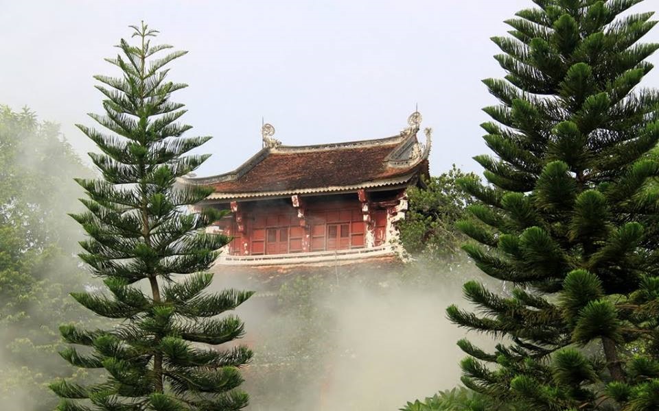
Chùa Quỳnh Lâm
Quỳnh Lâm Pagoda (Chinese characters: 瓊林寺, Sino-Vietnamese pronunciation: Quỳnh Lâm tự) is a famous ancient pagoda in Quảng Ninh, located within the Trần Dynasty Relics Site in Đông Triều.
🏯
Chùa Vạn Linh Khánh
Vạn Linh Khánh Pagoda, located in the Nam Thọ area, Trà Cổ ward, is one of the most representative heritage sites of Móng Cái city and was classified as a National Artistic Monument by the Ministry of Culture and Information in 1999.
The exact date of construction of Vạn Linh Khánh Pagoda is unclear. According to the inscription on a bronze bell recast in the 3rd year of Thiệu Trị (1843), it is mentioned that in the 15th year of Cảnh Thịnh, during the reign of King Lê Hiển Tông (1754), there already existed Linh Khánh Tự. In the summer of 2018, the main pagoda, on a large scale, was being rebuilt with large concrete pillars.
Vạn Linh Khánh Pagoda is composed of the following main structures: Tam quan (three-entrance gate), Nhà Tổ (Ancestral Hall), Nhà Mẫu (Mother Goddess Hall), and Nhà Khách (Guest House). Over time, the pagoda has undergone many restorations, and traces from the Lê dynasty no longer remain. However, the pagoda still preserves a fairly complete collection of worship objects and Dharma statues: a system of 53 ancient statues supplemented over various periods. Notably, there are 4 statues of the infant Shakyamuni, 2 statues of Quan Âm Tống tử (Child-bestowing Avalokiteśvara), and 2 small statues of the Three Buddhas (Tam thế).
Every year, at the Nam Thọ pagoda heritage site, many festivals are held, attracting a large number of Buddhist followers and visitors, such as the Shakyamuni Buddha Festival (8th of the 4th lunar month), Vu Lan Festival (7th lunar month), and Amitabha Buddha Festival (17th of the 11th lunar month), among others.

Khu di tích nhà Trần tại Đông Triều
The Trần Dynasty Relic Site at Đông Triều, Quảng Ninh Province, has been designated by the Prime Minister of Vietnam as a particularly important national relic. This is one of the most significant sites of the Trần Dynasty, situated in the ancestral homeland, where the Trần Ancestral Temple (Thái miếu nhà Trần) and the tombs of the Trần kings and royal family are preserved, alongside other sites such as the Bạch Đằng Victory relics and Trúc Lâm Yên Tử. The site includes two main relics: the Trần Ancestral Temple and Ngoạ Vân Pagoda, both of which are part of the Yên Tử – Vĩnh Nghiêm – Côn Sơn, Kiếp Bạc Complex of Relics and Scenic Spots, which has been recognised as a UNESCO World Heritage Site since 2025.
🏯
Chùa Bảo Sái
Chùa Bảo Sái is a Buddhist pagoda in Quảng Ninh, Vietnam. Its location comes from OpenStreetMap community data; further details will be added when reliable sources become available.

Chùa Cái Bầu
Chùa Cái Bầu is a Buddhist pagoda in Quảng Ninh, Vietnam. Its location comes from OpenStreetMap community data; further details will be added when reliable sources become available.
🏯
Chùa Giải Oan
Chùa Giải Oan is a Buddhist pagoda in Quảng Ninh, Vietnam. Its location comes from OpenStreetMap community data; further details will be added when reliable sources become available.
🏯
Chùa Hoa Yên
Chùa Hoa Yên is a Buddhist pagoda in Quảng Ninh, Vietnam. Its location comes from OpenStreetMap community data; further details will be added when reliable sources become available.
🏯
Chùa Linh Sơn
Chùa Linh Sơn is a Buddhist pagoda in Quảng Ninh, Vietnam. Its location comes from OpenStreetMap community data; further details will be added when reliable sources become available.
🏯
Chùa Lôi Âm Hạ
Chùa Lôi Âm Hạ is a Buddhist pagoda in Quảng Ninh, Vietnam. Its location comes from OpenStreetMap community data; further details will be added when reliable sources become available.
🏯
Chùa Minh Tâm
Chùa Minh Tâm is a Buddhist pagoda in Quảng Ninh, Vietnam. Its location comes from OpenStreetMap community data; further details will be added when reliable sources become available.
🏯
Chùa Một Cột
Chùa Một Cột is a Buddhist pagoda in Quảng Ninh, Vietnam. Its location comes from OpenStreetMap community data; further details will be added when reliable sources become available.
🏯
Chùa Phả Thiên
Chùa Phả Thiên is a Buddhist pagoda in Quảng Ninh, Vietnam. Its location comes from OpenStreetMap community data; further details will be added when reliable sources become available.
🏯
Chùa Quang Nghiêm
Chùa Quang Nghiêm is a Buddhist pagoda in Quảng Ninh, Vietnam. Its location comes from OpenStreetMap community data; further details will be added when reliable sources become available.
🏯
Chùa Triều
Chùa Triều is a Buddhist pagoda in Quảng Ninh, Vietnam. Its location comes from OpenStreetMap community data; further details will be added when reliable sources become available.
🏯
Chùa trình Yên Tử
Chùa trình Yên Tử is a Buddhist pagoda in Quảng Ninh, Vietnam. Its location comes from OpenStreetMap community data; further details will be added when reliable sources become available.
🏯
Chùa Trúc Lâm đảo Trần
Chùa Trúc Lâm đảo Trần is a Buddhist pagoda in Quảng Ninh, Vietnam. Its location comes from OpenStreetMap community data; further details will be added when reliable sources become available.
🏯
Chùa Vạn Ninh
Chùa Vạn Ninh is a Buddhist pagoda in Quảng Ninh, Vietnam. Its location comes from OpenStreetMap community data; further details will be added when reliable sources become available.
🏯
Chùa Vân Tiêu
Chùa Vân Tiêu is a Buddhist pagoda in Quảng Ninh, Vietnam. Its location comes from OpenStreetMap community data; further details will be added when reliable sources become available.
🏯
Chùa Xuân Lan
Chùa Xuân Lan is a Buddhist pagoda in Quảng Ninh, Vietnam. Its location comes from OpenStreetMap community data; further details will be added when reliable sources become available.
🏯
Đền An Sinh
Đền An Sinh is a temple (đền) in Quảng Ninh, Vietnam. Its location comes from OpenStreetMap community data; further details will be added when reliable sources become available.
🏯
Đền Cái Lân cũ
Đền Cái Lân cũ is a temple (đền) in Quảng Ninh, Vietnam. Its location comes from OpenStreetMap community data; further details will be added when reliable sources become available.
🏯
Đền Cao Lâm
Đền Cao Lâm is a temple (đền) in Quảng Ninh, Vietnam. Its location comes from OpenStreetMap community data; further details will be added when reliable sources become available.

Đền Cửa Ông
Cửa Ông Temple (Vietnamese: Đền Cửa Ông) is located in Cửa Ông Ward, Cẩm Phả, Quảng Ninh province, Vietnam. This is a place of worship for Hưng Nhượng Đại Vương Trần Quốc Tảng, a famous figure during the Trần dynasty, and it is also the venue for the annual Cửa Ông Temple Festival. At the end of 2017, Cửa Ông Temple was classified by the government as a Special National Site.
🏯
Đền Đông Cuông Vọng Từ
Đền Đông Cuông Vọng Từ is a temple (đền) in Quảng Ninh, Vietnam. Its location comes from OpenStreetMap community data; further details will be added when reliable sources become available.
🏯
Đền Ông Hoàng Đôi
Đền Ông Hoàng Đôi is a temple (đền) in Quảng Ninh, Vietnam. Its location comes from OpenStreetMap community data; further details will be added when reliable sources become available.
🏯
Đền Quan Sơn
Đền Quan Sơn is a temple (đền) in Quảng Ninh, Vietnam. Its location comes from OpenStreetMap community data; further details will be added when reliable sources become available.
🏯
Đền Thiên Hậu Thánh Mẫu
Đền Thiên Hậu Thánh Mẫu is a temple (đền) in Quảng Ninh, Vietnam. Its location comes from OpenStreetMap community data; further details will be added when reliable sources become available.
🏯
Đền thờ vua Lê Thánh Tông
Đền thờ vua Lê Thánh Tông is a temple (đền) in Quảng Ninh, Vietnam. Its location comes from OpenStreetMap community data; further details will be added when reliable sources become available.
🏯
Đền Trấn Ải Linh Từ
Đền Trấn Ải Linh Từ is a temple (đền) in Quảng Ninh, Vietnam. Its location comes from OpenStreetMap community data; further details will be added when reliable sources become available.
🏯
Đền Trung
Đền Trung is a temple (đền) in Quảng Ninh, Vietnam. Its location comes from OpenStreetMap community data; further details will be added when reliable sources become available.
🏯
Đền Vũng Đục
Đền Vũng Đục is a temple (đền) in Quảng Ninh, Vietnam. Its location comes from OpenStreetMap community data; further details will be added when reliable sources become available.
🏯
Đình Chùa Tiêu Dao
Đình Chùa Tiêu Dao is a village communal house (đình) in Quảng Ninh, Vietnam. Its location comes from OpenStreetMap community data; further details will be added when reliable sources become available.
🏯
Đình Làng Cầm
Đình Làng Cầm is a village communal house (đình) in Quảng Ninh, Vietnam. Its location comes from OpenStreetMap community data; further details will be added when reliable sources become available.
🏯
Đình làng Hà Phong
Đình làng Hà Phong is a village communal house (đình) in Quảng Ninh, Vietnam. Its location comes from OpenStreetMap community data; further details will be added when reliable sources become available.
🏯
Đình làng Tràng Vĩ
Đình làng Tràng Vĩ is a village communal house (đình) in Quảng Ninh, Vietnam. Its location comes from OpenStreetMap community data; further details will be added when reliable sources become available.

Đình Trà Cổ
Đình Trà Cổ is a village communal house (đình) in Quảng Ninh, Vietnam. Its location comes from OpenStreetMap community data; further details will be added when reliable sources become available.
Quảng Trị (7)

Chùa Hoằng Phúc
Hoằng Phúc Temple (Vietnamese: Chùa Hoằng Phúc, literally: Great Blessing, chữ Hán: 弘福寺) is a temple located in Thuan Trach Village, Mỹ Thủy Commune, Lệ Thủy District, Quảng Bình Province, North Central Coast Region of Vietnam. The temple has a history of more than 700 years, one of the oldest temples in Central Vietnam.

Chùa Tịnh Quang
Tịnh Quang Pagoda is a pagoda located on a mountainous area to the southwest of Ái Tử village, in Triệu Phong district, Quảng Trị province. This is the only tổ đình (ancestral/parent monastery) in Quảng Trị province, belonging to the Northern School of Vietnamese Buddhism, and is considered a spiritual symbol of Buddhism in Quảng Trị. Several monks who have been closely associated with the pagoda always regard it as their ancestral land, while some local people see the pagoda as a centre of charity.
The pagoda also holds an annual Tổ Anniversary Festival on the 18th day of the 2nd lunar month, organised in coordination by the Provincial Buddhist Administration Committee and the Reconstruction Committee (representing the Association of Buddhist Monks, Nuns, and lay Buddhists from the same homeland, who are responsible for the finances). The Tổ Anniversary Festival is organised on a large scale, reaching the level of a major festival in the region, attracting thousands of monks, nuns, and lay Buddhists from across the country, as well as local monks, nuns, and thousands of local Buddhist devotees.
With its cultural, historical, and spiritual values, the pagoda was recognised as a national heritage site by the Ministry of Culture and Information under Decision No. 2009/QĐ – BVHTT dated 15/11/1991.
🏯
Chùa Quảng Xá
Chùa Quảng Xá is a Buddhist pagoda in Quảng Trị (formerly Quảng Bình province), Vietnam. Its location comes from OpenStreetMap community data; further details will be added when reliable sources become available.
🏯
Đình Làng Lâm Lang
Đình Làng Lâm Lang is a village communal house (đình) in Quảng Trị (formerly Quảng Bình province), Vietnam. Its location comes from OpenStreetMap community data; further details will be added when reliable sources become available.
🏯
Chùa Hướng Phùng
Chùa Hướng Phùng is a Buddhist pagoda in Quảng Trị, Vietnam. Its location comes from OpenStreetMap community data; further details will be added when reliable sources become available.
🏯
Chùa Khe Sanh
Chùa Khe Sanh is a Buddhist pagoda in Quảng Trị, Vietnam. Its location comes from OpenStreetMap community data; further details will be added when reliable sources become available.
🏯
Đình làng Cao Hy
Đình làng Cao Hy is a village communal house (đình) in Quảng Trị, Vietnam. Its location comes from OpenStreetMap community data; further details will be added when reliable sources become available.
Sơn La (3)
🏯
Chùa Chiền Viện (Vặt Hồng)
Chien Vien Pagoda, also called Vat Hong Pagoda, is in Vat hamlet, Muong Sang commune, Moc Chau district, Son La province. It is regarded as the oldest pagoda of the Northwest and a rare form of Buddhist temple built by the Thai people.
🏯
Đền thờ vua Lê Thái Tông (Quế Lâm Linh Từ)
The King Le Thai Tong Temple, formally “Que Lam Linh Tu” (Sacred Temple of Que Lam), stands in Chieng Le ward, Son La city, within the relic complex of the Que Lam Ngu Che rock inscription.
🏯
Đền Thờ Vua Lê Thánh Tông
Đền Thờ Vua Lê Thánh Tông is a temple (đền) in Sơn La, Vietnam. Its location comes from OpenStreetMap community data; further details will be added when reliable sources become available.
Tây Ninh (140)
🏯
Chùa Phước Lâm
Phước Lâm Pagoda, also known as Ông Miêng Pagoda, is an ancient pagoda located in Xóm Chùa hamlet, Tân Lân commune, Tây Ninh province, Vietnam.
🏯
Chùa Thới Bình
Thới Bình Pagoda is located at the Vàm Rạch Dừa three-way junction in Phước Thới hamlet, Cần Giuộc commune, Tây Ninh province, Vietnam.

Chùa Tôn Thạnh
Tôn Thạnh Pagoda is a fairly famous pagoda in history and literature, located in Mỹ Lộc commune, Tây Ninh province, Vietnam.

Chùa Gò Kén
Gò Kén Pagoda, also known as Từ Lâm Tự or Thiền Lâm Pagoda, is a Buddhist pagoda located in Long Trung hamlet, Hòa Thành ward, Tây Ninh province. This is one of the earliest Buddhist architectural structures in Tây Ninh, with a history of over 100 years. It is also the place where Cao Huỳnh Cư, Cao Hoài Sang, and Phạm Công Tắc borrowed to found the Cao Đài religion. The current abbot of the pagoda is Thích Thiện Nghĩa. Together with the Tây Ninh Holy See and Bà Đen Mountain, these three are considered the three spiritual architectures that are almost aligned in Tây Ninh.
The pagoda was built on a high mound covered with kén vines. For this reason, people called Thiền Lâm Pagoda 'Gò Kén Pagoda'. This name has remained until today, even though the kén vines no longer exist. The aim of the pagoda is to become the Buddhist centre of Tây Ninh province.
🏯
Chùa Vĩnh Xuân
Vĩnh Xuân Pagoda, also known as Phước Lâm Tự, is a pagoda located on Phan Châu Trinh Street, Tân Ninh Ward. The pagoda faces Tây Ninh canal and looks towards Bà Đen Mountain. It is situated next to the Quan Tây Ninh Bridge area. This pagoda has also served as the centre of the Buddhist Sangha of Tây Ninh Province during many periods.
🏯
Chùa An Châu
Chùa An Châu is a Buddhist pagoda in Tây Ninh (formerly Long An province), Vietnam. Its location comes from OpenStreetMap community data; further details will be added when reliable sources become available.
🏯
Chùa An Hòa
Chùa An Hòa is a Buddhist pagoda in Tây Ninh (formerly Long An province), Vietnam. Its location comes from OpenStreetMap community data; further details will be added when reliable sources become available.
🏯
Chùa An Long
Chùa An Long is a Buddhist pagoda in Tây Ninh (formerly Long An province), Vietnam. Its location comes from OpenStreetMap community data; further details will be added when reliable sources become available.
🏯
Chùa Bồ Đề
Chùa Bồ Đề is a Buddhist pagoda in Tây Ninh (formerly Long An province), Vietnam. Its location comes from OpenStreetMap community data; further details will be added when reliable sources become available.
🏯
Chùa Châu Long
Chùa Châu Long is a Buddhist pagoda in Tây Ninh (formerly Long An province), Vietnam. Its location comes from OpenStreetMap community data; further details will be added when reliable sources become available.
🏯
Chùa Đông Lâm
Chùa Đông Lâm is a Buddhist pagoda in Tây Ninh (formerly Long An province), Vietnam. Its location comes from OpenStreetMap community data; further details will be added when reliable sources become available.
🏯
Chùa Đức Quang
Chùa Đức Quang is a Buddhist pagoda in Tây Ninh (formerly Long An province), Vietnam. Its location comes from OpenStreetMap community data; further details will be added when reliable sources become available.
🏯
Chùa Hội Long
Chùa Hội Long is a Buddhist pagoda in Tây Ninh (formerly Long An province), Vietnam. Its location comes from OpenStreetMap community data; further details will be added when reliable sources become available.
🏯
Chùa Hưng Cần
Chùa Hưng Cần is a Buddhist pagoda in Tây Ninh (formerly Long An province), Vietnam. Its location comes from OpenStreetMap community data; further details will be added when reliable sources become available.
🏯
Chùa Hưng Hòa
Chùa Hưng Hòa is a Buddhist pagoda in Tây Ninh (formerly Long An province), Vietnam. Its location comes from OpenStreetMap community data; further details will be added when reliable sources become available.
🏯
Chùa Hưng Long
Chùa Hưng Long is a Buddhist pagoda in Tây Ninh (formerly Long An province), Vietnam. Its location comes from OpenStreetMap community data; further details will be added when reliable sources become available.
🏯
Chùa Hưng Quang
Chùa Hưng Quang is a Buddhist pagoda in Tây Ninh (formerly Long An province), Vietnam. Its location comes from OpenStreetMap community data; further details will be added when reliable sources become available.
🏯
Chùa Khải Phước
Chùa Khải Phước is a Buddhist pagoda in Tây Ninh (formerly Long An province), Vietnam. Its location comes from OpenStreetMap community data; further details will be added when reliable sources become available.
🏯
Chùa Liên Hoa
Chùa Liên Hoa is a Buddhist pagoda in Tây Ninh (formerly Long An province), Vietnam. Its location comes from OpenStreetMap community data; further details will be added when reliable sources become available.
🏯
Chùa Linh Bửu
Chùa Linh Bửu is a Buddhist pagoda in Tây Ninh (formerly Long An province), Vietnam. Its location comes from OpenStreetMap community data; further details will be added when reliable sources become available.
🏯
Chùa Linh Phước
Chùa Linh Phước is a Buddhist pagoda in Tây Ninh (formerly Long An province), Vietnam. Its location comes from OpenStreetMap community data; further details will be added when reliable sources become available.
🏯
Chùa Linh Phước
Chùa Linh Phước is a Buddhist pagoda in Tây Ninh (formerly Long An province), Vietnam. Its location comes from OpenStreetMap community data; further details will be added when reliable sources become available.
🏯
Chùa Long Nghĩa
Chùa Long Nghĩa is a Buddhist pagoda in Tây Ninh (formerly Long An province), Vietnam. Its location comes from OpenStreetMap community data; further details will be added when reliable sources become available.
🏯
Chùa Nguyên Thỉ
Chùa Nguyên Thỉ is a Buddhist pagoda in Tây Ninh (formerly Long An province), Vietnam. Its location comes from OpenStreetMap community data; further details will be added when reliable sources become available.
🏯
Chùa Ông Bến Bạ
Chùa Ông Bến Bạ is a Buddhist pagoda in Tây Ninh (formerly Long An province), Vietnam. Its location comes from OpenStreetMap community data; further details will be added when reliable sources become available.
🏯
Chùa Phật Quang Cần Đước
Chùa Phật Quang Cần Đước is a Buddhist pagoda in Tây Ninh (formerly Long An province), Vietnam. Its location comes from OpenStreetMap community data; further details will be added when reliable sources become available.
🏯
Chùa Phước Hưng
Chùa Phước Hưng is a Buddhist pagoda in Tây Ninh (formerly Long An province), Vietnam. Its location comes from OpenStreetMap community data; further details will be added when reliable sources become available.
🏯
Chùa Phước Trường
Chùa Phước Trường is a Buddhist pagoda in Tây Ninh (formerly Long An province), Vietnam. Its location comes from OpenStreetMap community data; further details will be added when reliable sources become available.
🏯
Chùa Quan Âm
Chùa Quan Âm is a Buddhist pagoda in Tây Ninh (formerly Long An province), Vietnam. Its location comes from OpenStreetMap community data; further details will be added when reliable sources become available.
🏯
Chùa Thầy Thiện
Chùa Thầy Thiện is a Buddhist pagoda in Tây Ninh (formerly Long An province), Vietnam. Its location comes from OpenStreetMap community data; further details will be added when reliable sources become available.
🏯
Chùa Thiên Châu
Chùa Thiên Châu is a Buddhist pagoda in Tây Ninh (formerly Long An province), Vietnam. Its location comes from OpenStreetMap community data; further details will be added when reliable sources become available.
🏯
Chùa Thiên Mụ
Chùa Thiên Mụ is a Buddhist pagoda in Tây Ninh (formerly Long An province), Vietnam. Its location comes from OpenStreetMap community data; further details will be added when reliable sources become available.
🏯
Chùa Thiên Thuận
Chùa Thiên Thuận is a Buddhist pagoda in Tây Ninh (formerly Long An province), Vietnam. Its location comes from OpenStreetMap community data; further details will be added when reliable sources become available.
🏯
Chùa Thiền Tông Tân Diệu
Chùa Thiền Tông Tân Diệu is a Buddhist pagoda in Tây Ninh (formerly Long An province), Vietnam. Its location comes from OpenStreetMap community data; further details will be added when reliable sources become available.
🏯
Chùa Thọ Vức
Chùa Thọ Vức is a Buddhist pagoda in Tây Ninh (formerly Long An province), Vietnam. Its location comes from OpenStreetMap community data; further details will be added when reliable sources become available.
🏯
Chùa Tịnh An
Chùa Tịnh An is a Buddhist pagoda in Tây Ninh (formerly Long An province), Vietnam. Its location comes from OpenStreetMap community data; further details will be added when reliable sources become available.
🏯
Chùa Tịnh Độ
Chùa Tịnh Độ is a Buddhist pagoda in Tây Ninh (formerly Long An province), Vietnam. Its location comes from OpenStreetMap community data; further details will be added when reliable sources become available.
🏯
Chùa Trung Thuận
Chùa Trung Thuận is a Buddhist pagoda in Tây Ninh (formerly Long An province), Vietnam. Its location comes from OpenStreetMap community data; further details will be added when reliable sources become available.
🏯
Chùa Từ Phong
Chùa Từ Phong is a Buddhist pagoda in Tây Ninh (formerly Long An province), Vietnam. Its location comes from OpenStreetMap community data; further details will be added when reliable sources become available.
🏯
Chùa Từ Vân
Chùa Từ Vân is a Buddhist pagoda in Tây Ninh (formerly Long An province), Vietnam. Its location comes from OpenStreetMap community data; further details will be added when reliable sources become available.
🏯
Chùa Tường Vân
Chùa Tường Vân is a Buddhist pagoda in Tây Ninh (formerly Long An province), Vietnam. Its location comes from OpenStreetMap community data; further details will be added when reliable sources become available.
🏯
Chùa Vĩnh Phước
Chùa Vĩnh Phước is a Buddhist pagoda in Tây Ninh (formerly Long An province), Vietnam. Its location comes from OpenStreetMap community data; further details will be added when reliable sources become available.
🏯
Đền thờ Nguyễn Trung Trực
Đền thờ Nguyễn Trung Trực is a temple (đền) in Tây Ninh (formerly Long An province), Vietnam. Its location comes from OpenStreetMap community data; further details will be added when reliable sources become available.
🏯
Đền thờ Tổng Lãnh binh Nguyễn Văn Tiến
Đền thờ Tổng Lãnh binh Nguyễn Văn Tiến is a temple (đền) in Tây Ninh (formerly Long An province), Vietnam. Its location comes from OpenStreetMap community data; further details will be added when reliable sources become available.
🏯
Đình Bình Cư 1
Đình Bình Cư 1 is a village communal house (đình) in Tây Ninh (formerly Long An province), Vietnam. Its location comes from OpenStreetMap community data; further details will be added when reliable sources become available.
🏯
Đình Bình Đức
Đình Bình Đức is a village communal house (đình) in Tây Ninh (formerly Long An province), Vietnam. Its location comes from OpenStreetMap community data; further details will be added when reliable sources become available.
🏯
Đình Bình Lập
Đình Bình Lập is a village communal house (đình) in Tây Ninh (formerly Long An province), Vietnam. Its location comes from OpenStreetMap community data; further details will be added when reliable sources become available.
🏯
Đình Bình Quân
Đình Bình Quân is a village communal house (đình) in Tây Ninh (formerly Long An province), Vietnam. Its location comes from OpenStreetMap community data; further details will be added when reliable sources become available.
🏯
Đình Bình Yên
Đình Bình Yên is a village communal house (đình) in Tây Ninh (formerly Long An province), Vietnam. Its location comes from OpenStreetMap community data; further details will be added when reliable sources become available.
🏯
Đình Chánh Ngãi A
Đình Chánh Ngãi A is a village communal house (đình) in Tây Ninh (formerly Long An province), Vietnam. Its location comes from OpenStreetMap community data; further details will be added when reliable sources become available.
🏯
Đình Chánh Tân Kim
Đình Chánh Tân Kim is a village communal house (đình) in Tây Ninh (formerly Long An province), Vietnam. Its location comes from OpenStreetMap community data; further details will be added when reliable sources become available.
🏯
Đình Đạo Thạnh
Đình Đạo Thạnh is a village communal house (đình) in Tây Ninh (formerly Long An province), Vietnam. Its location comes from OpenStreetMap community data; further details will be added when reliable sources become available.
🏯
Đình Hòa An
Đình Hòa An is a village communal house (đình) in Tây Ninh (formerly Long An province), Vietnam. Its location comes from OpenStreetMap community data; further details will be added when reliable sources become available.
🏯
Đình Hòa Điều
Đình Hòa Điều is a village communal house (đình) in Tây Ninh (formerly Long An province), Vietnam. Its location comes from OpenStreetMap community data; further details will be added when reliable sources become available.
🏯
Đình Hướng Bình
Đình Hướng Bình is a village communal house (đình) in Tây Ninh (formerly Long An province), Vietnam. Its location comes from OpenStreetMap community data; further details will be added when reliable sources become available.
🏯
Đình Nhơn Phú
Đình Nhơn Phú is a village communal house (đình) in Tây Ninh (formerly Long An province), Vietnam. Its location comes from OpenStreetMap community data; further details will be added when reliable sources become available.
🏯
Đình Phú Khương
Đình Phú Khương is a village communal house (đình) in Tây Ninh (formerly Long An province), Vietnam. Its location comes from OpenStreetMap community data; further details will be added when reliable sources become available.
🏯
Đình Phú Thành
Đình Phú Thành is a village communal house (đình) in Tây Ninh (formerly Long An province), Vietnam. Its location comes from OpenStreetMap community data; further details will be added when reliable sources become available.
🏯
Đình Phước Chỉ
Đình Phước Chỉ is a village communal house (đình) in Tây Ninh (formerly Long An province), Vietnam. Its location comes from OpenStreetMap community data; further details will be added when reliable sources become available.
🏯
Đình Phước Đông
Đình Phước Đông is a village communal house (đình) in Tây Ninh (formerly Long An province), Vietnam. Its location comes from OpenStreetMap community data; further details will be added when reliable sources become available.
🏯
Đình Phước Lý
Đình Phước Lý is a village communal house (đình) in Tây Ninh (formerly Long An province), Vietnam. Its location comes from OpenStreetMap community data; further details will be added when reliable sources become available.
🏯
Đình Phước Toàn
Đình Phước Toàn is a village communal house (đình) in Tây Ninh (formerly Long An province), Vietnam. Its location comes from OpenStreetMap community data; further details will be added when reliable sources become available.
🏯
Đình Tân Chánh
Đình Tân Chánh is a village communal house (đình) in Tây Ninh (formerly Long An province), Vietnam. Its location comes from OpenStreetMap community data; further details will be added when reliable sources become available.
🏯
Đình Tân Phước Tây
Đình Tân Phước Tây is a village communal house (đình) in Tây Ninh (formerly Long An province), Vietnam. Its location comes from OpenStreetMap community data; further details will be added when reliable sources become available.
🏯
Đình Tân Xuân
Đình Tân Xuân is a village communal house (đình) in Tây Ninh (formerly Long An province), Vietnam. Its location comes from OpenStreetMap community data; further details will be added when reliable sources become available.
🏯
Đình thần An Trị
Đình thần An Trị is a village communal house (đình) in Tây Ninh (formerly Long An province), Vietnam. Its location comes from OpenStreetMap community data; further details will be added when reliable sources become available.
🏯
Đình thần Bình Cang
Đình thần Bình Cang is a village communal house (đình) in Tây Ninh (formerly Long An province), Vietnam. Its location comes from OpenStreetMap community data; further details will be added when reliable sources become available.
🏯
Đình thần Bình Phú
Đình thần Bình Phú is a village communal house (đình) in Tây Ninh (formerly Long An province), Vietnam. Its location comes from OpenStreetMap community data; further details will be added when reliable sources become available.
🏯
Đình thần Bình Tâm
Đình thần Bình Tâm is a village communal house (đình) in Tây Ninh (formerly Long An province), Vietnam. Its location comes from OpenStreetMap community data; further details will be added when reliable sources become available.
🏯
Đình thần Bình Trung
Đình thần Bình Trung is a village communal house (đình) in Tây Ninh (formerly Long An province), Vietnam. Its location comes from OpenStreetMap community data; further details will be added when reliable sources become available.
🏯
Đình thần Bình Yên Đông
Đình thần Bình Yên Đông is a village communal house (đình) in Tây Ninh (formerly Long An province), Vietnam. Its location comes from OpenStreetMap community data; further details will be added when reliable sources become available.
🏯
Đình thần Đức Hòa
Đình thần Đức Hòa is a village communal house (đình) in Tây Ninh (formerly Long An province), Vietnam. Its location comes from OpenStreetMap community data; further details will be added when reliable sources become available.
🏯
Đình thần Hòa Ngãi
Đình thần Hòa Ngãi is a village communal house (đình) in Tây Ninh (formerly Long An province), Vietnam. Its location comes from OpenStreetMap community data; further details will be added when reliable sources become available.
🏯
Đình thần Khánh Hậu
Đình thần Khánh Hậu is a village communal house (đình) in Tây Ninh (formerly Long An province), Vietnam. Its location comes from OpenStreetMap community data; further details will be added when reliable sources become available.
🏯
Đình thần Mỹ Hạnh
Đình thần Mỹ Hạnh is a village communal house (đình) in Tây Ninh (formerly Long An province), Vietnam. Its location comes from OpenStreetMap community data; further details will be added when reliable sources become available.
🏯
Đình thần Ngãi Lợi
Đình thần Ngãi Lợi is a village communal house (đình) in Tây Ninh (formerly Long An province), Vietnam. Its location comes from OpenStreetMap community data; further details will be added when reliable sources become available.
🏯
Đình thần Nhơn Hậu
Đình thần Nhơn Hậu is a village communal house (đình) in Tây Ninh (formerly Long An province), Vietnam. Its location comes from OpenStreetMap community data; further details will be added when reliable sources become available.
🏯
Đình thần Nhơn Nhượng
Đình thần Nhơn Nhượng is a village communal house (đình) in Tây Ninh (formerly Long An province), Vietnam. Its location comes from OpenStreetMap community data; further details will be added when reliable sources become available.
🏯
Đình thần Nhơn Thạnh
Đình thần Nhơn Thạnh is a village communal house (đình) in Tây Ninh (formerly Long An province), Vietnam. Its location comes from OpenStreetMap community data; further details will be added when reliable sources become available.
🏯
Đình thần Nhựt Tảo
Đình thần Nhựt Tảo is a village communal house (đình) in Tây Ninh (formerly Long An province), Vietnam. Its location comes from OpenStreetMap community data; further details will be added when reliable sources become available.
🏯
Đình thần Vĩnh Bình
Đình thần Vĩnh Bình is a village communal house (đình) in Tây Ninh (formerly Long An province), Vietnam. Its location comes from OpenStreetMap community data; further details will be added when reliable sources become available.
🏯
Đình thần Vĩnh Phú
Đình thần Vĩnh Phú is a village communal house (đình) in Tây Ninh (formerly Long An province), Vietnam. Its location comes from OpenStreetMap community data; further details will be added when reliable sources become available.
🏯
Đình Thọ Cang
Đình Thọ Cang is a village communal house (đình) in Tây Ninh (formerly Long An province), Vietnam. Its location comes from OpenStreetMap community data; further details will be added when reliable sources become available.
🏯
Đình Vạn Phước
Đình Vạn Phước is a village communal house (đình) in Tây Ninh (formerly Long An province), Vietnam. Its location comes from OpenStreetMap community data; further details will be added when reliable sources become available.
🏯
Đình Vĩnh Phong
Đình Vĩnh Phong is a village communal house (đình) in Tây Ninh (formerly Long An province), Vietnam. Its location comes from OpenStreetMap community data; further details will be added when reliable sources become available.
🏯
Đình Xã Thuận Mỹ
Đình Xã Thuận Mỹ is a village communal house (đình) in Tây Ninh (formerly Long An province), Vietnam. Its location comes from OpenStreetMap community data; further details will be added when reliable sources become available.
🏯
Đình Xuân Sanh
Đình Xuân Sanh is a village communal house (đình) in Tây Ninh (formerly Long An province), Vietnam. Its location comes from OpenStreetMap community data; further details will be added when reliable sources become available.
🏯
Đình Yên Mỹ
Đình Yên Mỹ is a village communal house (đình) in Tây Ninh (formerly Long An province), Vietnam. Its location comes from OpenStreetMap community data; further details will be added when reliable sources become available.
🏯
Miếu Bà Long Thượng
Miếu Bà Long Thượng is a shrine (miếu) in Tây Ninh (formerly Long An province), Vietnam. Its location comes from OpenStreetMap community data; further details will be added when reliable sources become available.
🏯
Miếu Năm Bà Ngũ Hành
Miếu Năm Bà Ngũ Hành is a shrine (miếu) in Tây Ninh (formerly Long An province), Vietnam. Its location comes from OpenStreetMap community data; further details will be added when reliable sources become available.
🏯
Miếu Quan Âm Golden Land
Miếu Quan Âm Golden Land is a shrine (miếu) in Tây Ninh (formerly Long An province), Vietnam. Its location comes from OpenStreetMap community data; further details will be added when reliable sources become available.
🏯
Tịnh xá Ngọc An
Tịnh xá Ngọc An is a Buddhist vihara (tịnh xá) in Tây Ninh (formerly Long An province), Vietnam. Its location comes from OpenStreetMap community data; further details will be added when reliable sources become available.
🏯
Tịnh Xá Ngọc Tâm
Tịnh Xá Ngọc Tâm is a Buddhist vihara (tịnh xá) in Tây Ninh (formerly Long An province), Vietnam. Its location comes from OpenStreetMap community data; further details will be added when reliable sources become available.
🏯
Tổ đình Kim Cang
Tổ đình Kim Cang is a ancestral Buddhist temple (tổ đình) in Tây Ninh (formerly Long An province), Vietnam. Its location comes from OpenStreetMap community data; further details will be added when reliable sources become available.
🏯
Chùa An Lạc
Chùa An Lạc is a Buddhist pagoda in Tây Ninh, Vietnam. Its location comes from OpenStreetMap community data; further details will be added when reliable sources become available.
🏯
Chùa Botum Kirirangsay
Chùa Botum Kirirangsay is a Buddhist pagoda in Tây Ninh, Vietnam. Its location comes from OpenStreetMap community data; further details will be added when reliable sources become available.
🏯
Chùa Đông Quan
Chùa Đông Quan is a Buddhist pagoda in Tây Ninh, Vietnam. Its location comes from OpenStreetMap community data; further details will be added when reliable sources become available.
🏯
Chùa Giác Ngạn
Chùa Giác Ngạn is a Buddhist pagoda in Tây Ninh, Vietnam. Its location comes from OpenStreetMap community data; further details will be added when reliable sources become available.
🏯
Chùa Hang
Chùa Hang is a Buddhist pagoda in Tây Ninh, Vietnam. Its location comes from OpenStreetMap community data; further details will be added when reliable sources become available.
🏯
Chùa Hạnh Lâm
Chùa Hạnh Lâm is a Buddhist pagoda in Tây Ninh, Vietnam. Its location comes from OpenStreetMap community data; further details will be added when reliable sources become available.
🏯
Chùa Hòa Đồng
Chùa Hòa Đồng is a Buddhist pagoda in Tây Ninh, Vietnam. Its location comes from OpenStreetMap community data; further details will be added when reliable sources become available.
🏯
Chùa Hòa Lâm
Chùa Hòa Lâm is a Buddhist pagoda in Tây Ninh, Vietnam. Its location comes from OpenStreetMap community data; further details will be added when reliable sources become available.
🏯
Chùa Kà Ốt
Chùa Kà Ốt is a Buddhist pagoda in Tây Ninh, Vietnam. Its location comes from OpenStreetMap community data; further details will be added when reliable sources become available.
🏯
Chùa Linh Bửu
Chùa Linh Bửu is a Buddhist pagoda in Tây Ninh, Vietnam. Its location comes from OpenStreetMap community data; further details will be added when reliable sources become available.
🏯
Chùa Linh Nghĩa
Chùa Linh Nghĩa is a Buddhist pagoda in Tây Ninh, Vietnam. Its location comes from OpenStreetMap community data; further details will be added when reliable sources become available.
🏯
Chùa Linh Nghĩa Diệu Pháp
Chùa Linh Nghĩa Diệu Pháp is a Buddhist pagoda in Tây Ninh, Vietnam. Its location comes from OpenStreetMap community data; further details will be added when reliable sources become available.
🏯
Chùa Linh Quang
Chùa Linh Quang is a Buddhist pagoda in Tây Ninh, Vietnam. Its location comes from OpenStreetMap community data; further details will be added when reliable sources become available.
🏯
Chùa Linh Sơn Từ Vân
Chùa Linh Sơn Từ Vân is a Buddhist pagoda in Tây Ninh, Vietnam. Its location comes from OpenStreetMap community data; further details will be added when reliable sources become available.
🏯
Chùa Niết Bàn
Chùa Niết Bàn is a Buddhist pagoda in Tây Ninh, Vietnam. Its location comes from OpenStreetMap community data; further details will be added when reliable sources become available.
🏯
Chùa Pháp Lâm
Chùa Pháp Lâm is a Buddhist pagoda in Tây Ninh, Vietnam. Its location comes from OpenStreetMap community data; further details will be added when reliable sources become available.
🏯
Chùa Phước Hòa
Chùa Phước Hòa is a Buddhist pagoda in Tây Ninh, Vietnam. Its location comes from OpenStreetMap community data; further details will be added when reliable sources become available.
🏯
Chùa Phước Quang
Chùa Phước Quang is a Buddhist pagoda in Tây Ninh, Vietnam. Its location comes from OpenStreetMap community data; further details will be added when reliable sources become available.
🏯
Chùa Suối Pháp
Chùa Suối Pháp is a Buddhist pagoda in Tây Ninh, Vietnam. Its location comes from OpenStreetMap community data; further details will be added when reliable sources become available.
🏯
Chùa Thiền Lâm Cổ
Chùa Thiền Lâm Cổ is a Buddhist pagoda in Tây Ninh, Vietnam. Its location comes from OpenStreetMap community data; further details will be added when reliable sources become available.
🏯
Chùa Tứ Phước
Chùa Tứ Phước is a Buddhist pagoda in Tây Ninh, Vietnam. Its location comes from OpenStreetMap community data; further details will be added when reliable sources become available.
🏯
Đình An Hòa
Đình An Hòa is a village communal house (đình) in Tây Ninh, Vietnam. Its location comes from OpenStreetMap community data; further details will be added when reliable sources become available.
🏯
Đình An Tịnh
Đình An Tịnh is a village communal house (đình) in Tây Ninh, Vietnam. Its location comes from OpenStreetMap community data; further details will be added when reliable sources become available.
🏯
Đình Bình Thạnh
Đình Bình Thạnh is a village communal house (đình) in Tây Ninh, Vietnam. Its location comes from OpenStreetMap community data; further details will be added when reliable sources become available.
🏯
Đình Đôn Thuận
Đình Đôn Thuận is a village communal house (đình) in Tây Ninh, Vietnam. Its location comes from OpenStreetMap community data; further details will be added when reliable sources become available.
🏯
Đình Gia Lộc
Đình Gia Lộc is a village communal house (đình) in Tây Ninh, Vietnam. Its location comes from OpenStreetMap community data; further details will be added when reliable sources become available.
🏯
Đình Hiệp Ninh
Đình Hiệp Ninh is a village communal house (đình) in Tây Ninh, Vietnam. Its location comes from OpenStreetMap community data; further details will be added when reliable sources become available.
🏯
Đình Hòa Hội
Đình Hòa Hội is a village communal house (đình) in Tây Ninh, Vietnam. Its location comes from OpenStreetMap community data; further details will be added when reliable sources become available.
🏯
Đình Long Chữ
Đình Long Chữ is a village communal house (đình) in Tây Ninh, Vietnam. Its location comes from OpenStreetMap community data; further details will be added when reliable sources become available.
🏯
Đình Long Thành
Đình Long Thành is a village communal house (đình) in Tây Ninh, Vietnam. Its location comes from OpenStreetMap community data; further details will be added when reliable sources become available.
🏯
Đình Long Thuận
Đình Long Thuận is a village communal house (đình) in Tây Ninh, Vietnam. Its location comes from OpenStreetMap community data; further details will be added when reliable sources become available.
🏯
Đình Phước Hiệp
Đình Phước Hiệp is a village communal house (đình) in Tây Ninh, Vietnam. Its location comes from OpenStreetMap community data; further details will be added when reliable sources become available.
🏯
Đình Thái Bình
Đình Thái Bình is a village communal house (đình) in Tây Ninh, Vietnam. Its location comes from OpenStreetMap community data; further details will be added when reliable sources become available.
🏯
Đình Thanh Phước
Đình Thanh Phước is a village communal house (đình) in Tây Ninh, Vietnam. Its location comes from OpenStreetMap community data; further details will be added when reliable sources become available.
🏯
Đình thần Lộc Hưng
Đình thần Lộc Hưng is a village communal house (đình) in Tây Ninh, Vietnam. Its location comes from OpenStreetMap community data; further details will be added when reliable sources become available.
🏯
Đình thần Phước Chỉ
Đình thần Phước Chỉ is a village communal house (đình) in Tây Ninh, Vietnam. Its location comes from OpenStreetMap community data; further details will be added when reliable sources become available.
🏯
Đình thần Phước Hội
Đình thần Phước Hội is a village communal house (đình) in Tây Ninh, Vietnam. Its location comes from OpenStreetMap community data; further details will be added when reliable sources become available.
🏯
Đình thần Phước Lưu
Đình thần Phước Lưu is a village communal house (đình) in Tây Ninh, Vietnam. Its location comes from OpenStreetMap community data; further details will be added when reliable sources become available.
🏯
Đình Trung Gia Bình
Đình Trung Gia Bình is a village communal house (đình) in Tây Ninh, Vietnam. Its location comes from OpenStreetMap community data; further details will be added when reliable sources become available.
🏯
Đình Trung Long Giang
Đình Trung Long Giang is a village communal house (đình) in Tây Ninh, Vietnam. Its location comes from OpenStreetMap community data; further details will be added when reliable sources become available.
🏯
Đình Trung Long Khánh
Đình Trung Long Khánh is a village communal house (đình) in Tây Ninh, Vietnam. Its location comes from OpenStreetMap community data; further details will be added when reliable sources become available.
🏯
Đình Trung Phước Trạch
Đình Trung Phước Trạch is a village communal house (đình) in Tây Ninh, Vietnam. Its location comes from OpenStreetMap community data; further details will be added when reliable sources become available.
🏯
Đình Trung Trí Bình
Đình Trung Trí Bình is a village communal house (đình) in Tây Ninh, Vietnam. Its location comes from OpenStreetMap community data; further details will be added when reliable sources become available.
🏯
Miếu Bà Thiên Hậu
Miếu Bà Thiên Hậu is a shrine (miếu) in Tây Ninh, Vietnam. Its location comes from OpenStreetMap community data; further details will be added when reliable sources become available.
🏯
Tịnh xá Ngọc Chơn
Tịnh xá Ngọc Chơn is a Buddhist vihara (tịnh xá) in Tây Ninh, Vietnam. Its location comes from OpenStreetMap community data; further details will be added when reliable sources become available.
🏯
Tịnh xá Ngọc Minh
Tịnh xá Ngọc Minh is a Buddhist vihara (tịnh xá) in Tây Ninh, Vietnam. Its location comes from OpenStreetMap community data; further details will be added when reliable sources become available.
Thái Nguyên (18)
🏯
Chùa Hang (Định Hóa)
Chùa Hang is located in Núi residential group, Định Hóa commune, Thái Nguyên province, Vietnam. This is a complex consisting of: Upper Cave (Hang Trên), Mother Goddess shrine (miếu Mẫu), Tam quan gatehouse (nhà Tam quan), and Lower Cave (Hang Dưới). Inside the cave, there are many stalactites of various shapes. A unique feature of the cave is that, over time, water flowing inside has created 'fairy fields' (ruộng cô tiên), a Buddha altar, an ancient stele from the Nguyễn dynasty, and an old bell. The Chùa Hang site is also associated with a historical event, as it was a place where Hồ Chí Minh once lived and worked during the resistance war against the French colonialists. Every year, the Chùa Hang festival is held on the 14th and 15th days of the first lunar month, attracting visitors who come to offer incense, sightsee, and enjoy the pagoda's scenery.

Chùa Hang (Kim Sơn Tự)
Chùa Hang (Kim Sơn Tự) Pagoda is located in Linh Sơn ward, Thái Nguyên province, Vietnam.
The scenic site of Chùa Hang (Kim Sơn Tự) Pagoda is situated 3 km north of the centre of Phan Đình Phùng ward, on the left side of National Highway 1B, in the direction from Thái Nguyên to Lạng Sơn. The pagoda possesses many distinctive features of the mountainous region, and was therefore selected for inclusion in the collection of 100 exemplary Vietnamese pagodas, first published in 2011. According to legend, this is an ancient pagoda dating back to the 11th century and was designated a National Scenic Site in 1999.
🏯
Chùa Thạch Long
Thach Long Pagoda (“Stone Dragon”) sits inside a limestone cave in Cao Ky commune, Cho Moi district, Bac Kan province, at nearly 300 m above sea level and about 400 m from National Route 3. It is regarded as one of the largest and airiest cave pagodas in northern Vietnam, able to hold thousands of worshippers.
🏯
Đền An Mạ (An Mã)
An Ma Temple stands on An Ma island — a limestone islet about 30 m high covered in greenery — in the middle of Ba Be lake, Nam Mau commune, Ba Be district, Bac Kan province. It is dedicated to the Buddha, the Forest Mother Goddess (Mau Thuong Ngan), the Mountain Princess and Saint Tran Hung Dao.
🏯
Chùa Bá Xuyên
Chùa Bá Xuyên is a Buddhist pagoda in Thái Nguyên, Vietnam. Its location comes from OpenStreetMap community data; further details will be added when reliable sources become available.
🏯
Chùa Chung
Chùa Chung is a Buddhist pagoda in Thái Nguyên, Vietnam. Its location comes from OpenStreetMap community data; further details will be added when reliable sources become available.
🏯
Chùa Đản
Chùa Đản is a Buddhist pagoda in Thái Nguyên, Vietnam. Its location comes from OpenStreetMap community data; further details will be added when reliable sources become available.
🏯
Chùa Đôi Cao
Chùa Đôi Cao is a Buddhist pagoda in Thái Nguyên, Vietnam. Its location comes from OpenStreetMap community data; further details will be added when reliable sources become available.

Chùa Hang - Kim Sơn Tự
Chùa Hang - Kim Sơn Tự is a Buddhist pagoda in Thái Nguyên, Vietnam. Its location comes from OpenStreetMap community data; further details will be added when reliable sources become available.
🏯
Chùa Huống Thượng
Chùa Huống Thượng is a Buddhist pagoda in Thái Nguyên, Vietnam. Its location comes from OpenStreetMap community data; further details will be added when reliable sources become available.
🏯
Chùa La Cảnh
Chùa La Cảnh is a Buddhist pagoda in Thái Nguyên, Vietnam. Its location comes from OpenStreetMap community data; further details will be added when reliable sources become available.
🏯
Chùa Làng Cả
Chùa Làng Cả is a Buddhist pagoda in Thái Nguyên, Vietnam. Its location comes from OpenStreetMap community data; further details will be added when reliable sources become available.
🏯
Chùa Phú Cốc
Chùa Phú Cốc is a Buddhist pagoda in Thái Nguyên, Vietnam. Its location comes from OpenStreetMap community data; further details will be added when reliable sources become available.
🏯
Chùa Phù Liễn
Chùa Phù Liễn is a Buddhist pagoda in Thái Nguyên, Vietnam. Its location comes from OpenStreetMap community data; further details will be added when reliable sources become available.
🏯
Chùa Tân Yên
Chùa Tân Yên is a Buddhist pagoda in Thái Nguyên, Vietnam. Its location comes from OpenStreetMap community data; further details will be added when reliable sources become available.
🏯
Đền Mẫu
Đền Mẫu is a temple (đền) in Thái Nguyên, Vietnam. Its location comes from OpenStreetMap community data; further details will be added when reliable sources become available.
🏯
Đền Thanh Lâm
Đền Thanh Lâm is a temple (đền) in Thái Nguyên, Vietnam. Its location comes from OpenStreetMap community data; further details will be added when reliable sources become available.
🏯
Đền Thượng
Đền Thượng is a temple (đền) in Thái Nguyên, Vietnam. Its location comes from OpenStreetMap community data; further details will be added when reliable sources become available.
Thanh Hóa (10)
🏯
Chùa Khải Nam
Khải Nam Pagoda is a temple with a history spanning more than eight centuries, located in Sầm Sơn Ward, Thanh Hóa Province. The pagoda has been recognised by the Vietnamese government as a National Historical and Cultural Relic, as part of the Khải Nam Pagoda – Cá Lập Temple relic complex.
🏯
Chùa Sùng Nghiêm Diên Thánh
Sùng Nghiêm Diên Thánh Pagoda is an ancient pagoda dating back to before the Lý dynasty and has been recognised as a national heritage site; the pagoda is located in Duy Tinh village, Văn Lộc commune, Hậu Lộc district, Thanh Hóa province. The pagoda is also a place of worship for General Trần Hưng Đạo.
🏯
Chùa Bảo Phúc
Chùa Bảo Phúc is a Buddhist pagoda in Thanh Hóa, Vietnam. Its location comes from OpenStreetMap community data; further details will be added when reliable sources become available.
🏯
Chùa Phước Hải
Chùa Phước Hải is a Buddhist pagoda in Thanh Hóa, Vietnam. Its location comes from OpenStreetMap community data; further details will be added when reliable sources become available.
🏯
Chùa Tranh
Chùa Tranh is a Buddhist pagoda in Thanh Hóa, Vietnam. Its location comes from OpenStreetMap community data; further details will be added when reliable sources become available.
🏯
Chùa Vi
Chùa Vi is a Buddhist pagoda in Thanh Hóa, Vietnam. Its location comes from OpenStreetMap community data; further details will be added when reliable sources become available.
🏯
Đền rồng
Đền rồng is a temple (đền) in Thanh Hóa, Vietnam. Its location comes from OpenStreetMap community data; further details will be added when reliable sources become available.
🏯
Đền soong
Đền soong is a temple (đền) in Thanh Hóa, Vietnam. Its location comes from OpenStreetMap community data; further details will be added when reliable sources become available.
🏯
Đình Gia Miêu
Đình Gia Miêu is a village communal house (đình) in Thanh Hóa, Vietnam. Its location comes from OpenStreetMap community data; further details will be added when reliable sources become available.
🏯
Miếu Triệu Tường
Miếu Triệu Tường is a shrine (miếu) in Thanh Hóa, Vietnam. Its location comes from OpenStreetMap community data; further details will be added when reliable sources become available.
TP. Hồ Chí Minh (1018)
🏯
Chùa Đại Tòng Lâm
Đại Tòng Lâm Pagoda, with its full name being Vạn Phật Quang Đại Tòng Lâm Tự, is a grand pagoda featuring many large-scale and modern structures. The pagoda is located on National Highway 51, Quảng Phú quarter, Phú Mỹ ward, Hồ Chí Minh City, Vietnam.
🏯
Chùa Hộ Pháp (Thích Ca Phật Đài)
Hộ Pháp Pagoda is a pagoda built in the Southern (Theravāda) Buddhist architectural style, located at 610/2A Trần Phú, Vũng Tàu Ward, Hồ Chí Minh City, within the Thích Ca Phật Đài architectural complex. The pagoda features four steles inscribed with the Dharmacakrapravartana Sūtra (Discourse on Turning the Wheel of Dharma) in four different languages. The Vietnam Record Organisation has recognised these as holding the record for 'The largest mother-of-pearl inlaid Dharmacakrapravartana Sūtra steles in four languages.'
🏯
Chùa Khỉ
Chùa Khỉ (the official name is Thiền viện Trúc Lâm Chân Nguyên) is located at the foot of Minh Đạm Mountain, in Phước Hải Commune, Hồ Chí Minh City. The pagoda was built in 1990.
🏯
Linh Sơn Cổ Tự
Linh Sơn Cổ Tự Pagoda is a Buddhist temple located at 104 Hoàng Hoa Thám, Vũng Tàu Ward, Ho Chi Minh City, Vietnam.
The pagoda was recognised by the Ministry of Culture and Information of Vietnam as a national historical and cultural site on 3 August 1991.
The pagoda was originally built in 1919 on Núi Nhỏ (Small Mountain), but as the French occupied the site to build a pilot station, another pagoda was constructed at the current location and has existed until today. This is the oldest pagoda in Vũng Tàu.
Although Linh Sơn Cổ Tự Pagoda is not grand or spacious, it is the oldest pagoda in Vũng Tàu, situated on Hoàng Hoa Thám Street, Vũng Tàu Ward.
In its early days, the pagoda was built on the slope of Small Mountain, but in 1919 this area was occupied by the French to build villas for their pilots. Immediately afterwards, another pagoda was built and has remained until today.
In the main hall, there is a 1.2-metre-high Buddha statue made of stone and gilded with gold leaf, skilfully carved to create a gentle and lively expression on the Buddha’s face, in the style of Chăm Buddha statues. Archaeologists estimate that it dates back about 1,600 years.
Regarding the origin of the Buddha statue, legend has it that over a year ago, a group of fishing boats from Central Vietnam came to fish at Bãi Trước. While searching for firewood on Núi Lớn (Big Mountain), they accidentally discovered two stone Buddha statues buried in the ground on the mountainside near Bãi Dâu. They dug them up together and waited until the next day to perform a ritual to take them away. When the local people heard the news, they rushed to see and insisted that these were local historical relics and demanded to keep them. The group of fishermen from Central Vietnam pleaded for a long time before being allowed to take the smaller statue. The larger statue was brought back by the villagers for worship and is the very statue currently enshrined at Linh Sơn Cổ Tự Pagoda.
🏯
Niết Bàn Tịnh Xá
Niết Bàn Tịnh Xá is a Buddhist tịnh xá (monastery/temple) situated on the slope of Núi Nhỏ (Small Mountain), in Vũng Tàu ward, Hồ Chí Minh City, Vietnam. The tịnh xá was organised and constructed by Most Venerable Thích Thiện Huệ from 1969 to 1974 on the slope of Núi Nhỏ, which was formerly known as Tao Phùng Mountain, facing the sea. This is a grand complex consisting of many buildings, covering an area of nearly 10,000 m², and is a famous spiritual tourism and pilgrimage site in Vũng Tàu.
On 14 December 1989, the temple was recognised and ranked as a national historical site by the Ministry of Culture and Information of Vietnam.

Thích Ca Phật Đài
Thích Ca Phật Đài (lit. 'Platform of Shakyamuni Buddha') is a notable Theravada Buddhist temple in the coastal city of Vung Tau in southern Vietnam. It lies to the northwest of the Lớn mountain and was built between 1961 and 1963 when it was opened.

Chùa Hội Khánh
Hội Khánh Temple (Vietnamese: Chùa Hội Khánh, Chữ Hán: 會慶寺) is an historic Buddhist temple built in 1741 in the city of Thủ Dầu Một, Bình Dương Province in southern Vietnam.

Chùa Tây Tạng
Tây Tạng Pagoda (西藏寺) is a Vietnamese pagoda, currently located at 46B Thích Quảng Đức, Thủ Dầu Một Ward, Ho Chi Minh City. This pagoda belongs to the Mahayana tradition, blending the Lâm Tế Chúc Thánh Zen school with Tibetan Vajrayana Buddhism. It has been recognised by the Vietnam Records Book as 'the pagoda with the largest Bodhidharma statue made from hair'.

Chùa Ấn Quang
Ấn Quang Pagoda (Vietnamese: Chùa Ấn Quang, chữ Hán: 印光寺, meaning: "Pagoda of the Light of the (Dharma) Seal") in Master Vạn Hạnh Street (Đường Sư Vạn Hạnh) is a meeting place for Vietnamese Buddhist leaders in Ho Chi Minh City and is a site of the Institute for Dharma Propagation. It has been at the focus of development of modern Vietnamese Buddhism as the seat of the School of Buddhist Studies and the headquarters of the Unified Buddhist Church of Vietnam.

Chùa Bửu Long
Bửu Long Pagoda, officially named Thiền viện Tổ đình Bửu Long (Bửu Long Patriarchal Zen Monastery), is a pagoda situated on a hill by the Đồng Nai River at 81 Nguyễn Xiển Street, Long Bình Ward, Ho Chi Minh City. The pagoda belongs to the Theravāda (Southern) Buddhist tradition and was founded by layman Võ Hà Thuật in 1942. In 2007, the pagoda underwent investment for construction and restoration. Bửu Long Pagoda features architectural elements of Thai and Indian temples, combined with the architectural style of pagodas from the Nguyễn dynasty period.
The highlight of the pagoda is the stupa named Gotama Cetiya, which began construction in 2007 and was completed after six years. Gotama Cetiya Stupa is a place for enshrining the Buddha's relics and those of the Noble Sangha. The stupa covers over 2,000 m² and stands 70 metres tall, built in the style of the ancient Funan culture. Surrounding it are smaller stupas, all made of bronze with a lustrous golden colour. Gotama Cetiya is the largest stupa in Vietnam, comprising five stupas of various sizes, with the main central stupa being the tallest and largest, featuring seven storeys. The ground and second floors serve as assembly halls, the third and fourth floors are meditation halls, and the fifth floor is the stupa enshrining the Buddha's relics and those of the Noble Sangha.

Chùa Cây Mai
Cây Mai Pagoda, also known as Mai Sơn Tự (Mai Mountain Pagoda) or Mai Khâu Tự (Mai Mound Pagoda), was situated on Mai Mound, formerly part of Gia Định. During the French colonial period, the pagoda was dismantled, leaving only the nearly flat Mai Mound, located at the corner of Hồng Bàng and Nguyễn Thị Nhỏ streets in Minh Phụng Ward, Ho Chi Minh City.

Chùa Chantarangsay
Chantarangsay Pagoda, also known as Candaransi Pagoda, and informally referred to locally as the Khmer Pagoda, is a Theravāda Buddhist pagoda located in Xuân Hòa ward (formerly District 3), Ho Chi Minh City. Built in 1946, the pagoda is deeply influenced by Khmer culture and architecture, blending Buddhist tradition with ancient Cambodian architectural art. The pagoda is currently situated at 164/235 Trần Quốc Thảo Street, on the banks of the Nhiêu Lộc – Thị Nghè canal. Chantarangsay Pagoda, together with Pothiwong Pagoda, is considered an outstanding architectural heritage of the Khmer community in the Ho Chi Minh City area.
🏯
Chùa Giác Hải
Giác Hải Pagoda, formerly known as Giác Sơn Pagoda, was established in 1887 by Mrs. Trần Thị Liễu. The pagoda was dedicated to Venerable Hoằng Ân, and later his disciple, Venerable Từ Phong, became the abbot. Venerable Từ Phong was a renowned Buddhist lecturer, with up to 20 pagodas dedicated to him. Afterwards, the pagoda was renamed Giác Hải Pagoda. The pagoda is located at 345/45 Hùng Vương Street, District 6, Ho Chi Minh City.

Chùa Giác Lâm
Giác Lâm Temple (Vietnamese: Chùa Giác Lâm; chữ Hán: 覺林寺, Giác Lâm tự) is a historic Buddhist temple in Ho Chi Minh City (Saigon), the largest city in Vietnam. Built in 1744, it is one of the oldest temples in the city. It was officially listed as a state-cultural and historical site by the Ministry of Culture, Sports and Tourism in Vietnam on November 16, 1988, under Decision 1288VH/QĐ. The temple is located at 565 (previously 118) Lạc Long Quân Street, Bảy Hiền, (previously Ward 10, Tân Bình district), at the Phú Thọ Hòa area of the city (which was originally the commune of Gia Định…
🏯
Chùa Giác Ngộ
Giác Ngộ Pagoda is a Buddhist pagoda in Ho Chi Minh City, Vietnam.

Chùa Giác Viên
Giác Viên Pagoda (覺圓寺), also known as Giác Viên Tổ đình (覺圓祖庭, 'ancestral temple of Giác Viên'), and formerly called Hố Đất Pagoda (as it was once located beside the Hố Đất canal), is an ancient pagoda currently situated at 161/35/20 Lạc Long Quân Street, Bình Thới Ward (formerly Ward 3, District 11), Ho Chi Minh City, Vietnam. The pagoda has been recognised by the Ministry of Culture and Information as a national historical and cultural monument under Decision No. 43 – VH/QĐ dated 7 January 1993.

Chùa Hoằng Pháp
Hoằng Pháp Temple (Chùa Hoằng Pháp, built 1957) is a temple in Hóc Môn, a suburb of Ho Chi Minh City.
🏯
Chùa Hội Sơn
Hội Sơn Pagoda, established from the early 17th century to the mid-21st century, is an ancient pagoda located in Ho Chi Minh City, at 1A1 Nguyễn Xiển Street, Long Bình Ward, District 9 (now Thủ Đức City). This is one of the oldest pagodas in Ho Chi Minh City, with a history of up to 300 years. In July 2012, an unfortunate incident occurred when this ancient pagoda was destroyed by fire.

Chùa Huê Nghiêm
Huê Nghiêm Pagoda (華嚴寺), also known as Huê Nghiêm 2 Pagoda, is located at 299B Lương Định Của, An Khánh Ward, Ho Chi Minh City, and belongs to the Northern School (Bắc tông) tradition. The abbot emeritus of Huê Nghiêm Pagoda is the Supreme Patriarch Thích Trí Quảng. The current abbot of the pagoda is Most Venerable Thích Lệ Trang.

Chùa Huệ Nghiêm
The Huệ Nghiêm Buddhist Institute, also known as Huệ Nghiêm Pagoda, is located at 220/110/1 Đỗ Năng Tế Street, Quarter 2, An Lạc A Ward, Bình Tân District, Ho Chi Minh City. The pagoda is a renowned centre in the South as well as throughout Vietnam for training monks in Buddhist precepts and discipline. Huệ Nghiêm Pagoda is the first monastic institution to establish a precepts platform for the transmission of Buddhist precepts in the more than 2,000-year history of Vietnamese Buddhism.

Chùa Khải Tường
Khải Tường Pagoda is an ancient temple, formerly located on a high mound in Tân Lộc hamlet, in what was once Gia Định; today, it would be in the area of the War Remnants Museum, at 28 Võ Văn Tần, District 3, Ho Chi Minh City, Vietnam. This can be considered one of the oldest Buddhist temples in that region, but it was destroyed during the French colonial period.
🏯
Chùa Kiểng Phước
Kiểng Phước Pagoda (called 'Chuông Pagoda' by the French), was formerly a pagoda of the Chinese community that was occupied and turned into a fortress by the Franco-Spanish allied forces in 1860. According to documents, this pagoda was located in District 5, Ho Chi Minh City (Vietnam) today, with 'wooden pillars, two gates, and walls all made of brick, and by 1866, it had disappeared, leaving only a few rotten wooden posts in the pagoda grounds.'
🏯
Chùa Kim Chương
Kim Chương Pagoda (Kim Chương Tự), also known as Phổ Quang Thiên Sơn Tự, Thiên Trường Tự, and Sắc Tứ Phổ Quang Thiên Sơn Tự, is a 'quốc tự' (national pagoda), located on the land of Tân Triêm village, formerly part of Gia Định. When the French army invaded this area, the monks dismantled the pagoda and moved it to Mỹ Thiện commune (now Mỹ Đức Tây commune, Đồng Tháp province), where it was rebuilt and renamed Hội Thọ Tự. According to researcher Trương Ngọc Tường, the site of the ancient pagoda is now approximately where Lâm Tế Pagoda stands, at 212A Nguyễn Trãi Street, Cầu Ông Lãnh ward, Ho Chi Minh City.
🏯
Chùa Long Huê
Long Huê Pagoda (common name), formerly known as Sắc Tứ Long Hoa Tự, Sắc Tứ Huệ Long Tự, and Ngự Tứ Quan Long Tự, is an ancient pagoda belonging to the Northern (Mahayana) Buddhist tradition. It is currently located at 131/27 Nguyễn Thái Sơn Street, Gò Vấp District, Ho Chi Minh City, Vietnam.
🏯
Chùa Nam Thiên Nhất Trụ
Nam Thiên Nhất Trụ Pagoda, also known as the One Pillar Pagoda, is a pagoda located in Thủ Đức City, Ho Chi Minh City. The pagoda is well known for its structure, which is similar to the One Pillar Pagoda in Hà Nội.
The pagoda is situated on Đặng Văn Bi Street, Thủ Đức City, Ho Chi Minh City. It was founded by Venerable Thích Trí Dũng on the 8th of April, 1958. The architectural design was drawn by architect Nguyễn Gia Đức, and the pagoda was completed in 1977. The construction of this pagoda aimed to provide a place for southern devotees to admire and worship the Buddha, to remember their ancestral roots, and to nurture hopes for national peace and prosperity, and the flourishing of their homeland. The pillar of the "Nam Thiên Nhất Trụ" pagoda is cast permanently from reinforced concrete. The roof is tiled and curved in the same style as the One Pillar Pagoda in Hà Nội.

Chùa Nghệ Sĩ
Nghệ Sĩ Pagoda (also known as Nhựt Quang Tự, Phật Quang Tự) is a pagoda located at 116/6 Thống Nhất Street, Thông Tây Hội Ward, Ho Chi Minh City.

Chùa Ngọc Hoàng
The Jade Emperor Pagoda (Vietnamese: Chùa Ngọc Hoàng; name: Ngọc Hoàng Điện, 玉皇殿, "Jade Emperor Hall", French: Temple Da Kao) also known as the Phước Hải Tự (Vietnamese: Chùa Phước Hải; 福海寺, "Luck Sea Temple") is a Taoist, Buddhist, Confucian pagoda located at District 1, Ho Chi Minh City, Vietnam. It was founded by a Chinese merchant named Liu Daoyuan (劉道源, Lưu Minh or Lưu Đạo Nguyên), a Cantonese migrant. It is also known from 1984 by the new Buddhist name Phước Hải Tự (福海寺, "Luck Sea Temple"). Then U.S. President Barack Obama paid a visit to the pagoda during his state trip to Vietnam…

Chùa Pháp Hoa (Thành phố Hồ Chí Minh)
In Thành phố Hồ Chí Minh, there are many Buddhist establishments bearing the name Pháp Hoa. However, this article only discusses the two prominent Pháp Hoa Pagodas in the city, located in Nhiêu Lộc Ward and Đức Nhuận Ward.
🏯
Chùa Phật Bảo
Phật Bảo Pagoda (also known as Buddharatanaràma) is one of 22 Theravāda Buddhist pagodas in Ho Chi Minh City. Since the 1930s, Vietnamese Theravāda Buddhism (PGNT) was transmitted from Cambodia by venerable patriarchs, including the late Most Venerables: Hộ Tông, Giới Nghiêm, Bửu Chơn, Thiện Luật, Tịnh Sự, and others. This was the initial period when Theravāda Buddhism was first propagated in Vietnam, so there was a great need for young monks with knowledge of Buddhist teachings and culture to join the venerables in spreading the Dharma during the dawn, the early transmission period of Theravāda Buddhism. There is a close and strong relationship between Vietnamese Theravāda Buddhism and the southern Buddhist countries such as Sri Lanka (Tích Lan), Thailand, Cambodia, and Laos. The study and practice of Buddhism in these southern Buddhist countries are entirely similar, both in form and content.
🏯
Chùa Phú Long
Phú Long Pagoda (other names: Ông Chất Pagoda, Phú Nhuận Village Pagoda, Bà Cả Đành Pagoda) is a Buddhist pagoda of the Northern tradition located at 62A Huỳnh Văn Bánh Street, Ward 15, Phú Nhuận District, Ho Chi Minh City.

Chùa Phụng Sơn
Phụng Sơn Pagoda, with the formal name Phụng Sơn Tự, also known as Chùa Gò, is located at 1408 3 Tháng 2 Street, Minh Phụng Ward, Ho Chi Minh City, Vietnam. This ancient pagoda was designated as a 'National-level Historical and Cultural Site' on 16 November 1988.
🏯
Chùa Phước Tường
Phước Tường Pagoda is a national-level historical and cultural relic located in District 9, Ho Chi Minh City. The pagoda was recognised and certified by the Ministry of Culture and Information of Vietnam on 27 July 1993, and was also recognised as an Architectural and Artistic Monument according to Decision No. 43/VH-QĐ dated 7 January 1993.

Chùa Pothiwong
Pothiwong Pagoda (Khmer: វត្តពោធិវង្ស), officially named Bodhivangsa Pathi Vong Wat, is one of two Khmer pagodas of the Theravāda Buddhist tradition in Ho Chi Minh City. Located at 21/2 Bùi Thế Mỹ Street, Ward 10, Tân Bình District, Pothiwong Pagoda, together with Chantarangsay Pagoda, is regarded as an outstanding architectural heritage of the Khmer community in the Ho Chi Minh City area.

Chùa Tập Phước
Tập Phước Pagoda (潗福寺), also known as Sắc Tứ Tập Phước Tự (敕賜潗福寺) (as the pagoda was granted an imperial edict by Emperor Gia Long in 1802), is currently located at 233 Phan Văn Trị Street, Bình Thạnh District, Ho Chi Minh City, Vietnam. This is one of the famous ancient pagodas in the former Gia Định region.
🏯
Chùa Trường Thọ
Trường Thọ Pagoda is an ancient pagoda belonging to the Lâm Tế Zen school; it is currently located at 53/524 Nguyễn Văn Nghi Street, Gò Vấp District, Ho Chi Minh City, Vietnam.
🏯
Chùa Từ Ân
Từ Ân Pagoda, also known as Sắc Tứ Từ Ân Tự (敕賜慈恩寺), was built in the 18th century in the Chợ Đũi area, at a location now within Tao Đàn Park, District 1, Ho Chi Minh City (Vietnam). When the French forces attacked and occupied Gia Định, Từ Ân Pagoda was burned down. Later (in 1870), a new Từ Ân Pagoda was erected in Phú Lâm (now in District 6, Ho Chi Minh City) to continue the religious lineage and to preserve the remaining artefacts from the old pagoda.

Chùa Vạn Đức
Vạn Đức Pagoda is currently located at 502 Tô Ngọc Vân Street, in Quarter 55, Tam Bình Ward, Ho Chi Minh City, Vietnam. This is one of the two major pagodas of Thủ Đức City. Vạn Đức Pagoda is one of the large-scale religious architectural works in Ho Chi Minh City. In addition to its aesthetic value, the structure also serves as a model for sculptural art in modern architecture.

Chùa Vĩnh Nghiêm (Thành phố Hồ Chí Minh)
Vĩnh Nghiêm Pagoda (Chùa Vĩnh Nghiêm; literally Ever Solemn) is a pagoda in an area of 6,000 square metres (65,000 sq ft) at 339, Nam Kỳ Khởi Nghĩa street, Ward 7, District 3 Ho Chi Minh City. This is the first pagoda in Vietnam to be built in Vietnamese traditional architecture style but with concrete. The highest structure in this pagoda is the 7-story, 40-metre-high (130 ft) tower. This pagoda houses and worship of one buddha and two bodhisattvas: Gautama Buddha, Manjusri, Samantabhadra. The Peace Bell was donated by a monk of Entsuji Temple in Fukushima, Japan. The seven-storey tower…

Chùa Xá Lợi
The Xá Lợi Pagoda (Vietnamese: Chùa Xá Lợi [saː˦˥ ləːj˨˩˨] SAW-LIE; chữ Hán: 舍利寺) is the largest pagoda in Ho Chi Minh City, Vietnam. It was built in 1956 and was the headquarters of Buddhism in South Vietnam. The pagoda is located in District 3, Ho Chi Minh City and lies on a plot of 5000 square metres. The name Xá Lợi is the Vietnamese translation for śarīra, a term used for relics of Buddhists.

Thiền viện Quảng Đức
Quảng Đức Zen Monastery is currently located at 294 Nam Kỳ Khởi Nghĩa Street (near Công Lý Bridge and Vĩnh Nghiêm Pagoda), in Xuân Hòa Ward (formerly Ward 8, District 3), Ho Chi Minh City, Vietnam. This is a large Zen monastery, serving as the location of Office 2 of the Central Committee of the Vietnam Buddhist Sangha. It is also the site for printing and the distribution office for Buddhist scriptures and books of the Ho Chi Minh City Buddhist Association.
🏯
Thiền viện Vạn Hạnh (Thành phố Hồ Chí Minh)
Vạn Hạnh Monastery is a Thiền Buddhist temple in Ho Chi Minh City, the largest city in Vietnam. The temple is located at 716 Nguyễn Kiệm Street on the road between Go Vap and Phu Nhuan districts. It is the location of the main Buddhist training centre for sangha in Vietnam, and is also the office of the Vietnamese Buddhist Research Institute.

Tịnh xá Trung Tâm
Tịnh Xá Trung Tâm is a Buddhist temple in Ho Chi Minh City, the largest city in Vietnam. It was founded in 1965 and is the spiritual birthplace of the khất sĩ tradition of Vietnamese Buddhism that attempts to recreate the original tradition of the Buddhist sangha by walking barefoot and begging for alms. The temple is located at 7 Nguyễn Trung Trực Street, in Bình Thạnh District. It is known for its weekly Bát Quan Trai Giới (Eight Precept Ritual) retreat, which is staged more frequently than at other institutions in the city, and has a reputation among its followers for rigour and…
🏯
Tu viện Khánh An
Khánh An Monastery is a grand Buddhist temple located in District 12, Ho Chi Minh City. It is referred to as a 'monastery' to downplay the overt colours of faith and religion. Khánh An Monastery regularly organises retreats, meditation courses, and Satipatthana (Four Foundations of Mindfulness) meditation, attracting the attention of a large number of monks and Buddhist laypeople. This is a place that draws people for worship and temple visits; many young people come to participate in short-term retreats and listen to Dharma talks. Khánh An Monastery is closely associated with historical events during the resistance against the French by the army and people of An Phú Đông, District 12. The temple has been recognised as a City-level historical site. As a revolutionary base, it marks many important events during the resistance against the French by the army and people of An Phú Đông, District 12, and is notable for its unique architecture. Khánh An Monastery was recognised as a City-level Historical Site by the People's Committee of Ho Chi Minh City on 27 July 2007, according to Decision No. 3269/QĐ-UBND. Khánh An Monastery is one of the temples with unique architecture, often thought to be in the Japanese temple style, but in fact, it was built entirely in the style of ancient Vietnamese temples.

Việt Nam Quốc Tự
The Việt Nam Quốc Tự (lit. 'Vietnam National Pagoda') is located on 3/2 Blvd., Hòa Hưng ward, Ho Chi Minh City, Vietnam. The pagoda, seven stories tall, is full of colorful, oversized statues of religious figures. On the first and fifteenth of the month, the pagoda opens up its third and seventh floors to the public. On other days, the second floor is accessible; it features a shrine made up of miniature Buddhas floating against a cloudy sky mural.
🏯
Chùa An Bửu
Chùa An Bửu is a Buddhist pagoda in TP. Hồ Chí Minh (formerly Bà Rịa – Vũng Tàu province), Vietnam. Its location comes from OpenStreetMap community data; further details will be added when reliable sources become available.
🏯
Chùa An Hòa
Chùa An Hòa is a Buddhist pagoda in TP. Hồ Chí Minh (formerly Bà Rịa – Vũng Tàu province), Vietnam. Its location comes from OpenStreetMap community data; further details will be added when reliable sources become available.
🏯
Chùa An Lạc
Chùa An Lạc is a Buddhist pagoda in TP. Hồ Chí Minh (formerly Bà Rịa – Vũng Tàu province), Vietnam. Its location comes from OpenStreetMap community data; further details will be added when reliable sources become available.
🏯
Chùa An Lạc Hạnh
Chùa An Lạc Hạnh is a Buddhist pagoda in TP. Hồ Chí Minh (formerly Bà Rịa – Vũng Tàu province), Vietnam. Its location comes from OpenStreetMap community data; further details will be added when reliable sources become available.
🏯
Chùa An Linh
Chùa An Linh is a Buddhist pagoda in TP. Hồ Chí Minh (formerly Bà Rịa – Vũng Tàu province), Vietnam. Its location comes from OpenStreetMap community data; further details will be added when reliable sources become available.
🏯
Chùa Anh Linh
Chùa Anh Linh is a Buddhist pagoda in TP. Hồ Chí Minh (formerly Bà Rịa – Vũng Tàu province), Vietnam. Its location comes from OpenStreetMap community data; further details will be added when reliable sources become available.
🏯
Chùa Bà
Chùa Bà is a Buddhist pagoda in TP. Hồ Chí Minh (formerly Bà Rịa – Vũng Tàu province), Vietnam. Its location comes from OpenStreetMap community data; further details will be added when reliable sources become available.
🏯
Chùa Bà
Chùa Bà is a Buddhist pagoda in TP. Hồ Chí Minh (formerly Bà Rịa – Vũng Tàu province), Vietnam. Its location comes from OpenStreetMap community data; further details will be added when reliable sources become available.
🏯
Chùa Bà
Chùa Bà is a Buddhist pagoda in TP. Hồ Chí Minh (formerly Bà Rịa – Vũng Tàu province), Vietnam. Its location comes from OpenStreetMap community data; further details will be added when reliable sources become available.
🏯
Chùa Bảo An
Chùa Bảo An is a Buddhist pagoda in TP. Hồ Chí Minh (formerly Bà Rịa – Vũng Tàu province), Vietnam. Its location comes from OpenStreetMap community data; further details will be added when reliable sources become available.
🏯
Chùa Báo Ân
Chùa Báo Ân is a Buddhist pagoda in TP. Hồ Chí Minh (formerly Bà Rịa – Vũng Tàu province), Vietnam. Its location comes from OpenStreetMap community data; further details will be added when reliable sources become available.
🏯
Chùa Bảo Hải
Chùa Bảo Hải is a Buddhist pagoda in TP. Hồ Chí Minh (formerly Bà Rịa – Vũng Tàu province), Vietnam. Its location comes from OpenStreetMap community data; further details will be added when reliable sources become available.
🏯
Chùa Bảo Quang
Chùa Bảo Quang is a Buddhist pagoda in TP. Hồ Chí Minh (formerly Bà Rịa – Vũng Tàu province), Vietnam. Its location comes from OpenStreetMap community data; further details will be added when reliable sources become available.
🏯
Chùa Bảo Tích
Chùa Bảo Tích is a Buddhist pagoda in TP. Hồ Chí Minh (formerly Bà Rịa – Vũng Tàu province), Vietnam. Its location comes from OpenStreetMap community data; further details will be added when reliable sources become available.
🏯
Chùa Bát Nhã
Chùa Bát Nhã is a Buddhist pagoda in TP. Hồ Chí Minh (formerly Bà Rịa – Vũng Tàu province), Vietnam. Its location comes from OpenStreetMap community data; further details will be added when reliable sources become available.
🏯
Chùa Bàu Sen
Chùa Bàu Sen is a Buddhist pagoda in TP. Hồ Chí Minh (formerly Bà Rịa – Vũng Tàu province), Vietnam. Its location comes from OpenStreetMap community data; further details will be added when reliable sources become available.
🏯
Chùa Bình Quang
Chùa Bình Quang is a Buddhist pagoda in TP. Hồ Chí Minh (formerly Bà Rịa – Vũng Tàu province), Vietnam. Its location comes from OpenStreetMap community data; further details will be added when reliable sources become available.
🏯
Chùa Bình Sơn
Chùa Bình Sơn is a Buddhist pagoda in TP. Hồ Chí Minh (formerly Bà Rịa – Vũng Tàu province), Vietnam. Its location comes from OpenStreetMap community data; further details will be added when reliable sources become available.
🏯
Chùa Bồ Đề
Chùa Bồ Đề is a Buddhist pagoda in TP. Hồ Chí Minh (formerly Bà Rịa – Vũng Tàu province), Vietnam. Its location comes from OpenStreetMap community data; further details will be added when reliable sources become available.
🏯
Chùa Bửu Lâm
Chùa Bửu Lâm is a Buddhist pagoda in TP. Hồ Chí Minh (formerly Bà Rịa – Vũng Tàu province), Vietnam. Its location comes from OpenStreetMap community data; further details will be added when reliable sources become available.
🏯
Chùa Bửu Long
Chùa Bửu Long is a Buddhist pagoda in TP. Hồ Chí Minh (formerly Bà Rịa – Vũng Tàu province), Vietnam. Its location comes from OpenStreetMap community data; further details will be added when reliable sources become available.
🏯
Chùa Bửu Long
Chùa Bửu Long is a Buddhist pagoda in TP. Hồ Chí Minh (formerly Bà Rịa – Vũng Tàu province), Vietnam. Its location comes from OpenStreetMap community data; further details will be added when reliable sources become available.
🏯
Chùa Bửu Quang
Chùa Bửu Quang is a Buddhist pagoda in TP. Hồ Chí Minh (formerly Bà Rịa – Vũng Tàu province), Vietnam. Its location comes from OpenStreetMap community data; further details will be added when reliable sources become available.
🏯
Chùa Bửu Quang
Chùa Bửu Quang is a Buddhist pagoda in TP. Hồ Chí Minh (formerly Bà Rịa – Vũng Tàu province), Vietnam. Its location comes from OpenStreetMap community data; further details will be added when reliable sources become available.
🏯
Chùa Bửu Thắng
Chùa Bửu Thắng is a Buddhist pagoda in TP. Hồ Chí Minh (formerly Bà Rịa – Vũng Tàu province), Vietnam. Its location comes from OpenStreetMap community data; further details will be added when reliable sources become available.
🏯
Chùa Bửu Thiên
Chùa Bửu Thiên is a Buddhist pagoda in TP. Hồ Chí Minh (formerly Bà Rịa – Vũng Tàu province), Vietnam. Its location comes from OpenStreetMap community data; further details will be added when reliable sources become available.
🏯
Chùa Bửu Tích
Chùa Bửu Tích is a Buddhist pagoda in TP. Hồ Chí Minh (formerly Bà Rịa – Vũng Tàu province), Vietnam. Its location comes from OpenStreetMap community data; further details will be added when reliable sources become available.
🏯
Chùa Chánh Giác
Chùa Chánh Giác is a Buddhist pagoda in TP. Hồ Chí Minh (formerly Bà Rịa – Vũng Tàu province), Vietnam. Its location comes from OpenStreetMap community data; further details will be added when reliable sources become available.
🏯
Chùa Chánh Thiên
Chùa Chánh Thiên is a Buddhist pagoda in TP. Hồ Chí Minh (formerly Bà Rịa – Vũng Tàu province), Vietnam. Its location comes from OpenStreetMap community data; further details will be added when reliable sources become available.
🏯
Chùa Châu Hưng
Chùa Châu Hưng is a Buddhist pagoda in TP. Hồ Chí Minh (formerly Bà Rịa – Vũng Tàu province), Vietnam. Its location comes from OpenStreetMap community data; further details will be added when reliable sources become available.
🏯
Chùa Chuẩn Đề
Chùa Chuẩn Đề is a Buddhist pagoda in TP. Hồ Chí Minh (formerly Bà Rịa – Vũng Tàu province), Vietnam. Its location comes from OpenStreetMap community data; further details will be added when reliable sources become available.
🏯
Chùa Cửu Long
Chùa Cửu Long is a Buddhist pagoda in TP. Hồ Chí Minh (formerly Bà Rịa – Vũng Tàu province), Vietnam. Its location comes from OpenStreetMap community data; further details will be added when reliable sources become available.
🏯
Chùa Di Lặc
Chùa Di Lặc is a Buddhist pagoda in TP. Hồ Chí Minh (formerly Bà Rịa – Vũng Tàu province), Vietnam. Its location comes from OpenStreetMap community data; further details will be added when reliable sources become available.
🏯
Chùa Diệu Linh
Chùa Diệu Linh is a Buddhist pagoda in TP. Hồ Chí Minh (formerly Bà Rịa – Vũng Tàu province), Vietnam. Its location comes from OpenStreetMap community data; further details will be added when reliable sources become available.
🏯
Chùa Dược Sư
Chùa Dược Sư is a Buddhist pagoda in TP. Hồ Chí Minh (formerly Bà Rịa – Vũng Tàu province), Vietnam. Its location comes from OpenStreetMap community data; further details will be added when reliable sources become available.
🏯
Chùa Dược Sư
Chùa Dược Sư is a Buddhist pagoda in TP. Hồ Chí Minh (formerly Bà Rịa – Vũng Tàu province), Vietnam. Its location comes from OpenStreetMap community data; further details will be added when reliable sources become available.
🏯
Chùa Đạt Quang
Chùa Đạt Quang is a Buddhist pagoda in TP. Hồ Chí Minh (formerly Bà Rịa – Vũng Tàu province), Vietnam. Its location comes from OpenStreetMap community data; further details will be added when reliable sources become available.
🏯
Chùa Đông Phương
Chùa Đông Phương is a Buddhist pagoda in TP. Hồ Chí Minh (formerly Bà Rịa – Vũng Tàu province), Vietnam. Its location comes from OpenStreetMap community data; further details will be added when reliable sources become available.
🏯
Chùa Đức Sơn
Chùa Đức Sơn is a Buddhist pagoda in TP. Hồ Chí Minh (formerly Bà Rịa – Vũng Tàu province), Vietnam. Its location comes from OpenStreetMap community data; further details will be added when reliable sources become available.
🏯
Chùa Giác Đế
Chùa Giác Đế is a Buddhist pagoda in TP. Hồ Chí Minh (formerly Bà Rịa – Vũng Tàu province), Vietnam. Its location comes from OpenStreetMap community data; further details will be added when reliable sources become available.
🏯
Chùa Giác Hạnh
Chùa Giác Hạnh is a Buddhist pagoda in TP. Hồ Chí Minh (formerly Bà Rịa – Vũng Tàu province), Vietnam. Its location comes from OpenStreetMap community data; further details will be added when reliable sources become available.
🏯
Chùa Giác Hoằng
Chùa Giác Hoằng is a Buddhist pagoda in TP. Hồ Chí Minh (formerly Bà Rịa – Vũng Tàu province), Vietnam. Its location comes from OpenStreetMap community data; further details will be added when reliable sources become available.
🏯
Chùa Giác Ngộ 2
Chùa Giác Ngộ 2 is a Buddhist pagoda in TP. Hồ Chí Minh (formerly Bà Rịa – Vũng Tàu province), Vietnam. Its location comes from OpenStreetMap community data; further details will be added when reliable sources become available.
🏯
Chùa Giác Tâm
Chùa Giác Tâm is a Buddhist pagoda in TP. Hồ Chí Minh (formerly Bà Rịa – Vũng Tàu province), Vietnam. Its location comes from OpenStreetMap community data; further details will be added when reliable sources become available.
🏯
Chùa Hải Đăng
Chùa Hải Đăng is a Buddhist pagoda in TP. Hồ Chí Minh (formerly Bà Rịa – Vũng Tàu province), Vietnam. Its location comes from OpenStreetMap community data; further details will be added when reliable sources become available.
🏯
Chùa Hải Trí
Chùa Hải Trí is a Buddhist pagoda in TP. Hồ Chí Minh (formerly Bà Rịa – Vũng Tàu province), Vietnam. Its location comes from OpenStreetMap community data; further details will be added when reliable sources become available.
🏯
Chùa Hải Vân
Chùa Hải Vân is a Buddhist pagoda in TP. Hồ Chí Minh (formerly Bà Rịa – Vũng Tàu province), Vietnam. Its location comes from OpenStreetMap community data; further details will be added when reliable sources become available.
🏯
Chùa Hàm Rồng
Chùa Hàm Rồng is a Buddhist pagoda in TP. Hồ Chí Minh (formerly Bà Rịa – Vũng Tàu province), Vietnam. Its location comes from OpenStreetMap community data; further details will be added when reliable sources become available.
🏯
Chùa Hang Mai
Chùa Hang Mai is a Buddhist pagoda in TP. Hồ Chí Minh (formerly Bà Rịa – Vũng Tàu province), Vietnam. Its location comes from OpenStreetMap community data; further details will be added when reliable sources become available.
🏯
Chùa Hang Tổ
Chùa Hang Tổ is a Buddhist pagoda in TP. Hồ Chí Minh (formerly Bà Rịa – Vũng Tàu province), Vietnam. Its location comes from OpenStreetMap community data; further details will be added when reliable sources become available.
🏯
Chùa Hạnh Minh
Chùa Hạnh Minh is a Buddhist pagoda in TP. Hồ Chí Minh (formerly Bà Rịa – Vũng Tàu province), Vietnam. Its location comes from OpenStreetMap community data; further details will be added when reliable sources become available.
🏯
Chùa Hoa Nghiêm
Chùa Hoa Nghiêm is a Buddhist pagoda in TP. Hồ Chí Minh (formerly Bà Rịa – Vũng Tàu province), Vietnam. Its location comes from OpenStreetMap community data; further details will be added when reliable sources become available.
🏯
Chùa Hoa Yên
Chùa Hoa Yên is a Buddhist pagoda in TP. Hồ Chí Minh (formerly Bà Rịa – Vũng Tàu province), Vietnam. Its location comes from OpenStreetMap community data; further details will be added when reliable sources become available.
🏯
Chùa Hòn Một
Chùa Hòn Một is a Buddhist pagoda in TP. Hồ Chí Minh (formerly Bà Rịa – Vũng Tàu province), Vietnam. Its location comes from OpenStreetMap community data; further details will be added when reliable sources become available.
🏯
Chùa Hội Bửu
Chùa Hội Bửu is a Buddhist pagoda in TP. Hồ Chí Minh (formerly Bà Rịa – Vũng Tàu province), Vietnam. Its location comes from OpenStreetMap community data; further details will be added when reliable sources become available.
🏯
Chùa Hội Phước
Chùa Hội Phước is a Buddhist pagoda in TP. Hồ Chí Minh (formerly Bà Rịa – Vũng Tàu province), Vietnam. Its location comes from OpenStreetMap community data; further details will be added when reliable sources become available.
🏯
Chùa Huệ Hưng
Chùa Huệ Hưng is a Buddhist pagoda in TP. Hồ Chí Minh (formerly Bà Rịa – Vũng Tàu province), Vietnam. Its location comes from OpenStreetMap community data; further details will be added when reliable sources become available.
🏯
Chùa Huệ Lâm
Chùa Huệ Lâm is a Buddhist pagoda in TP. Hồ Chí Minh (formerly Bà Rịa – Vũng Tàu province), Vietnam. Its location comes from OpenStreetMap community data; further details will be added when reliable sources become available.
🏯
Chùa Huệ Minh
Chùa Huệ Minh is a Buddhist pagoda in TP. Hồ Chí Minh (formerly Bà Rịa – Vũng Tàu province), Vietnam. Its location comes from OpenStreetMap community data; further details will be added when reliable sources become available.
🏯
Chùa Huệ Quang
Chùa Huệ Quang is a Buddhist pagoda in TP. Hồ Chí Minh (formerly Bà Rịa – Vũng Tàu province), Vietnam. Its location comes from OpenStreetMap community data; further details will be added when reliable sources become available.
🏯
Chùa Huệ Quang
Chùa Huệ Quang is a Buddhist pagoda in TP. Hồ Chí Minh (formerly Bà Rịa – Vũng Tàu province), Vietnam. Its location comes from OpenStreetMap community data; further details will be added when reliable sources become available.
🏯
Chùa Hưng Hoà
Chùa Hưng Hoà is a Buddhist pagoda in TP. Hồ Chí Minh (formerly Bà Rịa – Vũng Tàu province), Vietnam. Its location comes from OpenStreetMap community data; further details will be added when reliable sources become available.
🏯
Chùa Hưng Long
Chùa Hưng Long is a Buddhist pagoda in TP. Hồ Chí Minh (formerly Bà Rịa – Vũng Tàu province), Vietnam. Its location comes from OpenStreetMap community data; further details will be added when reliable sources become available.
🏯
Chùa Hưng Long
Chùa Hưng Long is a Buddhist pagoda in TP. Hồ Chí Minh (formerly Bà Rịa – Vũng Tàu province), Vietnam. Its location comes from OpenStreetMap community data; further details will be added when reliable sources become available.
🏯
Chùa Hưng Phú
Chùa Hưng Phú is a Buddhist pagoda in TP. Hồ Chí Minh (formerly Bà Rịa – Vũng Tàu province), Vietnam. Its location comes from OpenStreetMap community data; further details will be added when reliable sources become available.
🏯
Chùa Hương Tích
Chùa Hương Tích is a Buddhist pagoda in TP. Hồ Chí Minh (formerly Bà Rịa – Vũng Tàu province), Vietnam. Its location comes from OpenStreetMap community data; further details will be added when reliable sources become available.
🏯
Chùa Khánh An
Chùa Khánh An is a Buddhist pagoda in TP. Hồ Chí Minh (formerly Bà Rịa – Vũng Tàu province), Vietnam. Its location comes from OpenStreetMap community data; further details will be added when reliable sources become available.
🏯
Chùa Khánh Tân
Chùa Khánh Tân is a Buddhist pagoda in TP. Hồ Chí Minh (formerly Bà Rịa – Vũng Tàu province), Vietnam. Its location comes from OpenStreetMap community data; further details will be added when reliable sources become available.
🏯
Chùa Kiên Linh
Chùa Kiên Linh is a Buddhist pagoda in TP. Hồ Chí Minh (formerly Bà Rịa – Vũng Tàu province), Vietnam. Its location comes from OpenStreetMap community data; further details will be added when reliable sources become available.
🏯
Chùa Kim Cang
Chùa Kim Cang is a Buddhist pagoda in TP. Hồ Chí Minh (formerly Bà Rịa – Vũng Tàu province), Vietnam. Its location comes from OpenStreetMap community data; further details will be added when reliable sources become available.
🏯
Chùa Kim Liên
Chùa Kim Liên is a Buddhist pagoda in TP. Hồ Chí Minh (formerly Bà Rịa – Vũng Tàu province), Vietnam. Its location comes from OpenStreetMap community data; further details will be added when reliable sources become available.
🏯
Chùa Kim Liên 2
Chùa Kim Liên 2 is a Buddhist pagoda in TP. Hồ Chí Minh (formerly Bà Rịa – Vũng Tàu province), Vietnam. Its location comes from OpenStreetMap community data; further details will be added when reliable sources become available.
🏯
Chùa Kim Long
Chùa Kim Long is a Buddhist pagoda in TP. Hồ Chí Minh (formerly Bà Rịa – Vũng Tàu province), Vietnam. Its location comes from OpenStreetMap community data; further details will be added when reliable sources become available.
🏯
Chùa Kim Sơn
Chùa Kim Sơn is a Buddhist pagoda in TP. Hồ Chí Minh (formerly Bà Rịa – Vũng Tàu province), Vietnam. Its location comes from OpenStreetMap community data; further details will be added when reliable sources become available.
🏯
Chùa Lạc Bang
Chùa Lạc Bang is a Buddhist pagoda in TP. Hồ Chí Minh (formerly Bà Rịa – Vũng Tàu province), Vietnam. Its location comes from OpenStreetMap community data; further details will be added when reliable sources become available.
🏯
Chùa Liên Hoa
Chùa Liên Hoa is a Buddhist pagoda in TP. Hồ Chí Minh (formerly Bà Rịa – Vũng Tàu province), Vietnam. Its location comes from OpenStreetMap community data; further details will be added when reliable sources become available.
🏯
Chùa Linh Bửu
Chùa Linh Bửu is a Buddhist pagoda in TP. Hồ Chí Minh (formerly Bà Rịa – Vũng Tàu province), Vietnam. Its location comes from OpenStreetMap community data; further details will be added when reliable sources become available.
🏯
Chùa Linh Giác
Chùa Linh Giác is a Buddhist pagoda in TP. Hồ Chí Minh (formerly Bà Rịa – Vũng Tàu province), Vietnam. Its location comes from OpenStreetMap community data; further details will be added when reliable sources become available.
🏯
Chùa Linh Phong Thiên Uyên
Chùa Linh Phong Thiên Uyên is a Buddhist pagoda in TP. Hồ Chí Minh (formerly Bà Rịa – Vũng Tàu province), Vietnam. Its location comes from OpenStreetMap community data; further details will be added when reliable sources become available.
🏯
Chùa Linh Quang Tịnh Xá
Chùa Linh Quang Tịnh Xá is a Buddhist pagoda in TP. Hồ Chí Minh (formerly Bà Rịa – Vũng Tàu province), Vietnam. Its location comes from OpenStreetMap community data; further details will be added when reliable sources become available.
🏯
Chùa Linh Sơn
Chùa Linh Sơn is a Buddhist pagoda in TP. Hồ Chí Minh (formerly Bà Rịa – Vũng Tàu province), Vietnam. Its location comes from OpenStreetMap community data; further details will be added when reliable sources become available.
🏯
Chùa Linh Sơn
Chùa Linh Sơn is a Buddhist pagoda in TP. Hồ Chí Minh (formerly Bà Rịa – Vũng Tàu province), Vietnam. Its location comes from OpenStreetMap community data; further details will be added when reliable sources become available.
🏯
Chùa Linh Sơn Điện Bà
Chùa Linh Sơn Điện Bà is a Buddhist pagoda in TP. Hồ Chí Minh (formerly Bà Rịa – Vũng Tàu province), Vietnam. Its location comes from OpenStreetMap community data; further details will be added when reliable sources become available.
🏯
Chùa Long An
Chùa Long An is a Buddhist pagoda in TP. Hồ Chí Minh (formerly Bà Rịa – Vũng Tàu province), Vietnam. Its location comes from OpenStreetMap community data; further details will be added when reliable sources become available.
🏯
Chùa Long Bàn
Chùa Long Bàn is a Buddhist pagoda in TP. Hồ Chí Minh (formerly Bà Rịa – Vũng Tàu province), Vietnam. Its location comes from OpenStreetMap community data; further details will be added when reliable sources become available.
🏯
Chùa Long Hoa
Chùa Long Hoa is a Buddhist pagoda in TP. Hồ Chí Minh (formerly Bà Rịa – Vũng Tàu province), Vietnam. Its location comes from OpenStreetMap community data; further details will be added when reliable sources become available.
🏯
Chùa Long Hoa
Chùa Long Hoa is a Buddhist pagoda in TP. Hồ Chí Minh (formerly Bà Rịa – Vũng Tàu province), Vietnam. Its location comes from OpenStreetMap community data; further details will be added when reliable sources become available.
🏯
Chùa Long Hòa
Chùa Long Hòa is a Buddhist pagoda in TP. Hồ Chí Minh (formerly Bà Rịa – Vũng Tàu province), Vietnam. Its location comes from OpenStreetMap community data; further details will be added when reliable sources become available.
🏯
Chùa Long Hội
Chùa Long Hội is a Buddhist pagoda in TP. Hồ Chí Minh (formerly Bà Rịa – Vũng Tàu province), Vietnam. Its location comes from OpenStreetMap community data; further details will be added when reliable sources become available.
🏯
Chùa Long Quang
Chùa Long Quang is a Buddhist pagoda in TP. Hồ Chí Minh (formerly Bà Rịa – Vũng Tàu province), Vietnam. Its location comes from OpenStreetMap community data; further details will be added when reliable sources become available.
🏯
Chùa Long Quy
Chùa Long Quy is a Buddhist pagoda in TP. Hồ Chí Minh (formerly Bà Rịa – Vũng Tàu province), Vietnam. Its location comes from OpenStreetMap community data; further details will be added when reliable sources become available.
🏯
Chùa Long Thọ
Chùa Long Thọ is a Buddhist pagoda in TP. Hồ Chí Minh (formerly Bà Rịa – Vũng Tàu province), Vietnam. Its location comes from OpenStreetMap community data; further details will be added when reliable sources become available.
🏯
Chùa Long Triêm
Chùa Long Triêm is a Buddhist pagoda in TP. Hồ Chí Minh (formerly Bà Rịa – Vũng Tàu province), Vietnam. Its location comes from OpenStreetMap community data; further details will be added when reliable sources become available.
🏯
Chùa Long Tuyền
Chùa Long Tuyền is a Buddhist pagoda in TP. Hồ Chí Minh (formerly Bà Rịa – Vũng Tàu province), Vietnam. Its location comes from OpenStreetMap community data; further details will be added when reliable sources become available.
🏯
Chùa Minh Duyên Huệ Nhẫn
Chùa Minh Duyên Huệ Nhẫn is a Buddhist pagoda in TP. Hồ Chí Minh (formerly Bà Rịa – Vũng Tàu province), Vietnam. Its location comes from OpenStreetMap community data; further details will be added when reliable sources become available.
🏯
Chùa Minh Phước
Chùa Minh Phước is a Buddhist pagoda in TP. Hồ Chí Minh (formerly Bà Rịa – Vũng Tàu province), Vietnam. Its location comes from OpenStreetMap community data; further details will be added when reliable sources become available.
🏯
Chùa Minh Quang
Chùa Minh Quang is a Buddhist pagoda in TP. Hồ Chí Minh (formerly Bà Rịa – Vũng Tàu province), Vietnam. Its location comes from OpenStreetMap community data; further details will be added when reliable sources become available.
🏯
Chùa Ngọc Pháp
Chùa Ngọc Pháp is a Buddhist pagoda in TP. Hồ Chí Minh (formerly Bà Rịa – Vũng Tàu province), Vietnam. Its location comes from OpenStreetMap community data; further details will be added when reliable sources become available.
🏯
Chùa Như Lai
Chùa Như Lai is a Buddhist pagoda in TP. Hồ Chí Minh (formerly Bà Rịa – Vũng Tàu province), Vietnam. Its location comes from OpenStreetMap community data; further details will be added when reliable sources become available.
🏯
Chùa Như Lâm
Chùa Như Lâm is a Buddhist pagoda in TP. Hồ Chí Minh (formerly Bà Rịa – Vũng Tàu province), Vietnam. Its location comes from OpenStreetMap community data; further details will be added when reliable sources become available.
🏯
Chùa Như Ý
Chùa Như Ý is a Buddhist pagoda in TP. Hồ Chí Minh (formerly Bà Rịa – Vũng Tàu province), Vietnam. Its location comes from OpenStreetMap community data; further details will be added when reliable sources become available.
🏯
Chùa Niết Bàn
Chùa Niết Bàn is a Buddhist pagoda in TP. Hồ Chí Minh (formerly Bà Rịa – Vũng Tàu province), Vietnam. Its location comes from OpenStreetMap community data; further details will be added when reliable sources become available.
🏯
Chùa Pháp An
Chùa Pháp An is a Buddhist pagoda in TP. Hồ Chí Minh (formerly Bà Rịa – Vũng Tàu province), Vietnam. Its location comes from OpenStreetMap community data; further details will be added when reliable sources become available.
🏯
Chùa Pháp Hoa
Chùa Pháp Hoa is a Buddhist pagoda in TP. Hồ Chí Minh (formerly Bà Rịa – Vũng Tàu province), Vietnam. Its location comes from OpenStreetMap community data; further details will be added when reliable sources become available.
🏯
Chùa Pháp Thắng
Chùa Pháp Thắng is a Buddhist pagoda in TP. Hồ Chí Minh (formerly Bà Rịa – Vũng Tàu province), Vietnam. Its location comes from OpenStreetMap community data; further details will be added when reliable sources become available.
🏯
Chùa Phật Linh
Chùa Phật Linh is a Buddhist pagoda in TP. Hồ Chí Minh (formerly Bà Rịa – Vũng Tàu province), Vietnam. Its location comes from OpenStreetMap community data; further details will be added when reliable sources become available.
🏯
Chùa Phổ Diệu
Chùa Phổ Diệu is a Buddhist pagoda in TP. Hồ Chí Minh (formerly Bà Rịa – Vũng Tàu province), Vietnam. Its location comes from OpenStreetMap community data; further details will be added when reliable sources become available.
🏯
Chùa Phổ Đà
Chùa Phổ Đà is a Buddhist pagoda in TP. Hồ Chí Minh (formerly Bà Rịa – Vũng Tàu province), Vietnam. Its location comes from OpenStreetMap community data; further details will be added when reliable sources become available.
🏯
Chùa Phổ Đà
Chùa Phổ Đà is a Buddhist pagoda in TP. Hồ Chí Minh (formerly Bà Rịa – Vũng Tàu province), Vietnam. Its location comes from OpenStreetMap community data; further details will be added when reliable sources become available.
🏯
Chùa Phổ Đà Sơn
Chùa Phổ Đà Sơn is a Buddhist pagoda in TP. Hồ Chí Minh (formerly Bà Rịa – Vũng Tàu province), Vietnam. Its location comes from OpenStreetMap community data; further details will be added when reliable sources become available.
🏯
Chùa Phổ Hiền
Chùa Phổ Hiền is a Buddhist pagoda in TP. Hồ Chí Minh (formerly Bà Rịa – Vũng Tàu province), Vietnam. Its location comes from OpenStreetMap community data; further details will be added when reliable sources become available.
🏯
Chùa Phổ Minh
Chùa Phổ Minh is a Buddhist pagoda in TP. Hồ Chí Minh (formerly Bà Rịa – Vũng Tàu province), Vietnam. Its location comes from OpenStreetMap community data; further details will be added when reliable sources become available.
🏯
Chùa Phổ Quang
Chùa Phổ Quang is a Buddhist pagoda in TP. Hồ Chí Minh (formerly Bà Rịa – Vũng Tàu province), Vietnam. Its location comes from OpenStreetMap community data; further details will be added when reliable sources become available.
🏯
Chùa Phổ Quang
Chùa Phổ Quang is a Buddhist pagoda in TP. Hồ Chí Minh (formerly Bà Rịa – Vũng Tàu province), Vietnam. Its location comes from OpenStreetMap community data; further details will be added when reliable sources become available.
🏯
Chùa Phổ Quang
Chùa Phổ Quang is a Buddhist pagoda in TP. Hồ Chí Minh (formerly Bà Rịa – Vũng Tàu province), Vietnam. Its location comes from OpenStreetMap community data; further details will be added when reliable sources become available.
🏯
Chùa Phước An
Chùa Phước An is a Buddhist pagoda in TP. Hồ Chí Minh (formerly Bà Rịa – Vũng Tàu province), Vietnam. Its location comes from OpenStreetMap community data; further details will be added when reliable sources become available.
🏯
Chùa Phước Bửu
Chùa Phước Bửu is a Buddhist pagoda in TP. Hồ Chí Minh (formerly Bà Rịa – Vũng Tàu province), Vietnam. Its location comes from OpenStreetMap community data; further details will be added when reliable sources become available.
🏯
Chùa Phước Duyên
Chùa Phước Duyên is a Buddhist pagoda in TP. Hồ Chí Minh (formerly Bà Rịa – Vũng Tàu province), Vietnam. Its location comes from OpenStreetMap community data; further details will be added when reliable sources become available.
🏯
Chùa Phước Duyên
Chùa Phước Duyên is a Buddhist pagoda in TP. Hồ Chí Minh (formerly Bà Rịa – Vũng Tàu province), Vietnam. Its location comes from OpenStreetMap community data; further details will be added when reliable sources become available.
🏯
Chùa Phước Duyên
Chùa Phước Duyên is a Buddhist pagoda in TP. Hồ Chí Minh (formerly Bà Rịa – Vũng Tàu province), Vietnam. Its location comes from OpenStreetMap community data; further details will be added when reliable sources become available.
🏯
Chùa Phước Hội
Chùa Phước Hội is a Buddhist pagoda in TP. Hồ Chí Minh (formerly Bà Rịa – Vũng Tàu province), Vietnam. Its location comes from OpenStreetMap community data; further details will be added when reliable sources become available.
🏯
Chùa Phước Hưng
Chùa Phước Hưng is a Buddhist pagoda in TP. Hồ Chí Minh (formerly Bà Rịa – Vũng Tàu province), Vietnam. Its location comes from OpenStreetMap community data; further details will be added when reliable sources become available.
🏯
Chùa Phước Khánh
Chùa Phước Khánh is a Buddhist pagoda in TP. Hồ Chí Minh (formerly Bà Rịa – Vũng Tàu province), Vietnam. Its location comes from OpenStreetMap community data; further details will be added when reliable sources become available.
🏯
Chùa Phước Linh
Chùa Phước Linh is a Buddhist pagoda in TP. Hồ Chí Minh (formerly Bà Rịa – Vũng Tàu province), Vietnam. Its location comes from OpenStreetMap community data; further details will be added when reliable sources become available.
🏯
Chùa Phước Long
Chùa Phước Long is a Buddhist pagoda in TP. Hồ Chí Minh (formerly Bà Rịa – Vũng Tàu province), Vietnam. Its location comes from OpenStreetMap community data; further details will be added when reliable sources become available.
🏯
Chùa Phước Lộc
Chùa Phước Lộc is a Buddhist pagoda in TP. Hồ Chí Minh (formerly Bà Rịa – Vũng Tàu province), Vietnam. Its location comes from OpenStreetMap community data; further details will be added when reliable sources become available.
🏯
Chùa Phước Quang
Chùa Phước Quang is a Buddhist pagoda in TP. Hồ Chí Minh (formerly Bà Rịa – Vũng Tàu province), Vietnam. Its location comes from OpenStreetMap community data; further details will be added when reliable sources become available.
🏯
Chùa Phước Quang
Chùa Phước Quang is a Buddhist pagoda in TP. Hồ Chí Minh (formerly Bà Rịa – Vũng Tàu province), Vietnam. Its location comes from OpenStreetMap community data; further details will be added when reliable sources become available.
🏯
Chùa Phước Quang
Chùa Phước Quang is a Buddhist pagoda in TP. Hồ Chí Minh (formerly Bà Rịa – Vũng Tàu province), Vietnam. Its location comes from OpenStreetMap community data; further details will be added when reliable sources become available.
🏯
Chùa Phước Sơn
Chùa Phước Sơn is a Buddhist pagoda in TP. Hồ Chí Minh (formerly Bà Rịa – Vũng Tàu province), Vietnam. Its location comes from OpenStreetMap community data; further details will be added when reliable sources become available.
🏯
Chùa Phước Thành
Chùa Phước Thành is a Buddhist pagoda in TP. Hồ Chí Minh (formerly Bà Rịa – Vũng Tàu province), Vietnam. Its location comes from OpenStreetMap community data; further details will be added when reliable sources become available.
🏯
Chùa Phước Thạnh
Chùa Phước Thạnh is a Buddhist pagoda in TP. Hồ Chí Minh (formerly Bà Rịa – Vũng Tàu province), Vietnam. Its location comes from OpenStreetMap community data; further details will be added when reliable sources become available.
🏯
Chùa Quan Âm
Chùa Quan Âm is a Buddhist pagoda in TP. Hồ Chí Minh (formerly Bà Rịa – Vũng Tàu province), Vietnam. Its location comes from OpenStreetMap community data; further details will be added when reliable sources become available.
🏯
Chùa Quan Âm Nam Hải
Chùa Quan Âm Nam Hải is a Buddhist pagoda in TP. Hồ Chí Minh (formerly Bà Rịa – Vũng Tàu province), Vietnam. Its location comes from OpenStreetMap community data; further details will be added when reliable sources become available.
🏯
Chùa Quan Âm Tịnh Viện
Chùa Quan Âm Tịnh Viện is a Buddhist pagoda in TP. Hồ Chí Minh (formerly Bà Rịa – Vũng Tàu province), Vietnam. Its location comes from OpenStreetMap community data; further details will be added when reliable sources become available.
🏯
Chùa Quan Thánh
Chùa Quan Thánh is a Buddhist pagoda in TP. Hồ Chí Minh (formerly Bà Rịa – Vũng Tàu province), Vietnam. Its location comes from OpenStreetMap community data; further details will be added when reliable sources become available.
🏯
Chùa Quảng Ân
Chùa Quảng Ân is a Buddhist pagoda in TP. Hồ Chí Minh (formerly Bà Rịa – Vũng Tàu province), Vietnam. Its location comes from OpenStreetMap community data; further details will be added when reliable sources become available.
🏯
Chùa Quảng Châu
Chùa Quảng Châu is a Buddhist pagoda in TP. Hồ Chí Minh (formerly Bà Rịa – Vũng Tàu province), Vietnam. Its location comes from OpenStreetMap community data; further details will be added when reliable sources become available.
🏯
Chùa Quảng Đức
Chùa Quảng Đức is a Buddhist pagoda in TP. Hồ Chí Minh (formerly Bà Rịa – Vũng Tàu province), Vietnam. Its location comes from OpenStreetMap community data; further details will be added when reliable sources become available.
🏯
Chùa Quảng Liên
Chùa Quảng Liên is a Buddhist pagoda in TP. Hồ Chí Minh (formerly Bà Rịa – Vũng Tàu province), Vietnam. Its location comes from OpenStreetMap community data; further details will be added when reliable sources become available.
🏯
Chùa Quang Minh
Chùa Quang Minh is a Buddhist pagoda in TP. Hồ Chí Minh (formerly Bà Rịa – Vũng Tàu province), Vietnam. Its location comes from OpenStreetMap community data; further details will be added when reliable sources become available.
🏯
Chùa Quảng Phú
Chùa Quảng Phú is a Buddhist pagoda in TP. Hồ Chí Minh (formerly Bà Rịa – Vũng Tàu province), Vietnam. Its location comes from OpenStreetMap community data; further details will be added when reliable sources become available.
🏯
Chùa Quảng Thành
Chùa Quảng Thành is a Buddhist pagoda in TP. Hồ Chí Minh (formerly Bà Rịa – Vũng Tàu province), Vietnam. Its location comes from OpenStreetMap community data; further details will be added when reliable sources become available.
🏯
Chùa Qui Sơn
Chùa Qui Sơn is a Buddhist pagoda in TP. Hồ Chí Minh (formerly Bà Rịa – Vũng Tàu province), Vietnam. Its location comes from OpenStreetMap community data; further details will be added when reliable sources become available.
🏯
Chùa Sắc Tứ Vạn An
Chùa Sắc Tứ Vạn An is a Buddhist pagoda in TP. Hồ Chí Minh (formerly Bà Rịa – Vũng Tàu province), Vietnam. Its location comes from OpenStreetMap community data; further details will be added when reliable sources become available.
🏯
Chùa Sơn Linh
Chùa Sơn Linh is a Buddhist pagoda in TP. Hồ Chí Minh (formerly Bà Rịa – Vũng Tàu province), Vietnam. Its location comes from OpenStreetMap community data; further details will be added when reliable sources become available.
🏯
Chùa Tam Bảo
Chùa Tam Bảo is a Buddhist pagoda in TP. Hồ Chí Minh (formerly Bà Rịa – Vũng Tàu province), Vietnam. Its location comes from OpenStreetMap community data; further details will be added when reliable sources become available.
🏯
Chùa Tây Phương
Chùa Tây Phương is a Buddhist pagoda in TP. Hồ Chí Minh (formerly Bà Rịa – Vũng Tàu province), Vietnam. Its location comes from OpenStreetMap community data; further details will be added when reliable sources become available.
🏯
Chùa Thanh Long
Chùa Thanh Long is a Buddhist pagoda in TP. Hồ Chí Minh (formerly Bà Rịa – Vũng Tàu province), Vietnam. Its location comes from OpenStreetMap community data; further details will be added when reliable sources become available.
🏯
Chùa Thanh Long
Chùa Thanh Long is a Buddhist pagoda in TP. Hồ Chí Minh (formerly Bà Rịa – Vũng Tàu province), Vietnam. Its location comes from OpenStreetMap community data; further details will be added when reliable sources become available.
🏯
Chùa Thanh Minh
Chùa Thanh Minh is a Buddhist pagoda in TP. Hồ Chí Minh (formerly Bà Rịa – Vũng Tàu province), Vietnam. Its location comes from OpenStreetMap community data; further details will be added when reliable sources become available.
🏯
Chùa Thạnh Mỹ
Chùa Thạnh Mỹ is a Buddhist pagoda in TP. Hồ Chí Minh (formerly Bà Rịa – Vũng Tàu province), Vietnam. Its location comes from OpenStreetMap community data; further details will be added when reliable sources become available.
🏯
Chùa Thanh Quang
Chùa Thanh Quang is a Buddhist pagoda in TP. Hồ Chí Minh (formerly Bà Rịa – Vũng Tàu province), Vietnam. Its location comes from OpenStreetMap community data; further details will be added when reliable sources become available.
🏯
Chùa Thanh Sơn
Chùa Thanh Sơn is a Buddhist pagoda in TP. Hồ Chí Minh (formerly Bà Rịa – Vũng Tàu province), Vietnam. Its location comes from OpenStreetMap community data; further details will be added when reliable sources become available.
🏯
Chùa Thích Ca
Chùa Thích Ca is a Buddhist pagoda in TP. Hồ Chí Minh (formerly Bà Rịa – Vũng Tàu province), Vietnam. Its location comes from OpenStreetMap community data; further details will be added when reliable sources become available.
🏯
Chùa Thích Ca
Chùa Thích Ca is a Buddhist pagoda in TP. Hồ Chí Minh (formerly Bà Rịa – Vũng Tàu province), Vietnam. Its location comes from OpenStreetMap community data; further details will be added when reliable sources become available.
🏯
Chùa Thích Ca II
Chùa Thích Ca II is a Buddhist pagoda in TP. Hồ Chí Minh (formerly Bà Rịa – Vũng Tàu province), Vietnam. Its location comes from OpenStreetMap community data; further details will be added when reliable sources become available.
🏯
Chùa Thiên Ấn
Chùa Thiên Ấn is a Buddhist pagoda in TP. Hồ Chí Minh (formerly Bà Rịa – Vũng Tàu province), Vietnam. Its location comes from OpenStreetMap community data; further details will be added when reliable sources become available.
🏯
Chùa Thiên Bửu Tháp
Chùa Thiên Bửu Tháp is a Buddhist pagoda in TP. Hồ Chí Minh (formerly Bà Rịa – Vũng Tàu province), Vietnam. Its location comes from OpenStreetMap community data; further details will be added when reliable sources become available.
🏯
Chùa Thiên Khánh
Chùa Thiên Khánh is a Buddhist pagoda in TP. Hồ Chí Minh (formerly Bà Rịa – Vũng Tàu province), Vietnam. Its location comes from OpenStreetMap community data; further details will be added when reliable sources become available.
🏯
Chùa Thiên Phước
Chùa Thiên Phước is a Buddhist pagoda in TP. Hồ Chí Minh (formerly Bà Rịa – Vũng Tàu province), Vietnam. Its location comes from OpenStreetMap community data; further details will be added when reliable sources become available.
🏯
Chùa Thiện Quang
Chùa Thiện Quang is a Buddhist pagoda in TP. Hồ Chí Minh (formerly Bà Rịa – Vũng Tàu province), Vietnam. Its location comes from OpenStreetMap community data; further details will be added when reliable sources become available.
🏯
Chùa Thường Hạnh
Chùa Thường Hạnh is a Buddhist pagoda in TP. Hồ Chí Minh (formerly Bà Rịa – Vũng Tàu province), Vietnam. Its location comes from OpenStreetMap community data; further details will be added when reliable sources become available.
🏯
Chùa Tịnh Quang
Chùa Tịnh Quang is a Buddhist pagoda in TP. Hồ Chí Minh (formerly Bà Rịa – Vũng Tàu province), Vietnam. Its location comes from OpenStreetMap community data; further details will be added when reliable sources become available.
🏯
Chùa Tịnh Quang
Chùa Tịnh Quang is a Buddhist pagoda in TP. Hồ Chí Minh (formerly Bà Rịa – Vũng Tàu province), Vietnam. Its location comes from OpenStreetMap community data; further details will be added when reliable sources become available.
🏯
Chùa Trang Nghiêm
Chùa Trang Nghiêm is a Buddhist pagoda in TP. Hồ Chí Minh (formerly Bà Rịa – Vũng Tàu province), Vietnam. Its location comes from OpenStreetMap community data; further details will be added when reliable sources become available.
🏯
Chùa Trí Nghiêm
Chùa Trí Nghiêm is a Buddhist pagoda in TP. Hồ Chí Minh (formerly Bà Rịa – Vũng Tàu province), Vietnam. Its location comes from OpenStreetMap community data; further details will be added when reliable sources become available.
🏯
Chùa Trúc Lâm
Chùa Trúc Lâm is a Buddhist pagoda in TP. Hồ Chí Minh (formerly Bà Rịa – Vũng Tàu province), Vietnam. Its location comes from OpenStreetMap community data; further details will be added when reliable sources become available.
🏯
Chùa Trúc Lâm Bảo Sơn
Chùa Trúc Lâm Bảo Sơn is a Buddhist pagoda in TP. Hồ Chí Minh (formerly Bà Rịa – Vũng Tàu province), Vietnam. Its location comes from OpenStreetMap community data; further details will be added when reliable sources become available.
🏯
Chùa Từ Ân
Chùa Từ Ân is a Buddhist pagoda in TP. Hồ Chí Minh (formerly Bà Rịa – Vũng Tàu province), Vietnam. Its location comes from OpenStreetMap community data; further details will be added when reliable sources become available.
🏯
Chùa Từ Hòa
Chùa Từ Hòa is a Buddhist pagoda in TP. Hồ Chí Minh (formerly Bà Rịa – Vũng Tàu province), Vietnam. Its location comes from OpenStreetMap community data; further details will be added when reliable sources become available.
🏯
Chùa Từ Nghiêm
Chùa Từ Nghiêm is a Buddhist pagoda in TP. Hồ Chí Minh (formerly Bà Rịa – Vũng Tàu province), Vietnam. Its location comes from OpenStreetMap community data; further details will be added when reliable sources become available.
🏯
Chùa Từ Quang
Chùa Từ Quang is a Buddhist pagoda in TP. Hồ Chí Minh (formerly Bà Rịa – Vũng Tàu province), Vietnam. Its location comes from OpenStreetMap community data; further details will be added when reliable sources become available.
🏯
Chùa Từ Quang
Chùa Từ Quang is a Buddhist pagoda in TP. Hồ Chí Minh (formerly Bà Rịa – Vũng Tàu province), Vietnam. Its location comes from OpenStreetMap community data; further details will be added when reliable sources become available.

Chùa Vạn Đức
Chùa Vạn Đức is a Buddhist pagoda in TP. Hồ Chí Minh (formerly Bà Rịa – Vũng Tàu province), Vietnam. Its location comes from OpenStreetMap community data; further details will be added when reliable sources become available.
🏯
Chùa Vạn Phước
Chùa Vạn Phước is a Buddhist pagoda in TP. Hồ Chí Minh (formerly Bà Rịa – Vũng Tàu province), Vietnam. Its location comes from OpenStreetMap community data; further details will be added when reliable sources become available.
🏯
Chùa Vạn Phước
Chùa Vạn Phước is a Buddhist pagoda in TP. Hồ Chí Minh (formerly Bà Rịa – Vũng Tàu province), Vietnam. Its location comes from OpenStreetMap community data; further details will be added when reliable sources become available.
🏯
Chùa Vạn Thông
Chùa Vạn Thông is a Buddhist pagoda in TP. Hồ Chí Minh (formerly Bà Rịa – Vũng Tàu province), Vietnam. Its location comes from OpenStreetMap community data; further details will be added when reliable sources become available.
🏯
Chùa Vạn Tuệ
Chùa Vạn Tuệ is a Buddhist pagoda in TP. Hồ Chí Minh (formerly Bà Rịa – Vũng Tàu province), Vietnam. Its location comes from OpenStreetMap community data; further details will be added when reliable sources become available.
🏯
Chùa Viên Hưng
Chùa Viên Hưng is a Buddhist pagoda in TP. Hồ Chí Minh (formerly Bà Rịa – Vũng Tàu province), Vietnam. Its location comes from OpenStreetMap community data; further details will be added when reliable sources become available.
🏯
Chùa Viên Quang
Chùa Viên Quang is a Buddhist pagoda in TP. Hồ Chí Minh (formerly Bà Rịa – Vũng Tàu province), Vietnam. Its location comes from OpenStreetMap community data; further details will be added when reliable sources become available.
🏯
Chùa Viên Quang
Chùa Viên Quang is a Buddhist pagoda in TP. Hồ Chí Minh (formerly Bà Rịa – Vũng Tàu province), Vietnam. Its location comes from OpenStreetMap community data; further details will be added when reliable sources become available.
🏯
Chùa Viên Tuệ
Chùa Viên Tuệ is a Buddhist pagoda in TP. Hồ Chí Minh (formerly Bà Rịa – Vũng Tàu province), Vietnam. Its location comes from OpenStreetMap community data; further details will be added when reliable sources become available.
🏯
Chùa Vĩnh Long
Chùa Vĩnh Long is a Buddhist pagoda in TP. Hồ Chí Minh (formerly Bà Rịa – Vũng Tàu province), Vietnam. Its location comes from OpenStreetMap community data; further details will be added when reliable sources become available.
🏯
Chùa Vĩnh Nghiêm
Chùa Vĩnh Nghiêm is a Buddhist pagoda in TP. Hồ Chí Minh (formerly Bà Rịa – Vũng Tàu province), Vietnam. Its location comes from OpenStreetMap community data; further details will be added when reliable sources become available.
🏯
Đền Liệt sĩ
Đền Liệt sĩ is a temple (đền) in TP. Hồ Chí Minh (formerly Bà Rịa – Vũng Tàu province), Vietnam. Its location comes from OpenStreetMap community data; further details will be added when reliable sources become available.
🏯
Đền Liệt sĩ Xã Long Tân
Đền Liệt sĩ Xã Long Tân is a temple (đền) in TP. Hồ Chí Minh (formerly Bà Rịa – Vũng Tàu province), Vietnam. Its location comes from OpenStreetMap community data; further details will be added when reliable sources become available.
🏯
Đền Liệt sỹ căn cứ Minh Đạm
Đền Liệt sỹ căn cứ Minh Đạm is a temple (đền) in TP. Hồ Chí Minh (formerly Bà Rịa – Vũng Tàu province), Vietnam. Its location comes from OpenStreetMap community data; further details will be added when reliable sources become available.
🏯
Đền Mẫu Phủ Dầy
Đền Mẫu Phủ Dầy is a temple (đền) in TP. Hồ Chí Minh (formerly Bà Rịa – Vũng Tàu province), Vietnam. Its location comes from OpenStreetMap community data; further details will be added when reliable sources become available.
🏯
Đền thờ Đức Quan Thánh
Đền thờ Đức Quan Thánh is a temple (đền) in TP. Hồ Chí Minh (formerly Bà Rịa – Vũng Tàu province), Vietnam. Its location comes from OpenStreetMap community data; further details will be added when reliable sources become available.
🏯
Đền thờ Đức Thánh Trần
Đền thờ Đức Thánh Trần is a temple (đền) in TP. Hồ Chí Minh (formerly Bà Rịa – Vũng Tàu province), Vietnam. Its location comes from OpenStreetMap community data; further details will be added when reliable sources become available.
🏯
Đền thờ Đức Thánh Trần Hưng Đạo
Đền thờ Đức Thánh Trần Hưng Đạo is a temple (đền) in TP. Hồ Chí Minh (formerly Bà Rịa – Vũng Tàu province), Vietnam. Its location comes from OpenStreetMap community data; further details will be added when reliable sources become available.
🏯
Đền thờ Hùng Vương Mẫu Cửu
Đền thờ Hùng Vương Mẫu Cửu is a temple (đền) in TP. Hồ Chí Minh (formerly Bà Rịa – Vũng Tàu province), Vietnam. Its location comes from OpenStreetMap community data; further details will be added when reliable sources become available.
🏯
Đền thờ Liệt sĩ
Đền thờ Liệt sĩ is a temple (đền) in TP. Hồ Chí Minh (formerly Bà Rịa – Vũng Tàu province), Vietnam. Its location comes from OpenStreetMap community data; further details will be added when reliable sources become available.
🏯
Đền thờ Liệt sĩ Bình Ba
Đền thờ Liệt sĩ Bình Ba is a temple (đền) in TP. Hồ Chí Minh (formerly Bà Rịa – Vũng Tàu province), Vietnam. Its location comes from OpenStreetMap community data; further details will be added when reliable sources become available.
🏯
Đền thờ Liệt sĩ E33
Đền thờ Liệt sĩ E33 is a temple (đền) in TP. Hồ Chí Minh (formerly Bà Rịa – Vũng Tàu province), Vietnam. Its location comes from OpenStreetMap community data; further details will be added when reliable sources become available.
🏯
Đền thờ liệt sĩ huyện Châu Đức
Đền thờ liệt sĩ huyện Châu Đức is a temple (đền) in TP. Hồ Chí Minh (formerly Bà Rịa – Vũng Tàu province), Vietnam. Its location comes from OpenStreetMap community data; further details will be added when reliable sources become available.
🏯
Đền thờ Liệt sĩ huyện Long Điền
Đền thờ Liệt sĩ huyện Long Điền is a temple (đền) in TP. Hồ Chí Minh (formerly Bà Rịa – Vũng Tàu province), Vietnam. Its location comes from OpenStreetMap community data; further details will be added when reliable sources become available.
🏯
Đền thờ Liệt sĩ huyện Xuyên Mộc
Đền thờ Liệt sĩ huyện Xuyên Mộc is a temple (đền) in TP. Hồ Chí Minh (formerly Bà Rịa – Vũng Tàu province), Vietnam. Its location comes from OpenStreetMap community data; further details will be added when reliable sources become available.
🏯
Đền thờ Liệt sĩ Long Hải
Đền thờ Liệt sĩ Long Hải is a temple (đền) in TP. Hồ Chí Minh (formerly Bà Rịa – Vũng Tàu province), Vietnam. Its location comes from OpenStreetMap community data; further details will be added when reliable sources become available.
🏯
Đền thờ Liệt sĩ Long Phước
Đền thờ Liệt sĩ Long Phước is a temple (đền) in TP. Hồ Chí Minh (formerly Bà Rịa – Vũng Tàu province), Vietnam. Its location comes from OpenStreetMap community data; further details will be added when reliable sources become available.
🏯
Đền thờ Liệt sĩ Phường Long Hương
Đền thờ Liệt sĩ Phường Long Hương is a temple (đền) in TP. Hồ Chí Minh (formerly Bà Rịa – Vũng Tàu province), Vietnam. Its location comes from OpenStreetMap community data; further details will be added when reliable sources become available.
🏯
Đền thờ Liệt sĩ Phường Phước Hiệp
Đền thờ Liệt sĩ Phường Phước Hiệp is a temple (đền) in TP. Hồ Chí Minh (formerly Bà Rịa – Vũng Tàu province), Vietnam. Its location comes from OpenStreetMap community data; further details will be added when reliable sources become available.
🏯
Đền thờ liệt sĩ Phường Phước Trung
Đền thờ liệt sĩ Phường Phước Trung is a temple (đền) in TP. Hồ Chí Minh (formerly Bà Rịa – Vũng Tàu province), Vietnam. Its location comes from OpenStreetMap community data; further details will be added when reliable sources become available.
🏯
Đền thờ Liệt sĩ Vũng Tàu
Đền thờ Liệt sĩ Vũng Tàu is a temple (đền) in TP. Hồ Chí Minh (formerly Bà Rịa – Vũng Tàu province), Vietnam. Its location comes from OpenStreetMap community data; further details will be added when reliable sources become available.
🏯
Đền thờ Liệt sĩ xã An Ngãi
Đền thờ Liệt sĩ xã An Ngãi is a temple (đền) in TP. Hồ Chí Minh (formerly Bà Rịa – Vũng Tàu province), Vietnam. Its location comes from OpenStreetMap community data; further details will be added when reliable sources become available.
🏯
Đền thờ Liệt sĩ xã An Nhứt
Đền thờ Liệt sĩ xã An Nhứt is a temple (đền) in TP. Hồ Chí Minh (formerly Bà Rịa – Vũng Tàu province), Vietnam. Its location comes from OpenStreetMap community data; further details will be added when reliable sources become available.
🏯
Đền thờ Liệt sĩ xã Bàu Lâm
Đền thờ Liệt sĩ xã Bàu Lâm is a temple (đền) in TP. Hồ Chí Minh (formerly Bà Rịa – Vũng Tàu province), Vietnam. Its location comes from OpenStreetMap community data; further details will be added when reliable sources become available.
🏯
Đền thờ Liệt sĩ Xã Bình Châu
Đền thờ Liệt sĩ Xã Bình Châu is a temple (đền) in TP. Hồ Chí Minh (formerly Bà Rịa – Vũng Tàu province), Vietnam. Its location comes from OpenStreetMap community data; further details will be added when reliable sources become available.
🏯
Đền thờ Liệt sĩ xã Láng Dài
Đền thờ Liệt sĩ xã Láng Dài is a temple (đền) in TP. Hồ Chí Minh (formerly Bà Rịa – Vũng Tàu province), Vietnam. Its location comes from OpenStreetMap community data; further details will be added when reliable sources become available.
🏯
Đền thờ Liệt sĩ xã Long Mỹ
Đền thờ Liệt sĩ xã Long Mỹ is a temple (đền) in TP. Hồ Chí Minh (formerly Bà Rịa – Vũng Tàu province), Vietnam. Its location comes from OpenStreetMap community data; further details will be added when reliable sources become available.
🏯
Đền thờ Liệt sĩ xã Long Sơn
Đền thờ Liệt sĩ xã Long Sơn is a temple (đền) in TP. Hồ Chí Minh (formerly Bà Rịa – Vũng Tàu province), Vietnam. Its location comes from OpenStreetMap community data; further details will be added when reliable sources become available.
🏯
Đền thờ liệt sĩ xã Lộc An
Đền thờ liệt sĩ xã Lộc An is a temple (đền) in TP. Hồ Chí Minh (formerly Bà Rịa – Vũng Tàu province), Vietnam. Its location comes from OpenStreetMap community data; further details will be added when reliable sources become available.
🏯
Đền thờ Liệt sĩ xã Phước Tỉnh
Đền thờ Liệt sĩ xã Phước Tỉnh is a temple (đền) in TP. Hồ Chí Minh (formerly Bà Rịa – Vũng Tàu province), Vietnam. Its location comes from OpenStreetMap community data; further details will be added when reliable sources become available.
🏯
Đền thờ Liệt sĩ xã Tam Phước
Đền thờ Liệt sĩ xã Tam Phước is a temple (đền) in TP. Hồ Chí Minh (formerly Bà Rịa – Vũng Tàu province), Vietnam. Its location comes from OpenStreetMap community data; further details will be added when reliable sources become available.
🏯
Đền thờ Liệt sĩ Xã Tân Hoà
Đền thờ Liệt sĩ Xã Tân Hoà is a temple (đền) in TP. Hồ Chí Minh (formerly Bà Rịa – Vũng Tàu province), Vietnam. Its location comes from OpenStreetMap community data; further details will be added when reliable sources become available.
🏯
Đền thờ liệt sĩ Xã Xuyên Mộc
Đền thờ liệt sĩ Xã Xuyên Mộc is a temple (đền) in TP. Hồ Chí Minh (formerly Bà Rịa – Vũng Tàu province), Vietnam. Its location comes from OpenStreetMap community data; further details will be added when reliable sources become available.
🏯
Đền thờ Liệt sỹ Đất Đỏ
Đền thờ Liệt sỹ Đất Đỏ is a temple (đền) in TP. Hồ Chí Minh (formerly Bà Rịa – Vũng Tàu province), Vietnam. Its location comes from OpenStreetMap community data; further details will be added when reliable sources become available.
🏯
Đền thờ Ông Nam Hải Phước Tỉnh
Đền thờ Ông Nam Hải Phước Tỉnh is a temple (đền) in TP. Hồ Chí Minh (formerly Bà Rịa – Vũng Tàu province), Vietnam. Its location comes from OpenStreetMap community data; further details will be added when reliable sources become available.
🏯
Đền thờ Tiên Sư
Đền thờ Tiên Sư is a temple (đền) in TP. Hồ Chí Minh (formerly Bà Rịa – Vũng Tàu province), Vietnam. Its location comes from OpenStreetMap community data; further details will be added when reliable sources become available.
🏯
Đền thờ tổ Hùng Vương
Đền thờ tổ Hùng Vương is a temple (đền) in TP. Hồ Chí Minh (formerly Bà Rịa – Vũng Tàu province), Vietnam. Its location comes from OpenStreetMap community data; further details will be added when reliable sources become available.
🏯
Đền thờ Võ Thị Sáu
Đền thờ Võ Thị Sáu is a temple (đền) in TP. Hồ Chí Minh (formerly Bà Rịa – Vũng Tàu province), Vietnam. Its location comes from OpenStreetMap community data; further details will be added when reliable sources become available.
🏯
Đình An Thạnh
Đình An Thạnh is a village communal house (đình) in TP. Hồ Chí Minh (formerly Bà Rịa – Vũng Tàu province), Vietnam. Its location comes from OpenStreetMap community data; further details will be added when reliable sources become available.
🏯
Đình làng Phước An
Đình làng Phước An is a village communal house (đình) in TP. Hồ Chí Minh (formerly Bà Rịa – Vũng Tàu province), Vietnam. Its location comes from OpenStreetMap community data; further details will be added when reliable sources become available.
🏯
Đình Long Sơn
Đình Long Sơn is a village communal house (đình) in TP. Hồ Chí Minh (formerly Bà Rịa – Vũng Tàu province), Vietnam. Its location comes from OpenStreetMap community data; further details will be added when reliable sources become available.
🏯
Đình Long Xuyên
Đình Long Xuyên is a village communal house (đình) in TP. Hồ Chí Minh (formerly Bà Rịa – Vũng Tàu province), Vietnam. Its location comes from OpenStreetMap community data; further details will be added when reliable sources become available.
🏯
Đình Phước Hưng
Đình Phước Hưng is a village communal house (đình) in TP. Hồ Chí Minh (formerly Bà Rịa – Vũng Tàu province), Vietnam. Its location comes from OpenStreetMap community data; further details will be added when reliable sources become available.
🏯
Đình thần An Nhứt
Đình thần An Nhứt is a village communal house (đình) in TP. Hồ Chí Minh (formerly Bà Rịa – Vũng Tàu province), Vietnam. Its location comes from OpenStreetMap community data; further details will be added when reliable sources become available.
🏯
Đình thần Đội 4
Đình thần Đội 4 is a village communal house (đình) in TP. Hồ Chí Minh (formerly Bà Rịa – Vũng Tàu province), Vietnam. Its location comes from OpenStreetMap community data; further details will be added when reliable sources become available.
🏯
Đình thần Hắc Lăng
Đình thần Hắc Lăng is a village communal house (đình) in TP. Hồ Chí Minh (formerly Bà Rịa – Vũng Tàu province), Vietnam. Its location comes from OpenStreetMap community data; further details will be added when reliable sources become available.
🏯
Đình thần Hòa Long
Đình thần Hòa Long is a village communal house (đình) in TP. Hồ Chí Minh (formerly Bà Rịa – Vũng Tàu province), Vietnam. Its location comes from OpenStreetMap community data; further details will be added when reliable sources become available.
🏯
Đình thần Long Điền
Đình thần Long Điền is a village communal house (đình) in TP. Hồ Chí Minh (formerly Bà Rịa – Vũng Tàu province), Vietnam. Its location comes from OpenStreetMap community data; further details will be added when reliable sources become available.
🏯
Đình thần Long Hương
Đình thần Long Hương is a village communal house (đình) in TP. Hồ Chí Minh (formerly Bà Rịa – Vũng Tàu province), Vietnam. Its location comes from OpenStreetMap community data; further details will be added when reliable sources become available.
🏯
Đình thần Mỹ Xuân
Đình thần Mỹ Xuân is a village communal house (đình) in TP. Hồ Chí Minh (formerly Bà Rịa – Vũng Tàu province), Vietnam. Its location comes from OpenStreetMap community data; further details will be added when reliable sources become available.
🏯
Đình Thần Nông
Đình Thần Nông is a village communal house (đình) in TP. Hồ Chí Minh (formerly Bà Rịa – Vũng Tàu province), Vietnam. Its location comes from OpenStreetMap community data; further details will be added when reliable sources become available.
🏯
Đình thần Phước Hòa
Đình thần Phước Hòa is a village communal house (đình) in TP. Hồ Chí Minh (formerly Bà Rịa – Vũng Tàu province), Vietnam. Its location comes from OpenStreetMap community data; further details will be added when reliable sources become available.
🏯
Đình Thần Phước Hữu
Đình Thần Phước Hữu is a village communal house (đình) in TP. Hồ Chí Minh (formerly Bà Rịa – Vũng Tàu province), Vietnam. Its location comes from OpenStreetMap community data; further details will be added when reliable sources become available.
🏯
Đình thần Phước Lễ
Đình thần Phước Lễ is a village communal house (đình) in TP. Hồ Chí Minh (formerly Bà Rịa – Vũng Tàu province), Vietnam. Its location comes from OpenStreetMap community data; further details will be added when reliable sources become available.
🏯
Đình thần Phước Thạnh
Đình thần Phước Thạnh is a village communal house (đình) in TP. Hồ Chí Minh (formerly Bà Rịa – Vũng Tàu province), Vietnam. Its location comes from OpenStreetMap community data; further details will be added when reliable sources become available.
🏯
Đình thần Phước Thọ
Đình thần Phước Thọ is a village communal house (đình) in TP. Hồ Chí Minh (formerly Bà Rịa – Vũng Tàu province), Vietnam. Its location comes from OpenStreetMap community data; further details will be added when reliable sources become available.
🏯
Đình thần Thắng Nhì
Đình thần Thắng Nhì is a village communal house (đình) in TP. Hồ Chí Minh (formerly Bà Rịa – Vũng Tàu province), Vietnam. Its location comes from OpenStreetMap community data; further details will be added when reliable sources become available.
🏯
Đình thần Thắng Nhứt
Đình thần Thắng Nhứt is a village communal house (đình) in TP. Hồ Chí Minh (formerly Bà Rịa – Vũng Tàu province), Vietnam. Its location comes from OpenStreetMap community data; further details will be added when reliable sources become available.

Đình thần Thắng Tam
Đình thần Thắng Tam is a village communal house (đình) in TP. Hồ Chí Minh (formerly Bà Rịa – Vũng Tàu province), Vietnam. Its location comes from OpenStreetMap community data; further details will be added when reliable sources become available.
🏯
Đình thần Vũng Vằn
Đình thần Vũng Vằn is a village communal house (đình) in TP. Hồ Chí Minh (formerly Bà Rịa – Vũng Tàu province), Vietnam. Its location comes from OpenStreetMap community data; further details will be added when reliable sources become available.
🏯
Đình Xuyên Mộc
Đình Xuyên Mộc is a village communal house (đình) in TP. Hồ Chí Minh (formerly Bà Rịa – Vũng Tàu province), Vietnam. Its location comes from OpenStreetMap community data; further details will be added when reliable sources become available.
🏯
Miếu bà
Miếu bà is a shrine (miếu) in TP. Hồ Chí Minh (formerly Bà Rịa – Vũng Tàu province), Vietnam. Its location comes from OpenStreetMap community data; further details will be added when reliable sources become available.
🏯
Miếu bà Cát Lở
Miếu bà Cát Lở is a shrine (miếu) in TP. Hồ Chí Minh (formerly Bà Rịa – Vũng Tàu province), Vietnam. Its location comes from OpenStreetMap community data; further details will be added when reliable sources become available.
🏯
Miếu Bà Giếng Ngự Bãi Dâu - Miếu Gia Long
Miếu Bà Giếng Ngự Bãi Dâu - Miếu Gia Long is a shrine (miếu) in TP. Hồ Chí Minh (formerly Bà Rịa – Vũng Tàu province), Vietnam. Its location comes from OpenStreetMap community data; further details will be added when reliable sources become available.
🏯
Miếu bà Hàng Tre
Miếu bà Hàng Tre is a shrine (miếu) in TP. Hồ Chí Minh (formerly Bà Rịa – Vũng Tàu province), Vietnam. Its location comes from OpenStreetMap community data; further details will be added when reliable sources become available.
🏯
Miếu Bà Ngũ Bang
Miếu Bà Ngũ Bang is a shrine (miếu) in TP. Hồ Chí Minh (formerly Bà Rịa – Vũng Tàu province), Vietnam. Its location comes from OpenStreetMap community data; further details will be added when reliable sources become available.
🏯
Miếu bà Ngũ Hành
Miếu bà Ngũ Hành is a shrine (miếu) in TP. Hồ Chí Minh (formerly Bà Rịa – Vũng Tàu province), Vietnam. Its location comes from OpenStreetMap community data; further details will be added when reliable sources become available.
🏯
Miếu Bà Ngũ Hành
Miếu Bà Ngũ Hành is a shrine (miếu) in TP. Hồ Chí Minh (formerly Bà Rịa – Vũng Tàu province), Vietnam. Its location comes from OpenStreetMap community data; further details will be added when reliable sources become available.
🏯
Miếu Bà Thiên Hậu Sùng Chính
Miếu Bà Thiên Hậu Sùng Chính is a shrine (miếu) in TP. Hồ Chí Minh (formerly Bà Rịa – Vũng Tàu province), Vietnam. Its location comes from OpenStreetMap community data; further details will be added when reliable sources become available.
🏯
Miếu bà Xóm Bưng
Miếu bà Xóm Bưng is a shrine (miếu) in TP. Hồ Chí Minh (formerly Bà Rịa – Vũng Tàu province), Vietnam. Its location comes from OpenStreetMap community data; further details will be added when reliable sources become available.
🏯
Miếu Bà Xuyên Mộc
Miếu Bà Xuyên Mộc is a shrine (miếu) in TP. Hồ Chí Minh (formerly Bà Rịa – Vũng Tàu province), Vietnam. Its location comes from OpenStreetMap community data; further details will be added when reliable sources become available.
🏯
Miếu Hòn Bà
Miếu Hòn Bà is a shrine (miếu) in TP. Hồ Chí Minh (formerly Bà Rịa – Vũng Tàu province), Vietnam. Its location comes from OpenStreetMap community data; further details will be added when reliable sources become available.
🏯
Miếu Long Liên
Miếu Long Liên is a shrine (miếu) in TP. Hồ Chí Minh (formerly Bà Rịa – Vũng Tàu province), Vietnam. Its location comes from OpenStreetMap community data; further details will be added when reliable sources become available.
🏯
Miếu Năm Bà
Miếu Năm Bà is a shrine (miếu) in TP. Hồ Chí Minh (formerly Bà Rịa – Vũng Tàu province), Vietnam. Its location comes from OpenStreetMap community data; further details will be added when reliable sources become available.
🏯
Miếu Ngũ Hành
Miếu Ngũ Hành is a shrine (miếu) in TP. Hồ Chí Minh (formerly Bà Rịa – Vũng Tàu province), Vietnam. Its location comes from OpenStreetMap community data; further details will be added when reliable sources become available.
🏯
Miếu Ông Hổ
Miếu Ông Hổ is a shrine (miếu) in TP. Hồ Chí Minh (formerly Bà Rịa – Vũng Tàu province), Vietnam. Its location comes from OpenStreetMap community data; further details will be added when reliable sources become available.
🏯
Miếu Ông Hổ
Miếu Ông Hổ is a shrine (miếu) in TP. Hồ Chí Minh (formerly Bà Rịa – Vũng Tàu province), Vietnam. Its location comes from OpenStreetMap community data; further details will be added when reliable sources become available.
🏯
Miếu Ông Trịnh
Miếu Ông Trịnh is a shrine (miếu) in TP. Hồ Chí Minh (formerly Bà Rịa – Vũng Tàu province), Vietnam. Its location comes from OpenStreetMap community data; further details will be added when reliable sources become available.
🏯
Miếu Phước Tường
Miếu Phước Tường is a shrine (miếu) in TP. Hồ Chí Minh (formerly Bà Rịa – Vũng Tàu province), Vietnam. Its location comes from OpenStreetMap community data; further details will be added when reliable sources become available.
🏯
Miếu Quan Âm
Miếu Quan Âm is a shrine (miếu) in TP. Hồ Chí Minh (formerly Bà Rịa – Vũng Tàu province), Vietnam. Its location comes from OpenStreetMap community data; further details will be added when reliable sources become available.
🏯
Miếu Quan Công
Miếu Quan Công is a shrine (miếu) in TP. Hồ Chí Minh (formerly Bà Rịa – Vũng Tàu province), Vietnam. Its location comes from OpenStreetMap community data; further details will be added when reliable sources become available.
🏯
Miếu Quan Đội
Miếu Quan Đội is a shrine (miếu) in TP. Hồ Chí Minh (formerly Bà Rịa – Vũng Tàu province), Vietnam. Its location comes from OpenStreetMap community data; further details will be added when reliable sources become available.
🏯
Miếu Thần Hoàng ấp Ông Tô
Miếu Thần Hoàng ấp Ông Tô is a shrine (miếu) in TP. Hồ Chí Minh (formerly Bà Rịa – Vũng Tàu province), Vietnam. Its location comes from OpenStreetMap community data; further details will be added when reliable sources become available.
🏯
Miếu Thần Nông
Miếu Thần Nông is a shrine (miếu) in TP. Hồ Chí Minh (formerly Bà Rịa – Vũng Tàu province), Vietnam. Its location comes from OpenStreetMap community data; further details will be added when reliable sources become available.
🏯
Miếu Thần Tài
Miếu Thần Tài is a shrine (miếu) in TP. Hồ Chí Minh (formerly Bà Rịa – Vũng Tàu province), Vietnam. Its location comes from OpenStreetMap community data; further details will be added when reliable sources become available.
🏯
Thiền viện Bồ Đề
Thiền viện Bồ Đề is a Zen monastery (thiền viện) in TP. Hồ Chí Minh (formerly Bà Rịa – Vũng Tàu province), Vietnam. Its location comes from OpenStreetMap community data; further details will be added when reliable sources become available.
🏯
Thiền viện Chơn Không
Thiền viện Chơn Không is a Zen monastery (thiền viện) in TP. Hồ Chí Minh (formerly Bà Rịa – Vũng Tàu province), Vietnam. Its location comes from OpenStreetMap community data; further details will be added when reliable sources become available.
🏯
Thiền viện Chơn Tánh
Thiền viện Chơn Tánh is a Zen monastery (thiền viện) in TP. Hồ Chí Minh (formerly Bà Rịa – Vũng Tàu province), Vietnam. Its location comes from OpenStreetMap community data; further details will be added when reliable sources become available.
🏯
Thiền viện Di Lặc
Thiền viện Di Lặc is a Zen monastery (thiền viện) in TP. Hồ Chí Minh (formerly Bà Rịa – Vũng Tàu province), Vietnam. Its location comes from OpenStreetMap community data; further details will be added when reliable sources become available.
🏯
Thiền viện Giác Tuệ
Thiền viện Giác Tuệ is a Zen monastery (thiền viện) in TP. Hồ Chí Minh (formerly Bà Rịa – Vũng Tàu province), Vietnam. Its location comes from OpenStreetMap community data; further details will be added when reliable sources become available.
🏯
Thiền viện Huệ Chiếu
Thiền viện Huệ Chiếu is a Zen monastery (thiền viện) in TP. Hồ Chí Minh (formerly Bà Rịa – Vũng Tàu province), Vietnam. Its location comes from OpenStreetMap community data; further details will be added when reliable sources become available.
🏯
Thiền viện Minh Đức
Thiền viện Minh Đức is a Zen monastery (thiền viện) in TP. Hồ Chí Minh (formerly Bà Rịa – Vũng Tàu province), Vietnam. Its location comes from OpenStreetMap community data; further details will be added when reliable sources become available.
🏯
Thiền viện Phổ Chiếu
Thiền viện Phổ Chiếu is a Zen monastery (thiền viện) in TP. Hồ Chí Minh (formerly Bà Rịa – Vũng Tàu province), Vietnam. Its location comes from OpenStreetMap community data; further details will be added when reliable sources become available.
🏯
Thiền viện Thanh Sơn
Thiền viện Thanh Sơn is a Zen monastery (thiền viện) in TP. Hồ Chí Minh (formerly Bà Rịa – Vũng Tàu province), Vietnam. Its location comes from OpenStreetMap community data; further details will be added when reliable sources become available.
🏯
Thiền viện Tịch Chiếu
Thiền viện Tịch Chiếu is a Zen monastery (thiền viện) in TP. Hồ Chí Minh (formerly Bà Rịa – Vũng Tàu province), Vietnam. Its location comes from OpenStreetMap community data; further details will be added when reliable sources become available.
🏯
Thiền viện Trúc Lâm Chân Nguyên
Thiền viện Trúc Lâm Chân Nguyên is a Zen monastery (thiền viện) in TP. Hồ Chí Minh (formerly Bà Rịa – Vũng Tàu province), Vietnam. Its location comes from OpenStreetMap community data; further details will be added when reliable sources become available.
🏯
Thiền viện Trúc Lâm Phật Đăng
Thiền viện Trúc Lâm Phật Đăng is a Zen monastery (thiền viện) in TP. Hồ Chí Minh (formerly Bà Rịa – Vũng Tàu province), Vietnam. Its location comes from OpenStreetMap community data; further details will be added when reliable sources become available.
🏯
Thiền viện Viên Không
Thiền viện Viên Không is a Zen monastery (thiền viện) in TP. Hồ Chí Minh (formerly Bà Rịa – Vũng Tàu province), Vietnam. Its location comes from OpenStreetMap community data; further details will be added when reliable sources become available.
🏯
Thiền viện xá
Thiền viện xá is a Zen monastery (thiền viện) in TP. Hồ Chí Minh (formerly Bà Rịa – Vũng Tàu province), Vietnam. Its location comes from OpenStreetMap community data; further details will be added when reliable sources become available.
🏯
Tịnh xá Huỳnh Lâm
Tịnh xá Huỳnh Lâm is a Buddhist vihara (tịnh xá) in TP. Hồ Chí Minh (formerly Bà Rịa – Vũng Tàu province), Vietnam. Its location comes from OpenStreetMap community data; further details will be added when reliable sources become available.
🏯
Tịnh xá Ngọc Bích
Tịnh xá Ngọc Bích is a Buddhist vihara (tịnh xá) in TP. Hồ Chí Minh (formerly Bà Rịa – Vũng Tàu province), Vietnam. Its location comes from OpenStreetMap community data; further details will be added when reliable sources become available.
🏯
Tịnh xá Ngọc Bửu
Tịnh xá Ngọc Bửu is a Buddhist vihara (tịnh xá) in TP. Hồ Chí Minh (formerly Bà Rịa – Vũng Tàu province), Vietnam. Its location comes from OpenStreetMap community data; further details will be added when reliable sources become available.
🏯
Tịnh xá Ngọc Cát
Tịnh xá Ngọc Cát is a Buddhist vihara (tịnh xá) in TP. Hồ Chí Minh (formerly Bà Rịa – Vũng Tàu province), Vietnam. Its location comes from OpenStreetMap community data; further details will be added when reliable sources become available.
🏯
Tịnh xá Ngọc Chu
Tịnh xá Ngọc Chu is a Buddhist vihara (tịnh xá) in TP. Hồ Chí Minh (formerly Bà Rịa – Vũng Tàu province), Vietnam. Its location comes from OpenStreetMap community data; further details will be added when reliable sources become available.
🏯
Tịnh xá Ngọc Duyên
Tịnh xá Ngọc Duyên is a Buddhist vihara (tịnh xá) in TP. Hồ Chí Minh (formerly Bà Rịa – Vũng Tàu province), Vietnam. Its location comes from OpenStreetMap community data; further details will be added when reliable sources become available.
🏯
Tịnh xá Ngọc Đa
Tịnh xá Ngọc Đa is a Buddhist vihara (tịnh xá) in TP. Hồ Chí Minh (formerly Bà Rịa – Vũng Tàu province), Vietnam. Its location comes from OpenStreetMap community data; further details will be added when reliable sources become available.
🏯
Tịnh xá Ngọc Đăng
Tịnh xá Ngọc Đăng is a Buddhist vihara (tịnh xá) in TP. Hồ Chí Minh (formerly Bà Rịa – Vũng Tàu province), Vietnam. Its location comes from OpenStreetMap community data; further details will be added when reliable sources become available.
🏯
Tịnh xá Ngọc Điền
Tịnh xá Ngọc Điền is a Buddhist vihara (tịnh xá) in TP. Hồ Chí Minh (formerly Bà Rịa – Vũng Tàu province), Vietnam. Its location comes from OpenStreetMap community data; further details will be added when reliable sources become available.
🏯
Tịnh xá Ngọc Đức
Tịnh xá Ngọc Đức is a Buddhist vihara (tịnh xá) in TP. Hồ Chí Minh (formerly Bà Rịa – Vũng Tàu province), Vietnam. Its location comes from OpenStreetMap community data; further details will be added when reliable sources become available.
🏯
Tịnh xá Ngọc Hải
Tịnh xá Ngọc Hải is a Buddhist vihara (tịnh xá) in TP. Hồ Chí Minh (formerly Bà Rịa – Vũng Tàu province), Vietnam. Its location comes from OpenStreetMap community data; further details will be added when reliable sources become available.
🏯
Tịnh xá Ngọc Hoa Nghiêm
Tịnh xá Ngọc Hoa Nghiêm is a Buddhist vihara (tịnh xá) in TP. Hồ Chí Minh (formerly Bà Rịa – Vũng Tàu province), Vietnam. Its location comes from OpenStreetMap community data; further details will be added when reliable sources become available.
🏯
Tịnh xá Ngọc Lâm
Tịnh xá Ngọc Lâm is a Buddhist vihara (tịnh xá) in TP. Hồ Chí Minh (formerly Bà Rịa – Vũng Tàu province), Vietnam. Its location comes from OpenStreetMap community data; further details will be added when reliable sources become available.
🏯
Tịnh xá Ngọc Lâm
Tịnh xá Ngọc Lâm is a Buddhist vihara (tịnh xá) in TP. Hồ Chí Minh (formerly Bà Rịa – Vũng Tàu province), Vietnam. Its location comes from OpenStreetMap community data; further details will be added when reliable sources become available.
🏯
Tịnh xá Ngọc Phật
Tịnh xá Ngọc Phật is a Buddhist vihara (tịnh xá) in TP. Hồ Chí Minh (formerly Bà Rịa – Vũng Tàu province), Vietnam. Its location comes from OpenStreetMap community data; further details will be added when reliable sources become available.
🏯
Tịnh xá Ngọc Phước
Tịnh xá Ngọc Phước is a Buddhist vihara (tịnh xá) in TP. Hồ Chí Minh (formerly Bà Rịa – Vũng Tàu province), Vietnam. Its location comes from OpenStreetMap community data; further details will be added when reliable sources become available.
🏯
Tịnh xá Ngọc Quang
Tịnh xá Ngọc Quang is a Buddhist vihara (tịnh xá) in TP. Hồ Chí Minh (formerly Bà Rịa – Vũng Tàu province), Vietnam. Its location comes from OpenStreetMap community data; further details will be added when reliable sources become available.
🏯
Tịnh xá Ngọc Sơn
Tịnh xá Ngọc Sơn is a Buddhist vihara (tịnh xá) in TP. Hồ Chí Minh (formerly Bà Rịa – Vũng Tàu province), Vietnam. Its location comes from OpenStreetMap community data; further details will be added when reliable sources become available.
🏯
Tịnh xá Ngọc Sơn
Tịnh xá Ngọc Sơn is a Buddhist vihara (tịnh xá) in TP. Hồ Chí Minh (formerly Bà Rịa – Vũng Tàu province), Vietnam. Its location comes from OpenStreetMap community data; further details will be added when reliable sources become available.
🏯
Tịnh xá Ngọc Sơn Dinh
Tịnh xá Ngọc Sơn Dinh is a Buddhist vihara (tịnh xá) in TP. Hồ Chí Minh (formerly Bà Rịa – Vũng Tàu province), Vietnam. Its location comes from OpenStreetMap community data; further details will be added when reliable sources become available.
🏯
Tịnh xá Ngọc Tân
Tịnh xá Ngọc Tân is a Buddhist vihara (tịnh xá) in TP. Hồ Chí Minh (formerly Bà Rịa – Vũng Tàu province), Vietnam. Its location comes from OpenStreetMap community data; further details will be added when reliable sources become available.
🏯
Tịnh xá Ngọc Thạnh
Tịnh xá Ngọc Thạnh is a Buddhist vihara (tịnh xá) in TP. Hồ Chí Minh (formerly Bà Rịa – Vũng Tàu province), Vietnam. Its location comes from OpenStreetMap community data; further details will be added when reliable sources become available.
🏯
Tịnh xá Ngọc Thiền
Tịnh xá Ngọc Thiền is a Buddhist vihara (tịnh xá) in TP. Hồ Chí Minh (formerly Bà Rịa – Vũng Tàu province), Vietnam. Its location comes from OpenStreetMap community data; further details will be added when reliable sources become available.
🏯
Tịnh xá Ngọc Tiên
Tịnh xá Ngọc Tiên is a Buddhist vihara (tịnh xá) in TP. Hồ Chí Minh (formerly Bà Rịa – Vũng Tàu province), Vietnam. Its location comes from OpenStreetMap community data; further details will be added when reliable sources become available.
🏯
Tịnh xá Ngọc Tiên
Tịnh xá Ngọc Tiên is a Buddhist vihara (tịnh xá) in TP. Hồ Chí Minh (formerly Bà Rịa – Vũng Tàu province), Vietnam. Its location comes from OpenStreetMap community data; further details will be added when reliable sources become available.
🏯
Tịnh xá Ngọc Viên
Tịnh xá Ngọc Viên is a Buddhist vihara (tịnh xá) in TP. Hồ Chí Minh (formerly Bà Rịa – Vũng Tàu province), Vietnam. Its location comes from OpenStreetMap community data; further details will be added when reliable sources become available.
🏯
Tịnh xá Ngọc Xuân
Tịnh xá Ngọc Xuân is a Buddhist vihara (tịnh xá) in TP. Hồ Chí Minh (formerly Bà Rịa – Vũng Tàu province), Vietnam. Its location comes from OpenStreetMap community data; further details will be added when reliable sources become available.
🏯
Tịnh xá Pháp Hải
Tịnh xá Pháp Hải is a Buddhist vihara (tịnh xá) in TP. Hồ Chí Minh (formerly Bà Rịa – Vũng Tàu province), Vietnam. Its location comes from OpenStreetMap community data; further details will be added when reliable sources become available.
🏯
Tịnh xá Phổ Đà
Tịnh xá Phổ Đà is a Buddhist vihara (tịnh xá) in TP. Hồ Chí Minh (formerly Bà Rịa – Vũng Tàu province), Vietnam. Its location comes from OpenStreetMap community data; further details will be added when reliable sources become available.
🏯
Tịnh xá Phước Lạc
Tịnh xá Phước Lạc is a Buddhist vihara (tịnh xá) in TP. Hồ Chí Minh (formerly Bà Rịa – Vũng Tàu province), Vietnam. Its location comes from OpenStreetMap community data; further details will be added when reliable sources become available.
🏯
Tịnh xá Quang Minh
Tịnh xá Quang Minh is a Buddhist vihara (tịnh xá) in TP. Hồ Chí Minh (formerly Bà Rịa – Vũng Tàu province), Vietnam. Its location comes from OpenStreetMap community data; further details will be added when reliable sources become available.
🏯
Tổ đình Thiên Thai
Tổ đình Thiên Thai is a ancestral Buddhist temple (tổ đình) in TP. Hồ Chí Minh (formerly Bà Rịa – Vũng Tàu province), Vietnam. Its location comes from OpenStreetMap community data; further details will be added when reliable sources become available.
🏯
Tổ Đình Từ Nhãn
Tổ Đình Từ Nhãn is a ancestral Buddhist temple (tổ đình) in TP. Hồ Chí Minh (formerly Bà Rịa – Vũng Tàu province), Vietnam. Its location comes from OpenStreetMap community data; further details will be added when reliable sources become available.
🏯
Chùa An Lạc
Chùa An Lạc is a Buddhist pagoda in TP. Hồ Chí Minh (formerly Bình Dương province), Vietnam. Its location comes from OpenStreetMap community data; further details will be added when reliable sources become available.
🏯
Chùa An Linh
Chùa An Linh is a Buddhist pagoda in TP. Hồ Chí Minh (formerly Bình Dương province), Vietnam. Its location comes from OpenStreetMap community data; further details will be added when reliable sources become available.
🏯
Chùa An Phước
Chùa An Phước is a Buddhist pagoda in TP. Hồ Chí Minh (formerly Bình Dương province), Vietnam. Its location comes from OpenStreetMap community data; further details will be added when reliable sources become available.
🏯
Chùa Bà Thiên Hậu
Chùa Bà Thiên Hậu is a Buddhist pagoda in TP. Hồ Chí Minh (formerly Bình Dương province), Vietnam. Its location comes from OpenStreetMap community data; further details will be added when reliable sources become available.
🏯
Chùa Bà Thiên Hậu chợ Búng
Chùa Bà Thiên Hậu chợ Búng is a Buddhist pagoda in TP. Hồ Chí Minh (formerly Bình Dương province), Vietnam. Its location comes from OpenStreetMap community data; further details will be added when reliable sources become available.
🏯
Chùa Bùi Bửu
Chùa Bùi Bửu is a Buddhist pagoda in TP. Hồ Chí Minh (formerly Bình Dương province), Vietnam. Its location comes from OpenStreetMap community data; further details will be added when reliable sources become available.
🏯
Chùa Châu Thới
Chùa Châu Thới is a Buddhist pagoda in TP. Hồ Chí Minh (formerly Bình Dương province), Vietnam. Its location comes from OpenStreetMap community data; further details will be added when reliable sources become available.
🏯
Chùa Đức Hòa
Chùa Đức Hòa is a Buddhist pagoda in TP. Hồ Chí Minh (formerly Bình Dương province), Vietnam. Its location comes from OpenStreetMap community data; further details will be added when reliable sources become available.
🏯
Chùa Giác Tâm
Chùa Giác Tâm is a Buddhist pagoda in TP. Hồ Chí Minh (formerly Bình Dương province), Vietnam. Its location comes from OpenStreetMap community data; further details will be added when reliable sources become available.
🏯
Chùa Hội An
Chùa Hội An is a Buddhist pagoda in TP. Hồ Chí Minh (formerly Bình Dương province), Vietnam. Its location comes from OpenStreetMap community data; further details will be added when reliable sources become available.
🏯
Chùa Hội Quang
Chùa Hội Quang is a Buddhist pagoda in TP. Hồ Chí Minh (formerly Bình Dương province), Vietnam. Its location comes from OpenStreetMap community data; further details will be added when reliable sources become available.
🏯
Chùa Huỳnh Mai
Chùa Huỳnh Mai is a Buddhist pagoda in TP. Hồ Chí Minh (formerly Bình Dương province), Vietnam. Its location comes from OpenStreetMap community data; further details will be added when reliable sources become available.
🏯
Chùa Kim Thiền
Chùa Kim Thiền is a Buddhist pagoda in TP. Hồ Chí Minh (formerly Bình Dương province), Vietnam. Its location comes from OpenStreetMap community data; further details will be added when reliable sources become available.
🏯
Chùa Linh Sơn
Chùa Linh Sơn is a Buddhist pagoda in TP. Hồ Chí Minh (formerly Bình Dương province), Vietnam. Its location comes from OpenStreetMap community data; further details will be added when reliable sources become available.
🏯
Chùa Long Bửu
Chùa Long Bửu is a Buddhist pagoda in TP. Hồ Chí Minh (formerly Bình Dương province), Vietnam. Its location comes from OpenStreetMap community data; further details will be added when reliable sources become available.
🏯
Chùa Long Khánh
Chùa Long Khánh is a Buddhist pagoda in TP. Hồ Chí Minh (formerly Bình Dương province), Vietnam. Its location comes from OpenStreetMap community data; further details will be added when reliable sources become available.
🏯
Chùa Nam Bình
Chùa Nam Bình is a Buddhist pagoda in TP. Hồ Chí Minh (formerly Bình Dương province), Vietnam. Its location comes from OpenStreetMap community data; further details will be added when reliable sources become available.
🏯
Chùa Ông - Ấp Tây
Chùa Ông - Ấp Tây is a Buddhist pagoda in TP. Hồ Chí Minh (formerly Bình Dương province), Vietnam. Its location comes from OpenStreetMap community data; further details will be added when reliable sources become available.
🏯
Chùa Ông Bổn
Chùa Ông Bổn is a Buddhist pagoda in TP. Hồ Chí Minh (formerly Bình Dương province), Vietnam. Its location comes from OpenStreetMap community data; further details will be added when reliable sources become available.
🏯
Chùa Ông Ngựa
Chùa Ông Ngựa is a Buddhist pagoda in TP. Hồ Chí Minh (formerly Bình Dương province), Vietnam. Its location comes from OpenStreetMap community data; further details will be added when reliable sources become available.
🏯
Chùa Pháp An
Chùa Pháp An is a Buddhist pagoda in TP. Hồ Chí Minh (formerly Bình Dương province), Vietnam. Its location comes from OpenStreetMap community data; further details will be added when reliable sources become available.
🏯
Chùa Pháp Trì
Chùa Pháp Trì is a Buddhist pagoda in TP. Hồ Chí Minh (formerly Bình Dương province), Vietnam. Its location comes from OpenStreetMap community data; further details will be added when reliable sources become available.
🏯
Chùa Phước Tường
Chùa Phước Tường is a Buddhist pagoda in TP. Hồ Chí Minh (formerly Bình Dương province), Vietnam. Its location comes from OpenStreetMap community data; further details will be added when reliable sources become available.
🏯
Chùa Tân Hòa
Chùa Tân Hòa is a Buddhist pagoda in TP. Hồ Chí Minh (formerly Bình Dương province), Vietnam. Its location comes from OpenStreetMap community data; further details will be added when reliable sources become available.
🏯
Chùa Tây Thiên
Chùa Tây Thiên is a Buddhist pagoda in TP. Hồ Chí Minh (formerly Bình Dương province), Vietnam. Its location comes from OpenStreetMap community data; further details will be added when reliable sources become available.
🏯
Chùa Thái Sơn Núi Cậu
Chùa Thái Sơn Núi Cậu is a Buddhist pagoda in TP. Hồ Chí Minh (formerly Bình Dương province), Vietnam. Its location comes from OpenStreetMap community data; further details will be added when reliable sources become available.
🏯
Chùa Thiên Ân
Chùa Thiên Ân is a Buddhist pagoda in TP. Hồ Chí Minh (formerly Bình Dương province), Vietnam. Its location comes from OpenStreetMap community data; further details will be added when reliable sources become available.
🏯
Chùa Thiên Bình
Chùa Thiên Bình is a Buddhist pagoda in TP. Hồ Chí Minh (formerly Bình Dương province), Vietnam. Its location comes from OpenStreetMap community data; further details will be added when reliable sources become available.
🏯
Chùa Thiên Chơn
Chùa Thiên Chơn is a Buddhist pagoda in TP. Hồ Chí Minh (formerly Bình Dương province), Vietnam. Its location comes from OpenStreetMap community data; further details will be added when reliable sources become available.
🏯
Chùa Thiên Hòa
Chùa Thiên Hòa is a Buddhist pagoda in TP. Hồ Chí Minh (formerly Bình Dương province), Vietnam. Its location comes from OpenStreetMap community data; further details will be added when reliable sources become available.
🏯
Chùa Thiên Phước
Chùa Thiên Phước is a Buddhist pagoda in TP. Hồ Chí Minh (formerly Bình Dương province), Vietnam. Its location comes from OpenStreetMap community data; further details will be added when reliable sources become available.
🏯
Chùa Thuận Thiên
Chùa Thuận Thiên is a Buddhist pagoda in TP. Hồ Chí Minh (formerly Bình Dương province), Vietnam. Its location comes from OpenStreetMap community data; further details will be added when reliable sources become available.
🏯
Chùa Tiên Quang
Chùa Tiên Quang is a Buddhist pagoda in TP. Hồ Chí Minh (formerly Bình Dương province), Vietnam. Its location comes from OpenStreetMap community data; further details will be added when reliable sources become available.
🏯
Chùa Vĩnh Nghiêm
Chùa Vĩnh Nghiêm is a Buddhist pagoda in TP. Hồ Chí Minh (formerly Bình Dương province), Vietnam. Its location comes from OpenStreetMap community data; further details will be added when reliable sources become available.
🏯
Đền Thờ Đại Nam
Đền Thờ Đại Nam is a temple (đền) in TP. Hồ Chí Minh (formerly Bình Dương province), Vietnam. Its location comes from OpenStreetMap community data; further details will be added when reliable sources become available.
🏯
Đền Tử Sĩ
Đền Tử Sĩ is a temple (đền) in TP. Hồ Chí Minh (formerly Bình Dương province), Vietnam. Its location comes from OpenStreetMap community data; further details will be added when reliable sources become available.
🏯
Đình An Phú
Đình An Phú is a village communal house (đình) in TP. Hồ Chí Minh (formerly Bình Dương province), Vietnam. Its location comes from OpenStreetMap community data; further details will be added when reliable sources become available.
🏯
Đình An Tây
Đình An Tây is a village communal house (đình) in TP. Hồ Chí Minh (formerly Bình Dương province), Vietnam. Its location comes from OpenStreetMap community data; further details will be added when reliable sources become available.
🏯
Đình Dư Khánh
Đình Dư Khánh is a village communal house (đình) in TP. Hồ Chí Minh (formerly Bình Dương province), Vietnam. Its location comes from OpenStreetMap community data; further details will be added when reliable sources become available.
🏯
Đình Đông Minh
Đình Đông Minh is a village communal house (đình) in TP. Hồ Chí Minh (formerly Bình Dương province), Vietnam. Its location comes from OpenStreetMap community data; further details will be added when reliable sources become available.
🏯
Đình Đông Yên
Đình Đông Yên is a village communal house (đình) in TP. Hồ Chí Minh (formerly Bình Dương province), Vietnam. Its location comes from OpenStreetMap community data; further details will be added when reliable sources become available.
🏯
Đình Nhựt Thạnh
Đình Nhựt Thạnh is a village communal house (đình) in TP. Hồ Chí Minh (formerly Bình Dương province), Vietnam. Its location comes from OpenStreetMap community data; further details will be added when reliable sources become available.
🏯
Đình Phú Thuận
Đình Phú Thuận is a village communal house (đình) in TP. Hồ Chí Minh (formerly Bình Dương province), Vietnam. Its location comes from OpenStreetMap community data; further details will be added when reliable sources become available.
🏯
Đình Tân An
Đình Tân An is a village communal house (đình) in TP. Hồ Chí Minh (formerly Bình Dương province), Vietnam. Its location comes from OpenStreetMap community data; further details will be added when reliable sources become available.
🏯
Đình Tân Ba
Đình Tân Ba is a village communal house (đình) in TP. Hồ Chí Minh (formerly Bình Dương province), Vietnam. Its location comes from OpenStreetMap community data; further details will be added when reliable sources become available.
🏯
Đình Tân Mỹ
Đình Tân Mỹ is a village communal house (đình) in TP. Hồ Chí Minh (formerly Bình Dương province), Vietnam. Its location comes from OpenStreetMap community data; further details will be added when reliable sources become available.
🏯
Đình Tân Thới
Đình Tân Thới is a village communal house (đình) in TP. Hồ Chí Minh (formerly Bình Dương province), Vietnam. Its location comes from OpenStreetMap community data; further details will be added when reliable sources become available.
🏯
Đình Thái Hòa
Đình Thái Hòa is a village communal house (đình) in TP. Hồ Chí Minh (formerly Bình Dương province), Vietnam. Its location comes from OpenStreetMap community data; further details will be added when reliable sources become available.
🏯
Đình thần An Chử
Đình thần An Chử is a village communal house (đình) in TP. Hồ Chí Minh (formerly Bình Dương province), Vietnam. Its location comes from OpenStreetMap community data; further details will be added when reliable sources become available.
🏯
Đình thần An Điền
Đình thần An Điền is a village communal house (đình) in TP. Hồ Chí Minh (formerly Bình Dương province), Vietnam. Its location comes from OpenStreetMap community data; further details will be added when reliable sources become available.
🏯
Đình thần An Hòa
Đình thần An Hòa is a village communal house (đình) in TP. Hồ Chí Minh (formerly Bình Dương province), Vietnam. Its location comes from OpenStreetMap community data; further details will be added when reliable sources become available.
🏯
Đình thần An Lợi
Đình thần An Lợi is a village communal house (đình) in TP. Hồ Chí Minh (formerly Bình Dương province), Vietnam. Its location comes from OpenStreetMap community data; further details will be added when reliable sources become available.
🏯
Đình thần An Mỹ
Đình thần An Mỹ is a village communal house (đình) in TP. Hồ Chí Minh (formerly Bình Dương province), Vietnam. Its location comes from OpenStreetMap community data; further details will be added when reliable sources become available.
🏯
Đình thần An Nghiệp
Đình thần An Nghiệp is a village communal house (đình) in TP. Hồ Chí Minh (formerly Bình Dương province), Vietnam. Its location comes from OpenStreetMap community data; further details will be added when reliable sources become available.
🏯
Đình thần An Nhơn
Đình thần An Nhơn is a village communal house (đình) in TP. Hồ Chí Minh (formerly Bình Dương province), Vietnam. Its location comes from OpenStreetMap community data; further details will be added when reliable sources become available.
🏯
Đình thần An Phú
Đình thần An Phú is a village communal house (đình) in TP. Hồ Chí Minh (formerly Bình Dương province), Vietnam. Its location comes from OpenStreetMap community data; further details will be added when reliable sources become available.
🏯
Đình thần An Sơn
Đình thần An Sơn is a village communal house (đình) in TP. Hồ Chí Minh (formerly Bình Dương province), Vietnam. Its location comes from OpenStreetMap community data; further details will be added when reliable sources become available.
🏯
Đình thần An Thạnh
Đình thần An Thạnh is a village communal house (đình) in TP. Hồ Chí Minh (formerly Bình Dương province), Vietnam. Its location comes from OpenStreetMap community data; further details will be added when reliable sources become available.
🏯
Đình thần Bến Súc
Đình thần Bến Súc is a village communal house (đình) in TP. Hồ Chí Minh (formerly Bình Dương province), Vietnam. Its location comes from OpenStreetMap community data; further details will be added when reliable sources become available.
🏯
Đình thần Bình An
Đình thần Bình An is a village communal house (đình) in TP. Hồ Chí Minh (formerly Bình Dương province), Vietnam. Its location comes from OpenStreetMap community data; further details will be added when reliable sources become available.
🏯
Đình thần Bình Chánh
Đình thần Bình Chánh is a village communal house (đình) in TP. Hồ Chí Minh (formerly Bình Dương province), Vietnam. Its location comes from OpenStreetMap community data; further details will be added when reliable sources become available.
🏯
Đình thần Bình Chuẩn
Đình thần Bình Chuẩn is a village communal house (đình) in TP. Hồ Chí Minh (formerly Bình Dương province), Vietnam. Its location comes from OpenStreetMap community data; further details will be added when reliable sources become available.
🏯
Đình thần Bình Chử
Đình thần Bình Chử is a village communal house (đình) in TP. Hồ Chí Minh (formerly Bình Dương province), Vietnam. Its location comes from OpenStreetMap community data; further details will be added when reliable sources become available.
🏯
Đình thần Bình Đáng
Đình thần Bình Đáng is a village communal house (đình) in TP. Hồ Chí Minh (formerly Bình Dương province), Vietnam. Its location comes from OpenStreetMap community data; further details will be added when reliable sources become available.
🏯
Đình thần Bình Đường
Đình thần Bình Đường is a village communal house (đình) in TP. Hồ Chí Minh (formerly Bình Dương province), Vietnam. Its location comes from OpenStreetMap community data; further details will be added when reliable sources become available.
🏯
Đình thần Bình Giao
Đình thần Bình Giao is a village communal house (đình) in TP. Hồ Chí Minh (formerly Bình Dương province), Vietnam. Its location comes from OpenStreetMap community data; further details will be added when reliable sources become available.
🏯
Đình thần Bình Hòa
Đình thần Bình Hòa is a village communal house (đình) in TP. Hồ Chí Minh (formerly Bình Dương province), Vietnam. Its location comes from OpenStreetMap community data; further details will be added when reliable sources become available.
🏯
Đình thần Bình Hóa
Đình thần Bình Hóa is a village communal house (đình) in TP. Hồ Chí Minh (formerly Bình Dương province), Vietnam. Its location comes from OpenStreetMap community data; further details will be added when reliable sources become available.
🏯
Đình thần Bình Hưng
Đình thần Bình Hưng is a village communal house (đình) in TP. Hồ Chí Minh (formerly Bình Dương province), Vietnam. Its location comes from OpenStreetMap community data; further details will be added when reliable sources become available.
🏯
Đình thần Bình Nhâm
Đình thần Bình Nhâm is a village communal house (đình) in TP. Hồ Chí Minh (formerly Bình Dương province), Vietnam. Its location comes from OpenStreetMap community data; further details will be added when reliable sources become available.
🏯
Đình thần Bình Thắng
Đình thần Bình Thắng is a village communal house (đình) in TP. Hồ Chí Minh (formerly Bình Dương province), Vietnam. Its location comes from OpenStreetMap community data; further details will be added when reliable sources become available.
🏯
Đình thần Bưng Cù
Đình thần Bưng Cù is a village communal house (đình) in TP. Hồ Chí Minh (formerly Bình Dương province), Vietnam. Its location comes from OpenStreetMap community data; further details will be added when reliable sources become available.
🏯
Đình thần Chánh An
Đình thần Chánh An is a village communal house (đình) in TP. Hồ Chí Minh (formerly Bình Dương province), Vietnam. Its location comes from OpenStreetMap community data; further details will be added when reliable sources become available.
🏯
Đình thần Chánh Mỹ
Đình thần Chánh Mỹ is a village communal house (đình) in TP. Hồ Chí Minh (formerly Bình Dương province), Vietnam. Its location comes from OpenStreetMap community data; further details will be added when reliable sources become available.
🏯
Đình thần Dầu Tiếng
Đình thần Dầu Tiếng is a village communal house (đình) in TP. Hồ Chí Minh (formerly Bình Dương province), Vietnam. Its location comes from OpenStreetMap community data; further details will be added when reliable sources become available.
🏯
Đình thần Dĩ An
Đình thần Dĩ An is a village communal house (đình) in TP. Hồ Chí Minh (formerly Bình Dương province), Vietnam. Its location comes from OpenStreetMap community data; further details will be added when reliable sources become available.
🏯
Đình thần Điều Hòa
Đình thần Điều Hòa is a village communal house (đình) in TP. Hồ Chí Minh (formerly Bình Dương province), Vietnam. Its location comes from OpenStreetMap community data; further details will be added when reliable sources become available.
🏯
Đình thần Định Phước
Đình thần Định Phước is a village communal house (đình) in TP. Hồ Chí Minh (formerly Bình Dương province), Vietnam. Its location comes from OpenStreetMap community data; further details will be added when reliable sources become available.
🏯
Đình thần Đồng An
Đình thần Đồng An is a village communal house (đình) in TP. Hồ Chí Minh (formerly Bình Dương province), Vietnam. Its location comes from OpenStreetMap community data; further details will be added when reliable sources become available.
🏯
Đình thần Đông Tác
Đình thần Đông Tác is a village communal house (đình) in TP. Hồ Chí Minh (formerly Bình Dương province), Vietnam. Its location comes from OpenStreetMap community data; further details will be added when reliable sources become available.
🏯
Đình thần Hiệp Hưng
Đình thần Hiệp Hưng is a village communal house (đình) in TP. Hồ Chí Minh (formerly Bình Dương province), Vietnam. Its location comes from OpenStreetMap community data; further details will be added when reliable sources become available.
🏯
Đình thần Hòa Mỹ
Đình thần Hòa Mỹ is a village communal house (đình) in TP. Hồ Chí Minh (formerly Bình Dương province), Vietnam. Its location comes from OpenStreetMap community data; further details will be added when reliable sources become available.
🏯
Đình thần Hóa Nhựt
Đình thần Hóa Nhựt is a village communal house (đình) in TP. Hồ Chí Minh (formerly Bình Dương province), Vietnam. Its location comes from OpenStreetMap community data; further details will be added when reliable sources become available.
🏯
Đình thần Hưng Định
Đình thần Hưng Định is a village communal house (đình) in TP. Hồ Chí Minh (formerly Bình Dương province), Vietnam. Its location comes from OpenStreetMap community data; further details will be added when reliable sources become available.
🏯
Đình thần Khánh Vân
Đình thần Khánh Vân is a village communal house (đình) in TP. Hồ Chí Minh (formerly Bình Dương province), Vietnam. Its location comes from OpenStreetMap community data; further details will be added when reliable sources become available.
🏯
Đình thần Kiến An
Đình thần Kiến An is a village communal house (đình) in TP. Hồ Chí Minh (formerly Bình Dương province), Vietnam. Its location comes from OpenStreetMap community data; further details will be added when reliable sources become available.
🏯
Đình thần Mỹ Thạnh
Đình thần Mỹ Thạnh is a village communal house (đình) in TP. Hồ Chí Minh (formerly Bình Dương province), Vietnam. Its location comes from OpenStreetMap community data; further details will be added when reliable sources become available.
🏯
Đình thần Ngãi Thắng
Đình thần Ngãi Thắng is a village communal house (đình) in TP. Hồ Chí Minh (formerly Bình Dương province), Vietnam. Its location comes from OpenStreetMap community data; further details will be added when reliable sources become available.
🏯
Đình thần Phú Cường
Đình thần Phú Cường is a village communal house (đình) in TP. Hồ Chí Minh (formerly Bình Dương province), Vietnam. Its location comes from OpenStreetMap community data; further details will be added when reliable sources become available.
🏯
Đình thần Phú Hòa
Đình thần Phú Hòa is a village communal house (đình) in TP. Hồ Chí Minh (formerly Bình Dương province), Vietnam. Its location comes from OpenStreetMap community data; further details will be added when reliable sources become available.
🏯
Đình thần Phú Hội
Đình thần Phú Hội is a village communal house (đình) in TP. Hồ Chí Minh (formerly Bình Dương province), Vietnam. Its location comes from OpenStreetMap community data; further details will be added when reliable sources become available.
🏯
Đình thần Phú Hữu
Đình thần Phú Hữu is a village communal house (đình) in TP. Hồ Chí Minh (formerly Bình Dương province), Vietnam. Its location comes from OpenStreetMap community data; further details will be added when reliable sources become available.
🏯
Đình thần Phú Long
Đình thần Phú Long is a village communal house (đình) in TP. Hồ Chí Minh (formerly Bình Dương province), Vietnam. Its location comes from OpenStreetMap community data; further details will be added when reliable sources become available.
🏯
Đình thần Phú Lợi
Đình thần Phú Lợi is a village communal house (đình) in TP. Hồ Chí Minh (formerly Bình Dương province), Vietnam. Its location comes from OpenStreetMap community data; further details will be added when reliable sources become available.
🏯
Đình thần Phú Thuận
Đình thần Phú Thuận is a village communal house (đình) in TP. Hồ Chí Minh (formerly Bình Dương province), Vietnam. Its location comes from OpenStreetMap community data; further details will be added when reliable sources become available.
🏯
Đình thần Phú Trung
Đình thần Phú Trung is a village communal house (đình) in TP. Hồ Chí Minh (formerly Bình Dương province), Vietnam. Its location comes from OpenStreetMap community data; further details will be added when reliable sources become available.
🏯
Đình thần Phú Văn
Đình thần Phú Văn is a village communal house (đình) in TP. Hồ Chí Minh (formerly Bình Dương province), Vietnam. Its location comes from OpenStreetMap community data; further details will be added when reliable sources become available.
🏯
Đình thần Phước Hải
Đình thần Phước Hải is a village communal house (đình) in TP. Hồ Chí Minh (formerly Bình Dương province), Vietnam. Its location comes from OpenStreetMap community data; further details will be added when reliable sources become available.
🏯
Đình thần Phước Lộc
Đình thần Phước Lộc is a village communal house (đình) in TP. Hồ Chí Minh (formerly Bình Dương province), Vietnam. Its location comes from OpenStreetMap community data; further details will be added when reliable sources become available.
🏯
Đình thần Phước Lương
Đình thần Phước Lương is a village communal house (đình) in TP. Hồ Chí Minh (formerly Bình Dương province), Vietnam. Its location comes from OpenStreetMap community data; further details will be added when reliable sources become available.
🏯
Đình thần Tân An
Đình thần Tân An is a village communal house (đình) in TP. Hồ Chí Minh (formerly Bình Dương province), Vietnam. Its location comes from OpenStreetMap community data; further details will be added when reliable sources become available.
🏯
Đình thần Tân An
Đình thần Tân An is a village communal house (đình) in TP. Hồ Chí Minh (formerly Bình Dương province), Vietnam. Its location comes from OpenStreetMap community data; further details will be added when reliable sources become available.
🏯
Đình thần Tân Hiệp
Đình thần Tân Hiệp is a village communal house (đình) in TP. Hồ Chí Minh (formerly Bình Dương province), Vietnam. Its location comes from OpenStreetMap community data; further details will be added when reliable sources become available.
🏯
Đình thần Tân Hội
Đình thần Tân Hội is a village communal house (đình) in TP. Hồ Chí Minh (formerly Bình Dương province), Vietnam. Its location comes from OpenStreetMap community data; further details will be added when reliable sources become available.
🏯
Đình thần Tân Hội
Đình thần Tân Hội is a village communal house (đình) in TP. Hồ Chí Minh (formerly Bình Dương province), Vietnam. Its location comes from OpenStreetMap community data; further details will be added when reliable sources become available.
🏯
Đình thần Tân Long
Đình thần Tân Long is a village communal house (đình) in TP. Hồ Chí Minh (formerly Bình Dương province), Vietnam. Its location comes from OpenStreetMap community data; further details will be added when reliable sources become available.
🏯
Đình thần Tân Long
Đình thần Tân Long is a village communal house (đình) in TP. Hồ Chí Minh (formerly Bình Dương province), Vietnam. Its location comes from OpenStreetMap community data; further details will be added when reliable sources become available.
🏯
Đình thần Tân Long
Đình thần Tân Long is a village communal house (đình) in TP. Hồ Chí Minh (formerly Bình Dương province), Vietnam. Its location comes from OpenStreetMap community data; further details will be added when reliable sources become available.
🏯
Đình thần Tân Lương
Đình thần Tân Lương is a village communal house (đình) in TP. Hồ Chí Minh (formerly Bình Dương province), Vietnam. Its location comes from OpenStreetMap community data; further details will be added when reliable sources become available.
🏯
Đình thần Tân Nhuận
Đình thần Tân Nhuận is a village communal house (đình) in TP. Hồ Chí Minh (formerly Bình Dương province), Vietnam. Its location comes from OpenStreetMap community data; further details will be added when reliable sources become available.
🏯
Đình thần Tân Ninh
Đình thần Tân Ninh is a village communal house (đình) in TP. Hồ Chí Minh (formerly Bình Dương province), Vietnam. Its location comes from OpenStreetMap community data; further details will be added when reliable sources become available.
🏯
Đình thần Tân Phước
Đình thần Tân Phước is a village communal house (đình) in TP. Hồ Chí Minh (formerly Bình Dương province), Vietnam. Its location comes from OpenStreetMap community data; further details will be added when reliable sources become available.
🏯
Đình thần Tân Quang
Đình thần Tân Quang is a village communal house (đình) in TP. Hồ Chí Minh (formerly Bình Dương province), Vietnam. Its location comes from OpenStreetMap community data; further details will be added when reliable sources become available.
🏯
Đình thần Tân Quí
Đình thần Tân Quí is a village communal house (đình) in TP. Hồ Chí Minh (formerly Bình Dương province), Vietnam. Its location comes from OpenStreetMap community data; further details will be added when reliable sources become available.
🏯
Đình thần Tân Thạnh
Đình thần Tân Thạnh is a village communal house (đình) in TP. Hồ Chí Minh (formerly Bình Dương province), Vietnam. Its location comes from OpenStreetMap community data; further details will be added when reliable sources become available.
🏯
Đình thần Tân Tịch
Đình thần Tân Tịch is a village communal house (đình) in TP. Hồ Chí Minh (formerly Bình Dương province), Vietnam. Its location comes from OpenStreetMap community data; further details will be added when reliable sources become available.
🏯
Đình thần Tân Trạch
Đình thần Tân Trạch is a village communal house (đình) in TP. Hồ Chí Minh (formerly Bình Dương province), Vietnam. Its location comes from OpenStreetMap community data; further details will be added when reliable sources become available.
🏯
Đình thần Thuận Giao
Đình thần Thuận Giao is a village communal house (đình) in TP. Hồ Chí Minh (formerly Bình Dương province), Vietnam. Its location comes from OpenStreetMap community data; further details will be added when reliable sources become available.
🏯
Đình thần Tương Bình Hiệp
Đình thần Tương Bình Hiệp is a village communal house (đình) in TP. Hồ Chí Minh (formerly Bình Dương province), Vietnam. Its location comes from OpenStreetMap community data; further details will be added when reliable sources become available.
🏯
Đình thần Tương Hòa
Đình thần Tương Hòa is a village communal house (đình) in TP. Hồ Chí Minh (formerly Bình Dương province), Vietnam. Its location comes from OpenStreetMap community data; further details will be added when reliable sources become available.
🏯
Đình thần Uyên Hưng
Đình thần Uyên Hưng is a village communal house (đình) in TP. Hồ Chí Minh (formerly Bình Dương province), Vietnam. Its location comes from OpenStreetMap community data; further details will be added when reliable sources become available.
🏯
Đình thần Vĩnh Hòa
Đình thần Vĩnh Hòa is a village communal house (đình) in TP. Hồ Chí Minh (formerly Bình Dương province), Vietnam. Its location comes from OpenStreetMap community data; further details will be added when reliable sources become available.
🏯
Đình thần Vĩnh Phú
Đình thần Vĩnh Phú is a village communal house (đình) in TP. Hồ Chí Minh (formerly Bình Dương province), Vietnam. Its location comes from OpenStreetMap community data; further details will be added when reliable sources become available.
🏯
Đình thần Vĩnh Phú
Đình thần Vĩnh Phú is a village communal house (đình) in TP. Hồ Chí Minh (formerly Bình Dương province), Vietnam. Its location comes from OpenStreetMap community data; further details will be added when reliable sources become available.
🏯
Đình thần Vĩnh Tân
Đình thần Vĩnh Tân is a village communal house (đình) in TP. Hồ Chí Minh (formerly Bình Dương province), Vietnam. Its location comes from OpenStreetMap community data; further details will be added when reliable sources become available.
🏯
Đình thần Vĩnh Trường
Đình thần Vĩnh Trường is a village communal house (đình) in TP. Hồ Chí Minh (formerly Bình Dương province), Vietnam. Its location comes from OpenStreetMap community data; further details will be added when reliable sources become available.
🏯
Đình Tương Hiệp
Đình Tương Hiệp is a village communal house (đình) in TP. Hồ Chí Minh (formerly Bình Dương province), Vietnam. Its location comes from OpenStreetMap community data; further details will be added when reliable sources become available.
🏯
Đình Vĩnh Phước
Đình Vĩnh Phước is a village communal house (đình) in TP. Hồ Chí Minh (formerly Bình Dương province), Vietnam. Its location comes from OpenStreetMap community data; further details will be added when reliable sources become available.
🏯
Miếu bà Ngũ Hành
Miếu bà Ngũ Hành is a shrine (miếu) in TP. Hồ Chí Minh (formerly Bình Dương province), Vietnam. Its location comes from OpenStreetMap community data; further details will be added when reliable sources become available.
🏯
Miếu Cây Da Xề
Miếu Cây Da Xề is a shrine (miếu) in TP. Hồ Chí Minh (formerly Bình Dương province), Vietnam. Its location comes from OpenStreetMap community data; further details will be added when reliable sources become available.
🏯
Miếu Ngũ Hành
Miếu Ngũ Hành is a shrine (miếu) in TP. Hồ Chí Minh (formerly Bình Dương province), Vietnam. Its location comes from OpenStreetMap community data; further details will be added when reliable sources become available.
🏯
Miếu Ngũ Hành Bà Tùng
Miếu Ngũ Hành Bà Tùng is a shrine (miếu) in TP. Hồ Chí Minh (formerly Bình Dương province), Vietnam. Its location comes from OpenStreetMap community data; further details will be added when reliable sources become available.
🏯
Miếu Ngũ Hành Tân Hoà
Miếu Ngũ Hành Tân Hoà is a shrine (miếu) in TP. Hồ Chí Minh (formerly Bình Dương province), Vietnam. Its location comes from OpenStreetMap community data; further details will be added when reliable sources become available.
🏯
Miếu Thầy Cai
Miếu Thầy Cai is a shrine (miếu) in TP. Hồ Chí Minh (formerly Bình Dương province), Vietnam. Its location comes from OpenStreetMap community data; further details will be added when reliable sources become available.
🏯
Tịnh Xá Ngọc Bình
Tịnh Xá Ngọc Bình is a Buddhist vihara (tịnh xá) in TP. Hồ Chí Minh (formerly Bình Dương province), Vietnam. Its location comes from OpenStreetMap community data; further details will be added when reliable sources become available.
🏯
Chùa An Lạc
Chùa An Lạc is a Buddhist pagoda in TP. Hồ Chí Minh, Vietnam. Its location comes from OpenStreetMap community data; further details will be added when reliable sources become available.
🏯
Chùa An Lạc
Chùa An Lạc is a Buddhist pagoda in TP. Hồ Chí Minh, Vietnam. Its location comes from OpenStreetMap community data; further details will be added when reliable sources become available.
🏯
Chùa An Phú
Chùa An Phú is a Buddhist pagoda in TP. Hồ Chí Minh, Vietnam. Its location comes from OpenStreetMap community data; further details will be added when reliable sources become available.
🏯
Chùa Bà Châu Đốc 2
Chùa Bà Châu Đốc 2 is a Buddhist pagoda in TP. Hồ Chí Minh, Vietnam. Its location comes from OpenStreetMap community data; further details will be added when reliable sources become available.
🏯
Chùa Bà Châu Đốc 3 (Chùa Phước Long)
Chùa Bà Châu Đốc 3 (Chùa Phước Long) is a Buddhist pagoda in TP. Hồ Chí Minh, Vietnam. Its location comes from OpenStreetMap community data; further details will be added when reliable sources become available.
🏯
Chùa Báo Ân
Chùa Báo Ân is a Buddhist pagoda in TP. Hồ Chí Minh, Vietnam. Its location comes from OpenStreetMap community data; further details will be added when reliable sources become available.
🏯
Chùa Báo Ân
Chùa Báo Ân is a Buddhist pagoda in TP. Hồ Chí Minh, Vietnam. Its location comes from OpenStreetMap community data; further details will be added when reliable sources become available.
🏯
Chùa Bảo Long
Chùa Bảo Long is a Buddhist pagoda in TP. Hồ Chí Minh, Vietnam. Its location comes from OpenStreetMap community data; further details will be added when reliable sources become available.
🏯
Chùa Bảo Minh
Chùa Bảo Minh is a Buddhist pagoda in TP. Hồ Chí Minh, Vietnam. Its location comes from OpenStreetMap community data; further details will be added when reliable sources become available.
🏯
Chùa Bảo Quang
Chùa Bảo Quang is a Buddhist pagoda in TP. Hồ Chí Minh, Vietnam. Its location comes from OpenStreetMap community data; further details will be added when reliable sources become available.
🏯
Chùa Bát Nhã
Chùa Bát Nhã is a Buddhist pagoda in TP. Hồ Chí Minh, Vietnam. Its location comes from OpenStreetMap community data; further details will be added when reliable sources become available.
🏯
Chùa Bát Nhã
Chùa Bát Nhã is a Buddhist pagoda in TP. Hồ Chí Minh, Vietnam. Its location comes from OpenStreetMap community data; further details will be added when reliable sources become available.
🏯
Chùa Bát Nhã
Chùa Bát Nhã is a Buddhist pagoda in TP. Hồ Chí Minh, Vietnam. Its location comes from OpenStreetMap community data; further details will be added when reliable sources become available.
🏯
Chùa Bodhivangsa
Chùa Bodhivangsa is a Buddhist pagoda in TP. Hồ Chí Minh, Vietnam. Its location comes from OpenStreetMap community data; further details will be added when reliable sources become available.
🏯
Chùa Bồ Đề
Chùa Bồ Đề is a Buddhist pagoda in TP. Hồ Chí Minh, Vietnam. Its location comes from OpenStreetMap community data; further details will be added when reliable sources become available.
🏯
Chùa Bửu An
Chùa Bửu An is a Buddhist pagoda in TP. Hồ Chí Minh, Vietnam. Its location comes from OpenStreetMap community data; further details will be added when reliable sources become available.
🏯
Chùa Bửu Lâm
Chùa Bửu Lâm is a Buddhist pagoda in TP. Hồ Chí Minh, Vietnam. Its location comes from OpenStreetMap community data; further details will be added when reliable sources become available.
🏯
Chùa Bửu Quang
Chùa Bửu Quang is a Buddhist pagoda in TP. Hồ Chí Minh, Vietnam. Its location comes from OpenStreetMap community data; further details will be added when reliable sources become available.
🏯
Chùa Bửu Quang
Chùa Bửu Quang is a Buddhist pagoda in TP. Hồ Chí Minh, Vietnam. Its location comes from OpenStreetMap community data; further details will be added when reliable sources become available.
🏯
Chùa Bửu Sơn
Chùa Bửu Sơn is a Buddhist pagoda in TP. Hồ Chí Minh, Vietnam. Its location comes from OpenStreetMap community data; further details will be added when reliable sources become available.
🏯
Chùa Bửu Thành
Chùa Bửu Thành is a Buddhist pagoda in TP. Hồ Chí Minh, Vietnam. Its location comes from OpenStreetMap community data; further details will be added when reliable sources become available.
🏯
Chùa Bửu Thạnh
Chùa Bửu Thạnh is a Buddhist pagoda in TP. Hồ Chí Minh, Vietnam. Its location comes from OpenStreetMap community data; further details will be added when reliable sources become available.
🏯
Chùa Châu Hưng
Chùa Châu Hưng is a Buddhist pagoda in TP. Hồ Chí Minh, Vietnam. Its location comes from OpenStreetMap community data; further details will be added when reliable sources become available.
🏯
Chùa Chí Thành
Chùa Chí Thành is a Buddhist pagoda in TP. Hồ Chí Minh, Vietnam. Its location comes from OpenStreetMap community data; further details will be added when reliable sources become available.
🏯
Chùa Chơn Sơn
Chùa Chơn Sơn is a Buddhist pagoda in TP. Hồ Chí Minh, Vietnam. Its location comes from OpenStreetMap community data; further details will be added when reliable sources become available.
🏯
Chùa Chưởng Thánh
Chùa Chưởng Thánh is a Buddhist pagoda in TP. Hồ Chí Minh, Vietnam. Its location comes from OpenStreetMap community data; further details will be added when reliable sources become available.
🏯
Chùa Di Lặc
Chùa Di Lặc is a Buddhist pagoda in TP. Hồ Chí Minh, Vietnam. Its location comes from OpenStreetMap community data; further details will be added when reliable sources become available.
🏯
Chùa Diên Thọ
Chùa Diên Thọ is a Buddhist pagoda in TP. Hồ Chí Minh, Vietnam. Its location comes from OpenStreetMap community data; further details will be added when reliable sources become available.
🏯
Chùa Diệu Pháp
Chùa Diệu Pháp is a Buddhist pagoda in TP. Hồ Chí Minh, Vietnam. Its location comes from OpenStreetMap community data; further details will be added when reliable sources become available.
🏯
Chùa Diệu Tràng
Chùa Diệu Tràng is a Buddhist pagoda in TP. Hồ Chí Minh, Vietnam. Its location comes from OpenStreetMap community data; further details will be added when reliable sources become available.
🏯
Chùa Đại Bi
Chùa Đại Bi is a Buddhist pagoda in TP. Hồ Chí Minh, Vietnam. Its location comes from OpenStreetMap community data; further details will be added when reliable sources become available.
🏯
Chùa Đại Hạnh
Chùa Đại Hạnh is a Buddhist pagoda in TP. Hồ Chí Minh, Vietnam. Its location comes from OpenStreetMap community data; further details will be added when reliable sources become available.
🏯
Chùa Định Hương
Chùa Định Hương is a Buddhist pagoda in TP. Hồ Chí Minh, Vietnam. Its location comes from OpenStreetMap community data; further details will be added when reliable sources become available.
🏯
Chùa Định Lâm
Chùa Định Lâm is a Buddhist pagoda in TP. Hồ Chí Minh, Vietnam. Its location comes from OpenStreetMap community data; further details will be added when reliable sources become available.
🏯
Chùa Đông Hưng
Chùa Đông Hưng is a Buddhist pagoda in TP. Hồ Chí Minh, Vietnam. Its location comes from OpenStreetMap community data; further details will be added when reliable sources become available.
🏯
Chùa Đông Thạnh
Chùa Đông Thạnh is a Buddhist pagoda in TP. Hồ Chí Minh, Vietnam. Its location comes from OpenStreetMap community data; further details will be added when reliable sources become available.
🏯
Chùa Đức Nguyên
Chùa Đức Nguyên is a Buddhist pagoda in TP. Hồ Chí Minh, Vietnam. Its location comes from OpenStreetMap community data; further details will be added when reliable sources become available.
🏯
Chùa Đức Quang
Chùa Đức Quang is a Buddhist pagoda in TP. Hồ Chí Minh, Vietnam. Its location comes from OpenStreetMap community data; further details will be added when reliable sources become available.
🏯
Chùa Đức Quang
Chùa Đức Quang is a Buddhist pagoda in TP. Hồ Chí Minh, Vietnam. Its location comes from OpenStreetMap community data; further details will be added when reliable sources become available.
🏯
Chùa Giác Huệ
Chùa Giác Huệ is a Buddhist pagoda in TP. Hồ Chí Minh, Vietnam. Its location comes from OpenStreetMap community data; further details will be added when reliable sources become available.
🏯
Chùa Giác Linh
Chùa Giác Linh is a Buddhist pagoda in TP. Hồ Chí Minh, Vietnam. Its location comes from OpenStreetMap community data; further details will be added when reliable sources become available.
🏯
Chùa Giác Nguyên
Chùa Giác Nguyên is a Buddhist pagoda in TP. Hồ Chí Minh, Vietnam. Its location comes from OpenStreetMap community data; further details will be added when reliable sources become available.
🏯
Chùa Giác Nguyên
Chùa Giác Nguyên is a Buddhist pagoda in TP. Hồ Chí Minh, Vietnam. Its location comes from OpenStreetMap community data; further details will be added when reliable sources become available.
🏯
Chùa Giác Phước
Chùa Giác Phước is a Buddhist pagoda in TP. Hồ Chí Minh, Vietnam. Its location comes from OpenStreetMap community data; further details will be added when reliable sources become available.
🏯
Chùa Giác Quang
Chùa Giác Quang is a Buddhist pagoda in TP. Hồ Chí Minh, Vietnam. Its location comes from OpenStreetMap community data; further details will be added when reliable sources become available.
🏯
Chùa Giác Quang
Chùa Giác Quang is a Buddhist pagoda in TP. Hồ Chí Minh, Vietnam. Its location comes from OpenStreetMap community data; further details will be added when reliable sources become available.
🏯
Chùa Giác Sanh
Chùa Giác Sanh is a Buddhist pagoda in TP. Hồ Chí Minh, Vietnam. Its location comes from OpenStreetMap community data; further details will be added when reliable sources become available.
🏯
Chùa Giác Thanh
Chùa Giác Thanh is a Buddhist pagoda in TP. Hồ Chí Minh, Vietnam. Its location comes from OpenStreetMap community data; further details will be added when reliable sources become available.
🏯
Chùa Giác Vương
Chùa Giác Vương is a Buddhist pagoda in TP. Hồ Chí Minh, Vietnam. Its location comes from OpenStreetMap community data; further details will be added when reliable sources become available.
🏯
Chùa Hải Đức
Chùa Hải Đức is a Buddhist pagoda in TP. Hồ Chí Minh, Vietnam. Its location comes from OpenStreetMap community data; further details will be added when reliable sources become available.
🏯
Chùa Hải Đức
Chùa Hải Đức is a Buddhist pagoda in TP. Hồ Chí Minh, Vietnam. Its location comes from OpenStreetMap community data; further details will be added when reliable sources become available.
🏯
Chùa Hải Quang
Chùa Hải Quang is a Buddhist pagoda in TP. Hồ Chí Minh, Vietnam. Its location comes from OpenStreetMap community data; further details will be added when reliable sources become available.
🏯
Chùa Hải Quang
Chùa Hải Quang is a Buddhist pagoda in TP. Hồ Chí Minh, Vietnam. Its location comes from OpenStreetMap community data; further details will be added when reliable sources become available.
🏯
Chùa Hải Tuệ
Chùa Hải Tuệ is a Buddhist pagoda in TP. Hồ Chí Minh, Vietnam. Its location comes from OpenStreetMap community data; further details will be added when reliable sources become available.
🏯
Chùa Hạnh Đức
Chùa Hạnh Đức is a Buddhist pagoda in TP. Hồ Chí Minh, Vietnam. Its location comes from OpenStreetMap community data; further details will be added when reliable sources become available.
🏯
Chùa Hoà Khánh
Chùa Hoà Khánh is a Buddhist pagoda in TP. Hồ Chí Minh, Vietnam. Its location comes from OpenStreetMap community data; further details will be added when reliable sources become available.
🏯
Chùa Hồng Thanh
Chùa Hồng Thanh is a Buddhist pagoda in TP. Hồ Chí Minh, Vietnam. Its location comes from OpenStreetMap community data; further details will be added when reliable sources become available.
🏯
Chùa Huê Lâm
Chùa Huê Lâm is a Buddhist pagoda in TP. Hồ Chí Minh, Vietnam. Its location comes from OpenStreetMap community data; further details will be added when reliable sources become available.
🏯
Chùa Huệ Lâm
Chùa Huệ Lâm is a Buddhist pagoda in TP. Hồ Chí Minh, Vietnam. Its location comes from OpenStreetMap community data; further details will be added when reliable sources become available.
🏯
Chùa Huê Nghiêm Giảng
Chùa Huê Nghiêm Giảng is a Buddhist pagoda in TP. Hồ Chí Minh, Vietnam. Its location comes from OpenStreetMap community data; further details will be added when reliable sources become available.
🏯
Chùa Huê Nghiêm Giảng Tự
Chùa Huê Nghiêm Giảng Tự is a Buddhist pagoda in TP. Hồ Chí Minh, Vietnam. Its location comes from OpenStreetMap community data; further details will be added when reliable sources become available.
🏯
Chùa Huyền Trang
Chùa Huyền Trang is a Buddhist pagoda in TP. Hồ Chí Minh, Vietnam. Its location comes from OpenStreetMap community data; further details will be added when reliable sources become available.
🏯
Chùa Hưng Long
Chùa Hưng Long is a Buddhist pagoda in TP. Hồ Chí Minh, Vietnam. Its location comes from OpenStreetMap community data; further details will be added when reliable sources become available.
🏯
Chùa Hưng Phú
Chùa Hưng Phú is a Buddhist pagoda in TP. Hồ Chí Minh, Vietnam. Its location comes from OpenStreetMap community data; further details will be added when reliable sources become available.
🏯
Chùa Hưng Phước
Chùa Hưng Phước is a Buddhist pagoda in TP. Hồ Chí Minh, Vietnam. Its location comes from OpenStreetMap community data; further details will be added when reliable sources become available.
🏯
Chùa Hưng Phước
Chùa Hưng Phước is a Buddhist pagoda in TP. Hồ Chí Minh, Vietnam. Its location comes from OpenStreetMap community data; further details will be added when reliable sources become available.
🏯
Chùa Hưng Quốc
Chùa Hưng Quốc is a Buddhist pagoda in TP. Hồ Chí Minh, Vietnam. Its location comes from OpenStreetMap community data; further details will be added when reliable sources become available.
🏯
Chùa Khánh Hưng
Chùa Khánh Hưng is a Buddhist pagoda in TP. Hồ Chí Minh, Vietnam. Its location comes from OpenStreetMap community data; further details will be added when reliable sources become available.
🏯
Chùa Kiều Đàm
Chùa Kiều Đàm is a Buddhist pagoda in TP. Hồ Chí Minh, Vietnam. Its location comes from OpenStreetMap community data; further details will be added when reliable sources become available.
🏯
Chùa Kim Cương
Chùa Kim Cương is a Buddhist pagoda in TP. Hồ Chí Minh, Vietnam. Its location comes from OpenStreetMap community data; further details will be added when reliable sources become available.
🏯
Chùa Kim Liên
Chùa Kim Liên is a Buddhist pagoda in TP. Hồ Chí Minh, Vietnam. Its location comes from OpenStreetMap community data; further details will be added when reliable sources become available.
🏯
Chùa Kỳ Quang
Chùa Kỳ Quang is a Buddhist pagoda in TP. Hồ Chí Minh, Vietnam. Its location comes from OpenStreetMap community data; further details will be added when reliable sources become available.
🏯
Chùa Kỳ Quang 2
Chùa Kỳ Quang 2 is a Buddhist pagoda in TP. Hồ Chí Minh, Vietnam. Its location comes from OpenStreetMap community data; further details will be added when reliable sources become available.
🏯
Chùa Kỳ Quang 3
Chùa Kỳ Quang 3 is a Buddhist pagoda in TP. Hồ Chí Minh, Vietnam. Its location comes from OpenStreetMap community data; further details will be added when reliable sources become available.
🏯
Chùa Kỳ Viên
Chùa Kỳ Viên is a Buddhist pagoda in TP. Hồ Chí Minh, Vietnam. Its location comes from OpenStreetMap community data; further details will be added when reliable sources become available.
🏯
Chùa Lá
Chùa Lá is a Buddhist pagoda in TP. Hồ Chí Minh, Vietnam. Its location comes from OpenStreetMap community data; further details will be added when reliable sources become available.
🏯
Chùa Lâm Tế
Chùa Lâm Tế is a Buddhist pagoda in TP. Hồ Chí Minh, Vietnam. Its location comes from OpenStreetMap community data; further details will be added when reliable sources become available.
🏯
Chùa Liên Hoa
Chùa Liên Hoa is a Buddhist pagoda in TP. Hồ Chí Minh, Vietnam. Its location comes from OpenStreetMap community data; further details will be added when reliable sources become available.
🏯
Chùa Liên Hoa
Chùa Liên Hoa is a Buddhist pagoda in TP. Hồ Chí Minh, Vietnam. Its location comes from OpenStreetMap community data; further details will be added when reliable sources become available.
🏯
Chùa Liên Hoa
Chùa Liên Hoa is a Buddhist pagoda in TP. Hồ Chí Minh, Vietnam. Its location comes from OpenStreetMap community data; further details will be added when reliable sources become available.
🏯
Chùa Liên Hoa
Chùa Liên Hoa is a Buddhist pagoda in TP. Hồ Chí Minh, Vietnam. Its location comes from OpenStreetMap community data; further details will be added when reliable sources become available.
🏯
Chùa Liên Tông
Chùa Liên Tông is a Buddhist pagoda in TP. Hồ Chí Minh, Vietnam. Its location comes from OpenStreetMap community data; further details will be added when reliable sources become available.
🏯
Chùa Liên Trì
Chùa Liên Trì is a Buddhist pagoda in TP. Hồ Chí Minh, Vietnam. Its location comes from OpenStreetMap community data; further details will be added when reliable sources become available.
🏯
Chùa Linh Chưởng
Chùa Linh Chưởng is a Buddhist pagoda in TP. Hồ Chí Minh, Vietnam. Its location comes from OpenStreetMap community data; further details will be added when reliable sources become available.
🏯
Chùa Linh Hương
Chùa Linh Hương is a Buddhist pagoda in TP. Hồ Chí Minh, Vietnam. Its location comes from OpenStreetMap community data; further details will be added when reliable sources become available.

Chùa Linh Phước
Linh Phước Temple (Vietnamese: Chùa Linh Phước, Chữ Hán: 靈福寺, IPA: [t͡ɕûə̯ līŋ fwə̂kˀ]), also known as Ve Chai Temple, is located at No. 120 Tu Phuoc, Trai Mat District, Vietnam, 8 km from Da Lat city center, on Highway 20. The 49-meter-long dragon temple is made of 12,000 bottles; the dragon's head is 7 metres high. Linh Phuoc Pagoda is considered a special architectural mosaic of Da Lat city.
🏯
Chùa Linh Quang
Chùa Linh Quang is a Buddhist pagoda in TP. Hồ Chí Minh, Vietnam. Its location comes from OpenStreetMap community data; further details will be added when reliable sources become available.
🏯
Chùa Linh Sơn
Chùa Linh Sơn is a Buddhist pagoda in TP. Hồ Chí Minh, Vietnam. Its location comes from OpenStreetMap community data; further details will be added when reliable sources become available.
🏯
Chùa Linh Sơn Hải Hội
Chùa Linh Sơn Hải Hội is a Buddhist pagoda in TP. Hồ Chí Minh, Vietnam. Its location comes from OpenStreetMap community data; further details will be added when reliable sources become available.
🏯
Chùa Long An
Chùa Long An is a Buddhist pagoda in TP. Hồ Chí Minh, Vietnam. Its location comes from OpenStreetMap community data; further details will be added when reliable sources become available.
🏯
Chùa Long Hoa
Chùa Long Hoa is a Buddhist pagoda in TP. Hồ Chí Minh, Vietnam. Its location comes from OpenStreetMap community data; further details will be added when reliable sources become available.
🏯
Chùa Long Hoa Liên Bảo
Chùa Long Hoa Liên Bảo is a Buddhist pagoda in TP. Hồ Chí Minh, Vietnam. Its location comes from OpenStreetMap community data; further details will be added when reliable sources become available.
🏯
Chùa Long Nguyên
Chùa Long Nguyên is a Buddhist pagoda in TP. Hồ Chí Minh, Vietnam. Its location comes from OpenStreetMap community data; further details will be added when reliable sources become available.
🏯
Chùa Long Nhiễu
Chùa Long Nhiễu is a Buddhist pagoda in TP. Hồ Chí Minh, Vietnam. Its location comes from OpenStreetMap community data; further details will be added when reliable sources become available.
🏯
Chùa Long Vân
Chùa Long Vân is a Buddhist pagoda in TP. Hồ Chí Minh, Vietnam. Its location comes from OpenStreetMap community data; further details will be added when reliable sources become available.
🏯
Chùa Long Vĩnh
Chùa Long Vĩnh is a Buddhist pagoda in TP. Hồ Chí Minh, Vietnam. Its location comes from OpenStreetMap community data; further details will be added when reliable sources become available.
🏯
Chùa Lộc Dã
Chùa Lộc Dã is a Buddhist pagoda in TP. Hồ Chí Minh, Vietnam. Its location comes from OpenStreetMap community data; further details will be added when reliable sources become available.
🏯
Chùa Minh Đạo
Chùa Minh Đạo is a Buddhist pagoda in TP. Hồ Chí Minh, Vietnam. Its location comes from OpenStreetMap community data; further details will be added when reliable sources become available.
🏯
Chùa Minh Đức
Chùa Minh Đức is a Buddhist pagoda in TP. Hồ Chí Minh, Vietnam. Its location comes from OpenStreetMap community data; further details will be added when reliable sources become available.
🏯
Chùa Minh Nguyệt
Chùa Minh Nguyệt is a Buddhist pagoda in TP. Hồ Chí Minh, Vietnam. Its location comes from OpenStreetMap community data; further details will be added when reliable sources become available.
🏯
Chùa Một Cột
Chùa Một Cột is a Buddhist pagoda in TP. Hồ Chí Minh, Vietnam. Its location comes from OpenStreetMap community data; further details will be added when reliable sources become available.
🏯
Chùa Nam Phổ Đà
Chùa Nam Phổ Đà is a Buddhist pagoda in TP. Hồ Chí Minh, Vietnam. Its location comes from OpenStreetMap community data; further details will be added when reliable sources become available.
🏯
Chùa Nam Tông
Chùa Nam Tông is a Buddhist pagoda in TP. Hồ Chí Minh, Vietnam. Its location comes from OpenStreetMap community data; further details will be added when reliable sources become available.
🏯
Chùa Nguyên Hương
Chùa Nguyên Hương is a Buddhist pagoda in TP. Hồ Chí Minh, Vietnam. Its location comes from OpenStreetMap community data; further details will be added when reliable sources become available.
🏯
Chùa Nhựt Quang (chùa Nghệ sĩ)
Chùa Nhựt Quang (chùa Nghệ sĩ) is a Buddhist pagoda in TP. Hồ Chí Minh, Vietnam. Its location comes from OpenStreetMap community data; further details will be added when reliable sources become available.
🏯
Chùa Niết Bàn
Chùa Niết Bàn is a Buddhist pagoda in TP. Hồ Chí Minh, Vietnam. Its location comes from OpenStreetMap community data; further details will be added when reliable sources become available.
🏯
Chùa Ông
Chùa Ông is a Buddhist pagoda in TP. Hồ Chí Minh, Vietnam. Its location comes from OpenStreetMap community data; further details will be added when reliable sources become available.
🏯
Chùa Pháp Bảo
Chùa Pháp Bảo is a Buddhist pagoda in TP. Hồ Chí Minh, Vietnam. Its location comes from OpenStreetMap community data; further details will be added when reliable sources become available.
🏯
Chùa Pháp Bảo
Chùa Pháp Bảo is a Buddhist pagoda in TP. Hồ Chí Minh, Vietnam. Its location comes from OpenStreetMap community data; further details will be added when reliable sources become available.
🏯
Chùa Pháp Bửu
Chùa Pháp Bửu is a Buddhist pagoda in TP. Hồ Chí Minh, Vietnam. Its location comes from OpenStreetMap community data; further details will be added when reliable sources become available.
🏯
Chùa Pháp Bửu
Chùa Pháp Bửu is a Buddhist pagoda in TP. Hồ Chí Minh, Vietnam. Its location comes from OpenStreetMap community data; further details will be added when reliable sources become available.
🏯
Chùa Pháp Chơn
Chùa Pháp Chơn is a Buddhist pagoda in TP. Hồ Chí Minh, Vietnam. Its location comes from OpenStreetMap community data; further details will be added when reliable sources become available.
🏯
Chùa Pháp Giới
Chùa Pháp Giới is a Buddhist pagoda in TP. Hồ Chí Minh, Vietnam. Its location comes from OpenStreetMap community data; further details will be added when reliable sources become available.
🏯
Chùa Pháp Hải
Chùa Pháp Hải is a Buddhist pagoda in TP. Hồ Chí Minh, Vietnam. Its location comes from OpenStreetMap community data; further details will be added when reliable sources become available.
🏯
Chùa Pháp Minh Quang
Chùa Pháp Minh Quang is a Buddhist pagoda in TP. Hồ Chí Minh, Vietnam. Its location comes from OpenStreetMap community data; further details will be added when reliable sources become available.
🏯
Chùa Pháp Tạng
Chùa Pháp Tạng is a Buddhist pagoda in TP. Hồ Chí Minh, Vietnam. Its location comes from OpenStreetMap community data; further details will be added when reliable sources become available.
🏯
Chùa Pháp Thạnh
Chùa Pháp Thạnh is a Buddhist pagoda in TP. Hồ Chí Minh, Vietnam. Its location comes from OpenStreetMap community data; further details will be added when reliable sources become available.
🏯
Chùa Pháp Trí
Chùa Pháp Trí is a Buddhist pagoda in TP. Hồ Chí Minh, Vietnam. Its location comes from OpenStreetMap community data; further details will be added when reliable sources become available.
🏯
Chùa Pháp Truyền
Chùa Pháp Truyền is a Buddhist pagoda in TP. Hồ Chí Minh, Vietnam. Its location comes from OpenStreetMap community data; further details will be added when reliable sources become available.
🏯
Chùa Pháp Vân
Chùa Pháp Vân is a Buddhist pagoda in TP. Hồ Chí Minh, Vietnam. Its location comes from OpenStreetMap community data; further details will be added when reliable sources become available.
🏯
Chùa Phật Ấn
Chùa Phật Ấn is a Buddhist pagoda in TP. Hồ Chí Minh, Vietnam. Its location comes from OpenStreetMap community data; further details will be added when reliable sources become available.
🏯
Chùa Phật Bà Quan Âm
Chùa Phật Bà Quan Âm is a Buddhist pagoda in TP. Hồ Chí Minh, Vietnam. Its location comes from OpenStreetMap community data; further details will be added when reliable sources become available.
🏯
Chùa Phật Bửu
Chùa Phật Bửu is a Buddhist pagoda in TP. Hồ Chí Minh, Vietnam. Its location comes from OpenStreetMap community data; further details will be added when reliable sources become available.
🏯
Chùa Phật Bửu
Chùa Phật Bửu is a Buddhist pagoda in TP. Hồ Chí Minh, Vietnam. Its location comes from OpenStreetMap community data; further details will be added when reliable sources become available.
🏯
Chùa Phật Đà
Chùa Phật Đà is a Buddhist pagoda in TP. Hồ Chí Minh, Vietnam. Its location comes from OpenStreetMap community data; further details will be added when reliable sources become available.
🏯
Chùa Phật Học Xá Lợi
Chùa Phật Học Xá Lợi is a Buddhist pagoda in TP. Hồ Chí Minh, Vietnam. Its location comes from OpenStreetMap community data; further details will be added when reliable sources become available.
🏯
Chùa Phật Quang
Chùa Phật Quang is a Buddhist pagoda in TP. Hồ Chí Minh, Vietnam. Its location comes from OpenStreetMap community data; further details will be added when reliable sources become available.
🏯
Chùa Phong Linh
Chùa Phong Linh is a Buddhist pagoda in TP. Hồ Chí Minh, Vietnam. Its location comes from OpenStreetMap community data; further details will be added when reliable sources become available.
🏯
Chùa Phổ Quang
Chùa Phổ Quang is a Buddhist pagoda in TP. Hồ Chí Minh, Vietnam. Its location comes from OpenStreetMap community data; further details will be added when reliable sources become available.
🏯
Chùa Phổ Quang
Chùa Phổ Quang is a Buddhist pagoda in TP. Hồ Chí Minh, Vietnam. Its location comes from OpenStreetMap community data; further details will be added when reliable sources become available.
🏯
Chùa Phổ Quang Đường Huỳnh Lan Khanh
Chùa Phổ Quang Đường Huỳnh Lan Khanh is a Buddhist pagoda in TP. Hồ Chí Minh, Vietnam. Its location comes from OpenStreetMap community data; further details will be added when reliable sources become available.
🏯
Chùa Phú Thanh
Chùa Phú Thanh is a Buddhist pagoda in TP. Hồ Chí Minh, Vietnam. Its location comes from OpenStreetMap community data; further details will be added when reliable sources become available.
🏯
Chùa Phước An
Chùa Phước An is a Buddhist pagoda in TP. Hồ Chí Minh, Vietnam. Its location comes from OpenStreetMap community data; further details will be added when reliable sources become available.
🏯
Chùa Phước Duyên
Chùa Phước Duyên is a Buddhist pagoda in TP. Hồ Chí Minh, Vietnam. Its location comes from OpenStreetMap community data; further details will be added when reliable sources become available.
🏯
Chùa Phước Hải
Chùa Phước Hải is a Buddhist pagoda in TP. Hồ Chí Minh, Vietnam. Its location comes from OpenStreetMap community data; further details will be added when reliable sources become available.
🏯
Chùa Phước Hải
Chùa Phước Hải is a Buddhist pagoda in TP. Hồ Chí Minh, Vietnam. Its location comes from OpenStreetMap community data; further details will be added when reliable sources become available.
🏯
Chùa Phước Hải
Chùa Phước Hải is a Buddhist pagoda in TP. Hồ Chí Minh, Vietnam. Its location comes from OpenStreetMap community data; further details will be added when reliable sources become available.
🏯
Chùa Phước Hạnh
Chùa Phước Hạnh is a Buddhist pagoda in TP. Hồ Chí Minh, Vietnam. Its location comes from OpenStreetMap community data; further details will be added when reliable sources become available.
🏯
Chùa Phước Hậu
Chùa Phước Hậu is a Buddhist pagoda in TP. Hồ Chí Minh, Vietnam. Its location comes from OpenStreetMap community data; further details will be added when reliable sources become available.
🏯
Chùa Phước Hòa
Chùa Phước Hòa is a Buddhist pagoda in TP. Hồ Chí Minh, Vietnam. Its location comes from OpenStreetMap community data; further details will be added when reliable sources become available.
🏯
Chùa Phước Hòa
Chùa Phước Hòa is a Buddhist pagoda in TP. Hồ Chí Minh, Vietnam. Its location comes from OpenStreetMap community data; further details will be added when reliable sources become available.
🏯
Chùa Phước Lâm
Chùa Phước Lâm is a Buddhist pagoda in TP. Hồ Chí Minh, Vietnam. Its location comes from OpenStreetMap community data; further details will be added when reliable sources become available.
🏯
Chùa Phước Long
Chùa Phước Long is a Buddhist pagoda in TP. Hồ Chí Minh, Vietnam. Its location comes from OpenStreetMap community data; further details will be added when reliable sources become available.
🏯
Chùa Phước Quang
Chùa Phước Quang is a Buddhist pagoda in TP. Hồ Chí Minh, Vietnam. Its location comes from OpenStreetMap community data; further details will be added when reliable sources become available.
🏯
Chùa Phước Quang
Chùa Phước Quang is a Buddhist pagoda in TP. Hồ Chí Minh, Vietnam. Its location comes from OpenStreetMap community data; further details will be added when reliable sources become available.
🏯
Chùa Phước Thái
Chùa Phước Thái is a Buddhist pagoda in TP. Hồ Chí Minh, Vietnam. Its location comes from OpenStreetMap community data; further details will be added when reliable sources become available.
🏯
Chùa Phước Thành
Chùa Phước Thành is a Buddhist pagoda in TP. Hồ Chí Minh, Vietnam. Its location comes from OpenStreetMap community data; further details will be added when reliable sources become available.
🏯
Chùa Phước Viên
Chùa Phước Viên is a Buddhist pagoda in TP. Hồ Chí Minh, Vietnam. Its location comes from OpenStreetMap community data; further details will be added when reliable sources become available.
🏯
Chùa Quan Âm
Chùa Quan Âm is a Buddhist pagoda in TP. Hồ Chí Minh, Vietnam. Its location comes from OpenStreetMap community data; further details will be added when reliable sources become available.
🏯
Chùa Quan Âm
Chùa Quan Âm is a Buddhist pagoda in TP. Hồ Chí Minh, Vietnam. Its location comes from OpenStreetMap community data; further details will be added when reliable sources become available.
🏯
Chùa Quan Thế Âm
Chùa Quan Thế Âm is a Buddhist pagoda in TP. Hồ Chí Minh, Vietnam. Its location comes from OpenStreetMap community data; further details will be added when reliable sources become available.
🏯
Chùa Quan Thế Âm
Chùa Quan Thế Âm is a Buddhist pagoda in TP. Hồ Chí Minh, Vietnam. Its location comes from OpenStreetMap community data; further details will be added when reliable sources become available.
🏯
Chùa Quảng Bình
Chùa Quảng Bình is a Buddhist pagoda in TP. Hồ Chí Minh, Vietnam. Its location comes from OpenStreetMap community data; further details will be added when reliable sources become available.
🏯
Chùa Quang Bửu
Chùa Quang Bửu is a Buddhist pagoda in TP. Hồ Chí Minh, Vietnam. Its location comes from OpenStreetMap community data; further details will be added when reliable sources become available.
🏯
Chùa Quảng Đức
Chùa Quảng Đức is a Buddhist pagoda in TP. Hồ Chí Minh, Vietnam. Its location comes from OpenStreetMap community data; further details will be added when reliable sources become available.
🏯
Chùa Quang Minh
Chùa Quang Minh is a Buddhist pagoda in TP. Hồ Chí Minh, Vietnam. Its location comes from OpenStreetMap community data; further details will be added when reliable sources become available.
🏯
Chùa Quang Minh
Chùa Quang Minh is a Buddhist pagoda in TP. Hồ Chí Minh, Vietnam. Its location comes from OpenStreetMap community data; further details will be added when reliable sources become available.
🏯
Chùa Quang Minh
Chùa Quang Minh is a Buddhist pagoda in TP. Hồ Chí Minh, Vietnam. Its location comes from OpenStreetMap community data; further details will be added when reliable sources become available.
🏯
Chùa Quang Minh Như Lai
Chùa Quang Minh Như Lai is a Buddhist pagoda in TP. Hồ Chí Minh, Vietnam. Its location comes from OpenStreetMap community data; further details will be added when reliable sources become available.
🏯
Chùa Sắc Tứ Trường Thọ
Chùa Sắc Tứ Trường Thọ is a Buddhist pagoda in TP. Hồ Chí Minh, Vietnam. Its location comes from OpenStreetMap community data; further details will be added when reliable sources become available.
🏯
Chùa Sắc Tứ Từ Ân
Chùa Sắc Tứ Từ Ân is a Buddhist pagoda in TP. Hồ Chí Minh, Vietnam. Its location comes from OpenStreetMap community data; further details will be added when reliable sources become available.
🏯
Chùa Sùng Chính
Chùa Sùng Chính is a Buddhist pagoda in TP. Hồ Chí Minh, Vietnam. Its location comes from OpenStreetMap community data; further details will be added when reliable sources become available.
🏯
Chùa Sùng Đức
Chùa Sùng Đức is a Buddhist pagoda in TP. Hồ Chí Minh, Vietnam. Its location comes from OpenStreetMap community data; further details will be added when reliable sources become available.
🏯
Chùa Tam Bảo
Chùa Tam Bảo is a Buddhist pagoda in TP. Hồ Chí Minh, Vietnam. Its location comes from OpenStreetMap community data; further details will be added when reliable sources become available.
🏯
Chùa Tam Bửu
Chùa Tam Bửu is a Buddhist pagoda in TP. Hồ Chí Minh, Vietnam. Its location comes from OpenStreetMap community data; further details will be added when reliable sources become available.
🏯
Chùa Tam Bửu
Chùa Tam Bửu is a Buddhist pagoda in TP. Hồ Chí Minh, Vietnam. Its location comes from OpenStreetMap community data; further details will be added when reliable sources become available.
🏯
Chùa Tân Hòa
Chùa Tân Hòa is a Buddhist pagoda in TP. Hồ Chí Minh, Vietnam. Its location comes from OpenStreetMap community data; further details will be added when reliable sources become available.
🏯
Chùa Tân Hòa
Chùa Tân Hòa is a Buddhist pagoda in TP. Hồ Chí Minh, Vietnam. Its location comes from OpenStreetMap community data; further details will be added when reliable sources become available.
🏯
Chùa Tân Phước
Chùa Tân Phước is a Buddhist pagoda in TP. Hồ Chí Minh, Vietnam. Its location comes from OpenStreetMap community data; further details will be added when reliable sources become available.
🏯
Chùa Tây Thiên
Chùa Tây Thiên is a Buddhist pagoda in TP. Hồ Chí Minh, Vietnam. Its location comes from OpenStreetMap community data; further details will be added when reliable sources become available.
🏯
Chùa Tây Trúc
Chùa Tây Trúc is a Buddhist pagoda in TP. Hồ Chí Minh, Vietnam. Its location comes from OpenStreetMap community data; further details will be added when reliable sources become available.
🏯
Chùa Thái Bình
Chùa Thái Bình is a Buddhist pagoda in TP. Hồ Chí Minh, Vietnam. Its location comes from OpenStreetMap community data; further details will be added when reliable sources become available.
🏯
Chùa Thái Hòa
Chùa Thái Hòa is a Buddhist pagoda in TP. Hồ Chí Minh, Vietnam. Its location comes from OpenStreetMap community data; further details will be added when reliable sources become available.
🏯
Chùa Thái Nguyên
Chùa Thái Nguyên is a Buddhist pagoda in TP. Hồ Chí Minh, Vietnam. Its location comes from OpenStreetMap community data; further details will be added when reliable sources become available.
🏯
Chùa Thanh Long
Chùa Thanh Long is a Buddhist pagoda in TP. Hồ Chí Minh, Vietnam. Its location comes from OpenStreetMap community data; further details will be added when reliable sources become available.
🏯
Chùa Thạnh Phước
Chùa Thạnh Phước is a Buddhist pagoda in TP. Hồ Chí Minh, Vietnam. Its location comes from OpenStreetMap community data; further details will be added when reliable sources become available.
🏯
Chùa Thanh Tâm
Chùa Thanh Tâm is a Buddhist pagoda in TP. Hồ Chí Minh, Vietnam. Its location comes from OpenStreetMap community data; further details will be added when reliable sources become available.
🏯
Chùa Thầy Nhuận Từ
Chùa Thầy Nhuận Từ is a Buddhist pagoda in TP. Hồ Chí Minh, Vietnam. Its location comes from OpenStreetMap community data; further details will be added when reliable sources become available.
🏯
Chùa Thích Ca
Chùa Thích Ca is a Buddhist pagoda in TP. Hồ Chí Minh, Vietnam. Its location comes from OpenStreetMap community data; further details will be added when reliable sources become available.
🏯
Chùa Thiên Bản
Chùa Thiên Bản is a Buddhist pagoda in TP. Hồ Chí Minh, Vietnam. Its location comes from OpenStreetMap community data; further details will be added when reliable sources become available.
🏯
Chùa Thiên Chánh
Chùa Thiên Chánh is a Buddhist pagoda in TP. Hồ Chí Minh, Vietnam. Its location comes from OpenStreetMap community data; further details will be added when reliable sources become available.
🏯
Chùa Thiên Đức
Chùa Thiên Đức is a Buddhist pagoda in TP. Hồ Chí Minh, Vietnam. Its location comes from OpenStreetMap community data; further details will be added when reliable sources become available.
🏯
Chùa Thiên Giác
Chùa Thiên Giác is a Buddhist pagoda in TP. Hồ Chí Minh, Vietnam. Its location comes from OpenStreetMap community data; further details will be added when reliable sources become available.
🏯
Chùa Thiện Hạnh
Chùa Thiện Hạnh is a Buddhist pagoda in TP. Hồ Chí Minh, Vietnam. Its location comes from OpenStreetMap community data; further details will be added when reliable sources become available.
🏯
Chùa Thiên Huệ
Chùa Thiên Huệ is a Buddhist pagoda in TP. Hồ Chí Minh, Vietnam. Its location comes from OpenStreetMap community data; further details will be added when reliable sources become available.
🏯
Chùa Thiền Lâm
Chùa Thiền Lâm is a Buddhist pagoda in TP. Hồ Chí Minh, Vietnam. Its location comes from OpenStreetMap community data; further details will be added when reliable sources become available.
🏯
Chùa Thiền Lâm
Chùa Thiền Lâm is a Buddhist pagoda in TP. Hồ Chí Minh, Vietnam. Its location comes from OpenStreetMap community data; further details will be added when reliable sources become available.
🏯
Chùa Thiên Minh
Chùa Thiên Minh is a Buddhist pagoda in TP. Hồ Chí Minh, Vietnam. Its location comes from OpenStreetMap community data; further details will be added when reliable sources become available.
🏯
Chùa Thiện Mỹ
Chùa Thiện Mỹ is a Buddhist pagoda in TP. Hồ Chí Minh, Vietnam. Its location comes from OpenStreetMap community data; further details will be added when reliable sources become available.
🏯
Chùa Thiên Phước
Chùa Thiên Phước is a Buddhist pagoda in TP. Hồ Chí Minh, Vietnam. Its location comes from OpenStreetMap community data; further details will be added when reliable sources become available.
🏯
Chùa Thiện Phước
Chùa Thiện Phước is a Buddhist pagoda in TP. Hồ Chí Minh, Vietnam. Its location comes from OpenStreetMap community data; further details will be added when reliable sources become available.
🏯
Chùa Thiền Quang
Chùa Thiền Quang is a Buddhist pagoda in TP. Hồ Chí Minh, Vietnam. Its location comes from OpenStreetMap community data; further details will be added when reliable sources become available.
🏯
Chùa Thiền Tịnh
Chùa Thiền Tịnh is a Buddhist pagoda in TP. Hồ Chí Minh, Vietnam. Its location comes from OpenStreetMap community data; further details will be added when reliable sources become available.
🏯
Chùa Thiên Tôn
Chùa Thiên Tôn is a Buddhist pagoda in TP. Hồ Chí Minh, Vietnam. Its location comes from OpenStreetMap community data; further details will be added when reliable sources become available.
🏯
Chùa Thiền Tôn 1
Chùa Thiền Tôn 1 is a Buddhist pagoda in TP. Hồ Chí Minh, Vietnam. Its location comes from OpenStreetMap community data; further details will be added when reliable sources become available.
🏯
Chùa Thiền Tôn 2
Chùa Thiền Tôn 2 is a Buddhist pagoda in TP. Hồ Chí Minh, Vietnam. Its location comes from OpenStreetMap community data; further details will be added when reliable sources become available.
🏯
Chùa Thiên Trước
Chùa Thiên Trước is a Buddhist pagoda in TP. Hồ Chí Minh, Vietnam. Its location comes from OpenStreetMap community data; further details will be added when reliable sources become available.
🏯
Chùa Thới Hòa
Chùa Thới Hòa is a Buddhist pagoda in TP. Hồ Chí Minh, Vietnam. Its location comes from OpenStreetMap community data; further details will be added when reliable sources become available.
🏯
Chùa Tổ Đình Bửu Long
Chùa Tổ Đình Bửu Long is a Buddhist pagoda in TP. Hồ Chí Minh, Vietnam. Its location comes from OpenStreetMap community data; further details will be added when reliable sources become available.
🏯
Chùa Trúc Lâm
Chùa Trúc Lâm is a Buddhist pagoda in TP. Hồ Chí Minh, Vietnam. Its location comes from OpenStreetMap community data; further details will be added when reliable sources become available.
🏯
Chùa Trung Hòa
Chùa Trung Hòa is a Buddhist pagoda in TP. Hồ Chí Minh, Vietnam. Its location comes from OpenStreetMap community data; further details will be added when reliable sources become available.
🏯
Chùa Trường Thạnh
Chùa Trường Thạnh is a Buddhist pagoda in TP. Hồ Chí Minh, Vietnam. Its location comes from OpenStreetMap community data; further details will be added when reliable sources become available.
🏯
Chùa Tuyền Lâm
Chùa Tuyền Lâm is a Buddhist pagoda in TP. Hồ Chí Minh, Vietnam. Its location comes from OpenStreetMap community data; further details will be added when reliable sources become available.
🏯
Chùa Từ Hiếu
Chùa Từ Hiếu is a Buddhist pagoda in TP. Hồ Chí Minh, Vietnam. Its location comes from OpenStreetMap community data; further details will be added when reliable sources become available.
🏯
Chùa Từ Lâm
Chùa Từ Lâm is a Buddhist pagoda in TP. Hồ Chí Minh, Vietnam. Its location comes from OpenStreetMap community data; further details will be added when reliable sources become available.
🏯
Chùa Từ Minh
Chùa Từ Minh is a Buddhist pagoda in TP. Hồ Chí Minh, Vietnam. Its location comes from OpenStreetMap community data; further details will be added when reliable sources become available.
🏯
Chùa Từ Phong
Chùa Từ Phong is a Buddhist pagoda in TP. Hồ Chí Minh, Vietnam. Its location comes from OpenStreetMap community data; further details will be added when reliable sources become available.
🏯
Chùa Từ Quang
Chùa Từ Quang is a Buddhist pagoda in TP. Hồ Chí Minh, Vietnam. Its location comes from OpenStreetMap community data; further details will be added when reliable sources become available.
🏯
Chùa Từ Quang
Chùa Từ Quang is a Buddhist pagoda in TP. Hồ Chí Minh, Vietnam. Its location comes from OpenStreetMap community data; further details will be added when reliable sources become available.
🏯
Chùa Từ Quang
Chùa Từ Quang is a Buddhist pagoda in TP. Hồ Chí Minh, Vietnam. Its location comes from OpenStreetMap community data; further details will be added when reliable sources become available.
🏯
Chùa Từ Quang
Chùa Từ Quang is a Buddhist pagoda in TP. Hồ Chí Minh, Vietnam. Its location comes from OpenStreetMap community data; further details will be added when reliable sources become available.
🏯
Chùa Từ Tân
Chùa Từ Tân is a Buddhist pagoda in TP. Hồ Chí Minh, Vietnam. Its location comes from OpenStreetMap community data; further details will be added when reliable sources become available.
🏯
Chùa Từ Thoàn
Chùa Từ Thoàn is a Buddhist pagoda in TP. Hồ Chí Minh, Vietnam. Its location comes from OpenStreetMap community data; further details will be added when reliable sources become available.
🏯
Chùa Tường Quang
Chùa Tường Quang is a Buddhist pagoda in TP. Hồ Chí Minh, Vietnam. Its location comes from OpenStreetMap community data; further details will be added when reliable sources become available.
🏯
Chùa Tường Quang
Chùa Tường Quang is a Buddhist pagoda in TP. Hồ Chí Minh, Vietnam. Its location comes from OpenStreetMap community data; further details will be added when reliable sources become available.
🏯
Chùa Ưu Đàm
Chùa Ưu Đàm is a Buddhist pagoda in TP. Hồ Chí Minh, Vietnam. Its location comes from OpenStreetMap community data; further details will be added when reliable sources become available.
🏯
Chùa Vạn Hạnh
Chùa Vạn Hạnh is a Buddhist pagoda in TP. Hồ Chí Minh, Vietnam. Its location comes from OpenStreetMap community data; further details will be added when reliable sources become available.
🏯
Chùa Vạn Phật
Chùa Vạn Phật is a Buddhist pagoda in TP. Hồ Chí Minh, Vietnam. Its location comes from OpenStreetMap community data; further details will be added when reliable sources become available.
🏯
Chùa Vạn Quốc
Chùa Vạn Quốc is a Buddhist pagoda in TP. Hồ Chí Minh, Vietnam. Its location comes from OpenStreetMap community data; further details will be added when reliable sources become available.
🏯
Chùa Vạn Thọ
Chùa Vạn Thọ is a Buddhist pagoda in TP. Hồ Chí Minh, Vietnam. Its location comes from OpenStreetMap community data; further details will be added when reliable sources become available.
🏯
Chùa Văn Thánh
Chùa Văn Thánh is a Buddhist pagoda in TP. Hồ Chí Minh, Vietnam. Its location comes from OpenStreetMap community data; further details will be added when reliable sources become available.
🏯
Chùa Vân Sơn
Chùa Vân Sơn is a Buddhist pagoda in TP. Hồ Chí Minh, Vietnam. Its location comes from OpenStreetMap community data; further details will be added when reliable sources become available.
🏯
Chùa Viên Giác
Chùa Viên Giác is a Buddhist pagoda in TP. Hồ Chí Minh, Vietnam. Its location comes from OpenStreetMap community data; further details will be added when reliable sources become available.
🏯
Chùa Viên Giác
Chùa Viên Giác is a Buddhist pagoda in TP. Hồ Chí Minh, Vietnam. Its location comes from OpenStreetMap community data; further details will be added when reliable sources become available.
🏯
Chùa Viên Giác
Chùa Viên Giác is a Buddhist pagoda in TP. Hồ Chí Minh, Vietnam. Its location comes from OpenStreetMap community data; further details will be added when reliable sources become available.
🏯
Chùa Viên Minh
Chùa Viên Minh is a Buddhist pagoda in TP. Hồ Chí Minh, Vietnam. Its location comes from OpenStreetMap community data; further details will be added when reliable sources become available.
🏯
Chùa Vĩnh Phúc
Chùa Vĩnh Phúc is a Buddhist pagoda in TP. Hồ Chí Minh, Vietnam. Its location comes from OpenStreetMap community data; further details will be added when reliable sources become available.
🏯
Chùa Vĩnh Phước
Chùa Vĩnh Phước is a Buddhist pagoda in TP. Hồ Chí Minh, Vietnam. Its location comes from OpenStreetMap community data; further details will be added when reliable sources become available.
🏯
Chùa Vĩnh Xương
Chùa Vĩnh Xương is a Buddhist pagoda in TP. Hồ Chí Minh, Vietnam. Its location comes from OpenStreetMap community data; further details will be added when reliable sources become available.
🏯
Chùa Wat Chantaransay
Chùa Wat Chantaransay is a Buddhist pagoda in TP. Hồ Chí Minh, Vietnam. Its location comes from OpenStreetMap community data; further details will be added when reliable sources become available.
🏯
Chùa Xá Lợi Phật Đài
Chùa Xá Lợi Phật Đài is a Buddhist pagoda in TP. Hồ Chí Minh, Vietnam. Its location comes from OpenStreetMap community data; further details will be added when reliable sources become available.

Đền Bến Dược
The Bến Dược Memorial Temple (Vietnamese: Đền tưởng niệm Bến Dược - Củ Chi) is a cultural history project by the Communist Party Committee and people of Ho Chi Minh City, Vietnam. It was built to memorialize the significant contributions of the soldiers and people who were killed in the Saigon-Gia Định region during the anti-American and anti-French fighting. The temple is situated at the Bến Dược hamlet, Phú Mỹ Hưng commune, at the end of the Củ Chi tunnels. It is located on a 7-hectare plot in a historical heritage compound.
🏯
Đền Công Chính
Đền Công Chính is a temple (đền) in TP. Hồ Chí Minh, Vietnam. Its location comes from OpenStreetMap community data; further details will be added when reliable sources become available.
🏯
Đền Đức Thánh Trần
Đền Đức Thánh Trần is a temple (đền) in TP. Hồ Chí Minh, Vietnam. Its location comes from OpenStreetMap community data; further details will be added when reliable sources become available.
🏯
Đền Hoàng Sơn
Đền Hoàng Sơn is a temple (đền) in TP. Hồ Chí Minh, Vietnam. Its location comes from OpenStreetMap community data; further details will be added when reliable sources become available.
🏯
Đền Quan Đệ Tam
Đền Quan Đệ Tam is a temple (đền) in TP. Hồ Chí Minh, Vietnam. Its location comes from OpenStreetMap community data; further details will be added when reliable sources become available.
🏯
Đền Thờ Hẻm 182 Lê Văn Sỹ
Đền Thờ Hẻm 182 Lê Văn Sỹ is a temple (đền) in TP. Hồ Chí Minh, Vietnam. Its location comes from OpenStreetMap community data; further details will be added when reliable sources become available.
🏯
Đền thờ Họ Lê
Đền thờ Họ Lê is a temple (đền) in TP. Hồ Chí Minh, Vietnam. Its location comes from OpenStreetMap community data; further details will be added when reliable sources become available.
🏯
Đền thờ Lễ Thành hầu Nguyễn Hữu Cảnh
Đền thờ Lễ Thành hầu Nguyễn Hữu Cảnh is a temple (đền) in TP. Hồ Chí Minh, Vietnam. Its location comes from OpenStreetMap community data; further details will be added when reliable sources become available.
🏯
Đền thờ Liệt sĩ Ngã ba Giồng
Đền thờ Liệt sĩ Ngã ba Giồng is a temple (đền) in TP. Hồ Chí Minh, Vietnam. Its location comes from OpenStreetMap community data; further details will be added when reliable sources become available.
🏯
Đền thờ Nguyễn Ảnh Thủ
Đền thờ Nguyễn Ảnh Thủ is a temple (đền) in TP. Hồ Chí Minh, Vietnam. Its location comes from OpenStreetMap community data; further details will be added when reliable sources become available.
🏯
Đền Thờ Quan Đệ Nhị
Đền Thờ Quan Đệ Nhị is a temple (đền) in TP. Hồ Chí Minh, Vietnam. Its location comes from OpenStreetMap community data; further details will be added when reliable sources become available.
🏯
Đền thờ Tả quân Lê Văn Duyệt
Đền thờ Tả quân Lê Văn Duyệt is a temple (đền) in TP. Hồ Chí Minh, Vietnam. Its location comes from OpenStreetMap community data; further details will be added when reliable sources become available.
🏯
Đền Thờ Tổ Nghiệp
Đền Thờ Tổ Nghiệp is a temple (đền) in TP. Hồ Chí Minh, Vietnam. Its location comes from OpenStreetMap community data; further details will be added when reliable sources become available.
🏯
Đền Thờ Trần Hưng Đạo
Đền Thờ Trần Hưng Đạo is a temple (đền) in TP. Hồ Chí Minh, Vietnam. Its location comes from OpenStreetMap community data; further details will be added when reliable sources become available.
🏯
Đền thờ Trương Tấn Bửu
Đền thờ Trương Tấn Bửu is a temple (đền) in TP. Hồ Chí Minh, Vietnam. Its location comes from OpenStreetMap community data; further details will be added when reliable sources become available.
🏯
Đền thờ Võ Di Nguy
Đền thờ Võ Di Nguy is a temple (đền) in TP. Hồ Chí Minh, Vietnam. Its location comes from OpenStreetMap community data; further details will be added when reliable sources become available.
🏯
Đền thờ Võ Tánh
Đền thờ Võ Tánh is a temple (đền) in TP. Hồ Chí Minh, Vietnam. Its location comes from OpenStreetMap community data; further details will be added when reliable sources become available.

Đền thờ Vua Hùng
The Hùng King Temple is a temple dedicated to the Hùng kings, the Vietnamese rulers of the Hồng Bàng dynasty. The temple is located in the Saigon Zoo and Botanical Gardens, next to the Ho Chi Minh City Museum of History.
🏯
Đền tưởng niệm các Vua Hùng
Đền tưởng niệm các Vua Hùng is a temple (đền) in TP. Hồ Chí Minh, Vietnam. Its location comes from OpenStreetMap community data; further details will be added when reliable sources become available.
🏯
Đền tưởng niệm Rạch Già
Đền tưởng niệm Rạch Già is a temple (đền) in TP. Hồ Chí Minh, Vietnam. Its location comes from OpenStreetMap community data; further details will be added when reliable sources become available.
🏯
Đình An Hội
Đình An Hội is a village communal house (đình) in TP. Hồ Chí Minh, Vietnam. Its location comes from OpenStreetMap community data; further details will be added when reliable sources become available.
🏯
Đình An Lạc
Đình An Lạc is a village communal house (đình) in TP. Hồ Chí Minh, Vietnam. Its location comes from OpenStreetMap community data; further details will be added when reliable sources become available.
🏯
Đình An Nhơn
Đình An Nhơn is a village communal house (đình) in TP. Hồ Chí Minh, Vietnam. Its location comes from OpenStreetMap community data; further details will be added when reliable sources become available.
🏯
Đình An Phú
Đình An Phú is a village communal house (đình) in TP. Hồ Chí Minh, Vietnam. Its location comes from OpenStreetMap community data; further details will be added when reliable sources become available.
🏯
Đình An Phước
Đình An Phước is a village communal house (đình) in TP. Hồ Chí Minh, Vietnam. Its location comes from OpenStreetMap community data; further details will be added when reliable sources become available.
🏯
Đình An Tài
Đình An Tài is a village communal house (đình) in TP. Hồ Chí Minh, Vietnam. Its location comes from OpenStreetMap community data; further details will be added when reliable sources become available.
🏯
Đình Bà Giã
Đình Bà Giã is a village communal house (đình) in TP. Hồ Chí Minh, Vietnam. Its location comes from OpenStreetMap community data; further details will be added when reliable sources become available.
🏯
Đình Bàu Tre
Đình Bàu Tre is a village communal house (đình) in TP. Hồ Chí Minh, Vietnam. Its location comes from OpenStreetMap community data; further details will be added when reliable sources become available.
🏯
Đình Bình Chánh
Đình Bình Chánh is a village communal house (đình) in TP. Hồ Chí Minh, Vietnam. Its location comes from OpenStreetMap community data; further details will be added when reliable sources become available.
🏯
Đình Bình Chiểu
Đình Bình Chiểu is a village communal house (đình) in TP. Hồ Chí Minh, Vietnam. Its location comes from OpenStreetMap community data; further details will be added when reliable sources become available.
🏯
Đình Bình Đăng
Đình Bình Đăng is a village communal house (đình) in TP. Hồ Chí Minh, Vietnam. Its location comes from OpenStreetMap community data; further details will be added when reliable sources become available.
🏯
Đình Bình Điền
Đình Bình Điền is a village communal house (đình) in TP. Hồ Chí Minh, Vietnam. Its location comes from OpenStreetMap community data; further details will be added when reliable sources become available.

Đình Bình Đông
Đình Bình Đông is a village communal house (đình) in TP. Hồ Chí Minh, Vietnam. Its location comes from OpenStreetMap community data; further details will be added when reliable sources become available.
🏯
Đình Bình Giao
Đình Bình Giao is a village communal house (đình) in TP. Hồ Chí Minh, Vietnam. Its location comes from OpenStreetMap community data; further details will be added when reliable sources become available.
🏯
Đình Bình Hòa
Đình Bình Hòa is a village communal house (đình) in TP. Hồ Chí Minh, Vietnam. Its location comes from OpenStreetMap community data; further details will be added when reliable sources become available.
🏯
Đình Bình Hòa
Đình Bình Hòa is a village communal house (đình) in TP. Hồ Chí Minh, Vietnam. Its location comes from OpenStreetMap community data; further details will be added when reliable sources become available.
🏯
Đình Bình Khánh
Đình Bình Khánh is a village communal house (đình) in TP. Hồ Chí Minh, Vietnam. Its location comes from OpenStreetMap community data; further details will be added when reliable sources become available.
🏯
Đình Bình Khánh
Đình Bình Khánh is a village communal house (đình) in TP. Hồ Chí Minh, Vietnam. Its location comes from OpenStreetMap community data; further details will be added when reliable sources become available.
🏯
Đình Bình Long
Đình Bình Long is a village communal house (đình) in TP. Hồ Chí Minh, Vietnam. Its location comes from OpenStreetMap community data; further details will be added when reliable sources become available.
🏯
Đình Bình Lộc
Đình Bình Lộc is a village communal house (đình) in TP. Hồ Chí Minh, Vietnam. Its location comes from OpenStreetMap community data; further details will be added when reliable sources become available.
🏯
Đình Bình Lý
Đình Bình Lý is a village communal house (đình) in TP. Hồ Chí Minh, Vietnam. Its location comes from OpenStreetMap community data; further details will be added when reliable sources become available.
🏯
Đình Bình Nhan
Đình Bình Nhan is a village communal house (đình) in TP. Hồ Chí Minh, Vietnam. Its location comes from OpenStreetMap community data; further details will be added when reliable sources become available.
🏯
Đình Bình Tây
Đình Bình Tây is a village communal house (đình) in TP. Hồ Chí Minh, Vietnam. Its location comes from OpenStreetMap community data; further details will be added when reliable sources become available.
🏯
Đình Bình Thái
Đình Bình Thái is a village communal house (đình) in TP. Hồ Chí Minh, Vietnam. Its location comes from OpenStreetMap community data; further details will be added when reliable sources become available.
🏯
Đình Bình Thạnh
Đình Bình Thạnh is a village communal house (đình) in TP. Hồ Chí Minh, Vietnam. Its location comes from OpenStreetMap community data; further details will be added when reliable sources become available.
🏯
Đình Bình Thới
Đình Bình Thới is a village communal house (đình) in TP. Hồ Chí Minh, Vietnam. Its location comes from OpenStreetMap community data; further details will be added when reliable sources become available.
🏯
Đình Bình Thượng
Đình Bình Thượng is a village communal house (đình) in TP. Hồ Chí Minh, Vietnam. Its location comes from OpenStreetMap community data; further details will be added when reliable sources become available.
🏯
Đình Bình Tiên
Đình Bình Tiên is a village communal house (đình) in TP. Hồ Chí Minh, Vietnam. Its location comes from OpenStreetMap community data; further details will be added when reliable sources become available.
🏯
Đình Bình Trị Đông
Đình Bình Trị Đông is a village communal house (đình) in TP. Hồ Chí Minh, Vietnam. Its location comes from OpenStreetMap community data; further details will be added when reliable sources become available.

Đình Bình Trường
Đình Bình Trường is a village communal house (đình) in TP. Hồ Chí Minh, Vietnam. Its location comes from OpenStreetMap community data; further details will be added when reliable sources become available.
🏯
Đình Bình Yên
Đình Bình Yên is a village communal house (đình) in TP. Hồ Chí Minh, Vietnam. Its location comes from OpenStreetMap community data; further details will be added when reliable sources become available.
🏯
Đình Cần Thạnh
Đình Cần Thạnh is a village communal house (đình) in TP. Hồ Chí Minh, Vietnam. Its location comes from OpenStreetMap community data; further details will be added when reliable sources become available.
🏯
Đình Cầu Sơn
Đình Cầu Sơn is a village communal house (đình) in TP. Hồ Chí Minh, Vietnam. Its location comes from OpenStreetMap community data; further details will be added when reliable sources become available.
🏯
Đình Cây Sộp
Đình Cây Sộp is a village communal house (đình) in TP. Hồ Chí Minh, Vietnam. Its location comes from OpenStreetMap community data; further details will be added when reliable sources become available.
🏯
Đình Chánh An Phú
Đình Chánh An Phú is a village communal house (đình) in TP. Hồ Chí Minh, Vietnam. Its location comes from OpenStreetMap community data; further details will be added when reliable sources become available.
🏯
Đình Chánh Đa Phước
Đình Chánh Đa Phước is a village communal house (đình) in TP. Hồ Chí Minh, Vietnam. Its location comes from OpenStreetMap community data; further details will be added when reliable sources become available.
🏯
Đình Chánh Hưng
Đình Chánh Hưng is a village communal house (đình) in TP. Hồ Chí Minh, Vietnam. Its location comes from OpenStreetMap community data; further details will be added when reliable sources become available.
🏯
Đình Chánh Hưng Long
Đình Chánh Hưng Long is a village communal house (đình) in TP. Hồ Chí Minh, Vietnam. Its location comes from OpenStreetMap community data; further details will be added when reliable sources become available.
🏯
Đình Chánh Phước Cơ
Đình Chánh Phước Cơ is a village communal house (đình) in TP. Hồ Chí Minh, Vietnam. Its location comes from OpenStreetMap community data; further details will be added when reliable sources become available.
🏯
Đình Chánh Thôn Qui Đức
Đình Chánh Thôn Qui Đức is a village communal house (đình) in TP. Hồ Chí Minh, Vietnam. Its location comes from OpenStreetMap community data; further details will be added when reliable sources become available.
🏯
Đình Châu Thới
Đình Châu Thới is a village communal house (đình) in TP. Hồ Chí Minh, Vietnam. Its location comes from OpenStreetMap community data; further details will be added when reliable sources become available.

Đình Chí Hòa
Đình Chí Hòa is a village communal house (đình) in TP. Hồ Chí Minh, Vietnam. Its location comes from OpenStreetMap community data; further details will be added when reliable sources become available.
🏯
Đình Đại Thạnh
Đình Đại Thạnh is a village communal house (đình) in TP. Hồ Chí Minh, Vietnam. Its location comes from OpenStreetMap community data; further details will be added when reliable sources become available.
🏯
Đình Đồng Hoà
Đình Đồng Hoà is a village communal house (đình) in TP. Hồ Chí Minh, Vietnam. Its location comes from OpenStreetMap community data; further details will be added when reliable sources become available.
🏯
Đình Đông Phú
Đình Đông Phú is a village communal house (đình) in TP. Hồ Chí Minh, Vietnam. Its location comes from OpenStreetMap community data; further details will be added when reliable sources become available.
🏯
Đình Đức Hưng
Đình Đức Hưng is a village communal house (đình) in TP. Hồ Chí Minh, Vietnam. Its location comes from OpenStreetMap community data; further details will be added when reliable sources become available.
🏯
Đình Hanh Phú
Đình Hanh Phú is a village communal house (đình) in TP. Hồ Chí Minh, Vietnam. Its location comes from OpenStreetMap community data; further details will be added when reliable sources become available.
🏯
Đình Hậu Mỹ
Đình Hậu Mỹ is a village communal house (đình) in TP. Hồ Chí Minh, Vietnam. Its location comes from OpenStreetMap community data; further details will be added when reliable sources become available.
🏯
Đình Hiệp Ân
Đình Hiệp Ân is a village communal house (đình) in TP. Hồ Chí Minh, Vietnam. Its location comes from OpenStreetMap community data; further details will be added when reliable sources become available.
🏯
Đình Hiệp Phước
Đình Hiệp Phước is a village communal house (đình) in TP. Hồ Chí Minh, Vietnam. Its location comes from OpenStreetMap community data; further details will be added when reliable sources become available.
🏯
Đình Hòa Lục
Đình Hòa Lục is a village communal house (đình) in TP. Hồ Chí Minh, Vietnam. Its location comes from OpenStreetMap community data; further details will be added when reliable sources become available.
🏯
Đình Hòa Mỹ
Đình Hòa Mỹ is a village communal house (đình) in TP. Hồ Chí Minh, Vietnam. Its location comes from OpenStreetMap community data; further details will be added when reliable sources become available.
🏯
Đình Hòa Thạnh
Đình Hòa Thạnh is a village communal house (đình) in TP. Hồ Chí Minh, Vietnam. Its location comes from OpenStreetMap community data; further details will be added when reliable sources become available.
🏯
Đình Hưng Phú
Đình Hưng Phú is a village communal house (đình) in TP. Hồ Chí Minh, Vietnam. Its location comes from OpenStreetMap community data; further details will be added when reliable sources become available.
🏯
Đình Ích Phú
Đình Ích Phú is a village communal house (đình) in TP. Hồ Chí Minh, Vietnam. Its location comes from OpenStreetMap community data; further details will be added when reliable sources become available.
🏯
Đình Ích Thạnh
Đình Ích Thạnh is a village communal house (đình) in TP. Hồ Chí Minh, Vietnam. Its location comes from OpenStreetMap community data; further details will be added when reliable sources become available.
🏯
Đình Khánh Bình
Đình Khánh Bình is a village communal house (đình) in TP. Hồ Chí Minh, Vietnam. Its location comes from OpenStreetMap community data; further details will be added when reliable sources become available.
🏯
Đình Khánh Hội
Đình Khánh Hội is a village communal house (đình) in TP. Hồ Chí Minh, Vietnam. Its location comes from OpenStreetMap community data; further details will be added when reliable sources become available.
🏯
Đình Long Bình
Đình Long Bình is a village communal house (đình) in TP. Hồ Chí Minh, Vietnam. Its location comes from OpenStreetMap community data; further details will be added when reliable sources become available.
🏯
Đình Long Bình - Bàu Môn
Đình Long Bình - Bàu Môn is a village communal house (đình) in TP. Hồ Chí Minh, Vietnam. Its location comes from OpenStreetMap community data; further details will be added when reliable sources become available.
🏯
Đình Long Hòa
Đình Long Hòa is a village communal house (đình) in TP. Hồ Chí Minh, Vietnam. Its location comes from OpenStreetMap community data; further details will be added when reliable sources become available.
🏯
Đình Long Thạnh
Đình Long Thạnh is a village communal house (đình) in TP. Hồ Chí Minh, Vietnam. Its location comes from OpenStreetMap community data; further details will be added when reliable sources become available.
🏯
Đình Long Vĩnh
Đình Long Vĩnh is a village communal house (đình) in TP. Hồ Chí Minh, Vietnam. Its location comes from OpenStreetMap community data; further details will be added when reliable sources become available.
🏯
Đình Lương Hòa
Đình Lương Hòa is a village communal house (đình) in TP. Hồ Chí Minh, Vietnam. Its location comes from OpenStreetMap community data; further details will be added when reliable sources become available.

Đình Minh Hương Gia Thạnh
Đình Minh Hương Gia Thạnh is a village communal house (đình) in TP. Hồ Chí Minh, Vietnam. Its location comes from OpenStreetMap community data; further details will be added when reliable sources become available.
🏯
Đình Minh Phụng
Đình Minh Phụng is a village communal house (đình) in TP. Hồ Chí Minh, Vietnam. Its location comes from OpenStreetMap community data; further details will be added when reliable sources become available.
🏯
Đình Mỹ Hòa
Đình Mỹ Hòa is a village communal house (đình) in TP. Hồ Chí Minh, Vietnam. Its location comes from OpenStreetMap community data; further details will be added when reliable sources become available.
🏯
Đình Mỹ Phú
Đình Mỹ Phú is a village communal house (đình) in TP. Hồ Chí Minh, Vietnam. Its location comes from OpenStreetMap community data; further details will be added when reliable sources become available.
🏯
Đình Mỹ Thuận
Đình Mỹ Thuận is a village communal house (đình) in TP. Hồ Chí Minh, Vietnam. Its location comes from OpenStreetMap community data; further details will be added when reliable sources become available.
🏯
Đình Mỹ Thủy
Đình Mỹ Thủy is a village communal house (đình) in TP. Hồ Chí Minh, Vietnam. Its location comes from OpenStreetMap community data; further details will be added when reliable sources become available.
🏯
Đình Nam Chơn
Đình Nam Chơn is a village communal house (đình) in TP. Hồ Chí Minh, Vietnam. Its location comes from OpenStreetMap community data; further details will be added when reliable sources become available.
🏯
Đình Nghi Hòa
Đình Nghi Hòa is a village communal house (đình) in TP. Hồ Chí Minh, Vietnam. Its location comes from OpenStreetMap community data; further details will be added when reliable sources become available.
🏯
Đình Nghi Xuân
Đình Nghi Xuân is a village communal house (đình) in TP. Hồ Chí Minh, Vietnam. Its location comes from OpenStreetMap community data; further details will be added when reliable sources become available.
🏯
Đình Nhơn Đức
Đình Nhơn Đức is a village communal house (đình) in TP. Hồ Chí Minh, Vietnam. Its location comes from OpenStreetMap community data; further details will be added when reliable sources become available.
🏯
Đình Nhơn Hòa
Đình Nhơn Hòa is a village communal house (đình) in TP. Hồ Chí Minh, Vietnam. Its location comes from OpenStreetMap community data; further details will be added when reliable sources become available.
🏯
Đình Ông Quan Thánh
Đình Ông Quan Thánh is a village communal house (đình) in TP. Hồ Chí Minh, Vietnam. Its location comes from OpenStreetMap community data; further details will be added when reliable sources become available.
🏯
Đình Phong Đước
Đình Phong Đước is a village communal house (đình) in TP. Hồ Chí Minh, Vietnam. Its location comes from OpenStreetMap community data; further details will be added when reliable sources become available.
🏯
Đình Phong Phú
Đình Phong Phú is a village communal house (đình) in TP. Hồ Chí Minh, Vietnam. Its location comes from OpenStreetMap community data; further details will be added when reliable sources become available.
🏯
Đình Phong Phú
Đình Phong Phú is a village communal house (đình) in TP. Hồ Chí Minh, Vietnam. Its location comes from OpenStreetMap community data; further details will be added when reliable sources become available.
🏯
Đình Phong Thuận
Đình Phong Thuận is a village communal house (đình) in TP. Hồ Chí Minh, Vietnam. Its location comes from OpenStreetMap community data; further details will be added when reliable sources become available.
🏯
Đình Phú Định
Đình Phú Định is a village communal house (đình) in TP. Hồ Chí Minh, Vietnam. Its location comes from OpenStreetMap community data; further details will be added when reliable sources become available.
🏯
Đình Phú Hòa
Đình Phú Hòa is a village communal house (đình) in TP. Hồ Chí Minh, Vietnam. Its location comes from OpenStreetMap community data; further details will be added when reliable sources become available.
🏯
Đình Phú Hòa
Đình Phú Hòa is a village communal house (đình) in TP. Hồ Chí Minh, Vietnam. Its location comes from OpenStreetMap community data; further details will be added when reliable sources become available.
🏯
Đình Phú Lạc
Đình Phú Lạc is a village communal house (đình) in TP. Hồ Chí Minh, Vietnam. Its location comes from OpenStreetMap community data; further details will be added when reliable sources become available.
🏯
Đình Phú Lâm
Đình Phú Lâm is a village communal house (đình) in TP. Hồ Chí Minh, Vietnam. Its location comes from OpenStreetMap community data; further details will be added when reliable sources become available.
🏯
Đình Phú Lễ
Đình Phú Lễ is a village communal house (đình) in TP. Hồ Chí Minh, Vietnam. Its location comes from OpenStreetMap community data; further details will be added when reliable sources become available.
🏯
Đình Phú Mỹ
Đình Phú Mỹ is a village communal house (đình) in TP. Hồ Chí Minh, Vietnam. Its location comes from OpenStreetMap community data; further details will be added when reliable sources become available.
🏯
Đình Phú Nhiêu
Đình Phú Nhiêu is a village communal house (đình) in TP. Hồ Chí Minh, Vietnam. Its location comes from OpenStreetMap community data; further details will be added when reliable sources become available.

Đình Phú Nhuận
Đình Phú Nhuận is a village communal house (đình) in TP. Hồ Chí Minh, Vietnam. Its location comes from OpenStreetMap community data; further details will be added when reliable sources become available.
🏯
Đình Phú Thạnh
Đình Phú Thạnh is a village communal house (đình) in TP. Hồ Chí Minh, Vietnam. Its location comes from OpenStreetMap community data; further details will be added when reliable sources become available.
🏯
Đình Phú Thạnh
Đình Phú Thạnh is a village communal house (đình) in TP. Hồ Chí Minh, Vietnam. Its location comes from OpenStreetMap community data; further details will be added when reliable sources become available.
🏯
Đình Phú Trung
Đình Phú Trung is a village communal house (đình) in TP. Hồ Chí Minh, Vietnam. Its location comes from OpenStreetMap community data; further details will be added when reliable sources become available.
🏯
Đình Phú Xuân
Đình Phú Xuân is a village communal house (đình) in TP. Hồ Chí Minh, Vietnam. Its location comes from OpenStreetMap community data; further details will be added when reliable sources become available.
🏯
Đình Phục Đức
Đình Phục Đức is a village communal house (đình) in TP. Hồ Chí Minh, Vietnam. Its location comes from OpenStreetMap community data; further details will be added when reliable sources become available.
🏯
Đình Phước Bình
Đình Phước Bình is a village communal house (đình) in TP. Hồ Chí Minh, Vietnam. Its location comes from OpenStreetMap community data; further details will be added when reliable sources become available.
🏯
Đình Phước Cơ
Đình Phước Cơ is a village communal house (đình) in TP. Hồ Chí Minh, Vietnam. Its location comes from OpenStreetMap community data; further details will be added when reliable sources become available.
🏯
Đình Phước Hiệp
Đình Phước Hiệp is a village communal house (đình) in TP. Hồ Chí Minh, Vietnam. Its location comes from OpenStreetMap community data; further details will be added when reliable sources become available.
🏯
Đình Phước Long
Đình Phước Long is a village communal house (đình) in TP. Hồ Chí Minh, Vietnam. Its location comes from OpenStreetMap community data; further details will be added when reliable sources become available.
🏯
Đình Phước Lộc
Đình Phước Lộc is a village communal house (đình) in TP. Hồ Chí Minh, Vietnam. Its location comes from OpenStreetMap community data; further details will be added when reliable sources become available.
🏯
Đình Phước Thới
Đình Phước Thới is a village communal house (đình) in TP. Hồ Chí Minh, Vietnam. Its location comes from OpenStreetMap community data; further details will be added when reliable sources become available.
🏯
Đình Phước Trường
Đình Phước Trường is a village communal house (đình) in TP. Hồ Chí Minh, Vietnam. Its location comes from OpenStreetMap community data; further details will be added when reliable sources become available.
🏯
Đình Quảng Hòa
Đình Quảng Hòa is a village communal house (đình) in TP. Hồ Chí Minh, Vietnam. Its location comes from OpenStreetMap community data; further details will be added when reliable sources become available.
🏯
Đình Quới An
Đình Quới An is a village communal house (đình) in TP. Hồ Chí Minh, Vietnam. Its location comes from OpenStreetMap community data; further details will be added when reliable sources become available.
🏯
Đình Quới Xuân
Đình Quới Xuân is a village communal house (đình) in TP. Hồ Chí Minh, Vietnam. Its location comes from OpenStreetMap community data; further details will be added when reliable sources become available.
🏯
Đình Rạch Cát
Đình Rạch Cát is a village communal house (đình) in TP. Hồ Chí Minh, Vietnam. Its location comes from OpenStreetMap community data; further details will be added when reliable sources become available.
🏯
Đình Sơn Trà
Đình Sơn Trà is a village communal house (đình) in TP. Hồ Chí Minh, Vietnam. Its location comes from OpenStreetMap community data; further details will be added when reliable sources become available.
🏯
Đình Tăng Phú
Đình Tăng Phú is a village communal house (đình) in TP. Hồ Chí Minh, Vietnam. Its location comes from OpenStreetMap community data; further details will be added when reliable sources become available.
🏯
Đình Tân An
Đình Tân An is a village communal house (đình) in TP. Hồ Chí Minh, Vietnam. Its location comes from OpenStreetMap community data; further details will be added when reliable sources become available.
🏯
Đình Tân An Hội
Đình Tân An Hội is a village communal house (đình) in TP. Hồ Chí Minh, Vietnam. Its location comes from OpenStreetMap community data; further details will be added when reliable sources become available.
🏯
Đình Tân Đông
Đình Tân Đông is a village communal house (đình) in TP. Hồ Chí Minh, Vietnam. Its location comes from OpenStreetMap community data; further details will be added when reliable sources become available.
🏯
Đình Tân Đông
Đình Tân Đông is a village communal house (đình) in TP. Hồ Chí Minh, Vietnam. Its location comes from OpenStreetMap community data; further details will be added when reliable sources become available.
🏯
Đình Tân Hóa
Đình Tân Hóa is a village communal house (đình) in TP. Hồ Chí Minh, Vietnam. Its location comes from OpenStreetMap community data; further details will be added when reliable sources become available.
🏯
Đình Tân Hòa Đông
Đình Tân Hòa Đông is a village communal house (đình) in TP. Hồ Chí Minh, Vietnam. Its location comes from OpenStreetMap community data; further details will be added when reliable sources become available.
🏯
Đình Tân Hòa Tây
Đình Tân Hòa Tây is a village communal house (đình) in TP. Hồ Chí Minh, Vietnam. Its location comes from OpenStreetMap community data; further details will be added when reliable sources become available.
🏯
Đình Tân Hồ
Đình Tân Hồ is a village communal house (đình) in TP. Hồ Chí Minh, Vietnam. Its location comes from OpenStreetMap community data; further details will be added when reliable sources become available.
🏯
Đình Tân Hội
Đình Tân Hội is a village communal house (đình) in TP. Hồ Chí Minh, Vietnam. Its location comes from OpenStreetMap community data; further details will be added when reliable sources become available.
🏯
Đình Tân Hưng
Đình Tân Hưng is a village communal house (đình) in TP. Hồ Chí Minh, Vietnam. Its location comes from OpenStreetMap community data; further details will be added when reliable sources become available.
🏯
Đình Tân Khai
Đình Tân Khai is a village communal house (đình) in TP. Hồ Chí Minh, Vietnam. Its location comes from OpenStreetMap community data; further details will be added when reliable sources become available.
🏯
Đình Tân Kiên
Đình Tân Kiên is a village communal house (đình) in TP. Hồ Chí Minh, Vietnam. Its location comes from OpenStreetMap community data; further details will be added when reliable sources become available.
🏯
Đình Tân Kiểng
Đình Tân Kiểng is a village communal house (đình) in TP. Hồ Chí Minh, Vietnam. Its location comes from OpenStreetMap community data; further details will be added when reliable sources become available.
🏯
Đình Tân Kiều
Đình Tân Kiều is a village communal house (đình) in TP. Hồ Chí Minh, Vietnam. Its location comes from OpenStreetMap community data; further details will be added when reliable sources become available.
🏯
Đình Tân Lạc
Đình Tân Lạc is a village communal house (đình) in TP. Hồ Chí Minh, Vietnam. Its location comes from OpenStreetMap community data; further details will be added when reliable sources become available.
🏯
Đình Tân Liêm
Đình Tân Liêm is a village communal house (đình) in TP. Hồ Chí Minh, Vietnam. Its location comes from OpenStreetMap community data; further details will be added when reliable sources become available.
🏯
Đình Tân Mỹ Đông
Đình Tân Mỹ Đông is a village communal house (đình) in TP. Hồ Chí Minh, Vietnam. Its location comes from OpenStreetMap community data; further details will be added when reliable sources become available.
🏯
Đình Tân Nghĩa
Đình Tân Nghĩa is a village communal house (đình) in TP. Hồ Chí Minh, Vietnam. Its location comes from OpenStreetMap community data; further details will be added when reliable sources become available.
🏯
Đình Tân Nhiễu
Đình Tân Nhiễu is a village communal house (đình) in TP. Hồ Chí Minh, Vietnam. Its location comes from OpenStreetMap community data; further details will be added when reliable sources become available.
🏯
Đình Tân Nhơn
Đình Tân Nhơn is a village communal house (đình) in TP. Hồ Chí Minh, Vietnam. Its location comes from OpenStreetMap community data; further details will be added when reliable sources become available.
🏯
Đình Tân Nhựt
Đình Tân Nhựt is a village communal house (đình) in TP. Hồ Chí Minh, Vietnam. Its location comes from OpenStreetMap community data; further details will be added when reliable sources become available.
🏯
Đình Tân Phú Trung
Đình Tân Phú Trung is a village communal house (đình) in TP. Hồ Chí Minh, Vietnam. Its location comes from OpenStreetMap community data; further details will be added when reliable sources become available.
🏯
Đình Tân Phước
Đình Tân Phước is a village communal house (đình) in TP. Hồ Chí Minh, Vietnam. Its location comes from OpenStreetMap community data; further details will be added when reliable sources become available.
🏯
Đình Tân Qui Đông
Đình Tân Qui Đông is a village communal house (đình) in TP. Hồ Chí Minh, Vietnam. Its location comes from OpenStreetMap community data; further details will be added when reliable sources become available.
🏯
Đình Tân Sơn Nhì
Đình Tân Sơn Nhì is a village communal house (đình) in TP. Hồ Chí Minh, Vietnam. Its location comes from OpenStreetMap community data; further details will be added when reliable sources become available.
🏯
Đình Tân Tảo
Đình Tân Tảo is a village communal house (đình) in TP. Hồ Chí Minh, Vietnam. Its location comes from OpenStreetMap community data; further details will be added when reliable sources become available.
🏯
Đình Tân Thạnh Đông
Đình Tân Thạnh Đông is a village communal house (đình) in TP. Hồ Chí Minh, Vietnam. Its location comes from OpenStreetMap community data; further details will be added when reliable sources become available.
🏯
Đình Tân Thị
Đình Tân Thị is a village communal house (đình) in TP. Hồ Chí Minh, Vietnam. Its location comes from OpenStreetMap community data; further details will be added when reliable sources become available.
🏯
Đình Tân Thông
Đình Tân Thông is a village communal house (đình) in TP. Hồ Chí Minh, Vietnam. Its location comes from OpenStreetMap community data; further details will be added when reliable sources become available.
🏯
Đình Tân Thới
Đình Tân Thới is a village communal house (đình) in TP. Hồ Chí Minh, Vietnam. Its location comes from OpenStreetMap community data; further details will be added when reliable sources become available.
🏯
Đình Tân Thới Nhì
Đình Tân Thới Nhì is a village communal house (đình) in TP. Hồ Chí Minh, Vietnam. Its location comes from OpenStreetMap community data; further details will be added when reliable sources become available.
🏯
Đình Tân Thới Nhứt
Đình Tân Thới Nhứt is a village communal house (đình) in TP. Hồ Chí Minh, Vietnam. Its location comes from OpenStreetMap community data; further details will be added when reliable sources become available.
🏯
Đình Tân Thới Tam
Đình Tân Thới Tam is a village communal house (đình) in TP. Hồ Chí Minh, Vietnam. Its location comes from OpenStreetMap community data; further details will be added when reliable sources become available.
🏯
Đình Tân Thới Thượng
Đình Tân Thới Thượng is a village communal house (đình) in TP. Hồ Chí Minh, Vietnam. Its location comes from OpenStreetMap community data; further details will be added when reliable sources become available.
🏯
Đình Tân Thới Tứ
Đình Tân Thới Tứ is a village communal house (đình) in TP. Hồ Chí Minh, Vietnam. Its location comes from OpenStreetMap community data; further details will be added when reliable sources become available.
🏯
Đình Tân Thuận
Đình Tân Thuận is a village communal house (đình) in TP. Hồ Chí Minh, Vietnam. Its location comes from OpenStreetMap community data; further details will be added when reliable sources become available.
🏯
Đình Tân Thủy
Đình Tân Thủy is a village communal house (đình) in TP. Hồ Chí Minh, Vietnam. Its location comes from OpenStreetMap community data; further details will be added when reliable sources become available.
🏯
Đình Tân Trụ
Đình Tân Trụ is a village communal house (đình) in TP. Hồ Chí Minh, Vietnam. Its location comes from OpenStreetMap community data; further details will be added when reliable sources become available.
🏯
Đình Tân Túc
Đình Tân Túc is a village communal house (đình) in TP. Hồ Chí Minh, Vietnam. Its location comes from OpenStreetMap community data; further details will be added when reliable sources become available.
🏯
Đình Thái Bình
Đình Thái Bình is a village communal house (đình) in TP. Hồ Chí Minh, Vietnam. Its location comes from OpenStreetMap community data; further details will be added when reliable sources become available.
🏯
Đình Thái Bình
Đình Thái Bình is a village communal house (đình) in TP. Hồ Chí Minh, Vietnam. Its location comes from OpenStreetMap community data; further details will be added when reliable sources become available.
🏯
Đình Thái Hưng
Đình Thái Hưng is a village communal house (đình) in TP. Hồ Chí Minh, Vietnam. Its location comes from OpenStreetMap community data; further details will be added when reliable sources become available.
🏯
Đình Thái Mỹ
Đình Thái Mỹ is a village communal house (đình) in TP. Hồ Chí Minh, Vietnam. Its location comes from OpenStreetMap community data; further details will be added when reliable sources become available.
🏯
Đình Thái Phong
Đình Thái Phong is a village communal house (đình) in TP. Hồ Chí Minh, Vietnam. Its location comes from OpenStreetMap community data; further details will be added when reliable sources become available.
🏯
Đình Thạnh Hòa
Đình Thạnh Hòa is a village communal house (đình) in TP. Hồ Chí Minh, Vietnam. Its location comes from OpenStreetMap community data; further details will be added when reliable sources become available.
🏯
Đình thần An Khánh
Đình thần An Khánh is a village communal house (đình) in TP. Hồ Chí Minh, Vietnam. Its location comes from OpenStreetMap community data; further details will be added when reliable sources become available.
🏯
Đình thần An Phú Đông
Đình thần An Phú Đông is a village communal house (đình) in TP. Hồ Chí Minh, Vietnam. Its location comes from OpenStreetMap community data; further details will be added when reliable sources become available.
🏯
Đình thần Bình Chánh
Đình thần Bình Chánh is a village communal house (đình) in TP. Hồ Chí Minh, Vietnam. Its location comes from OpenStreetMap community data; further details will be added when reliable sources become available.
🏯
Đình thần Bình Đức
Đình thần Bình Đức is a village communal house (đình) in TP. Hồ Chí Minh, Vietnam. Its location comes from OpenStreetMap community data; further details will be added when reliable sources become available.
🏯
Đình thần Bình Hưng Hòa
Đình thần Bình Hưng Hòa is a village communal house (đình) in TP. Hồ Chí Minh, Vietnam. Its location comes from OpenStreetMap community data; further details will be added when reliable sources become available.
🏯
Đình thần Bình Khánh
Đình thần Bình Khánh is a village communal house (đình) in TP. Hồ Chí Minh, Vietnam. Its location comes from OpenStreetMap community data; further details will be added when reliable sources become available.
🏯
Đình thần Bình Lợi
Đình thần Bình Lợi is a village communal house (đình) in TP. Hồ Chí Minh, Vietnam. Its location comes from OpenStreetMap community data; further details will be added when reliable sources become available.
🏯
Đình thần Bình Lợi Trung
Đình thần Bình Lợi Trung is a village communal house (đình) in TP. Hồ Chí Minh, Vietnam. Its location comes from OpenStreetMap community data; further details will be added when reliable sources become available.
🏯
Đình thần Bình Mỹ
Đình thần Bình Mỹ is a village communal house (đình) in TP. Hồ Chí Minh, Vietnam. Its location comes from OpenStreetMap community data; further details will be added when reliable sources become available.
🏯
Đình thần Bình Phú
Đình thần Bình Phú is a village communal house (đình) in TP. Hồ Chí Minh, Vietnam. Its location comes from OpenStreetMap community data; further details will be added when reliable sources become available.
🏯
Đình thần Bình Phước
Đình thần Bình Phước is a village communal house (đình) in TP. Hồ Chí Minh, Vietnam. Its location comes from OpenStreetMap community data; further details will be added when reliable sources become available.
🏯
Đình thần Bình Quới Đông
Đình thần Bình Quới Đông is a village communal house (đình) in TP. Hồ Chí Minh, Vietnam. Its location comes from OpenStreetMap community data; further details will be added when reliable sources become available.
🏯
Đình thần Bình Quới Tây
Đình thần Bình Quới Tây is a village communal house (đình) in TP. Hồ Chí Minh, Vietnam. Its location comes from OpenStreetMap community data; further details will be added when reliable sources become available.
🏯
Đình thần Bình Thọ
Đình thần Bình Thọ is a village communal house (đình) in TP. Hồ Chí Minh, Vietnam. Its location comes from OpenStreetMap community data; further details will be added when reliable sources become available.
🏯
Đình thần Bình Triệu
Đình thần Bình Triệu is a village communal house (đình) in TP. Hồ Chí Minh, Vietnam. Its location comes from OpenStreetMap community data; further details will be added when reliable sources become available.
🏯
Đình thần Bình Trưng
Đình thần Bình Trưng is a village communal house (đình) in TP. Hồ Chí Minh, Vietnam. Its location comes from OpenStreetMap community data; further details will be added when reliable sources become available.
🏯
Đình thần Bình Xuân
Đình thần Bình Xuân is a village communal house (đình) in TP. Hồ Chí Minh, Vietnam. Its location comes from OpenStreetMap community data; further details will be added when reliable sources become available.
🏯
Đình thần Giao Khẩu
Đình thần Giao Khẩu is a village communal house (đình) in TP. Hồ Chí Minh, Vietnam. Its location comes from OpenStreetMap community data; further details will be added when reliable sources become available.
🏯
Đình thần Gò Cát
Đình thần Gò Cát is a village communal house (đình) in TP. Hồ Chí Minh, Vietnam. Its location comes from OpenStreetMap community data; further details will be added when reliable sources become available.
🏯
Đình thần Hanh Thông
Đình thần Hanh Thông is a village communal house (đình) in TP. Hồ Chí Minh, Vietnam. Its location comes from OpenStreetMap community data; further details will be added when reliable sources become available.
🏯
Đình thần Hòa Thới
Đình thần Hòa Thới is a village communal house (đình) in TP. Hồ Chí Minh, Vietnam. Its location comes from OpenStreetMap community data; further details will be added when reliable sources become available.
🏯
Đình thần Hội Thạnh
Đình thần Hội Thạnh is a village communal house (đình) in TP. Hồ Chí Minh, Vietnam. Its location comes from OpenStreetMap community data; further details will be added when reliable sources become available.
🏯
Đình thần Hưng Nhơn
Đình thần Hưng Nhơn is a village communal house (đình) in TP. Hồ Chí Minh, Vietnam. Its location comes from OpenStreetMap community data; further details will be added when reliable sources become available.
🏯
Đình thần Hưng Nhơn Chánh
Đình thần Hưng Nhơn Chánh is a village communal house (đình) in TP. Hồ Chí Minh, Vietnam. Its location comes from OpenStreetMap community data; further details will be added when reliable sources become available.
🏯
Đình thần Hưng Thái
Đình thần Hưng Thái is a village communal house (đình) in TP. Hồ Chí Minh, Vietnam. Its location comes from OpenStreetMap community data; further details will be added when reliable sources become available.
🏯
Đình thần Linh Đông
Đình thần Linh Đông is a village communal house (đình) in TP. Hồ Chí Minh, Vietnam. Its location comes from OpenStreetMap community data; further details will be added when reliable sources become available.
🏯
Đình thần Linh Tây
Đình thần Linh Tây is a village communal house (đình) in TP. Hồ Chí Minh, Vietnam. Its location comes from OpenStreetMap community data; further details will be added when reliable sources become available.
🏯
Đình thần Linh Trung
Đình thần Linh Trung is a village communal house (đình) in TP. Hồ Chí Minh, Vietnam. Its location comes from OpenStreetMap community data; further details will be added when reliable sources become available.
🏯
Đình thần Long Đại
Đình thần Long Đại is a village communal house (đình) in TP. Hồ Chí Minh, Vietnam. Its location comes from OpenStreetMap community data; further details will be added when reliable sources become available.
🏯
Đình thần Long Kiển
Đình thần Long Kiển is a village communal house (đình) in TP. Hồ Chí Minh, Vietnam. Its location comes from OpenStreetMap community data; further details will be added when reliable sources become available.
🏯
Đình thần Long Phú
Đình thần Long Phú is a village communal house (đình) in TP. Hồ Chí Minh, Vietnam. Its location comes from OpenStreetMap community data; further details will be added when reliable sources become available.
🏯
Đình thần Long Tân
Đình thần Long Tân is a village communal house (đình) in TP. Hồ Chí Minh, Vietnam. Its location comes from OpenStreetMap community data; further details will be added when reliable sources become available.
🏯
Đình thần Long Thới
Đình thần Long Thới is a village communal house (đình) in TP. Hồ Chí Minh, Vietnam. Its location comes from OpenStreetMap community data; further details will be added when reliable sources become available.
🏯
Đình thần Long Thuận
Đình thần Long Thuận is a village communal house (đình) in TP. Hồ Chí Minh, Vietnam. Its location comes from OpenStreetMap community data; further details will be added when reliable sources become available.
🏯
Đình thần Mỹ Khánh
Đình thần Mỹ Khánh is a village communal house (đình) in TP. Hồ Chí Minh, Vietnam. Its location comes from OpenStreetMap community data; further details will be added when reliable sources become available.
🏯
Đình thần Mỹ Thành
Đình thần Mỹ Thành is a village communal house (đình) in TP. Hồ Chí Minh, Vietnam. Its location comes from OpenStreetMap community data; further details will be added when reliable sources become available.
🏯
Đình thần Phú An
Đình thần Phú An is a village communal house (đình) in TP. Hồ Chí Minh, Vietnam. Its location comes from OpenStreetMap community data; further details will be added when reliable sources become available.
🏯
Đình thần Phú Hòa Đông
Đình thần Phú Hòa Đông is a village communal house (đình) in TP. Hồ Chí Minh, Vietnam. Its location comes from OpenStreetMap community data; further details will be added when reliable sources become available.
🏯
Đình thần Phú Thọ
Đình thần Phú Thọ is a village communal house (đình) in TP. Hồ Chí Minh, Vietnam. Its location comes from OpenStreetMap community data; further details will be added when reliable sources become available.
🏯
Đình thần Phước Hậu
Đình thần Phước Hậu is a village communal house (đình) in TP. Hồ Chí Minh, Vietnam. Its location comes from OpenStreetMap community data; further details will be added when reliable sources become available.
🏯
Đình thần Phước Thiện
Đình thần Phước Thiện is a village communal house (đình) in TP. Hồ Chí Minh, Vietnam. Its location comes from OpenStreetMap community data; further details will be added when reliable sources become available.
🏯
Đình thần Tân Điền
Đình thần Tân Điền is a village communal house (đình) in TP. Hồ Chí Minh, Vietnam. Its location comes from OpenStreetMap community data; further details will be added when reliable sources become available.
🏯
Đình thần Tân Đông
Đình thần Tân Đông is a village communal house (đình) in TP. Hồ Chí Minh, Vietnam. Its location comes from OpenStreetMap community data; further details will be added when reliable sources become available.
🏯
Đình thần Tân Đông Thượng
Đình thần Tân Đông Thượng is a village communal house (đình) in TP. Hồ Chí Minh, Vietnam. Its location comes from OpenStreetMap community data; further details will be added when reliable sources become available.
🏯
Đình thần Tân Liễu
Đình thần Tân Liễu is a village communal house (đình) in TP. Hồ Chí Minh, Vietnam. Its location comes from OpenStreetMap community data; further details will be added when reliable sources become available.
🏯
Đình thần Tân Sơn Hòa
Đình thần Tân Sơn Hòa is a village communal house (đình) in TP. Hồ Chí Minh, Vietnam. Its location comes from OpenStreetMap community data; further details will be added when reliable sources become available.
🏯
Đình thần Tân Tạo
Đình thần Tân Tạo is a village communal house (đình) in TP. Hồ Chí Minh, Vietnam. Its location comes from OpenStreetMap community data; further details will be added when reliable sources become available.
🏯
Đình thần Tân Thiện
Đình thần Tân Thiện is a village communal house (đình) in TP. Hồ Chí Minh, Vietnam. Its location comes from OpenStreetMap community data; further details will be added when reliable sources become available.
🏯
Đình thần Tân Thới
Đình thần Tân Thới is a village communal house (đình) in TP. Hồ Chí Minh, Vietnam. Its location comes from OpenStreetMap community data; further details will be added when reliable sources become available.
🏯
Đình thần Tân Thới Trung
Đình thần Tân Thới Trung is a village communal house (đình) in TP. Hồ Chí Minh, Vietnam. Its location comes from OpenStreetMap community data; further details will be added when reliable sources become available.
🏯
Đình thần Tân Xuân
Đình thần Tân Xuân is a village communal house (đình) in TP. Hồ Chí Minh, Vietnam. Its location comes from OpenStreetMap community data; further details will be added when reliable sources become available.
🏯
Đình thần Thạnh Phú
Đình thần Thạnh Phú is a village communal house (đình) in TP. Hồ Chí Minh, Vietnam. Its location comes from OpenStreetMap community data; further details will be added when reliable sources become available.
🏯
Đình thần Thạnh Phước
Đình thần Thạnh Phước is a village communal house (đình) in TP. Hồ Chí Minh, Vietnam. Its location comes from OpenStreetMap community data; further details will be added when reliable sources become available.
🏯
Đình thần Thuận Kiều
Đình thần Thuận Kiều is a village communal house (đình) in TP. Hồ Chí Minh, Vietnam. Its location comes from OpenStreetMap community data; further details will be added when reliable sources become available.
🏯
Đình thần Trung Mỹ Tây
Đình thần Trung Mỹ Tây is a village communal house (đình) in TP. Hồ Chí Minh, Vietnam. Its location comes from OpenStreetMap community data; further details will be added when reliable sources become available.
🏯
Đình thần Trường Khánh
Đình thần Trường Khánh is a village communal house (đình) in TP. Hồ Chí Minh, Vietnam. Its location comes from OpenStreetMap community data; further details will be added when reliable sources become available.
🏯
Đình thần Trường Lộc
Đình thần Trường Lộc is a village communal house (đình) in TP. Hồ Chí Minh, Vietnam. Its location comes from OpenStreetMap community data; further details will be added when reliable sources become available.
🏯
Đình thần Vĩnh Lộc
Đình thần Vĩnh Lộc is a village communal house (đình) in TP. Hồ Chí Minh, Vietnam. Its location comes from OpenStreetMap community data; further details will be added when reliable sources become available.
🏯
Đình thần Xuân Hiệp
Đình thần Xuân Hiệp is a village communal house (đình) in TP. Hồ Chí Minh, Vietnam. Its location comes from OpenStreetMap community data; further details will be added when reliable sources become available.
🏯
Đình thần Xuân Hòa
Đình thần Xuân Hòa is a village communal house (đình) in TP. Hồ Chí Minh, Vietnam. Its location comes from OpenStreetMap community data; further details will be added when reliable sources become available.
🏯
Đình thần Xuân Thới Đông
Đình thần Xuân Thới Đông is a village communal house (đình) in TP. Hồ Chí Minh, Vietnam. Its location comes from OpenStreetMap community data; further details will be added when reliable sources become available.
🏯
Đình thần Xuân Thới Tây
Đình thần Xuân Thới Tây is a village communal house (đình) in TP. Hồ Chí Minh, Vietnam. Its location comes from OpenStreetMap community data; further details will be added when reliable sources become available.
🏯
Đình thần Xuân Vinh
Đình thần Xuân Vinh is a village communal house (đình) in TP. Hồ Chí Minh, Vietnam. Its location comes from OpenStreetMap community data; further details will be added when reliable sources become available.

Đình Thông Tây Hội
Đình Thông Tây Hội is a village communal house (đình) in TP. Hồ Chí Minh, Vietnam. Its location comes from OpenStreetMap community data; further details will be added when reliable sources become available.
🏯
Đình Thới An
Đình Thới An is a village communal house (đình) in TP. Hồ Chí Minh, Vietnam. Its location comes from OpenStreetMap community data; further details will be added when reliable sources become available.
🏯
Đình Thới Đông
Đình Thới Đông is a village communal house (đình) in TP. Hồ Chí Minh, Vietnam. Its location comes from OpenStreetMap community data; further details will be added when reliable sources become available.
🏯
Đình Thới Hòa
Đình Thới Hòa is a village communal house (đình) in TP. Hồ Chí Minh, Vietnam. Its location comes from OpenStreetMap community data; further details will be added when reliable sources become available.
🏯
Đình Thới Tam Đông
Đình Thới Tam Đông is a village communal house (đình) in TP. Hồ Chí Minh, Vietnam. Its location comes from OpenStreetMap community data; further details will be added when reliable sources become available.
🏯
Đình Thới Tây
Đình Thới Tây is a village communal house (đình) in TP. Hồ Chí Minh, Vietnam. Its location comes from OpenStreetMap community data; further details will be added when reliable sources become available.
🏯
Đình Tri Hòa
Đình Tri Hòa is a village communal house (đình) in TP. Hồ Chí Minh, Vietnam. Its location comes from OpenStreetMap community data; further details will be added when reliable sources become available.
🏯
Đình Trung Lập
Đình Trung Lập is a village communal house (đình) in TP. Hồ Chí Minh, Vietnam. Its location comes from OpenStreetMap community data; further details will be added when reliable sources become available.
🏯
Đình Trường Thọ
Đình Trường Thọ is a village communal house (đình) in TP. Hồ Chí Minh, Vietnam. Its location comes from OpenStreetMap community data; further details will be added when reliable sources become available.
🏯
Đình Tứ Xuân
Đình Tứ Xuân is a village communal house (đình) in TP. Hồ Chí Minh, Vietnam. Its location comes from OpenStreetMap community data; further details will be added when reliable sources become available.
🏯
Đình Ưu Long
Đình Ưu Long is a village communal house (đình) in TP. Hồ Chí Minh, Vietnam. Its location comes from OpenStreetMap community data; further details will be added when reliable sources become available.
🏯
Đình Vĩnh Cư
Đình Vĩnh Cư is a village communal house (đình) in TP. Hồ Chí Minh, Vietnam. Its location comes from OpenStreetMap community data; further details will be added when reliable sources become available.
🏯
Đình Vĩnh Hội
Đình Vĩnh Hội is a village communal house (đình) in TP. Hồ Chí Minh, Vietnam. Its location comes from OpenStreetMap community data; further details will be added when reliable sources become available.
🏯
Đình Vĩnh Hội
Đình Vĩnh Hội is a village communal house (đình) in TP. Hồ Chí Minh, Vietnam. Its location comes from OpenStreetMap community data; further details will be added when reliable sources become available.
🏯
Đình Vĩnh Phước
Đình Vĩnh Phước is a village communal house (đình) in TP. Hồ Chí Minh, Vietnam. Its location comes from OpenStreetMap community data; further details will be added when reliable sources become available.
🏯
Đình Xuân Hòa
Đình Xuân Hòa is a village communal house (đình) in TP. Hồ Chí Minh, Vietnam. Its location comes from OpenStreetMap community data; further details will be added when reliable sources become available.
🏯
Miếu An Hòa
Miếu An Hòa is a shrine (miếu) in TP. Hồ Chí Minh, Vietnam. Its location comes from OpenStreetMap community data; further details will be added when reliable sources become available.
🏯
Miếu Bà Chúa Xứ Cá Sức
Miếu Bà Chúa Xứ Cá Sức is a shrine (miếu) in TP. Hồ Chí Minh, Vietnam. Its location comes from OpenStreetMap community data; further details will be added when reliable sources become available.
🏯
Miếu Bà Chúa Xứ Kinh Ngang
Miếu Bà Chúa Xứ Kinh Ngang is a shrine (miếu) in TP. Hồ Chí Minh, Vietnam. Its location comes from OpenStreetMap community data; further details will be added when reliable sources become available.
🏯
Miếu Bà Chúa Xứ Rạch Rán
Miếu Bà Chúa Xứ Rạch Rán is a shrine (miếu) in TP. Hồ Chí Minh, Vietnam. Its location comes from OpenStreetMap community data; further details will be added when reliable sources become available.
🏯
Miếu Bà Cố Vàm Tắc Rỗi
Miếu Bà Cố Vàm Tắc Rỗi is a shrine (miếu) in TP. Hồ Chí Minh, Vietnam. Its location comes from OpenStreetMap community data; further details will be added when reliable sources become available.
🏯
Miếu Bà Hiện (Miếu 5 Bà Ngũ Hành)
Miếu Bà Hiện (Miếu 5 Bà Ngũ Hành) is a shrine (miếu) in TP. Hồ Chí Minh, Vietnam. Its location comes from OpenStreetMap community data; further details will be added when reliable sources become available.
🏯
Miếu Bà Ngũ Hành Phú Hoà
Miếu Bà Ngũ Hành Phú Hoà is a shrine (miếu) in TP. Hồ Chí Minh, Vietnam. Its location comes from OpenStreetMap community data; further details will be added when reliable sources become available.
🏯
Miếu Bà Ngũ Hành Thiềng Liềng
Miếu Bà Ngũ Hành Thiềng Liềng is a shrine (miếu) in TP. Hồ Chí Minh, Vietnam. Its location comes from OpenStreetMap community data; further details will be added when reliable sources become available.
🏯
Miếu Bà Thiên Hậu Thánh Mẫu
Miếu Bà Thiên Hậu Thánh Mẫu is a shrine (miếu) in TP. Hồ Chí Minh, Vietnam. Its location comes from OpenStreetMap community data; further details will be added when reliable sources become available.
🏯
Miếu Cây Cầy
Miếu Cây Cầy is a shrine (miếu) in TP. Hồ Chí Minh, Vietnam. Its location comes from OpenStreetMap community data; further details will be added when reliable sources become available.
🏯
Miếu cây sung
Miếu cây sung is a shrine (miếu) in TP. Hồ Chí Minh, Vietnam. Its location comes from OpenStreetMap community data; further details will be added when reliable sources become available.
🏯
Miếu Chiến Sĩ
Miếu Chiến Sĩ is a shrine (miếu) in TP. Hồ Chí Minh, Vietnam. Its location comes from OpenStreetMap community data; further details will be added when reliable sources become available.
🏯
Miếu Da Sà
Miếu Da Sà is a shrine (miếu) in TP. Hồ Chí Minh, Vietnam. Its location comes from OpenStreetMap community data; further details will be added when reliable sources become available.
🏯
Miếu Khánh An
Miếu Khánh An is a shrine (miếu) in TP. Hồ Chí Minh, Vietnam. Its location comes from OpenStreetMap community data; further details will be added when reliable sources become available.
🏯
Miếu Lương Phú
Miếu Lương Phú is a shrine (miếu) in TP. Hồ Chí Minh, Vietnam. Its location comes from OpenStreetMap community data; further details will be added when reliable sources become available.
🏯
Miếu Năm Bà Ngũ Hành
Miếu Năm Bà Ngũ Hành is a shrine (miếu) in TP. Hồ Chí Minh, Vietnam. Its location comes from OpenStreetMap community data; further details will be added when reliable sources become available.
🏯
Miếu Năm Bà Ngũ Hành Tao Đàn
Miếu Năm Bà Ngũ Hành Tao Đàn is a shrine (miếu) in TP. Hồ Chí Minh, Vietnam. Its location comes from OpenStreetMap community data; further details will be added when reliable sources become available.
🏯
Miếu Ngũ Hành
Miếu Ngũ Hành is a shrine (miếu) in TP. Hồ Chí Minh, Vietnam. Its location comes from OpenStreetMap community data; further details will be added when reliable sources become available.
🏯
Miếu Ngũ Hành
Miếu Ngũ Hành is a shrine (miếu) in TP. Hồ Chí Minh, Vietnam. Its location comes from OpenStreetMap community data; further details will be added when reliable sources become available.
🏯
Miếu Ngũ Hành
Miếu Ngũ Hành is a shrine (miếu) in TP. Hồ Chí Minh, Vietnam. Its location comes from OpenStreetMap community data; further details will be added when reliable sources become available.
🏯
Miếu Ngũ Hành
Miếu Ngũ Hành is a shrine (miếu) in TP. Hồ Chí Minh, Vietnam. Its location comes from OpenStreetMap community data; further details will be added when reliable sources become available.
🏯
Miếu Quan Âm
Miếu Quan Âm is a shrine (miếu) in TP. Hồ Chí Minh, Vietnam. Its location comes from OpenStreetMap community data; further details will be added when reliable sources become available.
🏯
Miếu Sa Tân
Miếu Sa Tân is a shrine (miếu) in TP. Hồ Chí Minh, Vietnam. Its location comes from OpenStreetMap community data; further details will be added when reliable sources become available.
🏯
Miếu Thiên Hậu
Miếu Thiên Hậu is a shrine (miếu) in TP. Hồ Chí Minh, Vietnam. Its location comes from OpenStreetMap community data; further details will be added when reliable sources become available.
🏯
Thiền Viện Nguyên Thủy
Thiền Viện Nguyên Thủy is a Zen monastery (thiền viện) in TP. Hồ Chí Minh, Vietnam. Its location comes from OpenStreetMap community data; further details will be added when reliable sources become available.
🏯
Tịnh Xá Di Đà
Tịnh Xá Di Đà is a Buddhist vihara (tịnh xá) in TP. Hồ Chí Minh, Vietnam. Its location comes from OpenStreetMap community data; further details will be added when reliable sources become available.
🏯
Tịnh xá Giác Thông
Tịnh xá Giác Thông is a Buddhist vihara (tịnh xá) in TP. Hồ Chí Minh, Vietnam. Its location comes from OpenStreetMap community data; further details will be added when reliable sources become available.
🏯
Tịnh xá Kỳ Hoàn
Tịnh xá Kỳ Hoàn is a Buddhist vihara (tịnh xá) in TP. Hồ Chí Minh, Vietnam. Its location comes from OpenStreetMap community data; further details will be added when reliable sources become available.
🏯
Tịnh Xá Linh Quang
Tịnh Xá Linh Quang is a Buddhist vihara (tịnh xá) in TP. Hồ Chí Minh, Vietnam. Its location comes from OpenStreetMap community data; further details will be added when reliable sources become available.
🏯
Tịnh Xá Ngọc Bình
Tịnh Xá Ngọc Bình is a Buddhist vihara (tịnh xá) in TP. Hồ Chí Minh, Vietnam. Its location comes from OpenStreetMap community data; further details will be added when reliable sources become available.
🏯
Tịnh xá Ngọc Diệp
Tịnh xá Ngọc Diệp is a Buddhist vihara (tịnh xá) in TP. Hồ Chí Minh, Vietnam. Its location comes from OpenStreetMap community data; further details will be added when reliable sources become available.
🏯
Tịnh xá Ngọc Đức
Tịnh xá Ngọc Đức is a Buddhist vihara (tịnh xá) in TP. Hồ Chí Minh, Vietnam. Its location comes from OpenStreetMap community data; further details will be added when reliable sources become available.
🏯
Tịnh xá Ngọc Hòa
Tịnh xá Ngọc Hòa is a Buddhist vihara (tịnh xá) in TP. Hồ Chí Minh, Vietnam. Its location comes from OpenStreetMap community data; further details will be added when reliable sources become available.
🏯
Tịnh xá Ngọc Quy
Tịnh xá Ngọc Quy is a Buddhist vihara (tịnh xá) in TP. Hồ Chí Minh, Vietnam. Its location comes from OpenStreetMap community data; further details will be added when reliable sources become available.
🏯
Tịnh xá Ngọc Thanh
Tịnh xá Ngọc Thanh is a Buddhist vihara (tịnh xá) in TP. Hồ Chí Minh, Vietnam. Its location comes from OpenStreetMap community data; further details will be added when reliable sources become available.
🏯
Tịnh xá Như Lai
Tịnh xá Như Lai is a Buddhist vihara (tịnh xá) in TP. Hồ Chí Minh, Vietnam. Its location comes from OpenStreetMap community data; further details will be added when reliable sources become available.
🏯
Tịnh Xá Quan Âm
Tịnh Xá Quan Âm is a Buddhist vihara (tịnh xá) in TP. Hồ Chí Minh, Vietnam. Its location comes from OpenStreetMap community data; further details will be added when reliable sources become available.
🏯
Tịnh xá Sư Trúc Hiên
Tịnh xá Sư Trúc Hiên is a Buddhist vihara (tịnh xá) in TP. Hồ Chí Minh, Vietnam. Its location comes from OpenStreetMap community data; further details will be added when reliable sources become available.
🏯
Tịnh Xá Tòng Lâm
Tịnh Xá Tòng Lâm is a Buddhist vihara (tịnh xá) in TP. Hồ Chí Minh, Vietnam. Its location comes from OpenStreetMap community data; further details will be added when reliable sources become available.
🏯
Tổ Đình Kim Sơn
Tổ Đình Kim Sơn is a ancestral Buddhist temple (tổ đình) in TP. Hồ Chí Minh, Vietnam. Its location comes from OpenStreetMap community data; further details will be added when reliable sources become available.
🏯
Tổ Đình Phật Bửu
Tổ Đình Phật Bửu is a ancestral Buddhist temple (tổ đình) in TP. Hồ Chí Minh, Vietnam. Its location comes from OpenStreetMap community data; further details will be added when reliable sources become available.
Tuyên Quang (12)
🏯
Chùa Sùng Khánh
Sung Khanh Pagoda is located in Lang Nung hamlet, Dao Duc commune, Vi Xuyen district, Ha Giang province, near National Route 2 and 9 km from Ha Giang city. It was founded in the first lunar month of 1356 (Thieu Phong era, Tran dynasty) and completed by the full moon of the fourth month that year.
🏯
Chùa Bình Lâm
Binh Lam Pagoda is located in Muong Nam hamlet, Phu Linh commune, Vi Xuyen district, Ha Giang province. According to the bell's inscription, the pagoda dates to the Tran dynasty, in the upper Ba Dong district on the northern edge of Phu Linh of Dai Viet.
🏯
Chùa An Vinh
An Vinh Pagoda, formally “An Vinh Zen Temple”, is the largest pagoda in Tuyen Quang city, set on a hill in Hung Thanh commune about 4.5 km from the city center. It was founded in the 18th century on grounds of about 1,000 m².
🏯
Chùa Hương Nghiêm (Chùa Hang)
Huong Nghiem Pagoda, popularly the Cave Pagoda (Chua Hang), lies inside a natural cave at the foot of Huong Nghiem mountain in Phuc Loc hamlet, An Khang commune, Tuyen Quang city — an area rich in relics such as the Bau family citadel and Binh Ca wharf.
🏯
Chùa Hộ Quốc
Chùa Hộ Quốc is a Buddhist pagoda in Tuyên Quang (formerly Hà Giang province), Vietnam. Its location comes from OpenStreetMap community data; further details will be added when reliable sources become available.
🏯
Chùa Quan Âm
Chùa Quan Âm is a Buddhist pagoda in Tuyên Quang (formerly Hà Giang province), Vietnam. Its location comes from OpenStreetMap community data; further details will be added when reliable sources become available.
🏯
Đền Mẫu Hà Giang
Đền Mẫu Hà Giang is a temple (đền) in Tuyên Quang (formerly Hà Giang province), Vietnam. Its location comes from OpenStreetMap community data; further details will be added when reliable sources become available.
🏯
Đền Quan Hoàng
Đền Quan Hoàng is a temple (đền) in Tuyên Quang (formerly Hà Giang province), Vietnam. Its location comes from OpenStreetMap community data; further details will be added when reliable sources become available.
🏯
Đền Thác Con
Đền Thác Con is a temple (đền) in Tuyên Quang (formerly Hà Giang province), Vietnam. Its location comes from OpenStreetMap community data; further details will be added when reliable sources become available.
🏯
Miếu thờ Thần Nước
Miếu thờ Thần Nước is a shrine (miếu) in Tuyên Quang (formerly Hà Giang province), Vietnam. Its location comes from OpenStreetMap community data; further details will be added when reliable sources become available.
🏯
Đền Cô Bơ Thác
Đền Cô Bơ Thác is a temple (đền) in Tuyên Quang, Vietnam. Its location comes from OpenStreetMap community data; further details will be added when reliable sources become available.
🏯
Đình Tân Trào
Đình Tân Trào is a village communal house (đình) in Tuyên Quang, Vietnam. Its location comes from OpenStreetMap community data; further details will be added when reliable sources become available.
Vĩnh Long (57)
🏯
Chùa Viên Minh (Bến Tre)
Viên Minh Pagoda is located at 156 Nguyễn Đình Chiểu Street, within the An Hội ward area, Vĩnh Long province. The pagoda was built in 1874, covering an area of 3,358 m², on a site that was originally a miếu (spirit shrine) dedicated to Quan Công (Guan Yu). At first, the pagoda was constructed in a simple and modest manner, with the interior enshrining both the Buddha and a statue of Quan Thánh Đế (Emperor Guan), reflecting the beliefs of both the Hoa (Chinese) and Vietnamese communities. From 1951 to 1959, the pagoda was rebuilt, and its architecture has been preserved unchanged to this day. In 2002, the pagoda underwent further renovations, making it more spacious and dignified. In the front courtyard, two additional statues have been installed: a 3-metre-tall statue of Quan Thế Âm (Avalokiteśvara) standing on a lotus pedestal with cranes flanking both sides, and a 7-metre-tall statue of Buddha Shakyamuni. The main hall area is also arranged in a solemn manner, especially featuring two Buddha statues—Amitābha and Shakyamuni—whose cores are made of bamboo strips.

Chùa Hang (Trà Vinh)
Kompông Chrây Pagoda (meaning 'banyan tree wharf'), also known as Kompongnikroth, has its main name as Kompông Chrây because in the past, there was a ferry wharf under a banyan tree in front of the pagoda's gate. Later, as the side gate was designed to resemble a cave, people began to call it 'Chùa Hang' ('Cave Pagoda'). The pagoda belongs to the Khmer Theravāda Buddhist tradition and is located in Hamlet 4, Châu Thành Commune, Vĩnh Long Province, Vietnam.

Chùa Ông Mẹt
Ông Mẹt Pagoda (លោកតាមាស 'Lokta Meas') is commonly called Ông Mẹt because Vietnamese pronunciation cannot render 'Ta Meas'. The official Khmer name of the pagoda is Bodhisálaràja, and it is also known as Kom Pong Pagoda. The pagoda is located in Trà Vinh ward, Vĩnh Long province, Vietnam.
🏯
Chùa Vàm Ray
Vàm Ray Pagoda is a pagoda located in Hàm Giang commune, Vĩnh Long province, and is the largest Khmer pagoda in Vietnam.
🏯
Chùa Bồ Đề (Vĩnh Long)
Bồ Đề Pagoda is located in Mỹ Hưng hamlet, Mỹ Hoà commune, Bình Minh district, Vĩnh Long, about 30 km west of Vĩnh Long town and 2 km southeast of Cần Thơ city. Bồ Đề Pagoda was built in the mid-19th century. This place is a site of practice for many devout followers and many highly virtuous, eminent monks.

Chùa Tiên Châu
Tiên Châu Pagoda, also known as Tiên Châu Tự, and also called Di Đà Pagoda, is one of the oldest pagodas in Vĩnh Long province (Vietnam).
🏯
Chùa Đông Thiền
Chùa Đông Thiền is a Buddhist pagoda in Vĩnh Long (formerly Bến Tre province), Vietnam. Its location comes from OpenStreetMap community data; further details will be added when reliable sources become available.
🏯
Chùa Khánh Vân
Chùa Khánh Vân is a Buddhist pagoda in Vĩnh Long (formerly Bến Tre province), Vietnam. Its location comes from OpenStreetMap community data; further details will be added when reliable sources become available.
🏯
Chùa Pháp Tam
Chùa Pháp Tam is a Buddhist pagoda in Vĩnh Long (formerly Bến Tre province), Vietnam. Its location comes from OpenStreetMap community data; further details will be added when reliable sources become available.
🏯
Chùa Phật Bửu Phóng Quang
Chùa Phật Bửu Phóng Quang is a Buddhist pagoda in Vĩnh Long (formerly Bến Tre province), Vietnam. Its location comes from OpenStreetMap community data; further details will be added when reliable sources become available.
🏯
Chùa Phước Khánh
Chùa Phước Khánh is a Buddhist pagoda in Vĩnh Long (formerly Bến Tre province), Vietnam. Its location comes from OpenStreetMap community data; further details will be added when reliable sources become available.
🏯
Chùa Phước Linh
Chùa Phước Linh is a Buddhist pagoda in Vĩnh Long (formerly Bến Tre province), Vietnam. Its location comes from OpenStreetMap community data; further details will be added when reliable sources become available.

Đền thờ Nguyễn Đình Chiểu
Đền thờ Nguyễn Đình Chiểu is a temple (đền) in Vĩnh Long (formerly Bến Tre province), Vietnam. Its location comes from OpenStreetMap community data; further details will be added when reliable sources become available.
🏯
Đình An Hiệp
Đình An Hiệp is a village communal house (đình) in Vĩnh Long (formerly Bến Tre province), Vietnam. Its location comes from OpenStreetMap community data; further details will be added when reliable sources become available.
🏯
Đình An Hội
Đình An Hội is a village communal house (đình) in Vĩnh Long (formerly Bến Tre province), Vietnam. Its location comes from OpenStreetMap community data; further details will be added when reliable sources become available.
🏯
Đình Bình Hòa
Đình Bình Hòa is a village communal house (đình) in Vĩnh Long (formerly Bến Tre province), Vietnam. Its location comes from OpenStreetMap community data; further details will be added when reliable sources become available.
🏯
Đình Đại Định
Đình Đại Định is a village communal house (đình) in Vĩnh Long (formerly Bến Tre province), Vietnam. Its location comes from OpenStreetMap community data; further details will be added when reliable sources become available.
🏯
Đình Long Phụng
Đình Long Phụng is a village communal house (đình) in Vĩnh Long (formerly Bến Tre province), Vietnam. Its location comes from OpenStreetMap community data; further details will be added when reliable sources become available.
🏯
Đình Phú Lễ
Đình Phú Lễ is a village communal house (đình) in Vĩnh Long (formerly Bến Tre province), Vietnam. Its location comes from OpenStreetMap community data; further details will be added when reliable sources become available.
🏯
Đình Phú Tự - Cây đi sản bạch mai trăm tuổi
Đình Phú Tự - Cây đi sản bạch mai trăm tuổi is a village communal house (đình) in Vĩnh Long (formerly Bến Tre province), Vietnam. Its location comes from OpenStreetMap community data; further details will be added when reliable sources become available.

Đình Tân Thạch
Đình Tân Thạch is a village communal house (đình) in Vĩnh Long (formerly Bến Tre province), Vietnam. Its location comes from OpenStreetMap community data; further details will be added when reliable sources become available.
🏯
Đình thần Long Thạnh
Đình thần Long Thạnh is a village communal house (đình) in Vĩnh Long (formerly Bến Tre province), Vietnam. Its location comes from OpenStreetMap community data; further details will be added when reliable sources become available.
🏯
Đình Thần Thành Triệu
Đình Thần Thành Triệu is a village communal house (đình) in Vĩnh Long (formerly Bến Tre province), Vietnam. Its location comes from OpenStreetMap community data; further details will be added when reliable sources become available.
🏯
Đình Tiên Thủy
Đình Tiên Thủy is a village communal house (đình) in Vĩnh Long (formerly Bến Tre province), Vietnam. Its location comes from OpenStreetMap community data; further details will be added when reliable sources become available.
🏯
Miếu Ngọc Hoàng
Miếu Ngọc Hoàng is a shrine (miếu) in Vĩnh Long (formerly Bến Tre province), Vietnam. Its location comes from OpenStreetMap community data; further details will be added when reliable sources become available.
🏯
Tịnh xá Ngọc Trước
Tịnh xá Ngọc Trước is a Buddhist vihara (tịnh xá) in Vĩnh Long (formerly Bến Tre province), Vietnam. Its location comes from OpenStreetMap community data; further details will be added when reliable sources become available.
🏯
Chùa Cây Hẹ (Chùa Phnôm Pênh)
Chùa Cây Hẹ (Chùa Phnôm Pênh) is a Buddhist pagoda in Vĩnh Long (formerly Trà Vinh province), Vietnam. Its location comes from OpenStreetMap community data; further details will be added when reliable sources become available.
🏯
Chùa Hoà Lục
Chùa Hoà Lục is a Buddhist pagoda in Vĩnh Long (formerly Trà Vinh province), Vietnam. Its location comes from OpenStreetMap community data; further details will be added when reliable sources become available.
🏯
Chùa Lưu Tư
Chùa Lưu Tư is a Buddhist pagoda in Vĩnh Long (formerly Trà Vinh province), Vietnam. Its location comes from OpenStreetMap community data; further details will be added when reliable sources become available.
🏯
Chùa Majjhimarama
Chùa Majjhimarama is a Buddhist pagoda in Vĩnh Long (formerly Trà Vinh province), Vietnam. Its location comes from OpenStreetMap community data; further details will be added when reliable sources become available.
🏯
Chùa Mới
Chùa Mới is a Buddhist pagoda in Vĩnh Long (formerly Trà Vinh province), Vietnam. Its location comes from OpenStreetMap community data; further details will be added when reliable sources become available.
🏯
Chùa Ông Bổn
Chùa Ông Bổn is a Buddhist pagoda in Vĩnh Long (formerly Trà Vinh province), Vietnam. Its location comes from OpenStreetMap community data; further details will be added when reliable sources become available.
🏯
Chùa Phnôm Pênh
Chùa Phnôm Pênh is a Buddhist pagoda in Vĩnh Long (formerly Trà Vinh province), Vietnam. Its location comes from OpenStreetMap community data; further details will be added when reliable sources become available.
🏯
Chùa Phước Minh
Chùa Phước Minh is a Buddhist pagoda in Vĩnh Long (formerly Trà Vinh province), Vietnam. Its location comes from OpenStreetMap community data; further details will be added when reliable sources become available.
🏯
Chùa Phướng
Chùa Phướng is a Buddhist pagoda in Vĩnh Long (formerly Trà Vinh province), Vietnam. Its location comes from OpenStreetMap community data; further details will be added when reliable sources become available.
🏯
Chùa Prơm
Chùa Prơm is a Buddhist pagoda in Vĩnh Long (formerly Trà Vinh province), Vietnam. Its location comes from OpenStreetMap community data; further details will be added when reliable sources become available.
🏯
Chùa Sà Leng Mới
Chùa Sà Leng Mới is a Buddhist pagoda in Vĩnh Long (formerly Trà Vinh province), Vietnam. Its location comes from OpenStreetMap community data; further details will be added when reliable sources become available.
🏯
Chùa Thmokoal Kbaltouk
Chùa Thmokoal Kbaltouk is a Buddhist pagoda in Vĩnh Long (formerly Trà Vinh province), Vietnam. Its location comes from OpenStreetMap community data; further details will be added when reliable sources become available.
🏯
Đình Long Đức
Đình Long Đức is a village communal house (đình) in Vĩnh Long (formerly Trà Vinh province), Vietnam. Its location comes from OpenStreetMap community data; further details will be added when reliable sources become available.
🏯
Thiền Viện Trúc Lâm Trà Vinh
Thiền Viện Trúc Lâm Trà Vinh is a Zen monastery (thiền viện) in Vĩnh Long (formerly Trà Vinh province), Vietnam. Its location comes from OpenStreetMap community data; further details will be added when reliable sources become available.
🏯
Chùa Bà Thiên Hậu
Chùa Bà Thiên Hậu is a Buddhist pagoda in Vĩnh Long, Vietnam. Its location comes from OpenStreetMap community data; further details will be added when reliable sources become available.
🏯
Chùa Khmer Phù Ly
Chùa Khmer Phù Ly is a Buddhist pagoda in Vĩnh Long, Vietnam. Its location comes from OpenStreetMap community data; further details will be added when reliable sources become available.
🏯
Chùa Long An
Chùa Long An is a Buddhist pagoda in Vĩnh Long, Vietnam. Its location comes from OpenStreetMap community data; further details will be added when reliable sources become available.
🏯
Chùa Pháp Hải
Chùa Pháp Hải is a Buddhist pagoda in Vĩnh Long, Vietnam. Its location comes from OpenStreetMap community data; further details will be added when reliable sources become available.
🏯
Chùa Phù Ly 2
Chùa Phù Ly 2 is a Buddhist pagoda in Vĩnh Long, Vietnam. Its location comes from OpenStreetMap community data; further details will be added when reliable sources become available.
🏯
Chùa Tịnh Quang
Chùa Tịnh Quang is a Buddhist pagoda in Vĩnh Long, Vietnam. Its location comes from OpenStreetMap community data; further details will be added when reliable sources become available.
🏯
Đình Bình Phụng
Đình Bình Phụng is a village communal house (đình) in Vĩnh Long, Vietnam. Its location comes from OpenStreetMap community data; further details will be added when reliable sources become available.
🏯
Đình Long Hồ
Đình Long Hồ is a village communal house (đình) in Vĩnh Long, Vietnam. Its location comes from OpenStreetMap community data; further details will be added when reliable sources become available.

Đình Long Thanh
Đình Long Thanh is a village communal house (đình) in Vĩnh Long, Vietnam. Its location comes from OpenStreetMap community data; further details will be added when reliable sources become available.
🏯
Đình Quang Phong
Đình Quang Phong is a village communal house (đình) in Vĩnh Long, Vietnam. Its location comes from OpenStreetMap community data; further details will be added when reliable sources become available.
🏯
Đình Tân Giai
Đình Tân Giai is a village communal house (đình) in Vĩnh Long, Vietnam. Its location comes from OpenStreetMap community data; further details will be added when reliable sources become available.

Đình Tân Hoa
Đình Tân Hoa is a village communal house (đình) in Vĩnh Long, Vietnam. Its location comes from OpenStreetMap community data; further details will be added when reliable sources become available.

Đình Tân Ngãi
Đình Tân Ngãi is a village communal house (đình) in Vĩnh Long, Vietnam. Its location comes from OpenStreetMap community data; further details will be added when reliable sources become available.
🏯
Đình thần Mỹ Thuận
Đình thần Mỹ Thuận is a village communal house (đình) in Vĩnh Long, Vietnam. Its location comes from OpenStreetMap community data; further details will be added when reliable sources become available.
🏯
Đình thần Thiện Mỹ
Đình thần Thiện Mỹ is a village communal house (đình) in Vĩnh Long, Vietnam. Its location comes from OpenStreetMap community data; further details will be added when reliable sources become available.
🏯
Thiền Viện Thiện Minh
Thiền Viện Thiện Minh is a Zen monastery (thiền viện) in Vĩnh Long, Vietnam. Its location comes from OpenStreetMap community data; further details will be added when reliable sources become available.
🏯
Tịnh xá Ngọc Viên
Tịnh xá Ngọc Viên is a Buddhist vihara (tịnh xá) in Vĩnh Long, Vietnam. Its location comes from OpenStreetMap community data; further details will be added when reliable sources become available.